
Appenzell is one of my favorite regions in Switzerland as it is much quieter than the hotspots of the country but is equally as epic with the incredible Alpstein Mountain Range and its traditional-style towns. It’s quite a beautiful quintessential region, which has kept its traditional character by keeping the charm of the old chalets and cobblestone roads. I visited this region twice and barely had enough time to see all of the amazing hikes in Appenzell.
Throughout my time hiking in Appenzell, I experienced some beautiful trails and I’ve put together this Appenzell Hiking Guide so that you can choose a hike or two (or nine) for your visit to Appenzell. I’m sure you will find a great adventure on this list of my nine favorite hikes in Appenzell.

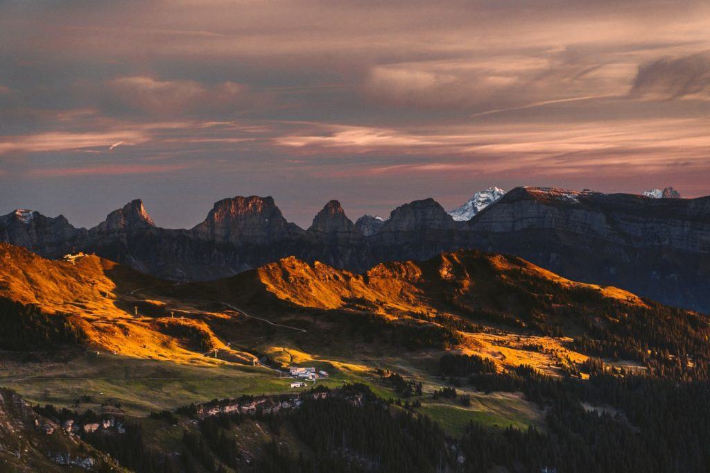
9 AWESOME HIKES IN APPENZELL, SWITZERLAND
In this blog post, you will find a description of each of the hikes in Appenzell and some photos I took as well as a link to the individual blog post I wrote about all of the hikes near Appenzell. You can click on that link for a more detailed review of the hike including maps, starting points, how to get there, photos, directions, difficulty, and a short story about my experience on that Appenzell hike.
Most of the hikes on this list are right in Appenzell, but a couple of these hikes are near Appenzell but not quite in the center of the region. I was based in Appenzell when I did all of these hikes and reached all of the trails by public transport so you will be able to reach any of these trails if you are based in Appenzell.

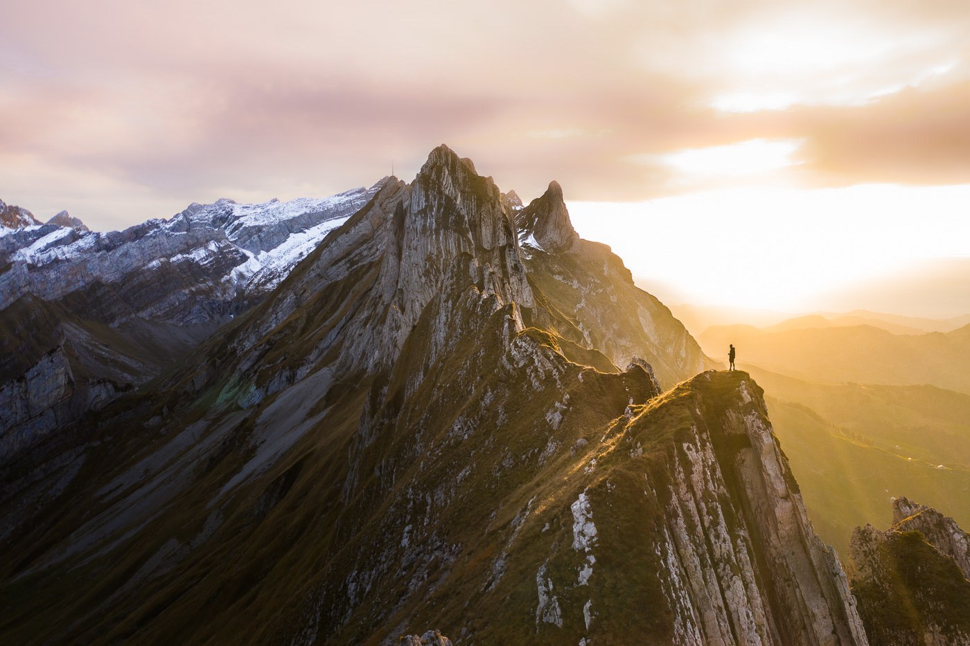
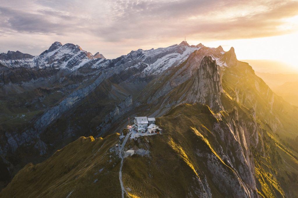
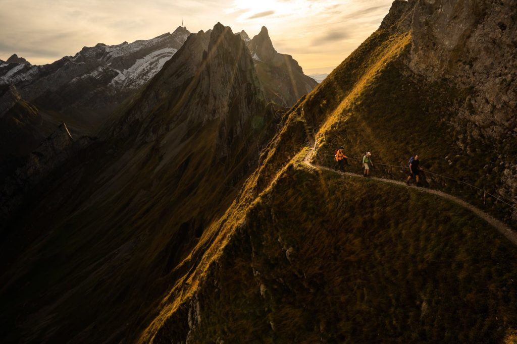
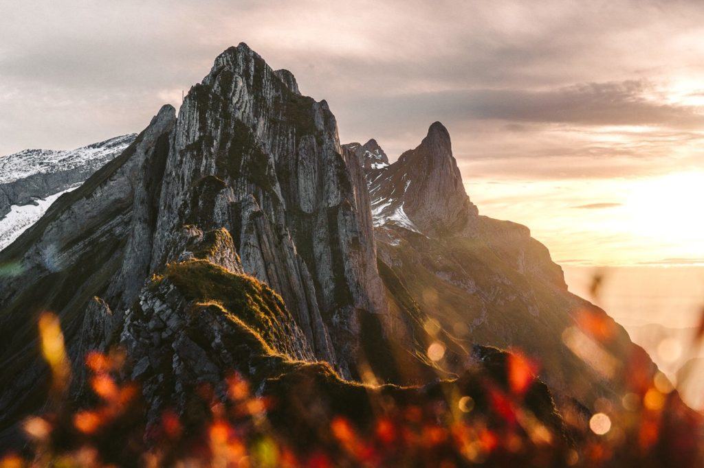
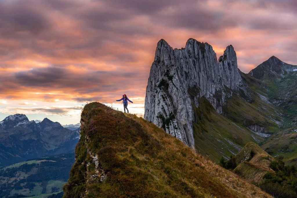
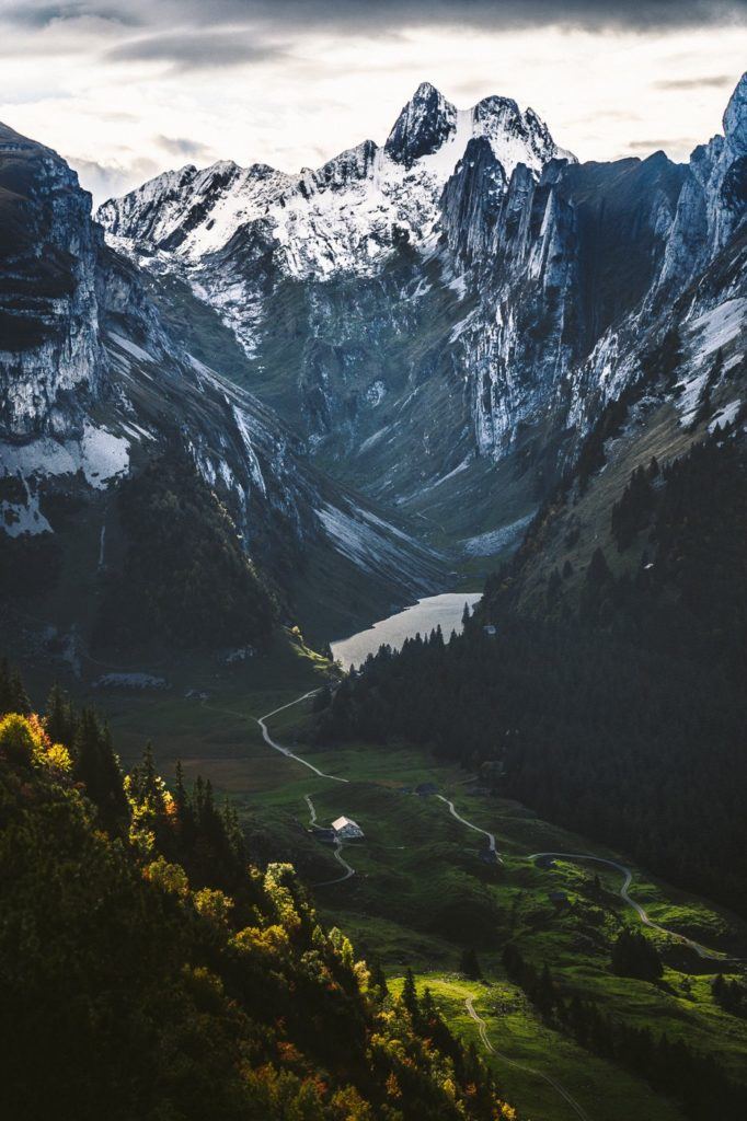
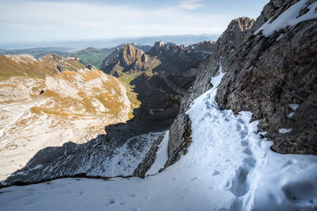
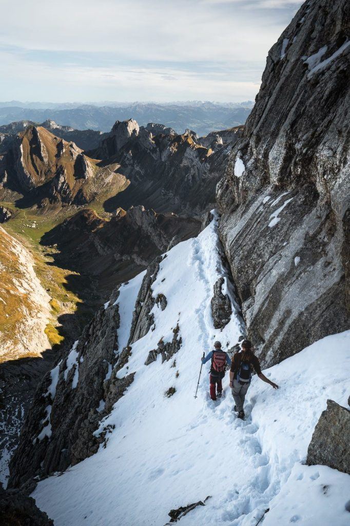
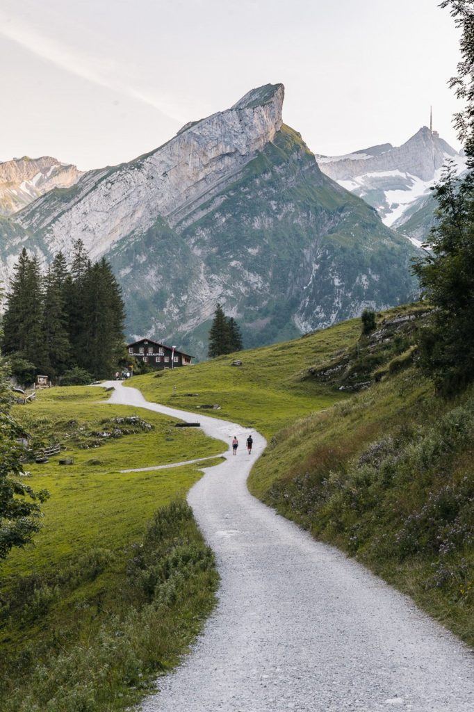
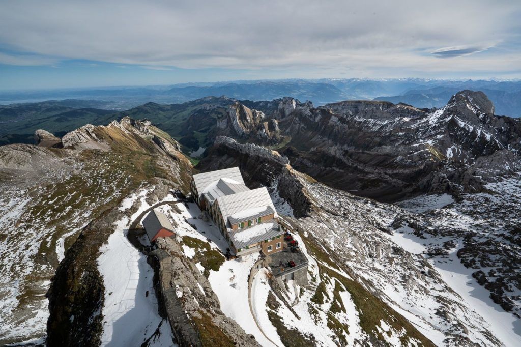
SCHÄFLER RIDGE HIKE AND MOUNTAIN HUT
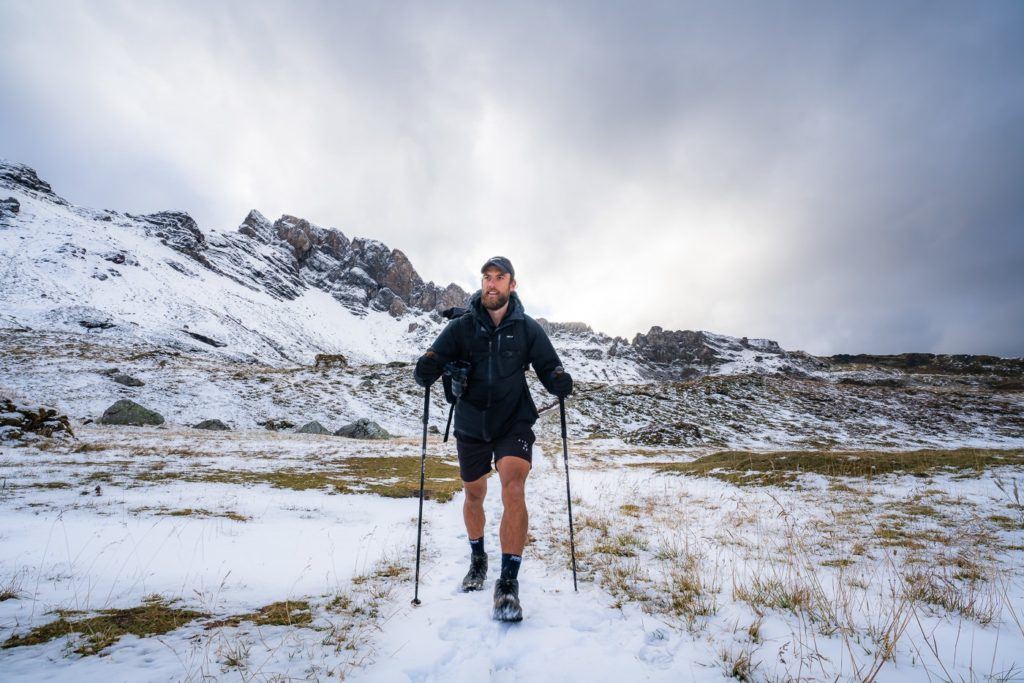
The Schäfler Hut (Schäflerhutte) is perched up above the incredible Schäfler Ridge, which is one of the most dramatic sections of the Alpstein region in Appenzellerland. If there is one hike you should do while in Appenzell it is this. You get so much along the way and then the finishing viewpoint is this incredible ridge, which will blow your mind.
The hike starts in Wasserauen and then takes you up the mountain to the world-famous Aescher Cliff Restaurant, before passing through Ebenalp and then up to Schäflerhutte and Schäfler Ridge. I advise staying overnight at the mountain hut so you can enjoy the sunset and the sunrise at this amazing spot. For me, this is one of the top hikes in Appenzell easily!
- Hike Distance: The hike distance from Wasserauen to Schäfler Hut is 7.5km. However, I suggest walking and exploring along the Schäfler Ridge, which will add an extra kilometer or two onto your tally. Bargain for about 8.5 kilometers one-way.
- Hike Duration: The total hiking time from Wasserauen to Schäfler Hut will be about three hours but depends a lot on your pace up 1200m of incline. I did the trail in just over 2 hours but was on quite a mission for pace. 3-4 hours will be enough time to reach the Schäfler Hut at a modest pace.
- Hike Difficulty: The hike is a red and white marked trail and quite simple. The incline will get a lot of people but there are no dangerous drop-offs or moments of high exposure. It is a trail that is very possible for children and the family dog.
- Hike Incline: From Wasserauen to Schäfler Hut the total incline is: 1,230m
Want more details and photos? View the full blog post here: SCHÄFLER RIDGE HIKE AND MOUNTAIN HUT

SAXER LÜCKE HIKE FROM HOHER KASTEN
The Saxer Lücke hike from Hoher Kasten takes you along a stunning ridge looking over Samtisersee until you reach the epic Saxer Lücke Ridgeline! It can be started from either Hoher Kasten or Staubern. I did it from Hoher Kasten and it was a 17km hike for the whole route.
This hike near Appenzell really gives you a lot throughout the whole way as you peer down into the valley on your left throughout the trail until you reach the sharp cliffs of Saxer Lücke at the end of the trail before making your way down to Falensee to finish the hiking trail.
- Hike Distance: The entire loop is 17km
- Hike Duration: The hike should take about 5 hours depending on how long you stop at Staubern and Saxer Lücke
- Hike Difficulty: The majority of the trail is flat or downhill. There aren’t many points at all with much exposure so I definitely would say this is possible for families, especially the fact that you can start at Staubern and cut some of the distance off. There was a trail the whole way, mostly dirt, gravel, and sometimes a little rocky.
- Hike Incline: 450 meters
Want more details and photos? View the full blog post here: SAXER LÜCKE HIKE FROM HOHER KASTEN
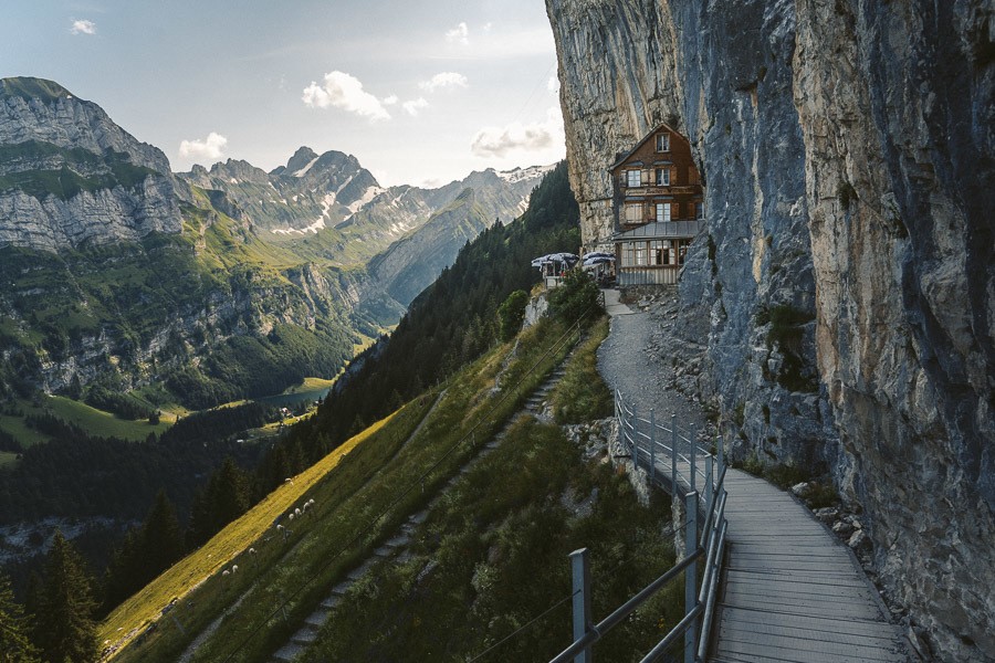
ASCHER, EBENALP & SEEALPSEE HIKE FROM WASSERAUEN
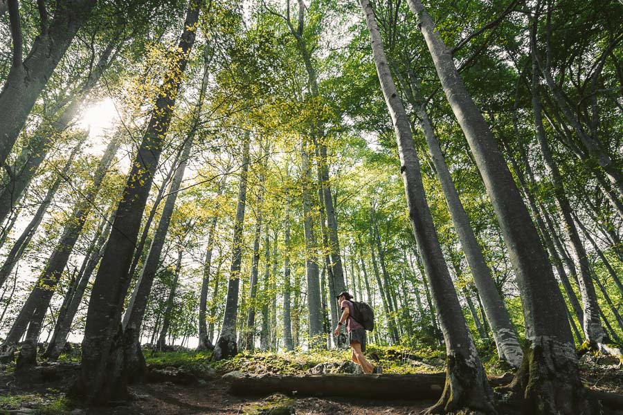
Wasserauen is quite simply a remarkable hiking hub for some of the best peaks in Switzerland. The regional mountain map is overflowing with options for trails that all seemingly intertwine, allowing you to plan your own route depending on your desired time and difficulty. We decided to begin our hike in Wasserauen and climb up through the forest to Ascher Restaurant and Ebenalp Peak before descending down through the forest below the restaurant to reach Seaalpsee, which is the stunning Alpine lake that sits in the valley below all of the formidable peaks above).
The hike up to Ascher Cliff Restaurant can also be done by a cable car but that wouldn’t be much of a hike. You can also link this hike with other points of interest in the Alpstein Mountain Range such as Schäfler Ridge
- Hike Duration: 4 hours
- Hike Difficulty: Some steep climbs. No technical climbing or rock climbing. The path the whole way. Moderate overall. Kids were on the trail.
- Hike Incline: Wasserauen 876m to Ebenalp 1644m.
Want more details and photos? View the full blog post here: ASCHER, EBENALP & SEEALPSEE HIKE FROM WASSERAUEN
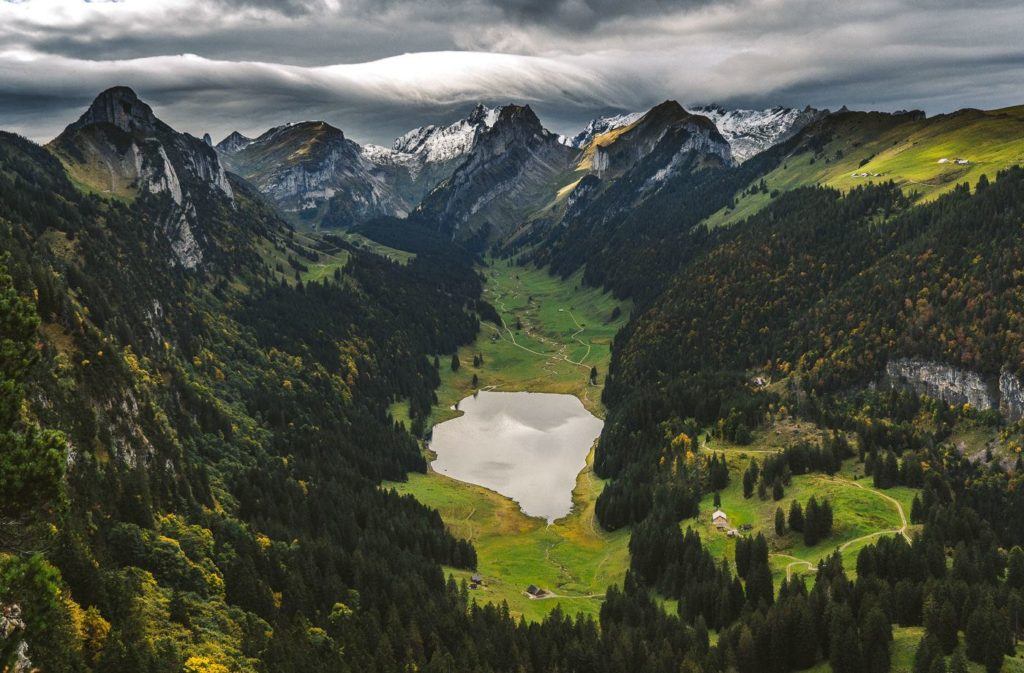
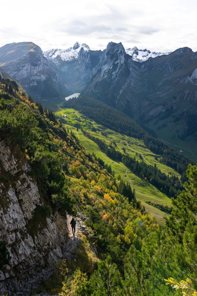
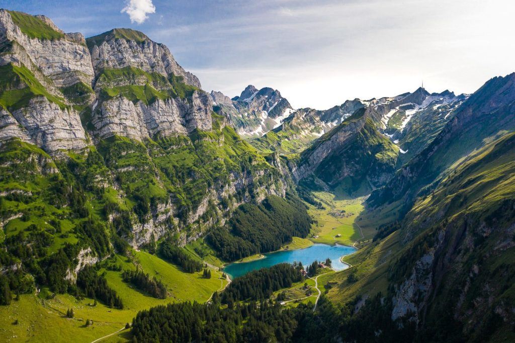
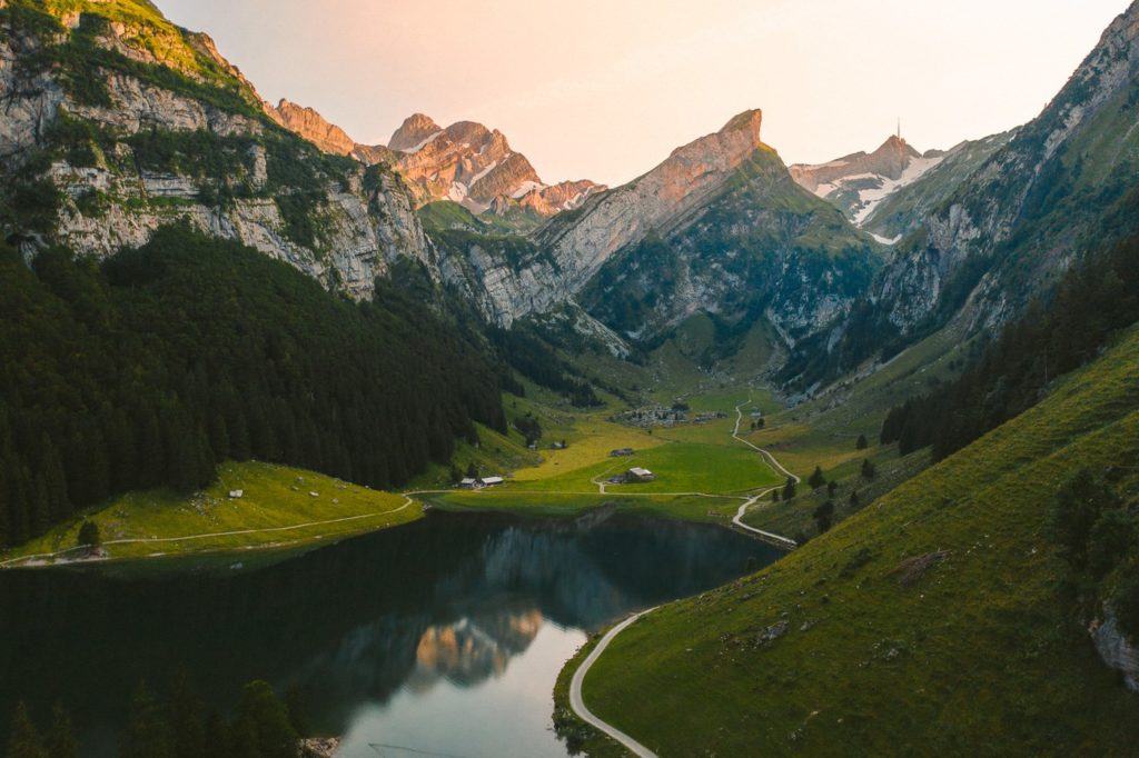
THREE LAKES HIKE IN THE ALPSTEIN REGION, APPENZELL
The Three Lakes Hike in Alpstein takes you on a scenic, but challenging walk to the Seealpsee, Fallensee, and Samtisersee. The route. The 17.3km trail has 1100+ meters of incline and while the trail is quite safe, the incline can be challenging and this is definitely no walk around the lake. Each of the three lakes is incredible in their own way and will blow you away.
- Hike Distance: The entire route is 17.34 kilometers
- Hike Duration: The hike should take around 6-8 hours in total depending on how long you spend at each lake.
- Hike Difficulty: The incline is what makes this hike a little challenging although it is spread out in different sections so it isn’t one big block of climbing. There are no dangerous spots on this trail with high exposure although many spots do have a big drop on one side. Usual care needs to be taken. Children can do this hike but with many drop-offs, close supervision would be advised.
- Hike Incline: 1150 meters.
Want more details and photos? View the full blog post here: THREE LAKES HIKE IN THE ALPSTEIN REGION
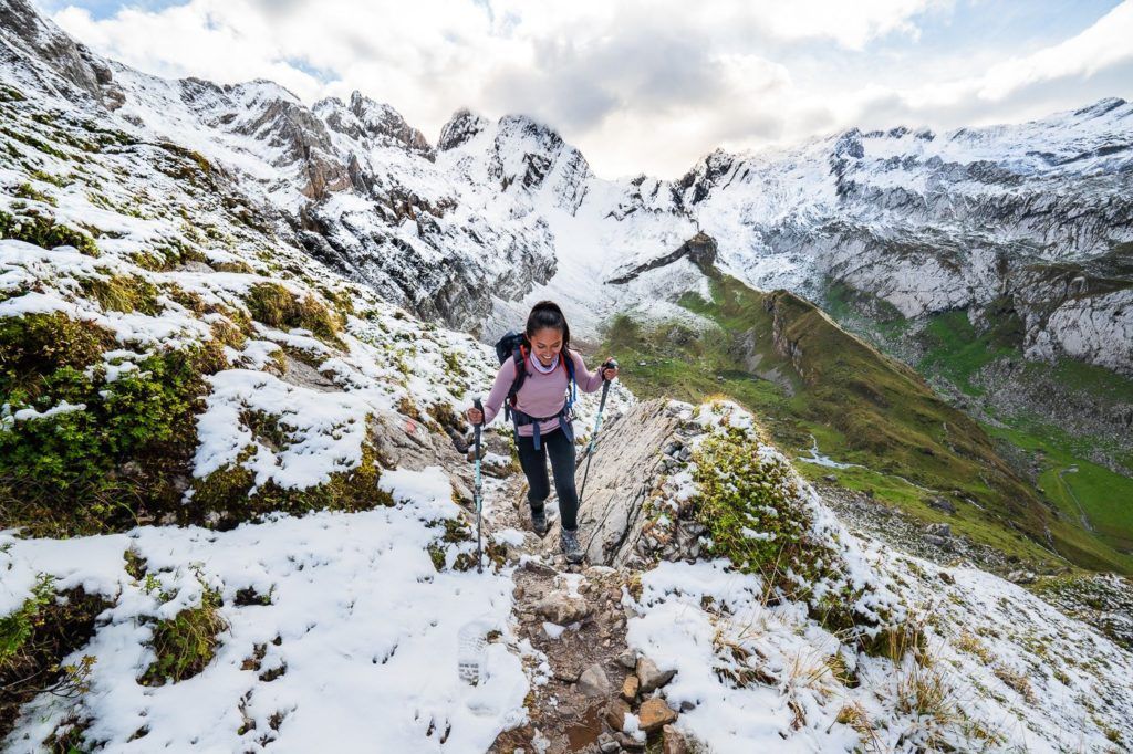
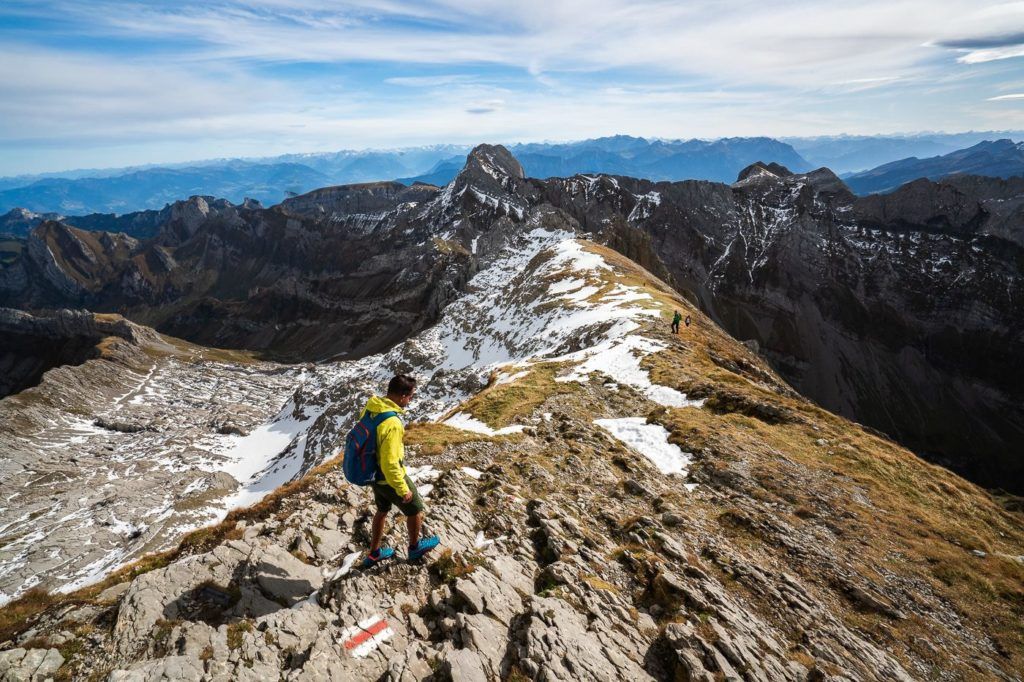
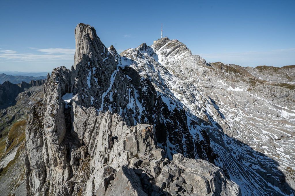
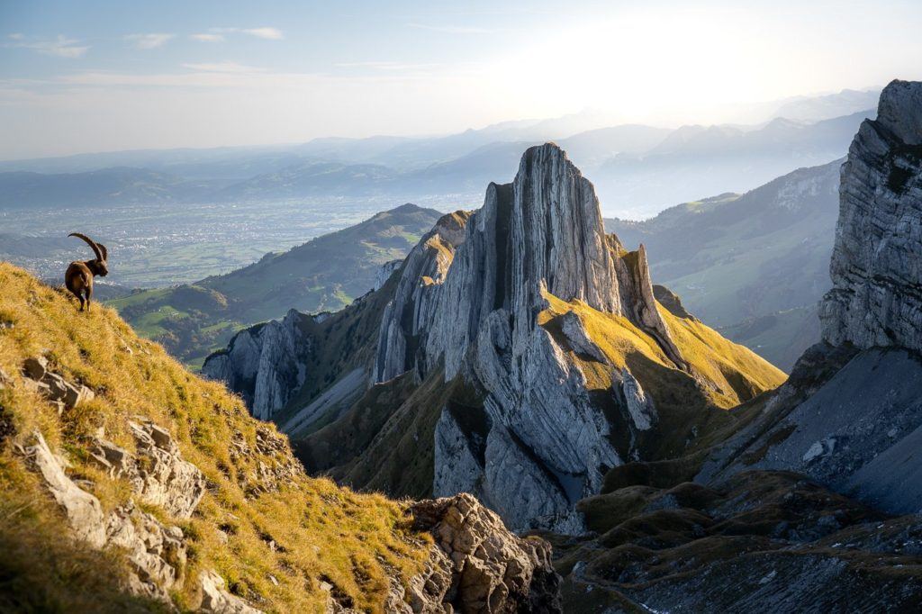
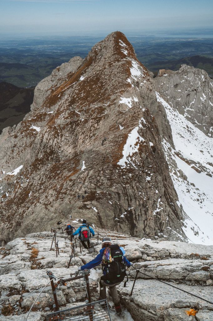
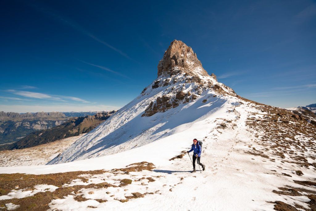
LISENGRAT: EPIC RIDGE HIKE BETWEEN SÄNTIS AND ALTMANN
The Lisengrat ridge hike is one of the most epic sections of trail I encountered on my adventures throughout Switzerland. Between Säntis Peak and Altmann, this narrow ridge is known as the toughest part of the Alpstein Loop. I attempted the Lisengrat ridge while completing the entire Alpstein Loop, which is up there with my favorite hiking route in Switzerland.
- Hike Distance: This depends on where you enter and exit along the Alpstein Mountain Range but the journey from Santis to Altmann is only a few kilometers.
- Hike Duration: The hike should take around 1-2 hours in total.
- Hike Difficulty: This was a very technical section of the Alpstein Mountain Range and I would say that you need to be experienced and exercise a high degree of caution. It is also recommended to only do this route on a dry day.
Want more details and photos? View the full blog post here: LISENGRAT: EPIC RIDGE HIKE BETWEEN SÄNTIS AND ALTMANN
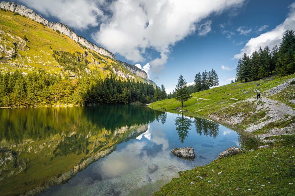
SEEALPSEE HIKE IN APPENZELL
Seealpsee is one of the most beautiful alpine lakes in Switzerland and can be found in the Alpstein region of Appenzell. The lake can be reached in under an hour from Wasserauen Train Station or with more strenuous hiking routes throughout Alpstein. This ease of accessibility and moderate incline make it one of the most popular attractions in the Alpstein and Appenzell regions.
- My first visit was in the summer when I hiked up to Ascher, Ebenalp and then down through the forest to Seealpsee. You can read that blog post here.
- The second visit was part of the ‘Alpstein 3 Lakes Hike’, which includes Samtisersee and Falensee. You can read that blog post here.
- The final visit was the final stop on my Alpstein Loop hike, which was a great way to finish my favorite overnight adventure in Switzerland.
Want more details and photos? View the full blog post here: SEEALPSEE HIKE IN APPENZELL – EVERYTHING YOU NEED TO KNOW
MOUNT SÄNTIS HIKE IN ALPSTEIN, SWITZERLAND
The Mount Säntis hike is one in the Alpstein region is one of the most spectacular trails in Switzerland. It’s possible to trek to the top of Mount Säntis as part of the Alpstein loop or as a straight ascent. Once you reach the top you will find incredible viewing platforms and a large restaurant.
There is also a cable car servicing Mount Säntis so you can choose to hike just one way and catch the cable car either up or down. No matter how you reach the Säntis Peak, the view of the Alpstein region from the summit is magical.
There are quite a few different ways to reach Mount Säntis, so it is difficult to share the one-defined route. What I will do is tell you your options and then share with you the route I took, which in general is the most epic and complete hike called the Alpstein Loop.
- The first option (which I did) is the Alpstein Loop. You begin at Wasserauen and hike up to Ebenalp, onto Schäfler Hut, and then up to Ohrli then finally onto Mount Säntis. From here you begin the descent down Lisengrat to Rotsteinpass, to Meglisalp, to Seebergsee, and finally back to Wasserauen station. Generally, you will spend at least one night at one of the mountain huts. Schäfler Hut is a good place to stay overnight or if you come in the other direction Rostein Hut is a good choice. This route is best done over 2-3 days.
- The second option is to hike up to Mount Säntis from either of those directions. Essentially, you will take half of the Alpstein Loop and then catch the cable car down. This makes the summit and descent possible in one day.
- The third option is to head up via Seebergsee and then Mesmer. I’ve never done this route so I cannot comment on its difficulty level but it is listed on the map below.
- The fourth option is to hike up from Meglisalp up to Säntis via Wagenlucke but again this is not an average route and I cannot comment on the difficulty. It is also listed on the map below.
- The fifth option is to hike up from Schwagalp. This is where the cable car is so many park their car here and then either hike up or down taking the cable car either up or down to make the hike more manageable.
Want more details and photos? View the full blog post here: MOUNT SÄNTIS HIKE IN ALPSTEIN, SWITZERLAND
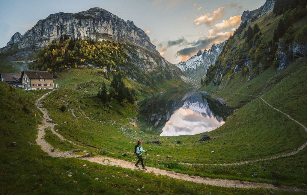
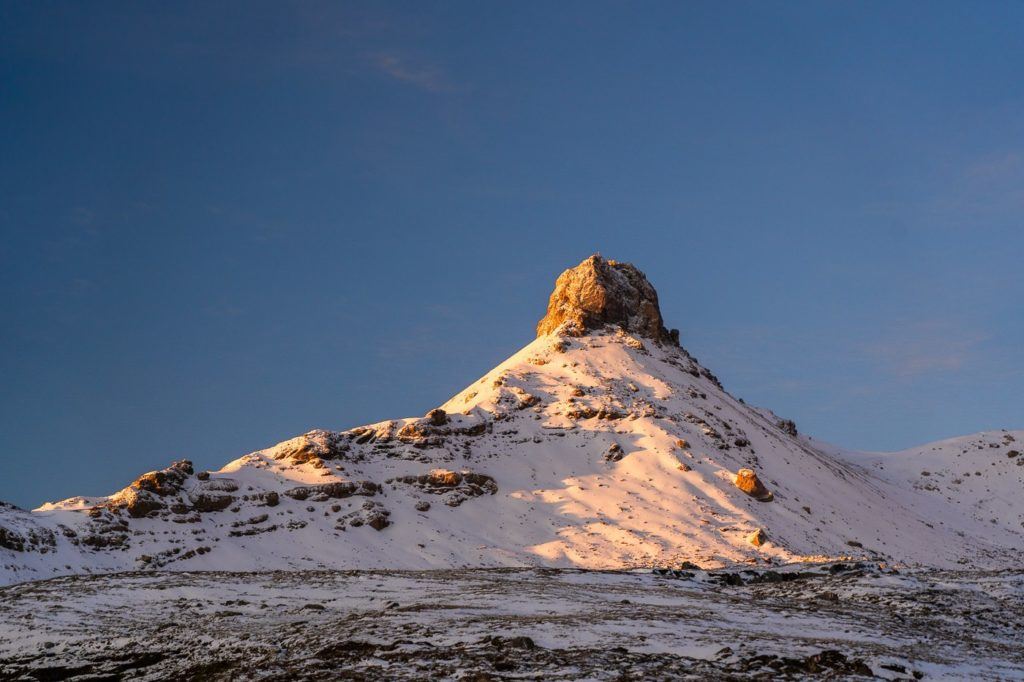
FALENSEE (FALEN LAKE) HIKE – EVERYTHING YOU NEED TO KNOW
The Falensee (Falen Lake) is an incredible alpine lake situated next to the Bollenwees Mountain Hut in the Alpstein region of Appenzell. It can be an adventure in itself or part of several hikes nearby. The Bollenwees Mountain Hut, which is right next to the Falensee, is a great overnight stay and base camp for sunset and sunrise missions in the surrounding lakes and peaks.
I visited the Falensee on two occasions. The first visit was part of the ‘Alpstein Three Lakes Hike‘ and the second occasion was at the end of the Hoher Kasten to Saxer Lucke Hike. However, you can also hike in from Brulisau just to stay overnight at Bollenwees and visit the Falensee. In this blog post, I will detail all of the options to visit the Falensee and what other hikes you could do when using Falensee and Bollenwees as a base camp.
Want more details and photos? View the full blog post here: FALENSEE (FALEN LAKE) HIKE – EVERYTHING YOU NEED TO KNOW
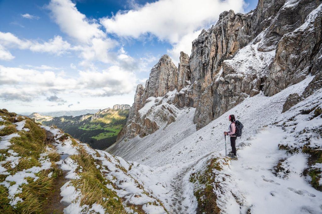
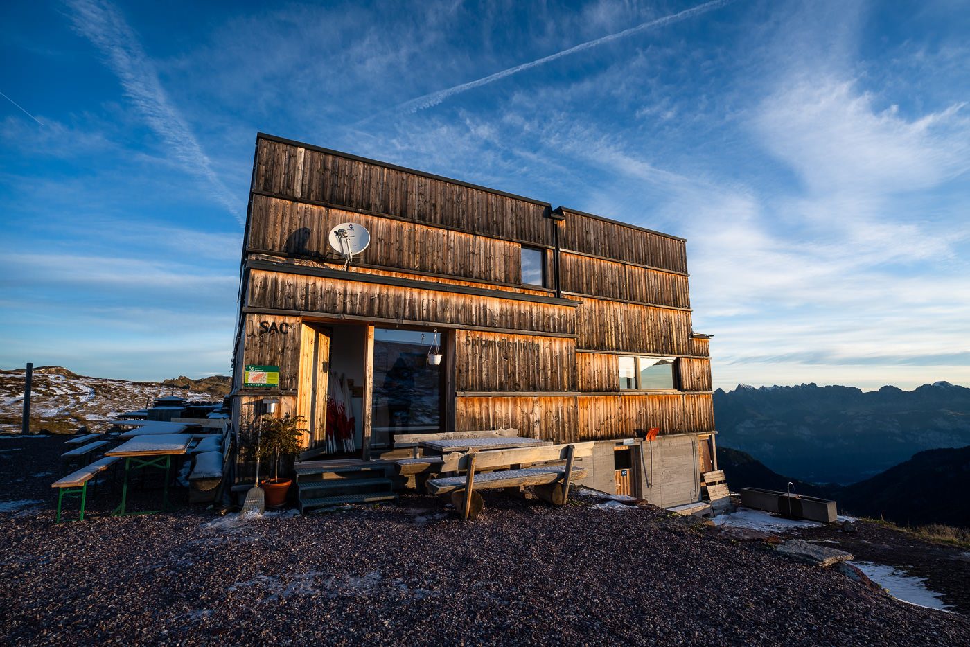
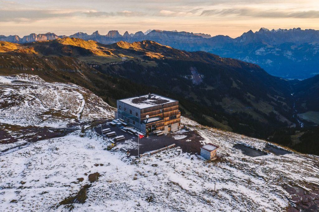
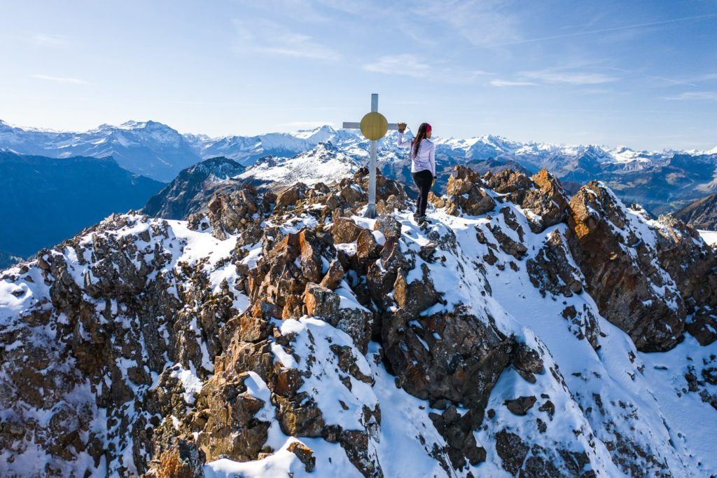
HIKING TO THE SPITZMEILEN HUT AND SPITZMEILEN PEAK
Now this one isn’t right in Appenzell and took about two hours by train to reach there. We left our luggage at our hotel in Appenzell for one night and returned the next day after our overnight at the Spitzmeilen Hut. Why not hike to the Spitzmeilen Hut (Spitzmeilenhutte) for a beautiful overnight stay before climbing the Spitzmeilen Peak and the Wissmeilen Peak in the morning!? We did this hike after the first snowfall of the year and while a little dangerous, the views were magical from Spitzmeilen Peak!
Hike Distance: The hike from Tannenboden to Spitzmeilen Hut (after catch the cable car from Unterterzen) was 11.6 kilometers. The next day the hike from Spitzmeilen Hut to Spitzmeilen Peak to Wissmeilen Peak and then down to Engi was 14.17 kilometers. You could take a cable car up further and walk a shorter distance to Spitzmeilen Hut and Engi is not the shortest route down. Therefore there are many ways to make it shorter but this is definitely one of the most scenic routes totaling just over 25km over two days.
- Hike Duration: We did the hike over two days. Day one from Tannenboden to Spitzmeilen Hut took just under 3 hours of moving time but 4.5 hours including stops, photos. Day two from Spitzmeilen Hut to Spitzmeilen Peak to Wissmeilen Peak to Engi took 3.5 hours of moving time but 6-7 hours in total including a lot of photos, hanging out at the summit and many stops along the way.
- Hike Difficulty: The hike from Tannenboden to Spitzmeilen Hut is very low difficulty and is mostly through vast valleys once you are up the initial incline. The climb to Spitzmeilen was quite difficult in the snow with some exposure and then, of course, the climb up Spitzmeilen summit is not easy. There are chains in place to help you climb but you will need to be in pretty good shape despite the chains. There is no technical rock climbing required but the worst-case scenario is losing grip of the chain or slipping and you will have a 20m drop onto rocks. From Spitzmeilen to Wissmeilen and Wissmeilen Pass the trail is quite exposed and is not always a great path. Again, I did this trail in the snow so I imagine it is much easier in the summer as it is marked as a red and white trail, although for us it felt like an alpine route!
- Hike Incline: Tannenboden to Spitzmeilen Hut: 854m Spitzmeilen Hut to Spitzmeilen to Wissmeilen to Engi: 453m incline (Decline: 1657m)
Want more details and photos? View the full blog post here: HIKING TO THE SPITZMEILEN HUT AND SPITZMEILEN PEAK
I hope you enjoyed that list of epic hikes in Appenzell in my Appenzell Hiking Guide. If there are any hikes in Appenzell you think I need to check out on my next visit, please comment on them below!
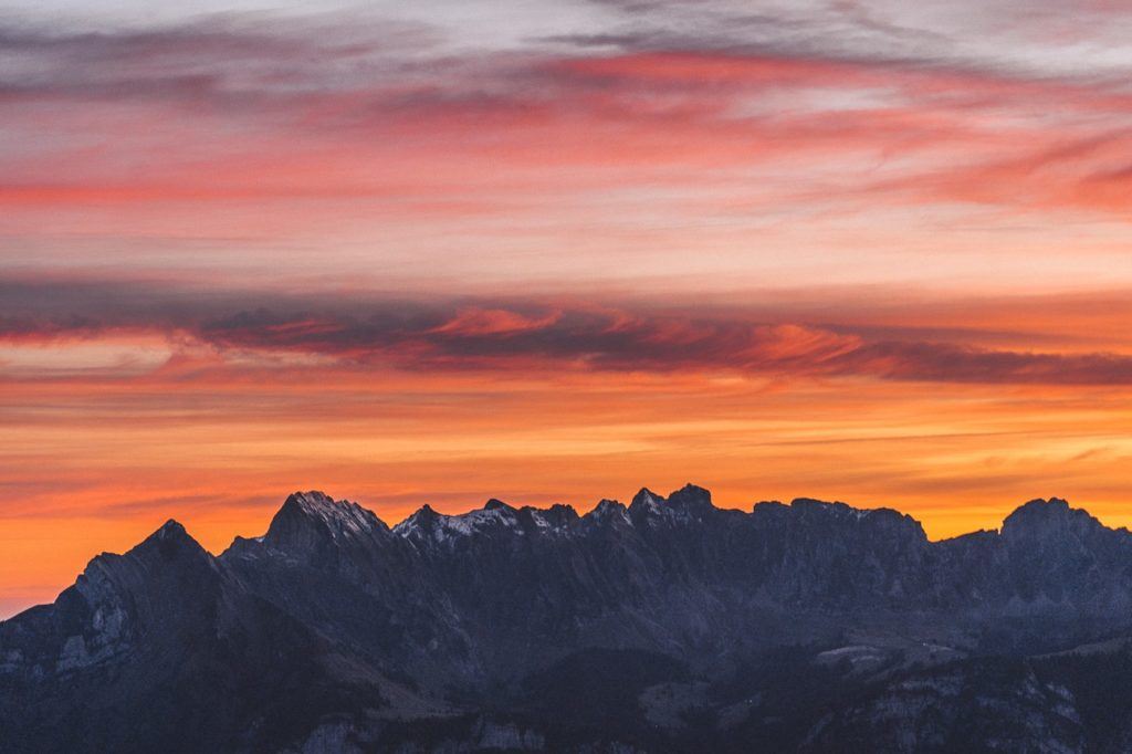
THINGS TO KNOW BEFORE VISITING ALPSTEIN REGION
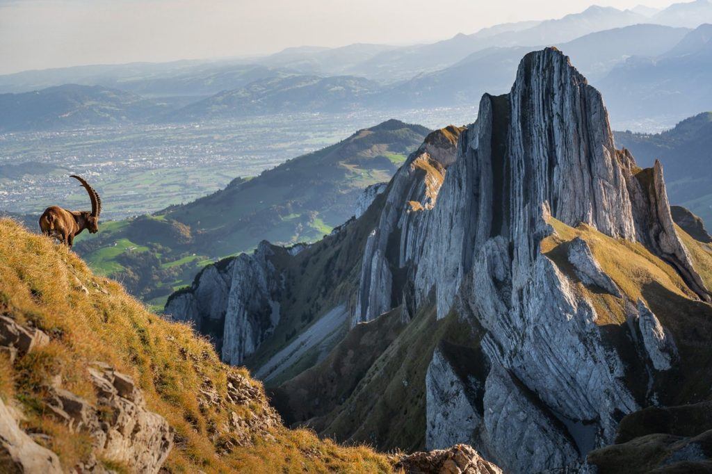
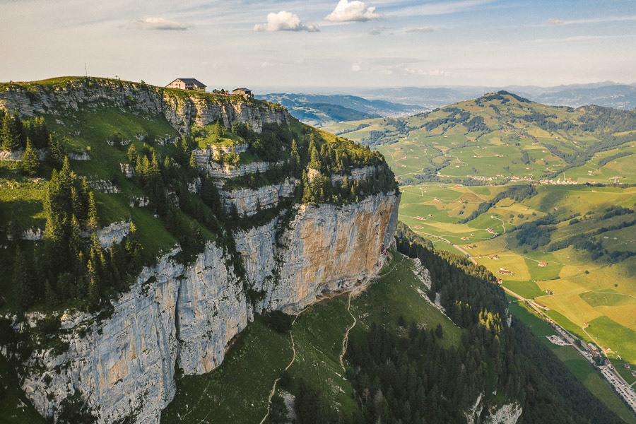
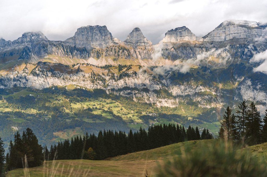
The Alpstein region is a sub-range of the Appenzell Alps located mainly in Eastern Switzerland. It’s a breathtaking area known for its rugged limestone peaks, deep valleys, and picturesque landscapes. Here are some essential things to know about the Alpstein region:
- Dramatic Peaks: The Alpstein boasts iconic peaks like Säntis, which is the highest mountain in the region. These mountains are characterized by their steep limestone formations.
- Hiking Destination: Alpstein is a hiker’s paradise with a network of trails ranging from easy walks to challenging climbs. The region offers spectacular vistas, alpine meadows, and pristine lakes.
- Säntis: Standing at 2,502 meters, Säntis offers panoramic views of six countries on a clear day: Switzerland, Germany, Austria, Liechtenstein, France, and Italy. There’s a cable car that takes visitors to the peak.
- Seealpsee: A picturesque lake situated in the heart of Alpstein, Seealpsee is a popular spot for relaxation and offers a serene view of the surrounding mountains.
- Aescher Guesthouse: This mountain guesthouse is built into the side of a steep cliff and is one of the most iconic and photographed places in Switzerland. It’s a great spot to rest during hikes and enjoy the landscape.
- Wildkirchli Caves: Accessible via a short hike from the Aescher Guesthouse, these caves have revealed artifacts suggesting prehistoric habitation.
- Accessibility: The region is most easily accessed from the towns of Appenzell and Wasserauen. These areas serve as starting points for many excursions into the Alpstein.
- Swiss Cheese: The Appenzell region, which encompasses the Alpstein, is renowned for its cheese. When visiting, trying Appenzeller cheese, known for its distinct flavor, is a must.
- Cultural Significance: The Appenzell region, including Alpstein, is steeped in traditions and customs, with colorful events, unique voting procedures (like the open-air assembly known as “Landsgemeinde”), and vibrant artwork.
- Climbing Opportunities: Beyond hiking, Alpstein offers numerous rock-climbing routes, attracting climbers from around the world.
- Accommodation: Throughout the Alpstein, there are numerous mountain huts and guesthouses, providing rustic accommodations and local cuisine to travelers.
- Weather Conditions: The weather in the Alpstein can change rapidly, especially at higher altitudes. It’s crucial to be prepared for varying conditions and to check the weather forecast before setting out on hikes or climbs.
SWISS TRAVEL PASS or HALF-FARE CARD
OPTION 1: Buy the Swiss Half Fare Card: Switzerland trains, buses, and cable cars are EXPENSIVE! I found the best way to get around cheaply was to buy the Swiss Half-Fare Card before I arrived. It gives you 50% off every regular train, bus, and even many cable cars. It only costs $150 USD but pays itself off in just a few days with many train tickets in Switzerland costing close to $100 alone. If you are staying for more than 5 days, I suggest buying the Swiss Half-Fare Card.
OPTION 2: Buy the Swiss Travel Pass: The second option is to get the Swiss Travel Pass, which gives you unlimited train, bus, and (many) cable car rides but it’s pretty expensive at around $100 USD per day so if you don’t travel each day it isn’t worth it.
OPTION 3: Buy the FLEXI Swiss Travel Pass: The final (BEST) option is to get the FLEXI Swiss Travel Pass, which allows you to buy 8 days’ worth of transit but you can choose the night before if you want to activate the next day. That way you don’t need to travel every day to get your money’s worth, you can just activate the FLEXI Swiss Travel Pass on the days when you are doing sizeable transits. My advice is to book the Swiss Half-Fare Card or the FLEXI Swiss Travel Pass in advance before your trip so it’s ready to go when you arrive.
GET A SWISS TRAVEL PASS!


Enjoy UNLIMITED train, boat, and bus rides in Switzerland for up to 15 days. Click to book a flex Swiss Travel Pass or choose the Consecutive Swiss Travel Pass.
The Swiss Travel Pass starts at $260 for 3 days. Click here to check if it’s available on your travel dates.
MY SWITZERLAND HIKING GUIDES
I spent 100 days hiking in Switzerland and created a guide for different regions around the country. You can click on one of my Switzerland hiking guides below to help you plan your trip.
- The Complete Guide: 50 AWESOME HIKES IN IN SWITZERLAND
- The Via Ferrata Guide: 4 EPIC SWITZERLAND VIA FERRATA COURSES
- Lauterbrunnen Guide: 10 AWESOME HIKES NEAR LAUTERBRUNNEN
- Interlaken Guide: 15 AWESOME HIKES IN INTERLAKEN
- Grindelwald Guide: 12 AWESOME HIKES NEAR GRINDELWALD:
- Mürren Guide: 7 AWESOME HIKES IN MURREN
- Appenzell Guide: 9 AWESOME HIKES NEAR APPENZELL
- Chur Guide: 7 AWESOME HIKES NEAR CHUR

MY SWITZERLAND TRAVEL TIPS
- For Backpackers: SWITZERLAND BUDGET BACKPACKING GUIDE
- Travel Tips: 20 THINGS TO KNOW BEFORE VISITING SWITZERLAND
- Transport Tips: RENTING AND DRIVING A CAR IN SWITZERLAND
- Accommodation Guide: 30 BEST PLACES TO STAY IN SWITZERLAND

Anna
Friday 5th of September 2025
I love this post! That’s what I was looking for. I don’t know why I have never found your blog via Google, only chat gpt sugestie it for me today. All info in one post and the variety of hikes - everyone can find here something that’s meeting the expectations. We decided to check Shafler Hut tomorrow.
Erica
Wednesday 2nd of August 2023
This post was very informative! I have been looking into traveling to Switzerland and hiking to the Shafler Hut. I tend to be an anxious traveler, though, and upon looking at the Shafler Hut website, I noticed that they do not have WiFi. Is there cell service at the Shafler Hut? I would feel uneasy being without WiFi or cell service.
Steve
Sunday 16th of July 2023
Been coming to CH and especially Appenzell for over 30 years to enjoy this UNBELIEVABLY beautiful region and you nailed the descriptions of these hikes…great job!!
Suzanne and jeff
Tuesday 20th of June 2023
Really enjoyed reading your blog We are returning to Switzerland after not being there for 5 years We have been in many areas: murren, Wengen, zermatt , lauterbrunnen, Kandersteg and searching for a new area that could possibly be as amazing as those! Any recommendations and comments are helpful Planning to hike in September Thank you