
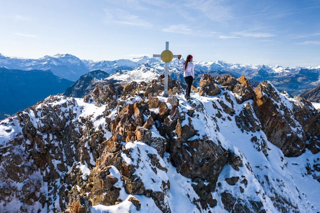
Chur is one of my favorite regions in Switzerland as it is much quieter than the hotspots of the country but is equally as beautiful, such as the Rhine Valley and other spectacular regions nearby. I visited the Chur region for eight days and barely had enough time to see all of the amazing hikes in Chur. Throughout my time hiking near Chur, I experienced some beautiful trails and I’ve put together this Chur Hiking Guide so that you can choose a hike or two (or seven) for your visit to Chur. I’m sure you will find a great adventure on this list of my nine favorite hikes in Chur.
7 AWESOME HIKES NEAR CHUR, SWITZERLAND
In this blog post, you will find a description of each of the hikes near Chur and some photos I took as well as a link to the individual blog post I wrote about all of the hikes near Chur. You can click on that link for a more detailed review of the hike including maps, starting points, how to get there, photos, directions, difficulty, and a short story about my experience on that Chur hike.
Some of the hikes on this list are right in Chur, but a couple of these hikes are near Chur but not quite in the center of the region. I was based in Chur when I did all of these hikes and reached all of the trails by public transport so you will be able to reach any of these trails if you are based in Chur.
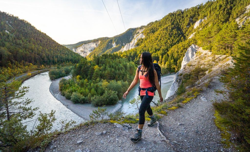
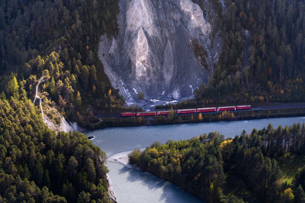
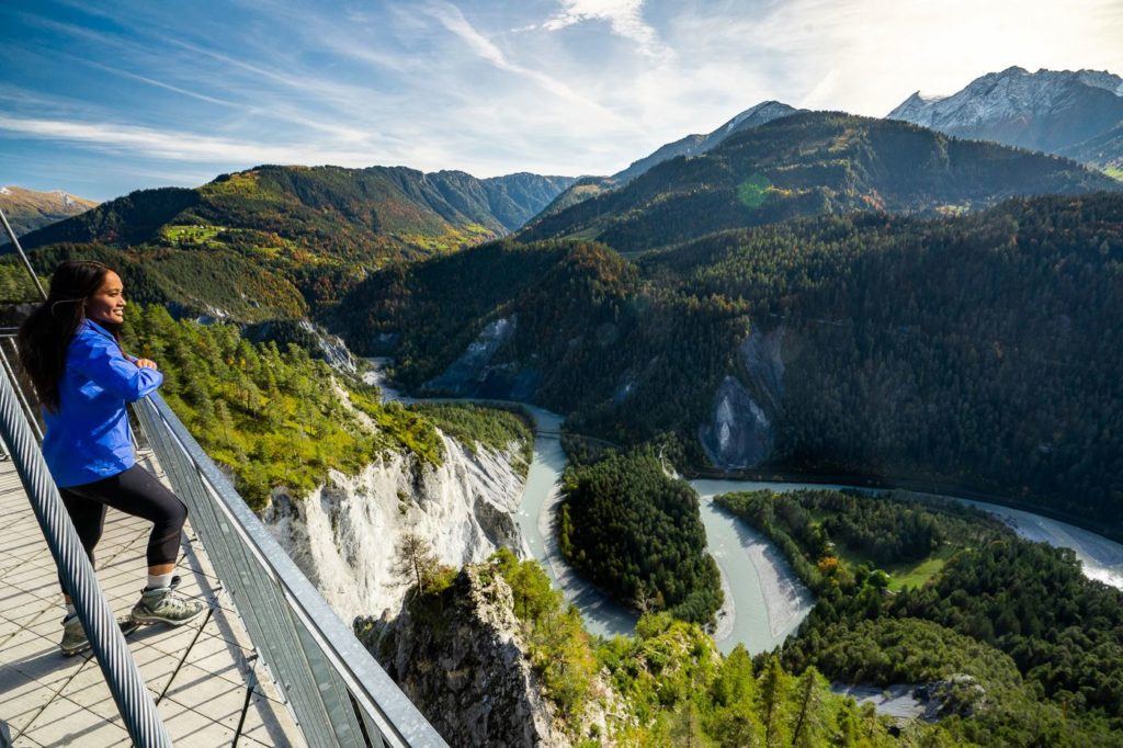
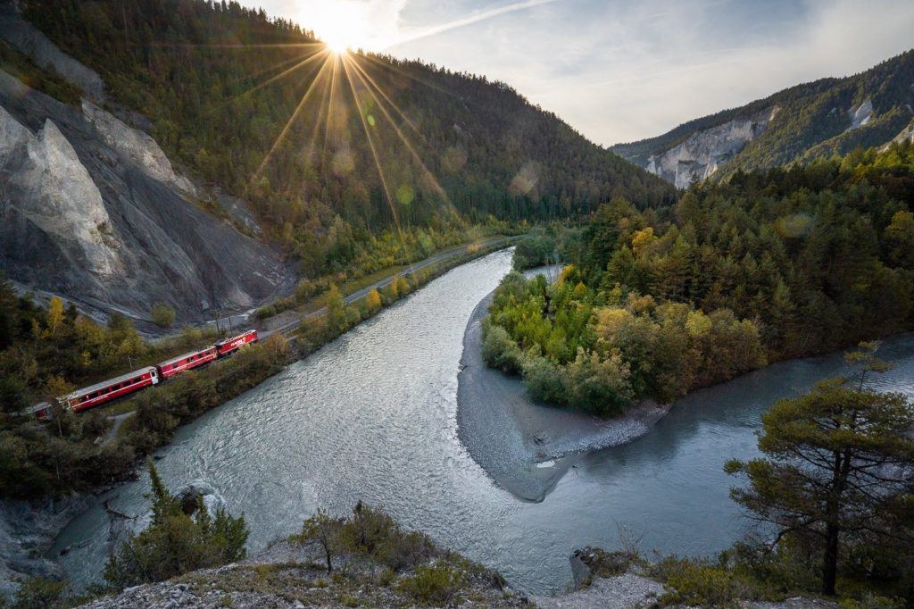
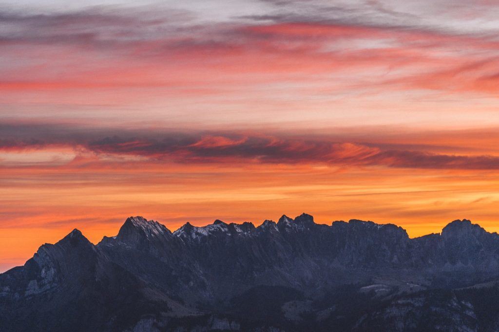
RHINE GORGE RIVER HIKE & VIEWPOINT ‘SWISS GRAND CANYON’
The Rhine Gorge is often referred to as the ‘Swiss Grand Canyon’, and while that may be a bit of a stretch in terms of comparison, it is an impressive gorge and a great location for hiking. The strange rock formations, cliffs, and blue-tinted water make the Rhine River and the gorge one of the most unique attractions in Switzerland.
There are multiple hiking routes through the gorge but with lots of entry and exit points, as well as a train running through the gorge itself, you have lots of options for your adventure. The hikes can range from a few kilometers to a huge 21-kilometer journey. Many visitors prefer to take a train ride through the gorge or a great option for non-hikers is to enjoy the viewing platform overlooking the Rhine Gorge.
Want more details and photos? View the full blog post here: RHINE GORGE RIVER HIKE & VIEWPOINT ‘SWISS GRAND CANYON’
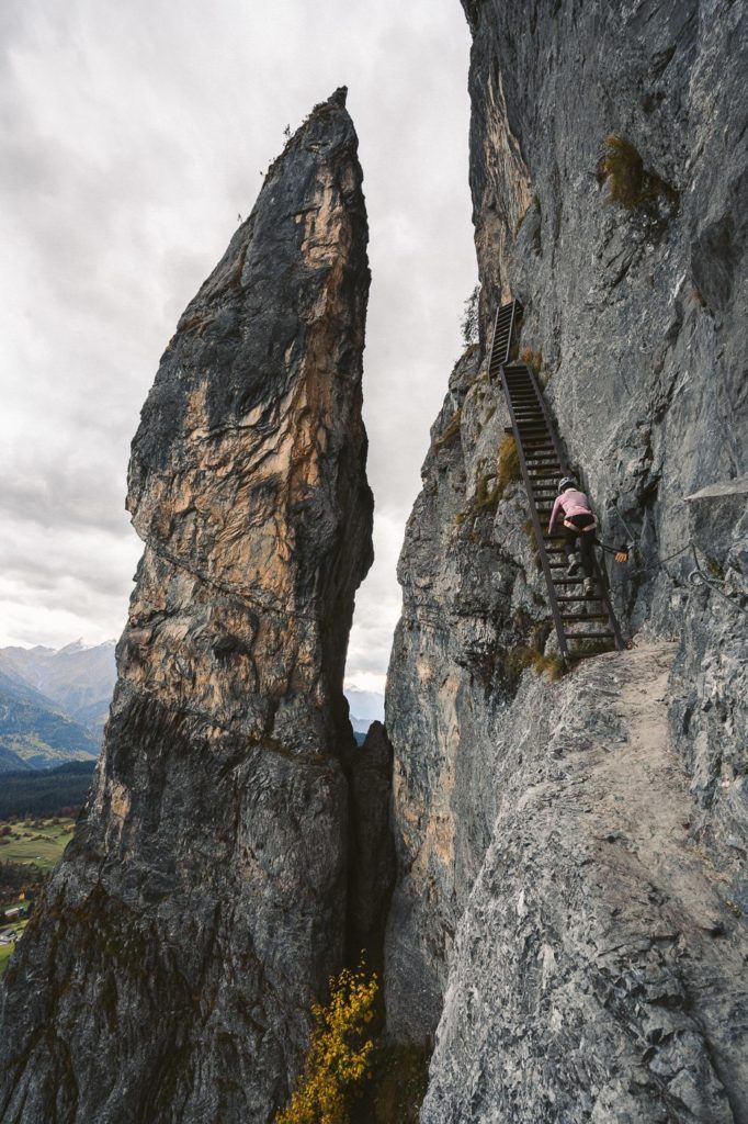
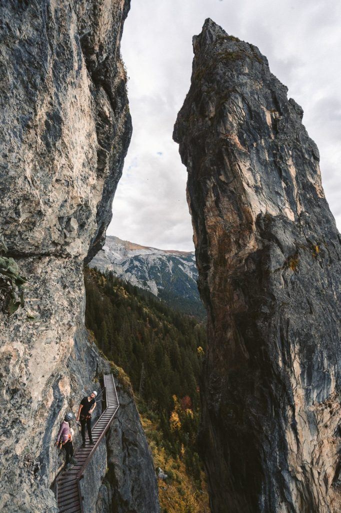
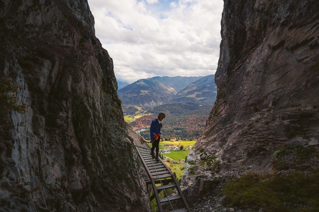
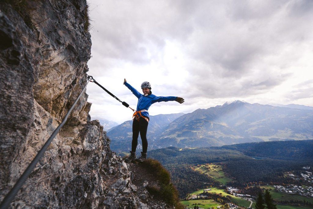
PINUT VIA FERRATA (KLETTERSTEIG) IN FLIMS – EPIC CLIFFSIDE STAIRWAY
The Via Ferrata (Klettersteig) in Flims is an epic series of staircases and ladders on the edge of a cliff that winds up hundreds of meters above the valley. From the summit, you have incredible views of Crestasee, Caumasee and the entire region of Flims
The Pinut Via Ferrata is actually the oldest of it’s kind in all of Switzerland and was opened in 1907. For those who are nervous hearing about climbing a century-old ladder, fear not. This Via Ferrata is maintained by the tourism board and was fully renovated in 2007.
The first part of the Pinut Via Ferrata is, in my opinion, the most spectacular. There is a huge spire that you pass by on the boardwalks in between scaling the ladders up the cliffside. It is a really unique rock formation and by walking upon the cliffside you get a close-up inspection.
The route then continues up the wall and actually leads you inside some caves and small tunnels, all the while connected to the strong cable, which keeps you safe throughout the hike. From within the tunnels and caves, you can see out the gaps all the way down to Flims and the lakes.
Want more details and photos? View the full blog post here: PINUT VIA FERRATA (KLETTERSTEIG) IN FLIMS – EPIC CLIFFSIDE STAIRWAY
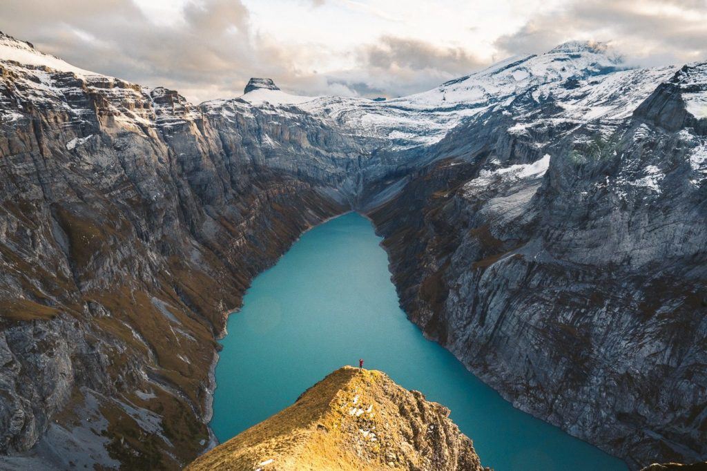
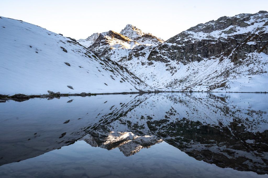
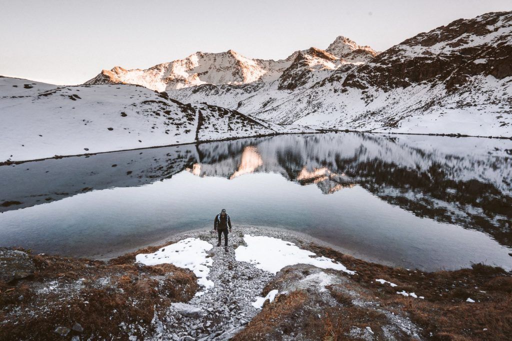
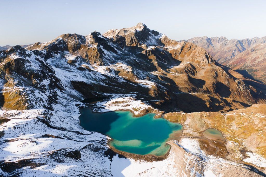
MUTTSEE HUT HIKE VIA LIMERENSEE LAKE
The hike to the Muttsee Hut (Muttseehutte) is one of the stranger journeys I’ve made in Switzerland but the end result is incredible. The adventure begins in Linthal where you need to walk 6.7 km to the Tierfehd cable car and then 3 kilometers through a dark, wet tunnel before emerging at the Limerensee. The trail then winds up a very steep mountain until you reach some epic viewpoints of the Limerensee and, of course, the Muttsee Hut.
- Hike Distance: The hike distance from the top of the Tierfehd Cable car through the tunnel and to the Muttsee Hut is 5.8 kilometers. However, if you are using public transport, you will need to walk from the Linthal train station to Tierfehd cable car station, which is an extra 6.7km and a total of 12.5 kilometers.
- Hike Duration: As mentioned above, it depends on whether you have to make the journey from Linthal or you are starting at the Tierfehd cable car station. If you begin at Linthal, you can expect the entire journey to take about 4-5 hours. If you begin at Tierfehd the journey will take 2-3 hours.
- Hike Difficulty: The hike is a red and white marked trail and quite simple. I did the hike in October on the last week of opening for Muttsee Hut and even with a bit of snow around it was quite simple. The areas of difficulty are a few narrow paths with exposure on one side but these narrow paths are still at least one meter wide and there are chains in these sections. The incline is challenging from the end of the tunnel to the Muttsee Hut and is non-stop ascent although it is only 5-600m of incline so if you are prepared to take a few breaks you will make it eventually, no matter your physical ability.
- Hike Incline: From Linthal the total incline is 900-1000m but from the Tierfehd cable car station the total hiking incline (once getting off the cable car at the start of the tunnel) is 600m.
Want more details and photos? View the full blog post here: MUTTSEE HUT HIKE VIA LIMERENSEE LAKE
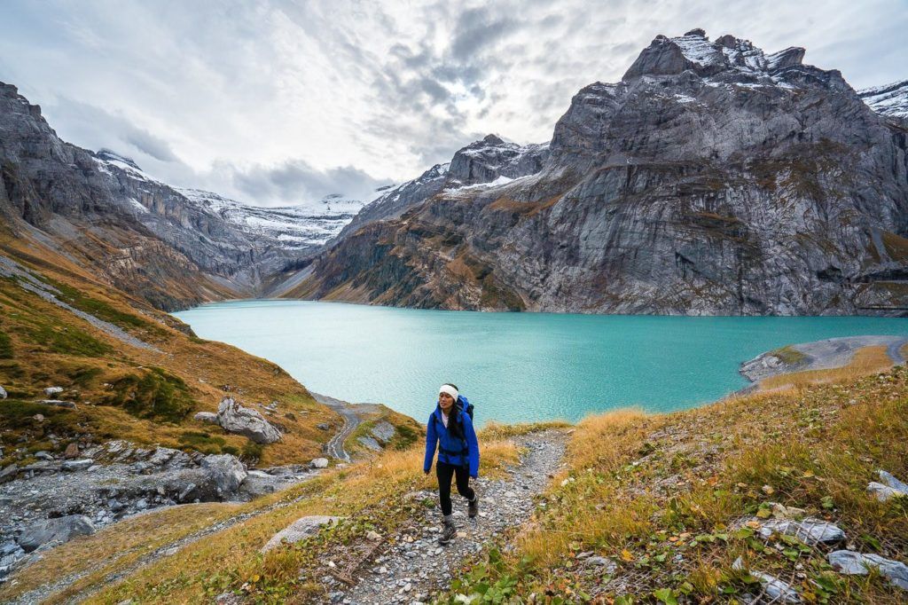
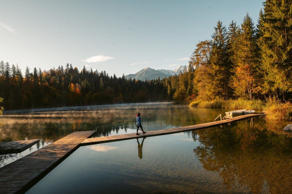
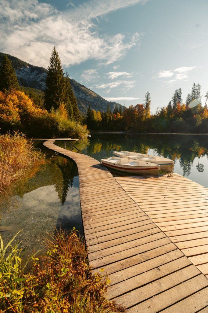
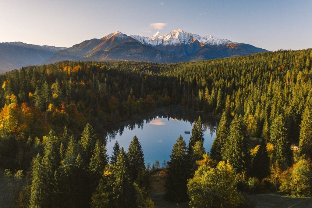
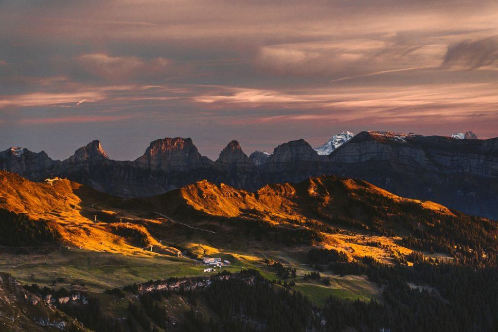
CRESTASEE AND CAUMASEE LAKE LOOP WALK
Crestasee and Caumasee are two stunning lakes near Chur. You can catch the public bus from Chur city center out to Crestasee and then do a circle of that lake before following the circuit path through the forest to reach Caumasee, which is the second lake.
Crestasee is a beautiful lake surrounded by a forest with a backdrop of mountain ridges. I visited in the fall so the trees were changing colors and creating some stunning reflections on the steaming lake in the early morning. Caumasee, on the other hand, is a huge lake, where many tourists come to visit the cafe, take a walk, and even have a swim in the summer.
The entire circuit takes about two hours with a stop at each lake but you can extend the route by hiking down to the Rhine Gorge viewpoint called ‘Il Spir’. We even hiked down into the gorge after visiting the two lakes and this made the entire day a 21km hike but if you just want a small adventure to the lakes it is just a few kilometers between the Crestasee and Caumasee.
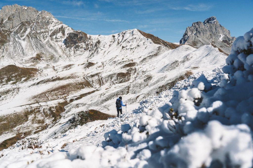
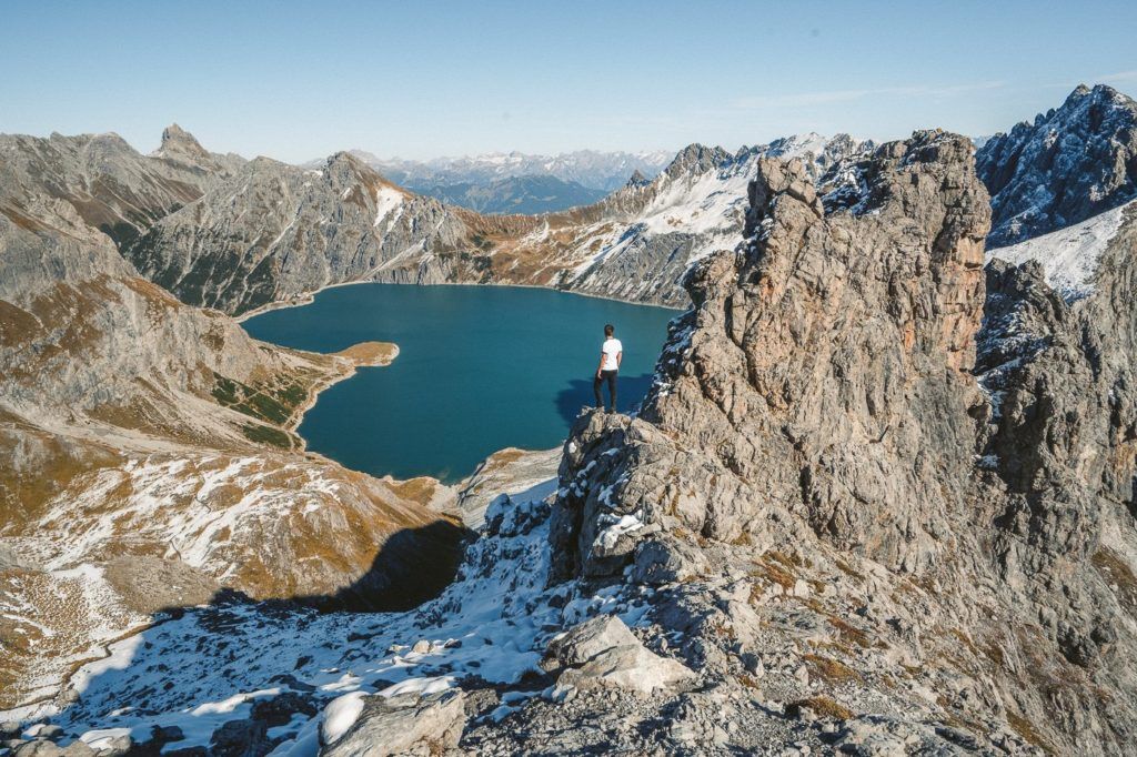
LUNERSEE HIKE – LOVE HEART LAKE VIEWPOINT AT GAMSLUGGEN
While the Lunersee (lake) is actually in Austria, the viewing point we went to is right on the Swiss side of the border. Funnily enough, you could actually walk down to the lake from where we were and cross the border into Austria.
The hike to Lunersee Lake is quite an interesting adventure because although we were in Switzerland and hiked all the way to the viewpoint above the lake, it is actually in Austria. If you went down to walk around the Lunersee Lake, you would have crossed the border and entered Austria. The hike itself is long and full of adventure with some chains and exposure towards the end. The shape of the lake is a love-heart but only when viewed from certain angles such as the Gamsluggen viewpoint in Switzerland.
Want more details and photos? View the full blog post here: LUNERSEE HIKE – LOVE HEART LAKE VIEWPOINT AT GAMSLUGGEN
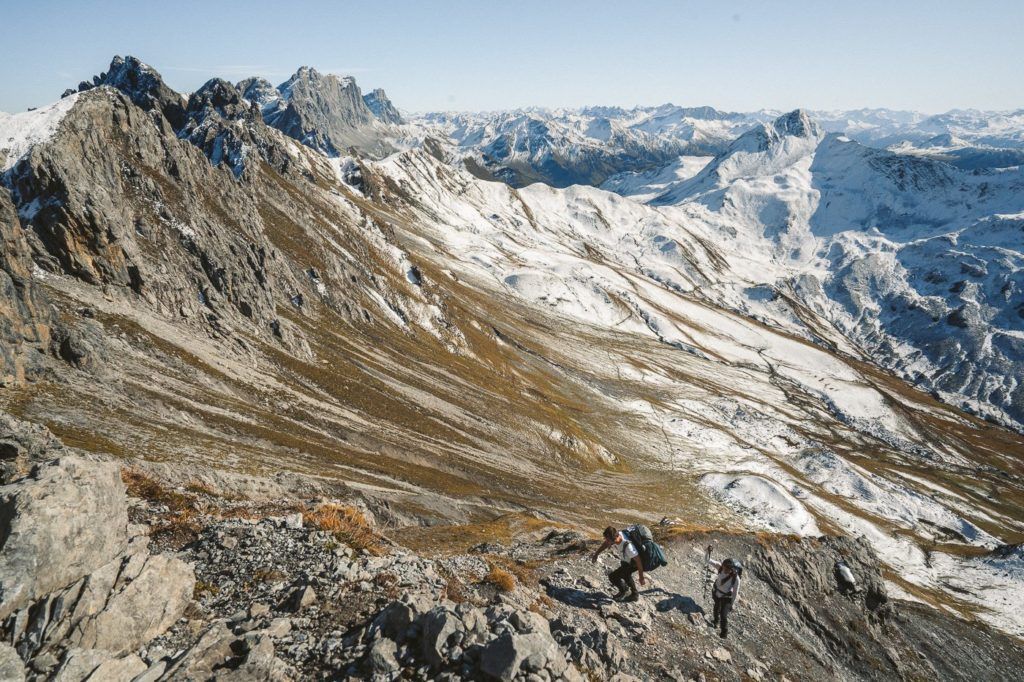
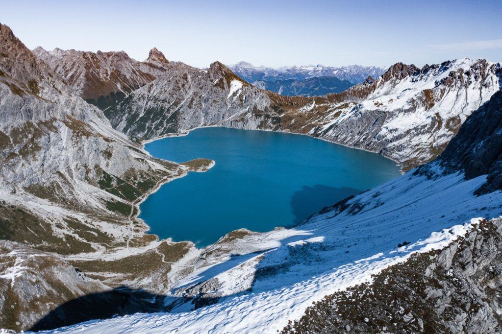
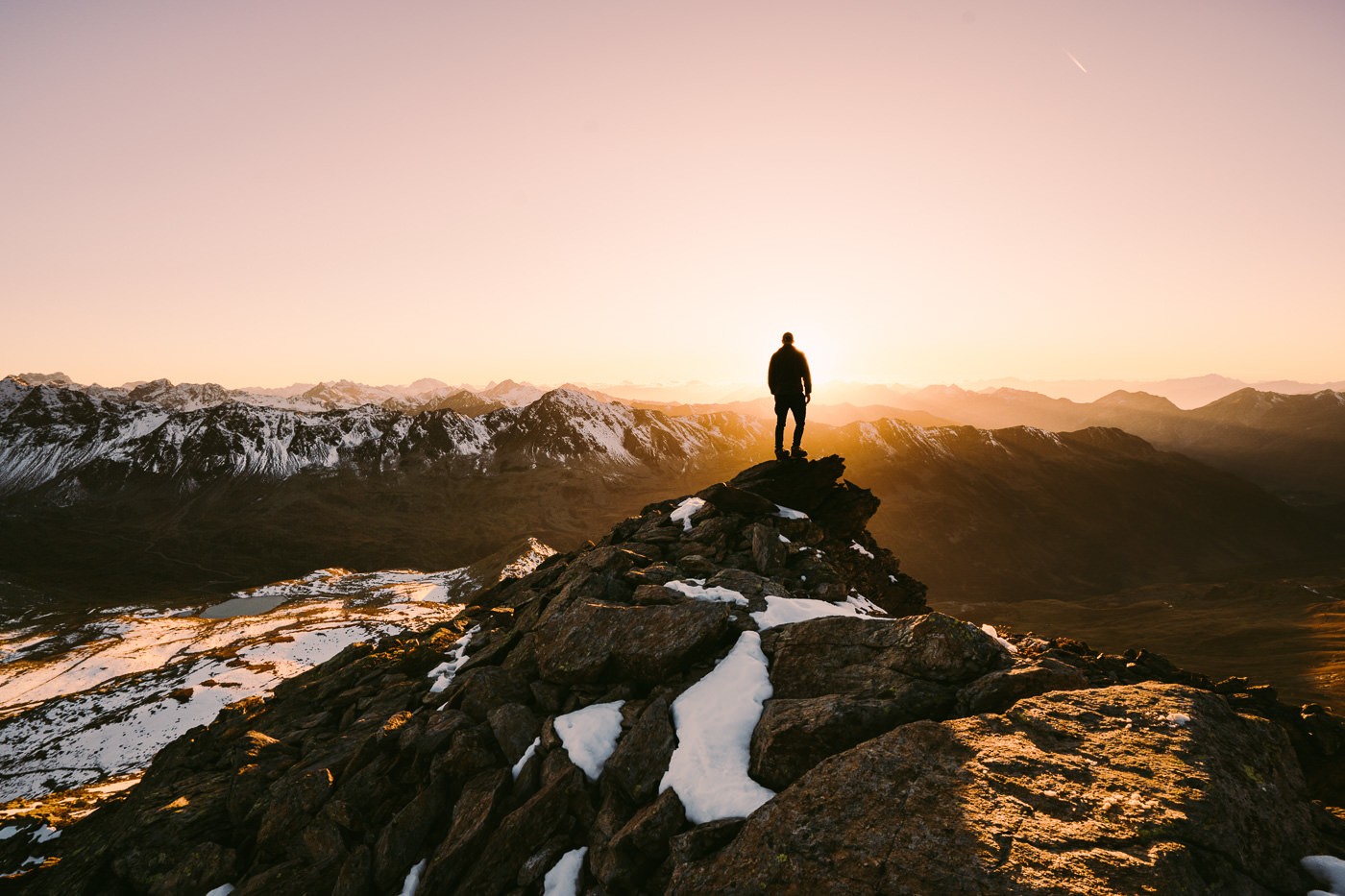
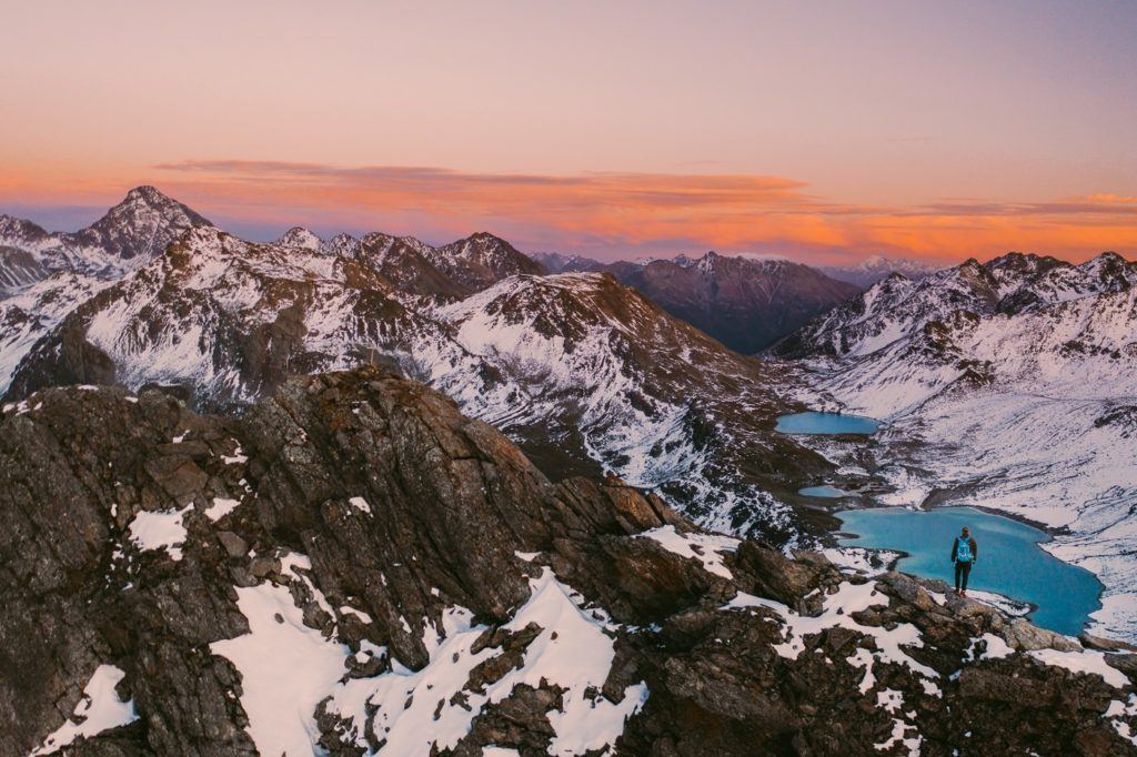
JORISEEN LAKE & JORIHORN SUMMIT HIKE IN DAVOS
This hike near Chur epic 12km loop trail that takes you to multiple lakes and then to the summit of Jorihorn where you have epic views of Joriseen and the Swiss Alps. The trail takes you past each of the lakes in the valley before summitting the Jorihorn for the sunset view of a lifetime.
- Hike Distance: The entire loop was 12.75km but if you don’t summit Jorihorn the loop is just 11km.
- Hike Duration: The whole loop including Jorihorn will take 5-6 hours including rest times but you could bargain for an extra hour if you take lunch down by the lakes. The incline sections and Jorihorn climb are not quick parts of the trail. Our actual moving time or hiking time was just over three hours but we made a lot of photo stops and had a 1-hour lunch and drone-stop.
- Hike Difficulty: The incline is what makes this hike a little challenging although it is spread out in different sections so it isn’t one big block of climbing. There are no dangerous spots on this trail with high exposure although many spots do have a big drop on one side a chain is offered. Usual care needs to be taken. Children can do this hike but with many drop-offs, close supervision would be advised. The climb to Jorihorn is more difficult than the regular loop with exposure on both sides, steep slippery slopes and rock clambering required. Keep in mind, I did this hike in October so it would be much safer all around if there was no snow.
- Hike Incline: 1002 meters.
Want more details and photos? View the full blog post here: JORISEEN LAKE & JORIHORN SUMMIT HIKE IN DAVOS
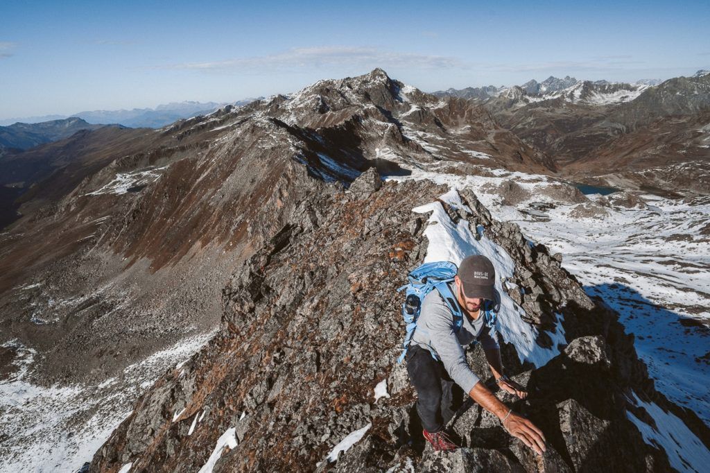

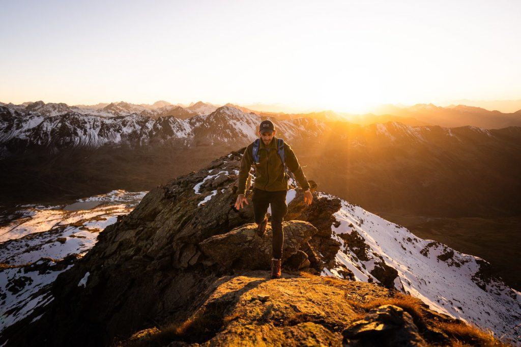
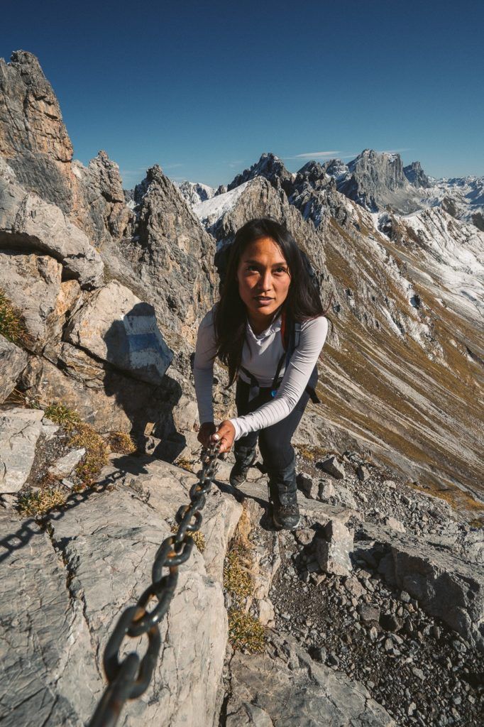
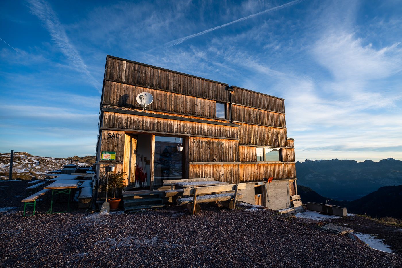
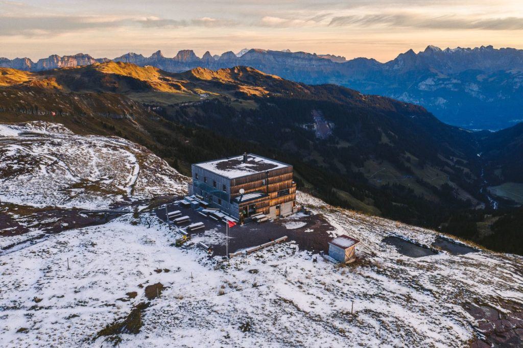
HIKING TO THE SPITZMEILEN HUT AND SPITZMEILEN PEAK
Now this one isn’t right in Appenzell and took about two hours by train to reach there. We left our luggage at our hotel in Chur for one night and returned the next day after our overnight at the Spitzmeilen Hut. Why not hike to the Spitzmeilen Hut (Spitzmeilenhutte) for a beautiful overnight stay before climbing the Spitzmeilen Peak and the Wissmeilen Peak in the morning!? We did this hike after the first snowfall of the year and while a little dangerous, the views were magical from Spitzmeilen Peak!
- Hike Distance: The hike from Tannenboden to Spitzmeilen Hut (after catching the cable car from Unterterzen) was 11.6 kilometers. The next day the hike from Spitzmeilen Hut to Spitzmeilen Peak to Wissmeilen Peak and then down to Engi was 14.17 kilometers. You could take a cable car up further and walk a shorter distance to Spitzmeilen Hut and Engi is not the shortest route down. Therefore there are many ways to make it shorter but this is definitely one of the most scenic routes totaling just over 25km over two days.
- Hike Duration: We did the hike over two days. Day one from Tannenboden to Spitzmeilen Hut took just under 3 hours of moving time but 4.5 hours including stops, and photos. Day two from Spitzmeilen Hut to Spitzmeilen Peak to Wissmeilen Peak to Engi took 3.5 hours of moving time but 6-7 hours in total including a lot of photos, hanging out at the summit and many stops along the way.
- Hike Difficulty: The hike from Tannenboden to Spitzmeilen Hut is very low difficulty and is mostly through vast valleys once you are up the initial incline. The climb to Spitzmeilen was quite difficult in the snow with some exposure and then, of course, the climb up Spitzmeilen summit was not easy. There are chains in place to help you climb but you will need to be in pretty good shape despite the chains. There is no technical rock climbing required but the worst-case scenario is losing grip of the chain or slipping and you will have a 20m drop onto rocks. From Spitzmeilen to Wissmeilen and Wissmeilen Pass the trail is quite exposed and is not always a great path. Again, I did this trail in the snow so I imagine it is much easier in the summer as it is marked as a red-and-white trail, although for us it felt like an alpine route!
- Hike Incline: Tannenboden to Spitzmeilen Hut: 854m Spitzmeilen Hut to Spitzmeilen to Wissmeilen to Engi: 453m incline (Decline: 1657m)
Want more details and photos? View the full blog post here: HIKING TO THE SPITZMEILEN HUT AND SPITZMEILEN PEAK
I hope you enjoyed that list of epic hikes in Chur in my Chur Hiking Guide. If there are any hikes in Chur you think I need to check out on my next visit, please comment on them below!
THINGS TO KNOW ABOUT CHUR
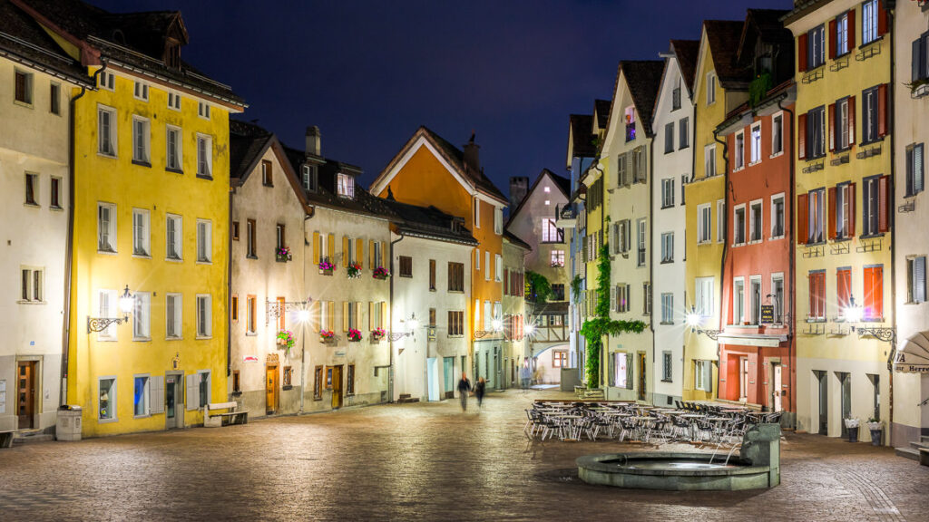
Chur is the oldest city in Switzerland and serves as the capital of the canton of Graubünden in the eastern part of the country. Here are some essential things to know about Chur:
- Historical Significance: Chur boasts over 5,000 years of history, making it the oldest continuously inhabited city in Switzerland. Its Old Town is beautifully preserved and offers a glimpse into its storied past.
- Location: Chur is nestled in the Rhine Valley and is surrounded by impressive mountains, making it a scenic location and a gateway to popular Alpine destinations.
- Cathedral of Saint Mary of the Assumption: Located in the Old Town, this cathedral is a highlight of Chur and dates back to the 12th century. It is notable for its Romanesque architecture and historical artifacts.
- Museums: The Rätisches Museum in Chur provides insights into the history and culture of the region. There are also art museums and galleries that showcase local and international works.
- Bernina Express: Chur serves as one of the starting points for the renowned Bernina Express train journey, which is a UNESCO World Heritage route. The train travels through picturesque landscapes, including the Bernina Range, before reaching Tirano in Italy.
- Outdoor Activities: Due to its location, Chur offers various outdoor recreational activities. In the winter, it’s a hub for skiing and snowboarding. In warmer months, hiking, mountain biking, and paragliding are popular.
- Culinary Scene: Chur boasts a diverse culinary scene with restaurants offering local Graubünden specialties and international cuisines. The region is also known for its wines.
- Festivals and Events: Chur hosts various events throughout the year, from music festivals to traditional celebrations that highlight the region’s rich culture.
- Accessibility: Chur has good transportation connections. It’s easily reachable by train from major Swiss cities and has road links that make it accessible for those driving.
- Shopping: The city offers various shopping opportunities, from modern shops to boutique stores in the Old Town selling local handicrafts.
- Language: While the official language of Chur is German, the canton of Graubünden is the only trilingual canton in Switzerland. Besides German, Romansh and Italian are also spoken in different parts of the canton.
- Theater and Music: Chur has a vibrant arts scene with its theater hosting numerous performances throughout the year. There are also various music venues and events that cater to different tastes.
SWISS TRAVEL PASS or HALF-FARE CARD
OPTION 1: Buy the Swiss Half Fare Card: Switzerland trains, buses, and cable cars are EXPENSIVE! I found the best way to get around cheaply was to buy the Swiss Half-Fare Card before I arrived. It gives you 50% off every regular train, bus, and even many cable cars. It only costs $150 USD but pays itself off in just a few days with many train tickets in Switzerland costing close to $100 alone. If you are staying for more than 5 days, I suggest buying the Swiss Half-Fare Card.
OPTION 2: Buy the Swiss Travel Pass: The second option is to get the Swiss Travel Pass, which gives you unlimited train, bus, and (many) cable car rides but it’s pretty expensive at around $100 USD per day so if you don’t travel each day it isn’t worth it.
OPTION 3: Buy the FLEXI Swiss Travel Pass: The final (BEST) option is to get the FLEXI Swiss Travel Pass, which allows you to buy 8 days’ worth of transit but you can choose the night before if you want to activate the next day. That way you don’t need to travel every day to get your money’s worth, you can just activate the FLEXI Swiss Travel Pass on the days when you are doing sizeable transits. My advice is to book the Swiss Half-Fare Card or the FLEXI Swiss Travel Pass in advance before your trip so it’s ready to go when you arrive.
GET A SWISS TRAVEL PASS!


Enjoy UNLIMITED train, boat, and bus rides in Switzerland for up to 15 days. Click to book a flex Swiss Travel Pass or choose the Consecutive Swiss Travel Pass.
The Swiss Travel Pass starts at $260 for 3 days. Click here to check if it’s available on your travel dates.
MY SWITZERLAND HIKING GUIDES
I spent 100 days hiking in Switzerland and created a guide for different regions around the country. You can click on one of my Switzerland hiking guides below to help you plan your trip.
- The Complete Guide: 50 AWESOME HIKES IN IN SWITZERLAND
- The Via Ferrata Guide: 4 EPIC SWITZERLAND VIA FERRATA COURSES
- Lauterbrunnen Guide: 10 AWESOME HIKES NEAR LAUTERBRUNNEN
- Interlaken Guide: 15 AWESOME HIKES IN INTERLAKEN
- Grindelwald Guide: 12 AWESOME HIKES NEAR GRINDELWALD:
- Mürren Guide: 7 AWESOME HIKES IN MURREN
- Appenzell Guide: 9 AWESOME HIKES NEAR APPENZELL
- Chur Guide: 7 AWESOME HIKES NEAR CHUR

MY SWITZERLAND TRAVEL TIPS
- For Backpackers: SWITZERLAND BUDGET BACKPACKING GUIDE
- Travel Tips: 20 THINGS TO KNOW BEFORE VISITING SWITZERLAND
- Transport Tips: RENTING AND DRIVING A CAR IN SWITZERLAND
- Accommodation Guide: 30 BEST PLACES TO STAY IN SWITZERLAND

Maggie
Friday 16th of June 2023
Month of July and Auguste you can buy for SFR 115.-( month), a Ticket , with this you travel whole Kanton Graubünden, train and buses! Looking for overnight staying at Davos, contact me!
Jackson
Sunday 18th of June 2023
That sounds like a good deal!
Rafa
Thursday 13th of January 2022
Man....!, epic journey you had in Graubunden or Grisons. I am new to Switzerland and I am exploring the country, your guide for Graubunden is priceless, thank you very much. Hope you are keeping well.