
The Saxer Lücke hike from Hoher Kasten takes you along a stunning ridge looking over Samtisersee until you reach the epic Saxer Lücke Ridgeline! It can be started from either Hoher Kasten or Staubern. I did it from Hoher Kasten and it was a 17km hike for the whole route.
SAXER LÜCKE HIKE FROM HOHER KASTEN
Nestled within the stunning mountain landscape of the Alpstein region in Switzerland, the Saxer Lücke Hike from Hoher Kasten offers a thrilling adventure for passionate hikers and nature enthusiasts. Starting at the summit of Hoher Kasten, accessible via a panoramic cable car ride, the trail meanders through rugged ridges, lush alpine meadows, and traditional Swiss mountain huts. As you traverse this well-marked path, you’ll be rewarded with breathtaking views of the Rhine Valley, the Appenzell Alps, and the remarkable rock window formation of Saxer Lücke.
SAXER LÜCKE HIKE DETAILS
- Hike Distance: The entire loop is 17km
- Hike Duration: The hike should take about 5 hours depending on how long you stop at Staubern and Saxer Lücke
- Hike Difficulty: The majority of the trail is flat or downhill. There aren’t many points at all with much exposure so I definitely would say this is possible for families, especially the fact that you can start at Staubern and cut some of the distance off. There was a trail the whole way, mostly dirt, gravel and sometimes a little rocky.
- Hike Incline: 450 meters
YOU WILL ALSO LIKE MY APPENZELL HIKING GUIDE: 9 AWESOME HIKES IN APPENZELL, SWITZERLAND
HOW TO GET TO SAXER LÜCKE
There are several options to get to Saxer Lücke. I’ll detail the three most popular routes below. I did the first option.
- Take a cable car from Brulisau to Hoher Kasten Viewpoint and hike to Saxer Lücke via Staubern.
- Take a cable car directly to Staubern from Frümsnerbergstrasse and hike to Saxer Lücke.
- From Bollenwees hike up 35-minutes to Saxer Lucke. Bollenwees is a mountain hut where you could stay overnight or reach during the day from Brulisau or even Wasserauen as part of the Three Lakes Hike or similar.
MY EXPERIENCE ON THE SAXER LÜCKE HIKE FROM HOHER KASTEN
The Saxer Lücke had been on my list for a while as it’s one of those locations you see a photo of and it sticks with you for a while. After a few months of hiking around Switzerland, it was time to go for the Sax.
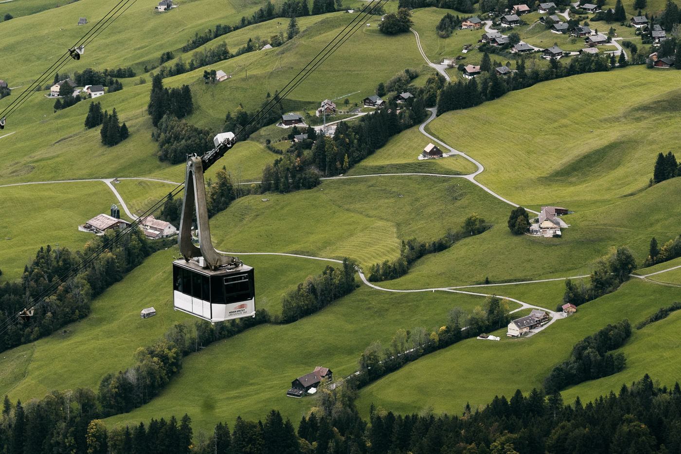
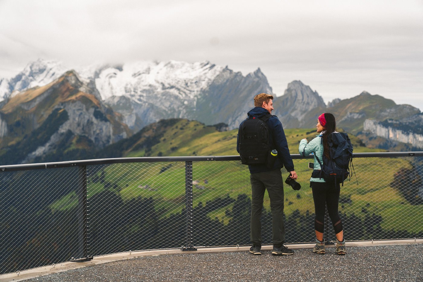
We had a car this day so parked it a little bit down from Brulisau and walked back to the cable car so that we would have a shorter walk later that night. The cable car up to Hoher Kasten is quite popular as the viewpoint has a revolving restaurant and you can actually see Italy, Austria, Germany and, Lichtenstein from the summit. The single-trip fee was $26 or $13 if you have a Swiss Travel Pass or the Swiss Half Card.
At the summit, we were actually a bit disappointed because there were clouds completely engulfing us. There was no view at all. Had we picked the wrong day for this epic hike? All you can do is cross your fingers and push on… after a coffee delay.
We enjoyed a latte inside the restaurant and by the time we had finished, the weather outside was clearing up. It was still pretty gloomy but we were happy to be able to see our surroundings. Make sure you check out the viewpoint at Hoher Kasten before you begin the hike.
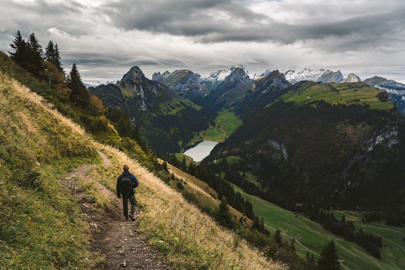
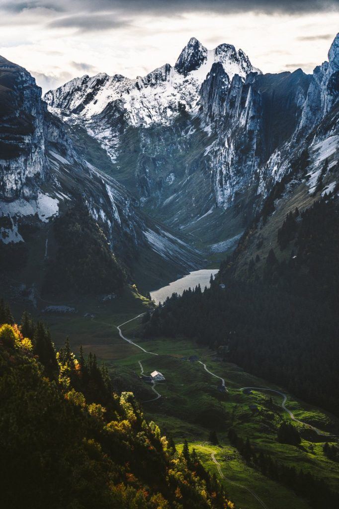
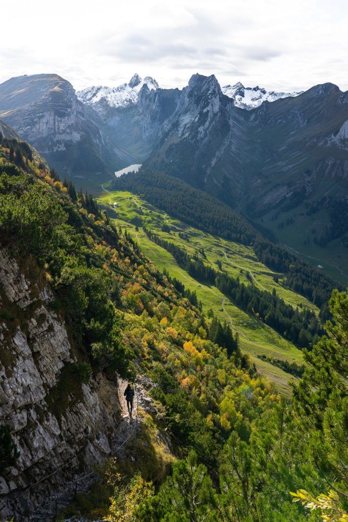
The trail begins with views of Appenzell in the valley below and Samtisersee in the distance. It’s quite a beautiful valley that Samitsersee is located in with cliffs creating an amphitheater. We began the hike at 11:30 am even though that was way more time than needed. This meant we could stop along the way, have lunch at Staubern, and meander along the trail.
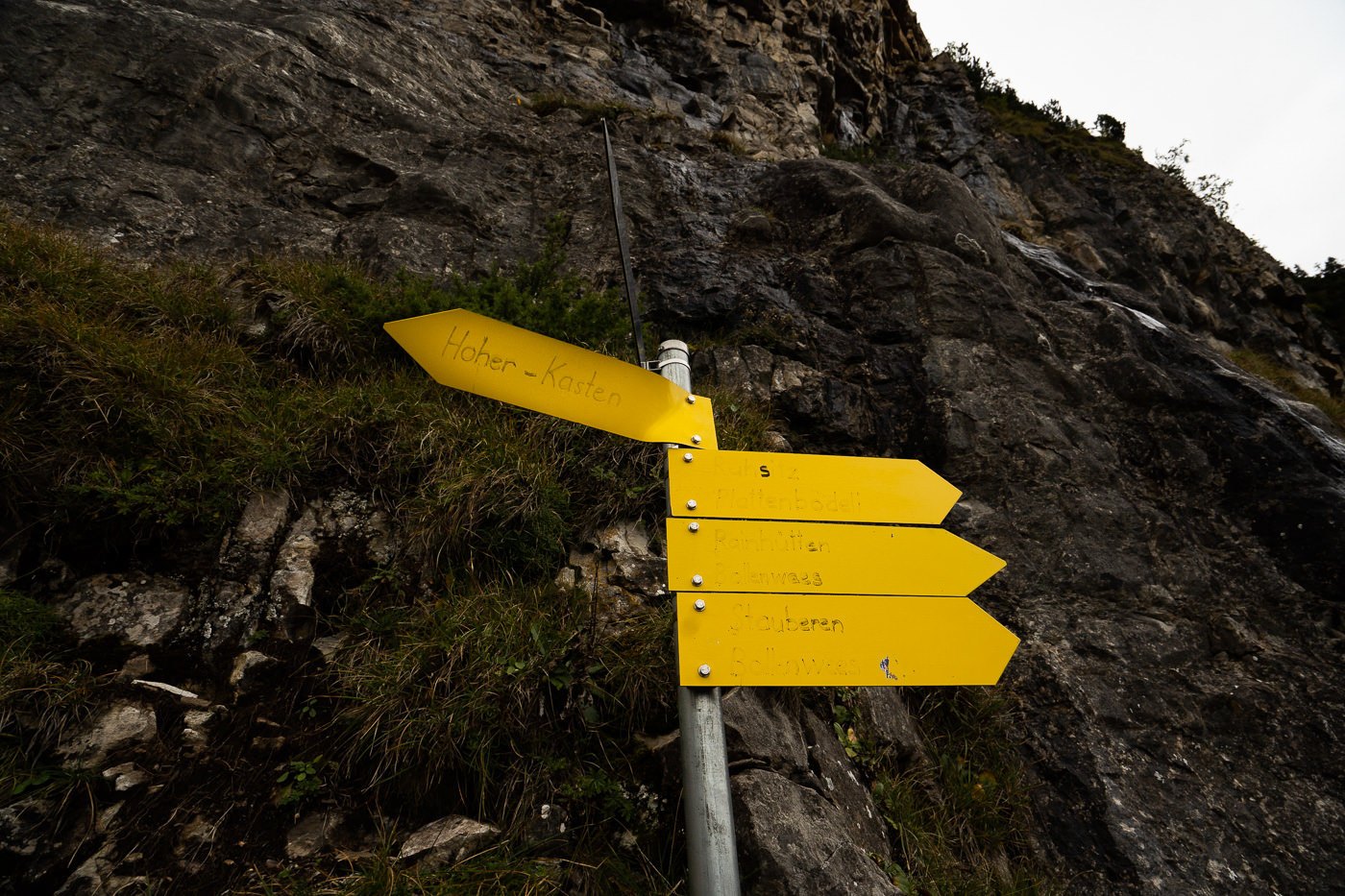
At the bottom of the first ridge, there was a sign pointing towards Hoher Kasten and it was the most un-Swiss sign I have ever seen. Normally in Switzerland, everything is in perfect order, in great condition, and of high quality. Yet one of the signs was hand-drawn and quite faded. First-time visitors may not get the joke but regular hikers will enjoy this Swiss sign that needs some love.
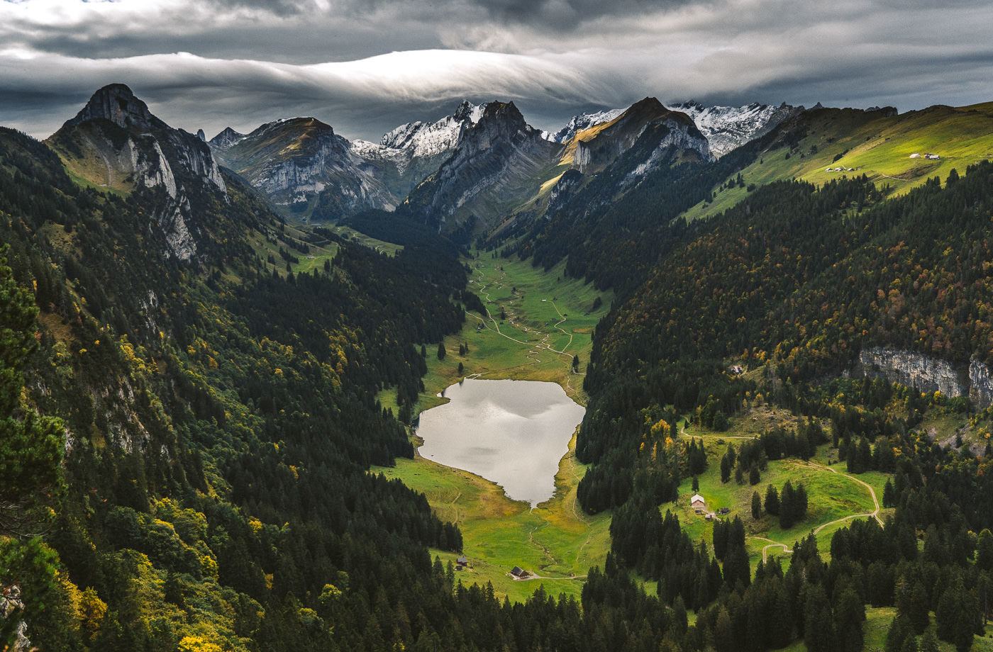
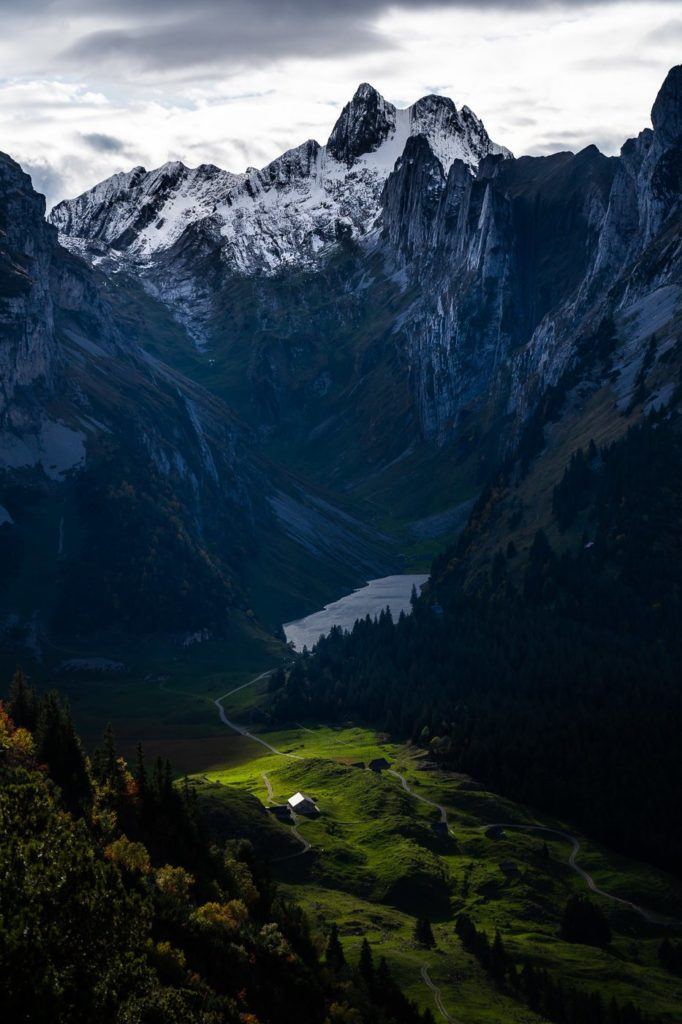
For the next hour or so, you make your way along the underside of the cliff following the undulations of the trail. All the while, you have views down over Samtisersee and even glimpses of Fallensee as the trail goes on. Santis even popped its head out a few times as well. There’s always something to look at on your right-hand side.
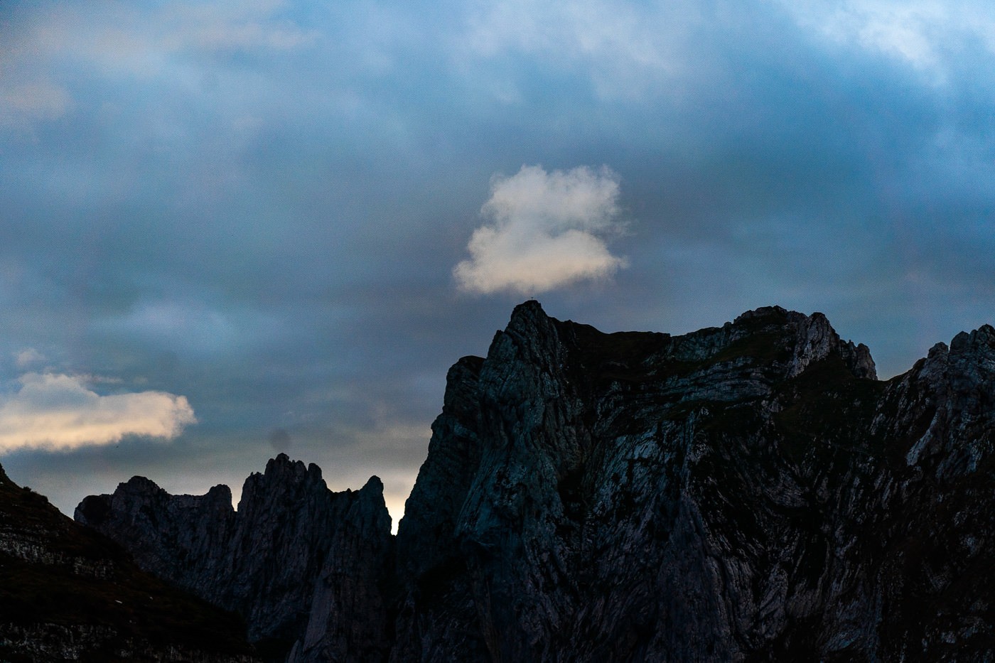
At one point, some incredible clouds started forming and I knew the scene was going to become very epic, very soon. A few streaks of light shot through as the clouds waterfalled onto Santis in an incredible moment.
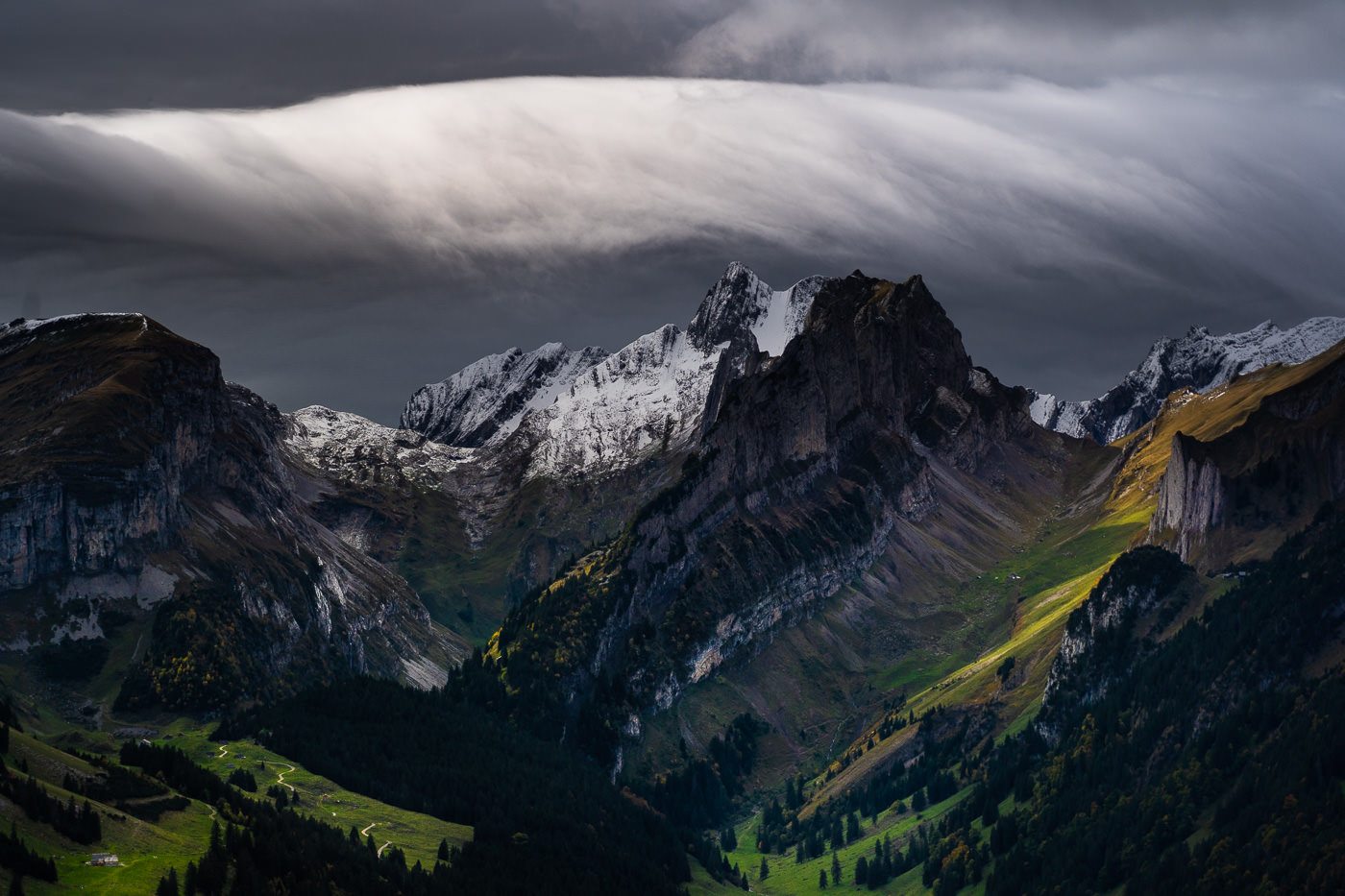
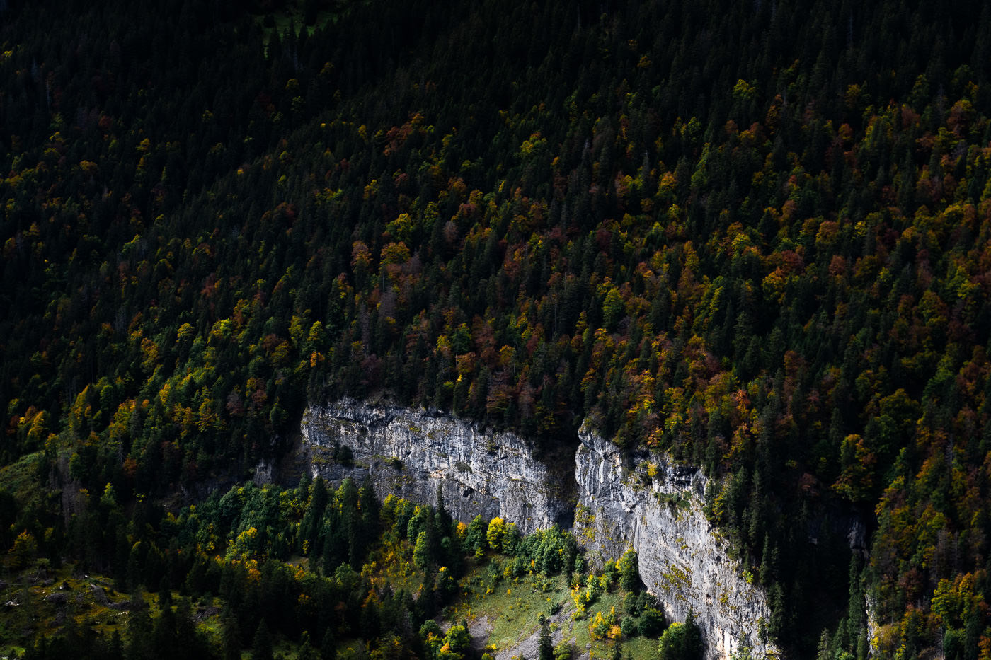
Across the valley, the first colors of Fall (Autumn) were beginning to show as the oranges, reds, and yellows shone through the dark greens of the forest.
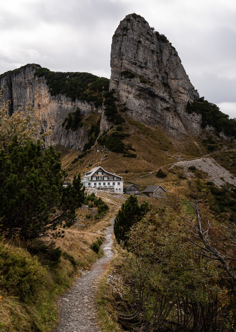
After an hour and a half at a pretty slow pace, we made it to Staubern Mountain Hut. Here is a great place to grab lunch or a coffee before you continue the journey toward Saxer Lücke.
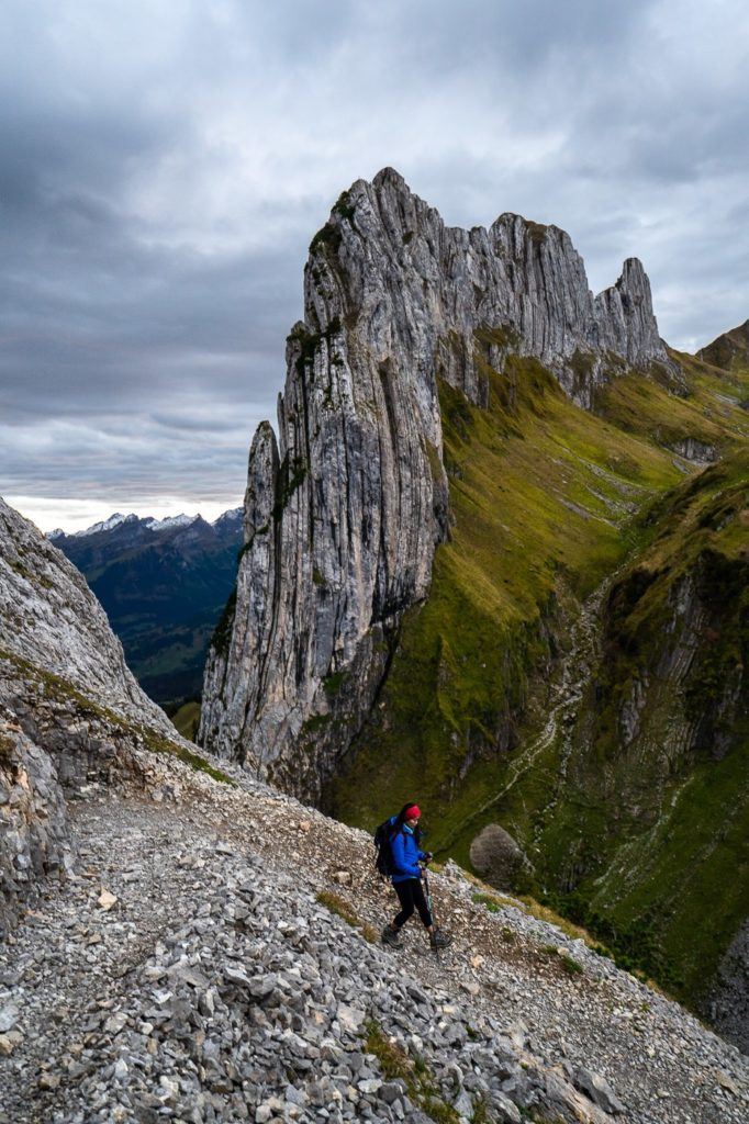
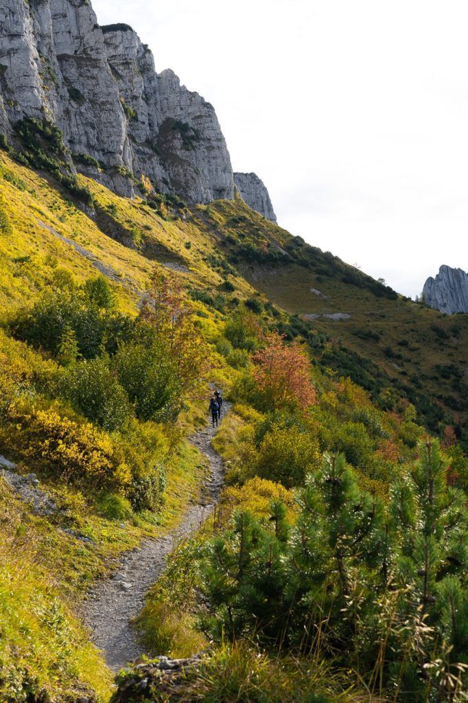
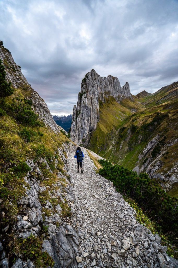
After Stabuern, the trail gets quite interesting with the Fall colors and a few really wide-open moments with views out to Fallensee. This stretch is only meant to take 80 minutes from Staubern to Saxer Lücke, so you can schedule your time well. We still had quite a bit of time til sunset so we took in the sights along the way.
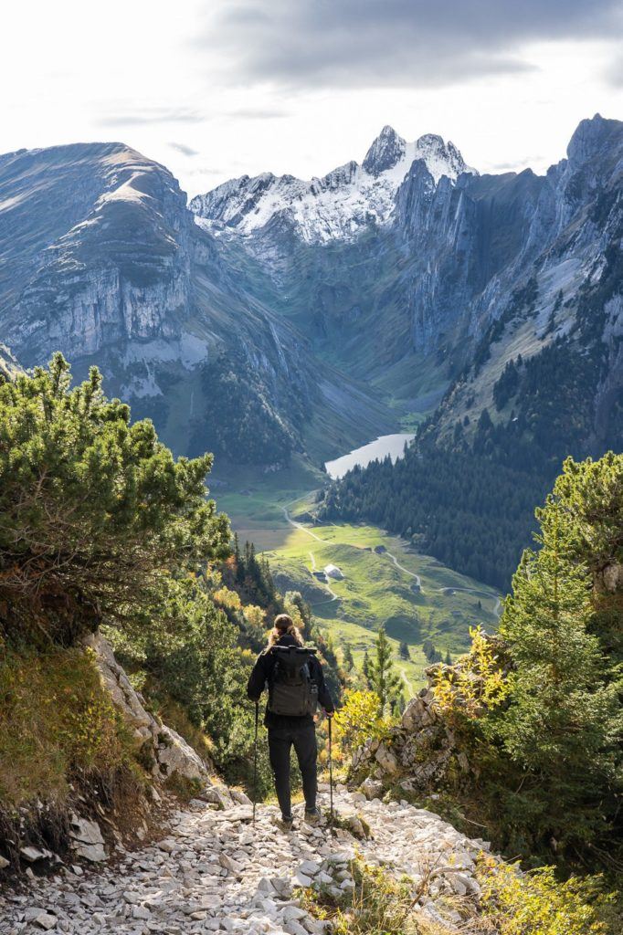
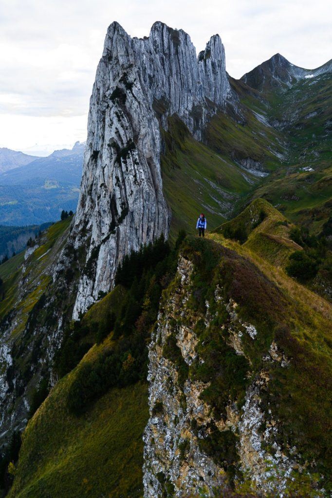
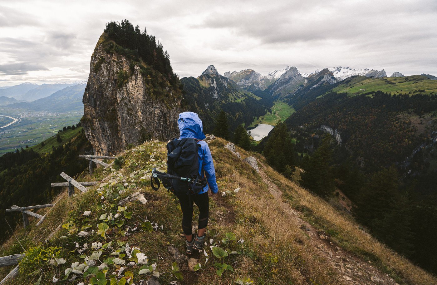
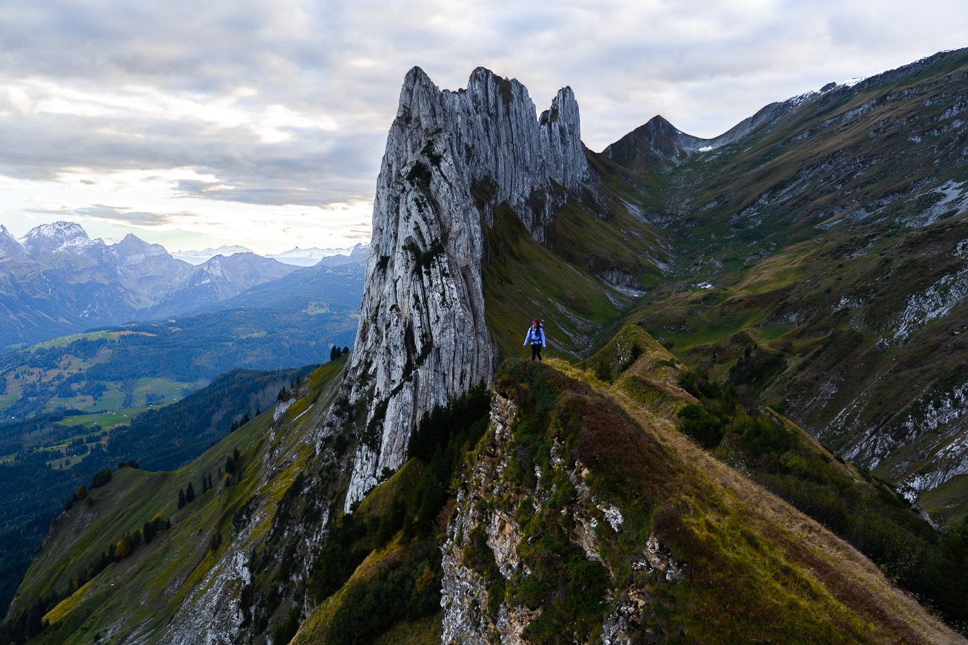
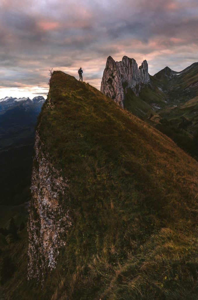
After 2.5 hours of very relaxed moving time, we made it to Saxer Lücke. Finally, after months of waiting, I’d made it to this famous spot. It didn’t disappoint. The trail leads you along a winding ridge, up and down several humps before revealing the mighty saw-tooth ridge known as Saxer Lücke.
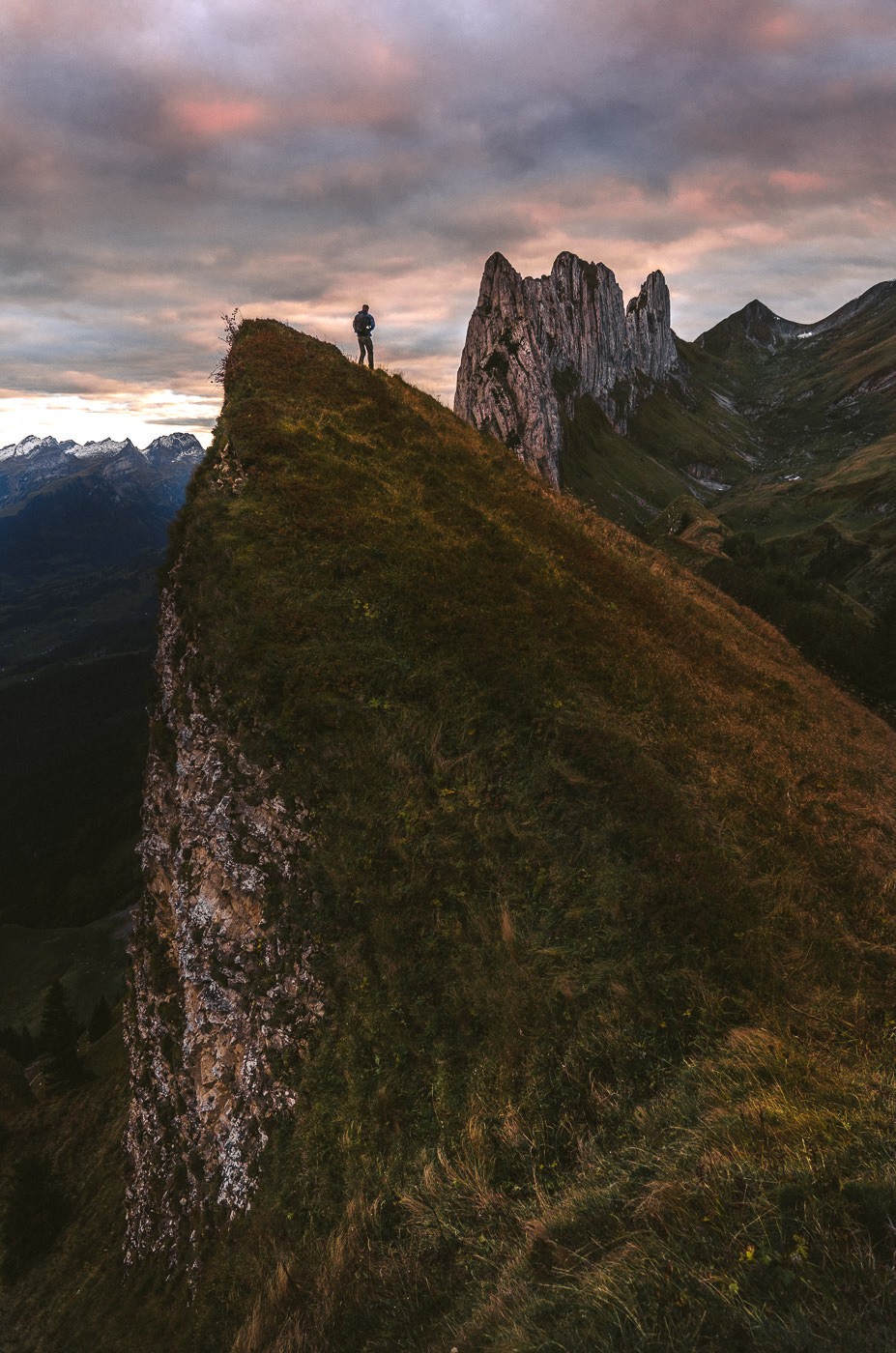
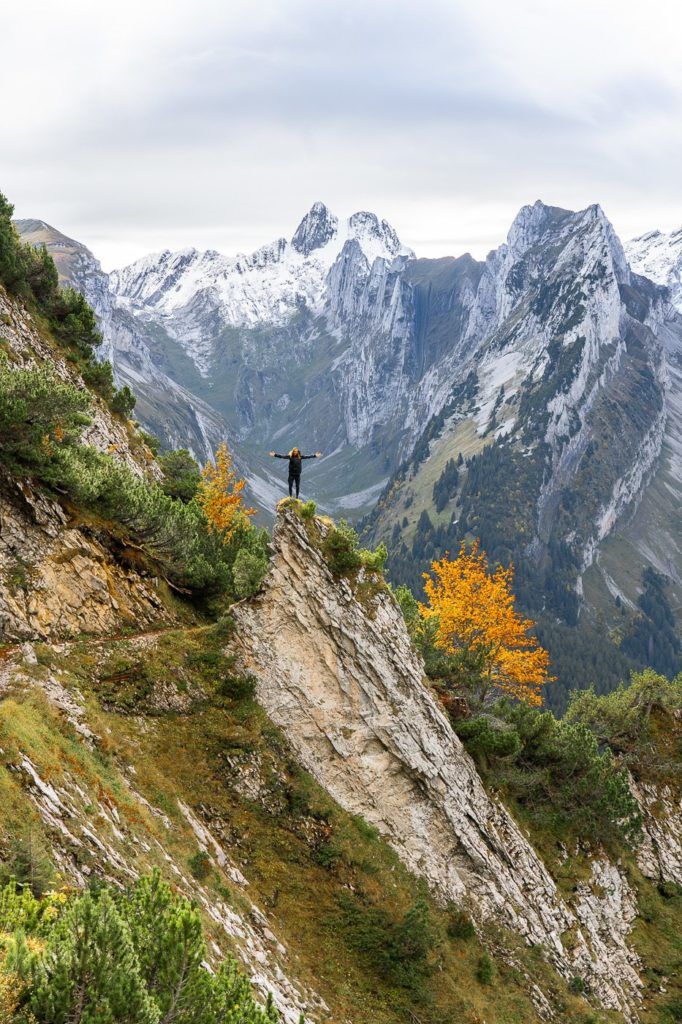
There are lots of great little platforms, plateaus, and ridges to take photos from and the view keeps changing as you make your further and further down the ridge. The sun sets to the right of the ridge so you lose any light just before sunset. It would probably be a sunrise spot for the best lighting in my opinion. Having said that, it is a great location no matter the lighting, and often the best conditions up at Saxer Lücke include some mystical fog.
These are the photos we took up at Saxer Lücke.
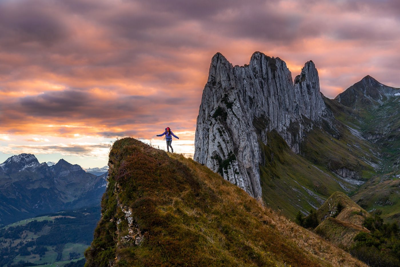
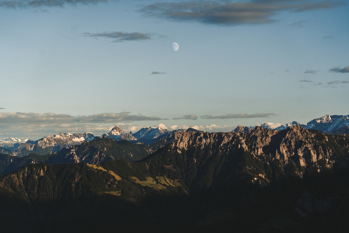
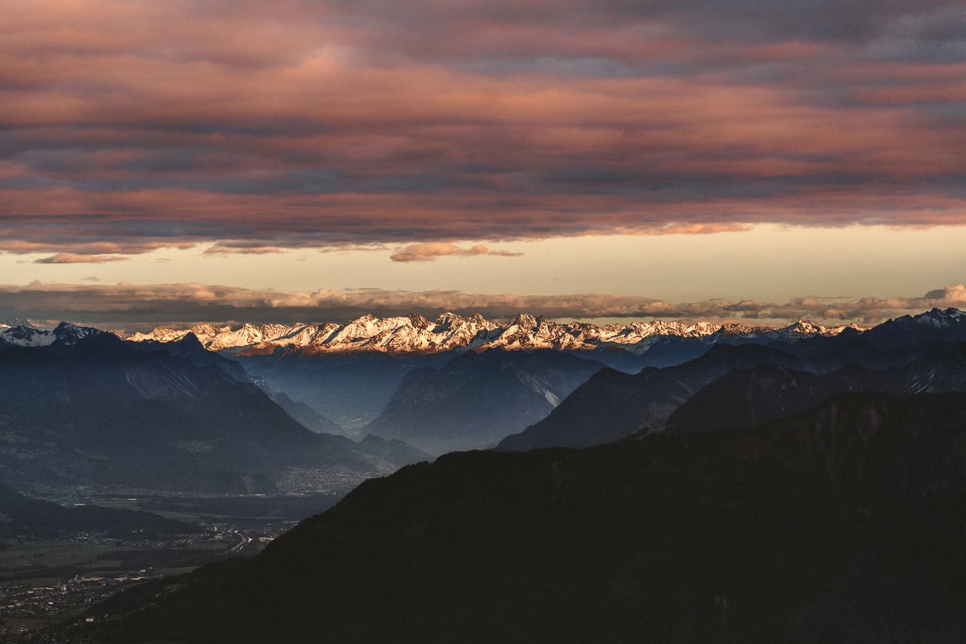
The view across the Rhine to Austria is unbelievable and the alpenglow, the moon, and the layers on this night made the scene almost more spectacular than Saxer Lücke itself.
After enjoying the sunset, we began the long journey back down to Brulisau. It’s about 9km from Saxer Lücke to Brulisau so you still have quite a journey ahead of you although it’s almost all downhill. There are still a few little viewpoints of Saxer Lücke left on the trail down to Bollenwees Mountain Hut.
If you have planned things well, you might be staying overnight at the Bollenwees Mountain Hut, which would mean you only have a 35-minute walk down from Saxer Lücke before enjoying dinner and some warmth. If you are like us, you are walking in the dark to Brulisau. It is definitely worth it and not a dangerous hike down at all with no drop-offs or steep, narrow trails once you pass Bollenwees. It took us about 1.5 hours to reach our car, which was parked 1.5 kilometers before Brulisau.
The night sky on the walk to Brulisau was pretty remarkable and the walk back wasn’t too bad. I can’t recommend this hike enough and if you can somehow get up there for sunrise, I wish you all the best and hope you get great conditions and enjoy the view.
Dr Amba Tobin
Tuesday 31st of October 2023
Wonderful photos. I did the Schafler Ridge hike--to the Hut in late September. Got a late start and missed the last cable car down. Luckily there was a private party of Chocolate makers from around the world. They gave me a ride down at 10pm from Ebenalp. I was super happy as I had a flight to Amsterdam the next morning from Zurich. (ex jazz singer from late 80s to 90s in the Netherlands, Switzerland and France Mainly 85 to 94...quite a different Europe 30 some years ago for music)
Calvin
Wednesday 11th of October 2023
Just did this today, thanks so much
CHIRANJEEV KOHLI
Thursday 2nd of September 2021
I haven't really looked at all the content but seems promising. So glad I found this.
Marc Hastenteufel
Friday 11th of October 2019
Even you were not too lucky with the blue sky it looks amazing! Now I must go there. Thank you!