
The Mount Säntis hike in the Alpstein region is one of the most spectacular trails in Switzerland. It’s possible to trek to the top of Mount Säntis as part of the Alpstein loop or as a straight ascent. Once you reach the top you will find incredible viewing platforms and a large restaurant. There is a cable car servicing Mount Säntis so you can choose to hike just one way and catch the cable car either up or down.
THE MOUNT SÄNTIS HIKE
No matter how you reach Mount Säntis Peak, the view of the Alpstein region from the summit is magical. In this blog post, I’ll share all the details you need to know about the Säntis hike. I’ll share how to get there, the distance, duration, mountain huts in the area, and the different route options.
HOW TO GET TO MOUNT SÄNTIS
There are quite a few different ways to reach Mount Säntis, so it is difficult to share the one-defined route. What I will do is tell you your options and then share with you the route I took, which in general is the most epic and complete hike called the Alpstein Loop.
- The first option (which I did) is the Alpstein Loop. You begin at Wasserauen and hiked up to Ebenalp, onto Schäfler Hut, and then up to Ohrli then finally onto Mount Säntis. From here you begin the descent down Lisengrat to Rotsteinpass, to Meglisalp, to Seebergsee and finally back to Wasserauen station. Generally, you will spend at least one night at one of the mountain huts. Schäfler Hut is a good place to stay overnight or if you come in the other direction Rostein Hut is a good choice. This route is best done over 2-3 days.
- The second option is to hike up to Mount Säntis from either of those directions. Essentially, you will take half of the Alpstein Loop and then catch the cable car down. This makes the summit and descent possible in one day.
- The third option is to head up via Seebergsee and then Mesmer. I’ve never done this route so I cannot comment on its difficulty level but it is listed on the map below.
- The fourth option is to hike up from Meglisalp up to Säntis via Wagenlucke but again this is not an average route and I cannot comment on the difficulty. It is also listed on the map below.
- The fifth option is to hike up from Schwagalp. This is where the cable car is so many park their car here and then either hike up or down taking the cable car either up or down to make the hike more manageable.
These are the main options from within the Alpstein regions, although there are a number of other ways to reach the waypoints listed from around the sides for an alternate route, in general, you will have to pass via one of the above routes at some stage. For example, you can catch the cable car to Ebenalp and begin from there to skip the first section of the hike.
GETTING TO WASSERAUEN (THE STARTING POINT)
Wasserauen is the starting point for the Schäfler Hut hike and is easily accessible by train or car. Wasserauen is in the northeast of Switzerland near the Liechtenstein border. Luckily, Switzerland is a relatively small country so you can reach the town of Wasserauen from most places including Zurich (2-hr journey by car).
There is no major city nearby with journeys of 2+ hours from Chur, Lucerne, and Bern to reach Wasserauen. I was based in the Appenzell district when doing this hike so it was just a 15-minute train journey for me.
TRAILHEAD INSTRUCTIONS FOR MOUNT SÄNTIS HIKE
The Schäfler Hut hike begins in Wasserauen. There is a train station directly at the foot of the hike, which is also where you will find the cable car if you decide not to hike the whole way and take the cable car to Ebenalp.
When you arrive at Wasserauen, you will find yourself in a giant parking lot. A damn pretty parking lot but you will soon realize, this is not an off-the-beaten-path trail. There is a cable car to Ebenalp that I will detail later, which means you get a lot of tourists rather than hikers, which is fine but we are here to detail the hike.
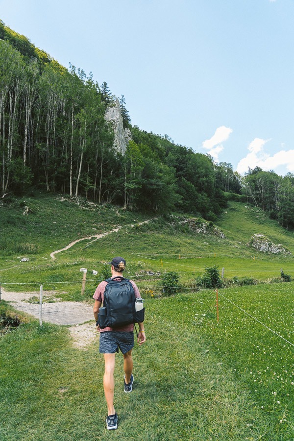
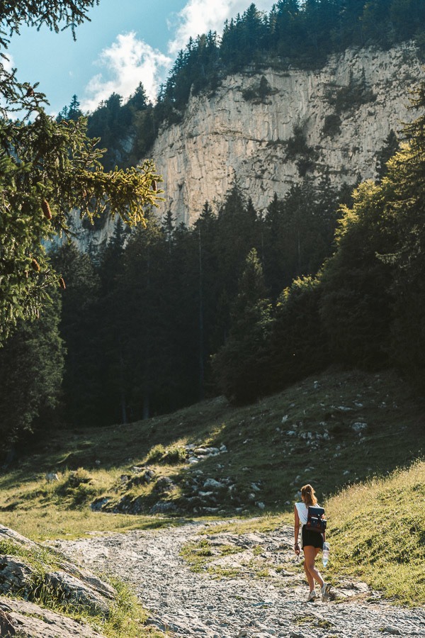
From the Alpen Rose Hotel, walk away from the Seealpsee direction and away from the parking lot. The trail is on the left side next to a wooden house and heads directly up into the forest.
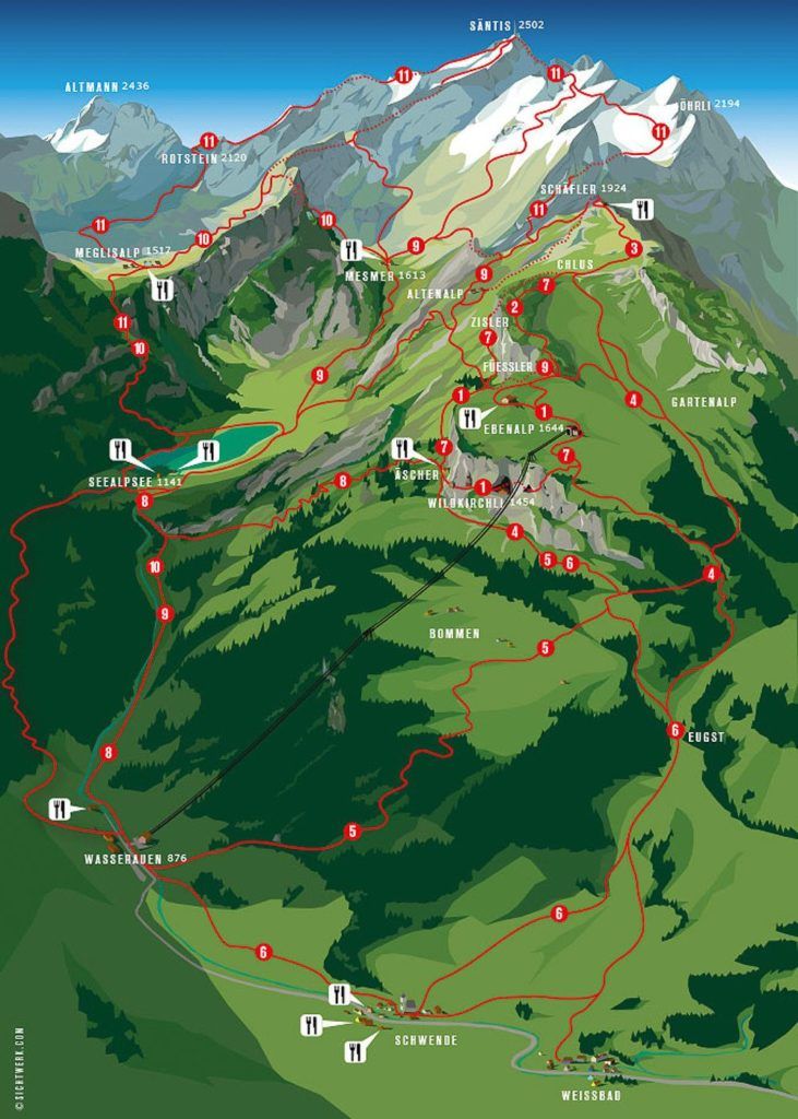
ALPSTEIN AREA MAP
The map below shows the entire Alpstein Loop hiking region from Wasserauen. As you can see there are so many different connecting trails, which makes it a great spot for all different abilities and schedules. In this blog post, I’ll share how to do the Mount Säntis Hike and return but in the Alpstein region, there are always many options for how to make a loop or visit multiple spots in one day. The below checklist is for including Mount Säntis Peak in your Alpstein Loop.
- Begin in Wasserauen
- Hike up the hill through the forest to Bommen
- Arrive at Ascher Cliff Restaurant
- Head up the cliff to Wildkirchli to see the Church and Cave
- Continue up the hill to Ebenalp Viewpoint
- Continue further to Fuessler Viewpoint
- Continue further to reach Schäfler Hut
- Hike onwards to Ohrli
- Ascend up to Säntis
- Descend along the Lisengrat Ridge
- Down to Rotstein Hut
- Descend to Meglisalp
- Pass by Seebergsee
- Hike back down to Wasserauen
The maps below show the overall hiking routes for Alpstein and the cropped map shows the route from Ebenalp to Schäfler.
MY EXPERIENCE HIKING TO MOUNT SÄNTIS
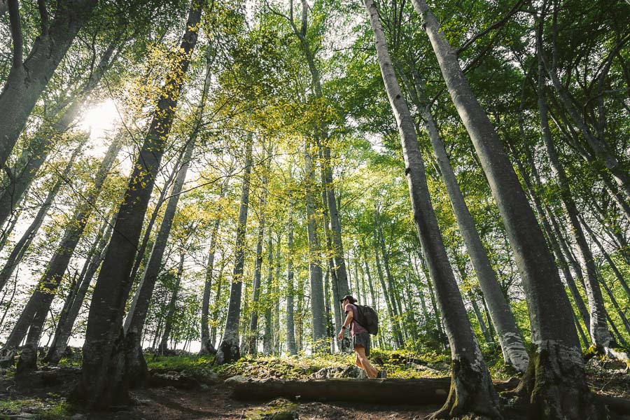
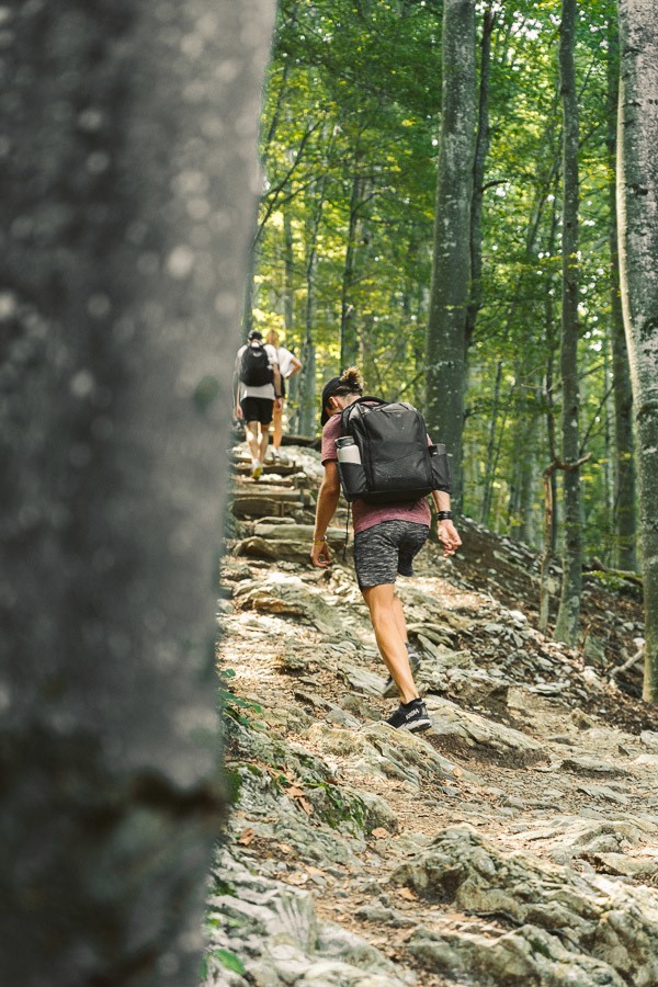
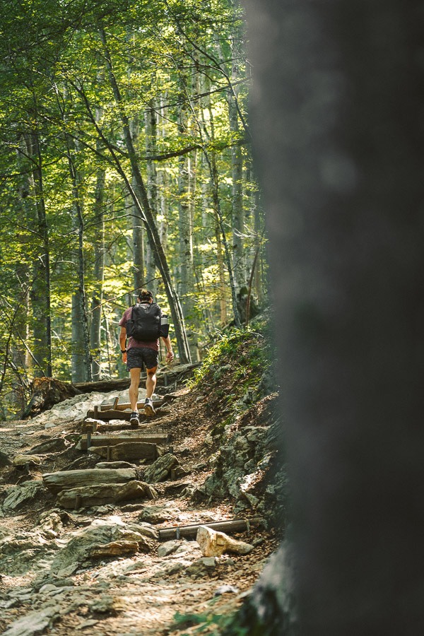
The trail begins through the forest with a very steep set of switchbacks. The forest was beautiful with towering trees giving us some much-needed shade and an incredible scene as hikers in the distance ducked in and out of the tree trunks. The incline was relentless for a good 20-30 minutes before we finally reached the open field atop the hill. (For reference some of these photos are from a summer trip to Ebenalp and some are from during the first snowy weeks of the season in October)
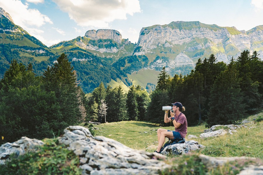
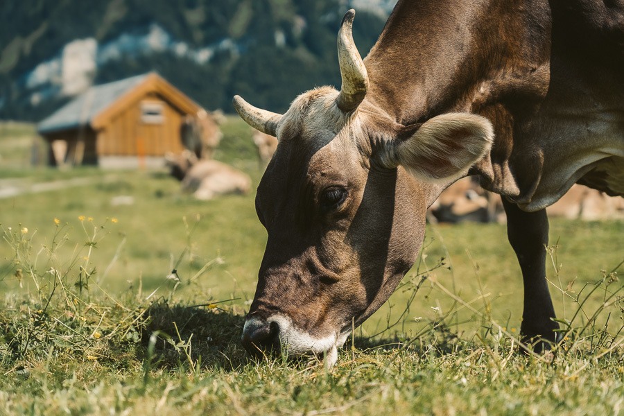
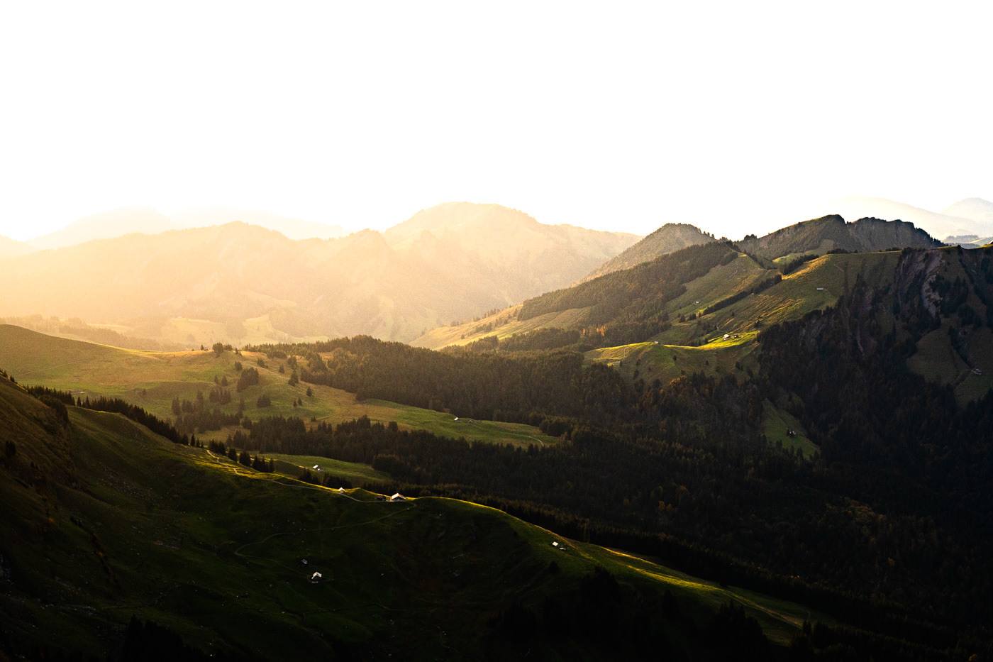
As we left the forest and entered the farming fields above, we were welcomed with our first view of the surrounding mountains. With lactic acid in the legs and epic mountain vistas in all directions, we sat down and took it all in while rehydrating. The trail would flatten out for a while as we made our way through Bommel to the sound of the bells, ringing from the necks of the local cows.
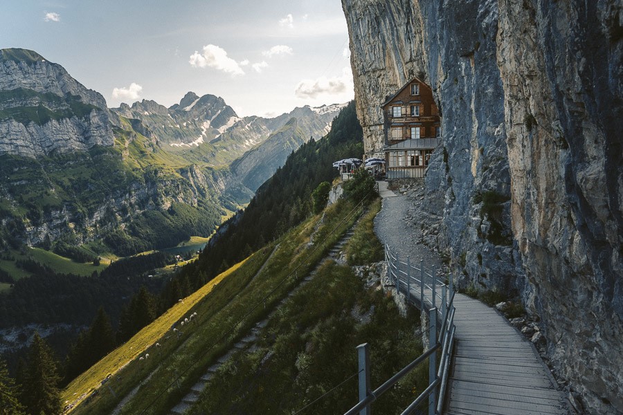
After making our way through the fields of Bommel, we began another ascent up the hill towards the famous Ascher Cliff Restaurant. With some shade from the mountain, we took a reprieve from the harsh Swiss sun while enjoying the mountain range to the left of the Wasserauen valley.
The Ascher Cliff restaurant is rather famous due to its incredibly scenic position and was featured in National Geographic, which instantly made it a favorite location for tourists. We thought it might be quite expensive given it is Switzerland and this was an in-demand spot but to our surprise, it was on par with average cafe prices from the city. We chilled out at the restaurant for half an hour enjoying a coffee amongst other hikers, families, and trail runners.
It is of note to mention that you can take the cable car up to Ebenalp and then walk the short way down to Ascher Cliff Restaurant if you aren’t intending to do much hiking but still want to enjoy this iconic restaurant location.
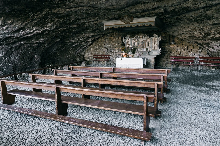
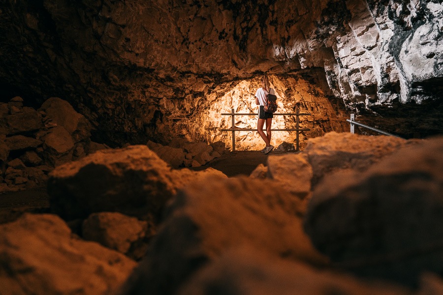
Once you finish your last sip of coffee at the Ascher Cliff Restaurant, you can head up the stairs toward the church and the caves. Inside one of the caves are pews and a shrine within the church. To my surprise, an actual service is held here once a month, which would be quite the pilgrimage for many who make the journey.
Beyond the church are some caves you need to walk through to make it to Ebenalp. Inside the caves are lights showing you points of interest with placards explaining important parts about the caves, such as the fact that bears used to live inside.
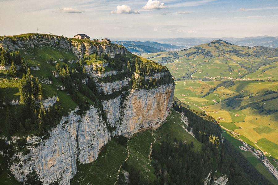
After passing through the caves, you are just about at the Ebenalp viewpoint. However, you still need to push through a little more incline to make it up to Ebenalp, which sits at 1,644m above sea level. At the viewpoint, you will find a restaurant and several small buildings selling souvenirs. We took this chance to sit down on the benches, take the whole scene in and even send the drone out for a scouting mission.
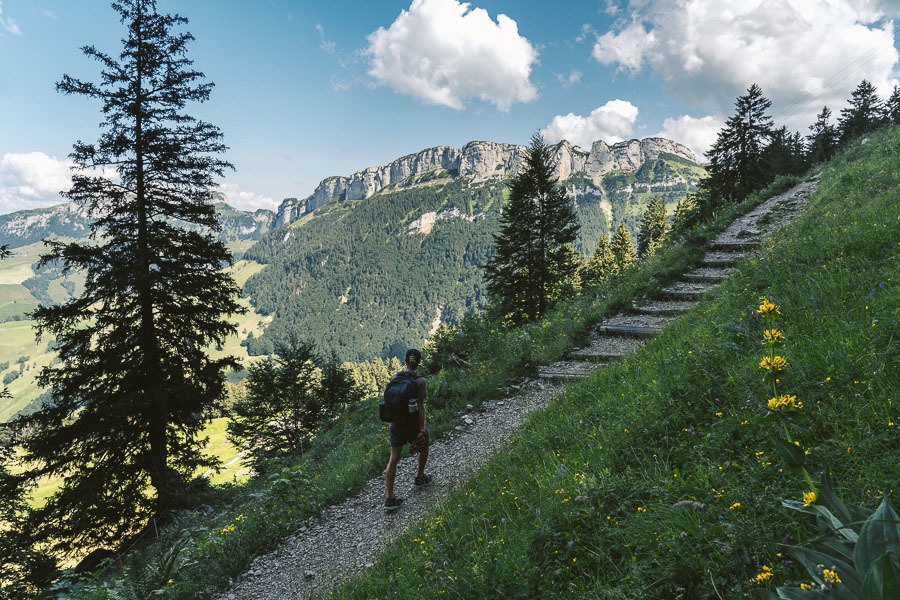
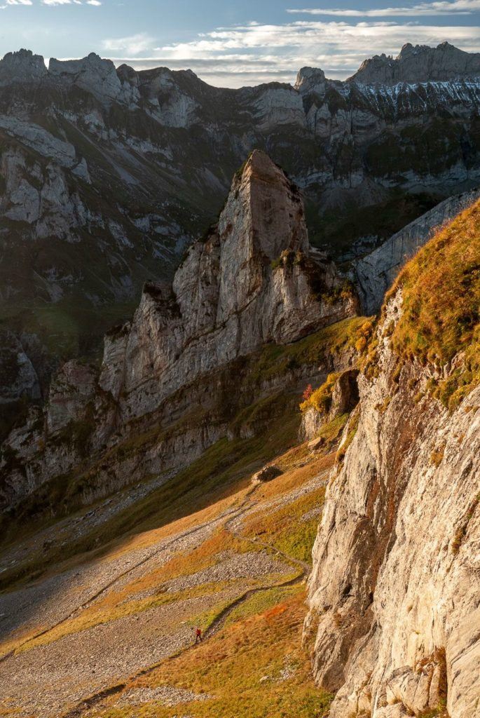
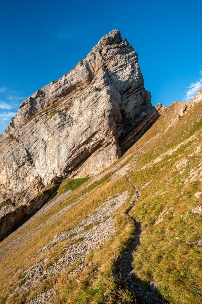
From Ebenalp to Schäfler the journey is just under three kilometers with a couple of hundred meters of incline. The route gives you several great views along the way on either side of the trail before sending you into a series of switchbacks set to test out your legs on what should be the final moments of incline for the day.
From Ebenalp to Schäfler Hut you can expect to take just under an hour to complete the hike. Once you reach the hut you may want to stop for a drink or a snack before venturing on for a few more moments to the viewpoint, which is one of the best spots in the Alpstein region.
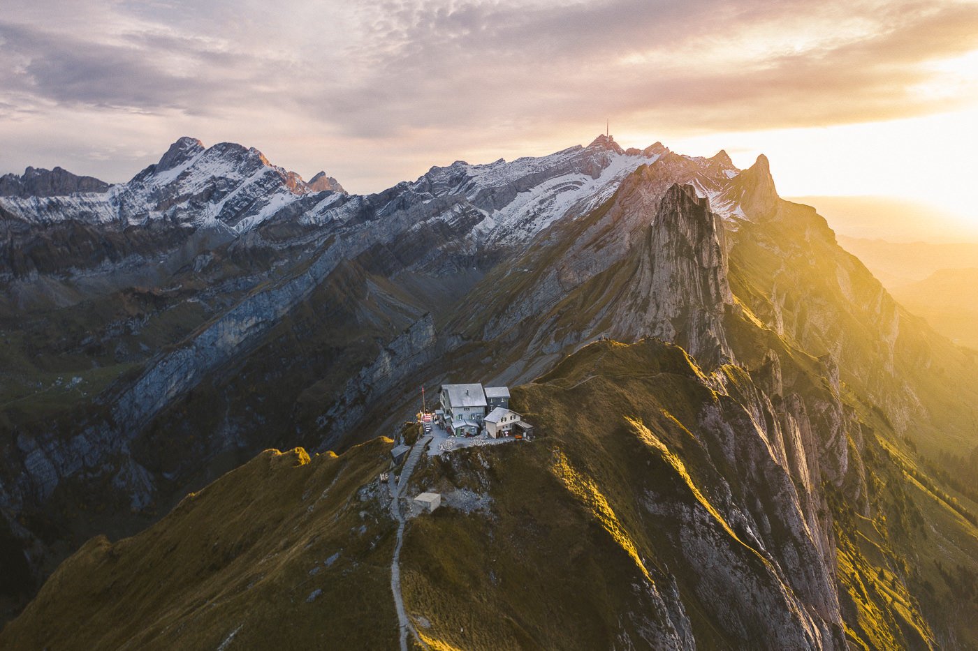
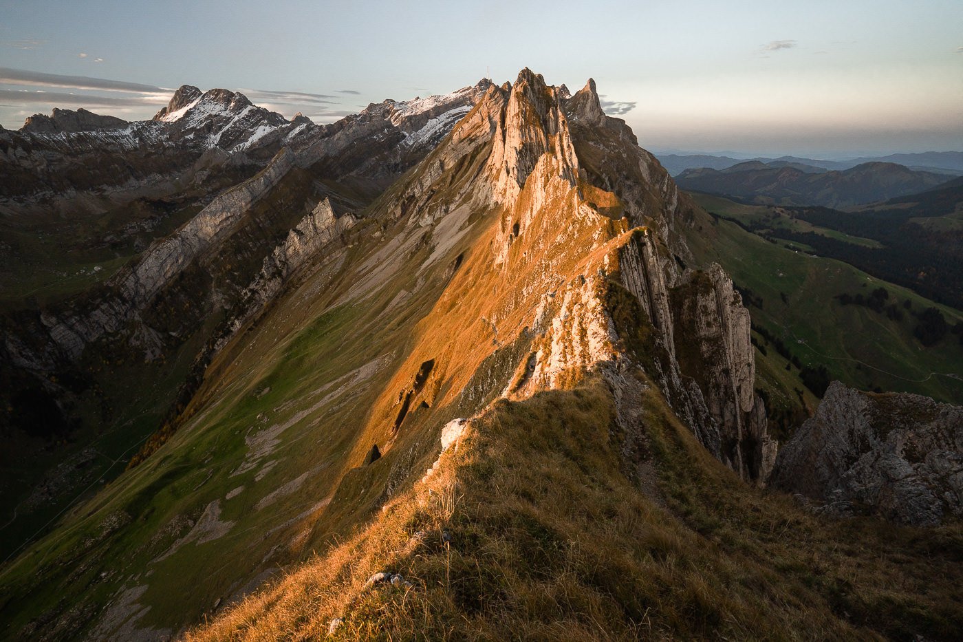
The first viewpoint is just above the Schäfler Ridge and is only 1-minute up the hill from the Schäfler Hut. Here you can get great views of Schäfler Ridge, Santis, and the valleys on either side without having to venture much further. I took the following shot here about 1.5 hours before sunset.
I had decided to visit the Schäfler Ridge for the golden hour and stay for sunset. Schäfler Hut had no more spaces but I’d managed to book a night at Ebenalp Mountain Hut so I only had a 2-kilometer hike back in the dark. If you plan to do sunrise or sunset at Schäfler Ridge, I suggest staying in one of these two huts obviously, the best one to stay at is Schäfler hut but you will need to book in advance, especially if it is a weekend.
The golden hour had arrived so I ventured down from the top viewpoint and began to wander along the path on Schäfler Ridge capturing other hikers and exploring the different angles as the light continued to change.
As the peak moment of the sunset came, I decided to head up onto the spine of Schäfler, which is off the path. Be careful if you do this as there is a drop-off on both sides but particularly to the right. Here I found some beautiful red foliage and some incredible little viewpoints that looked great both on the camera and the drone.
I hiked back to Ebenalp in the dark with my head torch but returned the next morning for sunrise. I was lucky to get great conditions for both sunset and sunrise. It was much quieter at sunrise with just a few other people up to witness the first light rather than the crowd for sunset.
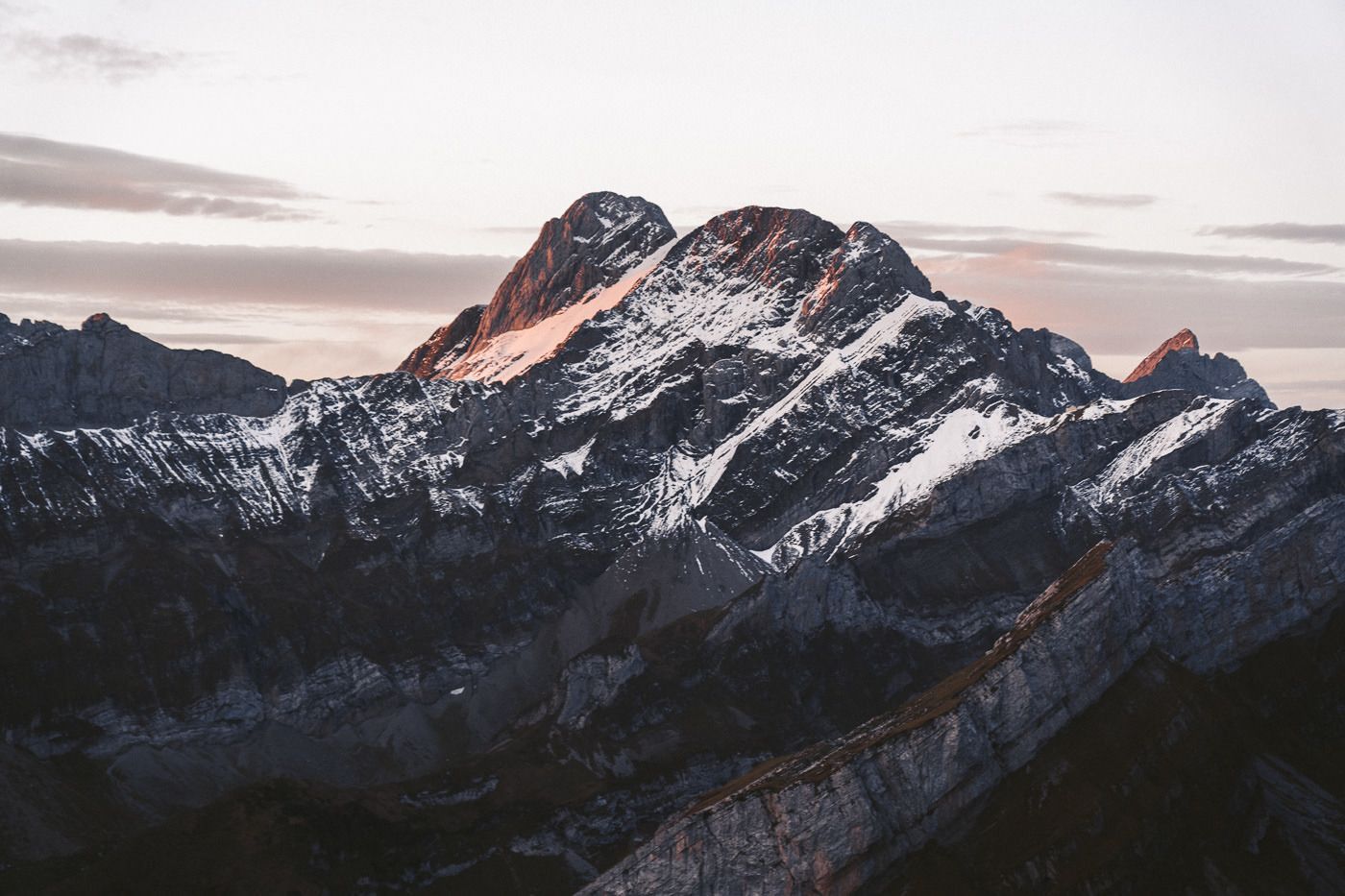
A little bit of alpenglow and early lit hit Santis and the surrounding peaks, which was the perfect way to start the day.
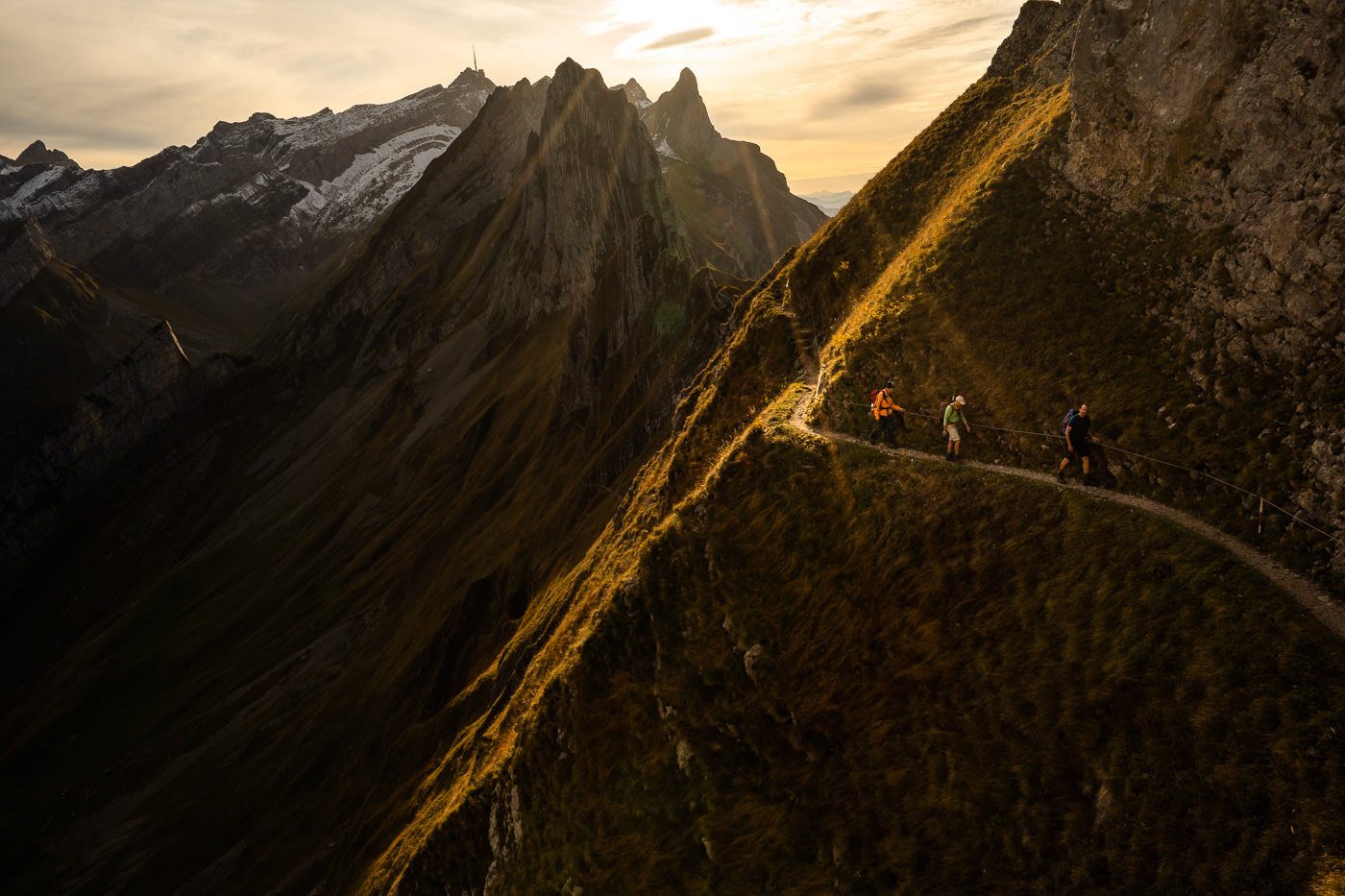
It was now time to cross the Schäfler Ridge and head on towards Ohrli. From this point on the trail was very empty. There were just one or two other hikers out that moment that had decided to venture past Schäfler Hut. The hut was full so it was still quite busy there in the morning but not many people tend to venture past the hut especially this late in the season.
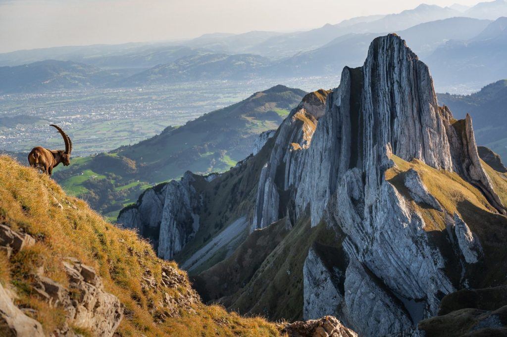
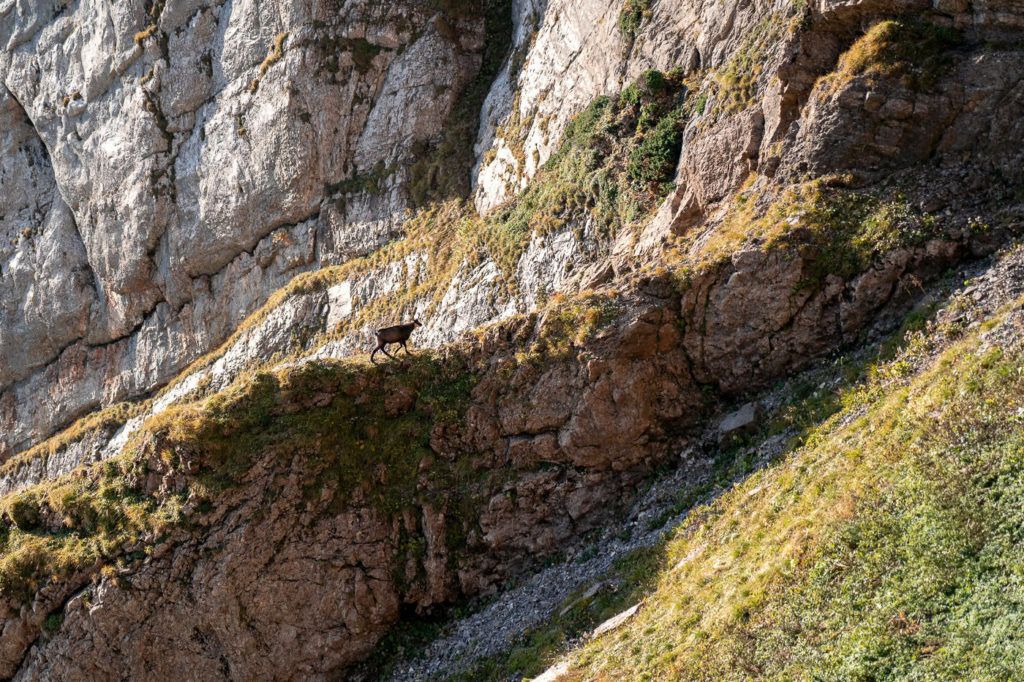
I really enjoyed walking the inside the Schäfler Ridge and even spotted a few Ibex. It would be a sign of things to come as I would encounter a huge pack of Ibex just around the corner.
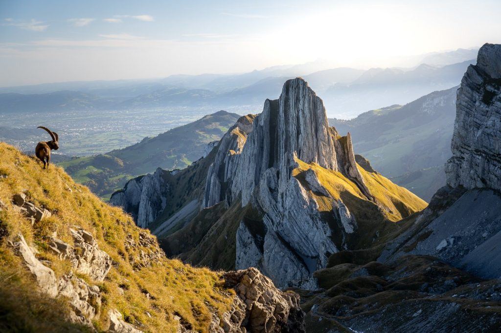
Once up and over Schäfler Ridge we now entered the Ohrli section of the Alpstein Loop, which was among my favorite parts of the journey to Mount Säntis. This was for two reasons. Firstly, I loved how from Ohrli the Schäfler Ridge was perfectly framed.
Secondly, this is where a huge pack of alpine Ibex is often found and on this day I bumped into more than 20 very close to the trail. In no rush, I hung out here shooting some photos of them for half an hour or so.
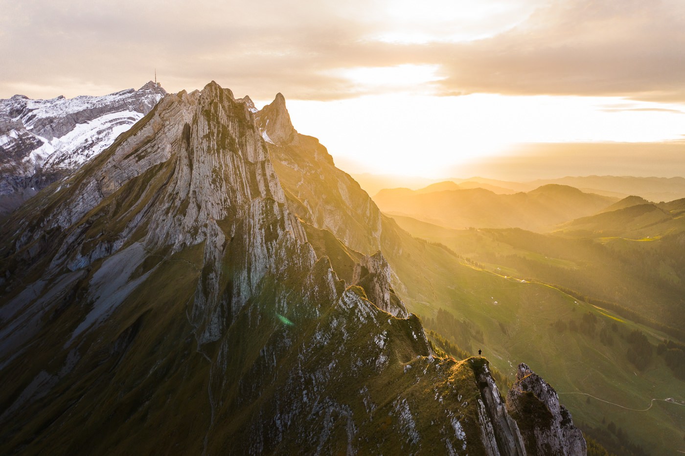
Moving on from Ohrli is an interesting little ridge line that actually got me a bit lost. I follow the trail up the ridge to the right but it got narrower and narrower until I questioned it and realized I was meant to go up and over it to the left and ascend to Säntis from there.
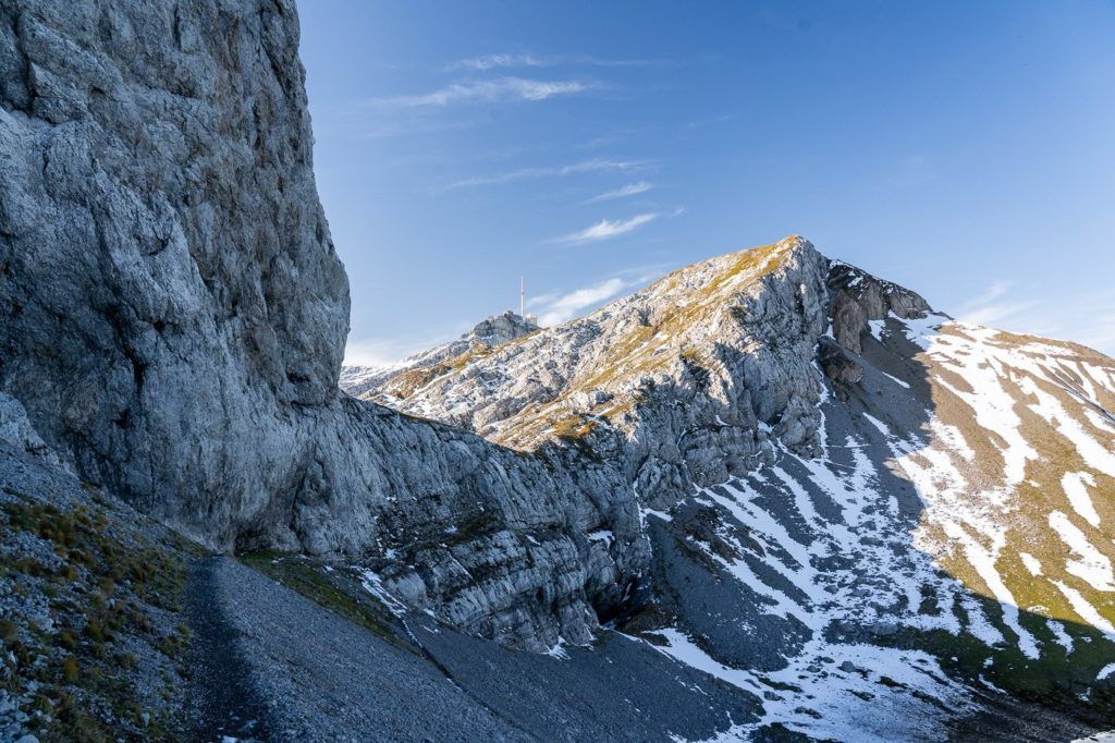
This was the view looking back down the ridge. I was meant to be over to my right-hand side to the side of the ridge.
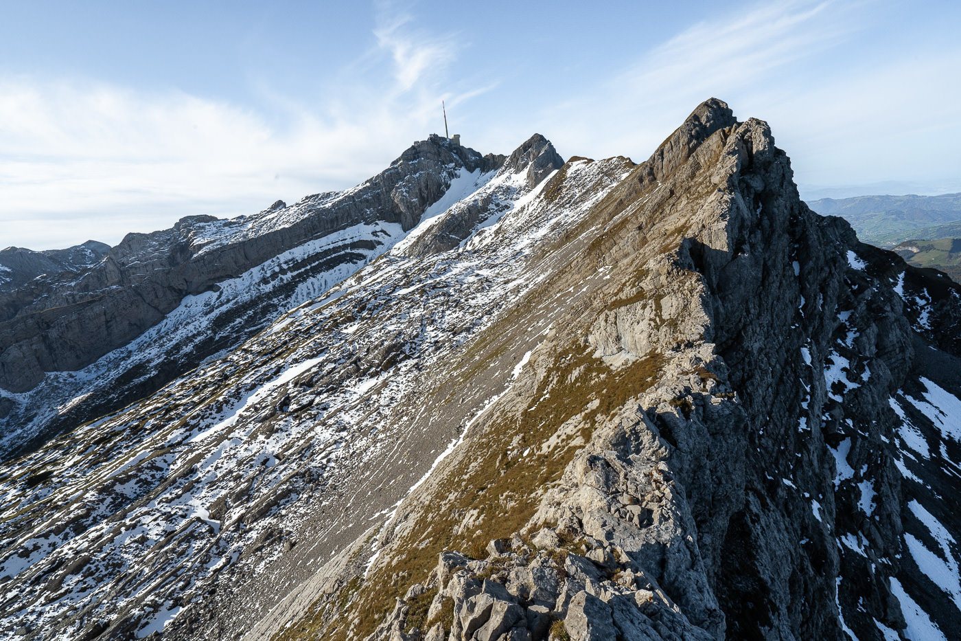
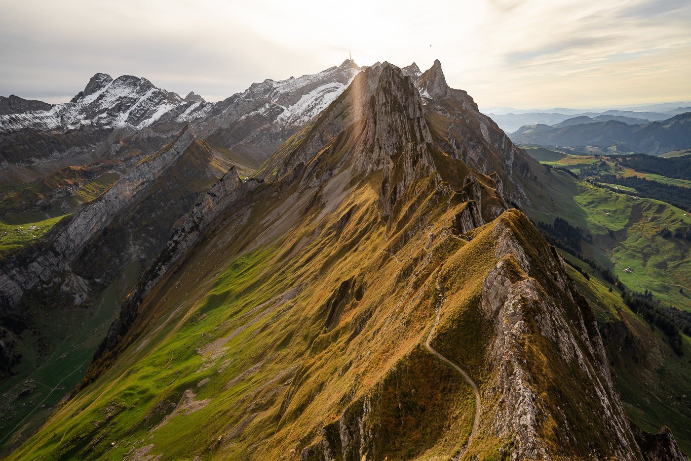
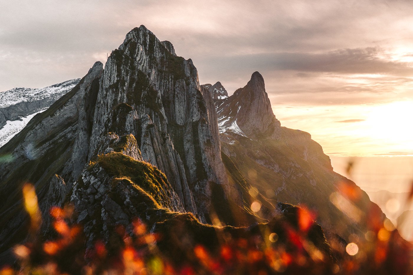
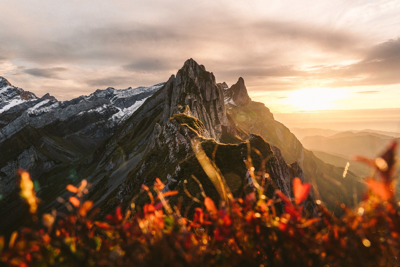
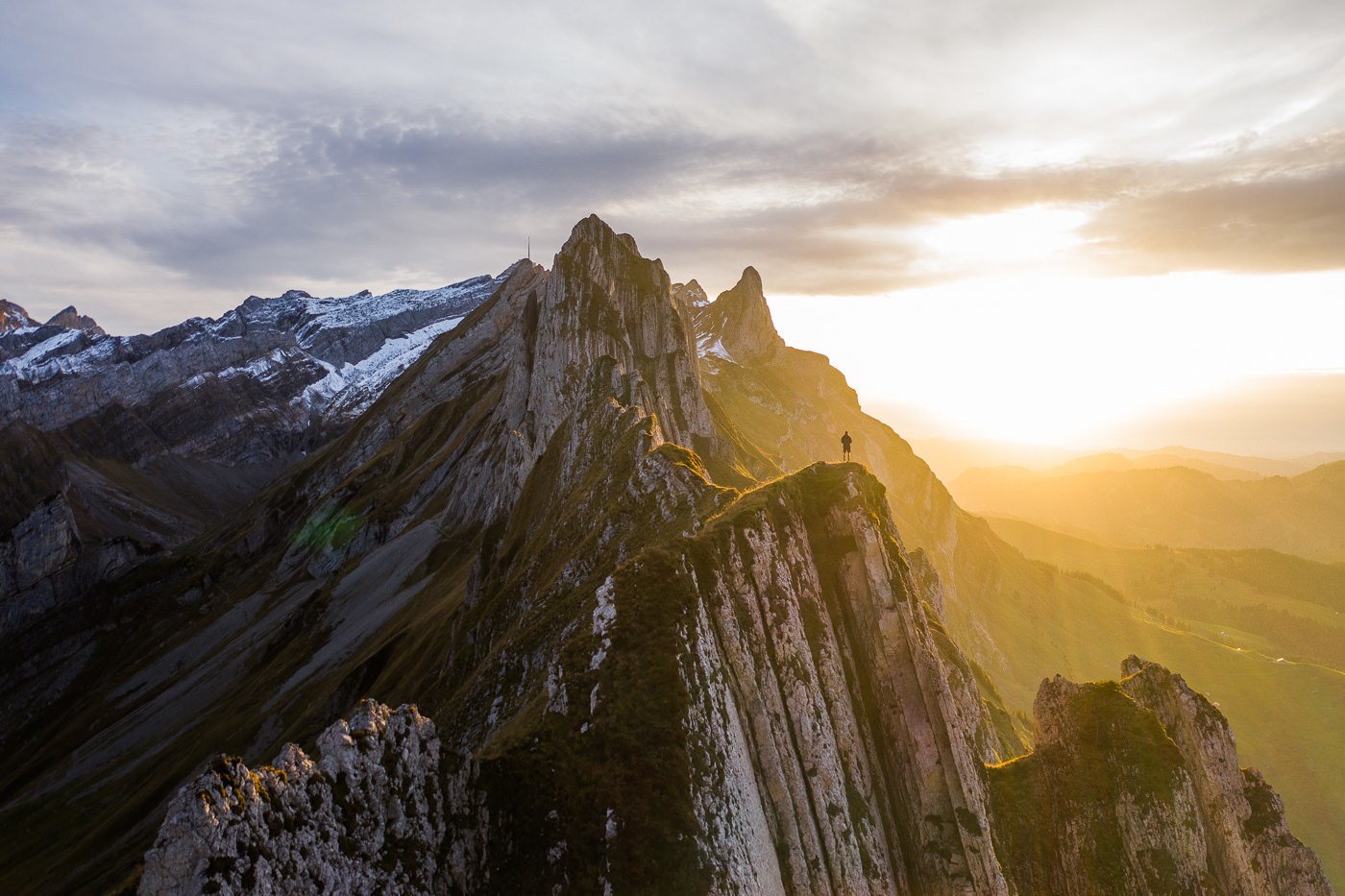
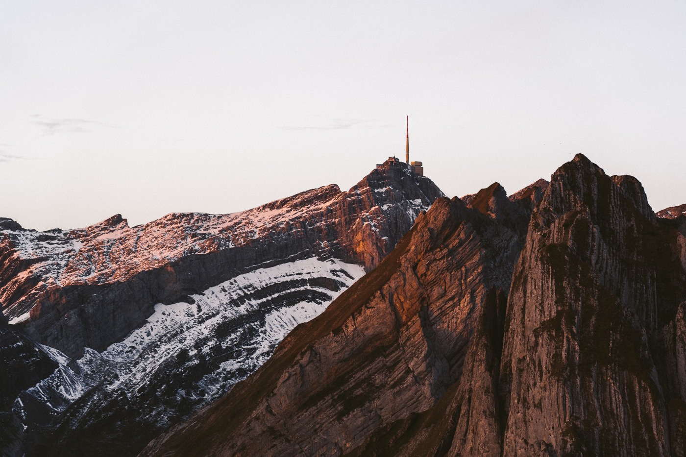
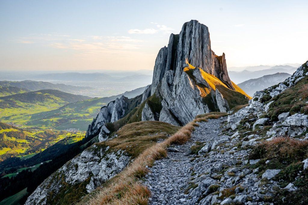
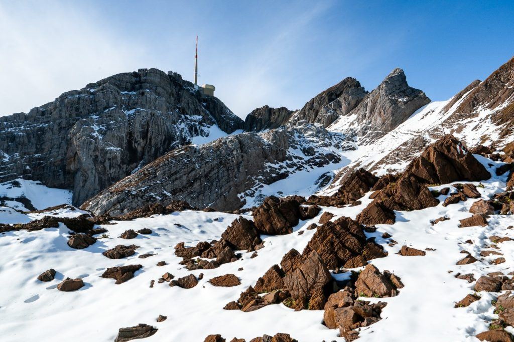
The view of Mount Säntis from just past Ohrli.

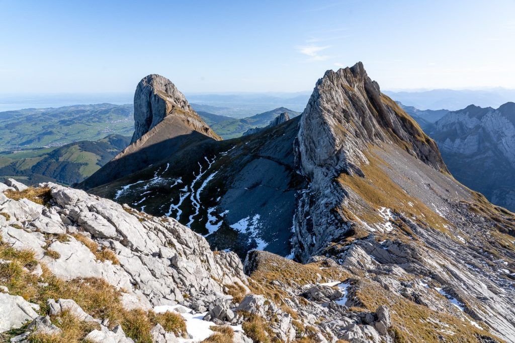
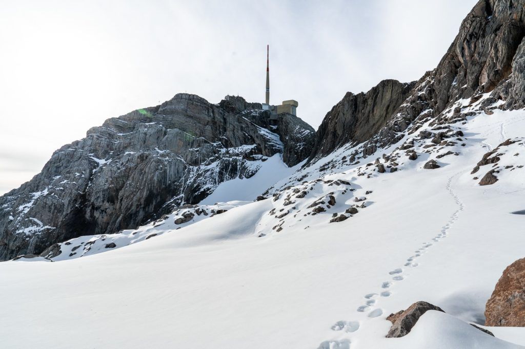
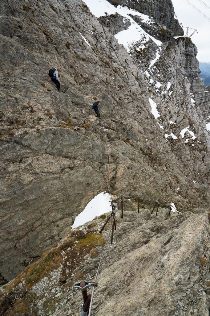
Now that I was back down on the track, following the trail markers, it was just a short way to Säntis Peak. However, this is the toughest part of the hike whether it is covered in snow or dry. I went in early October, which mean I had to deal with knee-high snow at times. It was manageable and there are no moments of exposure until you reach the final rocky climb. It was an adventurous part of the trail with lots of sub-routes you could choose as you made your way to the channel, which you can see below is just to the right of Säntis.
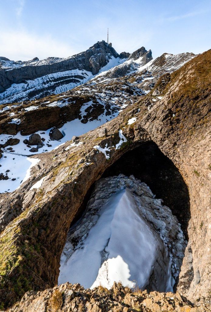
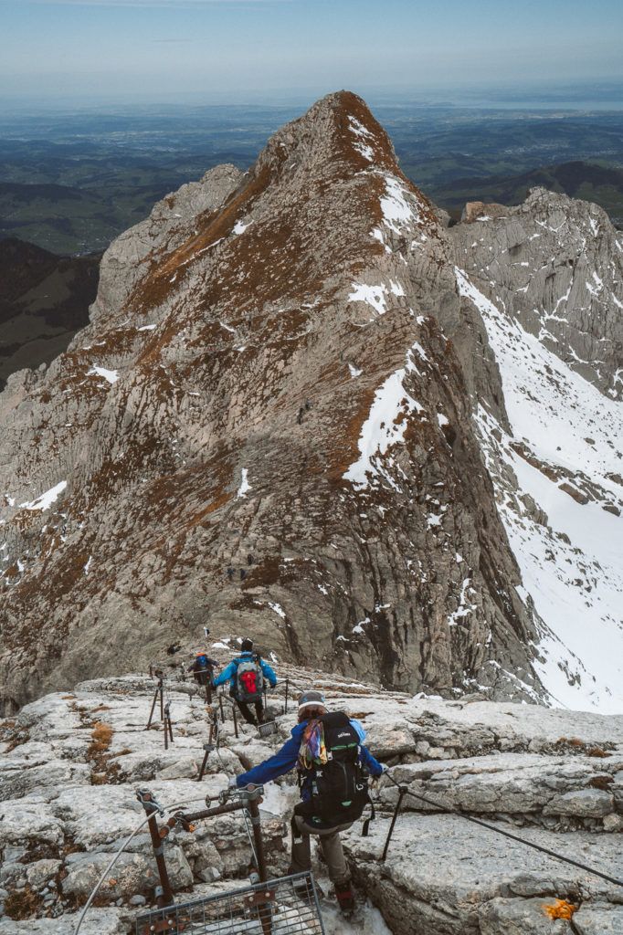
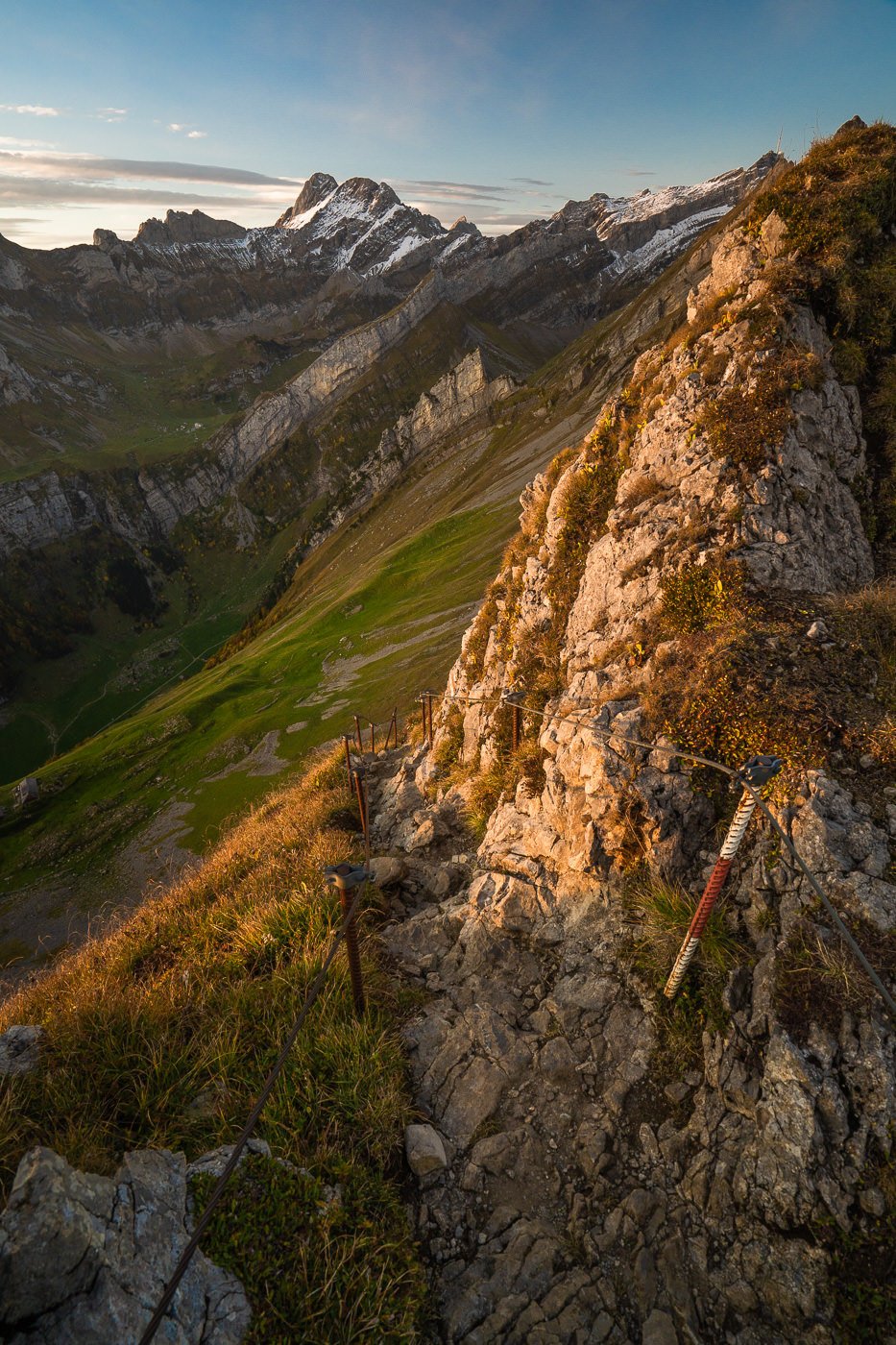
There are a few moments of exposure now that you make the final climb up to Säntis Peak, but at any moment of danger, you have the chains and ropes. That was my biggest concern but my worries were quashed and it was definitely not something I should have been worried about. I would overall rate this hike as difficult for an average hiker but nothing extreme or very risky in my opinion. There were no moments of exposure that were not accompanied by chains or ropes to help you stay secure.
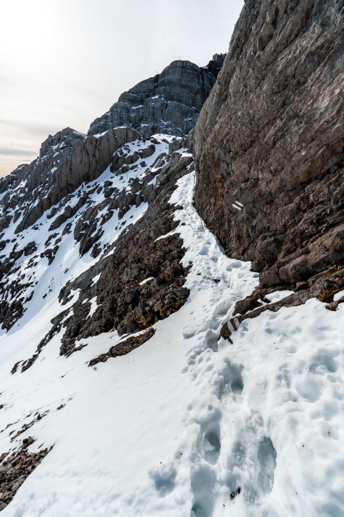
The final part of the climb is along the rocky ridgeline that leads up to Säntis Peak. Chains and ropes are fixed along the route which at times is very steep. There will be lots of other hikers here as they head down to follow the route of the cable car. This is an alternate route up to Mount Säntis.

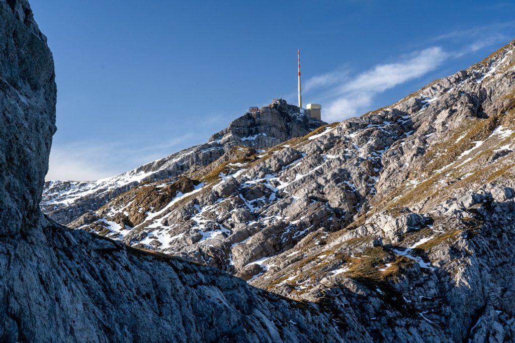
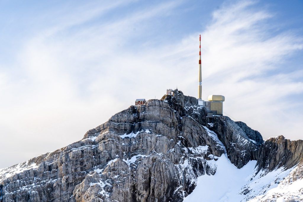
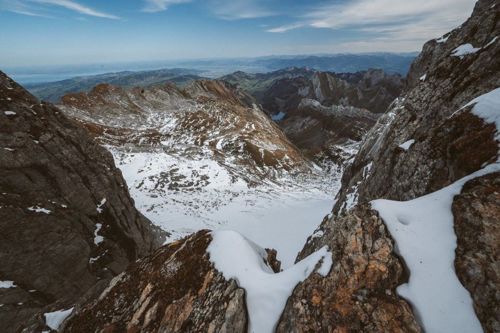
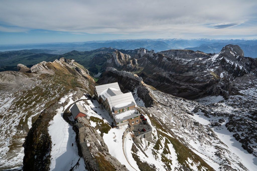
After that big effort over two days, I made it to Mount Säntis. I sent the drone up to capture the view including the restaurant at the top so you can see exactly how it looks. I settled into the restaurant with outdoor seating and looked over the view while enjoying a big bowl of pumpkin soup and a well-deserved vegetable rosti.
After hanging out at Säntis Peak for an hour, I decided to continue on and complete the Alpstein Loop that afternoon by hiking to the Rotstein Hut via Lisengrat and then down to Wasserauen via Meglisalp. I won’t include that all in detail here but if you want to read about the Lisengrat Hike you can click the link below. It is the most difficult and dangerous part of the Alpstein Loop and I suggest doing it in dry weather not when covered in snow.
Read the full blog post: LISENGRAT: EPIC RIDGE HIKE BETWEEN SÄNTIS AND ALTMANN
SWISS TRAVEL PASS or HALF-FARE CARD
OPTION 1: Buy the Swiss Half Fare Card: Switzerland trains, buses, and cable cars are EXPENSIVE! I found the best way to get around cheaply was to buy the Swiss Half-Fare Card before I arrived. It gives you 50% off every regular train, bus, and even many cable cars. It only costs $150 USD but pays itself off in just a few days with many train tickets in Switzerland costing close to $100 alone. If you are staying for more than 5 days, I suggest buying the Swiss Half-Fare Card.
OPTION 2: Buy the Swiss Travel Pass: The second option is to get the Swiss Travel Pass, which gives you unlimited train, bus, and (many) cable car rides but it’s pretty expensive at around $100 USD per day so if you don’t travel each day it isn’t worth it.
OPTION 3: Buy the FLEXI Swiss Travel Pass: The final (BEST) option is to get the FLEXI Swiss Travel Pass, which allows you to buy 8 days’ worth of transit but you can choose the night before if you want to activate the next day. That way you don’t need to travel every day to get your money’s worth, you can just activate the FLEXI Swiss Travel Pass on the days when you are doing sizeable transits. My advice is to book the Swiss Half-Fare Card or the FLEXI Swiss Travel Pass in advance before your trip so it’s ready to go when you arrive.
GET A SWISS TRAVEL PASS!


Enjoy UNLIMITED train, boat, and bus rides in Switzerland for up to 15 days. Click to book a flex Swiss Travel Pass or choose the Consecutive Swiss Travel Pass.
The Swiss Travel Pass starts at $260 for 3 days. Click here to check if it’s available on your travel dates.
MY SWITZERLAND HIKING GUIDES
I spent 100 days hiking in Switzerland and created a guide for different regions around the country. You can click on one of my Switzerland hiking guides below to help you plan your trip.
- The Complete Guide: 50 AWESOME HIKES IN IN SWITZERLAND
- The Via Ferrata Guide: 4 EPIC SWITZERLAND VIA FERRATA COURSES
- Lauterbrunnen Guide: 10 AWESOME HIKES NEAR LAUTERBRUNNEN
- Interlaken Guide: 15 AWESOME HIKES IN INTERLAKEN
- Grindelwald Guide: 12 AWESOME HIKES NEAR GRINDELWALD:
- Mürren Guide: 7 AWESOME HIKES IN MURREN
- Appenzell Guide: 9 AWESOME HIKES NEAR APPENZELL
- Chur Guide: 7 AWESOME HIKES NEAR CHUR

MY SWITZERLAND TRAVEL TIPS
- For Backpackers: SWITZERLAND BUDGET BACKPACKING GUIDE
- Travel Tips: 20 THINGS TO KNOW BEFORE VISITING SWITZERLAND
- Transport Tips: RENTING AND DRIVING A CAR IN SWITZERLAND
- Accommodation Guide: 30 BEST PLACES TO STAY IN SWITZERLAND

Arthur Tilanus
Tuesday 10th of March 2020
Hi Jackson,
Cheers for the information! Your pictures are amazing, but most of all I really appreciate the genuinely useful information and details you included. This blog was exactly what I was hoping for and it will definitely help me to plan the various hikes this summer. Cheers mate, enjoy your travels!
Jackson
Tuesday 10th of March 2020
Hi Arthur,
Awesome thanks so much I apprecaite it. Happy hiking I'll be back in Switzerland this summer too :)