
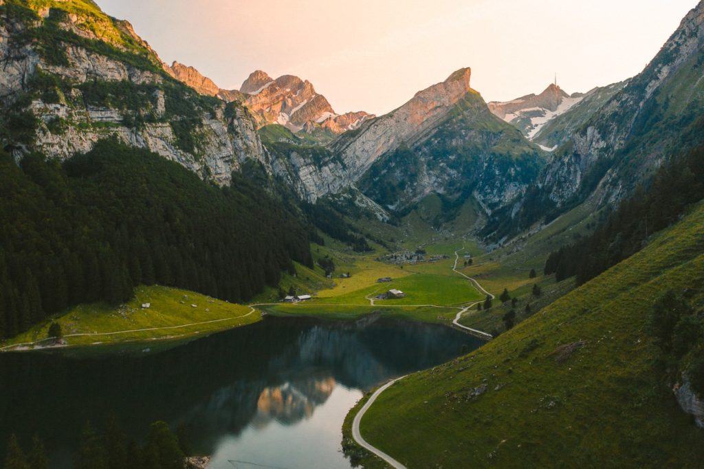
The “Three Lakes Hike” in Appenzell, Switzerland, offers an enchanting journey into the heart of the majestic Alpine region. This challenging yet breathtaking hike passes through three stunning mountain lakes – the Seealpsee, Fählensee, and Sämtisersee, each unique with its beauty and charm

THREE LAKES HIKE: COMPLETE GUIDE
The Three Lakes Hike in Appenzell is 17.3km in length and has 1100+ meters of incline. While the trail is quite safe, the incline can be challenging and this is definitely no walk around the lake. Each of the three lakes is incredible in its own way and will blow you away.
THREE LAKES HIKE DETAILS
- Hike Distance: The entire route is 17.34 kilometers
- Hike Duration: The hike should take around 6-8 hours in total depending how long you spend at each lake.
- Hike Difficulty: The incline is what makes this hike a little challenging although it is spread out in different sections so it isn’t one big block of climbing. There are no dangerous spots on this trail with high exposure although many spots do have a big drop on one side. Usual care needs to be taken. Children can do this hike but with many drop-offs, close supervision would be advised.
- Hike Incline: 1150 meters.
HOW TO GET TO THE THREE LAKES HIKE IN ALPSTEIN
The Three Lakes Hike in Alpstein begins at Wasserauen. There is a train that goes directly to the starting point at Wasserauen or a huge parking lot. It’s the same parking lot for the cable car to Ebenalp/Ascher. It’s important to note that you will not finish at the same point you started at so that will require some maneuverability with your car situation.
The hike ends in Brulisau, where you can catch a bus/train combo back around to Wasserauen, which takes approximately 30 minutes. Be sure to check what time the last bus and trains are going.
I caught the train to Wasserauen, started the hike at Wasserauen and then finished at Brulisau and caught the train/bus back to Appenzell.
The waypoints (stop along the way) you need to know are:
- Wasserauen – Seealpsee – Unterstrich – Meglisalp – Widderalpsattel – Bollenwees am Fählensee – Sämtisersee – Plattenbödeli – Brülisau
MY EXPERIENCE ON THE THREE LAKES HIKE
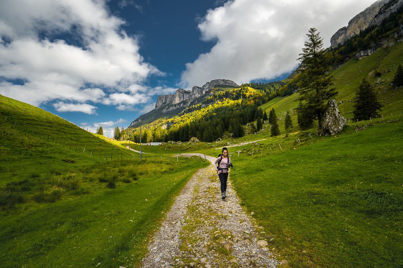
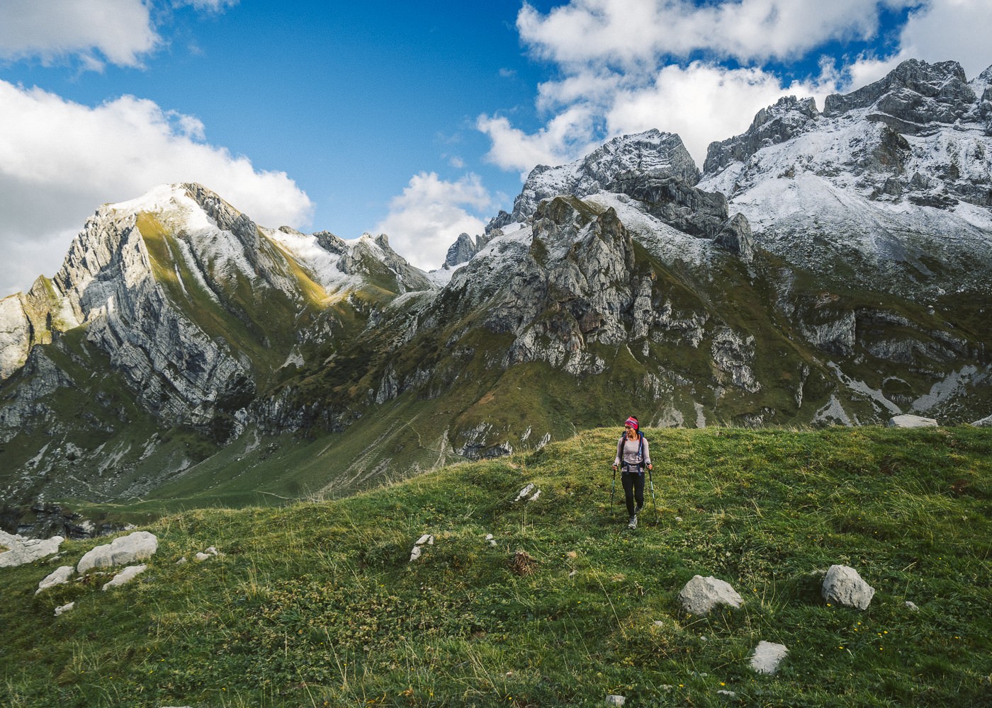
I began my day in Appenzell District where I was staying. One 11-minute train had me at the Waserauen Station, which is a hub of activity as it is the starting point for the hike to Ebenalp and Seealpsee as well as the cable car to Ebenalp. The first stop on the hike is Seealpsee.
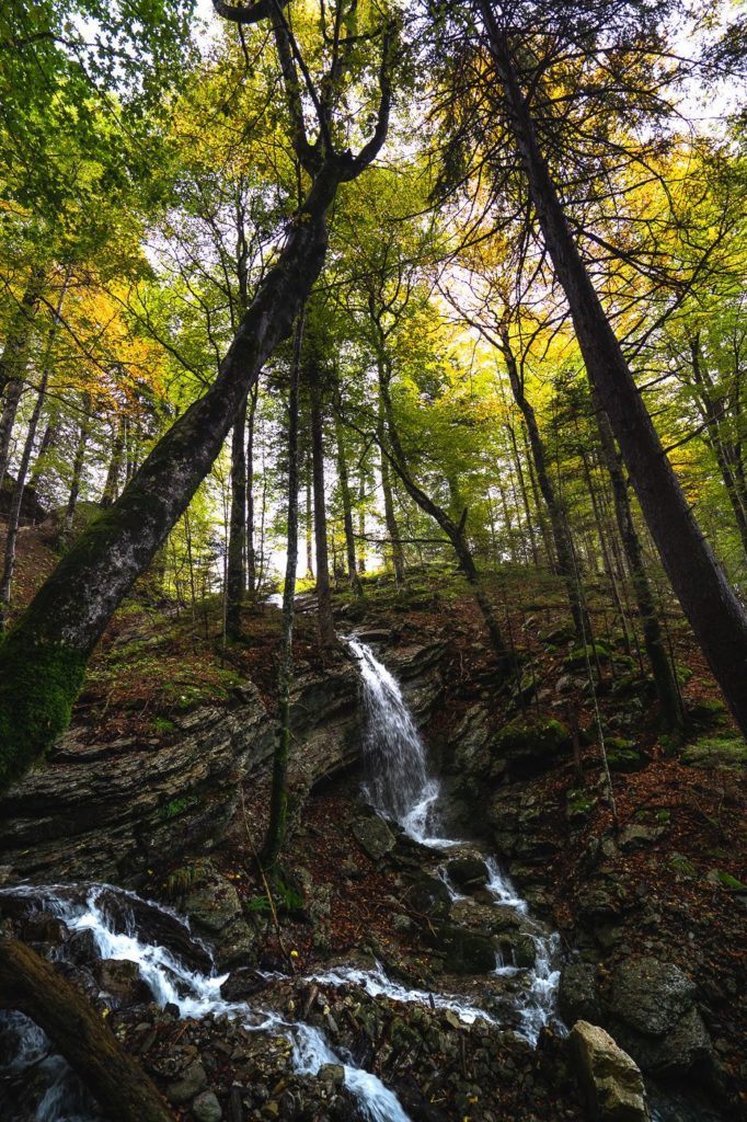
There are two routes to Seealpsee and I’ve done both but I definitely recommend the hike up through the forest and past the waterfalls. I didn’t even know this trail existed until my second visit. The other trail has a minimal incline and just heads straight through the valley. Either way, you can reach Meglisalp (the next waypoint) with either route.
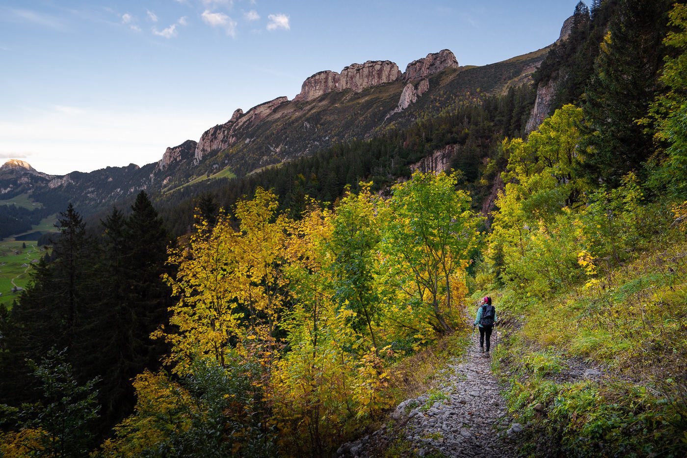
The forest trail was beautiful as the fall (autumn) colors had just begun and the waterfalls were in full motion. This part of the trek was one of the two main climbs of the day and will have you sweating in the early moments of this 17km trek. Below is an image of the forest trail and on the right an image of the valley trail. The choice is yours.

The forest trail gives you great views above Seealpsee, which is actually something you don’t get on the valley trail. It drops you down at the edge of Seealpsee, which is truly a beautiful lake in the narrow but long valley. You can do an entire lap of Seealpsee or even stop for a snack and coffee at the restaurant but you still have quite a long way to go and there are many other coffees to be had along this trail.
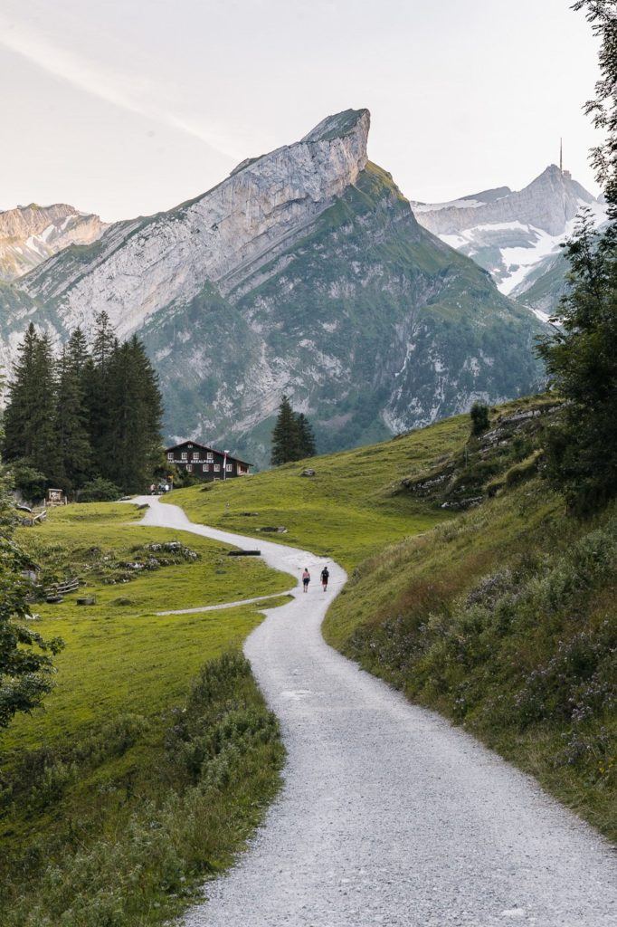
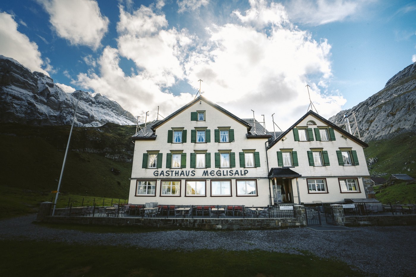
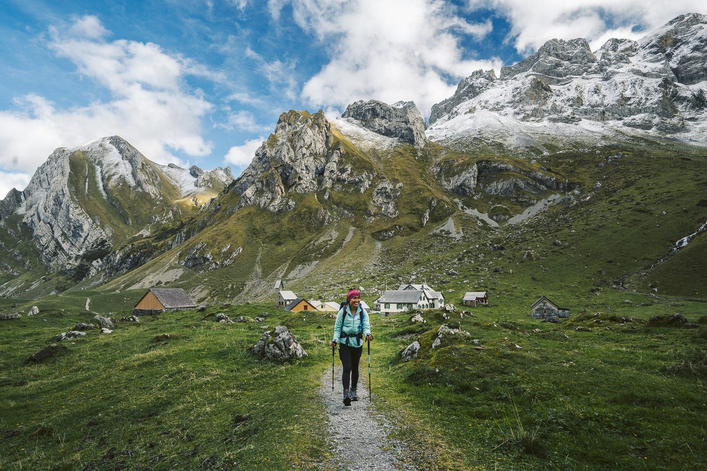
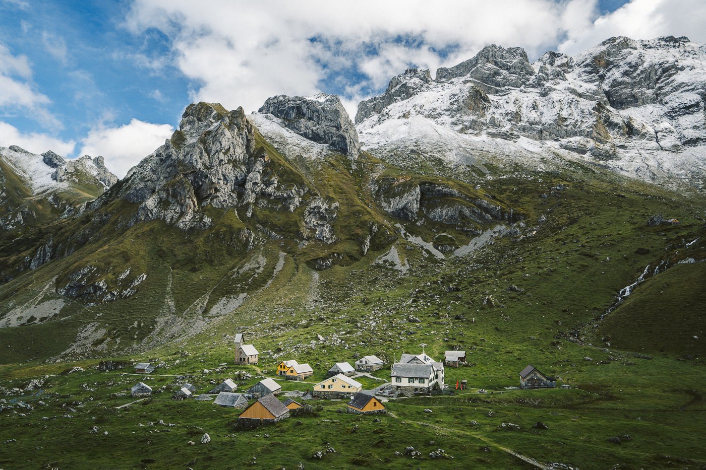
The trail makes its second climb of the route as you head up to Meglisalp Village. When you reach the top there is an epic ridge, perfectly flat that looms over the valley where the 15 buildings are found that make up Meglisalp. This is a good stop for lunch or at least a coffee.
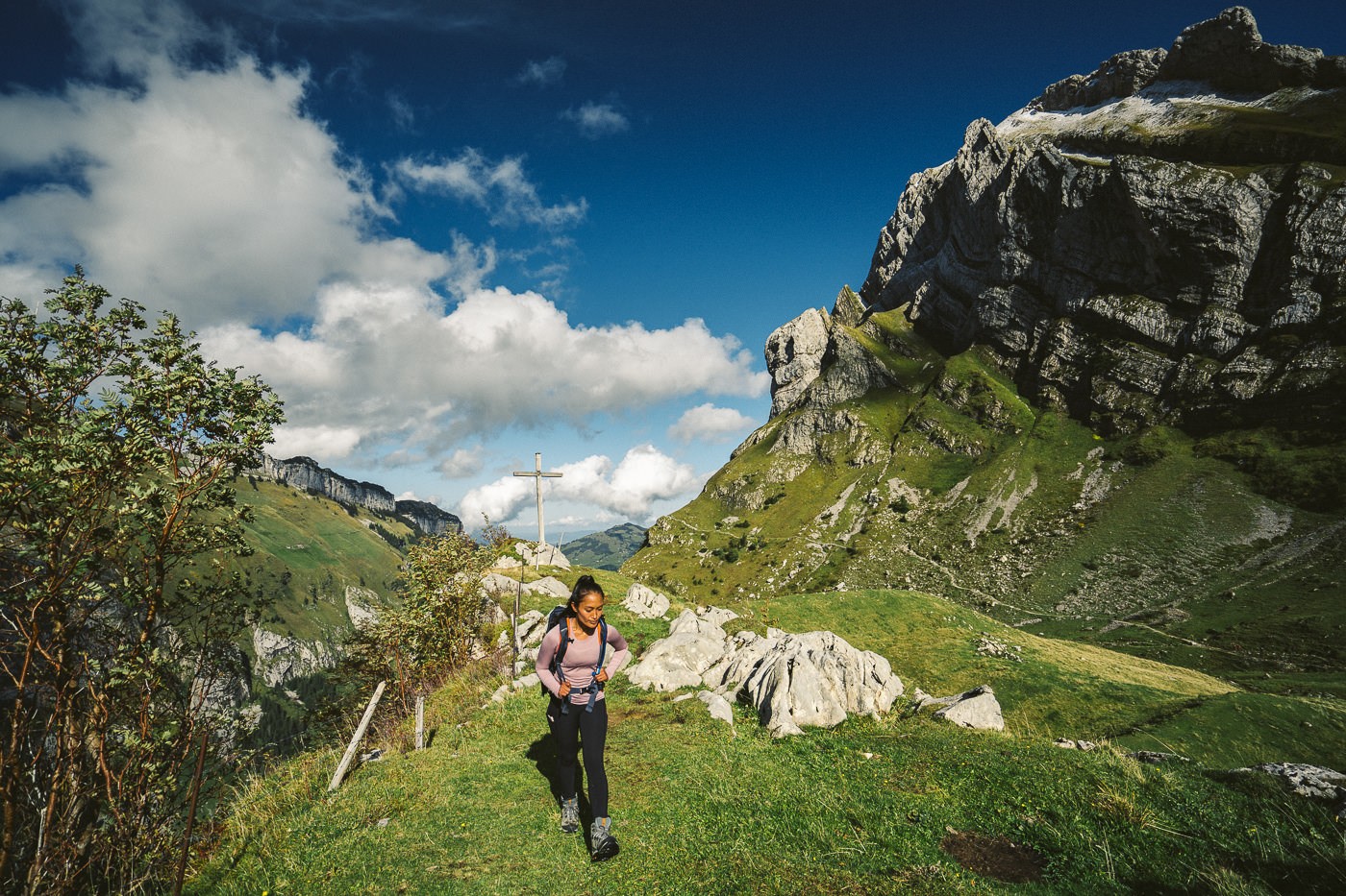
We actually made a bit of a mistake at the Gasthaus Meglisalp and went up the mountain on the wrong side! We hiked up for about 45 minutes before realizing our mistake. Luckily we did actually realize before we walked all the way to Santis! It turned out to be a great viewpoint and gave us some new perspectives of Meglisalp Village.
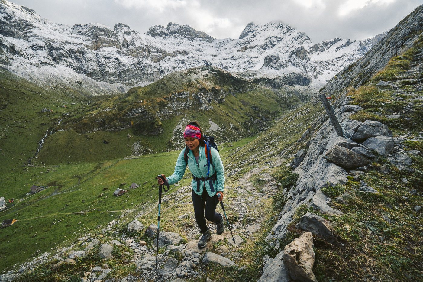
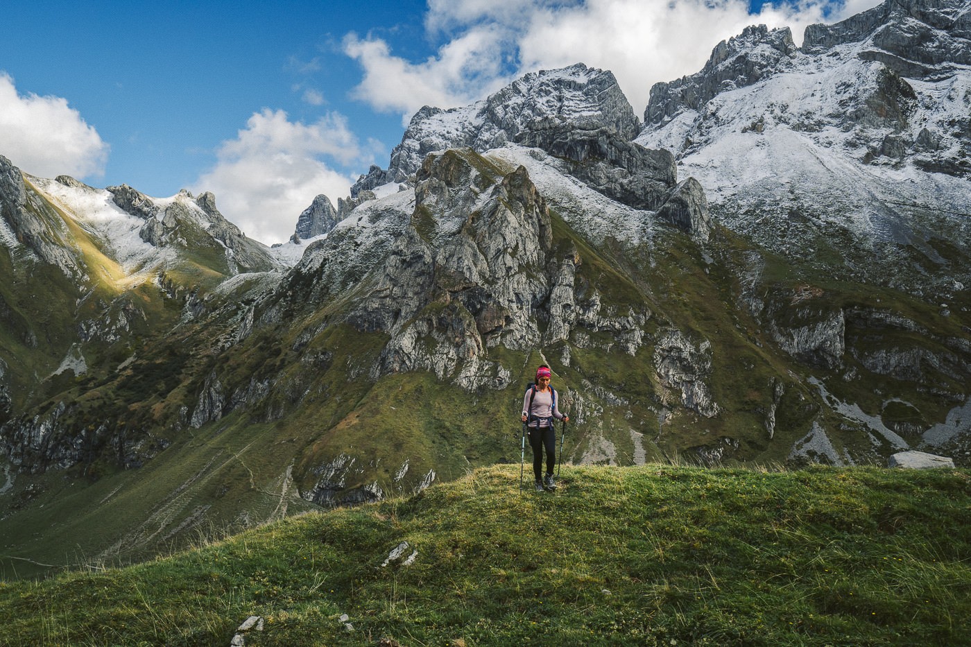
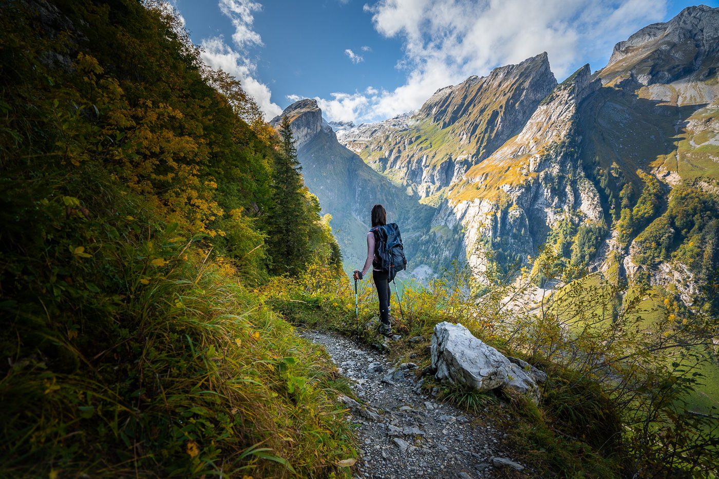
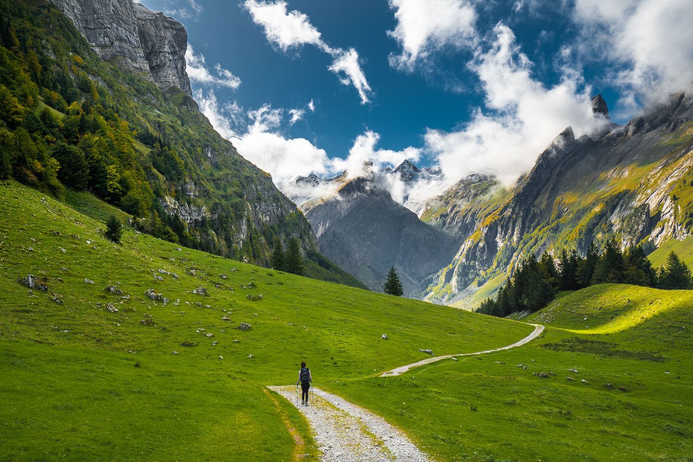
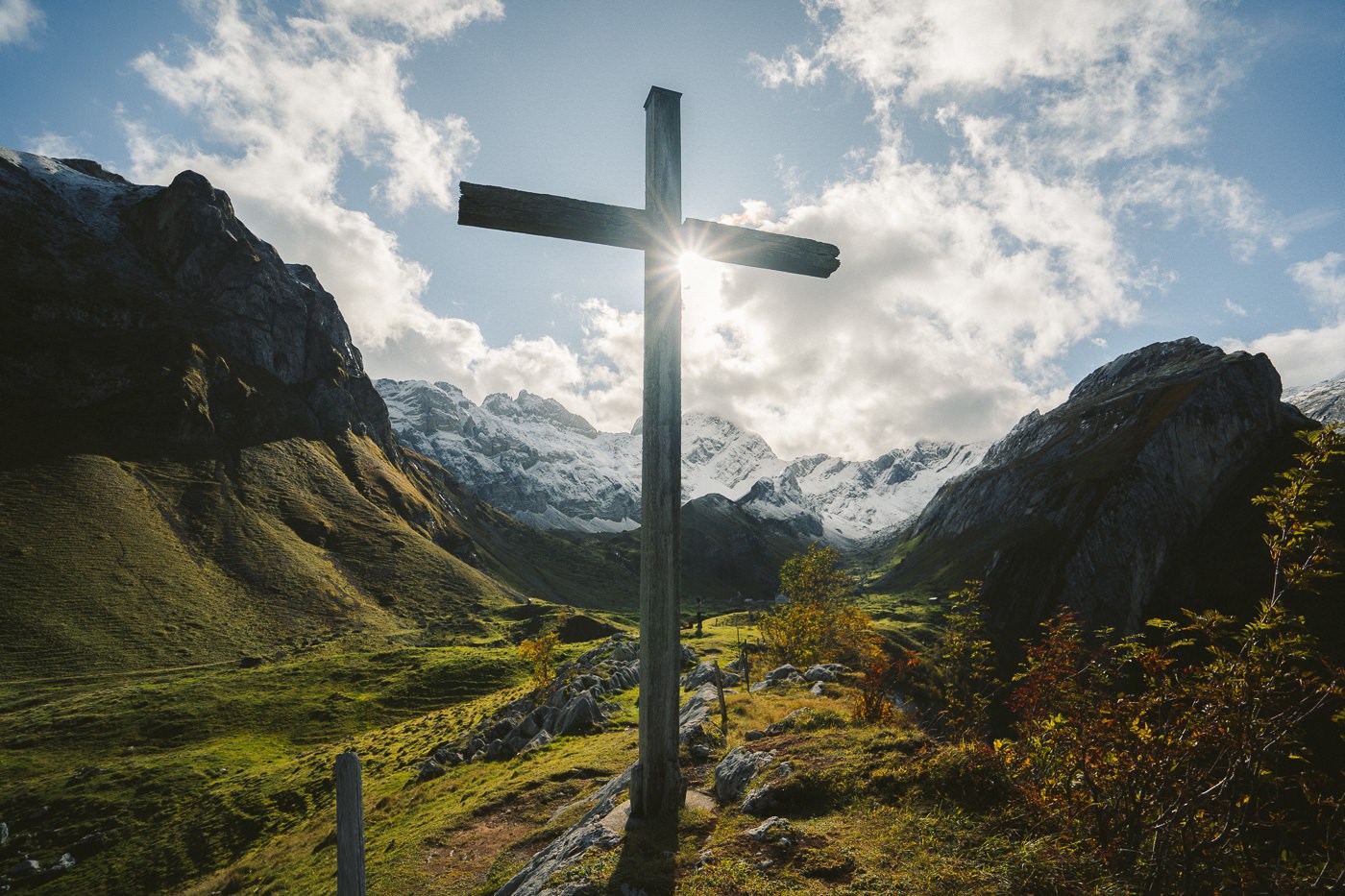
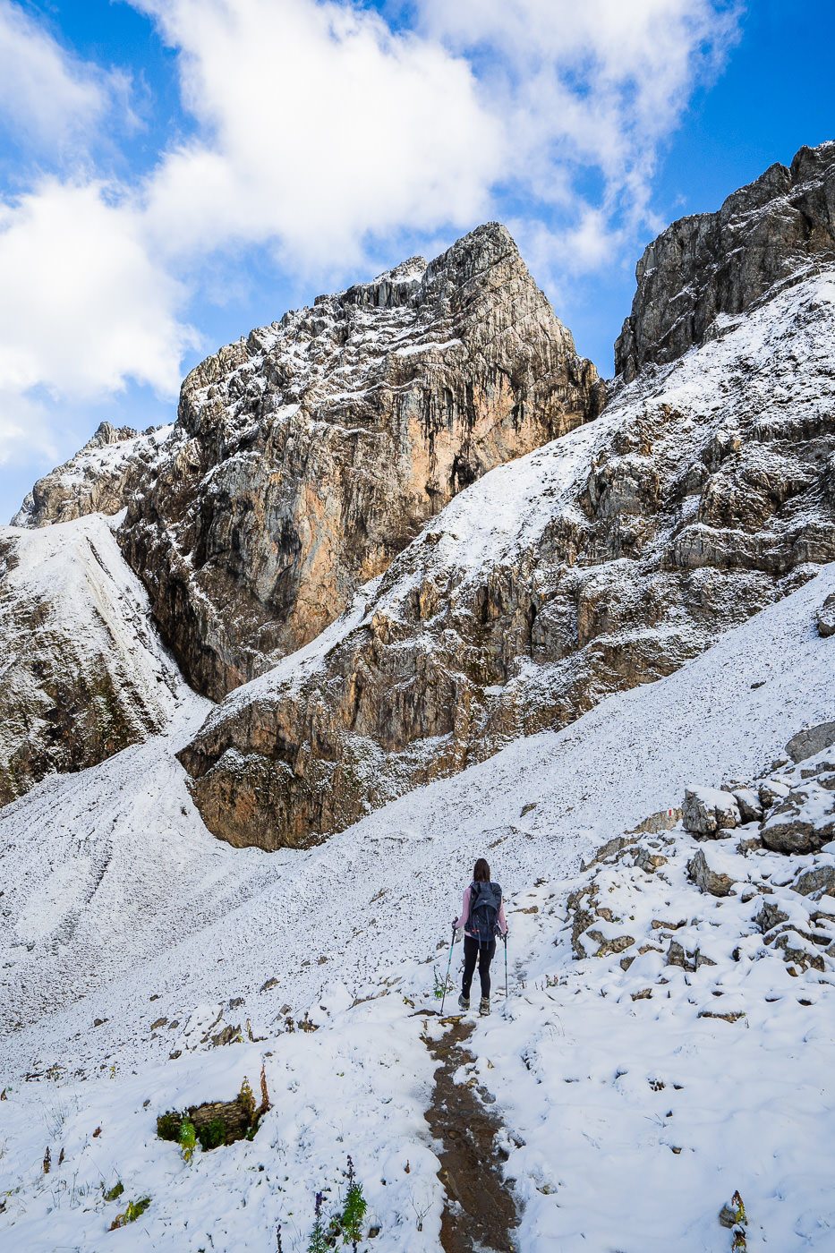
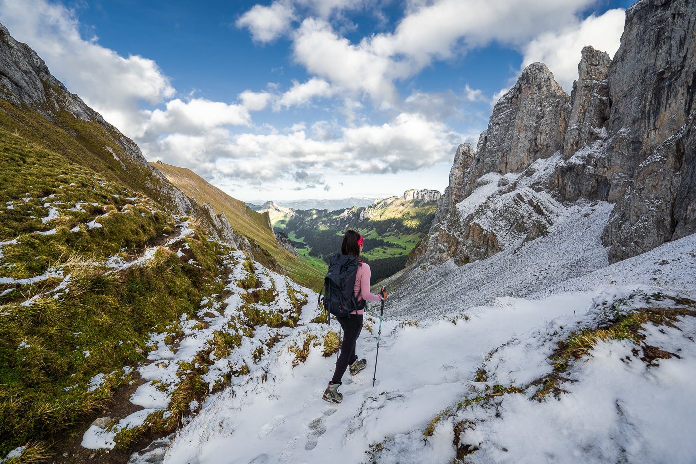
We realized our mistake and headed back down to Meglisalp and over to the other side of the valley to make the climb up to Wilderalpsattel. This was the second big climb of the trail and it took us over an hour to make the climb to the saddle. The first snow of the year had already claimed some of the trail and we found ourselves walking on a slippery path, although it was still very manageable. It gave the landscape a different vibe and it was a truly magical section to trek through.
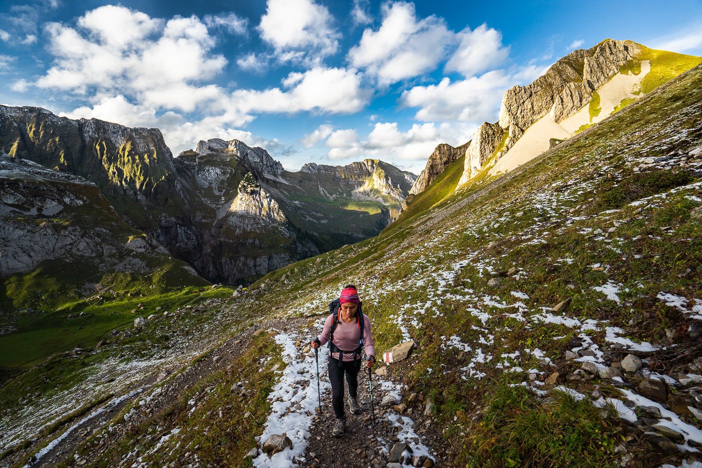
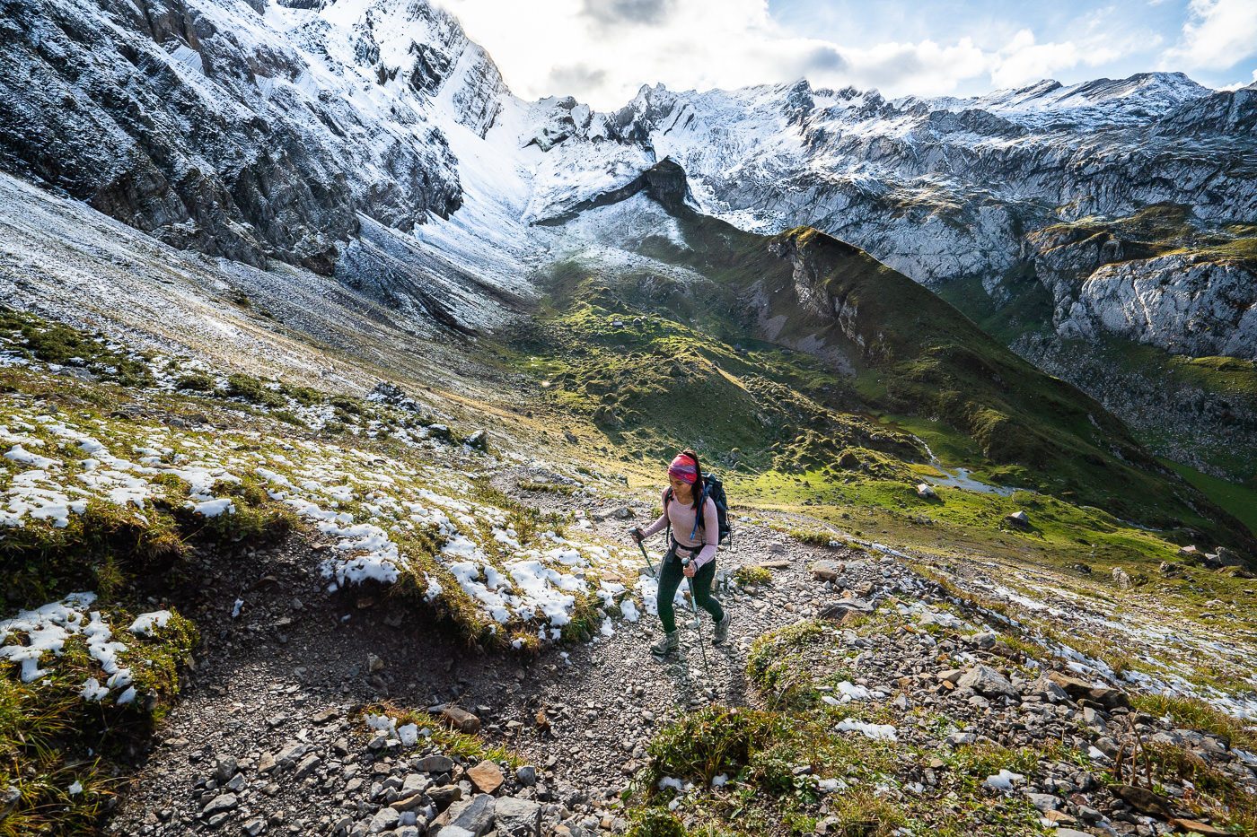
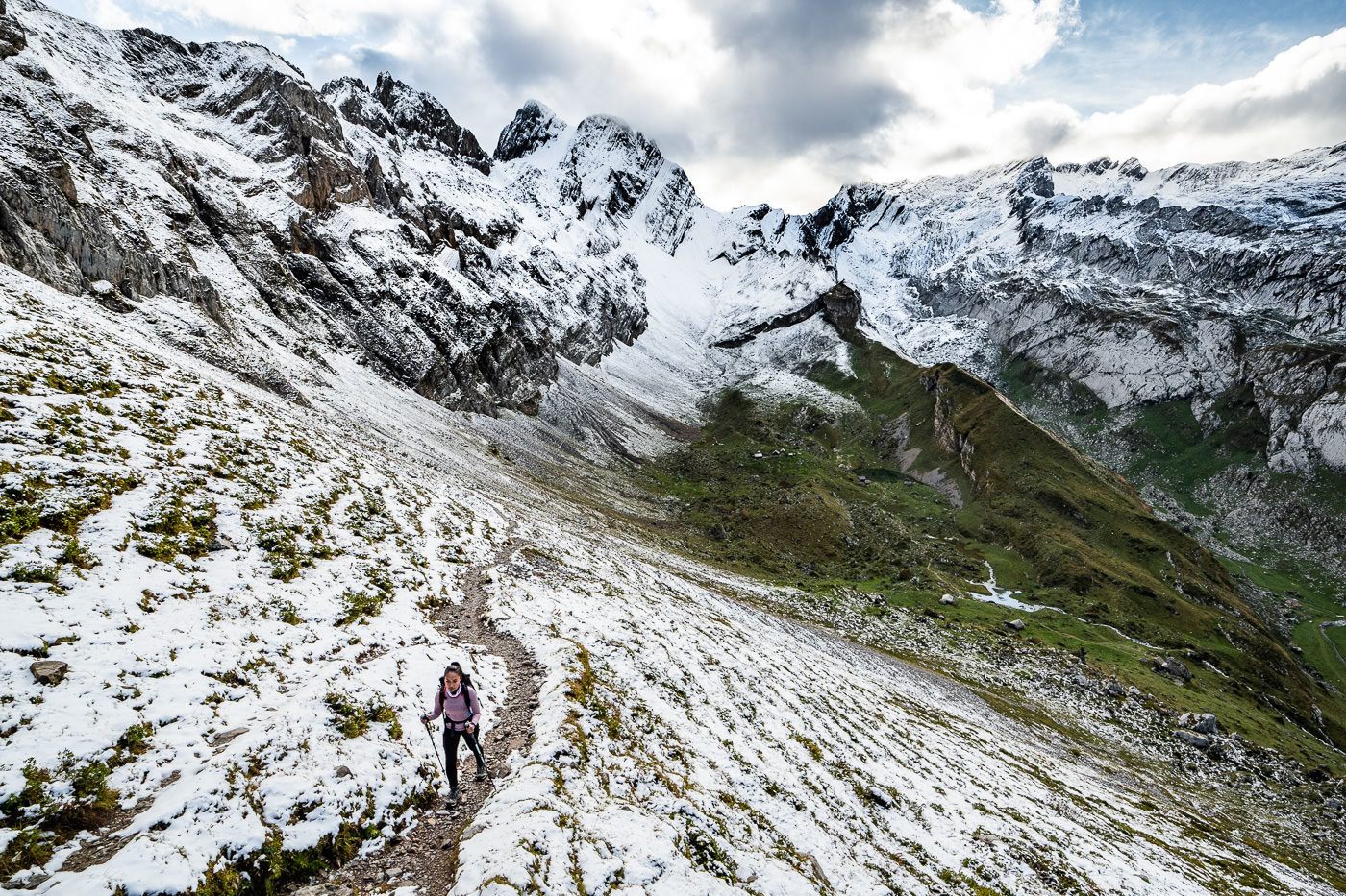
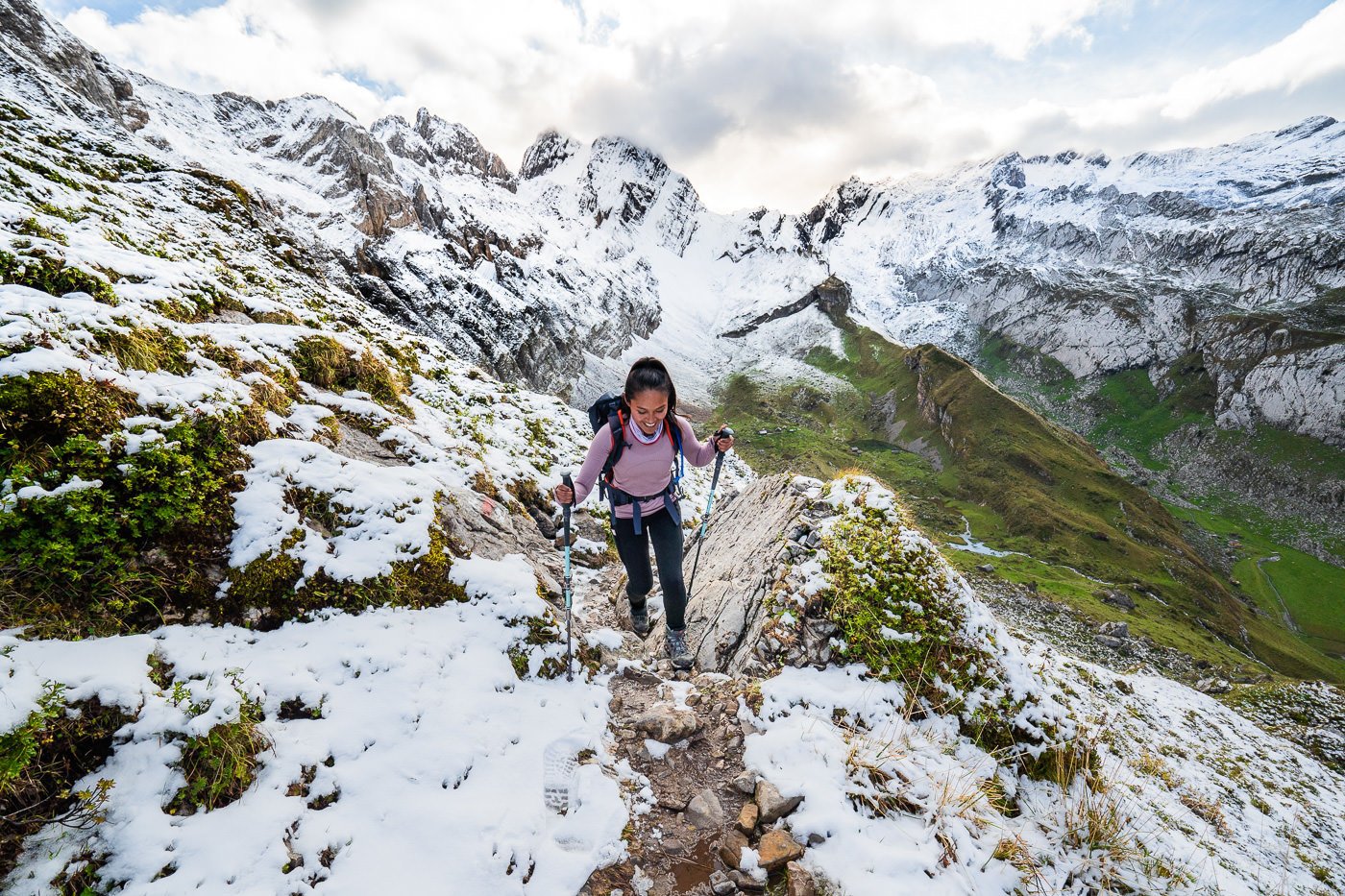
At the Wilderalpsattel it’s a great place to take a breather and shoot some photos. You’ve just climbed up a few hundred meters without a break and now have epic views on both sides of the saddle! The snow got even a little bit thicker at this point although we were still clear to hike without crampons or any safety measures.
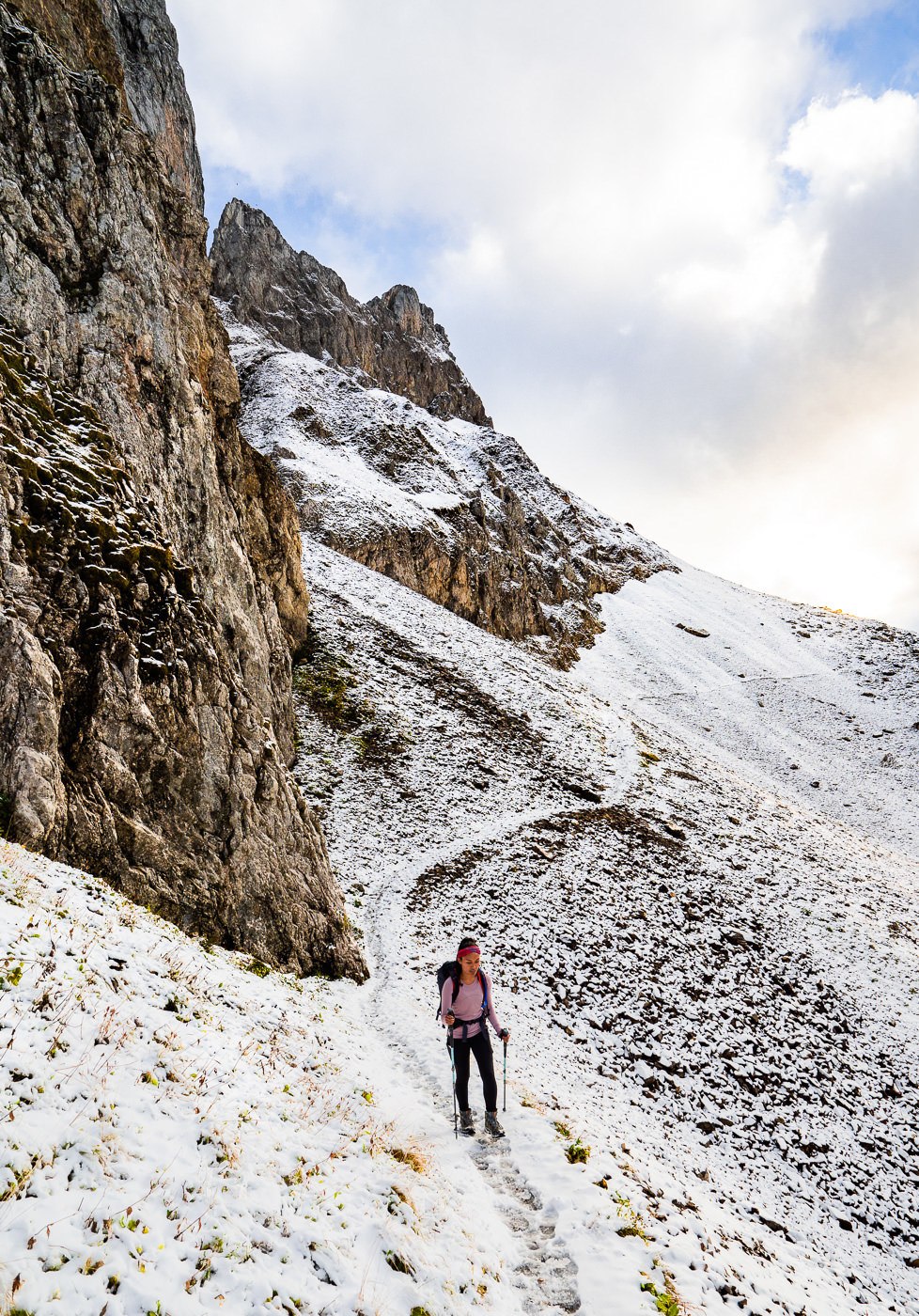
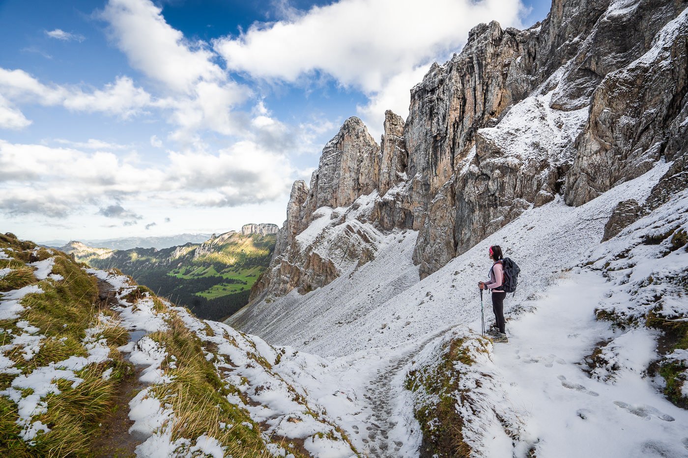

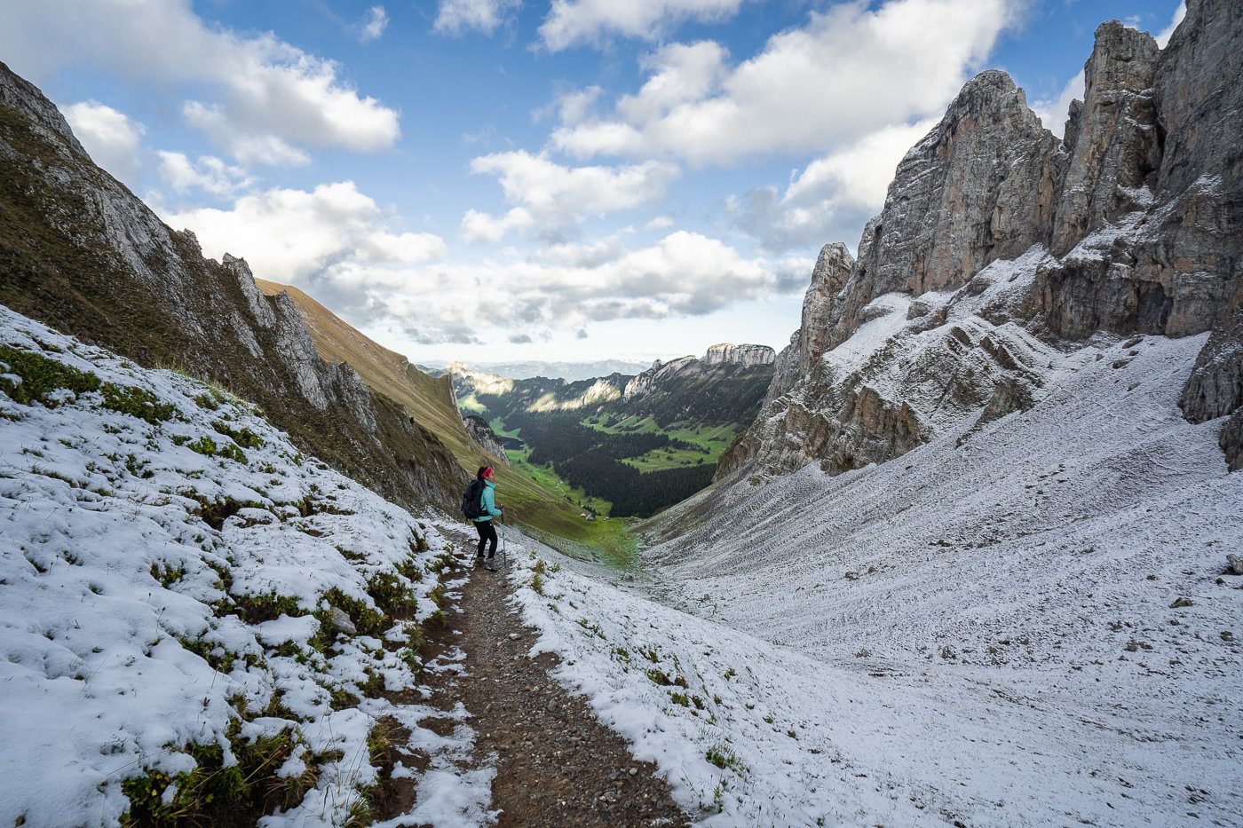
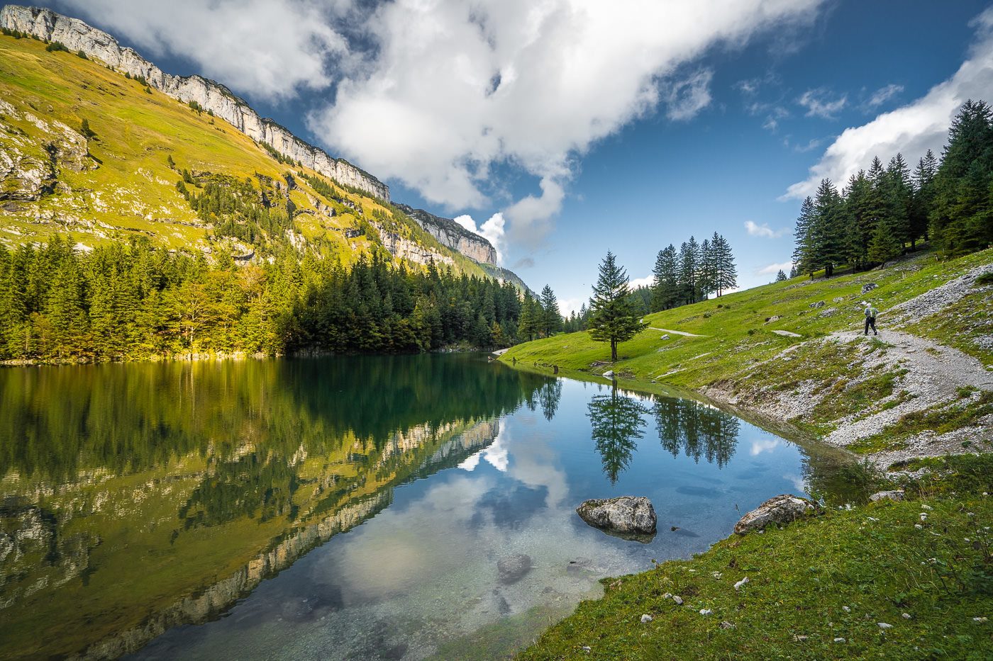
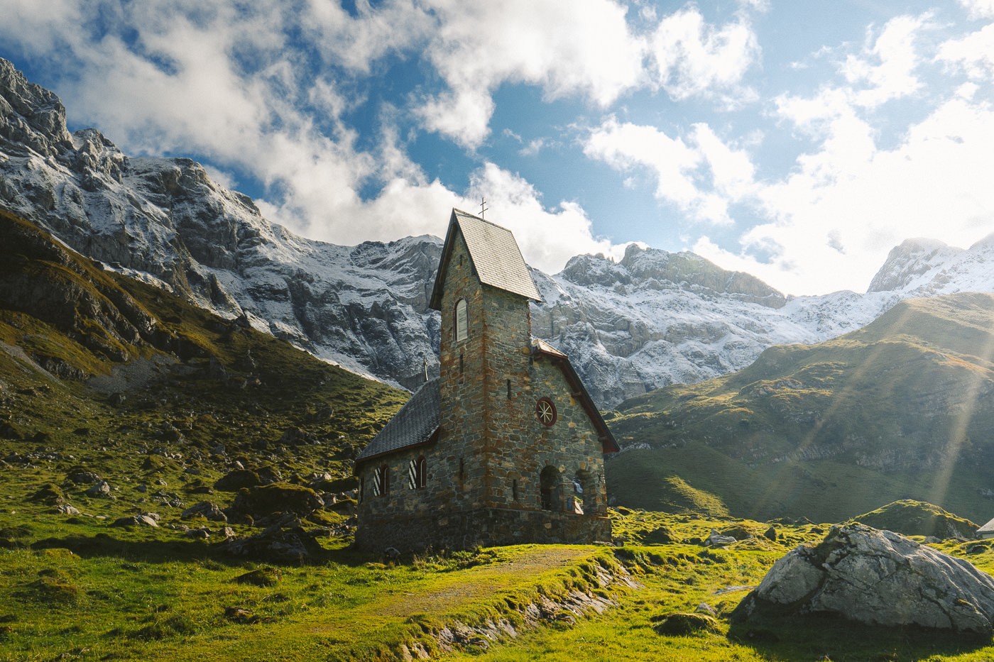
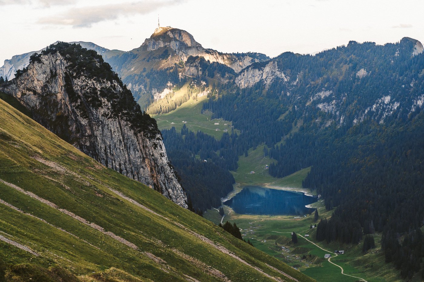
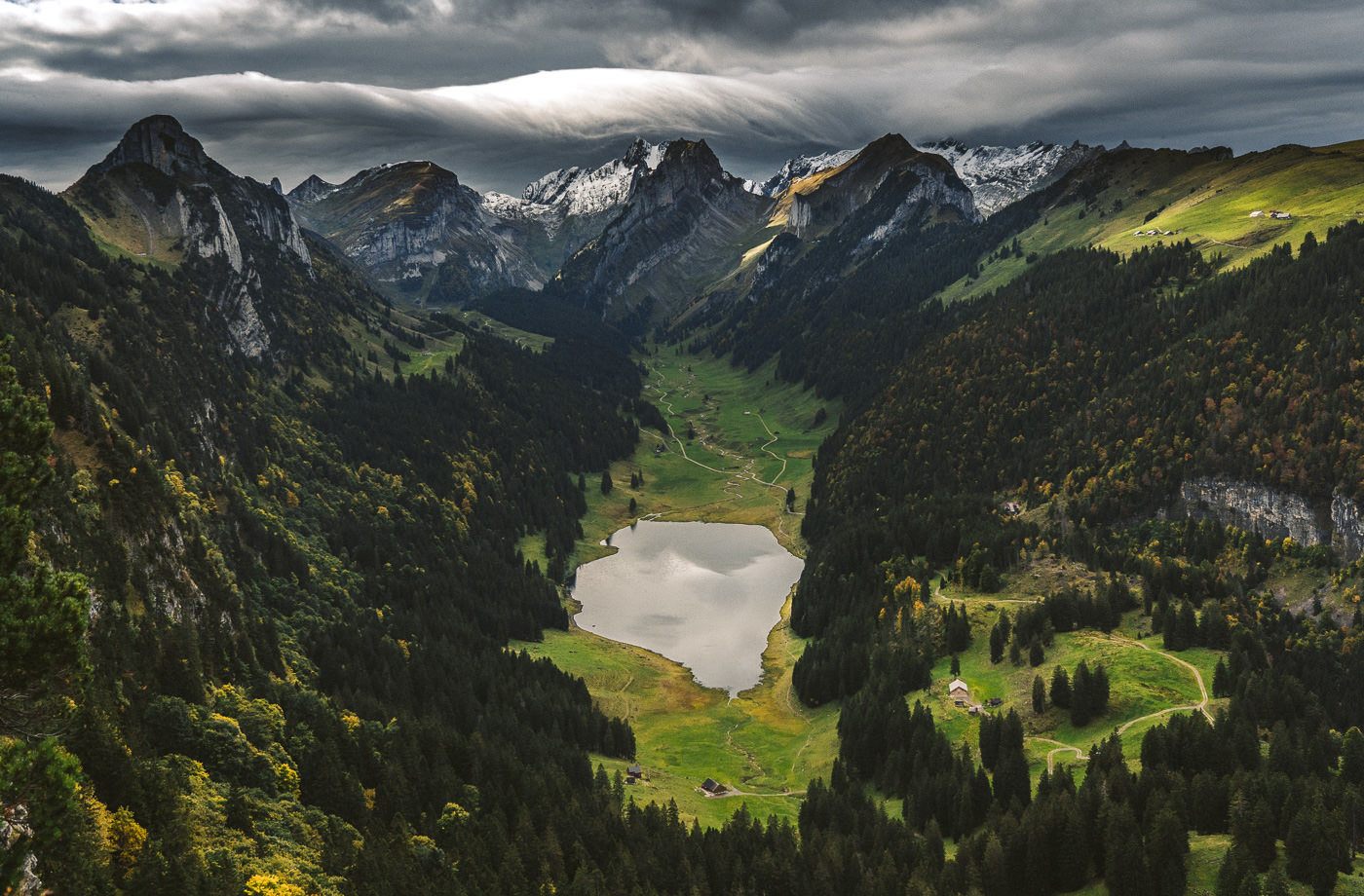
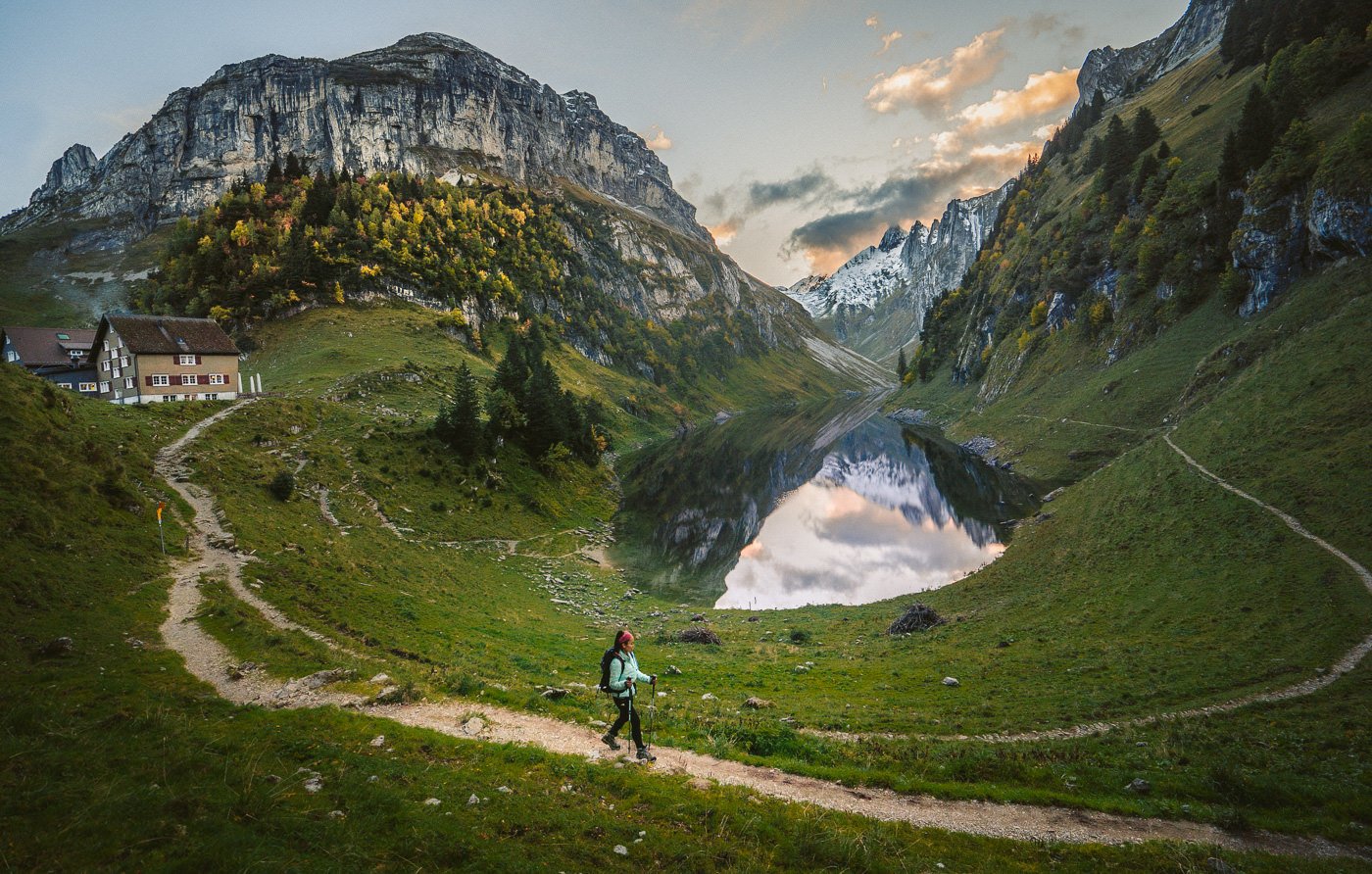
The next viewpoint came at the small hut at the foot of the trail down from Wilderalpsattel. Here we could see all the way to Hoher Kasten and Samtisersee. Below is the view of Samtisersee from the hut and then the second photo is the view of Samtisersee from the next day when I took the photo along the trail from Hoher Kasten to Saxer Lucke.
For the correct route, you are meant to visit Fallensee and then see Samtisersee on the way through the valley to Brulisau. We did that but in the dark because we watched the sunset at Fallensee. Therefore we made sure to take some photos and enjoy the Samtisersee from afar knowing it would be dark when we walked past later in the day. Most people will be finished in the day and see Samtisersee Lake in full sunlight!
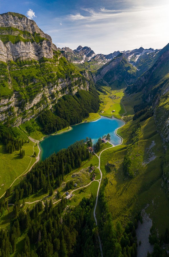
We continued on the route down to Falensee, which is signed by the name ‘Bollenwees’, which is the mountain hut right next to Fallensee. This part of the trail was extra special at this time of the year with the yellow and orange leaves creating some beautiful contrasts against the dark greens.
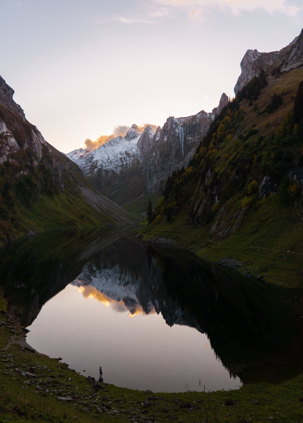
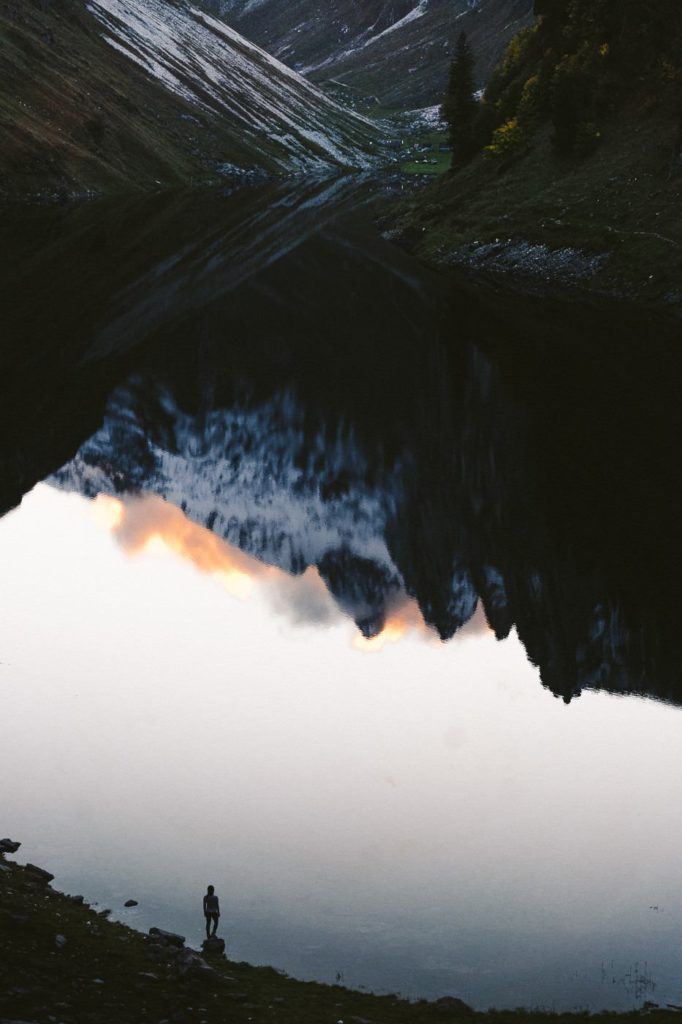
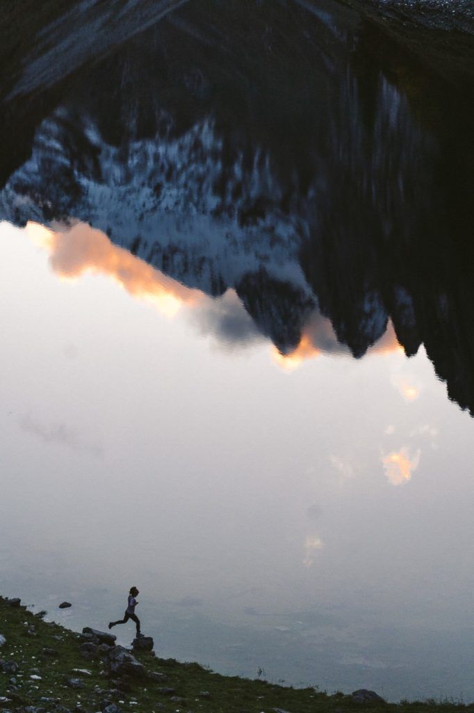
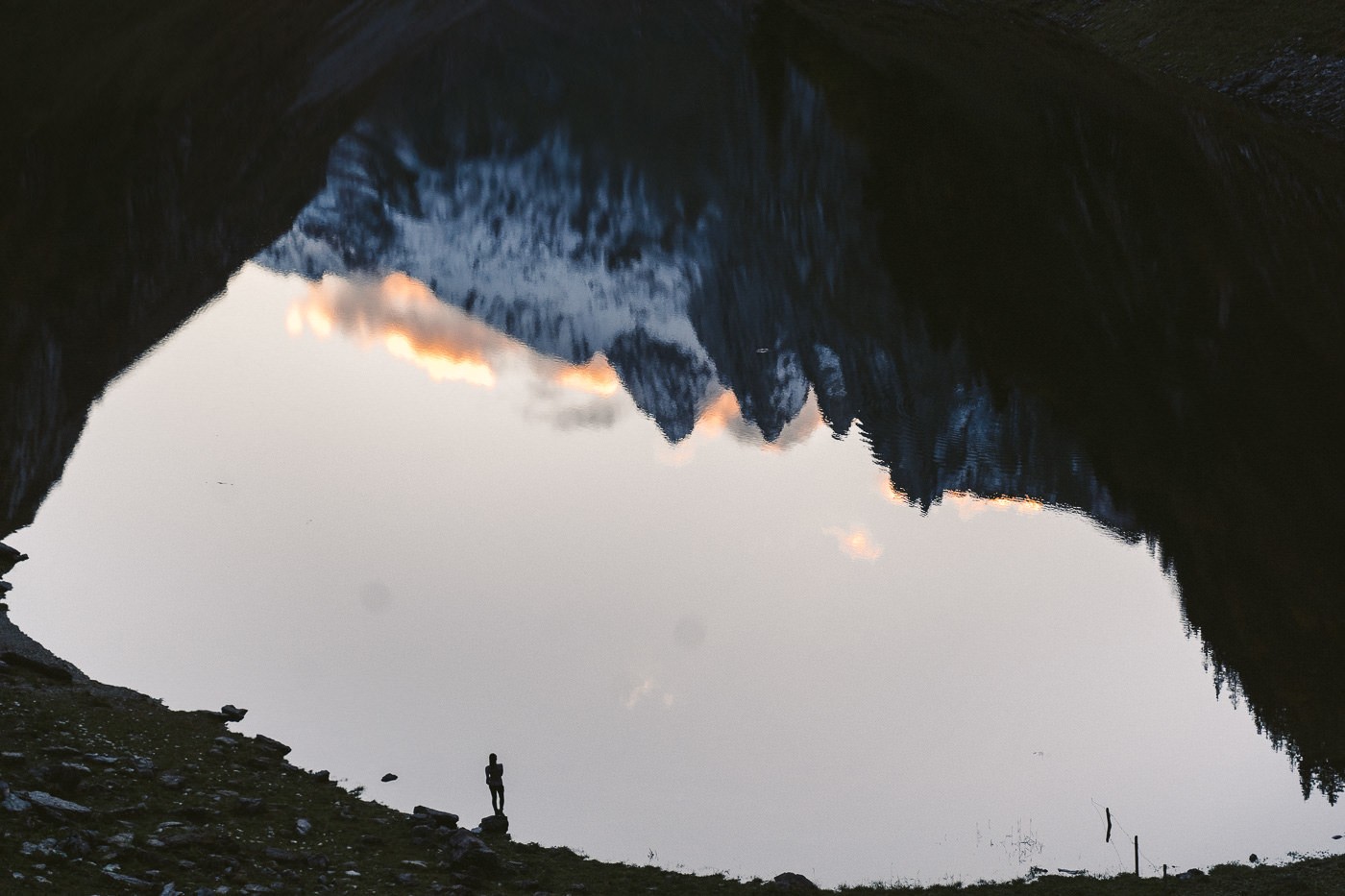
We made it to Fallensee as the last light of the day was coming down. It’s truly an incredible spot and my favorite of all the three lakes on the trail. The mountains on either side are so close that the lake is met with walls that seem to leave little room to walk around the lake, although there is a trail.
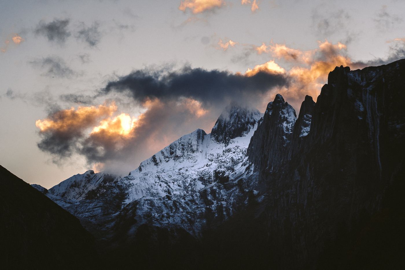
The reflections in the lake were stunning as were the peaks and pastel clouds on the far side. We enjoyed the sunset here a lot before heading into the Bollenwees restaurant for some soup and bread.
We then had to make the 7-kilometer hike back to Brulisau in the dark. That’s the price you pay for staying at Fallensee for sunset unless you stay overnight at Bollenwees Mountain Hut.
Plot Twist: As we exited the restaurant two local guys were about to drive off (the public can’t drive on this gravel road) and they offered us a lift… not only to Brulisau but all the way to Appenzell. They were workers and going there anyway. Our gamble paid off and the friendly Swiss showed us some of their finest hospitality.
As I said, normally if hiking during the day, after Fallensee, you would continue down the hill to Samtisersee and then on to Brulisau. I did actually walk this trail the next day when I was coming down from Saxer Lucke.
A suggestion I could make for you is to make this hike a two-day expedition. On the first day, you go to Seealpsee and Fallensee and then eat dinner and stay at Bollenwees. In the morning hike up 35 minutes to Saxer Lucke viewpoint for sunrise and then either hike all the way to Hoher Kasten or come back down to Bollenwees and hike back to Brulisau, visiting Samtisersee on the way. Both would be great weekend expeditions.
Hope you enjoyed this blog, it was a great hike in the Alpstein region of Appenzell and one for all.
SWISS TRAVEL PASS or HALF-FARE CARD
OPTION 1: Buy the Swiss Half Fare Card: Switzerland trains, buses, and cable cars are EXPENSIVE! I found the best way to get around cheaply was to buy the Swiss Half-Fare Card before I arrived. It gives you 50% off every regular train, bus, and even many cable cars. It only costs $150 USD but pays itself off in just a few days with many train tickets in Switzerland costing close to $100 alone. If you are staying for more than 5 days, I suggest buying the Swiss Half-Fare Card.
OPTION 2: Buy the Swiss Travel Pass: The second option is to get the Swiss Travel Pass, which gives you unlimited train, bus, and (many) cable car rides but it’s pretty expensive at around $100 USD per day so if you don’t travel each day it isn’t worth it.
OPTION 3: Buy the FLEXI Swiss Travel Pass: The final (BEST) option is to get the FLEXI Swiss Travel Pass, which allows you to buy 8 days’ worth of transit but you can choose the night before if you want to activate the next day. That way you don’t need to travel every day to get your money’s worth, you can just activate the FLEXI Swiss Travel Pass on the days when you are doing sizeable transits. My advice is to book the Swiss Half-Fare Card or the FLEXI Swiss Travel Pass in advance before your trip so it’s ready to go when you arrive.
GET A SWISS TRAVEL PASS!


Enjoy UNLIMITED train, boat, and bus rides in Switzerland for up to 15 days. Click to book a flex Swiss Travel Pass or choose the Consecutive Swiss Travel Pass.
The Swiss Travel Pass starts at $260 for 3 days. Click here to check if it’s available on your travel dates.
MY SWITZERLAND HIKING GUIDES
I spent 100 days hiking in Switzerland and created a guide for different regions around the country. You can click on one of my Switzerland hiking guides below to help you plan your trip.
- The Complete Guide: 50 AWESOME HIKES IN IN SWITZERLAND
- The Via Ferrata Guide: 4 EPIC SWITZERLAND VIA FERRATA COURSES
- Lauterbrunnen Guide: 10 AWESOME HIKES NEAR LAUTERBRUNNEN
- Interlaken Guide: 15 AWESOME HIKES IN INTERLAKEN
- Grindelwald Guide: 12 AWESOME HIKES NEAR GRINDELWALD:
- Mürren Guide: 7 AWESOME HIKES IN MURREN
- Appenzell Guide: 9 AWESOME HIKES NEAR APPENZELL
- Chur Guide: 7 AWESOME HIKES NEAR CHUR

MY SWITZERLAND TRAVEL TIPS
- For Backpackers: SWITZERLAND BUDGET BACKPACKING GUIDE
- Travel Tips: 20 THINGS TO KNOW BEFORE VISITING SWITZERLAND
- Transport Tips: RENTING AND DRIVING A CAR IN SWITZERLAND
- Accommodation Guide: 30 BEST PLACES TO STAY IN SWITZERLAND

Jessica
Sunday 19th of September 2021
Hi, thanks for sharing this hike adventure! I would like to do this end October for my birthday, hoping that weather will be kind with me ;). I've got a question, when you wrote you can choose on the forest trail or valley trail to Seealpsee...both trails are clearly indicated on the path? And to avoid to take the incorrect way after Meglisalp, which way we shaould take (if you remember)? thanks a lot and have a good journey era!! :)