
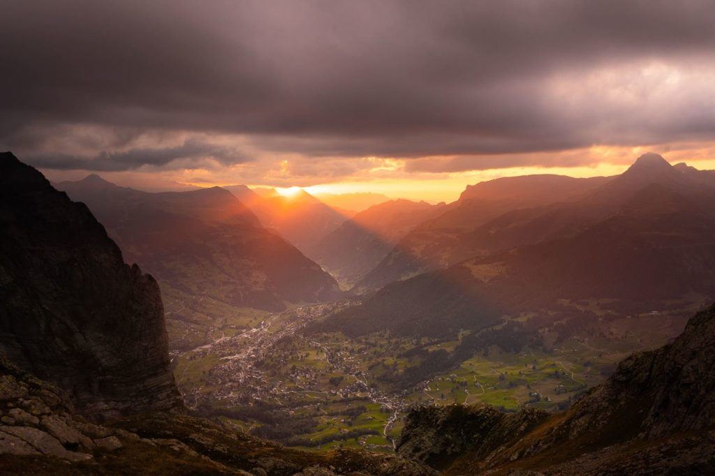
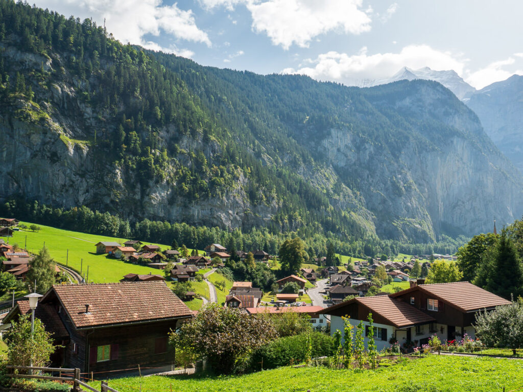
Grindelwald is one of my favorite regions in Switzerland with possibly the most picturesque valley in the entire world. I visited this region for a week and barely had enough time to see all of the amazing hikes in Grindelwald. Throughout my time hiking in and near Grindelwald, I experienced some beautiful trails and I’ve put together this Grindelwald Hiking Guide so that you can choose a hike or two (or ten) for your visit to Grindelwald. I’m sure you will find a great adventure on this list of my nine favorite hikes in Grindelwald.
12 AWESOME HIKES IN GRINDELWALD, SWITZERLAND
In this blog post, you will find a description of each of the hikes near Grindelwald and some photos I took as well as a link to the individual blog post I wrote about all of the hikes near Grindelwald. You can click on that link for a more detailed review of the hike including maps, starting points, how to get there, photos, directions, difficulty, and a short story about my experience on that Grindelwald hike.
Some of the hikes on this list are right in Grindelwald like the Baregg Hut hike. However, a few of these hikes are near Grindelwald but not quite in the center of the region. I was based in Interlaken and Grindelwald when I did all of these hikes and reached all of the trails by public transport so you will be able to reach any of these trails if you are based in any of those spots or even in Interlaken. I’ve made sure to only add hikes onto this list that are under 1.5 by train to any trailhead and you can do all of them as a day hike from Grindelwald.
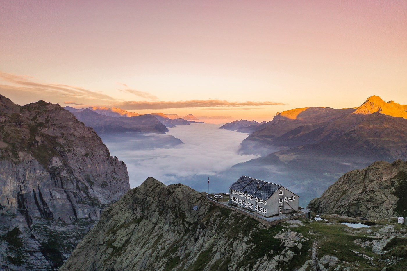
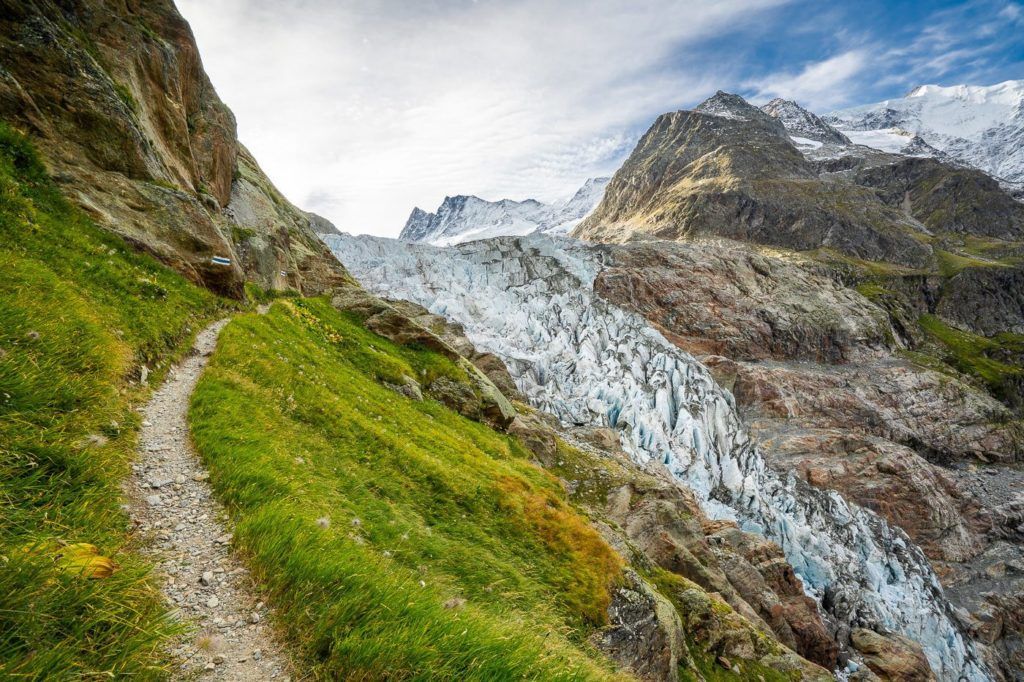
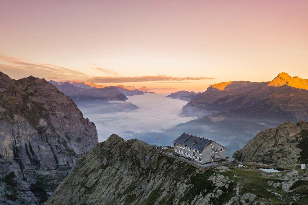
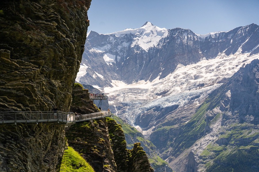
BAREGG HUT HIKE
Baregg Hut (Bareghutte) is perched on the edge of a cliff, overlooking the lower Grindelwald Glacier. It’s just a 3km walk from Pfingstegg and is a great place for an overnight stay and a basecamp to hiking to the Schreckhorn Hut (Schreckhornhutte). If you are based in Grindelwald you will simply walk from your accommodation to the Pfingsteggbahn and start from there. I caught the train from Interlaken to Grindelwald and began from there and returned the next day but it is just as simple to make the 1-hour journey from Lauterbrunnen to the start of the Baregg Hut hike.
The trail follows along the edge of the cliff, alongside the Lower Grindelwald Glacier… or at least where the glacier used to be. This hike shows you exactly how much the glacier has receded in the last century and a half. I arrived at the hut in the late afternoon dropped my gear off in the dormitory, got changed, and went outside to enjoy the scenery.
The dormitory-style rooms have nice bunk beds with comfortable mattresses and brilliant views even from the bunks themselves. Inside the mountain hut, you will find showers, bathrooms, a dining room, and lots of areas to hang out, play cards, and enjoy the cozy atmosphere.
Want more details and photos? View the full blog post here: BAREGG HUT HIKE WITH OVERNIGHT STAY & HIKE TO SCHRECKHORN HUT
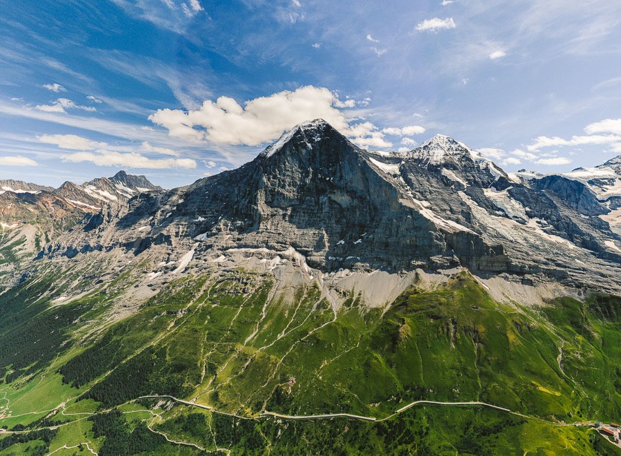
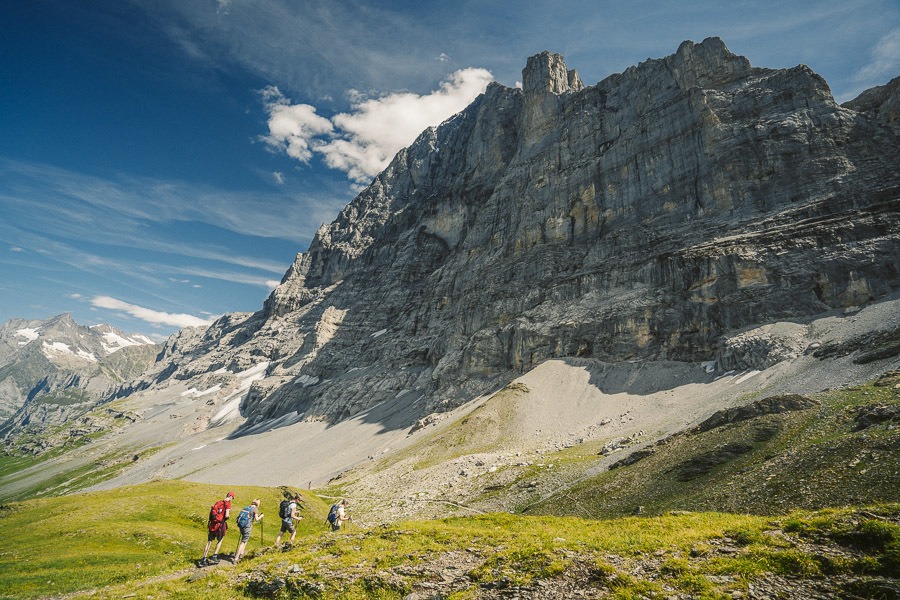
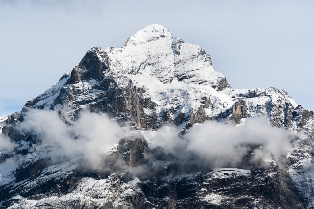
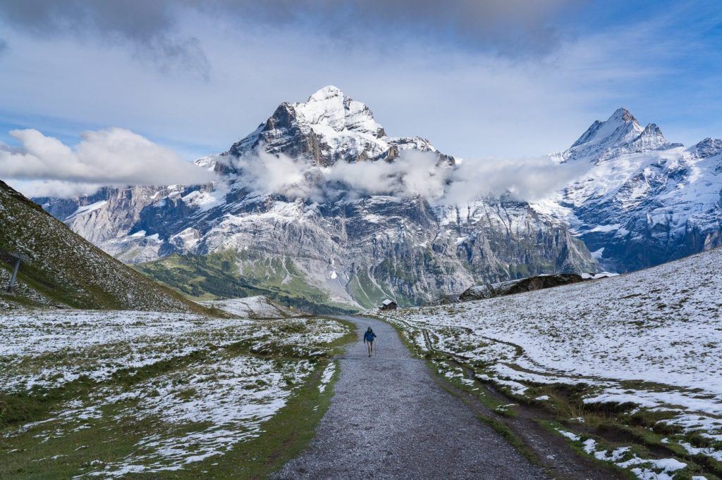
THE EIGER TRAIL HIKE: EIGERGLETSCHER TO ALPIGLEN
The Eiger Trail hike is one of the most popular routes in Switzerland because the path leads hikers directly under the world-famous Eiger North Face Wall, which is renowned as one of the toughest climbs in the world. To reach the start of the trail you can take the long train from Wengen/Lauterbrunnen or the short train from Grindelwald. If you are feeling very energetic you can walk to the trailhead from Grindelwald but it’s all uphill. Warning served.
The trail starts off with 200m of incline, although it is spread over a couple of kilometers and is nothing too strenuous. At this point, you cannot see Eiger, but the views across the valley and the towering glacial mountains are incredible and there is something to gawk at in every direction.
It isn’t long before you will reach the Eiger viewing area. It’s about 2km into the trail and there will likely be a little gathering of people and possibly some local cows. Here you will look up towards Eiger Mountain and if you read the signs, you can even identify the path the climbers use to scale the North Face wall of Eiger. You then follow the path back in the direction of Grindelwald til you hit the train station for a ride back with all of the other tired hikers.
The distance from Eigergletscher Train Station to Alpiglen along the Eiger Trail is 6.5km. The hike takes about 2.5 hours although if you went straight through without taking photos or stopping it would be well under two hours. It could be run in well under an hour and is actually a popular trail run for those staying in Grindelwald. I’d say this is up there as one of the most popular hikes in Grindelwald.
Want more details and photos? View the full blog post here: THE EIGER TRAIL HIKE: EIGERGLETSCHER TO ALPIGLEN
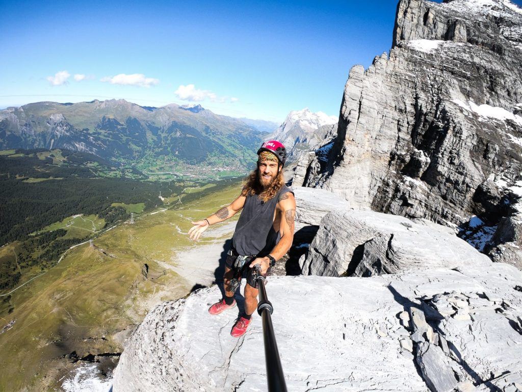
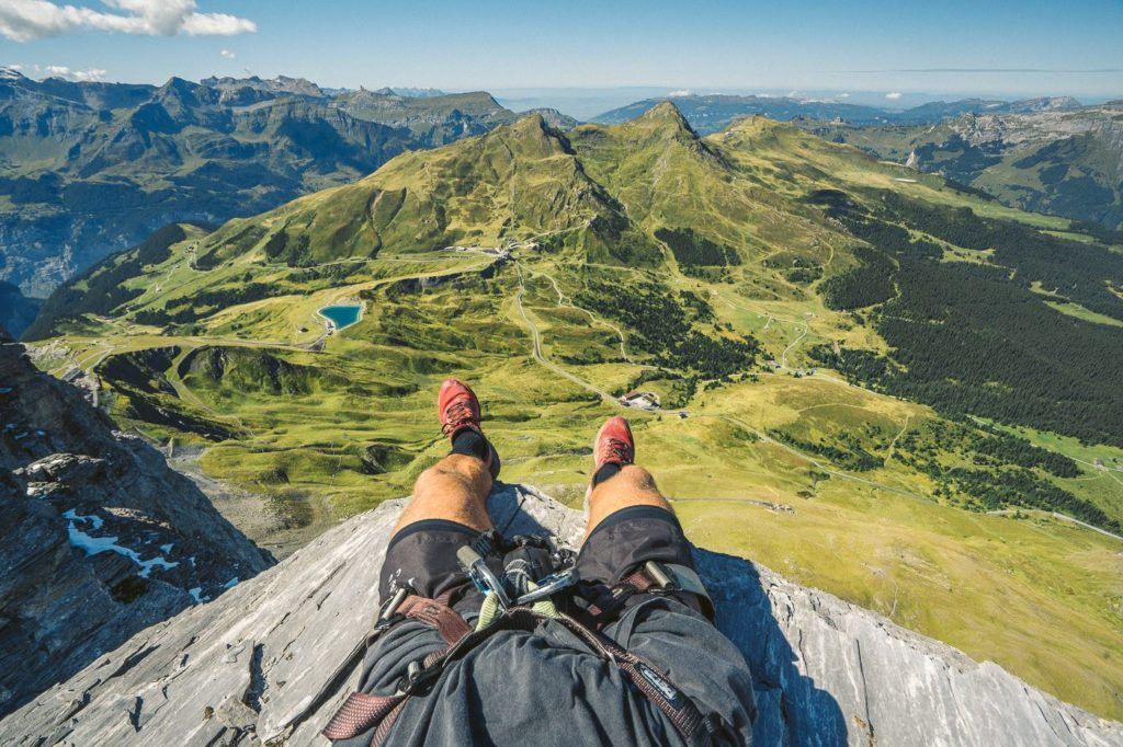
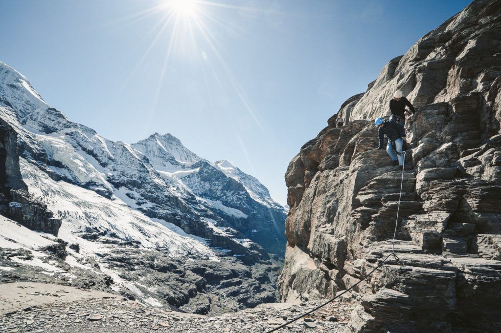
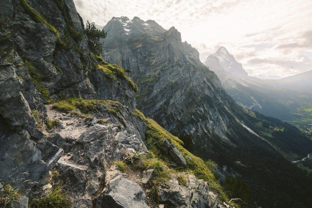
THE ROTSTOCK VIA FERRATA AT EIGER, GRINDELWALD
The Rotstock Via Ferrata is an epic climb right next to the famous North Face Wall of Eiger. Using a harness, stairs, and metal stairs you can climb 400m of incline to the 360-degree panoramic viewpoint. If the hiking trail I detailed above isn’t enough, this time you can get a taste of the big wall by doing the Via Ferrata alongside the Eiger Wall.
For those who don’t know what a Via Ferrata is, it’s basically a series of ladders, steps, and rock climbing that leads you up a wall. You are wearing a harness and clip into a strong wire at the start of the Via Ferrata. From that point, you are always clipped in with at least one clip.
The total hike distance was 5km from the start of the Eiger Trail and up to the summit and then back down to Eigergletscher Station. If you are up for a thrill this is the hiking trail in Grindelwald I would recommend.
Want more details and photos? View the full blog post here: THE ROTSTOCK VIA FERRATA AT EIGER, GRINDELWALD
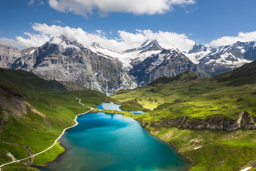
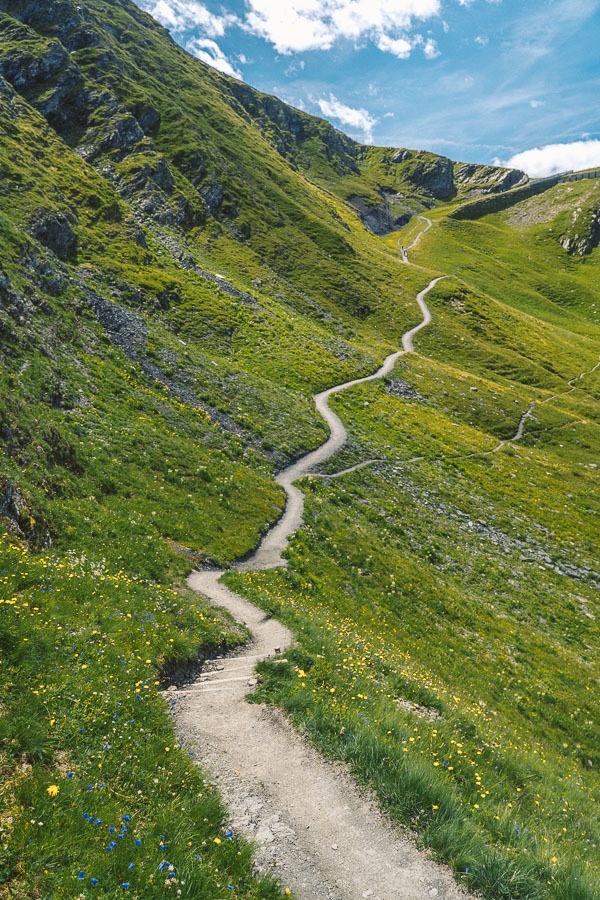
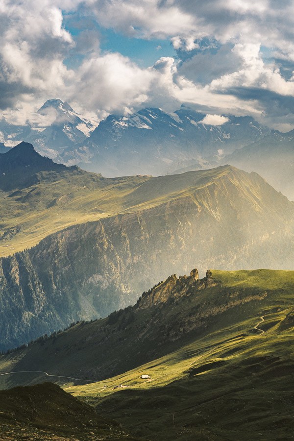
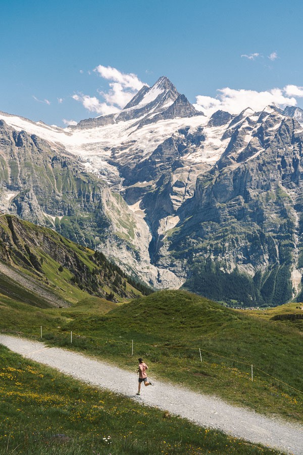
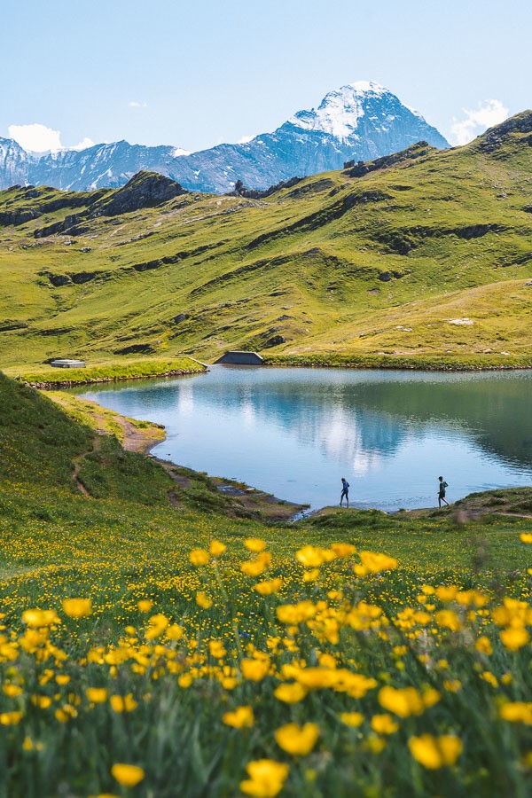
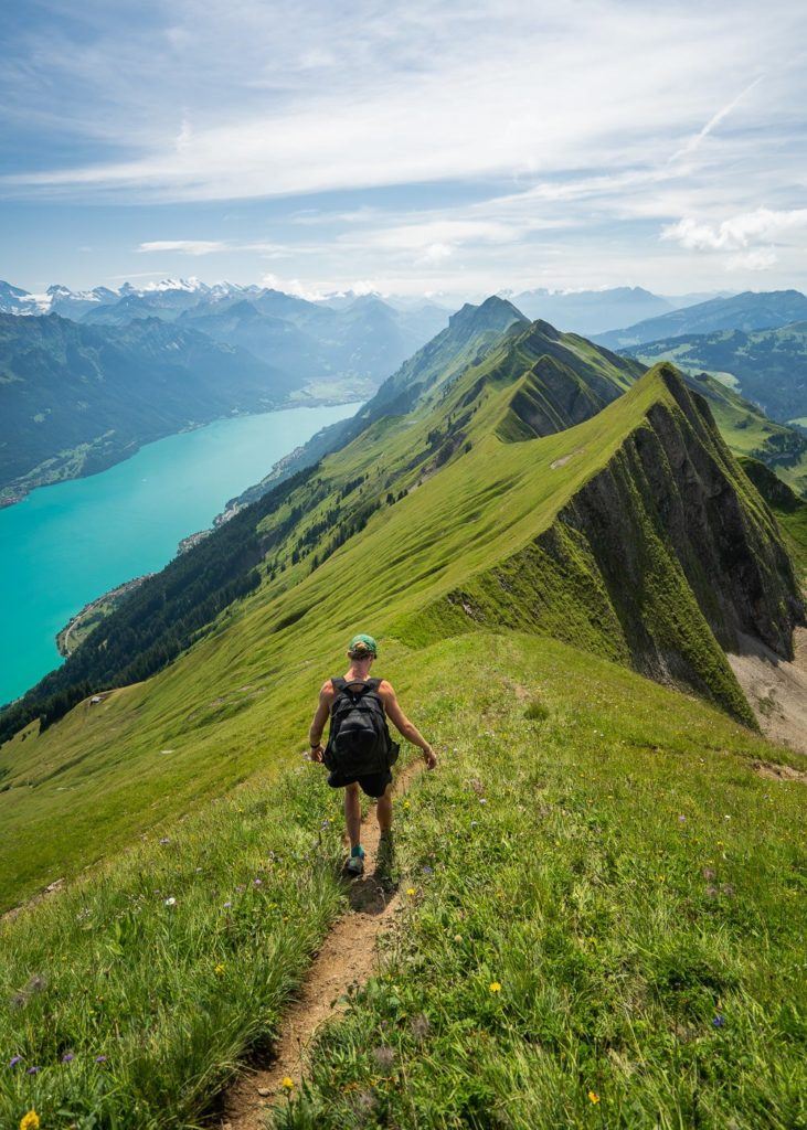
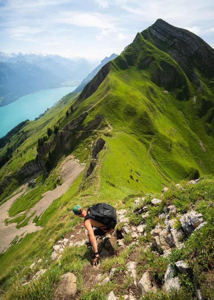
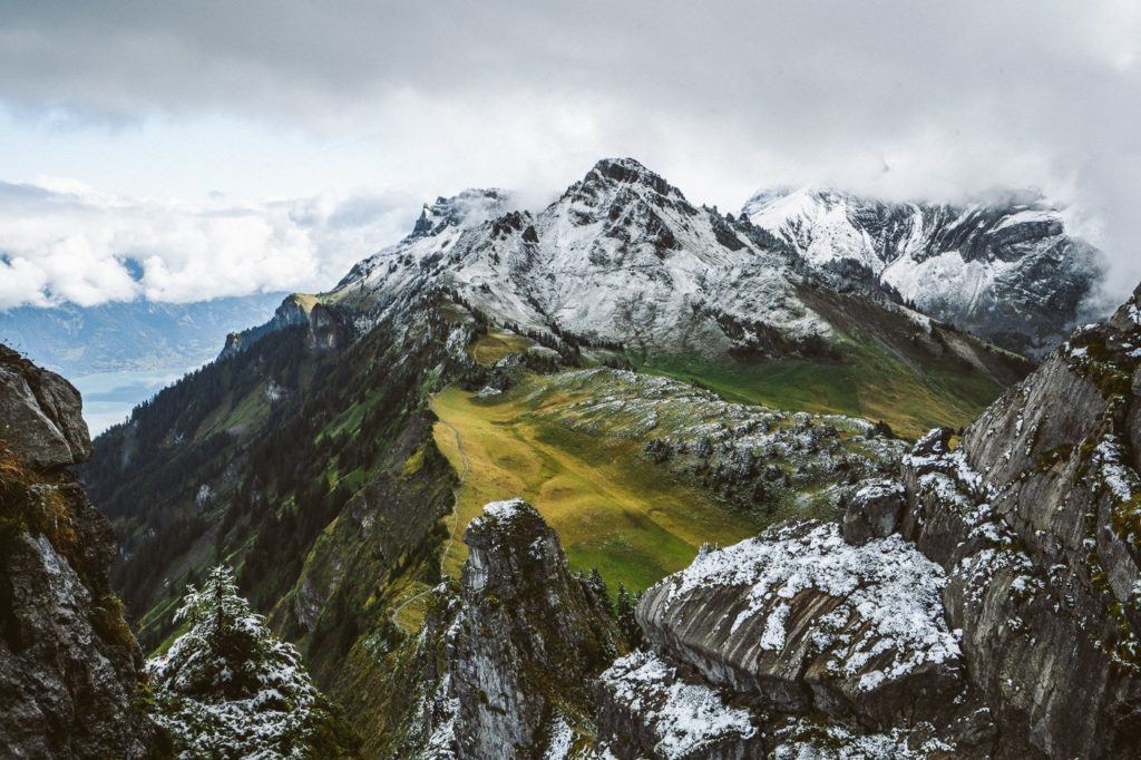
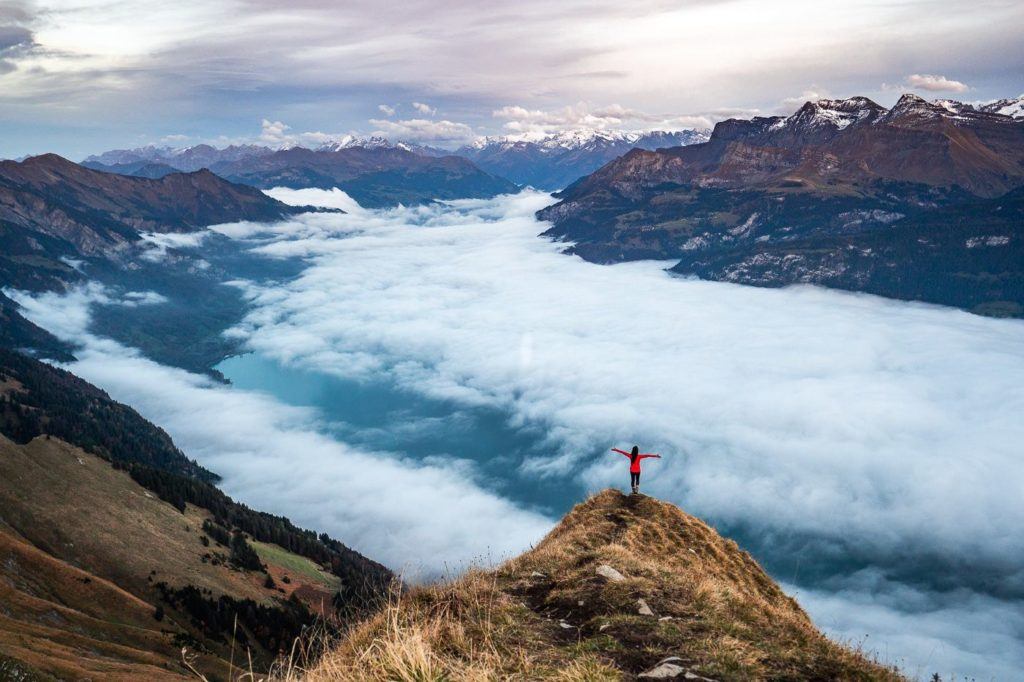
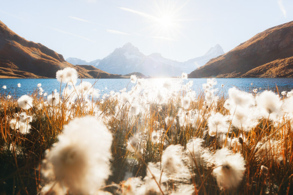
HIKING TO FAULHORN SUMMIT VIA FIRST & BACHALPSEE
Bachalpsee is one of the most stunning alpine lakes in Switzerland, surrounded by wildflowers and adorned with an incredible backdrop of glacial mountains. The beauty of the Bachalpsee Lake is that because there is a cable car to First, it is just a one-hour trek from the First station to the lake, despite being located at 2,265m in altitude. In terms of having it all… this is up there as one of the most all-around impressive hikes in Grindelwald!
This is another great hike if you are staying in Grindelwald as the cable car station to take you from Grindelwald to First, called the Firstbahn, is right in the heart of Grindelwald. So you just go from your hotel in Grindelwald straight to the starting point.
- Hike Distance: After the cable car to First the hike from First to Bachalpsee was 3km one way and you will need to hike back so 6km in total.
- Hike Duration: 2 hours of moving time. With breaks, swimming, and photos, the total time was 3 hours return.
- Hike Difficulty: Very easy. Dirt trail the whole way. Some incline but nothing too major just 188m up and 188m down.
- Hike Incline: 188m
Want more details and photos? View the full blog post here: HIKING TO FAULHORN SUMMIT VIA FIRST & BACHALPSEE

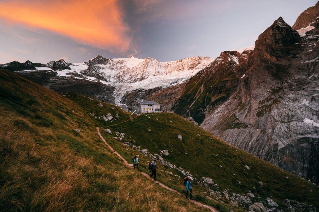
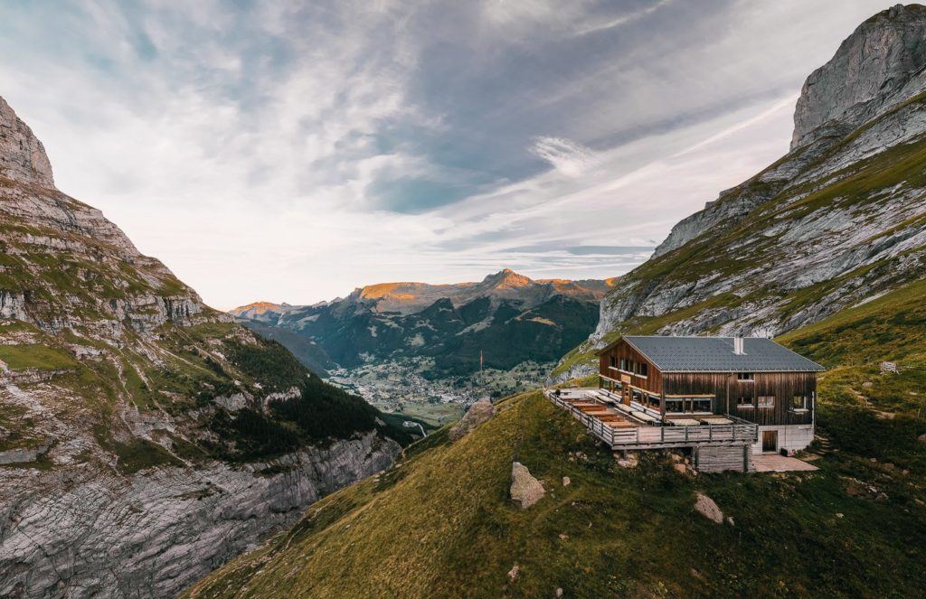
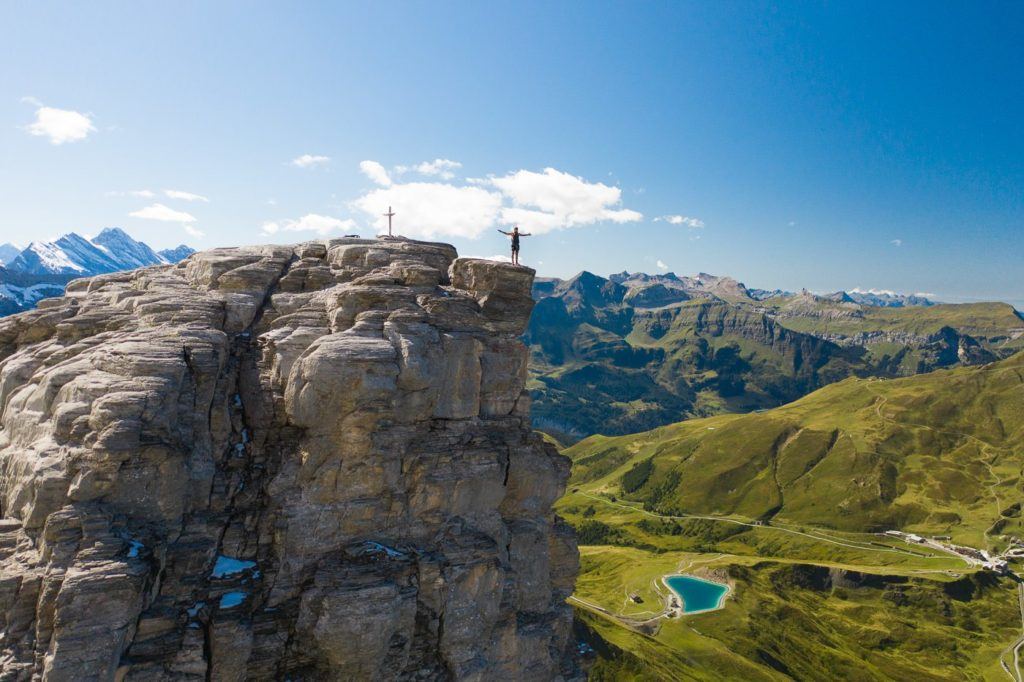
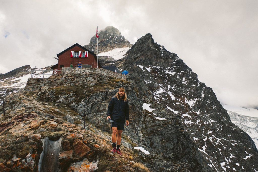
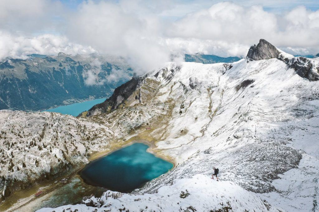
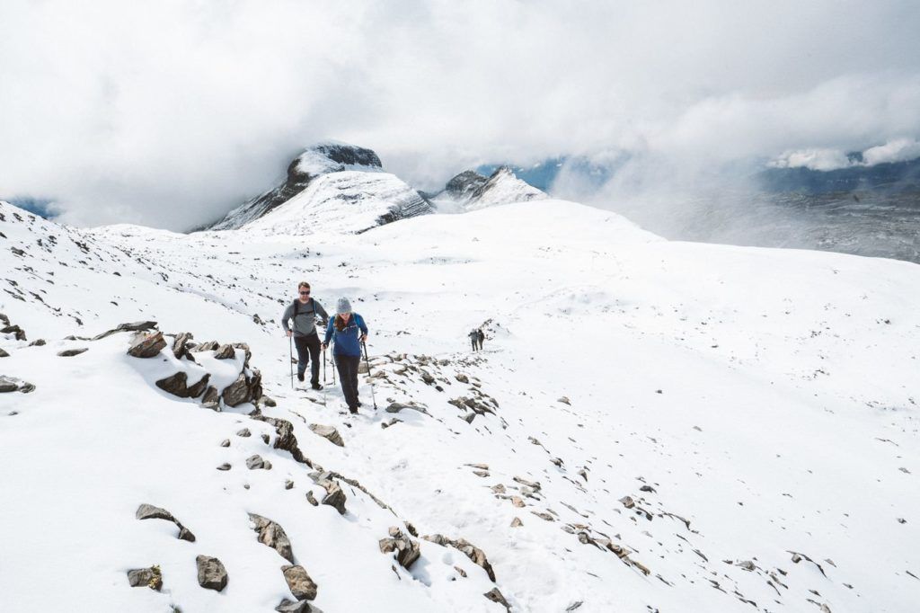
HIKING TO GLECKSTEIN HUT AND CHRINNENHORN PEAK
Gleckstein Hut (Glecksteinhutte) sits above Grindelwald with incredible views down into the valley, while dramatic glaciers loom behind in the mountains. It’s an incredible place to stay the night and enjoy the sunrise and sunset. A few hundred meters above the Gleckstein Hut is the Chrinnerhorn summit, a peak accessible without mountaineering experience but with epic views down towards Gleckstein Hut and over Grindelwald.
The suggested duration is 3 hours and 50 minutes according to the sign but I went up in 1 hour and 34 minutes and came down the next day in 58 minutes. The path is a red-and-white trail rating but has a few exposed areas. There is cable wherever the trail is exposed. 1,100m of incline will challenge many but there were quite a few older hikers making it up the hut so a slow and steady approach will mean most are capable.
What I suggest is to stay one night in a hotel in Grindelwald and then check out the next morning but leave your luggage in the storage room. That night you hike up to Gleckstein Hut and stay there the night before returning to the hotel to collect your bag or stay one more night at that accommodation. Some of the best hiking in Grindelwald involves an overnight stay so you need to be flexible with your logistics like this example.
Want more details and photos? View the full blog post here: HIKING TO GLECKSTEIN HUT AND CHRINNENHORN PEAK
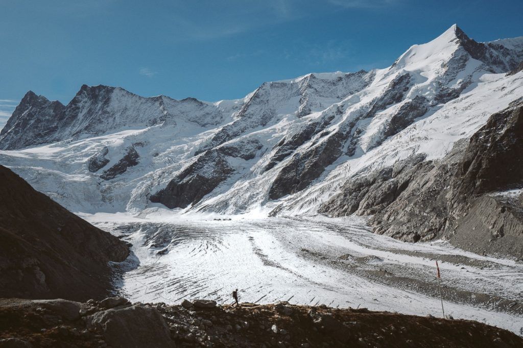
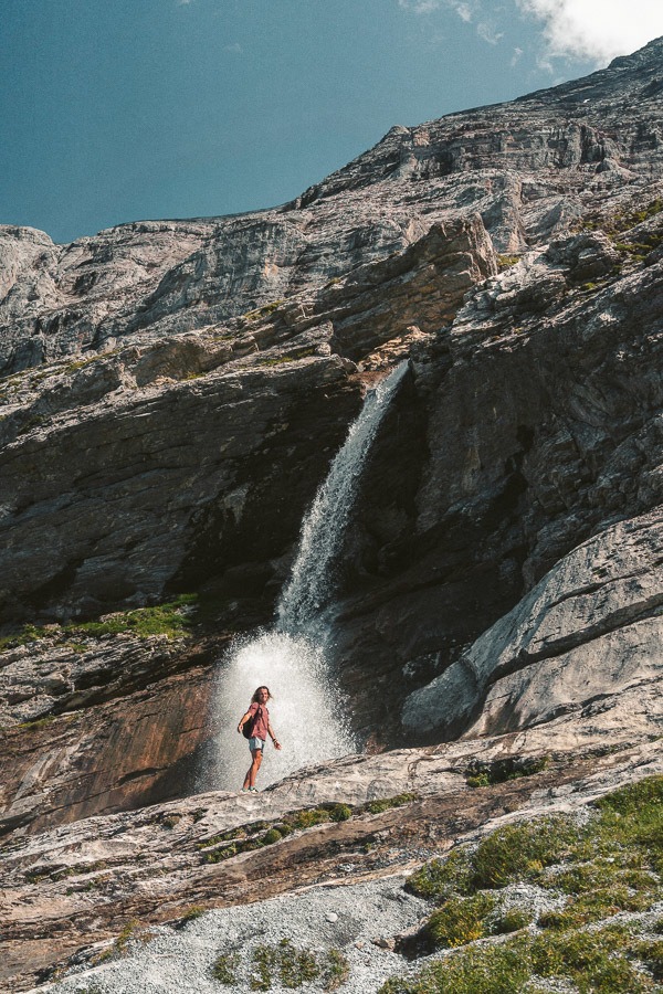
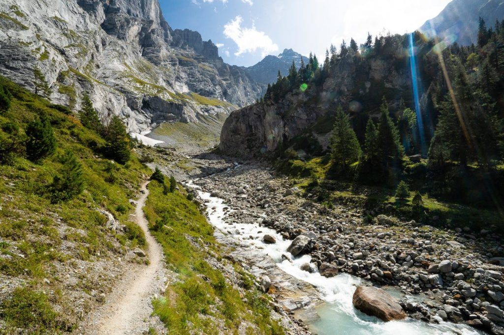
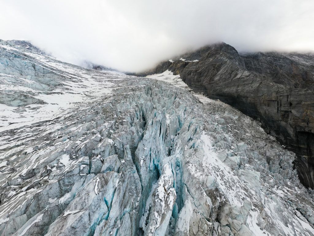
HIKING TO DOSSEN HUT VIA ROSENLAUI GLACIER
The Dossen Hut hike is an epic 19km T4 Difficulty route that starts off at Rosenlaui Glacier, and leads you up to the mountain hut and down to Innertkirchen. This one requires a train and a bus from Grindelwald but don’t worry it’s not a long trip.
The hike begins by taking you through a canyon and a number of waterfalls before you begin the T4 route up the rocky slopes. Ladders, ropes, and pegs lead you up the scramble to the mountain hut where you have an epic view of the Rosenlaui Glacier. You then return through the canyon on the other side of the ridge before catching the train back to Grindelwald.
The suggested duration is about 8 hours from Rosenlaui Hotel to Dossen Hut and down to Innertkirchen. However, as you will see in this blog post, I did the hike in 5 hours but also had to run an extra 5km from Innertkirchen to Meiringen Train Station. So it is possible in less than 5 hours but likely it will take 5-10 hours for most hikers. It’s one of the most adventurous hiking routes near Grindelwald and will be far less busy than the Eiger Trail and Bachalpsee.
Want more details and photos? View the full blog post here: HIKING TO DOSSEN HUT VIA ROSENLAUI GLACIER
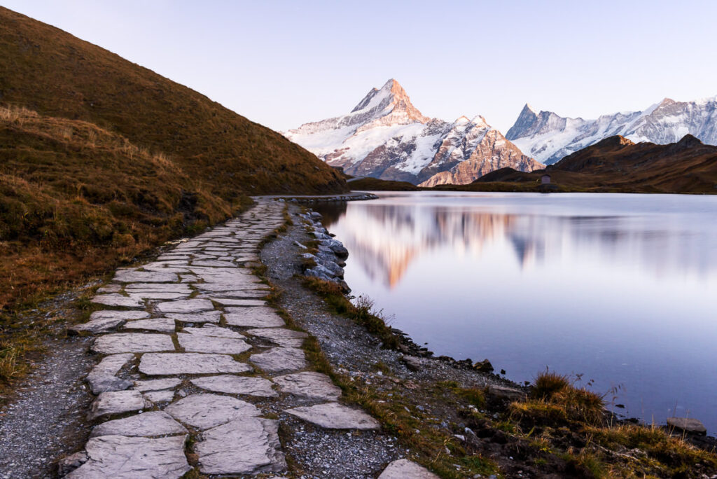
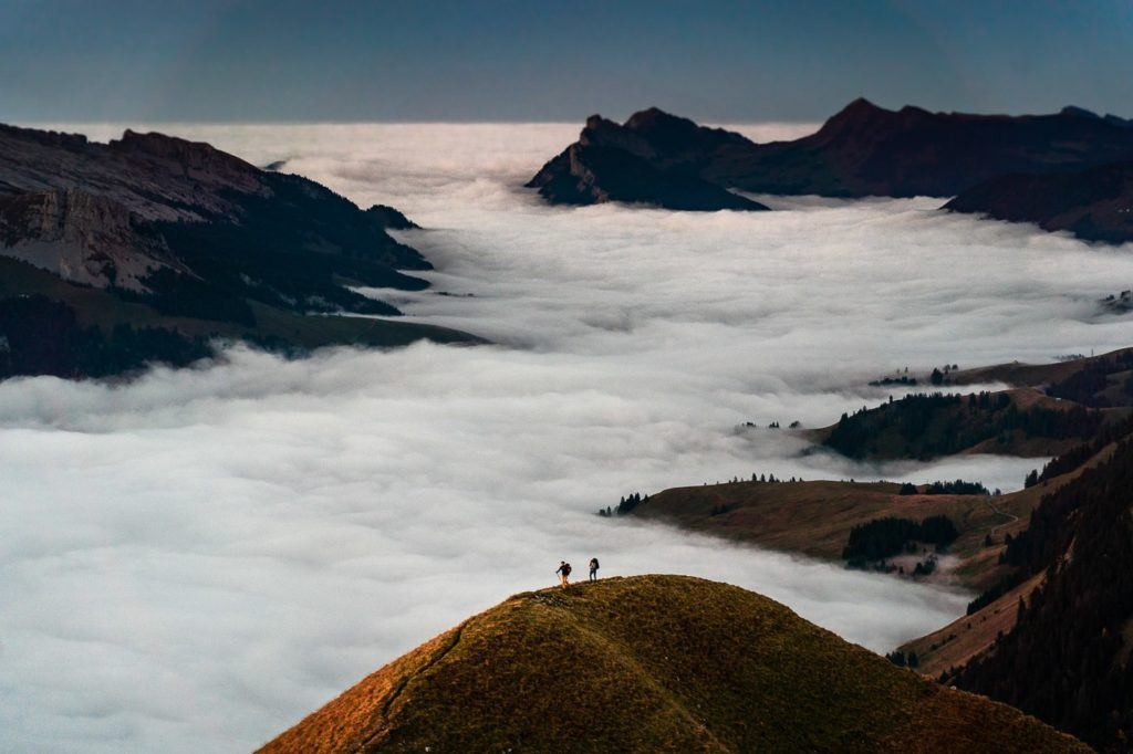
HIKING TO LAKE BACHALPSEE FROM GRINDELWALD/FIRST
Bachalpsee is one of the most stunning alpine lakes in Switzerland, surrounded by wildflowers and adorned with an incredible backdrop of glacial mountains. The beauty of the Bachalpsee Lake is that because there is a cable car to First, it is just a one-hour trek from the First station to the lake, despite being located at 2,265m in altitude.
Bachalpsee is one of the most spectacular lakes in Switzerland and probably one of the most incredible lakes you will find on a hike near Interlaken. It’s relatively easy to get there with the cable car or you can refer to an earlier hike on this list: Schynige Platte to First if you want to take the long adventurous route.
After the cable car to First, the hike from First to Bachalpsee was 3km one way and you will need to hike back so 6km in total.
Want more details and photos? View the full blog post here: HIKING TO LAKE BACHALPSEE FROM GRINDELWALD/FIRST
HARDERGRAT TRAIL
The Hardergrat hike has to be somewhere at the top of this list. It’s known as one of the toughest hikes in Interlaken and also one of the most dangerous.
The trail begins at Brienz and runs along the Brienzersee (Brienz Lake) all the way to Harder Kulm Station. It takes fit hikers about six hours to complete and there are many parts with very, very steep drop-offs. It is for experienced hikers and to be avoided on wet days is the steep cliffs can be unforgiving.
It is possible to get the train up at Brienz and then down from Harder Kulm but you will need to hike fast and with determination because if you miss the last train you will be hiking down another 800m of incline.
The best route is to get the early train (it’s also half-price) at Brienz and then work your way to Harder-Kulm Station and make sure you catch the last train down. Alternatively, if you are a hiking machine, you can hike up to Brienzer Rothorn, along the ridge to Harder Kulm Station, and then down to Interlaken for a total of almost 30 kilometers and 3000m+ of incline throughout the day. Good luck with the journey.
Want more details and photos? View the full blog post here: HARDERGRAT TRAIL

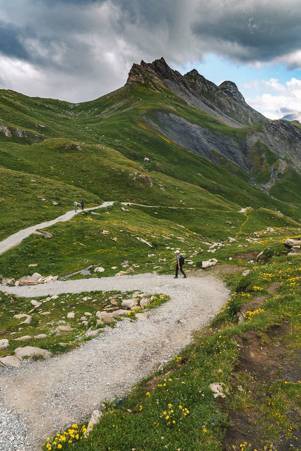
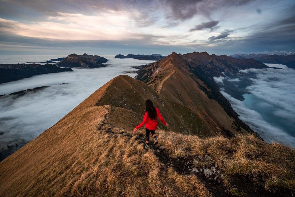
SCHYNIGE PLATTE TO FIRST HIKE
The hike from Schynige Platte to First via Faulhorn is among the top hikes near Grindelwald with an epic view around every turn. Expect a long day on the legs with 16km of the trail ahead of you and nearly 1000m of incline. The soup and coffee at Faulhorn with magical views make it all worthwhile.
This hike is quite special because it has views of Brienzersee along the way before heading up past alpine lakes to the Fualhorn Mountain Hut. I did this hike near Grindelwald after the first snow of the season and it was just stunning. It’s also a great hike for the middle of the summer when there is now snow, which would be a unique experience as well.
This epic hike near Grindelwald is not extremely difficult with very few areas of concern for moderately experienced hikers. While 1000m of incline is substantial, there are no points where the trail is overly exposed. Many parts of the trail are rocky and involve a tiny bit of clambering but you never need to use your hands or climb.
The best way to do it is to catch the train to the Schnyige Platte Station and then hike back to Faulhornn/First before taking the train to Grindelwald so you finish back at your hotel in Grindelwald.
The hike took me a total time of 5 hours. It could be done in a little less time, especially if you don’t summit Oberberg and Faulhorn but that is the whole point of the hike! I’d bargain for 5-7 hours for the total trip and you will enjoy a coffee and soup at Faulhorn and have lots of spare time to enjoy your hike.
The main point to remember is that (at least during summer) the last cable car down from First to Grindelwald is at 5:30 so you need to leave from Schynige Platte before midday to make that. If you miss it, there is a 2-hour trail down to Grindelwald that you will have to take on tired legs.
Want more details and photos? View the full blog post here: SCHYNIGE PLATTE HIKE TO FAULHORN & FIRST
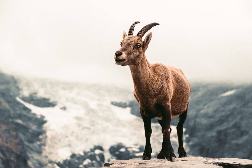
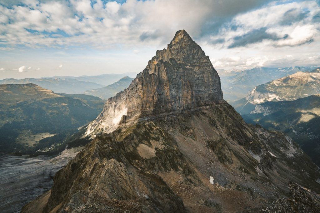
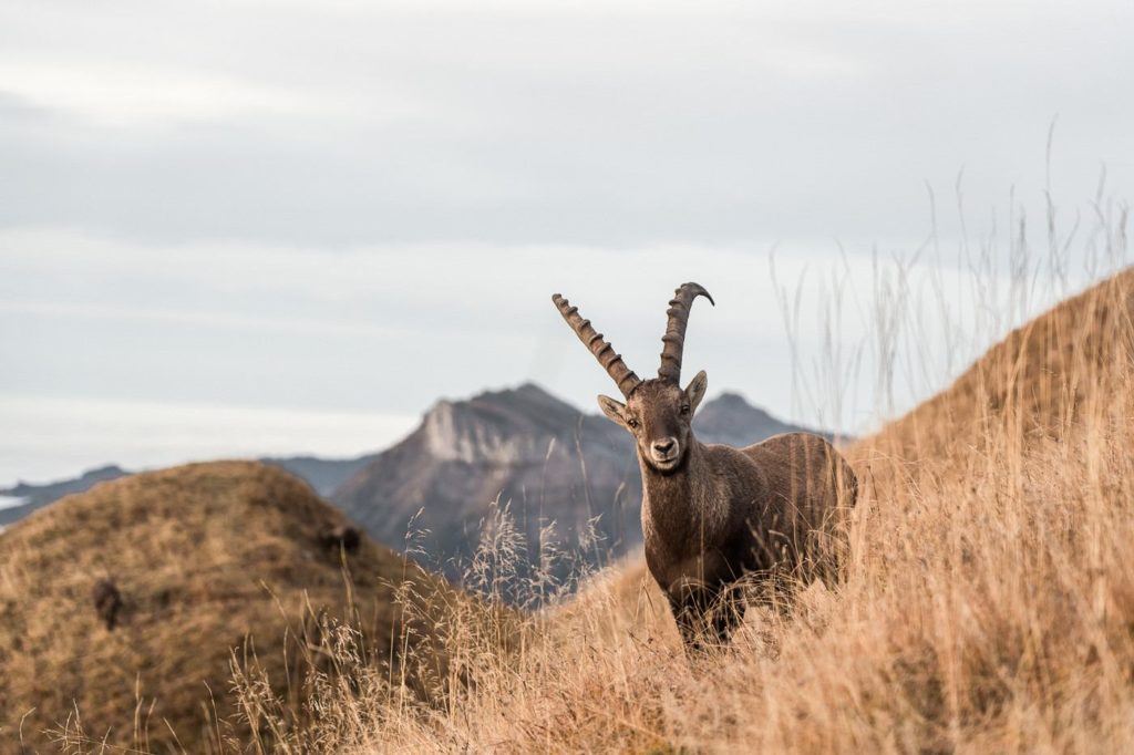
AUGSTMATTHORN HIKE FROM HARDER KULM
Augstmatthorn is one of the most spectacular summits along the Hardergrat Ridge. It’s famous not only for the stunning views but for the Ibex colony that calls Augstmatthorn home. There are several ways to reach Augstmatthorn but the most popular route is to begin at Harder Kulm and walk along the ridge to the summit.
The view up at Augstmatthorn with the clouds beneath us was just incredible. We could see all the way down the Hardergrat ridge, and had epic views of Brienzersee and beyond. The Ibex colony was hanging around without too much care for us as hikers and it was pretty magical to watch these amazing creatures in such an epic location. This hiking trail is up there as one of the top hikes near Grindelwald for me!
The hike distance from Harder Kulm to Augstmatthorn and then down to Habkern is 16 kilometers. From Habkern you then catch the bus back to your destination. If you plan to do an out-and-back from Harder Kulm, you should leave quite early in the day to make sure you catch the last train down from Harder Kulm to Interlaken.
Want more details and photos? View the full blog post here: AUGSTMATTHORN HIKE FROM HARDER KULM
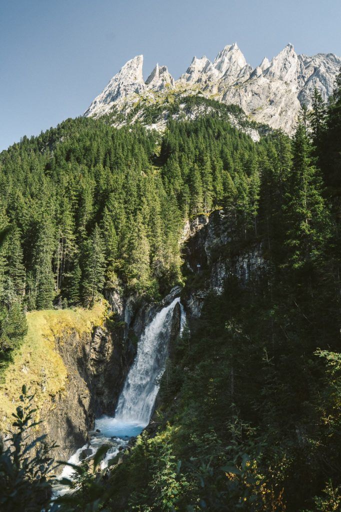
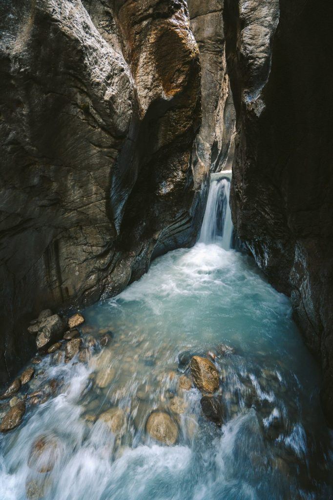
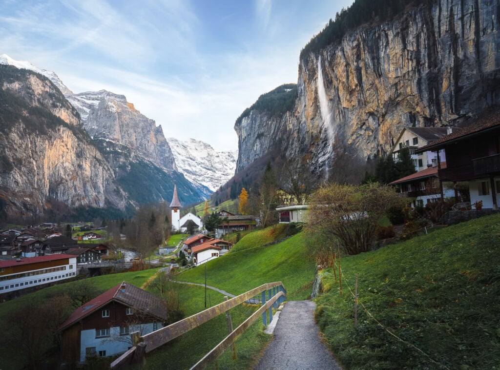
STAUBBACH FALLS HIKE
One of the most popular short hikes in Lauterbrunnen (very close to Grindelwald) is the Staubbach Falls trail, which is just 6 kilometers but very highly rated. The out-and-back trail takes you from Lauterbrunnen town out to this stunning 300-meter-tall waterfall. It’s actually the third-highest waterfall in all of Switzerland, which makes it all the more impressive.
The waterfall got its name based on the mist that sprays off from the waterfall as it crashed down to the ground. This trail can be combined with the nearby Trümmelbach Falls if the adventure is a bit too short with just one waterfall.
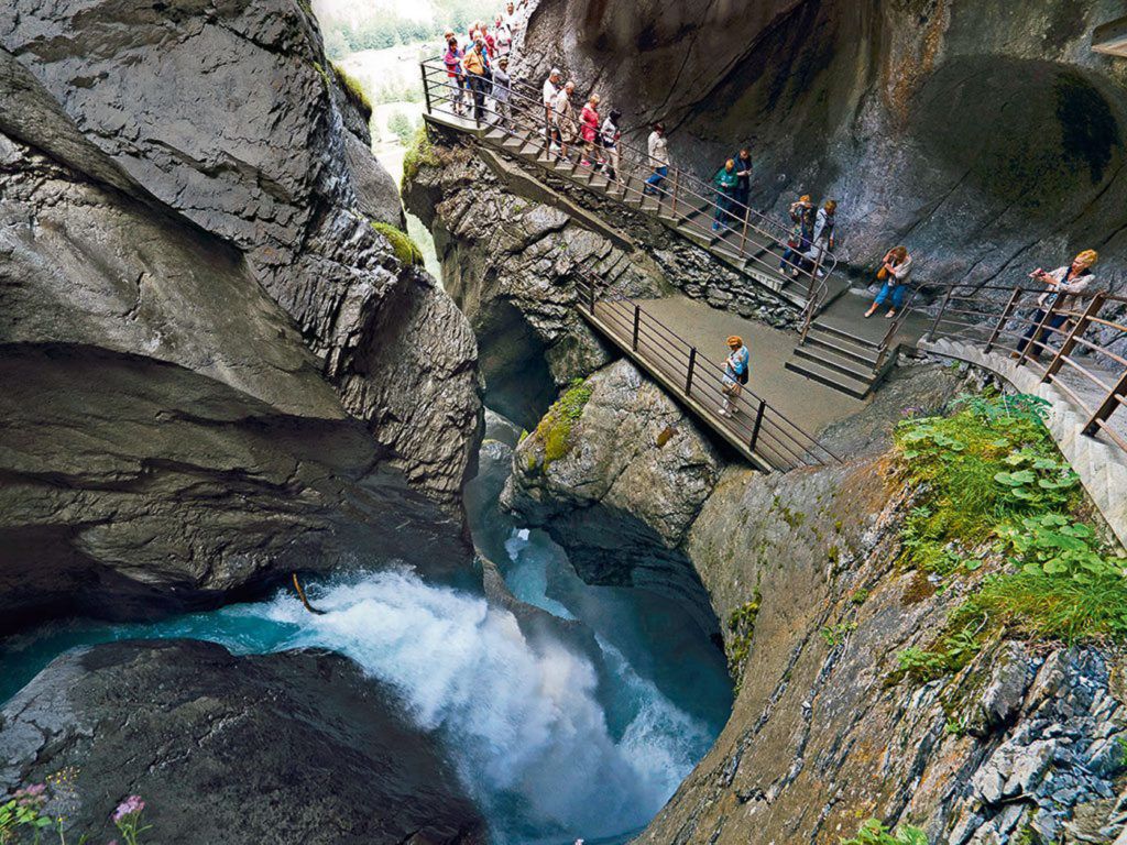
TRUMMELBACH FALLS SHORT TRAIL
Trummelbach Falls is Europe’s largest subterranean waterfall and is one of the highlights in Lauterbrunnen Valley, which is also known as the valley of 72 waterfalls. Trummelbach Falls is among the most famous of those 72 waterfalls At 20,000 liters of water per second, this roaring waterfall is an impressive sight. The hike from to town center of Lauterbrunnen is just 5 kilometers but it can be added on to part of a loop trail all the way up through Gimmelwald and Murren. It takes just 45 minutes to get to Lauterbrunnen from Grindelwald so it’s a great hiking adventure from Grindelwald.
I hope you enjoyed that list of epic hikes in Grindelwald in my Grindelwald Hiking Guide. If there are any hikes in Grindelwald you think I need to check out on my next visit, please comment them below!
THINGS TO KNOW ABOUT HIKING IN GRINDELWALD
Grindelwald, located in the Bernese Oberland region of Switzerland, is a prime destination for hikers and outdoor enthusiasts. Here are some key things you should know about hiking in Grindelwald:
- Stunning Scenery: Grindelwald is situated amidst the iconic Swiss Alps, offering breathtaking views of Eiger, Mönch, and Jungfrau peaks. The landscapes here range from green alpine meadows to imposing glaciers and rugged cliffs.
- Varied Trails: There’s something for everyone, from beginner to experienced hikers. Popular routes include the Eiger Trail, First to Bachalpsee, and the Männlichen to Kleine Scheidegg trail.
- Weather: Mountain weather is unpredictable. While summers are generally warmer and suited for hiking, conditions can change quickly. It’s always good to check the weather forecast and be prepared for varying conditions like rain or sudden temperature drops.
- Safety: Always inform someone about your hiking route and expected return time. Carry a map, or compass, and consider using GPS. While the trails are well-marked, it’s easy to lose your way, especially if fog sets in.
- Equipment: Wear sturdy hiking boots with good grip. Pack rain gear, sun protection (hat, sunglasses, sunscreen), plenty of water, and snacks. A first aid kit, whistle, and multi-purpose tool can be lifesavers in emergencies.
- Wildlife: Grindelwald is home to diverse alpine wildlife including marmots, ibex, and chamois. While they might be intriguing, it’s essential to observe from a distance and not feed or disturb them.
- Gondolas and Trains: Grindelwald offers various cable cars, gondolas, and mountain railways. These can save you considerable time and energy, allowing you to access high-altitude starting points, such as First or Männlichen.
- Accommodations: Grindelwald has numerous accommodations, ranging from luxury hotels to mountain huts. It’s wise to book in advance during peak seasons.
- Guided Tours: If you’re not confident about hiking alone or want deeper insights into the region, consider hiring a local guide or joining a guided tour.
- Local Delicacies: After a long day of hiking, treat yourself to local Swiss specialties. Fondue, raclette, and rösti are must-try dishes in the region.
BEST TIME OF YEAR FOR HIKING IN GRINDELWALD
- Summer (June to August):
- Pros:
- Warm and generally stable weather, with temperatures ranging from 15°C to 25°C.
- Long daylight hours, allowing for extended hikes.
- All trails are accessible, including high-altitude routes.
- Meadows in full bloom, creating picturesque landscapes.
- Cons:
- It’s the peak tourist season, so trails can be crowded, especially the popular ones.
- Accommodation and other facilities may be more expensive due to high demand.
- Pros:
- Autumn (September to November):
- Pros:
- Spectacular fall colors, particularly in September and early October.
- Cooler temperatures which some hikers might prefer.
- Less crowded than summer months.
- Cons:
- Weather becomes less predictable as the season progresses.
- Higher altitude trails may become inaccessible due to early snowfall, especially towards the end of November.
- Pros:
- Spring (April to June):
- Pros:
- Alpine flowers start to bloom, offering beautiful scenery.
- Less crowded than the peak summer months.
- Refreshing temperatures and clear skies, especially in late spring.
- Cons:
- Some trails, especially at higher altitudes, might still be closed or covered in snow, especially in early spring.
- Potential for unpredictable weather with a mix of rain, snow, and sunshine.
- Pros:
- Winter (December to March):
- Pros:
- Snow-covered landscapes offer a magical and serene atmosphere.
- Suitable for winter hiking, snowshoeing, or cross-country skiing.
- Cons:
- Most high-altitude trails are closed or require specialized equipment.
- Shorter daylight hours.
- Cold temperatures, requiring warm clothing and gear.
- Pros:
Overall, the best time for traditional hiking in Grindelwald is between late June and early September. However, if you prefer fewer crowds and a more tranquil atmosphere, consider the shoulder seasons of late spring (May to early June) and early autumn (September to early October). Remember, whenever you choose to hike, always check local weather conditions and trail statuses in advance.
SWISS TRAVEL PASS or HALF-FARE CARD
OPTION 1: Buy the Swiss Half Fare Card: Switzerland trains, buses, and cable cars are EXPENSIVE! I found the best way to get around cheaply was to buy the Swiss Half-Fare Card before I arrived. It gives you 50% off every regular train, bus, and even many cable cars. It only costs $150 USD but pays itself off in just a few days with many train tickets in Switzerland costing close to $100 alone. If you are staying for more than 5 days, I suggest buying the Swiss Half-Fare Card.
OPTION 2: Buy the Swiss Travel Pass: The second option is to get the Swiss Travel Pass, which gives you unlimited train, bus, and (many) cable car rides but it’s pretty expensive at around $100 USD per day so if you don’t travel each day it isn’t worth it.
OPTION 3: Buy the FLEXI Swiss Travel Pass: The final (BEST) option is to get the FLEXI Swiss Travel Pass, which allows you to buy 8 days’ worth of transit but you can choose the night before if you want to activate the next day. That way you don’t need to travel every day to get your money’s worth, you can just activate the FLEXI Swiss Travel Pass on the days when you are doing sizeable transits. My advice is to book the Swiss Half-Fare Card or the FLEXI Swiss Travel Pass in advance before your trip so it’s ready to go when you arrive.
GET A SWISS TRAVEL PASS!


Enjoy UNLIMITED train, boat, and bus rides in Switzerland for up to 15 days. Click to book a flex Swiss Travel Pass or choose the Consecutive Swiss Travel Pass.
The Swiss Travel Pass starts at $260 for 3 days. Click here to check if it’s available on your travel dates.
MY SWITZERLAND HIKING GUIDES
I spent 100 days hiking in Switzerland and created a guide for different regions around the country. You can click on one of my Switzerland hiking guides below to help you plan your trip.
- The Complete Guide: 50 AWESOME HIKES IN IN SWITZERLAND
- The Via Ferrata Guide: 4 EPIC SWITZERLAND VIA FERRATA COURSES
- Lauterbrunnen Guide: 10 AWESOME HIKES NEAR LAUTERBRUNNEN
- Interlaken Guide: 15 AWESOME HIKES IN INTERLAKEN
- Grindelwald Guide: 12 AWESOME HIKES NEAR GRINDELWALD:
- Mürren Guide: 7 AWESOME HIKES IN MURREN
- Appenzell Guide: 9 AWESOME HIKES NEAR APPENZELL
- Chur Guide: 7 AWESOME HIKES NEAR CHUR
MY SWITZERLAND TRAVEL TIPS
- For Backpackers: SWITZERLAND BUDGET BACKPACKING GUIDE
- Travel Tips: 20 THINGS TO KNOW BEFORE VISITING SWITZERLAND
- Transport Tips: RENTING AND DRIVING A CAR IN SWITZERLAND
- Accommodation Guide: 30 BEST PLACES TO STAY IN SWITZERLAND

Laura
Tuesday 28th of May 2024
This is the best web site I've found so far to help plan my trip! My only question is how do you know if trails are open? We are planning to travel next Spring at the end of May but I can't seem to find a web site that shows if a trail is open. Any suggestions?
tamar
Sunday 19th of May 2024
Hi! I am looking for hut to hut hiking, we are in good shape but not experienced in hiking. We will come to the area around July any recommendations?