
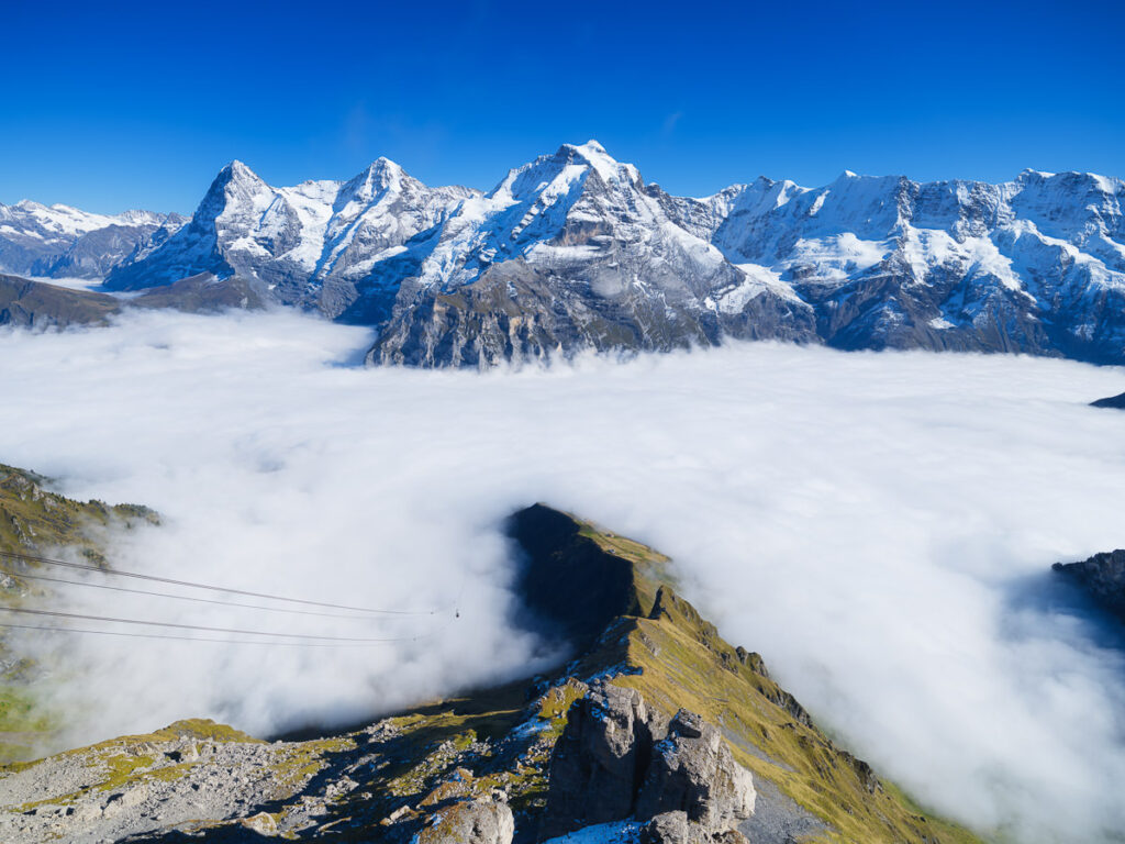
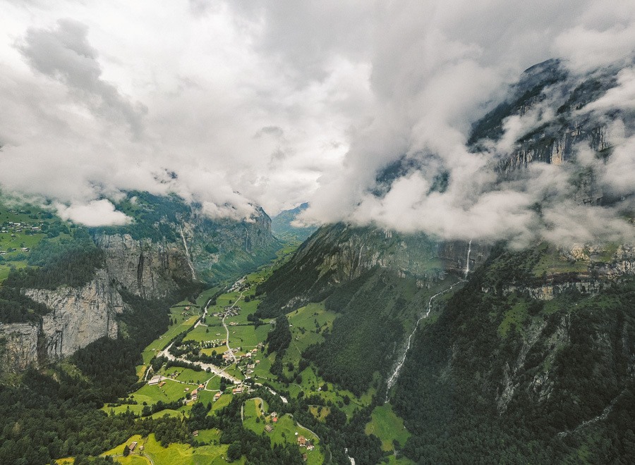
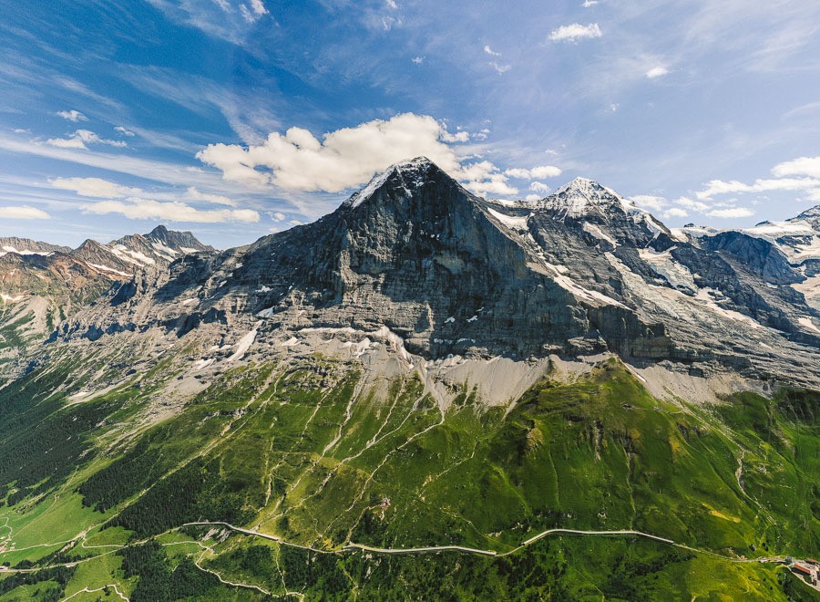
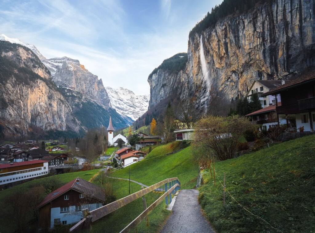
Murren is one of my favorite regions in Switzerland. Here you will find some of the best balcony views in the world, looking down over Lauterbrunnen Valley with the ‘Big 3’ in the distance (Eiger, Jungfrau, Monch). Throughout my time hiking in and nearby Murren, I experienced some beautiful trails and I’ve put together this Murren Hiking Guide so that you can choose a hike or two (or seven) for your visit to Lauterbrunnen. I’m sure you will find a great adventure on this list of my nine favorite hikes in Lauterbrunnen.
7 AWESOME HIKES NEAR MURREN
In this blog post, you will find a description of each of the hikes near Murren and some photos I took as well as a link to the individual blog post I wrote about all of the hikes near Murren. You can click on that link for a more detailed review of the hike including maps, starting points, how to get there, photos, directions, difficulty, and a short story about my experience on that Murren hike.
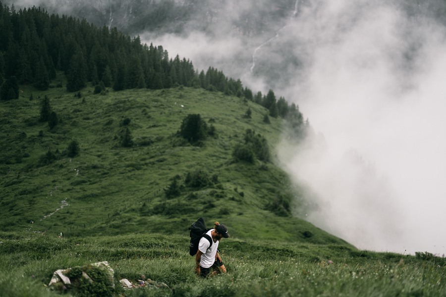
Some of the hikes on this list are right in Murren, but a couple of these hikes are near Murren but not quite in the center of the region. I was based in Murren and Wengen when I did all of these hikes and reached all of the trails by public transport so you will be able to reach any of these trails if you are based in Murren or one of the nearby towns. All of the trails are within about one hour maximum transit time to the trailhead, so they are all in the region.
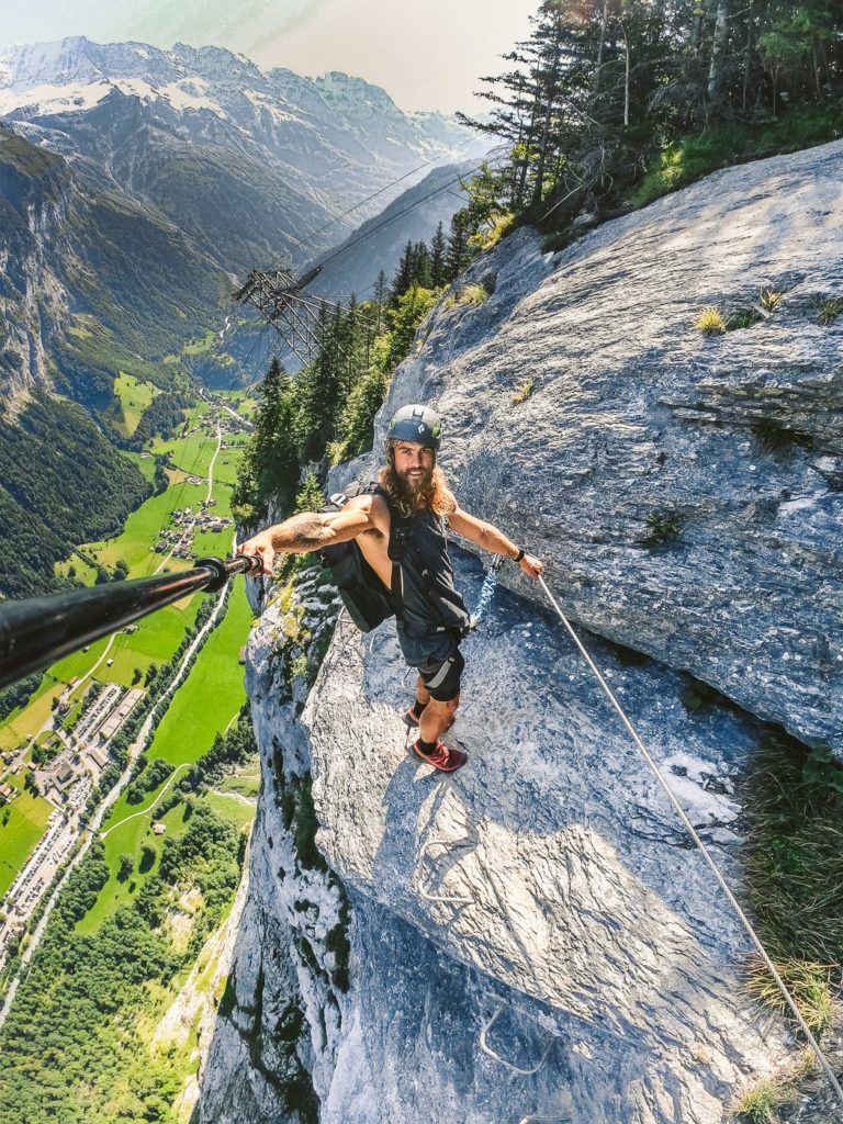
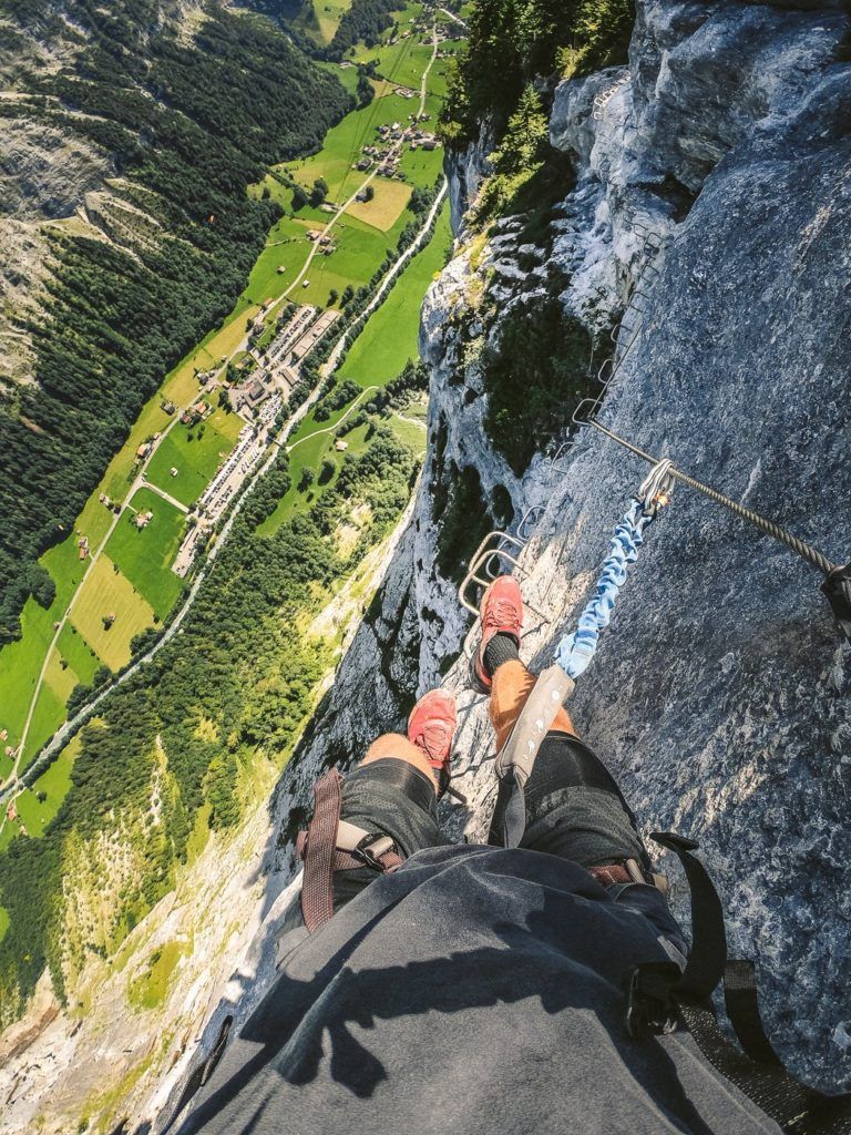
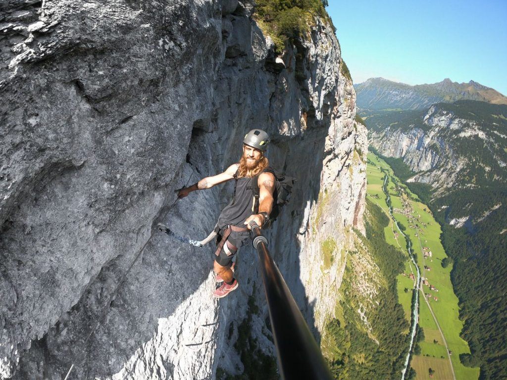
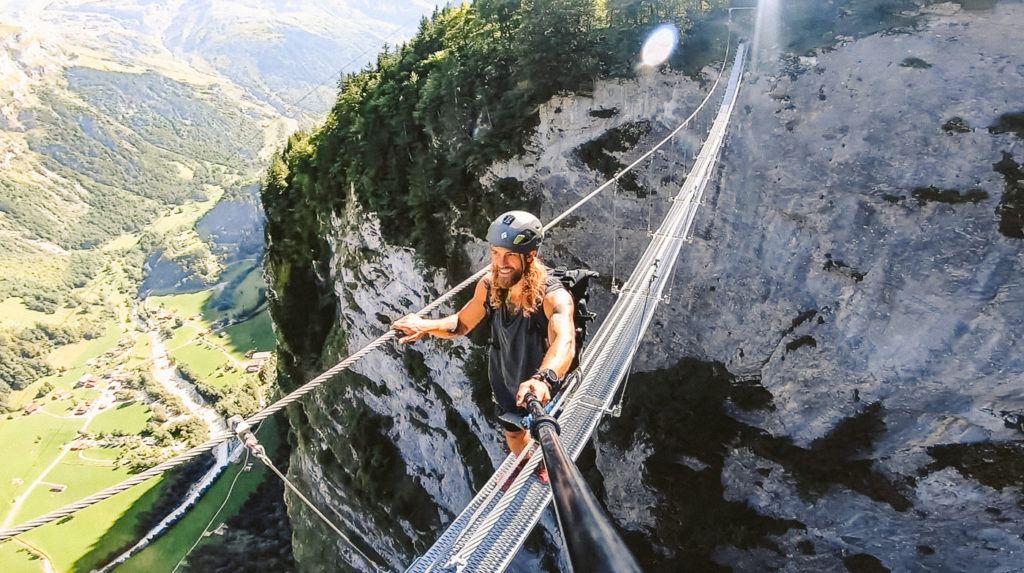
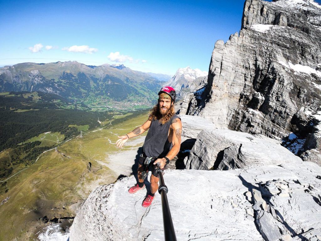
MURREN TO GIMMELWALD VIA FERRATA
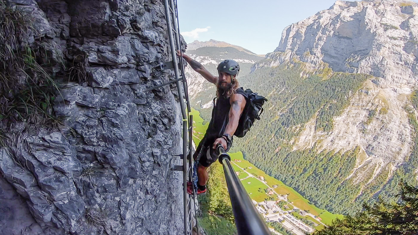
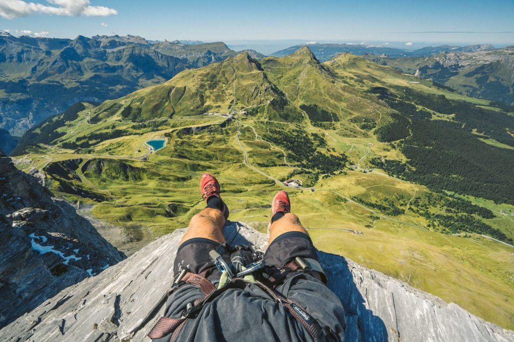
The Via Ferrata from Murren to Gimmelwald is one of the most epic adventures in Switzerland. Traverse ladders and steps on the edge of a cliff overlooking Lauterbrunnen, but don’t worry you are strapped in with a harness!
For those who don’t know what a Via Ferrata is, it’s basically a series of ladders, steps, and rock climbing that leads you up a wall. You are wearing a harness and clip into a strong wire at the start of the Via Ferrata. From that point, you are always clipped in with at least one clip.
This is one of the most exhilarating hiking experiences you can have while based in Murren. You will literally be hanging off the wall over a 500-meter drop-down into Lauterbrunnen Valley. Are you up for it?
I’ve added the instructions to get to the start of the Murren Via Ferrata below.
- Once you arrive at the Murren Train Station turn left out of the station and walk for 10 minutes past Hotel Edelweiss and you will arrive at the sports chalet on your right and Intersport on your left for the hiring of the gear.
This is one of the top easy hikes in Murren, although easy is relative. If you have a fear of hikes, this might be the hardest hike of your life.
Want more details and photos? View the full blog post here: THE MURREN TO GIMMELWALD VIA FERRATA

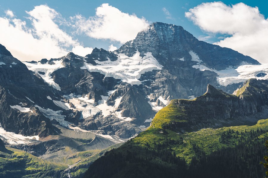
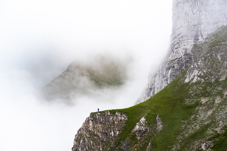
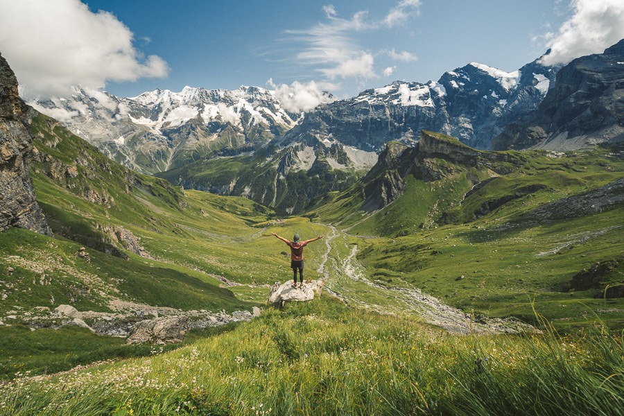
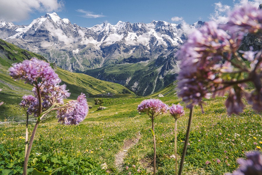
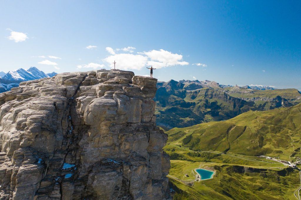
TANZBODELI & OBERSTEINBERG HIKE: THE BEST VIEW OF LAUTERBRUNNEN
Tanzbodeli is one of my favorite hikes in the region because it provides the best 360 degrees of the entire mountainscape. On a clear day, it feels as though you are at the center of the Jungfrau region and you can see all of the glacier-laden peaks. On a gloomy, cloudy day, it is equally impressive as you are seemingly inside a cloud, on top of the world. We had bits of both on our journey to Tanzbodeli and Obersteinberg from Gimmewald. If you want the best view of the region this is one of the best hikes in Murren for that dramatic landscape you have in mind
- Hike Distance: 13.9km Total distance from Gimmelwald to Tanzbodeli to Obersteinberg to Stechelberg. The total distance from Gimmelwald to Tanzbodeli was 6 steep kilometers in 2 hours.
- Hike Duration: 4 hours of moving time but total time was 7 hours including an hour at the summit, an hour at the Obersteinberg Hotel, and other stops.
- Hike Difficulty: The trail is not technically difficult although there are parts where you will clamber up rocks. No drop-offs are ever apparent on either side of the trail. Dirt path most of the way. Relatively simple hiking although the incline is quite steep and the air does get thin. Physically challenging but relatively safe.
- Hike Incline: Total elevation throughout the hike is 1100 meters.
Want more details and photos? View the full blog post here: TANZBODELI & OBERSTEINBERG HIKE: THE BEST VIEW OF LAUTERBRUNNEN
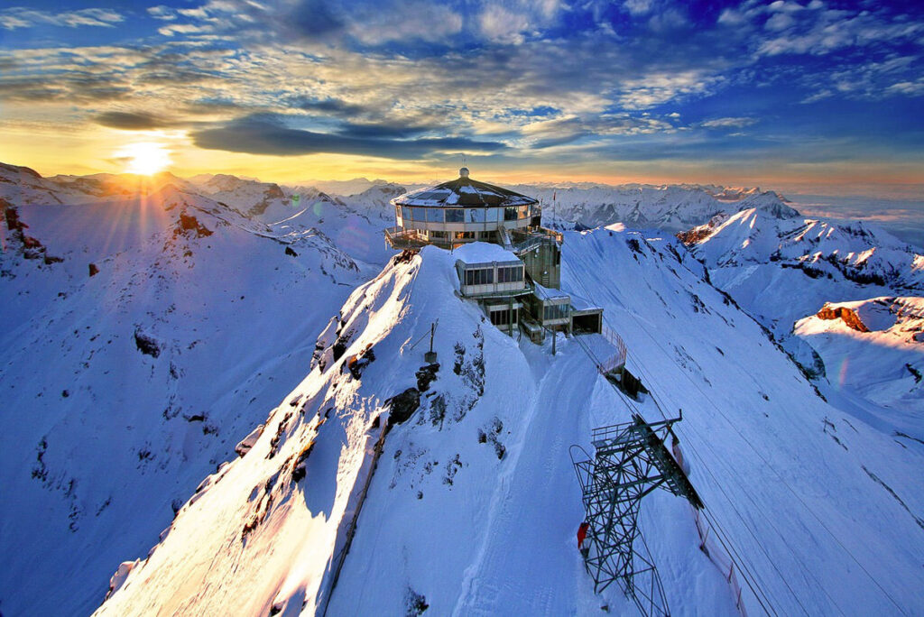
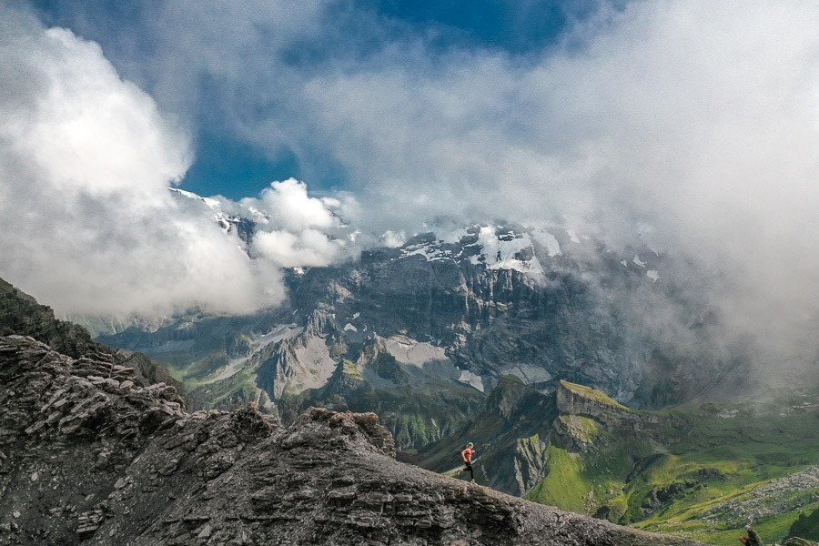
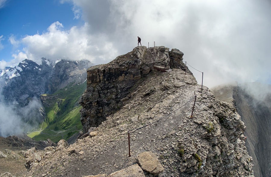
MURREN TO SCHILTHORN HIKE (PIZ GLORIA)
The hike from Murren to Schilthorn is challenging with 1600m of altitude climbed throughout the trail to the Piz Gloria summit where James Bond ‘007’ was filmed. At the summit, you can reward yourself after the long hike with a warm bowl of soup at the revolving restaurant, which lets you take in the 360-degree panoramic views as you enjoy your meal. From Interlaken, you will want to leave quite early to give yourself enough time to do the hike and get back for what is a very possible day-hike from Interlaken.
The trail from Murren to Rotstockhutte is relatively easy. Most of the way is a dirt path although there are some sections that are a mixture of rock and path. Most families will easily navigate their way to Rotstockhutte with only 300-400m of elevation.
Rotstockhutte to Schilthorn is very steep. You collect over 1000 meters of an incline in just a few kilometers, which means it is just straight up the mountain. Here you clamber over rocks and are constantly heading uphill. However, it is quite safe and there are no drop-offs.
If you can manage the steep incline there isn’t much more to worry about. This is the toughest hike in Murren but you can catch the cable car down like us, which softens the blow.
It’s 12.9km Total distance from Murren to Schilthorn mountain summit. If you want to hike down you will need to add a few more kilometers but we caught the Schilthornbahn down to Murren, which was a nice way to return after a long day on the legs.
Want more details and photos? View the full blog post here: MURREN TO SCHILTHORN HIKE
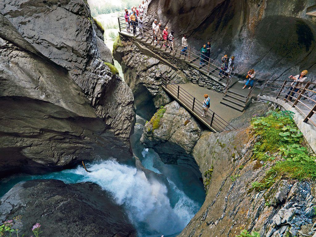
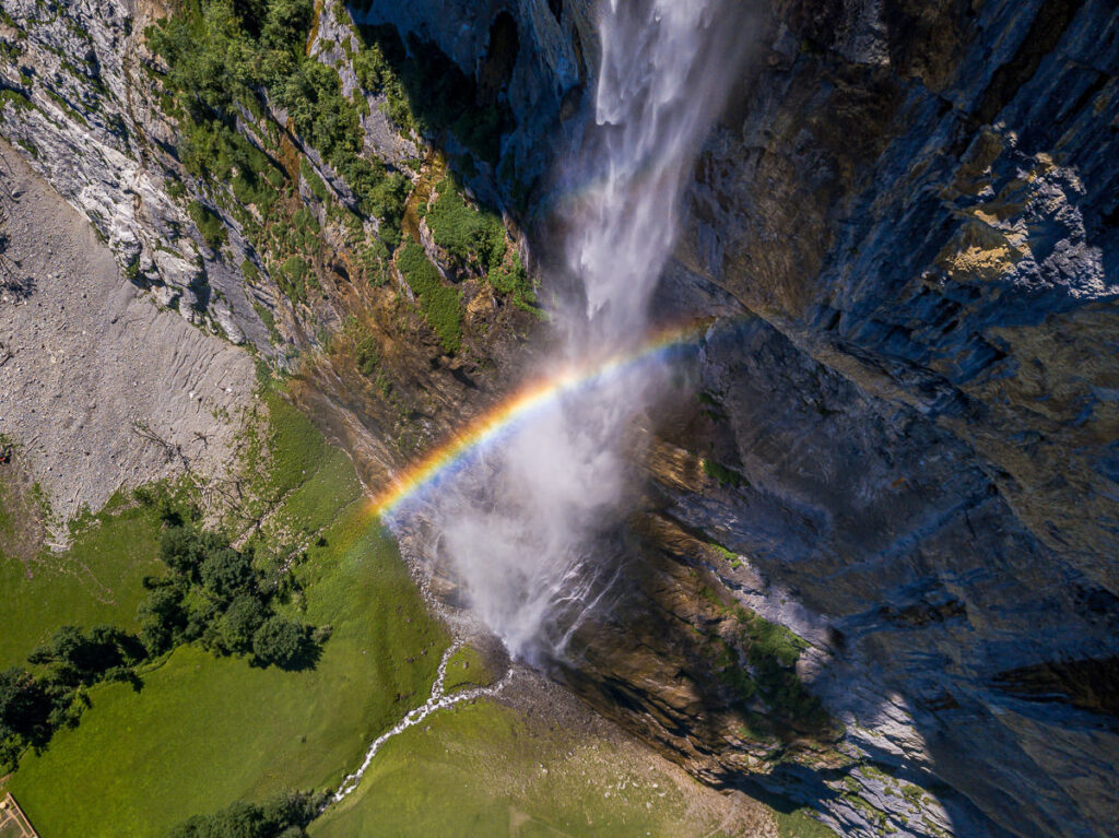
TRUMMELBACH FALLS SHORT TRAIL
Trummelbach Falls is Europe’s largest subterranean waterfall and is one of the highlights in Lauterbrunnen Valley, which is also known as the valley of 72 waterfalls. Trummelbach Falls is among the most famous of those 72 waterfalls At 20,000 liters of water per second, this roaring waterfall is an impressive sight. The hike from to town center of Lauterbrunnen is just 5 kilometers but it can be added on to part of a loop trail all the way up through Gimmelwald and Murren. It’s a great little hike near Murren down in Lauterbrunnen Valley below.
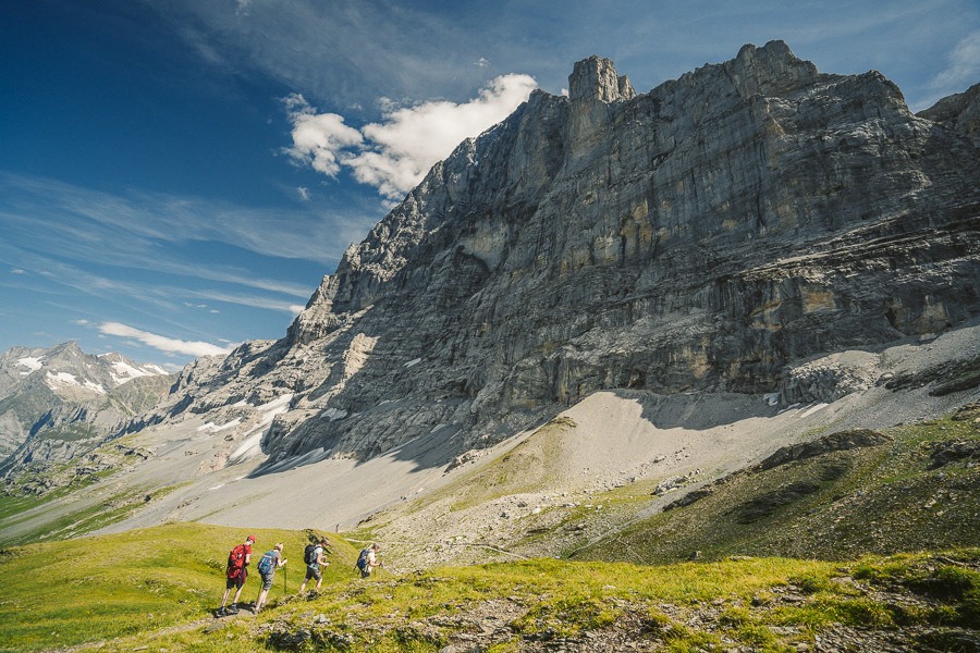
THE EIGER TRAIL HIKE: EIGERGLETSCHER TO ALPIGLEN
The Eiger Trail hike is one of the most popular routes in Switzerland because the path leads hikers directly under the world-famous Eiger North Face Wall, which is renowned as one of the toughest climbs in the world. But don’t worry the climb might be one of the toughest in the world but this hiking trail is quite basic.
The trail starts off with 200m of incline, although it is spread over a couple of kilometers and is nothing too strenuous. At this point, you cannot see Eiger, but the views across the valley and the towering glacial mountains are incredible and there is something to gawk at in every direction.
It isn’t long before you will reach the Eiger viewing area. It’s about 2km into the trail and there will likely be a little gathering of people and possibly some local cows. Here you will look up towards Eiger Mountain and if you read the signs, you can even identify the path the climbers use to scale the North Face wall of Eiger.
The distance from Eigergletscher Train Station to Alpiglen along the Eiger Trail is 6.5km. The hike takes about 2.5 hours although if you went straight through without taking photos or stopping it would be well under two hours. It could be run in well under an hour and is one of the top hikes near Murren with a deep history.
Want more details and photos? View the full blog post here: THE EIGER TRAIL HIKE: EIGERGLETSCHER TO ALPIGLEN
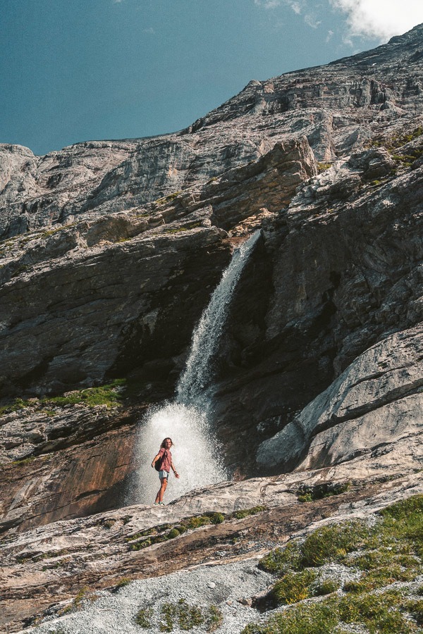
STAUBBACH FALLS HIKE
One of the most popular short hikes near Lauterbrunnen is the Staubbach Falls trail, which is just 6 kilometers but very highly rated. The out-and-back trail takes you from Lauterbrunnen town out to this stunning 300-meter-tall waterfall. It’s actually the third-highest waterfall in all of Switzerland, which makes it all the more impressive.
The waterfall got its name based on the mist that sprays off from the waterfall as it crashed down to the ground. This trail can be combined with the nearby Trümmelbach Falls if the adventure is a bit too short with just one waterfall.
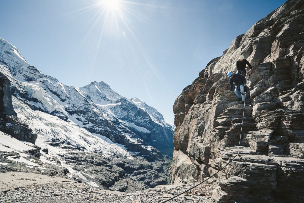
THE ROTSTOCK VIA FERRATA AT EIGER, GRINDELWALD
The Rotstock Via Ferrata is an epic climb right next to the famous North Face Wall of Eiger. Using a harness, stairs, and metal stairs you can climb 400m of incline to the 360-degree panoramic viewpoint. It’s one of the most adventurous hikes near Murren with just a couple of trains required in the transit.
For those who don’t know what a Via Ferrata is, it’s basically a series of ladders, steps, and rock climbing that leads you up a wall. You are wearing a harness and clip into a strong wire at the start of the Via Ferrata. From that point, you are always clipped in with at least one clip.
The total hike distance was 5km from the start of the Eiger Trail and up to the summit and then back down to Eigergletscher Station.
Want more details and photos? View the full blog post here: THE ROTSTOCK VIA FERRATA AT EIGER, GRINDELWALD
I hope you enjoyed that list of epic hikes in Lauterbrunnen in my Murren Hiking Guide. If there are any hikes in Lauterbrunnen you think I need to check out on my next visit, please comment them below!
THINGS TO KNOW ABOUT MURREN
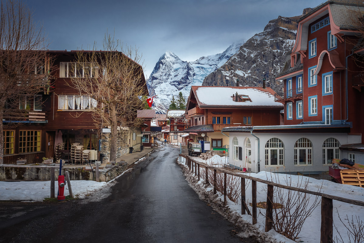
Mürren is a picturesque mountain village in the Bernese Oberland region of Switzerland. It’s perched on a terrace above the Lauterbrunnen Valley and offers breathtaking views of the three towering mountains: Eiger, Mönch, and Jungfrau. Here’s what you need to know about Mürren:
- Car-free Village: Mürren is one of the few car-free resort villages in Switzerland. You can only access it by train or cable car, which adds to its serene and untouched charm.
- Schilthorn: This is one of Mürren’s primary attractions. The summit offers panoramic views of the Swiss Alps and is also known for the rotating Piz Gloria restaurant, famously featured in the James Bond film “On Her Majesty’s Secret Service.”
- Winter Sports: Mürren is a hub for skiing, snowboarding, and other winter activities. The village has its own ski area, and it’s also the starting point for the famous Inferno Ski Race, one of the oldest and longest amateur ski races in the world.
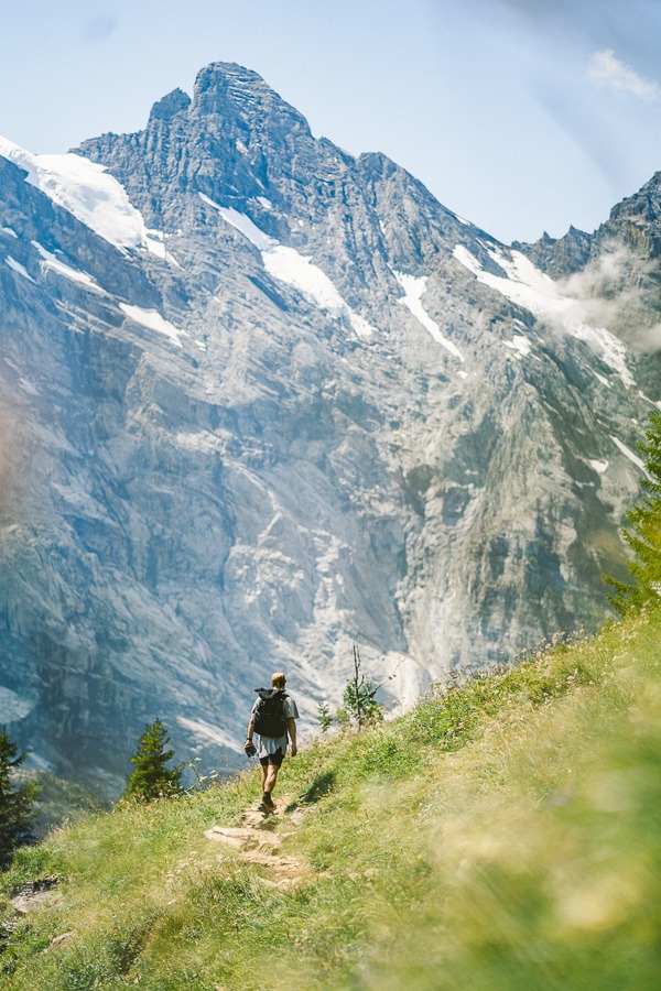
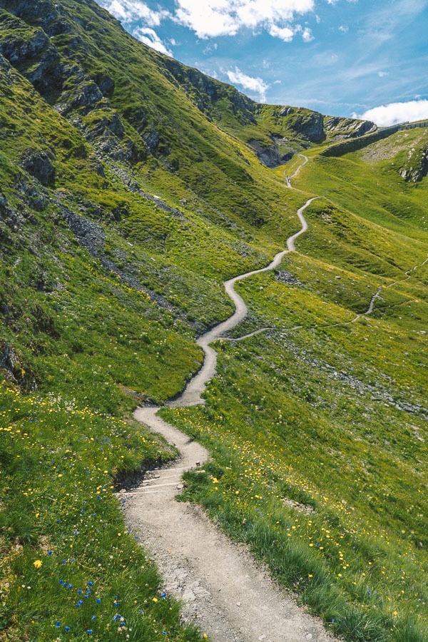
- Hiking: During the summer months, Mürren is a popular base for hiking. There are numerous trails with varying difficulty levels, ranging from relaxed strolls to challenging mountain treks.
- Accommodations: Mürren offers a range of accommodations, from luxury hotels with alpine views to cozy chalets and guesthouses.
- The Via Ferrata: For adventure seekers, there’s a via ferrata that runs from Mürren to Gimmelwald. It provides climbers with thrilling paths and bridges alongside precipitous cliffs.
- Swiss Cuisine: There are several restaurants in the village where you can enjoy traditional Swiss dishes, including raclette and fondue.
- Events: Mürren hosts various events throughout the year, from the aforementioned Inferno Ski Race in winter to traditional Swiss festivals and celebrations in summer.
- Accessibility: To reach Mürren, visitors often take a train to Lauterbrunnen, then a cable car and train combination via Grutschalp. The journey is scenic and offers stunning views of the valley and surrounding peaks.
- Mürren BLM: This is the mountain railway line that connects the village to Grutschalp. The journey itself provides travelers with some spectacular views of the region.
- History and Preservation: Mürren has managed to retain much of its traditional charm. The village has resisted over-commercialization, ensuring that visitors experience a genuine Swiss mountain village atmosphere.
- Weather: Like many mountain villages, Mürren’s weather can be quite variable. It’s always a good idea to check the forecast ahead of time and be prepared for sudden changes, especially when heading out for hikes or ski trips.
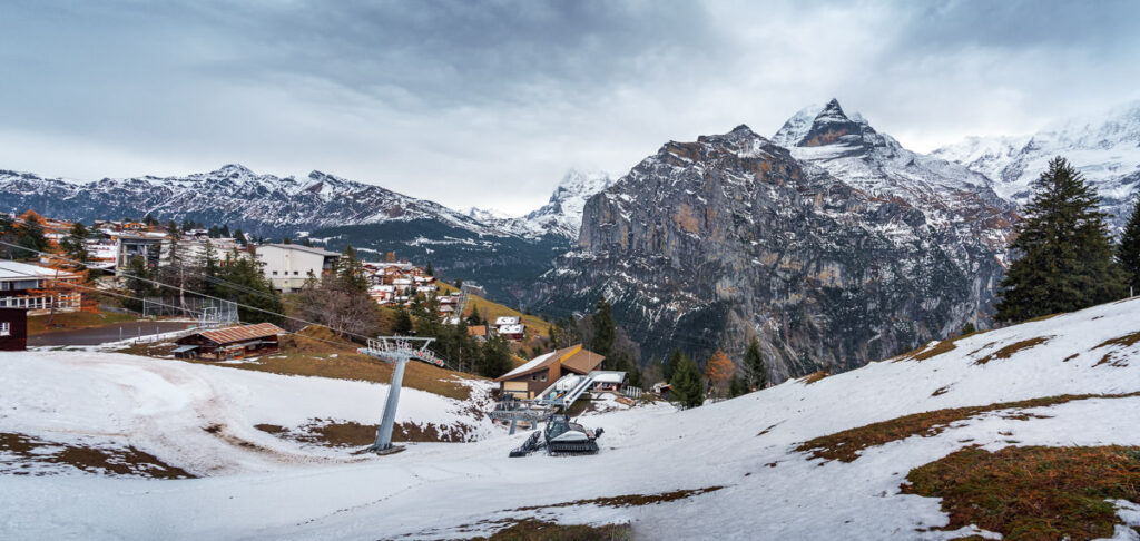
HIKING IN MURREN IN WINTER
Hiking in Mürren during winter is a truly magical experience as the landscape transforms into a snow-covered wonderland. However, winter hiking comes with its own set of considerations for safety and enjoyment. Here’s what you need to know about hiking in Mürren during the winter months:
- Prepared Trails: Not all summer hiking trails will be accessible or safe during the winter. However, Mürren and its surrounding areas offer specially prepared winter hiking trails. These are often compacted and marked for winter use.
- Equipment: Good, waterproof hiking boots are essential. Consider using crampons or microspikes for added traction on icy patches. A walking pole or ice axe can also be helpful.
- Clothing: Dress in layers. Winter in the Alps can be bitterly cold, so wearing moisture-wicking base layers, insulating mid-layers, and waterproof and windproof outer layers is essential. Don’t forget a hat, gloves, and a scarf.
- Weather and Avalanche Awareness: Winter weather can change rapidly in mountainous regions. Before setting out, always check the weather forecast and be aware of avalanche risks. Some trails might traverse areas prone to avalanches, so it’s essential to be informed and avoid those areas after recent heavy snowfall or when there’s a high avalanche risk.
- Daylight: Days are shorter during the winter months. Always plan your hike to ensure you return well before darkness falls. It’s a good idea to carry a headlamp or flashlight, even if you plan to be back by daylight.
- Guided Hikes: If you’re unfamiliar with the area or winter hiking in general, consider joining a guided hike. Local guides will know the best and safest routes, and they’ll be equipped to deal with any unexpected situations.
SWISS TRAVEL PASS or HALF-FARE CARD
OPTION 1: Buy the Swiss Half Fare Card: Switzerland trains, buses, and cable cars are EXPENSIVE! I found the best way to get around cheaply was to buy the Swiss Half-Fare Card before I arrived. It gives you 50% off every regular train, bus, and even many cable cars. It only costs $150 USD but pays itself off in just a few days with many train tickets in Switzerland costing close to $100 alone. If you are staying for more than 5 days, I suggest buying the Swiss Half-Fare Card.
OPTION 2: Buy the Swiss Travel Pass: The second option is to get the Swiss Travel Pass, which gives you unlimited train, bus, and (many) cable car rides but it’s pretty expensive at around $100 USD per day so if you don’t travel each day it isn’t worth it.
OPTION 3: Buy the FLEXI Swiss Travel Pass: The final (BEST) option is to get the FLEXI Swiss Travel Pass, which allows you to buy 8 days’ worth of transit but you can choose the night before if you want to activate the next day. That way you don’t need to travel every day to get your money’s worth, you can just activate the FLEXI Swiss Travel Pass on the days when you are doing sizeable transits. My advice is to book the Swiss Half-Fare Card or the FLEXI Swiss Travel Pass in advance before your trip so it’s ready to go when you arrive.
GET A SWISS TRAVEL PASS!


Enjoy UNLIMITED train, boat, and bus rides in Switzerland for up to 15 days. Click to book a flex Swiss Travel Pass or choose the Consecutive Swiss Travel Pass.
The Swiss Travel Pass starts at $260 for 3 days. Click here to check if it’s available on your travel dates.
MY SWITZERLAND HIKING GUIDES
I spent 100 days hiking in Switzerland and created a guide for different regions around the country. You can click on one of my Switzerland hiking guides below to help you plan your trip.
- The Complete Guide: 50 AWESOME HIKES IN IN SWITZERLAND
- The Via Ferrata Guide: 4 EPIC SWITZERLAND VIA FERRATA COURSES
- Lauterbrunnen Guide: 10 AWESOME HIKES NEAR LAUTERBRUNNEN
- Interlaken Guide: 15 AWESOME HIKES IN INTERLAKEN
- Grindelwald Guide: 12 AWESOME HIKES NEAR GRINDELWALD:
- Mürren Guide: 7 AWESOME HIKES IN MURREN
- Appenzell Guide: 9 AWESOME HIKES NEAR APPENZELL
- Chur Guide: 7 AWESOME HIKES NEAR CHUR

MY SWITZERLAND TRAVEL TIPS
- For Backpackers: SWITZERLAND BUDGET BACKPACKING GUIDE
- Travel Tips: 20 THINGS TO KNOW BEFORE VISITING SWITZERLAND
- Transport Tips: RENTING AND DRIVING A CAR IN SWITZERLAND
- Accommodation Guide: 30 BEST PLACES TO STAY IN SWITZERLAND

Da
Friday 16th of February 2024
hi Jackson,
very nice list. really useful! I live in Switzerland, so if u wanna return and do some more hikes and via ferattas here, let s connect.
regards, Daiana
Zoltan
Wednesday 30th of September 2020
Hi Jackson.
Thanks for the detailed info about Swiss hikes. We are going to Lauterbrunnen area in mid oct for 6 days. Probably we gonna stay in Murren/Grindelwald. Can you recommend a few photo location.We are going to have only a few days so we would like to go to do the best hikes/cable car trips it's possible. Thanks again, Zoltan
Jackson
Wednesday 30th of September 2020
Hi Zoltan,
You are welcome. I had fun making the guides. I would hike from Murren to Schilthorn, that's an incredible hike (You'll find the guide on my blog) Second hike is from Schynige Platte to Faulhorn to Bachalpsee to First (Also an article on my blog) Next is to hike to a mountain hut from Grindelwald and stay one night like Baregg Hut or Gleckstein Hut.
Enjoy