
Hike to the Spitzmeilen Hut (Spitzmeilenhutte) for a beautiful overnight stay before climbing the Spitzmeilen Peak and the Wissmeilen Peak in the morning! We did this hike after the first snowfall of the year and while a little dangerous, the views were magical from Spitzmeilen Peak!
SPITZMEILEN HUT & SUMMIT HIKE DETAILS
- Hike Distance: The hike from Tannenboden to Spitzmeilen Hut (after catching the cable car from Unterterzen) was 11.6 kilometers. The next day the hike from Spitzmeilen Hut to Spitzmeilen Peak to Wissmeilen Peak and then down to Engi was 14.17 kilometers. You could take a cable car up further and walk a shorter distance to Spitzmeilen Hut and Engi is not the shortest route down. Therefore there are many ways to make it shorter but this is definitely one of the most scenic routes totaling just over 25km over two days.
- Hike Duration: We did the hike over two days. Day one from Tannenboden to Spitzmeilen Hut took just under 3 hours of moving time but 4.5 hours including stops, and photos. Day two from Spitzmeilen Hut to Spitzmeilen Peak to Wissmeilen Peak to Engi took 3.5 hours of moving time but 6-7 hours in total including a lot of photos, hanging out at the summit and many stops along the way.
- Hike Difficulty: The hike from Tannenboden to Spitzmeilen Hut is very low difficulty and is mostly through vast valleys once you are up the initial incline.
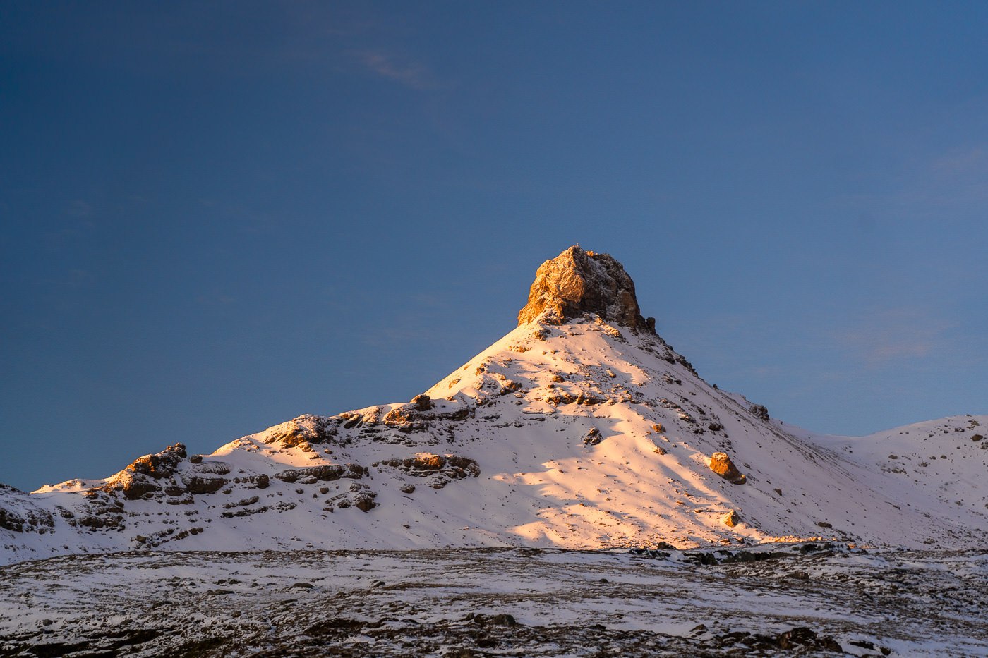
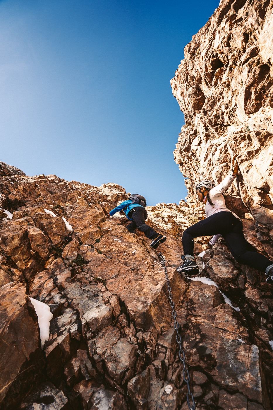
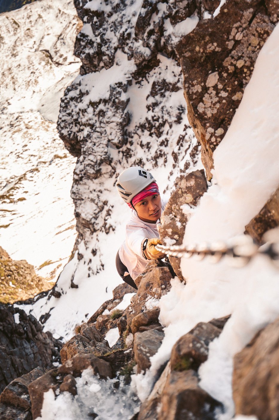
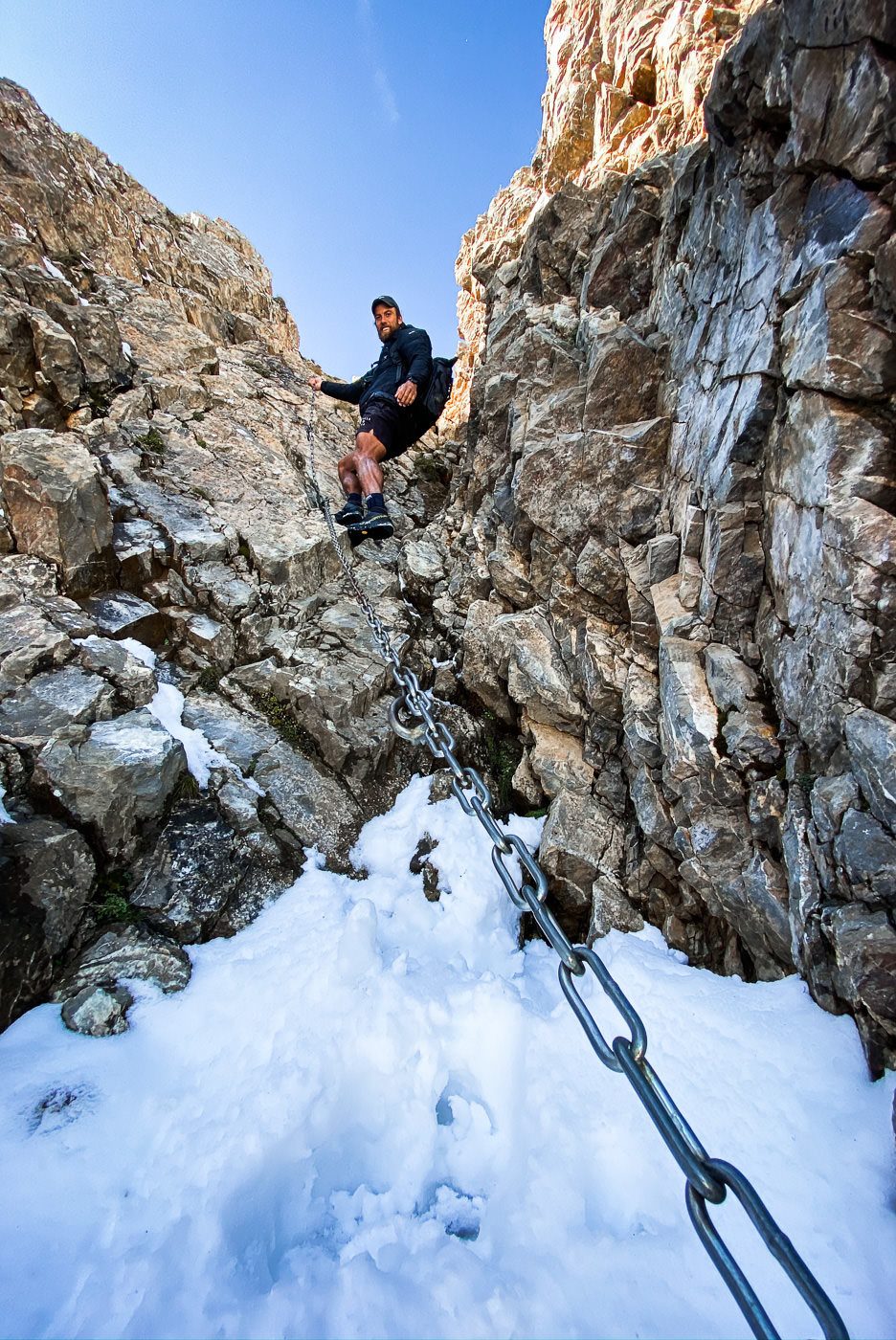
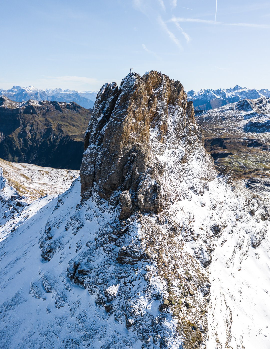
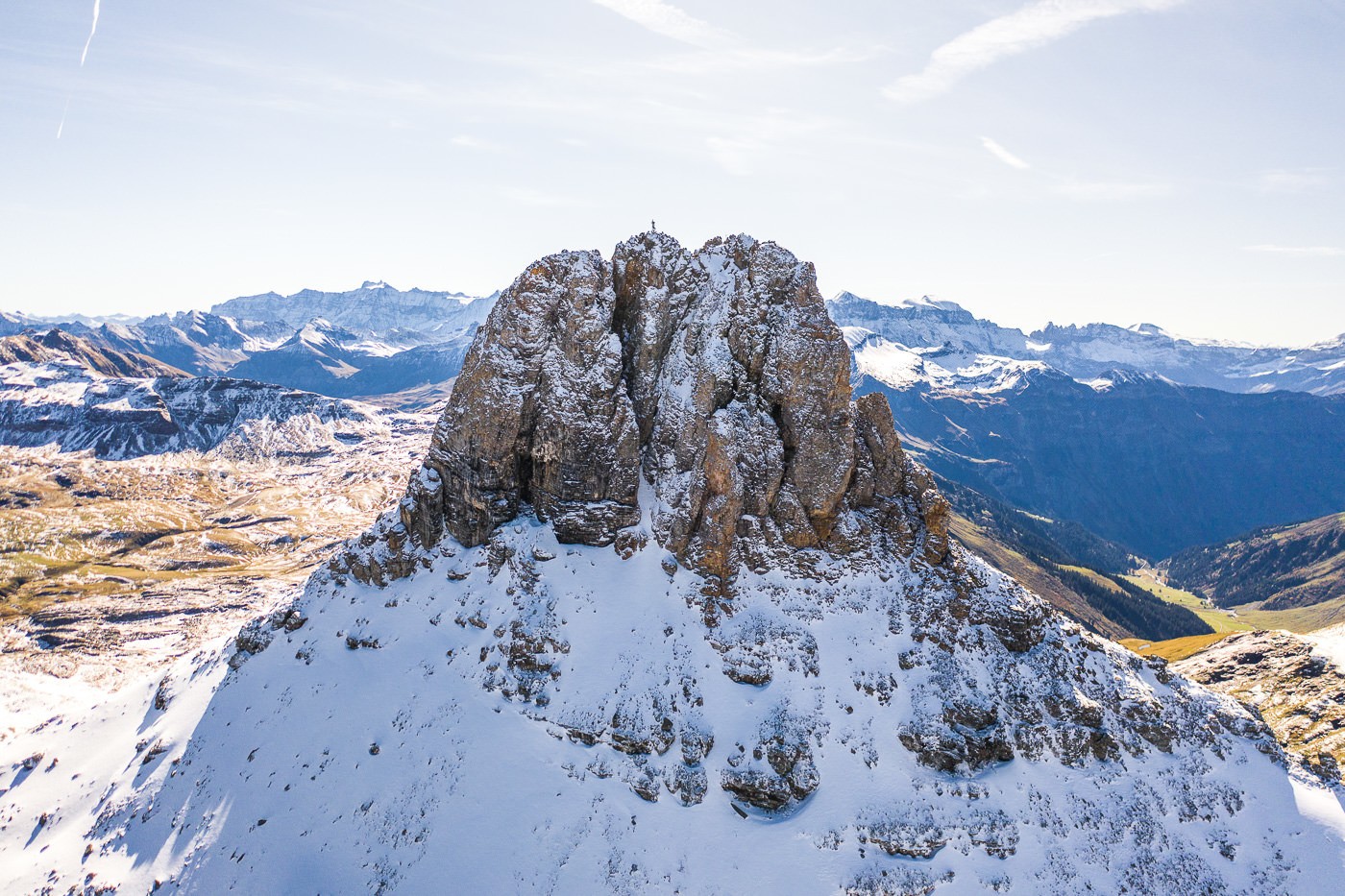
- Climbing Difficulty: The climb to Spitzmeilen was quite difficult in the snow with some exposure and then, of course, the climb up Spitzmeilen summit is not easy. There are chains in place to help you climb but you will need to be in pretty good shape despite the chains. There is no technical rock climbing required but the worst-case scenario is losing grip of the chain or slipping and you will have a 20m drop onto rocks. Not being dramatic, just trying to prepare you for that last little climb. If you are comfortable climbing on a slight angle with a chain to help it shouldn’t be too difficult. I’ve included photos below to help you decide if it is beyond your ability or worth attempting. It is advised to wear a helmet in case of falling rocks.
- Down to Wissmeilen: From Spitzmeilen to Wissmeilen and Wissmeilen Pass the trail is quite exposed and is not always a great path. Again, I did this trail in the snow so I imagine it is much easier in the summer as it is marked as a red-and-white trail, although for us it felt like an alpine route!
- Hike Incline: Tannenboden to Spitzmeilen Hut: 854m Spitzmeilen Hut to Spitzmeilen to Wissmeilen to Engi: 453m incline (Decline: 1657m)
YOU WILL ALSO LIKE MY SWITZERLAND HIKING GUIDE: 50 AWESOME HIKES IN SWITZERLAND
HOW TO GET TO SPITZMEILEN HUT
The train station you will need to transit to is Unterterzen, which is next to the big lake Walensee. From Unterterzen you can begin hiking but that would be a long day. Most people (like us) take the cable car to Tannenboden via Oberterzen.
From Tannenboden you will begin the hike up the hill on the right-hand side of the downhill toboggan track. Follow the signs towards Maschgenkamm and then from that Berghaus (restaurant) to Spitzmeilen Hut.
If you have the Swiss Half-Card you will receive a huge discount on your tickets. I bought mine when I arrived in Switzerland and it has saved me over a thousand dollars throughout my trip.
MY EXPERIENCE HIKING TO SPITZMEILEN HUT FROM TANNENBODEN
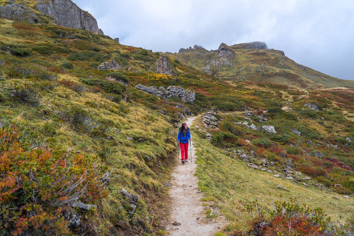
After catching the train to Unterterzen we jumped on the cable car to Tannenboden via Oberterzen. At Tannenboden, we weren’t quite sure where the trail began but it goes up a hill on the right-hand side of the toboggan. To be honest, the start of the hike wasn’t very interesting at all and we were wondering if we should have just caught the cable car. There were some nice views to the cliffs on the far side of Walensee but other than that it was bit of a muddy, gloomy start to the trail. Luckily the hike got progressively better starting at a 2/10 and reaching a 9.5/10 by the time we were standing on top of Spitzmeilen summit.
The trail winds up a consistent incline of switchbacks until you reach Maschgenkamm restaurant. We stopped here for a coffee. It is more or less the halfway mark to the Spitzemilen Hut, or at least is separates the cable car/infrastructure side from the wild. From this point on the hike improves and you are thrust into the wilderness.
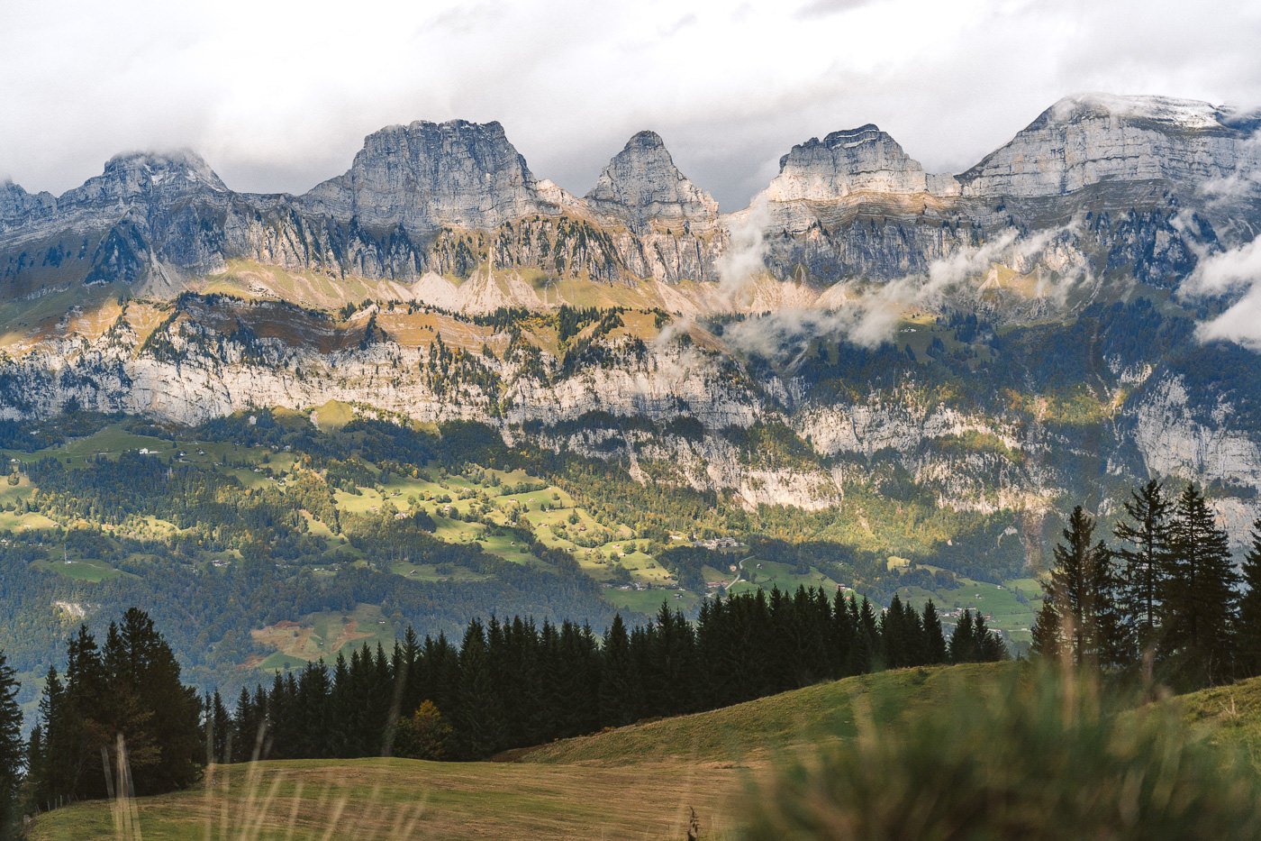
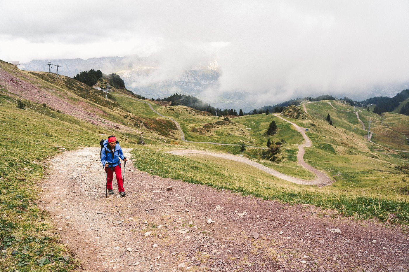
After winding down the remainder of the gravel trail, you enter a muddy path that leads you through a relatively flat valley, all the time looking up towards Spitzmeilen and Wissmeilen. This section of the trail had a Lord of the Rings, Icelandic feel to it and amidst the mystic, gloomy clouds, we quite enjoyed this part.
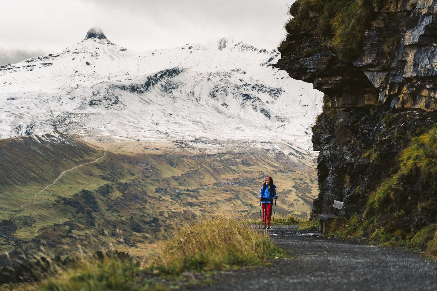
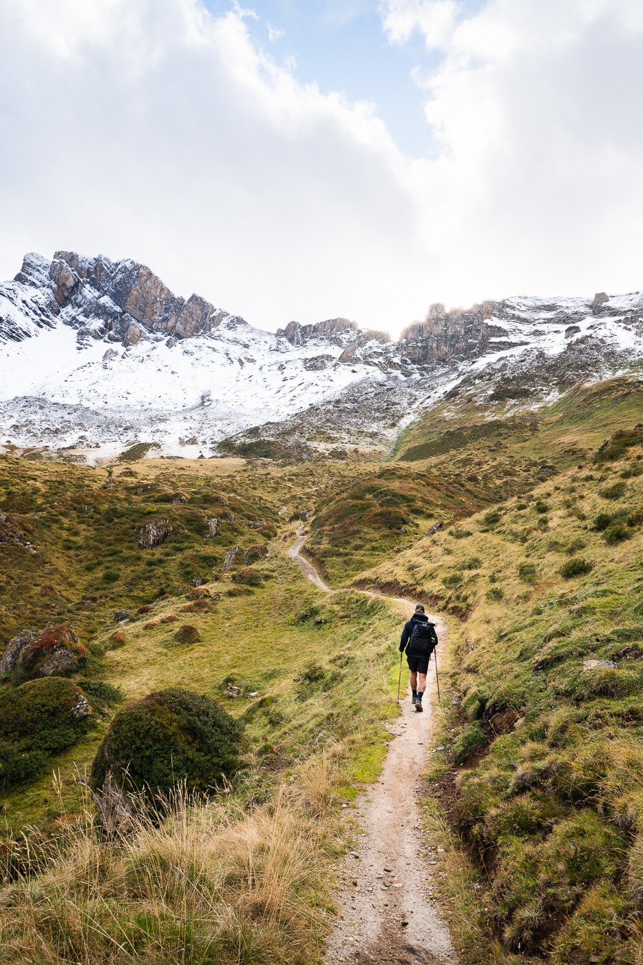
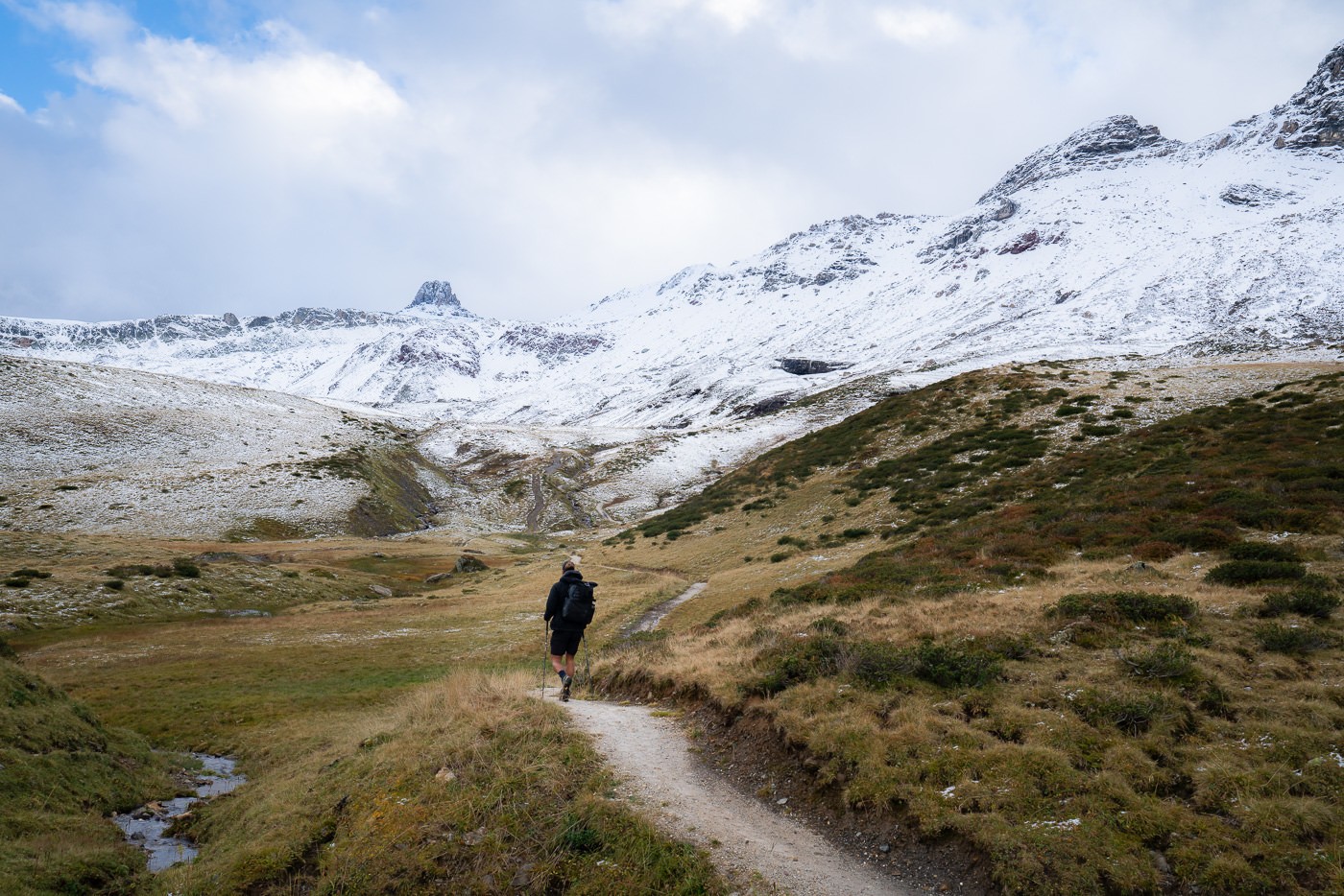
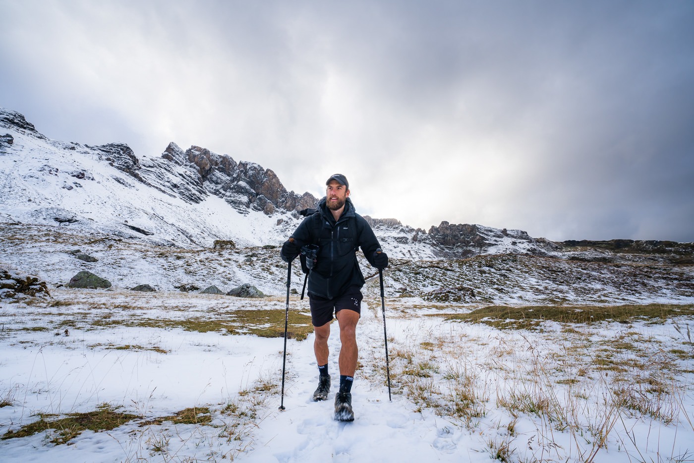
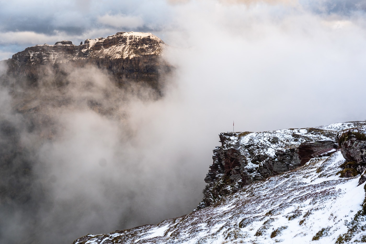
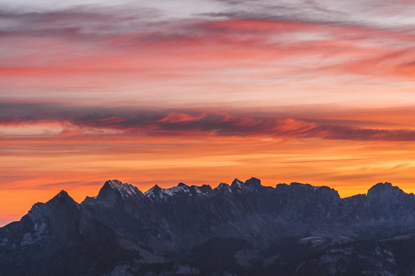
We did the hike in mid-October, which meant the last third of the hike to Spitzmeilen Hut was through some snow. Nothing was deeper than 1-2 feet but when sticking on the trail, we kept mostly dry. The snow added quite a lot to the scenery although there was a lot of slush. Looking up at Spitzmeilen, I was pretty sure we wouldn’t be able to climb it the next morning due to the snow on the rocks. We decided to just enjoy the night, wake up for sunrise, and hike as far as we could till we deemed it too dangerous if that was the case.
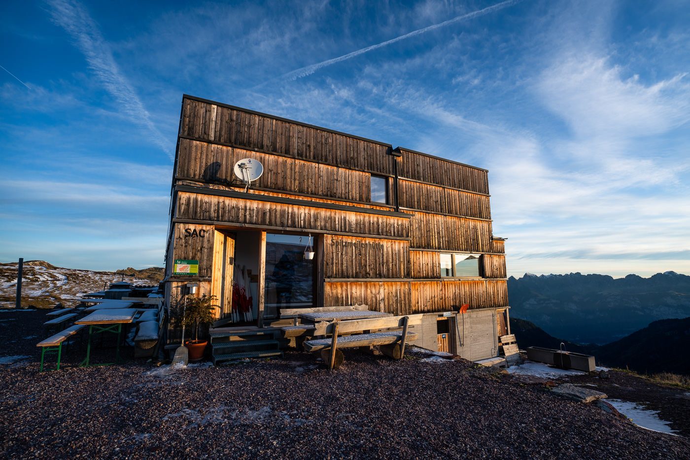
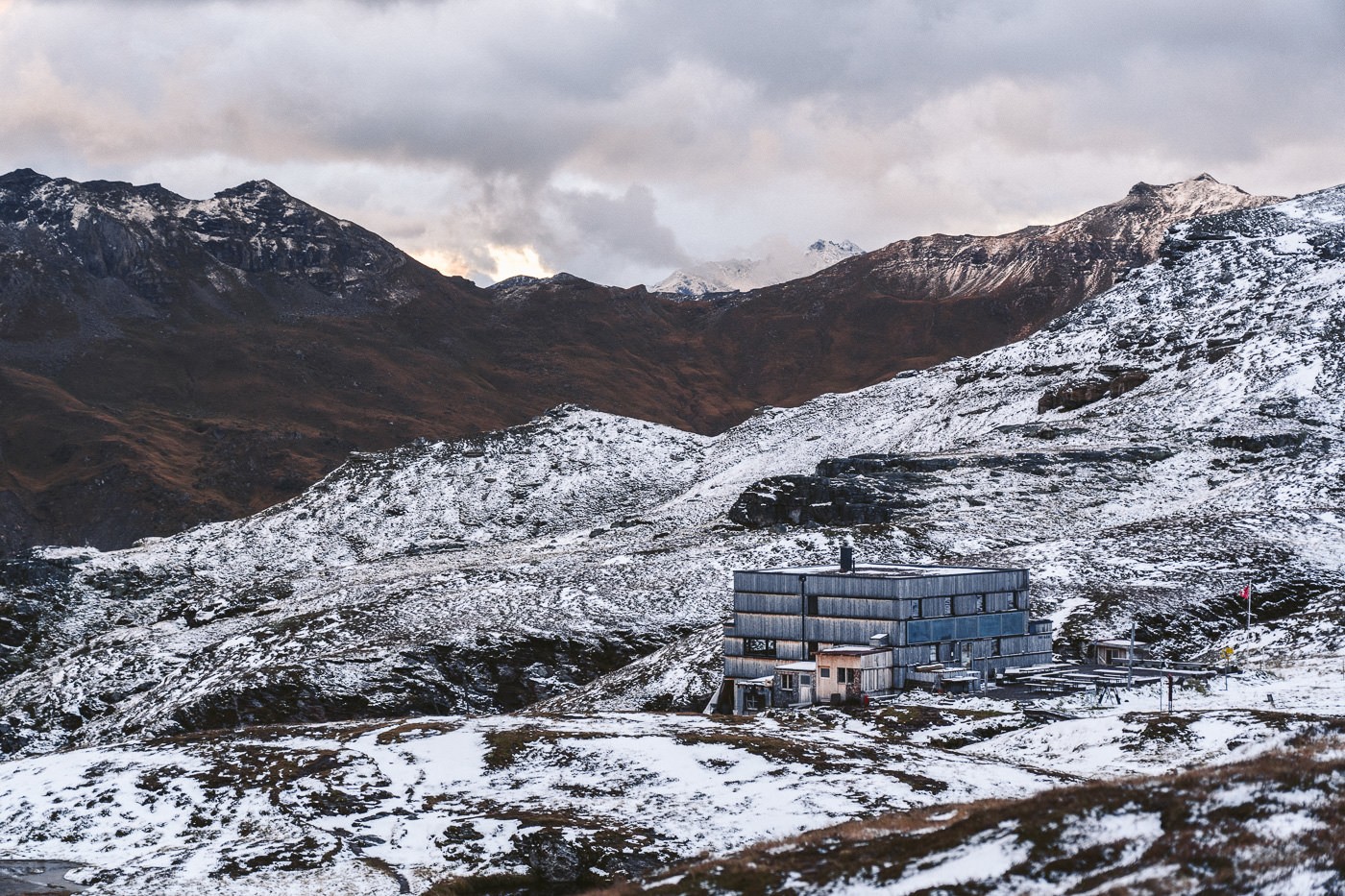
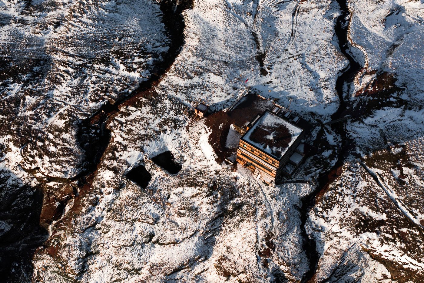
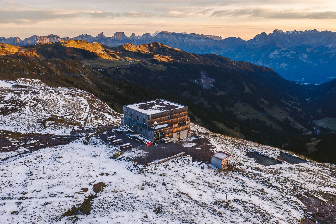
We reached the Spitzmeilen Hut just before sunset and the golden hour was in full swing. The hut is actually a unique style and almost looks like a Rubik’s cube from afar, which is different from most of the traditional chalet-style huts I’d stayed in across Switzerland. The design was one of my favorites I’ve visited so far. We enjoyed a great three-course meal at the hut and because it was mid-October and a weekday, we had an entire dormitory room to ourselves. During the summer, the hut is much busier.
HIKING FROM SPITZMEILEN HUT TO SPITZMEILEN PEAK
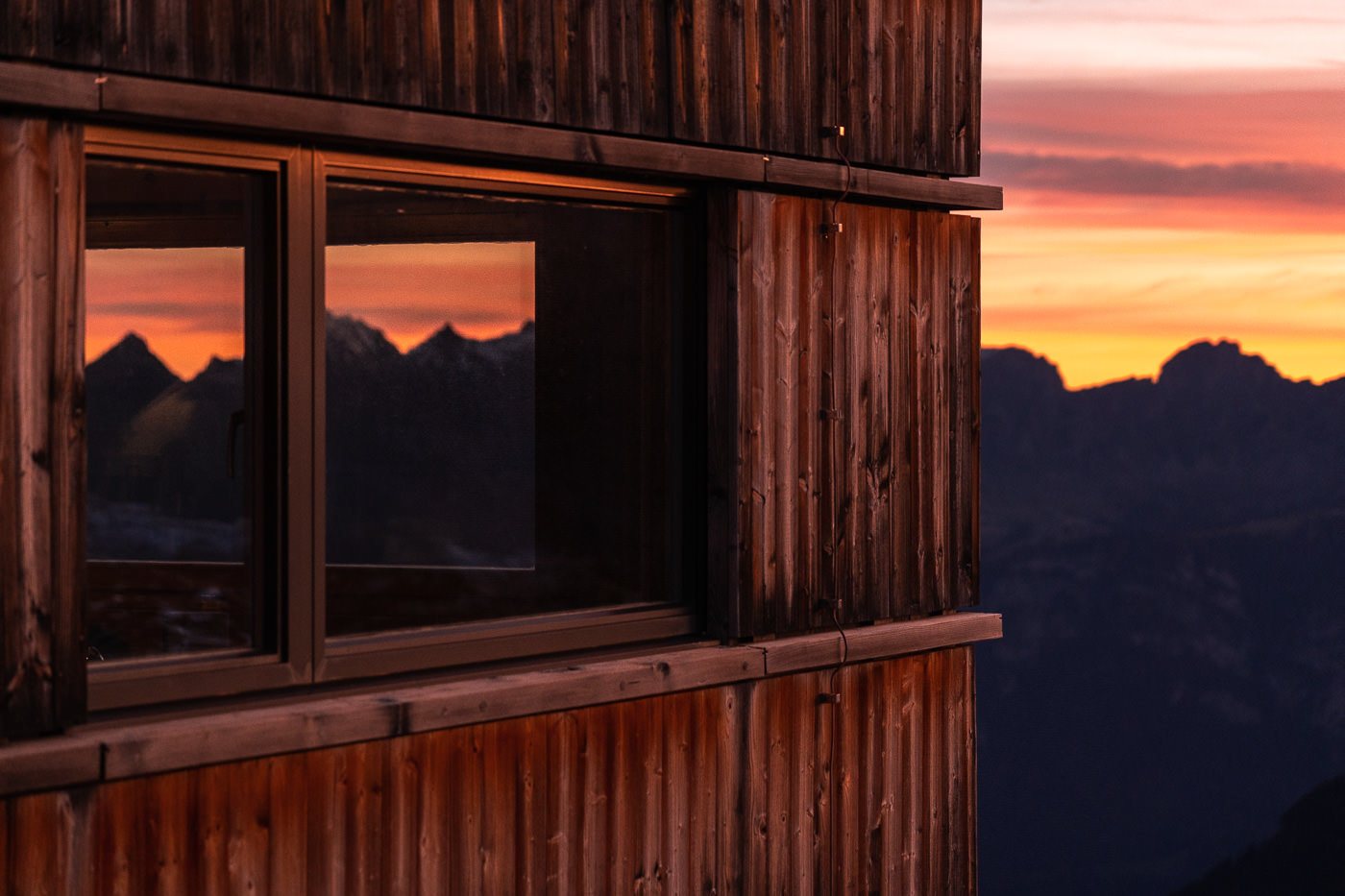
As I woke, I peered out of the window to see the first light of the pre-sunrise glow and gathered my gear together, poured a coffee, and headed downstairs to watch the colors develop in the sky from the warmth of the dining room. Incredibly peaceful. As the colors started to show themselves, I put my gloves on and headed outside to shoot the layers in the distance and the details in the windows of the hut.
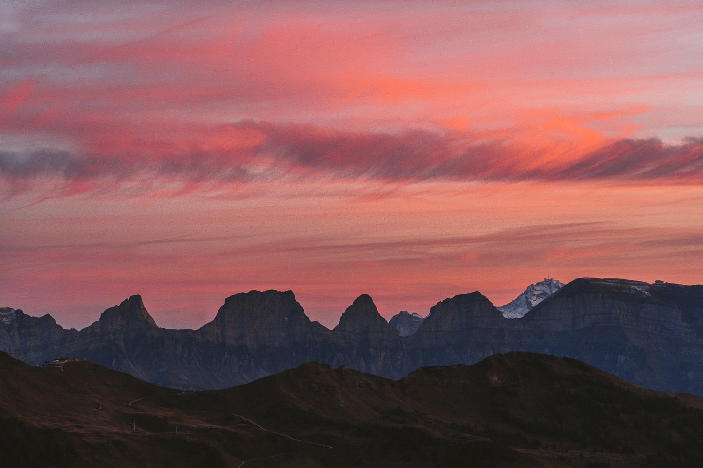
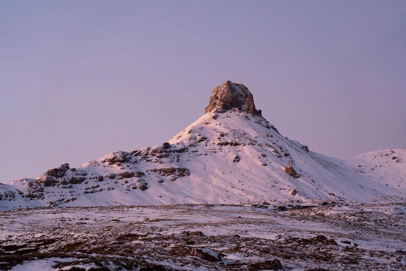
We went back inside the hut, enjoyed breakfast, and then took a look up at Spitzmeilen (nicknamed by our local friends ‘The Nipple’). It looked ominous, but we thought we would give it a go.
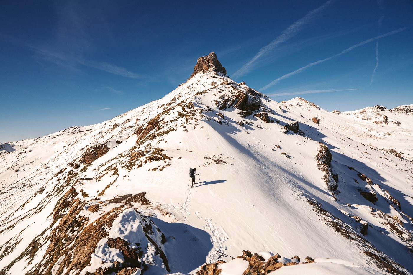
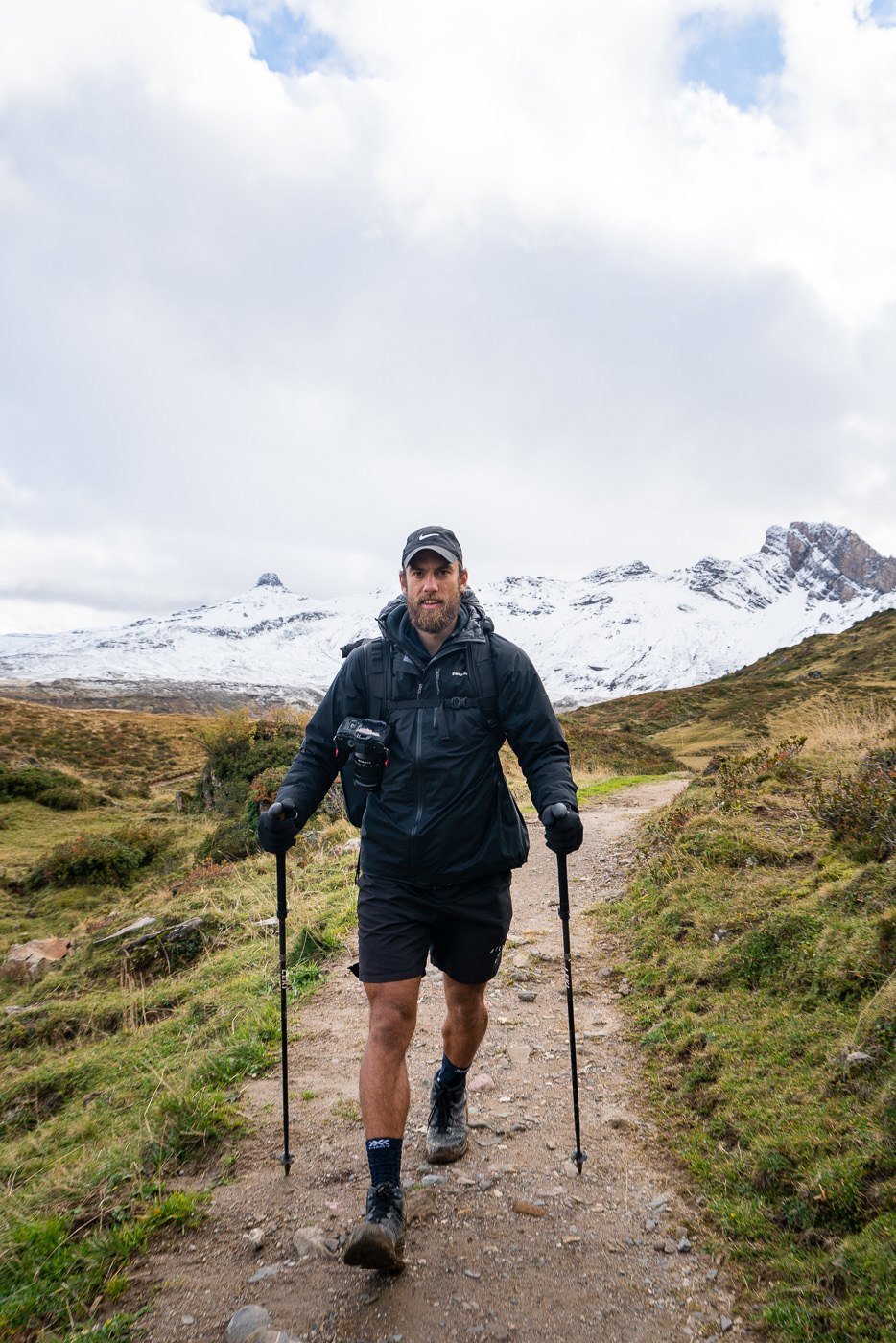
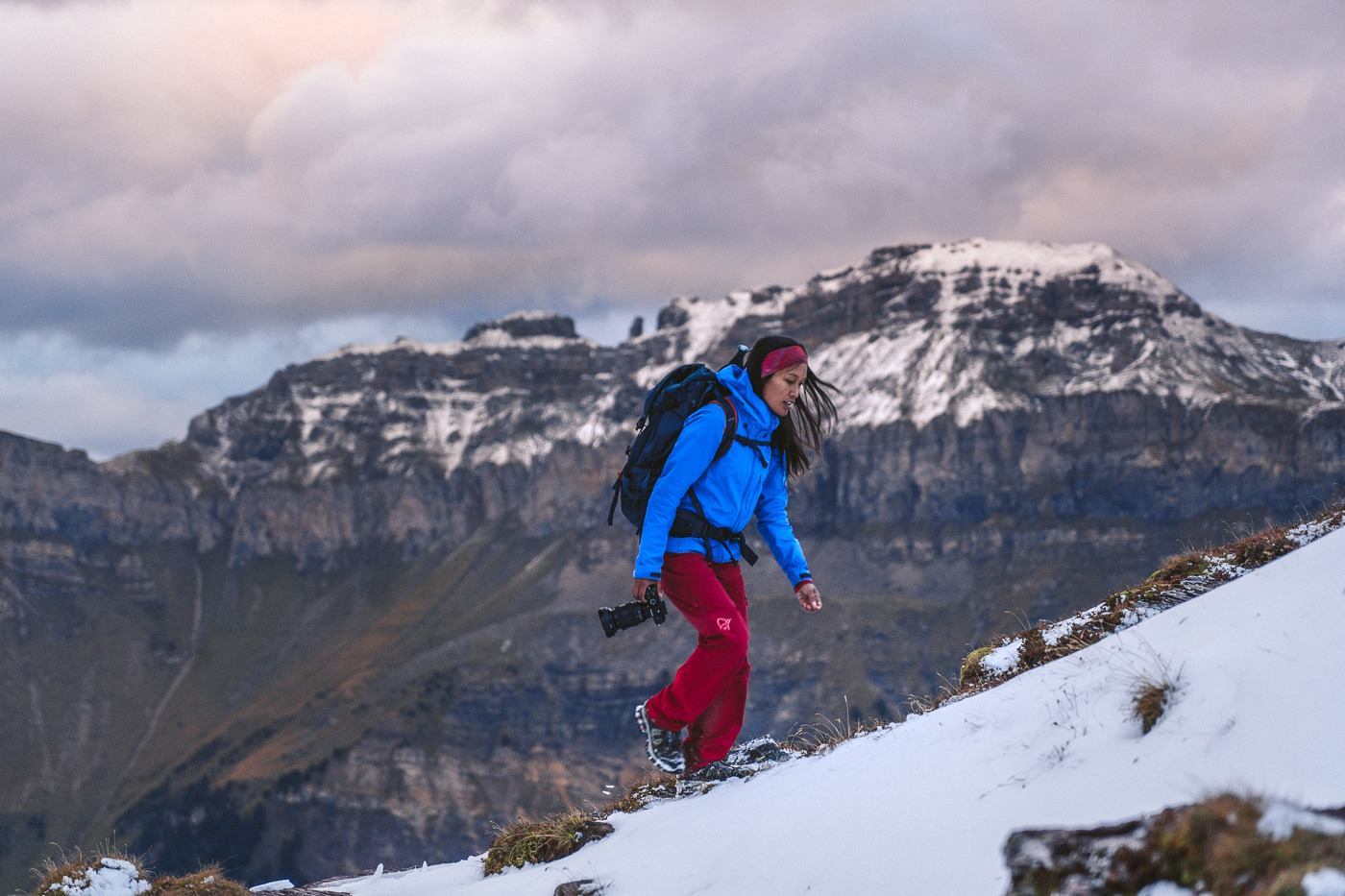
The hike up to Spitzmeilen Peak was set to only take less than an hour with only 2-3 kilometers between us and the base of the climb. However, from the first step out of the hut, we were trekking through snow that became thicker as we neared the base. At times the climb was quite steep and although this trail might be a red-and-white trail in the summer, it was quite difficult in the winter. The wardens at the mountain hut had told us it was possible but advised it could be dangerous in parts.
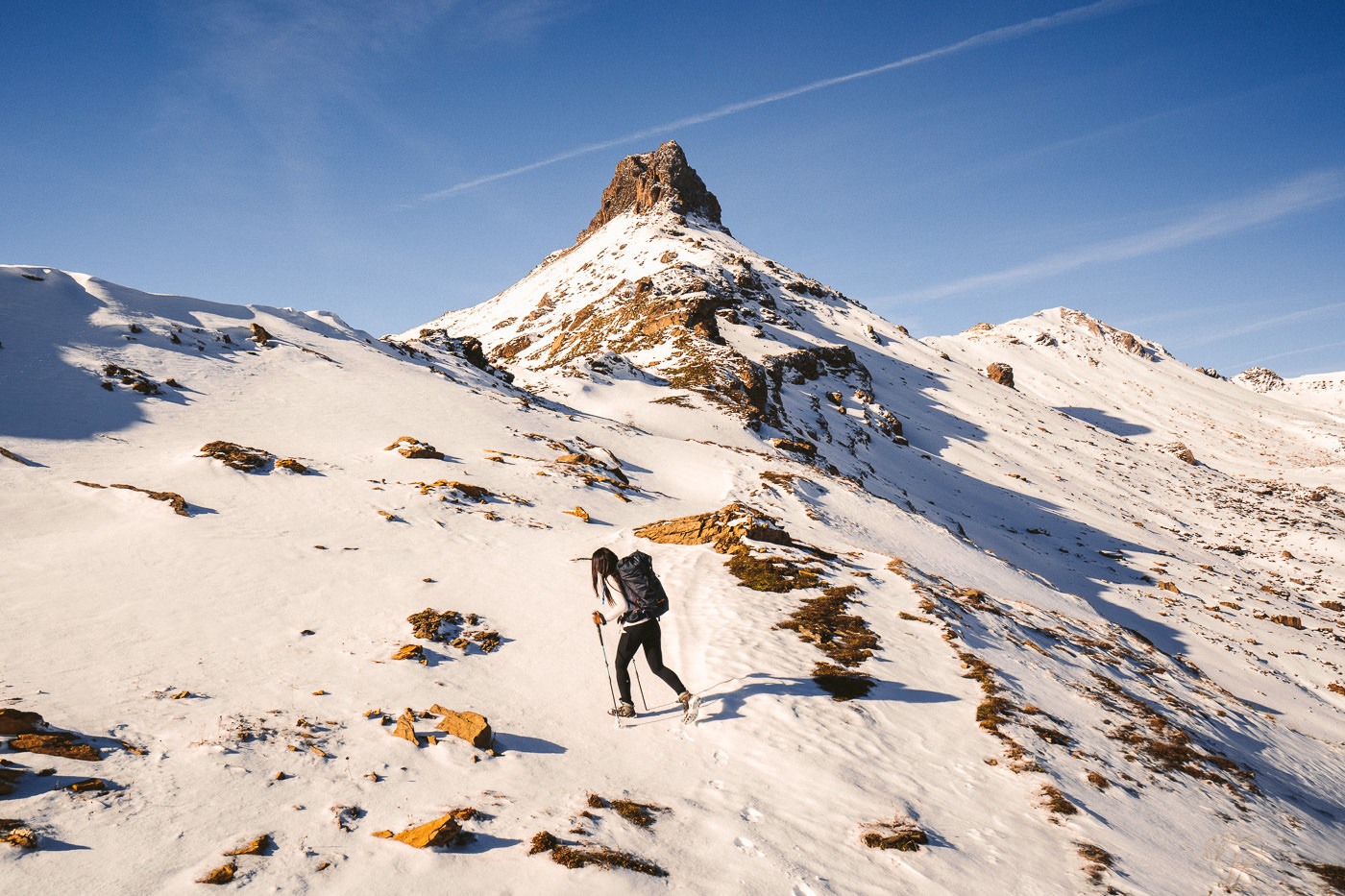
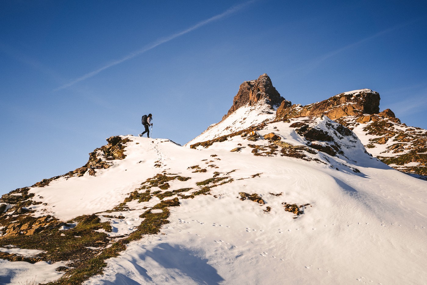
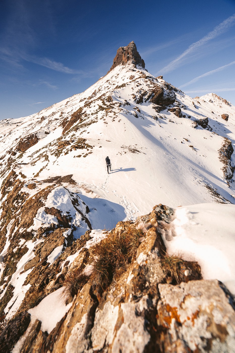
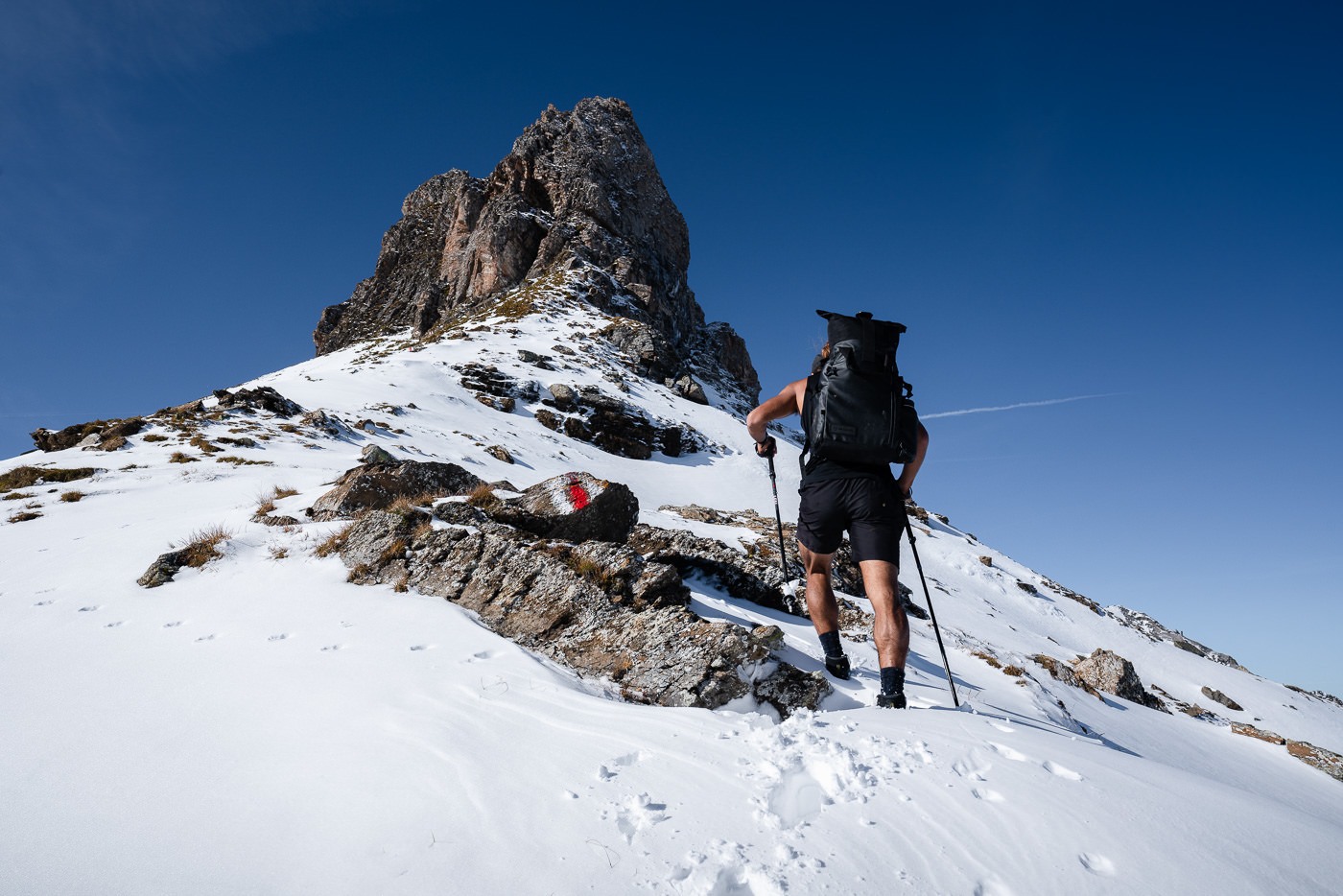

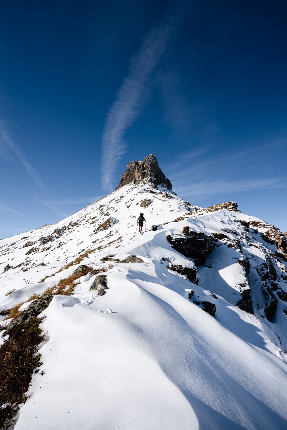
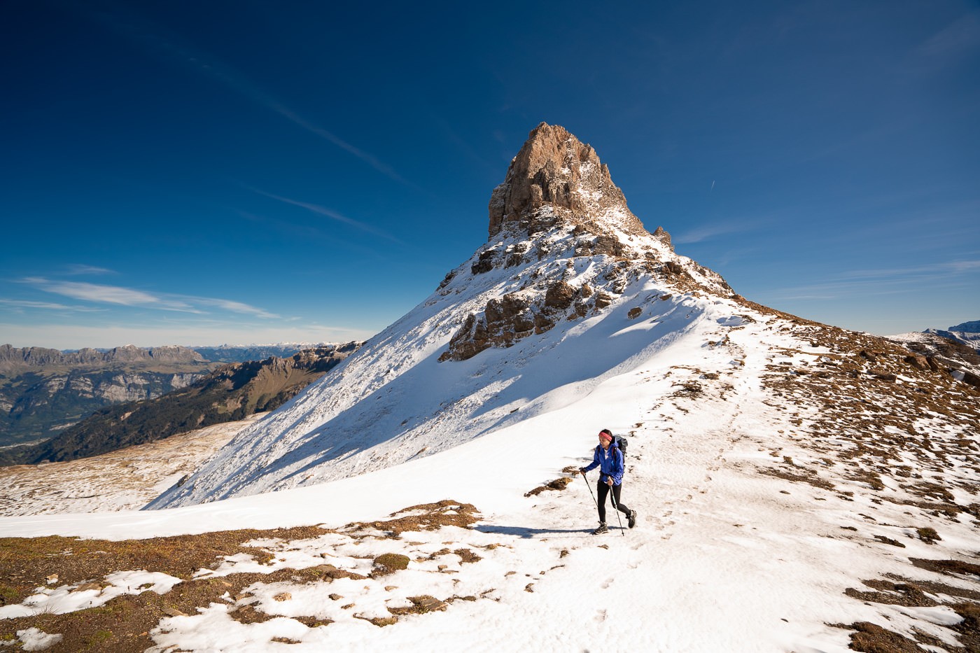
Once we reached the base of Spitzmeilen, it didn’t look quite as scary. While certain sides of the peak look almost impossible to climb, around the backside is a crack in the rock where you make your way to the top assisted by chains. The good thing about this trail is that even if you decide the climb is not for you, it’s not been time wasted as the trail now continues to Wissmeilen.
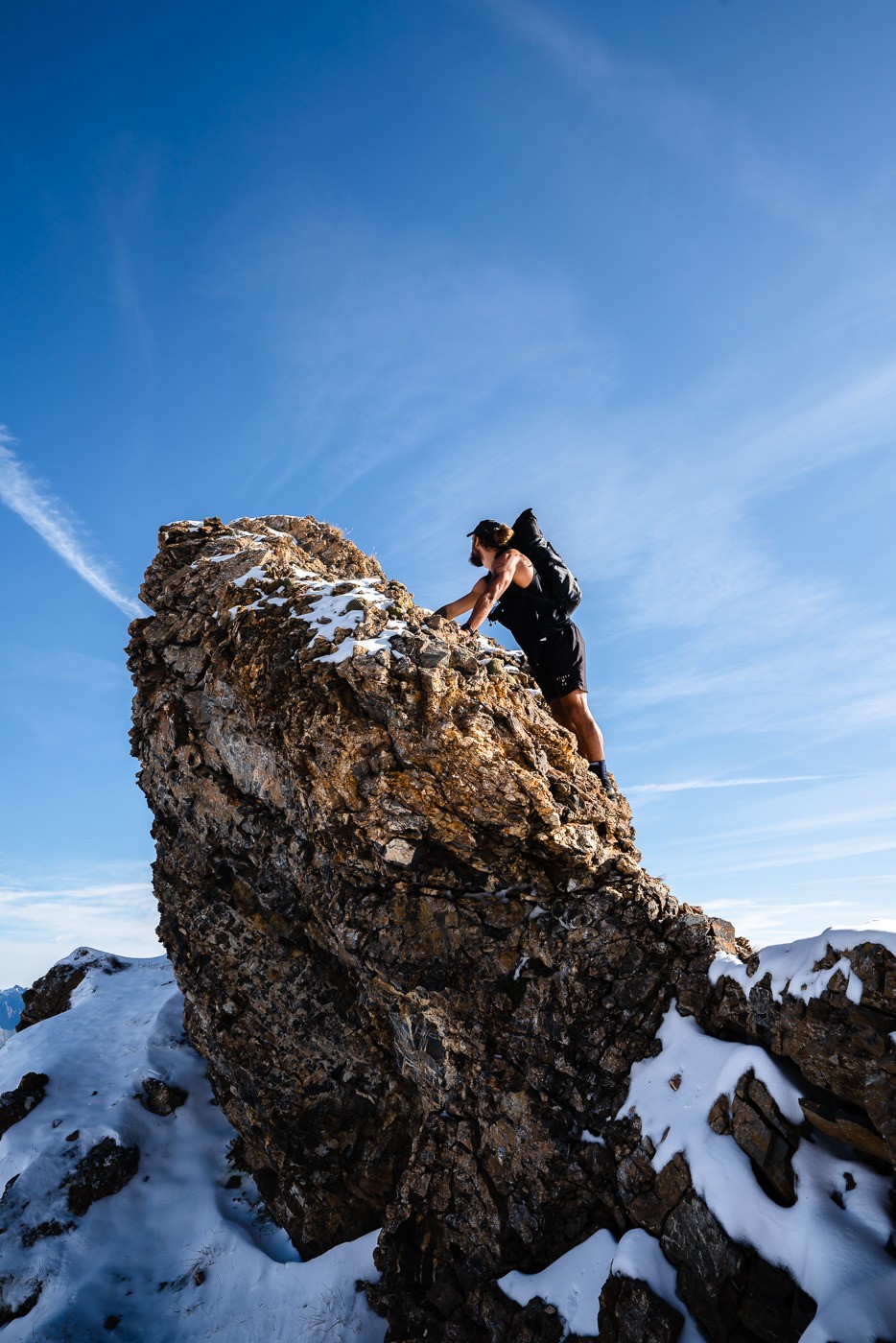
We decided to head up the climb, which was about 30 meters at a guess. There were chains the entire way but you needed to be very attentive and have sure footing and grip as you progress your way up the climb. I managed to take a few photos on the way up while resting in safe positions.
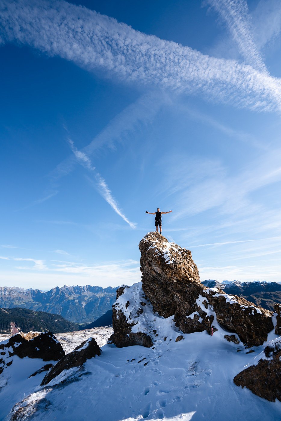
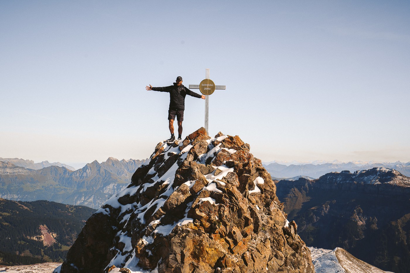
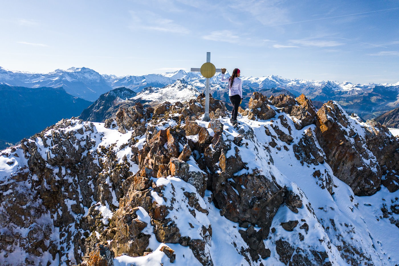
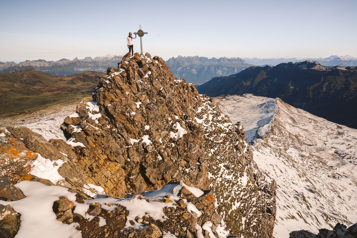
After the short but challenging ascent, we made it to the top of the Spitzmeilen Peak! At the beginning of the hike the day before, I was convinced it would be too snowy but nevertheless, there we stood. A giant cross with a gold circle rests on top of the summit, which is 2,508 meters above sea level. The drop-offs at the summit are very steep so you need to watch your footing and tread with care while enjoying the panoramic views on top of the Spitzmeilen peak.
SPITZMEILEN PEAK TO ENGI VIA WISSMEILEN
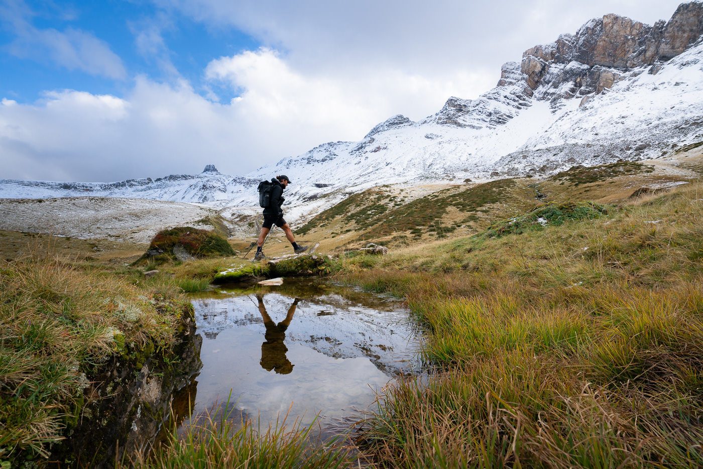
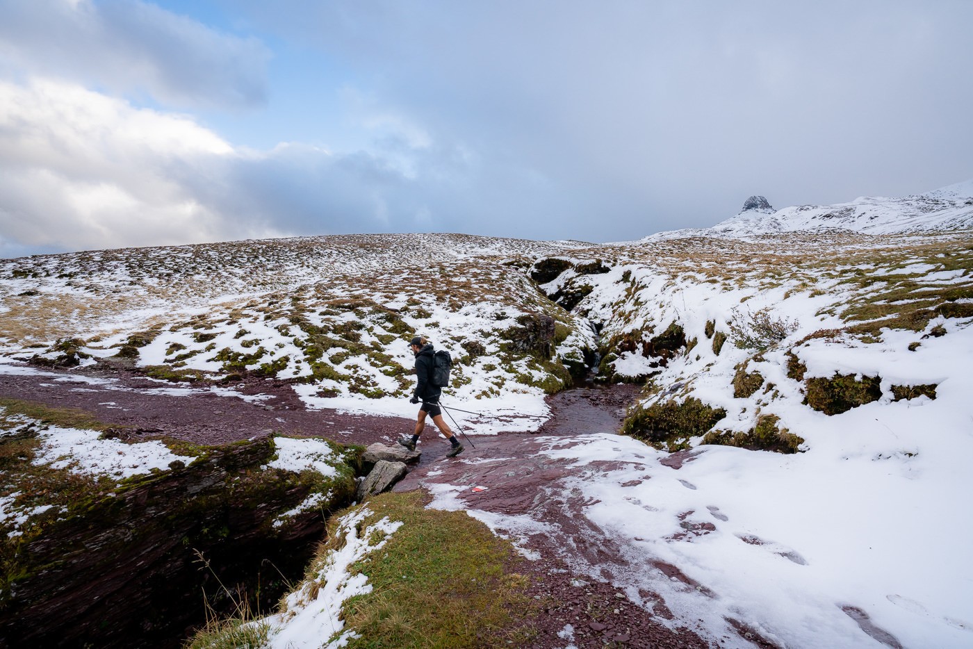
Getting back down from the Spitzmeilen Peak required even more care than coming up and I’ll be honest, I was glad to be back at the base. We picked up our trekking poles and continued around the base in a clockwise direction until we emerged on the other side. I’m not sure if you can cross the front side as it looked quite steep. The trail behind the back of the Spitzmeilen was marked red and white, so despite being covered in snow we felt a bit safer.
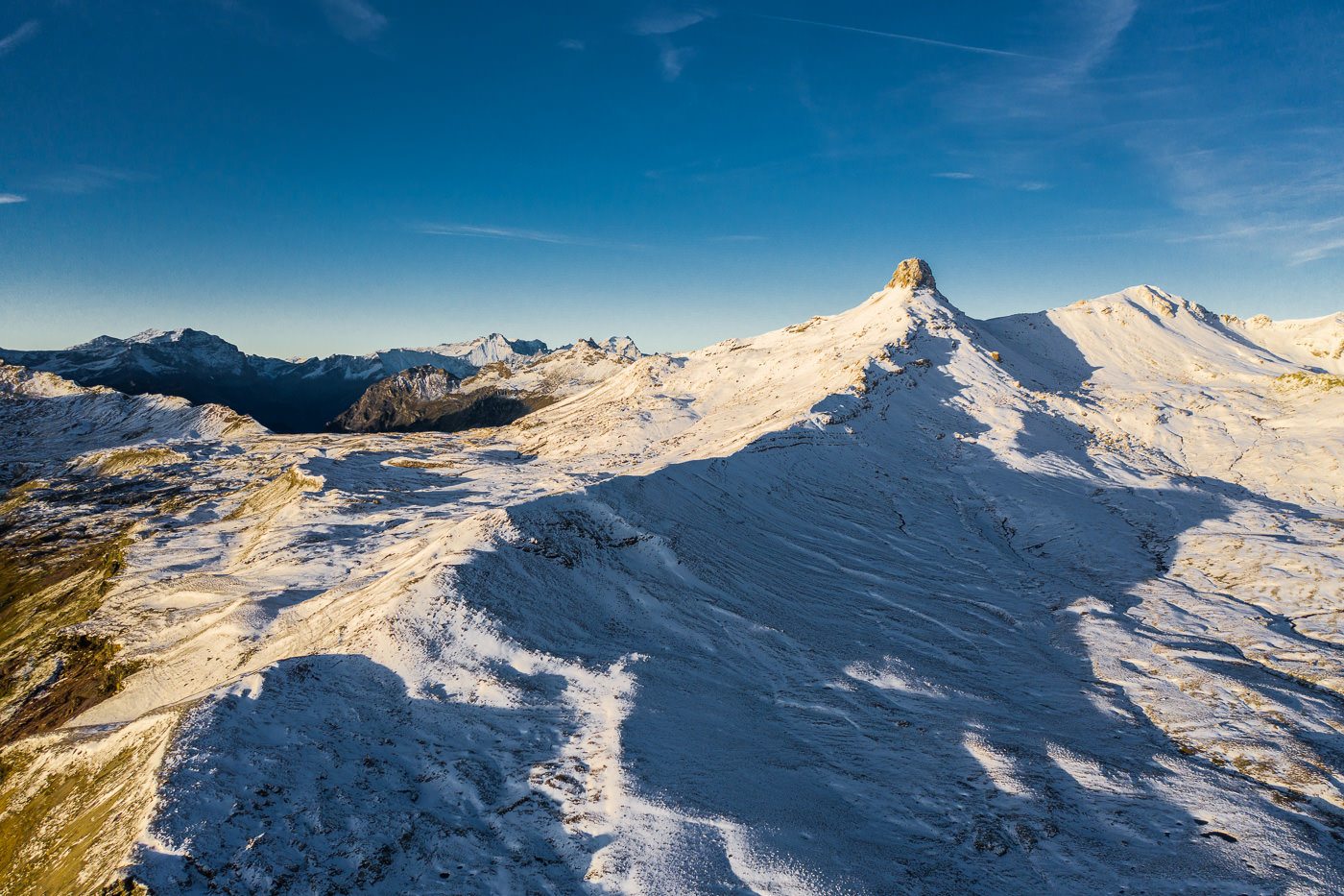
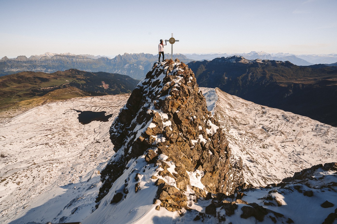
The trail now leads you along the ridge to the Wissmeilen summit, which is much less impressive than Spitzmeilen. The route is quite rocky and a little bit hard to navigate. Again, it is likely much easier in the summer when there is no snow.
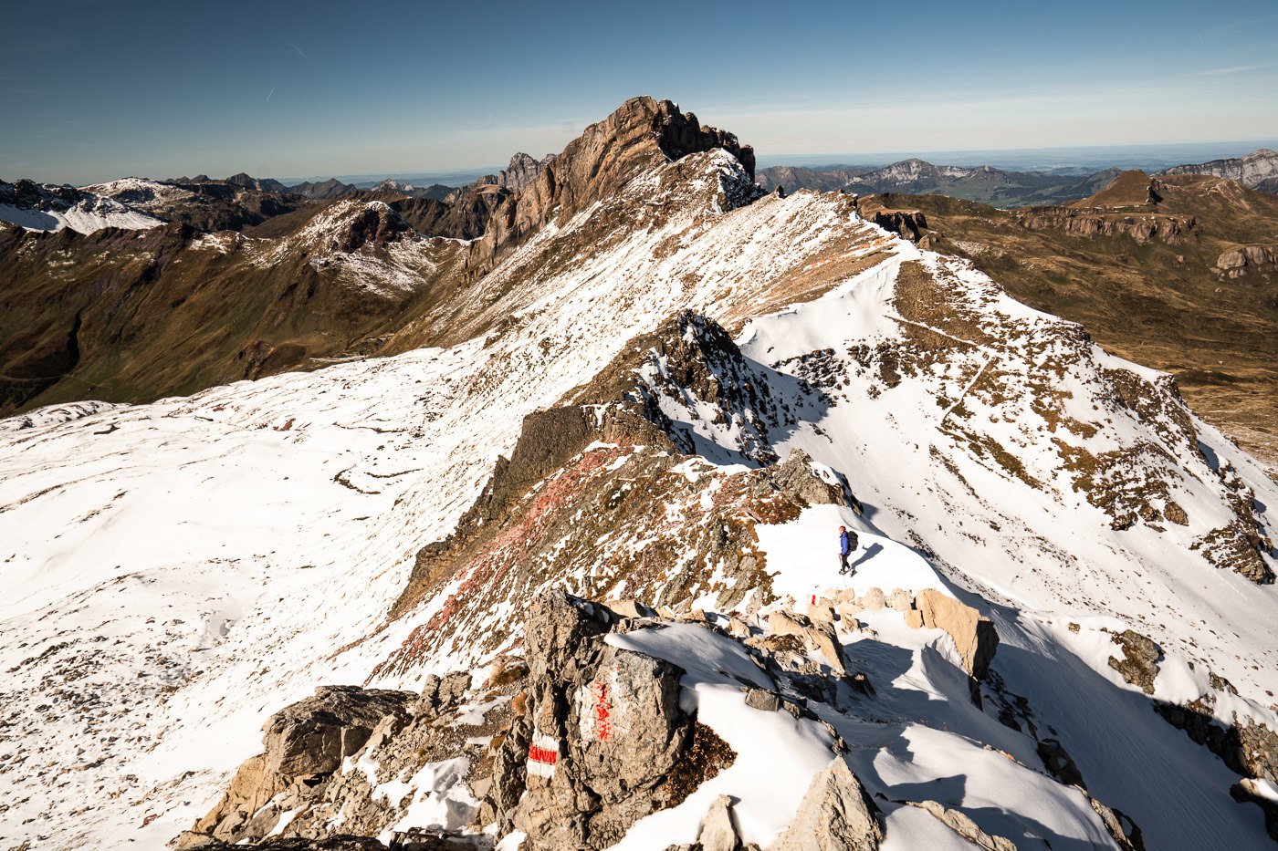
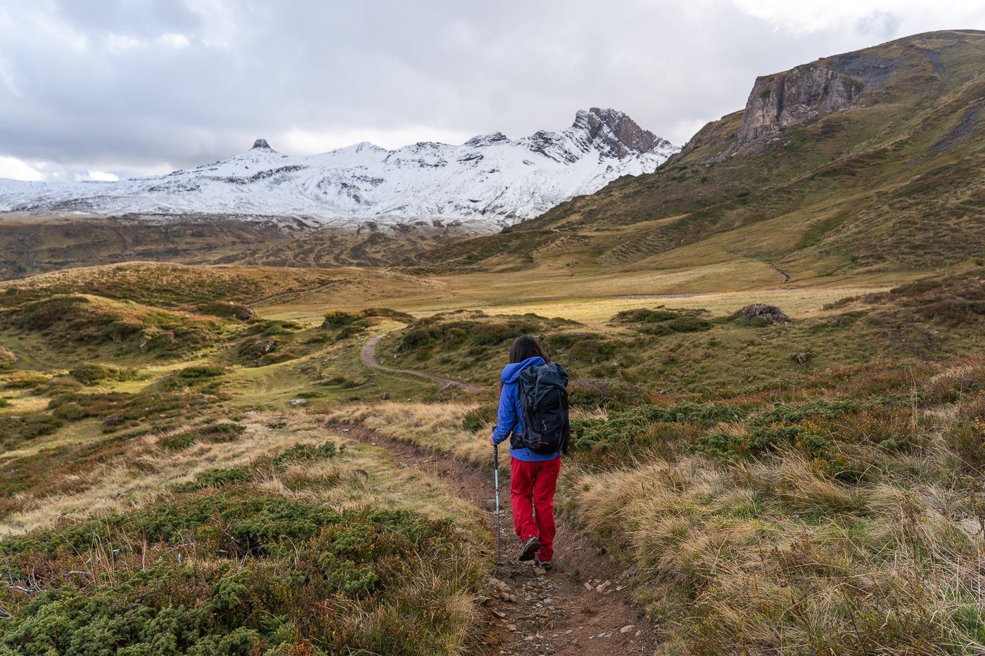
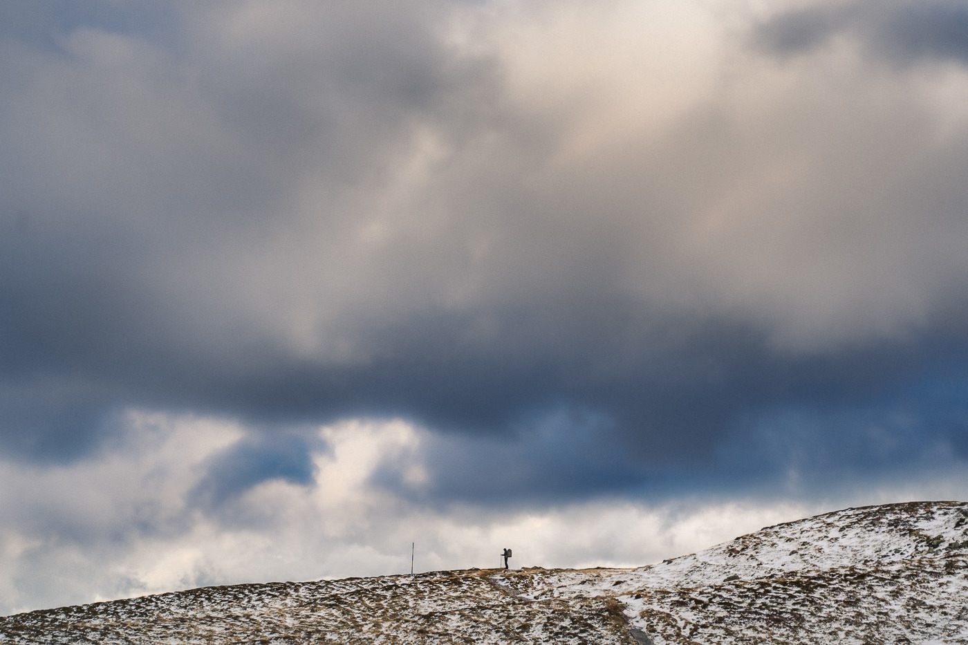
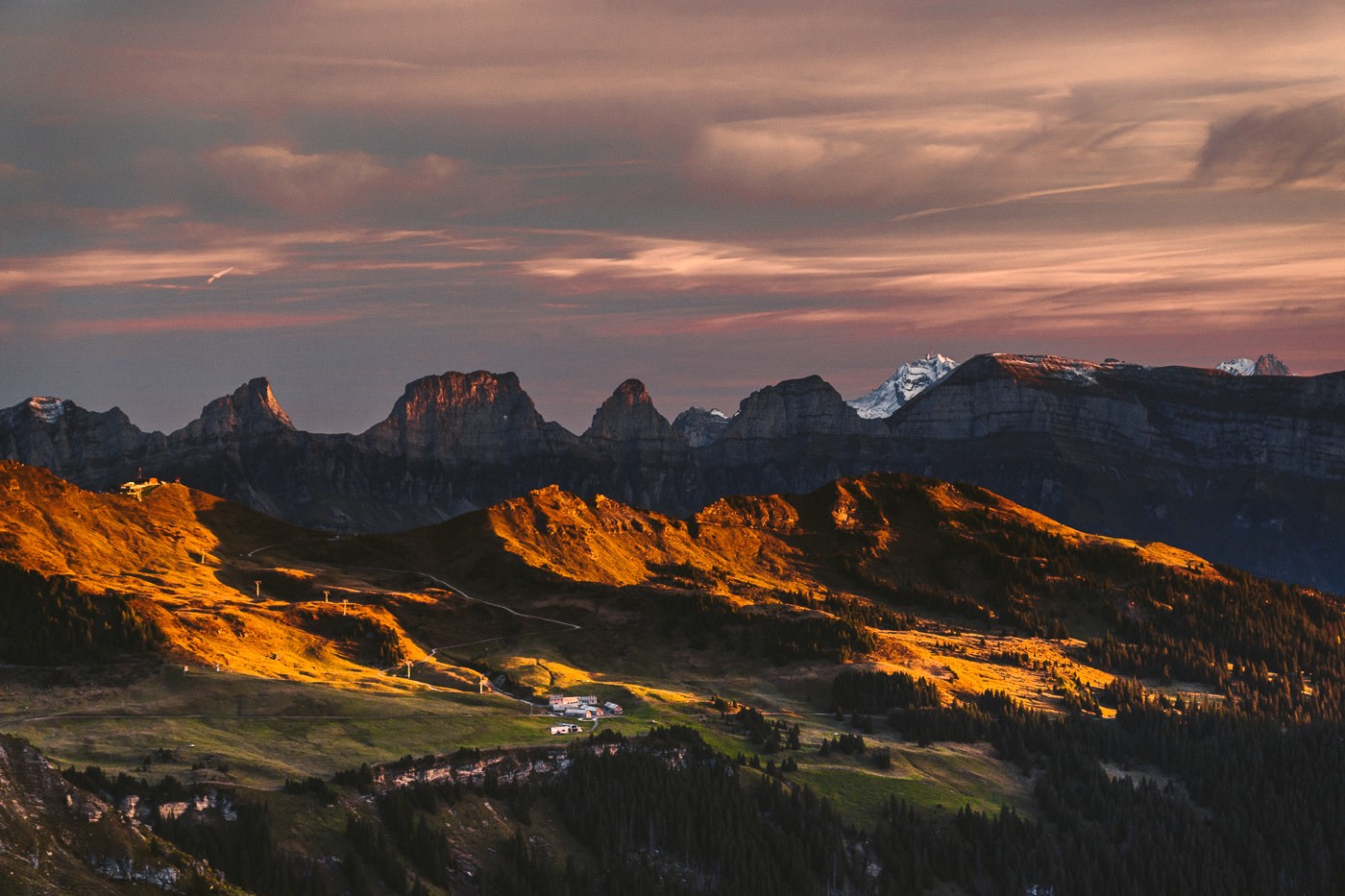
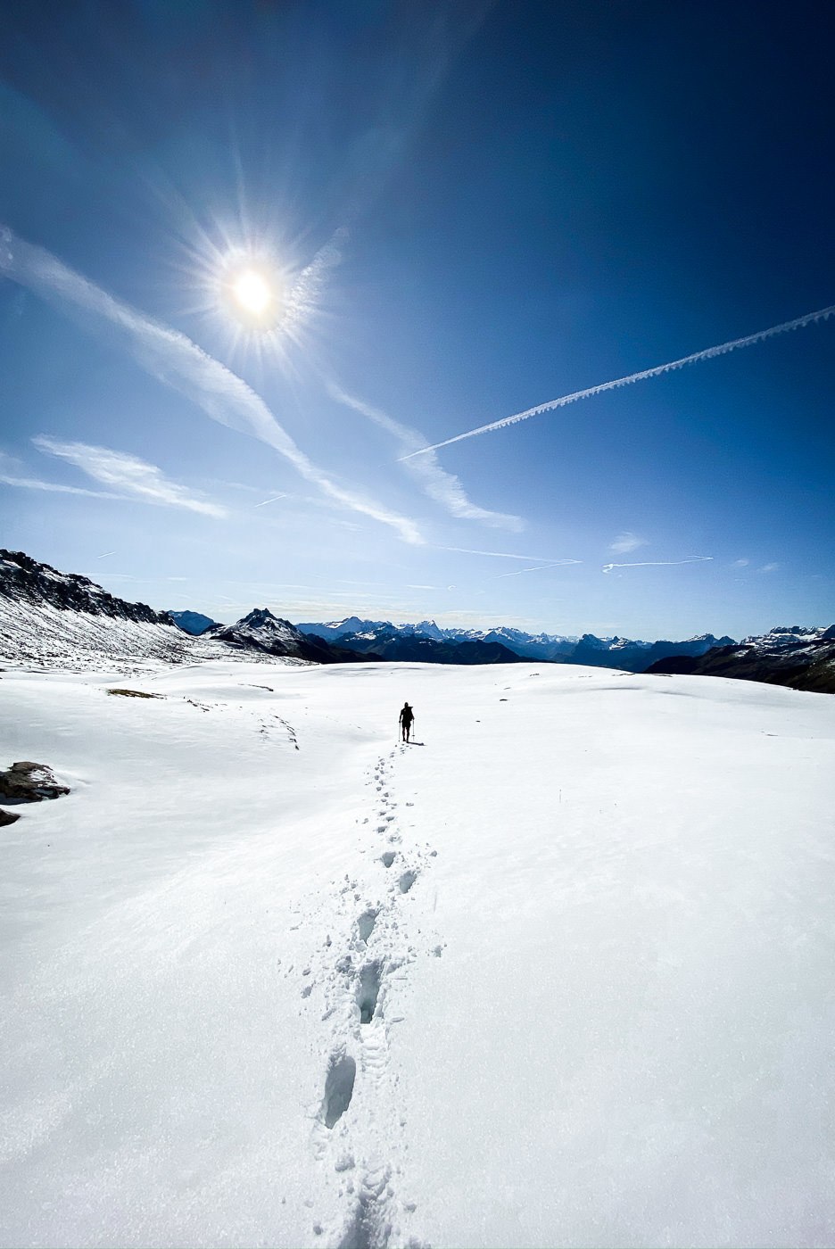
After the Wissmeilen summit, you head down a precarious trail to the Wissmeilen Pass. It’s important to note that there is a direct, relatively safe route from Spitzmeilen Hut to Wissmeilen Pass that bypasses both Spitzmeilen and Wissmeilen summits. Once you reach the pass, you begin the descent down the opposite side of the ridge to the Spitzmeilen Hut. It’s a steep decline with lots of switchbacks along the trail until you reach a plateau. It seemed like a white desert with the snowfall.
The excitement of the hike is mostly over at this point. You will now walk down the mountain for the next few hours until you reach Engi. The total decline for the day will be 1600 meters. The landscape was beautiful but not as ‘epic’ as the peaks we had just left behind. Now we were met with rivers, rolling fields, and one beautiful waterfall. After the waterfall, the trail follows the river all the way to Engi. It’s important to let you know there are no mountain huts or stops for food along the way from Spitzmeilen Hut to Engi (during October).
We made it down at around 5 pm, after spending a lot of time at the summit of Spitzmeilen and elsewhere along the trail taking photos. From Engi, you can catch a bus back to the train station and begin your journey home.
I hope you enjoyed this blog post and found it useful. Have a great hike and stay safe.
HOW TO BOOK A NIGHT AT SPITZMEILEN HUT
In order to book a night (or more) at Spitzmeilen Hut you will need to send an email, make a phone call or fill out the form on their website. They are not on other booking platforms, this is how the hut is booked.
- To email Spitzmeilen Hut you can contact them here: info@spitzmeilenhuette.ch
- To visit the website to make a booking you can do so here: spitzmeilenhuette.ch
- To make a booking via phone you can do so with this number: +41 81 733 22 32
WHAT IS INCLUDED WHEN YOU STAY AT SPITZMEILEN HUT
The way mountain huts generally work is that you reserve a bed and also your half-board is included, which means you get a great dinner and breakfast service. Depending on the hut you can also get tea and drinking water but some do charge for this pending availability. You can choose to stay overnight without half-board but understand that there is no ‘cafe’ around the corner. I think the only reason you would choose not to have half-board is if you arrived very late and left very early missing dinner and breakfast.
The price of one night at Spitzmeilen Hut with half-board (two meals) is: $80
If you are a Swiss Alpine Club member (SAC) your price will be: $65
TANNENBODEN TO SPITZMEILEN HUT HIKING MAP
You can download my map in GPX form to use on your Garmin or smartwatch by clicking here.
SPITZMEILEN HUT TO SPITZMEILEN SUMMIT TO WISSMEILEN TO ENGI HIKING MAP
You can download my map in GPX form to use on your Garmin or smartwatch by clicking here.
SWISS TRAVEL PASS or HALF-FARE CARD
OPTION 1: Buy the Swiss Half Fare Card: Switzerland trains, buses, and cable cars are EXPENSIVE! I found the best way to get around cheaply was to buy the Swiss Half-Fare Card before I arrived. It gives you 50% off every regular train, bus, and even many cable cars. It only costs $150 USD but pays itself off in just a few days with many train tickets in Switzerland costing close to $100 alone. If you are staying for more than 5 days, I suggest buying the Swiss Half-Fare Card.
OPTION 2: Buy the Swiss Travel Pass: The second option is to get the Swiss Travel Pass, which gives you unlimited train, bus, and (many) cable car rides but it’s pretty expensive at around $100 USD per day so if you don’t travel each day it isn’t worth it.
OPTION 3: Buy the FLEXI Swiss Travel Pass: The final (BEST) option is to get the FLEXI Swiss Travel Pass, which allows you to buy 8 days’ worth of transit but you can choose the night before if you want to activate the next day. That way you don’t need to travel every day to get your money’s worth, you can just activate the FLEXI Swiss Travel Pass on the days when you are doing sizeable transits. My advice is to book the Swiss Half-Fare Card or the FLEXI Swiss Travel Pass in advance before your trip so it’s ready to go when you arrive.
GET A SWISS TRAVEL PASS!


Enjoy UNLIMITED train, boat, and bus rides in Switzerland for up to 15 days. Click to book a flex Swiss Travel Pass or choose the Consecutive Swiss Travel Pass.
The Swiss Travel Pass starts at $260 for 3 days. Click here to check if it’s available on your travel dates.
MY SWITZERLAND HIKING GUIDES
I spent 100 days hiking in Switzerland and created a guide for different regions around the country. You can click on one of my Switzerland hiking guides below to help you plan your trip.
- The Complete Guide: 50 AWESOME HIKES IN IN SWITZERLAND
- The Via Ferrata Guide: 4 EPIC SWITZERLAND VIA FERRATA COURSES
- Lauterbrunnen Guide: 10 AWESOME HIKES NEAR LAUTERBRUNNEN
- Interlaken Guide: 15 AWESOME HIKES IN INTERLAKEN
- Grindelwald Guide: 12 AWESOME HIKES NEAR GRINDELWALD:
- Mürren Guide: 7 AWESOME HIKES IN MURREN
- Appenzell Guide: 9 AWESOME HIKES NEAR APPENZELL
- Chur Guide: 7 AWESOME HIKES NEAR CHUR

MY SWITZERLAND TRAVEL TIPS
- For Backpackers: SWITZERLAND BUDGET BACKPACKING GUIDE
- Travel Tips: 20 THINGS TO KNOW BEFORE VISITING SWITZERLAND
- Transport Tips: RENTING AND DRIVING A CAR IN SWITZERLAND
- Accommodation Guide: 30 BEST PLACES TO STAY IN SWITZERLAND

Kedar K
Thursday 17th of October 2019
This is definitely a good place for hiking. Hope you had a fun
Jackson
Thursday 17th of October 2019
Thankyou. was amazing!