
The Eiger Trail is a breathtaking hiking route situated in the Swiss Alps. It allows hikers to get close to the imposing north face of the Eiger mountain. The trail begins at Alpiglen and ends at Eigergletscher, covering around 6 kilometers and taking about 2-3 hours to complete depending on your speed. As you traverse the path, you’ll be treated to awe-inspiring views of the mountain’s rugged terrain, steep cliffs, and tranquil alpine meadows. Though the trail can be moderately challenging in parts, it’s well-maintained and suitable for most hikers with a moderate level of fitness.
HIKING THE EIGER TRAIL: ALPIGLEN TO EIGERGLETSCHER
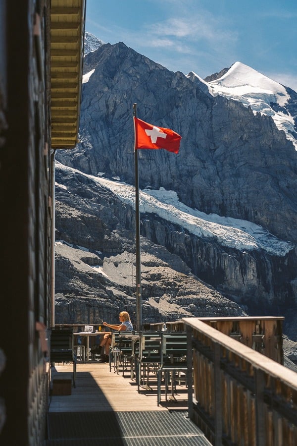
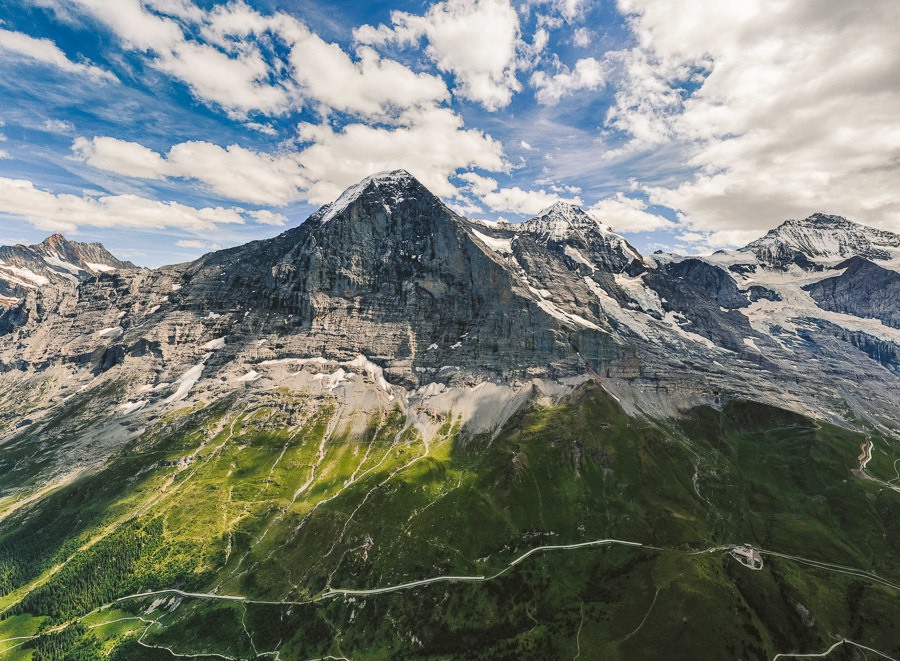
The Eiger Trail hike is one of the most popular routes in Switzerland because the path leads hikers directly under the world-famous Eiger North Face Wall, which is renowned as one of the toughest climbs in the world. In this blog post, I’ll share all of the details so you can know how to hike the Eiger Trail from Alpiglen to Eigergletscher in Grindelwald.
EIGER TRAIL DETAILS
- Hike Distance: The distance from Eigergletscher Train Station to Alpiglen along the Eiger Trail is 6.5km.
- Hike Duration: 2.5 hours although if you went straight through without taking photos or stopping it would be well under two hours. It could be run in under an hour.
- Hike Difficulty: The path is gravel and involves no technical aspects. This is a family-friendly, dog-friendly trail.
- Hike Incline: Starting point at Eigergletscher: 2,322m – Alpiglen: 1,616
YOU WILL ALSO LIKE MY SWITZERLAND HIKING GUIDE: 50 AWESOME HIKES IN SWITZERLAND
HOW TO GET TO THE EIGER TRAIL
The Eiger Trail begins at the Eigergletscher Train Station and finishes at Alpiglen Train Station (although you can hike down from Alpiglen Train Station back to Grindelwald Grund Station if you prefer). Getting to Eigergletscher Train Station is actually a little bit of a mission.
- First, you need to arrive at Grund Train Station and purchase your ticket. You can purchase a ticket all the way through to Eigergletscher Station from Grund although there are two separate trains you will need. At Kleine Scheidegg, you will have to get off and head to the brown sign and line up for the train to Eigergletscher.
- This station is crazily busy as it is the train to Jungfraujoch’s ‘Top of Europe’ viewpoint. It was genuinely tourist mayhem with hundreds of people barging around. Don’t worry they won’t be on the Eiger Trail.
- Once you arrive at Eigergletscher Station, you will see the trail on the left-hand side of the tracks as you face the mountains, and from that point, it is well-signed with the classic yellow signs. The train journey from Grund to Eigergletscher took us about 50 minutes in total including the wait time at Kleine Scheidegg and costs 32.50 CHF, which is about $30 USD.
We used our Swiss Half-Fare Card so we only had to pay half of the ticket price. You can check the train timetable here for the current schedule to Eigergletscher.
MY EXPERIENCE HIKING THE EIGER TRAIL
I’ll be honest… getting to the Eigergletscher station in the summer peak season was a bit of a mess by Swiss standards. There were hoards of tourists barging through everywhere, people yelling to get out of the way and then everyone was lined up in chutes like cattle just to get on the train. It was mildly orderly as you would expect in Switzerland but very full on and we didn’t feel like we were on a mountain adventure.
Luckily, those packs of wild tourists were heading up to Jungfraujoch viewpoint. All of the hikers got out at Eigergletscher (which was less than 1% of the passengers on the train). From that point on it was back to the normal peace and quiet in the Swiss Alps. From Eigergletscher, we crossed the tracks and got started on the famous Eiger Trail.
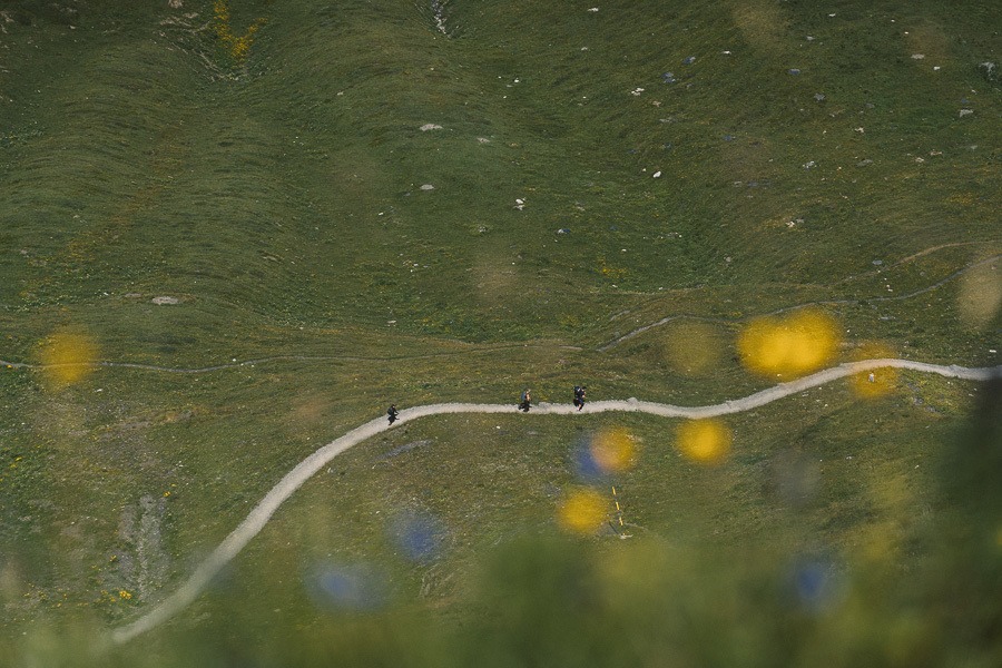
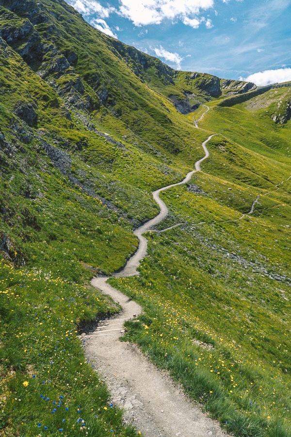
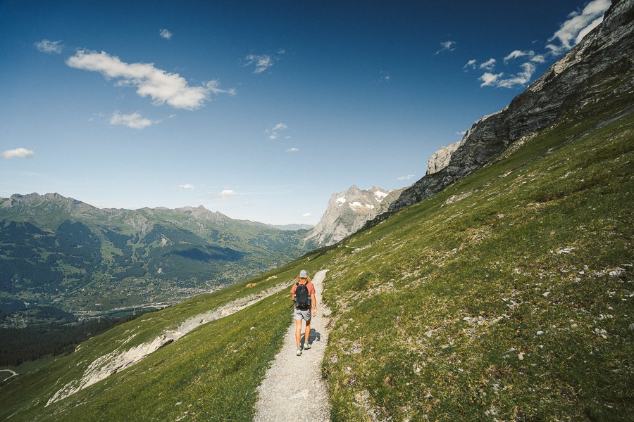
The trail is quite short compared to many of the long mountain hikes in Switzerland. It was just 6.5 kilometers before us and our eventual finishing point in Alpiglen. I was in no rush and wanted to cruise through the trail. We slowly meandered along and still finished within 2.5 hours including a drone flight, sun baking session, and long stops throughout the trail for photos.
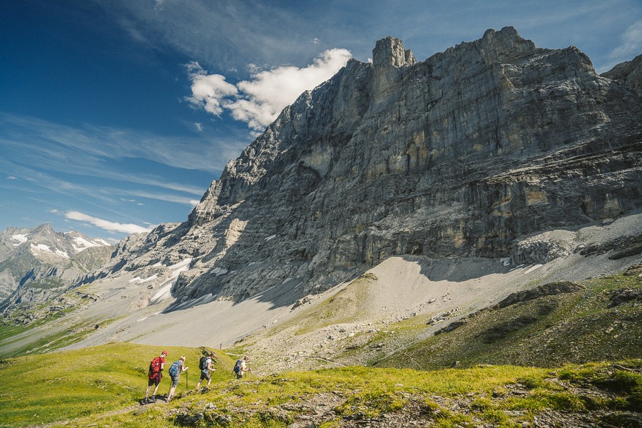
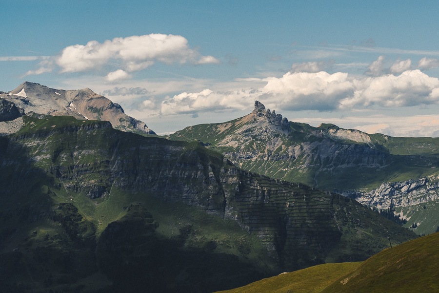
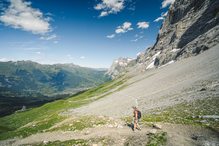
The trail starts off with 200m of incline, although it is spread over a couple of kilometers and is nothing too strenuous. At this point, you cannot see Eiger, but the views across the valley and the towering glacial mountains are incredible and there is something to gawk at in every direction.
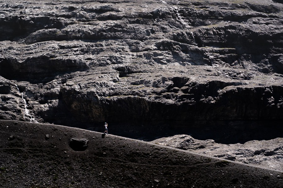
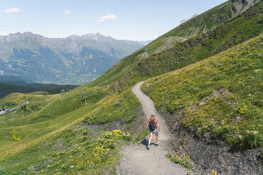
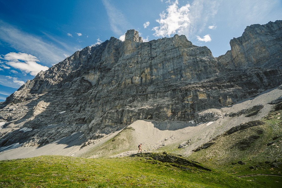
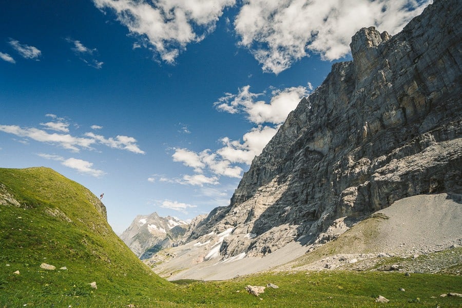
The trail at this point is a gravel path with a lush green valley on one side and a huge wall of mountain on the other. It’s quite a unique trail in this regard, where the aim is more to observe the mountain rather than to climb it.
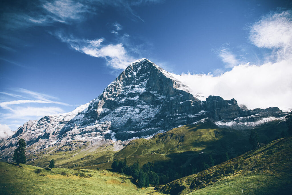
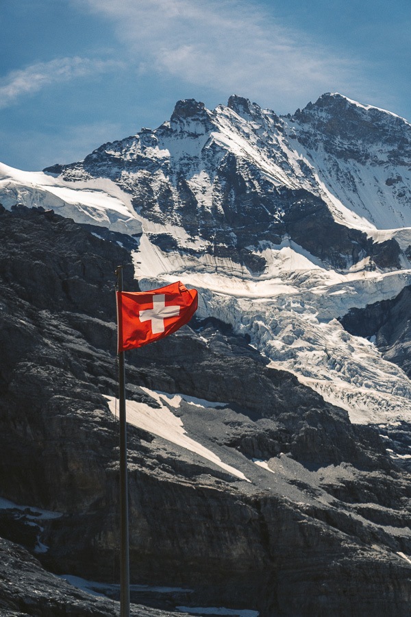
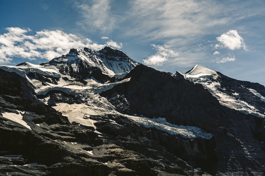
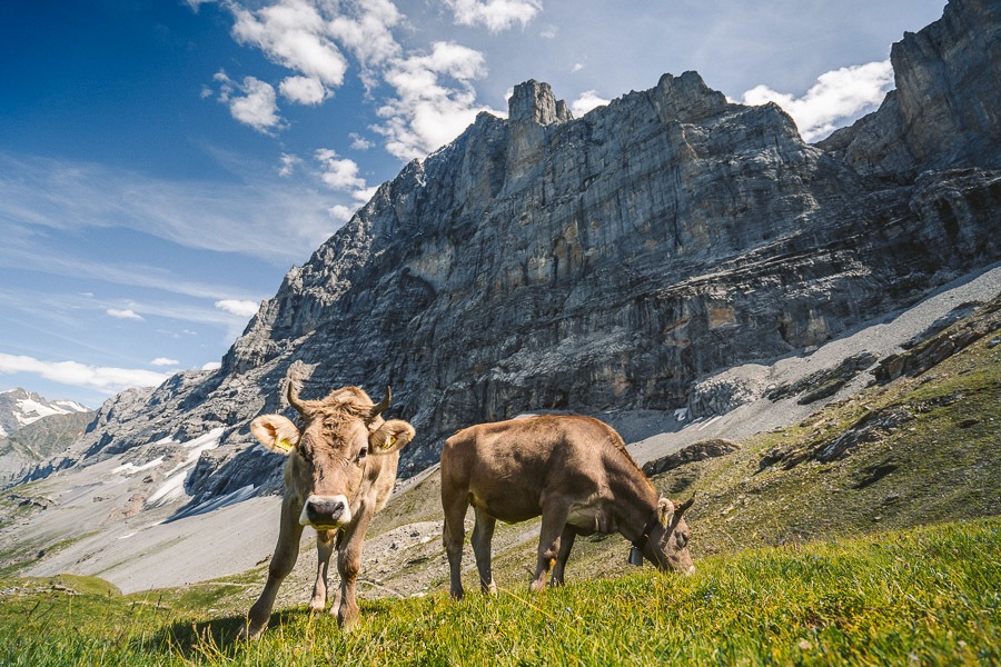
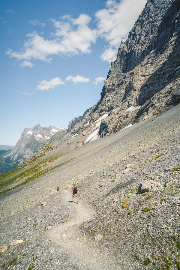
It isn’t long before you will reach the Eiger ‘North Face’ viewing area. It’s about 2km into the trail and there will likely be a little gathering of people and possibly some local cows. Here you will look up towards Eiger Mountain and if you read the signs, you can even identify the path the climbers use to scale the North Face wall of Eiger.
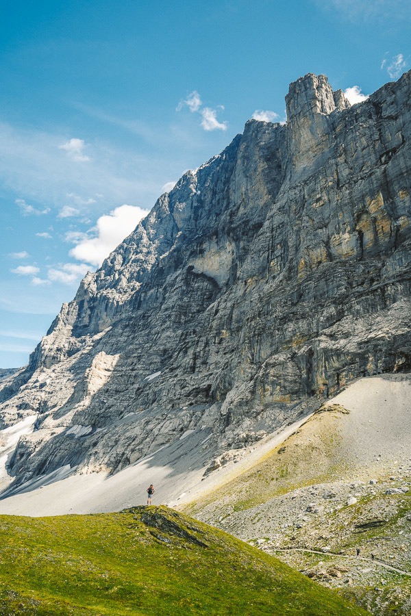
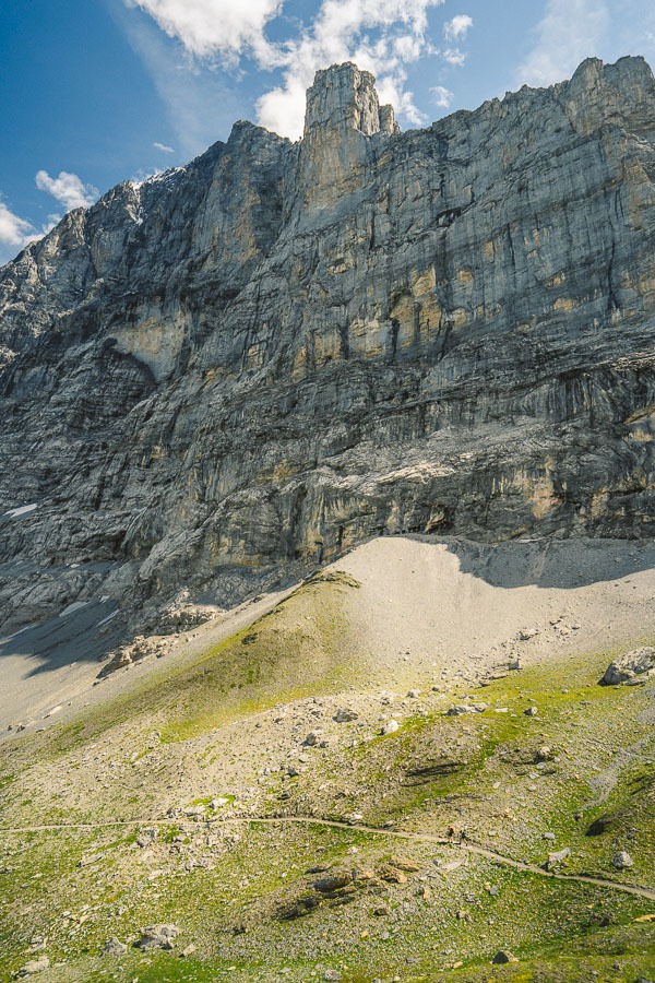
The interesting part about this viewpoint is only a portion of the mountain is visible. This is because you are so close to the wall you can only see partway up despite it seeming like the entire mountain. I found this out as I fly the drone backward away from the wall and the rest of Eiger became visible.
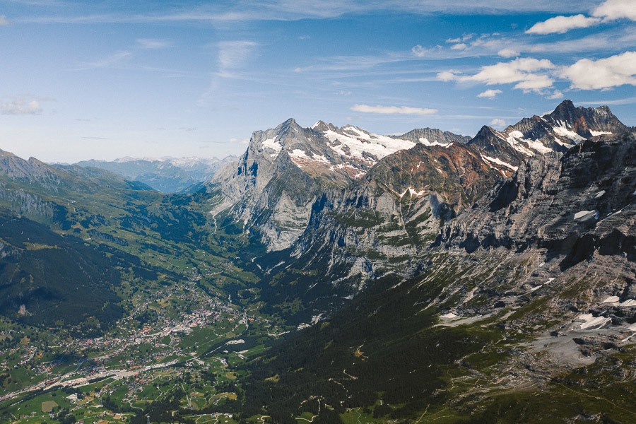
After the viewing point of Eiger, the trail is pretty much all downhill. You will drop about 600m now over the next 4 kilometers as you continue to take in the epic mountains on your right and the small villages in the valley on your left.
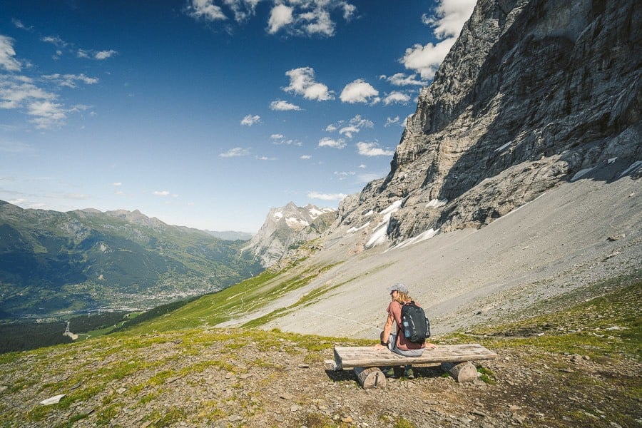
Shortly after the Eiger viewing point is a wonderful bench viewpoint. The Swiss really know how to place a good bench or maybe it’s just there aren’t many bad spots to put a bench in Switzerland. Either way, this is a great spot to relax in solitude and take in the whole region for a few minutes before getting stuck into the second half of the hike.
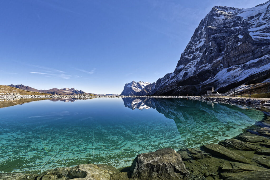
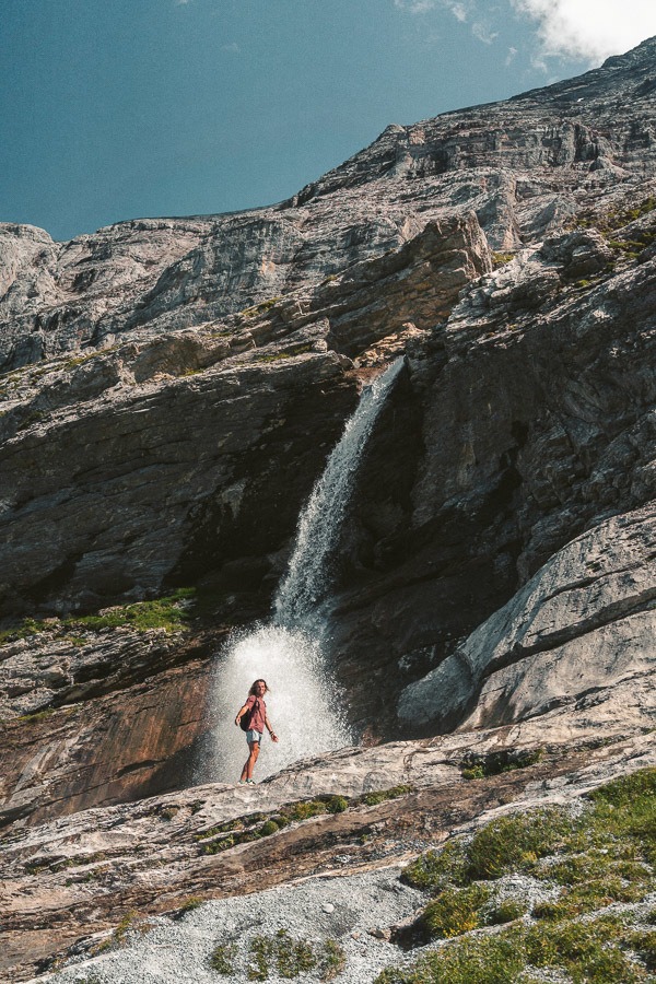
The rest of the trail continues on the gravel track for a couple of kilometers until you reach a point where you will turn left. Shortly after you turn left there was a waterfall plummeting into a pool, which turned into a wild river running through a slot canyon. I’m sure this will look mightily different depending on the time of year you visit but for us it was spectacular!
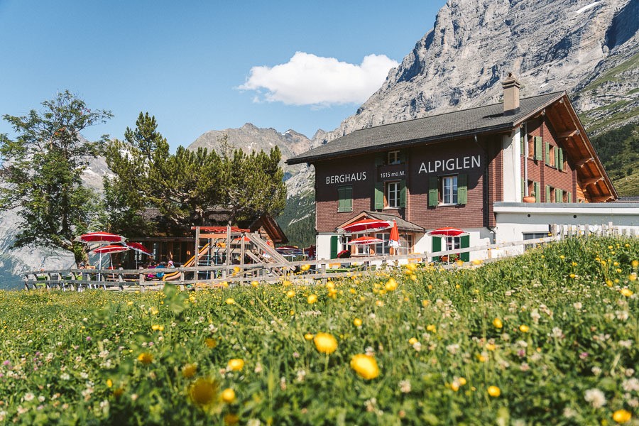
The trail now winds through a series of steep switchbacks dropping several hundred meters of the course of a kilometer before turning you towards Alpiglen Station. You will need to walk through a strategically placed restaurant to reach the station! If you prefer to walk all the way back down to the station, the sign stated it would take 90 minutes to reach Grindelwald from Alpiglen Station. We took the train, which cost us $6 to reach Grund where we completed our loop!
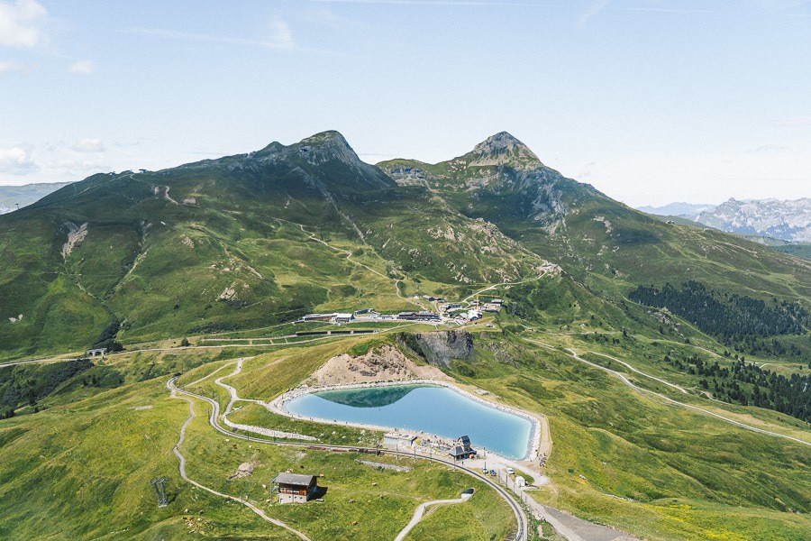
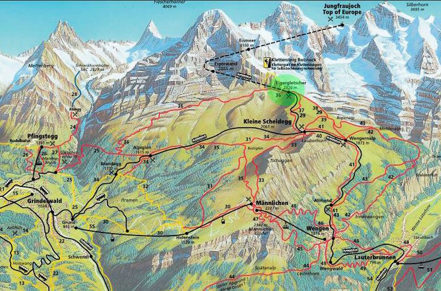
EIGER TRAIL MAP
The map below shows the trails, trains, and cable cars in the Jungfrau region. You can see Eigergletscher, Alpiglen and the Kleine Scheidegg Station.
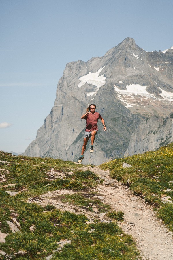
THE EIGER ULTRA TRAIL MARATHON
Each year athletes from all over the world come to Eiger to compete in the Eiger Ultra Marathon. The event began in 2013 and takes runners through some of the most breathtaking viewpoints in the region. Runners pass through popular spots such as Faulhorn, Kleine Scheidegg, and First before the trail runs beneath the Eiger itself.
The race is 101km in length and there is a 6700-meter altitude gain throughout the race. That’s all sounding a little tougher than the 6.5km downward trek of the regular Eiger Trail Hike.
CLIMBING THE NORTH FACE OF EIGER MOUNTAIN
The Eiger first began attracting mountaineers from all over Europe to attempt the North Face, which at the time was known as the ‘last problem of the Alps’. In 1938, Anderl Heckmair, Fritz Kasparek, Ludwig Vörg and Heinrich Harrer finally conquered the climb after spending years tackling the ascent route.
Since then it has been climbed by many, but only experienced climbers. The summit is 3,970 meters. The ascent is only suitable for people with previous rock climbing and mountaineering experience. You will need crampons and an ice axe.
Climbers need to be capable of seconding steep rock pitches in mountain boots while wearing a rucksack. The summit day is very long and can take 10-12 hours, which means you need great fitness and concentration.
If you are an experienced climber and interested in climbing ‘The Eiger’, there are a number of tours available ranging from $2,000 to $4,000 USD depending on the length of preparations necessary.
THINGS TO KNOW ABOUT THE EIGER TRAIL
- Close Encounter with the Eiger North Face: The Eiger Trail offers hikers an up-close view of the Eiger’s famous North Face, an imposing 1,800-meter high wall of rock and ice that’s considered one of the greatest challenges in the world of mountaineering.
- Historical Significance: The trail is of significant historical interest as it runs beneath the Eiger North Face, where many climbers have tragically lost their lives. There are commemorative plaques along the route to honor these individuals.
- Eigergletscher Station: The trail ends at the Eigergletscher railway station, which is the last stop before the Jungfraujoch – Top of Europe station. It’s the highest railway station in Europe.
- Fauna and Flora: The trail offers an opportunity to experience a variety of Swiss Alpine flora and fauna. You might spot chamois, ibex, or marmots, and see diverse alpine plant life.
- Spectacular Views: The Eiger Trail affords stunning views not only of the Eiger’s North Face, but also of the Grindelwald valley and surrounding peaks in the Bernese Alps.
- A Storied Past: The Eiger has a rich mountaineering history, with many stories of heroism and tragedy. The 1938 ascent of the North Face by Anderl Heckmair, Ludwig Vörg, Heinrich Harrer, and Fritz Kasparek is particularly famous, and their route is visible from the Eiger Trail.
SWISS TRAVEL PASS or HALF-FARE CARD
OPTION 1: Buy the Swiss Half Fare Card: Switzerland trains, buses, and cable cars are EXPENSIVE! I found the best way to get around cheaply was to buy the Swiss Half-Fare Card before I arrived. It gives you 50% off every regular train, bus, and even many cable cars. It only costs $150 USD but pays itself off in just a few days with many train tickets in Switzerland costing close to $100 alone. If you are staying for more than 5 days, I suggest buying the Swiss Half-Fare Card.
OPTION 2: Buy the Swiss Travel Pass: The second option is to get the Swiss Travel Pass, which gives you unlimited train, bus, and (many) cable car rides but it’s pretty expensive at around $100 USD per day so if you don’t travel each day it isn’t worth it.
OPTION 3: Buy the FLEXI Swiss Travel Pass: The final (BEST) option is to get the FLEXI Swiss Travel Pass, which allows you to buy 8 days’ worth of transit but you can choose the night before if you want to activate the next day. That way you don’t need to travel every day to get your money’s worth, you can just activate the FLEXI Swiss Travel Pass on the days when you are doing sizeable transits. My advice is to book the Swiss Half-Fare Card or the FLEXI Swiss Travel Pass in advance before your trip so it’s ready to go when you arrive.
GET A SWISS TRAVEL PASS!


Enjoy UNLIMITED train, boat, and bus rides in Switzerland for up to 15 days. Click to book a flex Swiss Travel Pass or choose the Consecutive Swiss Travel Pass.
The Swiss Travel Pass starts at $260 for 3 days. Click here to check if it’s available on your travel dates.
MY SWITZERLAND HIKING GUIDES
I spent 100 days hiking in Switzerland and created a guide for different regions around the country. You can click on one of my Switzerland hiking guides below to help you plan your trip.
- The Complete Guide: 50 AWESOME HIKES IN IN SWITZERLAND
- The Via Ferrata Guide: 4 EPIC SWITZERLAND VIA FERRATA COURSES
- Lauterbrunnen Guide: 10 AWESOME HIKES NEAR LAUTERBRUNNEN
- Interlaken Guide: 15 AWESOME HIKES IN INTERLAKEN
- Grindelwald Guide: 12 AWESOME HIKES NEAR GRINDELWALD:
- Mürren Guide: 7 AWESOME HIKES IN MURREN
- Appenzell Guide: 9 AWESOME HIKES NEAR APPENZELL
- Chur Guide: 7 AWESOME HIKES NEAR CHUR

MY SWITZERLAND TRAVEL TIPS
- For Backpackers: SWITZERLAND BUDGET BACKPACKING GUIDE
- Travel Tips: 20 THINGS TO KNOW BEFORE VISITING SWITZERLAND
- Transport Tips: RENTING AND DRIVING A CAR IN SWITZERLAND
- Accommodation Guide: 30 BEST PLACES TO STAY IN SWITZERLAND

Dave
Wednesday 16th of November 2022
Hi, and thanks for such useful information. We are planning to go to the Jungfrau region in early June next year and I have already found info on a number of hikes we'd like to do (including this one) and had even started booking accommodation. Then last night I stumbled on a Website (swissfamilyfun.com) that said several hikes in the area don't open until mid-June and that this one, the Eiger Hike, doesn't usually open up until July due to snow and it being at a high altitude. Just wondering if you had any info on this because I may have to put our entire month-long Europe trip back a month which is a major headache. Thanks
Kristiina
Saturday 21st of August 2021
I did this hike two days ago and I'd say that it would probably be cooler to go the otherway around - ascend from Grindelwald and end at the Eigergletcher station because then you gradually get closer to the massive Eiger wall and you have it in front of you all the time. On the other hand, it is quite a long way up so if you plan it as your final hike of the trip as I did then going all the way down is definitely easier :) There is now also a gondola from Grindelwald to Eigergletcher, not sure if it was there when you were hiking in the region.
Oh, and once at the wall where there's the info sign, take the small track heading up to the wall (it's the beginning of the via ferrata). It offers amazing views and you get to be very close to the monstrous wall! Just don't get on the via ferrata unless you have the gear...
Jackson
Tuesday 24th of August 2021
Yea definitely interesting to do both ways!
Lise
Sunday 15th of August 2021
We walked this trail today and loved it! So far we are one week down in Switzerland and did quite a few of your recommended hikes! Only one piece of advice for this hike, take the train down from alpligen station..! We hiked down to grindelwald but the path down is mainly on the normal road, next to the railway. And a bit to steep to walk comfortably. Did not actually add anything to the trip, except some extra exercise..
Maarten
Wednesday 24th of June 2020
Hi Jackson,
I just found your site on google while doing some research on trails in Switserland. Great site, fantastic footage and very useful information. Also well done on being able to travel so much and so long! I have been trying to make a choice with regards to the travel options. I do have a car as I am driving to Switserland (the great advantage to living in Europe) but still I feel like I will be needing quite a few trains or gondola's. So I am still trying to decide what pass I would need. I will be in Switserland for 14 days and in that time I am going around to some of the main spots like Grindelwald, Zermatt and places in between. So I can drive in between those places, but at the spots I feel like I will still be needing public transport (including gondolas). Any recommendation? It sounds to me that the month long half price pass might be the best option, but I am still not sure. Any advice? Happy travels!
Jackson
Thursday 25th of June 2020
Hi Maarten,
If you have a car I would definitely use it. Very easy to get around in Switzerland. I had a car for 3 weeks out of my 3 months in Switzerland and it was a great period. It made it easy to park right at the trail, get to and from places for sunrise/sunset without worrying about train and cable car schedules and saved a lot of time. I think it will be cheaper than public transport anyway because the train is so epensive and you can keep a mixture of gear in there. I'd definitely take the car. Keep in mind Zermatt is car-free town so you need to park in the town before and then catch the short train ride there but that is common. You could then get a half-card so you don't need to pay full price for cable cars but lots of cable cars aren't covered by the half-card. make sure to check with the most expensive ones if they accept half card to see if it is worth it.