
If you’re looking for a high-altitude hike with breathtaking views of the Bernese Oberland region in Switzerland, the Schynige Platte Hike to Faulhorn to First trail is a fantastic option. This trail is famous for its panoramic vistas of iconic peaks like Eiger, Mönch, and Jungfrau, as well as stunning Alpine lakes and lush meadows. Beginning at the historic mountain railway station of Schynige Platte, hikers will encounter a diverse landscape, with vibrant wildflowers, charming mountain huts, and even some local wildlife. The trek concludes at First, a summit featuring an adventure park and incredible views, making the Schynige Platte to Faulhorn to First hike a must-do experience for any nature enthusiast visiting Switzerland.
Schynige Platte Hike to Faulhorn to First
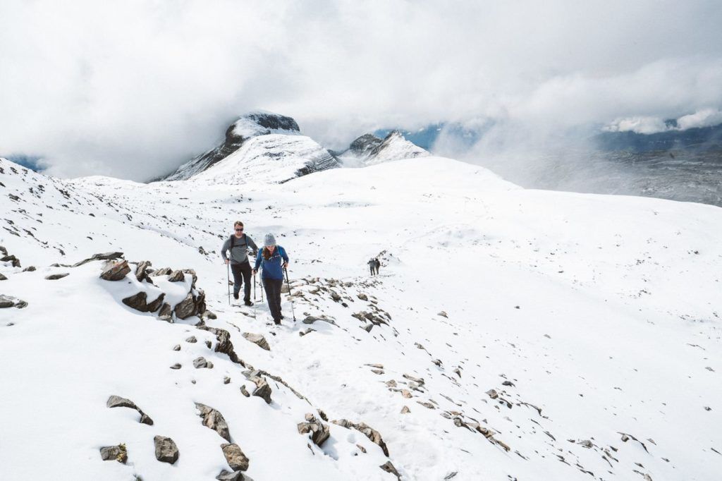
The hike from Schynige Platte to First via Faulhorn is among the top hikes in Switzerland with an epic view around every turn. Expect a long day on the legs with 16km of the trail ahead of you and nearly 1000m of incline. The soup and coffee at Faulhorn with magical views make it all worthwhile and will give you the strength to power to the finish line at First Station.
Schynige Platte Hike Details
- Hike Distance: The total hike distance was 16.2 kilometers, which includes the summit of Faulhorn. Schynige Platte to Oberberg to Loucherhorn to Egg to Faulhorn to Bachalpsee to First.
- Hike Duration: The hike took me a total time of 5 hours. It could be done in a little less time, especially if you don’t summit Oberberg and Faulhorn but that is the whole point of the hike! I’d bargain for 5-7 hours for the total trip and you will enjoy a coffee and soup at Faulhorn and have lots of spare time to enjoy your hike. The main point to remember is that (at least during summer) the last cable car down from First to Grindelwald is at 5:30 so you need to leave from Schynige Platte before midday to make that. If you miss it, there is a 2-hour trail down to Grindelwald that you will have to take on tired legs.
- Hike Difficulty: This route is not extremely difficult with very few areas of concern. While 1000m of incline is substantial, there are no points where the trail is overly exposed. Many parts of the trail are rocky and involve a tiny bit of clambering but you never need to use your hands or climb.
- Hike Incline: Total incline for the day was about 1000m or maybe slightly less. My Garmin ran out of battery but it was meant to be 825m without summiting Oberberg so I would say between 900m and 1000m.
YOU WILL ALSO LIKE MY SWITZERLAND HIKING GUIDE: 50 AWESOME HIKES IN SWITZERLAND
HOW TO GET TO SCHYNIGE PLATTE
It is most likely you are staying in Interlaken if you are doing this hike or at least transiting through if you are staying elsewhere. Therefore, I will give instructions from Interlaken, which is where I was staying.
- First, you need to get from Interlaken to Wilderswil. This is accessible by train from Interlaken West and/or Interlaken Ost. It is a very short trip.
- Secondly, you will now need to take the Schynige Platte Bahn from Wilderswil to Schynige Platte. This is a very historic, old-style train and for that reason, it is also quite slow. The entire journey aboard the Schynige Platte Bahn took 45-mins as we crawled up the mountain. It was a scenic ride but make sure you factor that into your starting time because you need to finish in first before 5:30 for the last cable car down to Grindelwald. Expect about 60-90 minutes from Interlaken to Schynige Platte including wait times so leave no later than 9 am from Interlaken to be safe.
- At Schynige Platte, there are many signs pointing you to Oberberg and then, from there onwards to Faulhorn and First. As always, the trail is signed well so once you get off the train, head up into the alpine garden over the hill and towards Oberberg.
If you have the Swiss Half-Card you will receive a huge discount on your tickets. I bought mine when I arrived in Switzerland and it has saved me over a thousand dollars.
MY DRONE VIDEO FROM SCHYNIGE PLATTE HIKE TO FIRST
I made a little drone video from the peaks and ridges along the route. I hope you enjoy it.

SCHYNIGE PLATTE HIKE: MY EXPERIENCE
The hike from Schynige Platte to First via Faulhorn is among the top hikes in Switzerland with an epic view around every turn. Expect a long day on the legs with 16km of the trail ahead of you and nearly 1000m of incline. The soup and coffee at Faulhorn with magical views make it all worthwhile
I began my day in Interlaken so that meant I had to walk to Interlaken West train station and catch the train to Wilderswil. Once at Wilderswil, I waited for the Schynige Platte Bahn. It’s a historic train and I think many of the tourists caught it up to Schynige Platte and went for a wander before catching it back down as a bit of a mountain experience.
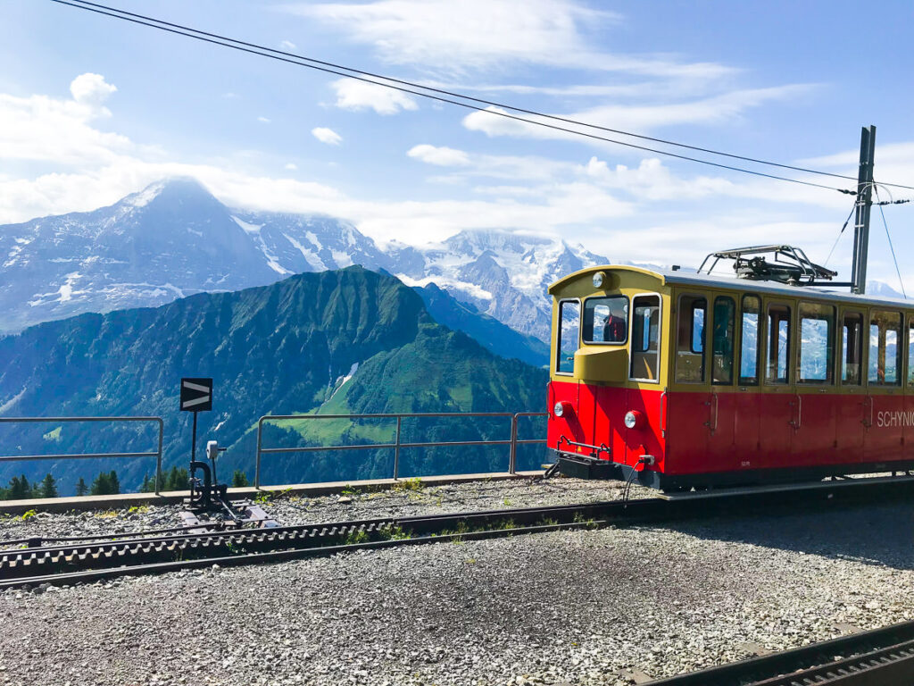
This train took so long. Many trains and cable cars in Switzerland claim to be the steepest or oldest but the Schynige Platte Bahn has surely got to be the slowest. It’s very old and has old-style carriages, which is cool but it’s definitely not built for speed. I was in no rush but 45-mins for 4-5kms is still notable!
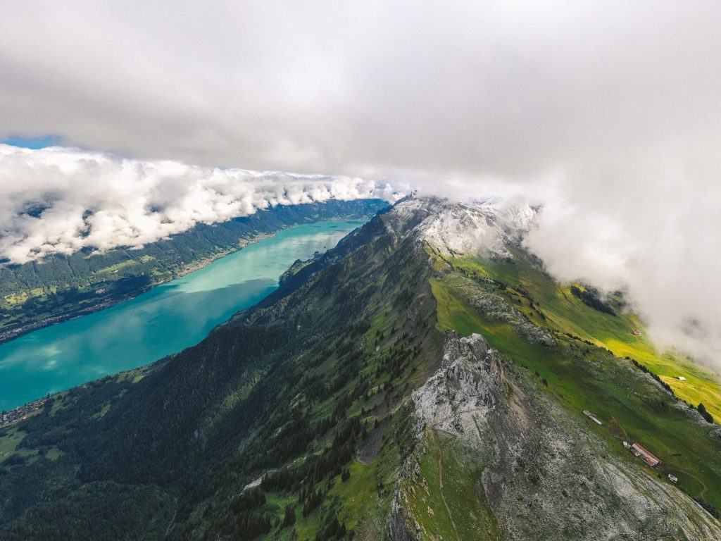
When we reached the Schynige Platte summit station there were quite a lot of signs. In fact, there were several signs pointing in different directions for First, Faulhorn, and Oberbeghorn. Essentially, it doesn’t matter which one you take but the best way is to head up onto the hill and through the alpine garden. This route takes you to Oberberghorn with a scenic view of Lake Brienz the whole way.
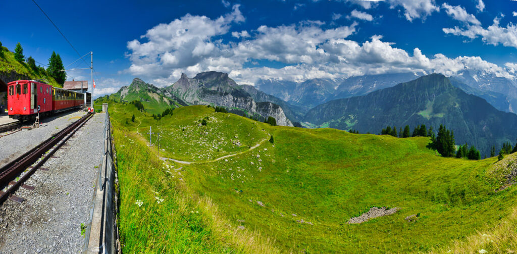
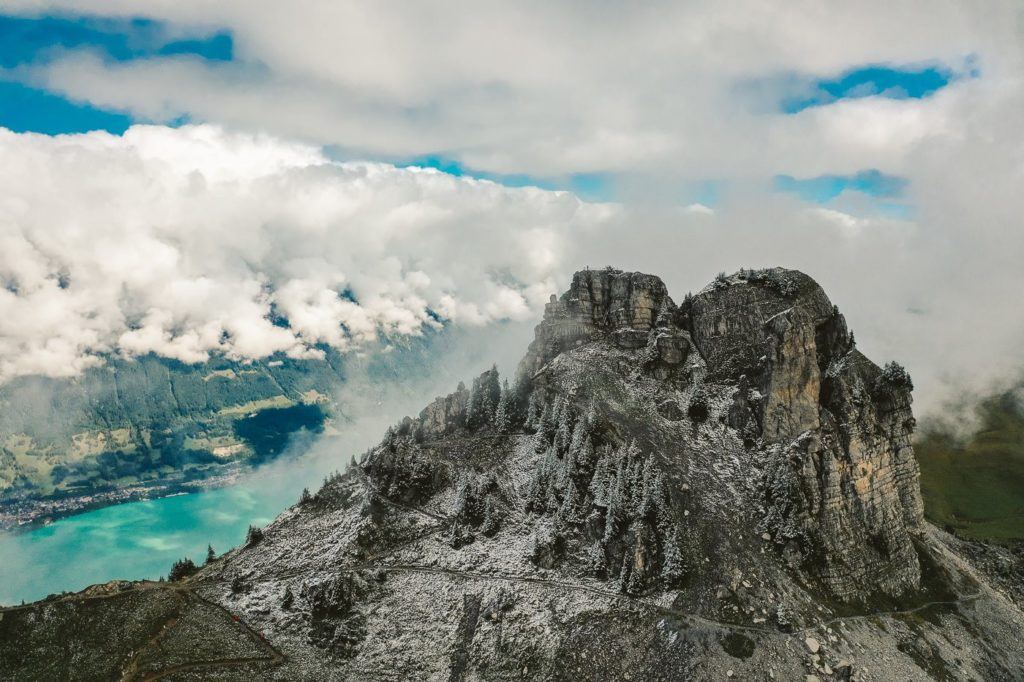
The trail sits on the edge of the ridge for the first part of the hike, which means you can look over to the Hardergrat Ridge as you go. It’s not part of the trail to climb up onto the Oberberghorn but I highly recommend it.
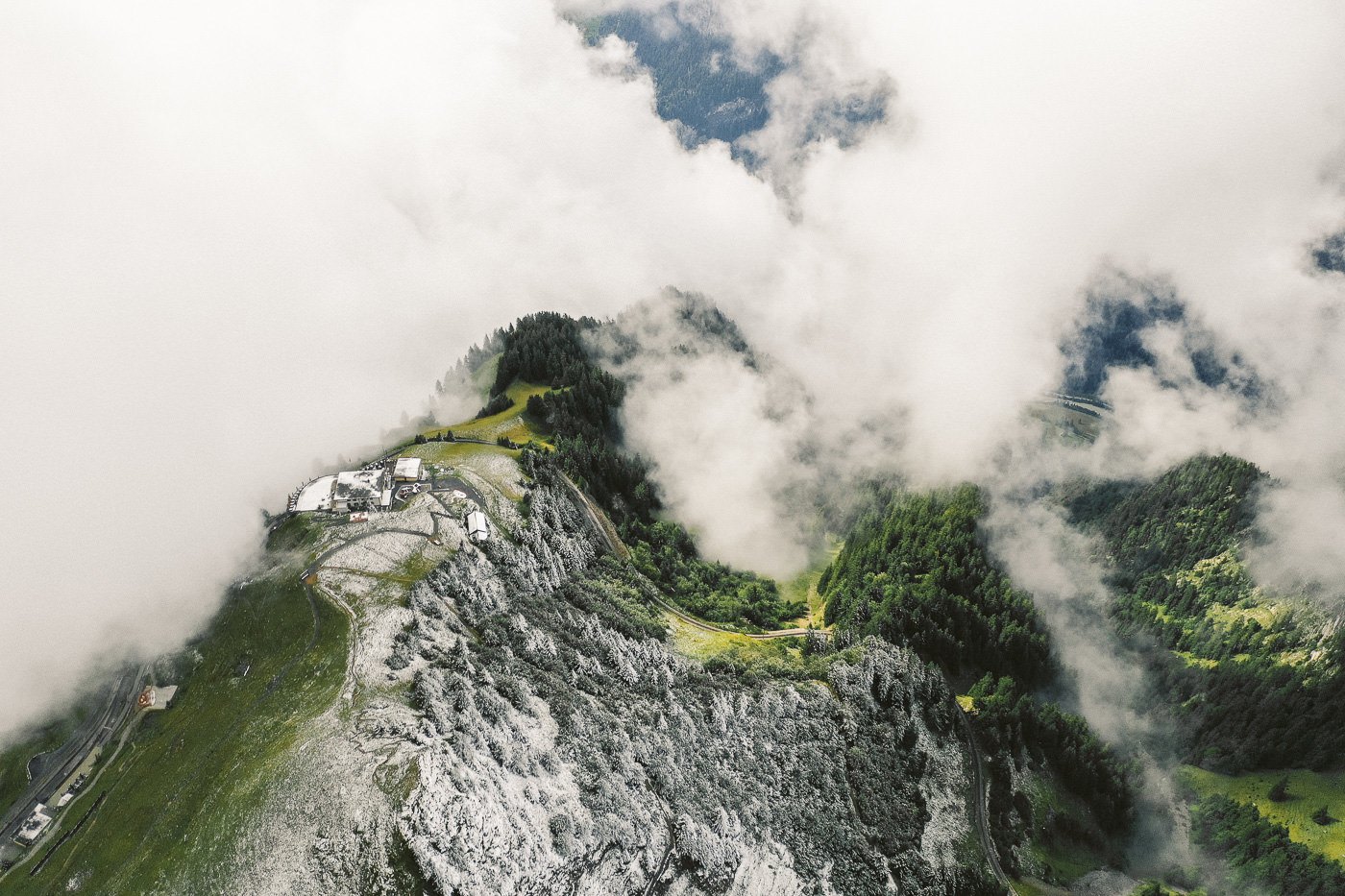
For me, it was the best view of the entire trail and no one else came up on top. I just sat up there taking it in for about half an hour before flying my drone. It takes a little effort to get up and there are a few sets of stairs but it is only about a 15-minute journey to the top.
From the top of Oberberghorn, you can see all the way back down to Interlaken, Lake Brienz, Hardergrat, Augstmatthorn, and all the way down to Brienz. There is a small platform on top and it has got to be one of the best views in the Interlaken region.
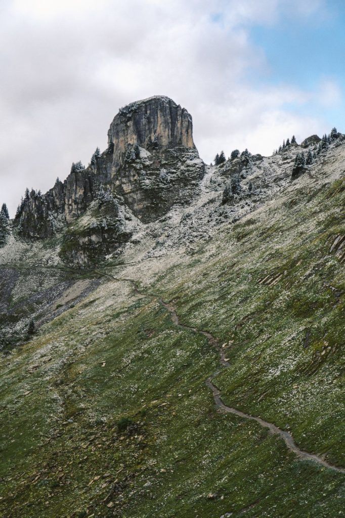
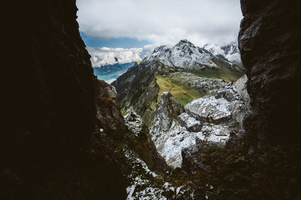
Halfway up the climb to Oberberghorn is an epic little viewpoint that lets you peak out through the gap towards the trail you are about to walk down. It had just been snowing so I was treated to a winter wonderland out of my little window
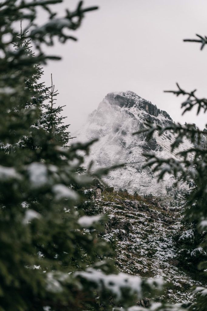
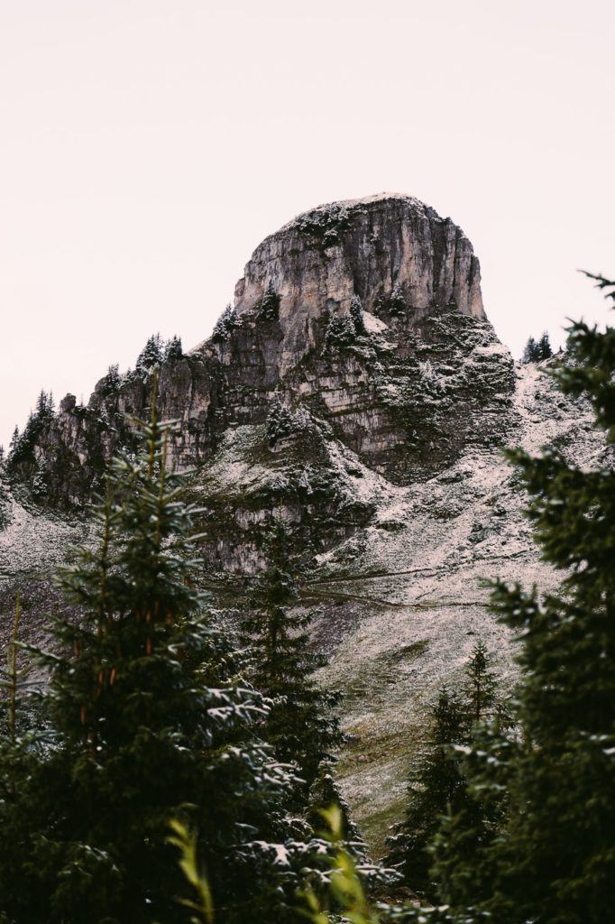
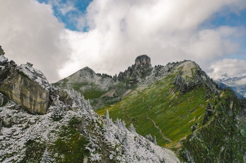
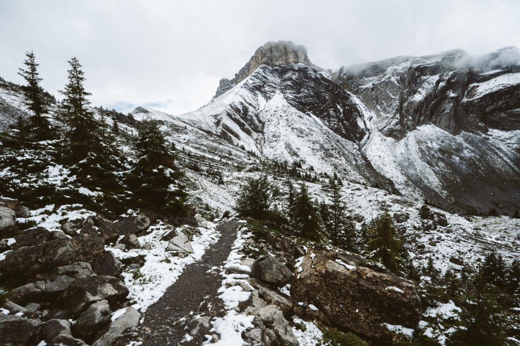
Moving on from Oberberghorn, the trail leads you along a relatively easy but undulating trail. A backdrop of epic cliffs is a constant as you navigate your way following the red and white signs. During this part of the trail, there isn’t too much need to stop, the path is flat enough that you can take in your surroundings while walking and make some good time (that you lost admiring the view at Oberberghorn!)
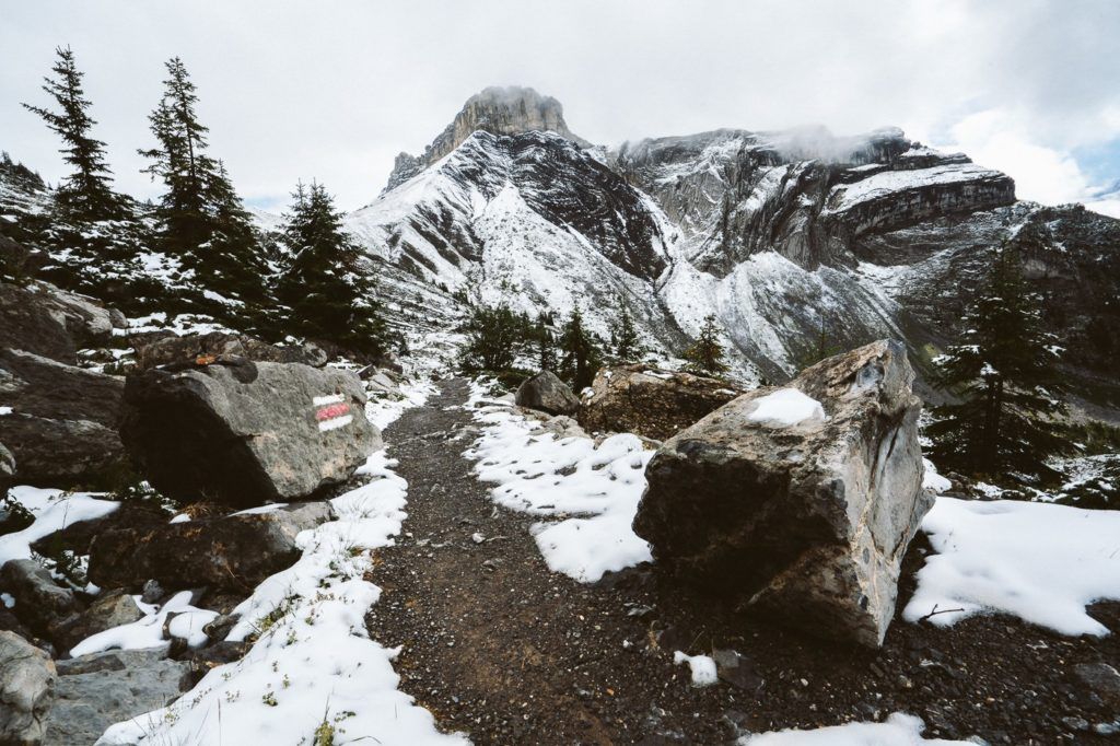
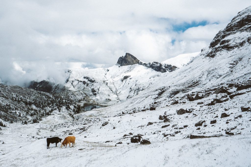
The trail became quite snowy at this point and a sea of white greeted me as I turned a corner and the entire trail opened up. A few cows were the only ones to share this section of the trail with me, although I could make out a few tourists down at the lake.
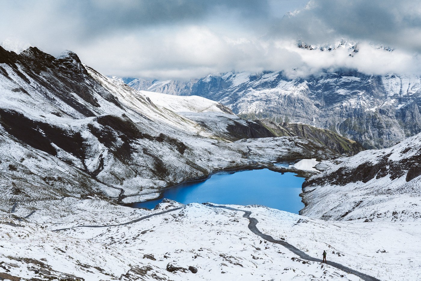
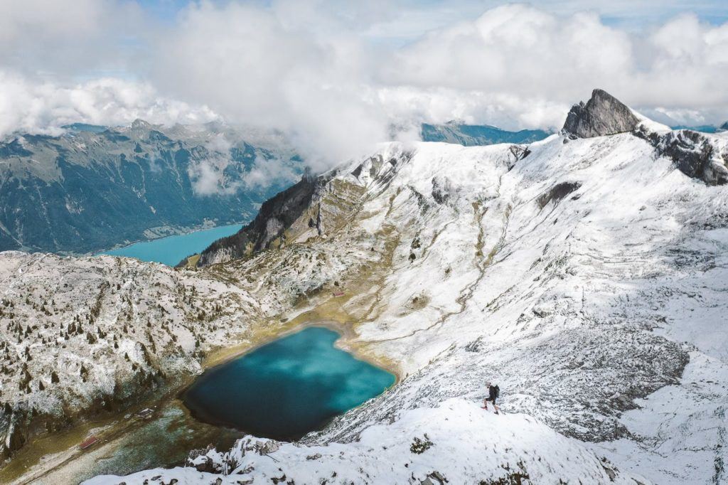
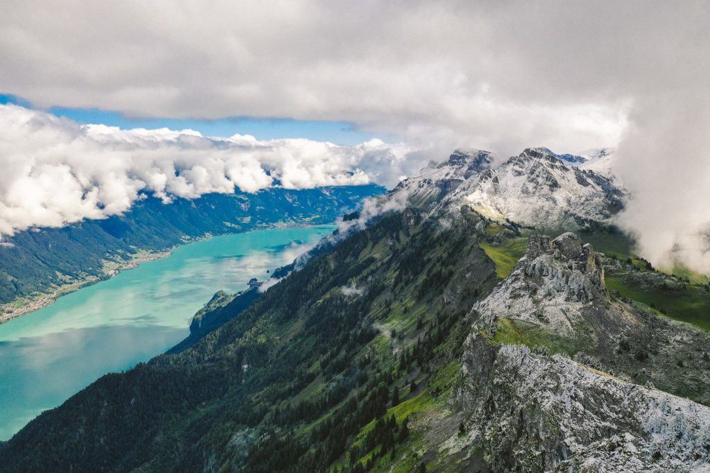
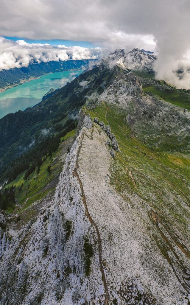
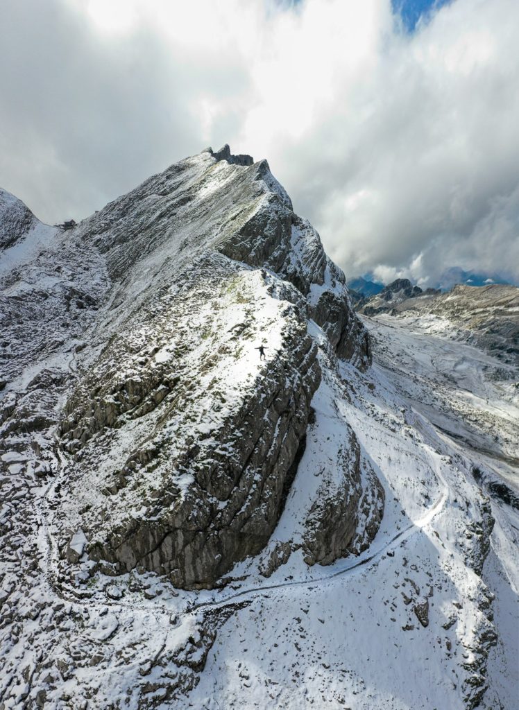
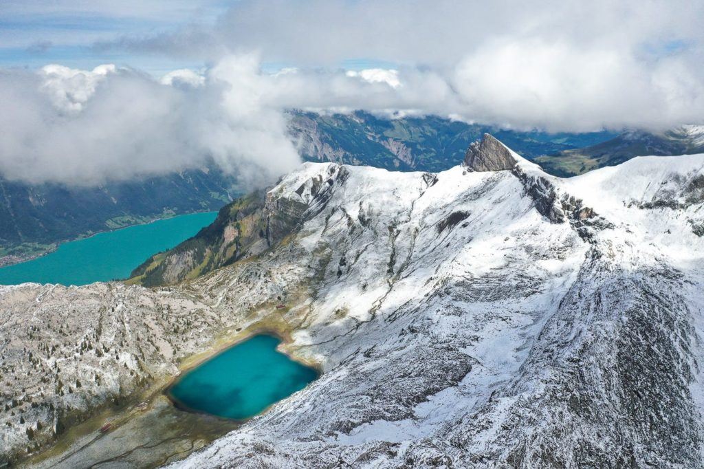
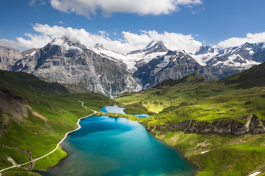
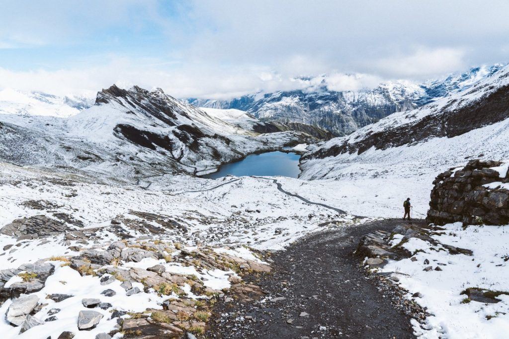
As you make your way along the Sagissa ridge, you will get a great view of the Sagistalsee (alpine lake) below. It’s quite a remarkable view because on a clear day like I had you can see the lake but also the vibrant blue of Lake Brienz in the background. I climbed a little ridge here for a great vantage point of the whole scene! You can spot me on the ridge in the photo below.
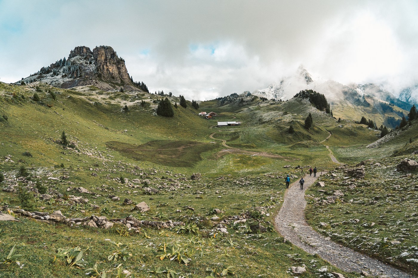
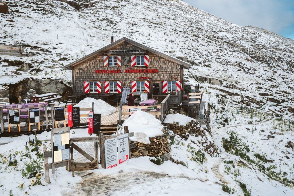
After passing above the Lake you are heading on towards the Manndlenen mountain lodge where you may want to stop for a coffee before marking the charge up the hill. This section of the trail is probably the steepest as you bust your way up to Faulhorn but still, it’s nothing crazy and the grade isn’t too bad. Below you can see the Manndlenen hut wedged in the gap in the mountains.
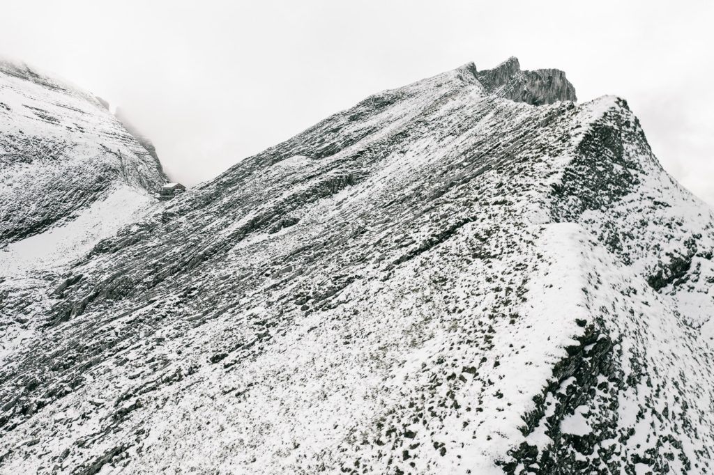
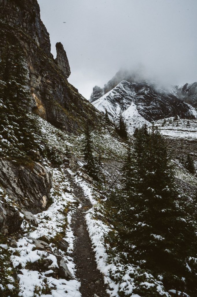
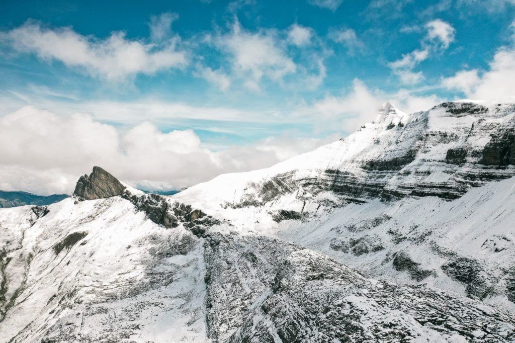
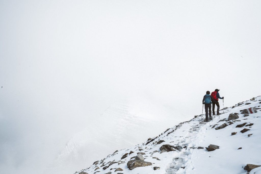
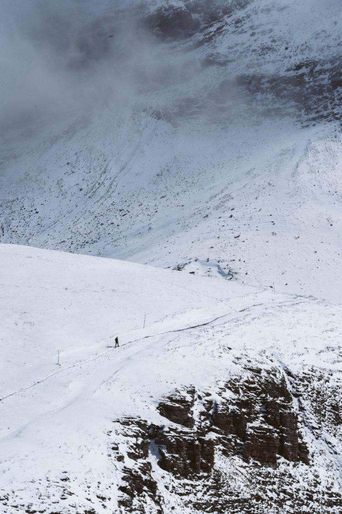
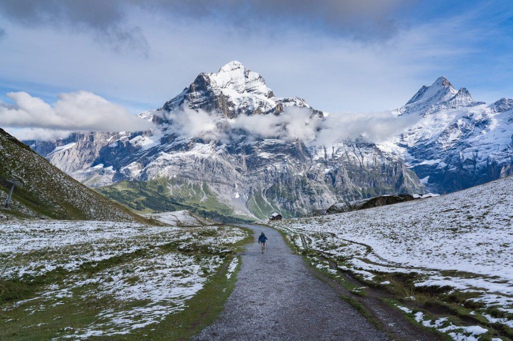
Time to climb! Up you head to Faulhorn Summit. Don’t forget to keep looking back over your shoulder because the view just keeps getting better and better. The path here was almost all snow for me but in the summer it will be a dirt/rocky path. Make sure to check the weather and plan accordingly. This part of the trail provided some great views and I really enjoyed this little climb.
Faulhorn Summit is brilliant. It has a little hill with 360-degree views, dormitories, and a great restaurant. I had a coffee and a pea soup with bread, which kept me warm and rejuvenated me for the climb down. It would be epic to stay up here one night and watch the sunset and sunrise but on this occasion, I had time for a quick soup before scurrying down to make sure I didn’t miss the last cable car at 5:30 pm.
I began the hike down, which should take about 1.5 hours, and it was quite interesting because I had done this trail previously. I hiked from First to Faulhorn back in the summer when it was green, and sunny and I even swam in the lake! On this occasion, I was walking through snow!
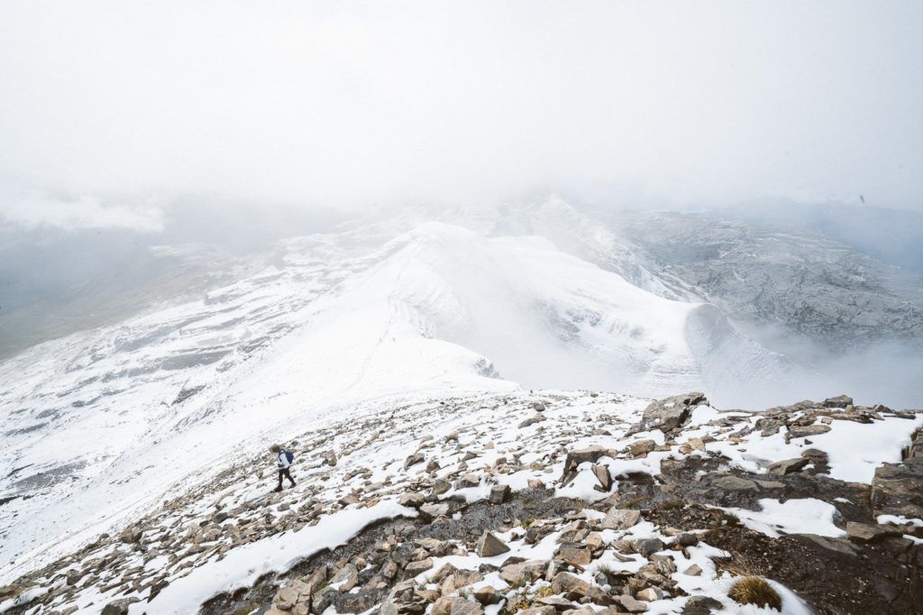
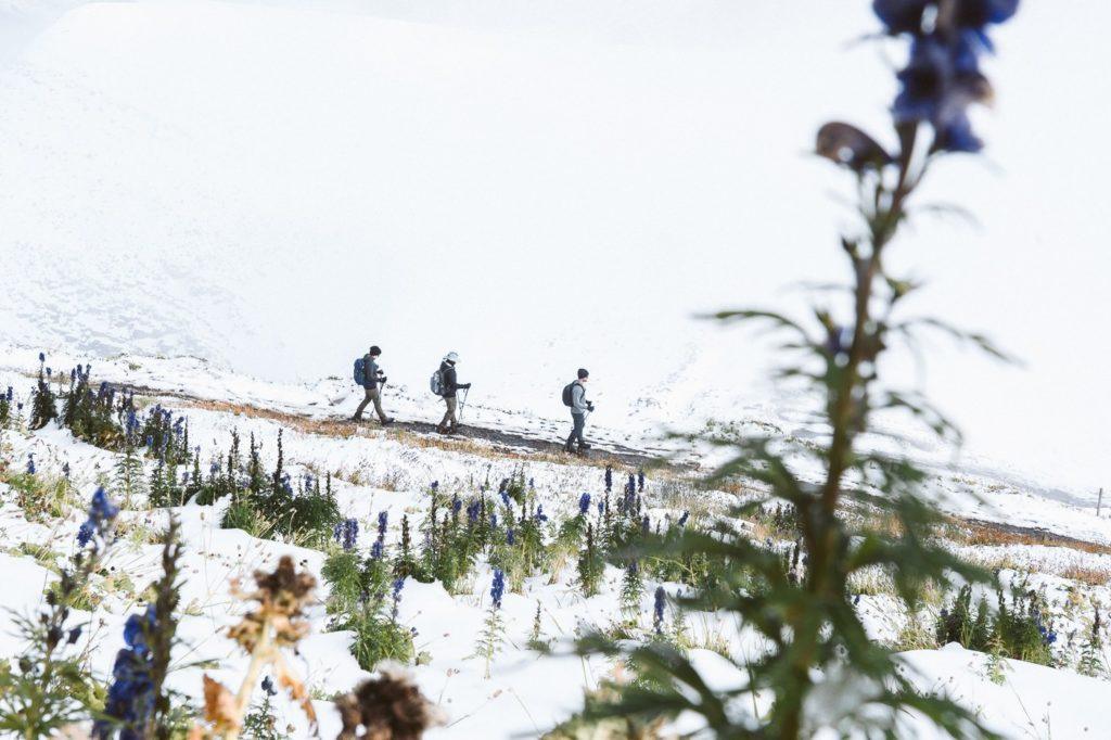
I shot a few of the other hikes on my way down, which has become quite a skill of mine as I hike solo a lot and often like to stalk another hiker to use them as a scale reference in my photos. I don’t get to place them in a perfect position or ask them to stand on top of a ridge. I just shoot them where they are walking and they have no idea. Here are a few of the shots I took (of people I don’t know) on the way down to Bachalpsee.
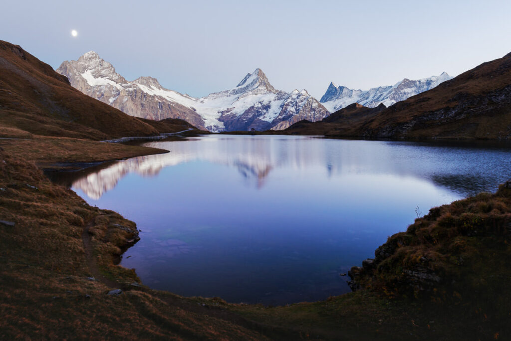
Once you reach Bachalpsee, you know you have less than one hour to go. It’s a nice smooth trail from this point on and you have an absolutely epic backdrop the whole way back if the clouds cooperate. It’s crazy to think how different the landscape can look just 30 days apart. Here’s a photo from my previous visit to Bachalpsee.
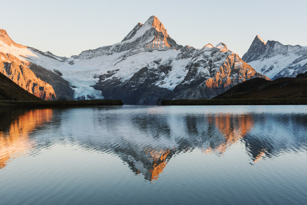
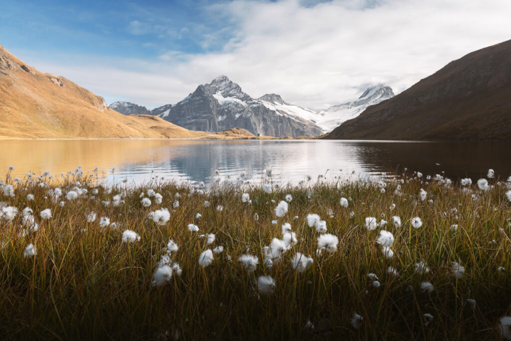
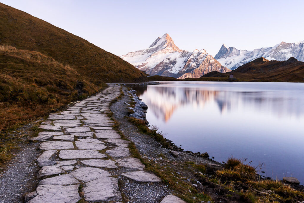
From Bachalpsee to First, you have a simple one-hour walk down the hill. If you are in a rush to make the last cable car, you could power-walk it in thirty minutes. The journey from Bachalpsee to First is another stunning part of the trail.
ARRIVING AT FIRST STATION
At First Station, it will likely be chaotic with tourists everywhere. Anywhere in Switzerland that is accessible by cable car brings with it the hoards of summer tourists that don’t like hiking but want the views. First Station is no exception and actually encourages these types of tourists with attractions at their station such as a traditional Swiss-style restaurant where you can grab lunch before heading out on the hike to Bachalpsee.
There is also a pretty epic viewing point called the First Cliff Walk. This cliff-walk (albeit touristy) is actually pretty cool, and for me to admit that given how touristy it seems is tough. The railed walkway winds along the edge of the cliff, as you walk seemingly on a suspended path until you reach the big ‘cliff walk’.
The railed, walkway winds along the edge of the cliff, as you walk seemingly on a suspended path until you reach the big ‘cliff walk’. Here you venture out onto a platform, almost walking the plank pirate-style. You can see through the floor and of course, enjoy the incredible views all around you if you can’t bear to look at the giant drop below you.
There is also a zipline and other activities at the top of First including the option to Go-Kart or Scooter back down the hill instead of taking the cable car.

I hope you enjoyed this guide to the Schynige Platte to Faulhorn to First hike.
SWISS TRAVEL PASS or HALF-FARE CARD
OPTION 1: Buy the Swiss Half Fare Card: Switzerland trains, buses, and cable cars are EXPENSIVE! I found the best way to get around cheaply was to buy the Swiss Half-Fare Card before I arrived. It gives you 50% off every regular train, bus, and even many cable cars. It only costs $150 USD but pays itself off in just a few days with many train tickets in Switzerland costing close to $100 alone. If you are staying for more than 5 days, I suggest buying the Swiss Half-Fare Card.
OPTION 2: Buy the Swiss Travel Pass: The second option is to get the Swiss Travel Pass, which gives you unlimited train, bus, and (many) cable car rides but it’s pretty expensive at around $100 USD per day so if you don’t travel each day it isn’t worth it.
OPTION 3: Buy the FLEXI Swiss Travel Pass: The final (BEST) option is to get the FLEXI Swiss Travel Pass, which allows you to buy 8 days’ worth of transit but you can choose the night before if you want to activate the next day. That way you don’t need to travel every day to get your money’s worth, you can just activate the FLEXI Swiss Travel Pass on the days when you are doing sizeable transits. My advice is to book the Swiss Half-Fare Card or the FLEXI Swiss Travel Pass in advance before your trip so it’s ready to go when you arrive.
GET A SWISS TRAVEL PASS!


Enjoy UNLIMITED train, boat, and bus rides in Switzerland for up to 15 days. Click to book a flex Swiss Travel Pass or choose the Consecutive Swiss Travel Pass.
The Swiss Travel Pass starts at $260 for 3 days. Click here to check if it’s available on your travel dates.
MY SWITZERLAND HIKING GUIDES
I spent 100 days hiking in Switzerland and created a guide for different regions around the country. You can click on one of my Switzerland hiking guides below to help you plan your trip.
- The Complete Guide: 50 AWESOME HIKES IN IN SWITZERLAND
- The Via Ferrata Guide: 4 EPIC SWITZERLAND VIA FERRATA COURSES
- Lauterbrunnen Guide: 10 AWESOME HIKES NEAR LAUTERBRUNNEN
- Interlaken Guide: 15 AWESOME HIKES IN INTERLAKEN
- Grindelwald Guide: 12 AWESOME HIKES NEAR GRINDELWALD:
- Mürren Guide: 7 AWESOME HIKES IN MURREN
- Appenzell Guide: 9 AWESOME HIKES NEAR APPENZELL
- Chur Guide: 7 AWESOME HIKES NEAR CHUR

MY SWITZERLAND TRAVEL TIPS
- For Backpackers: SWITZERLAND BUDGET BACKPACKING GUIDE
- Travel Tips: 20 THINGS TO KNOW BEFORE VISITING SWITZERLAND
- Transport Tips: RENTING AND DRIVING A CAR IN SWITZERLAND
- Accommodation Guide: 30 BEST PLACES TO STAY IN SWITZERLAND

Polly
Sunday 23rd of March 2025
Is this hike an option mid may ?
Dayrn
Saturday 3rd of June 2023
Great stuff. If I got on the first train to Schynige Platte and wanted to do Schynige Platte to Faulhorn First trail, will this cover the panorama or part? If not, is it feasible to do both and still make the last first train down? Any advice would be great.
Jackson
Sunday 18th of June 2023
Yes I believe so.. you will start the hike from Schynige Platte and hike to Faulhorn, down to first, then down to Grindelwald. Depends on your speed just check first and last train time.
Jacob
Thursday 16th of June 2022
Hi, what part of this hike would you consider as the nicest? Ideally, I would want to take the same cable car up and down for car logistics. Does the area around Schynige Platte have better views than First? Let me know if you have any trail suggestions. Thanks in advance!
Jill
Monday 4th of April 2022
Hello! This trail looks amazing. Is it open 365 days, throughout the year? I am visiting in early May and understand that some hiking trails will be closed.
Kristiina
Saturday 21st of August 2021
A quick update to those planning the hike for the current hiking season - the access to the Oberberg is closed due to, I'd assume, some broken ladder and there's no indication to when it will be fixed. I was there just a few days ago and sadly could not go and enjoy those epic views but otherwise this hike truly is amazing. Even if the clouds stop you from seeing the full panorama, as was my case, the terrain and flowers are beautiful.