
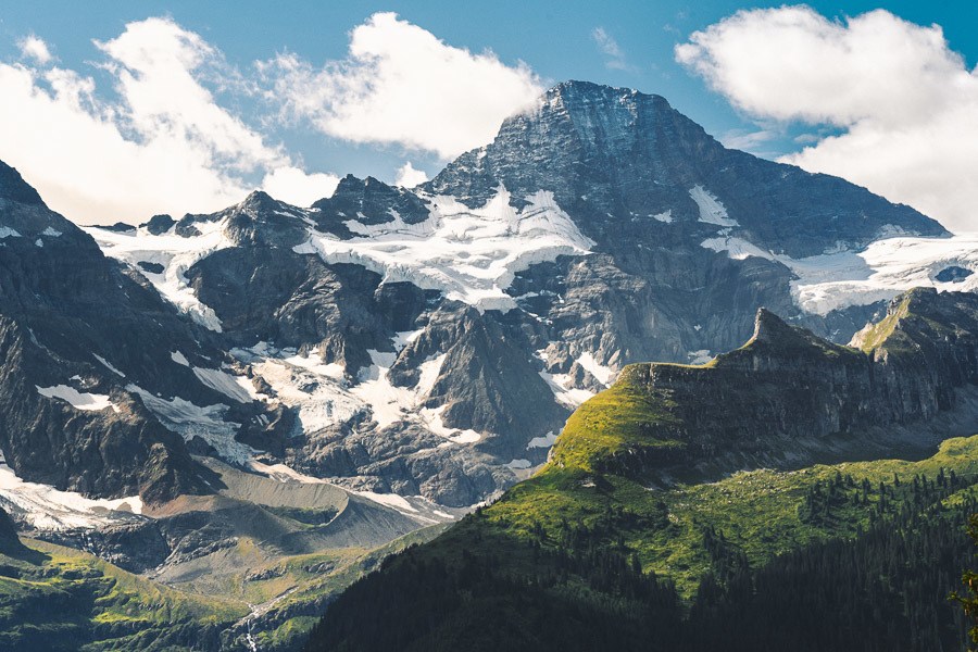
Tanzbodeli is one of my favorite hikes in the Lauterbrunnen region because it provides the best 360 degrees of the entire mountainscape. On a clear day, it feels as though you are at the center of the Jungfrau region and you can see all of the glacier-laden peaks. On a gloomy, cloudy day, it is equally impressive as you are seemingly inside a cloud, on top of the world. We had bits of both on our journey to Tanzbodeli and Obersteinberg from Gimmewald.
TANZBODELI & OBERSTEINBERG HIKE
- Hike Distance: 13.9km Total distance from Gimmelwald to Tanzbodeli to Obersteinberg to Stechelberg. The total distance from Gimmelwald to Tanzbodeli was 6 steep kilometers in 2 hours.
- Hike Duration: 4 hours of moving time but the total time was 7 hours including an hour at the summit, an hour at the Obersteinberg Hotel, and other stops.
- Hike Difficulty: The trail is not technically difficult although there are parts where you will clamber up rocks. No drop-offs are ever apparent on either side of the trail. Dirt path most of the way. Relatively simple hiking although the incline is quite steep and air does get thin. Physically challenging but relatively safe.
- Hike Incline: Total elevation throughout the hike is 1100 meters.
YOU WILL ALSO LIKE MY SWITZERLAND HIKING GUIDE: 50 AWESOME HIKES IN SWITZERLAND
HOW TO GET TO TANZBODELI HIKE
The hike to Tanzbodeli can start from Stechelberg or Gimmelwald (among other various points making it shorter or longer), which are the two most popular spots to begin the trail. We began in Gimmelwald by catching the Schilthornbahn up to Gimmelwald and that still gave us 1100-meters of elevation for the day. This was an enjoyable distance and elevation throughout this hike, so I would suggest this starting point also.
I’ve attached my GPX map below, which you can download here for use on your Garmin, smartwatch or another app.
MY EXPERIENCE HIKING TO TANZBODELI & OBERSTEINBERG
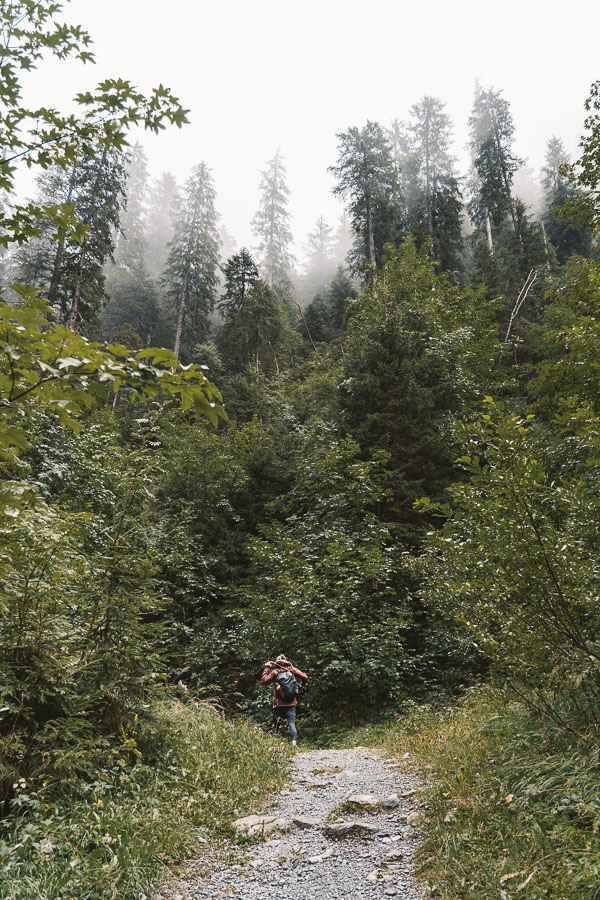
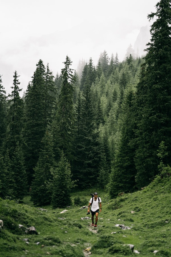
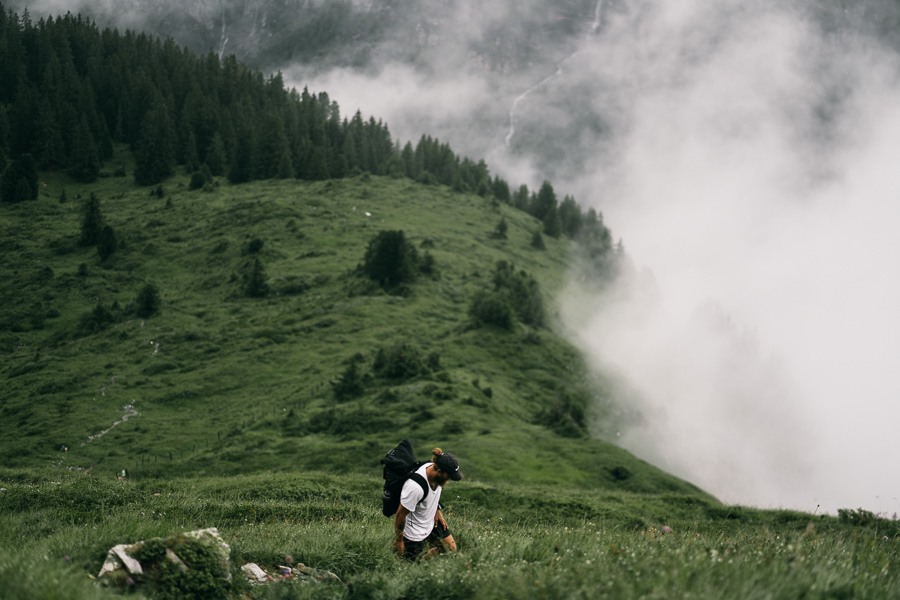
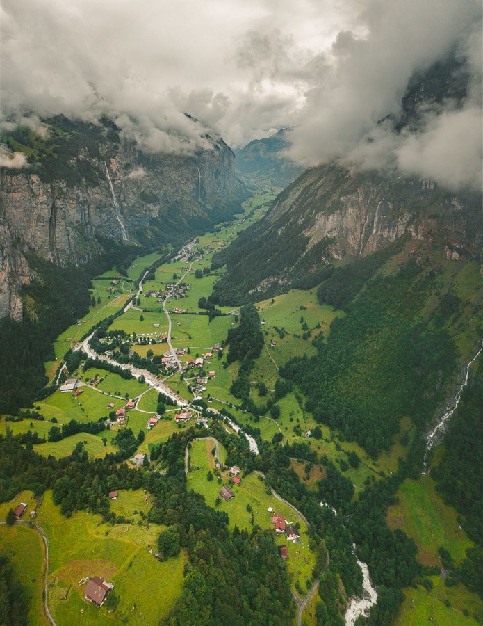
The hike from Gimmelwald to Tanzbodeli has a bit of everything. You start in the dense forest before emerging onto the lush green hills to ascend up to the ‘dance floor’ as it’s called. Here you have a huge plateau that sits beneath the Spitzhorn and has 360-degree views of the Jungfrau region. On one side sits the Sefinen Valley while on the other side, you stare down a huge drop-off into Lauterbrunnen.
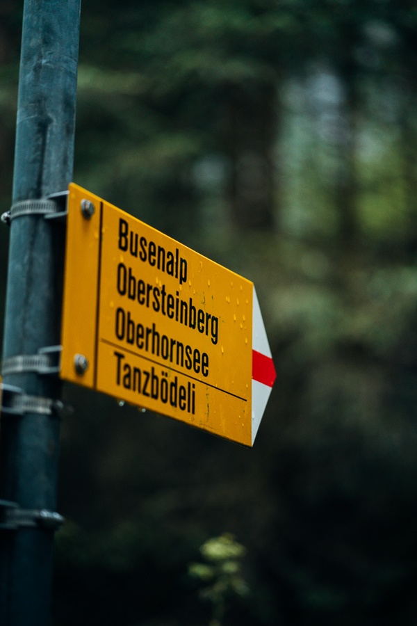
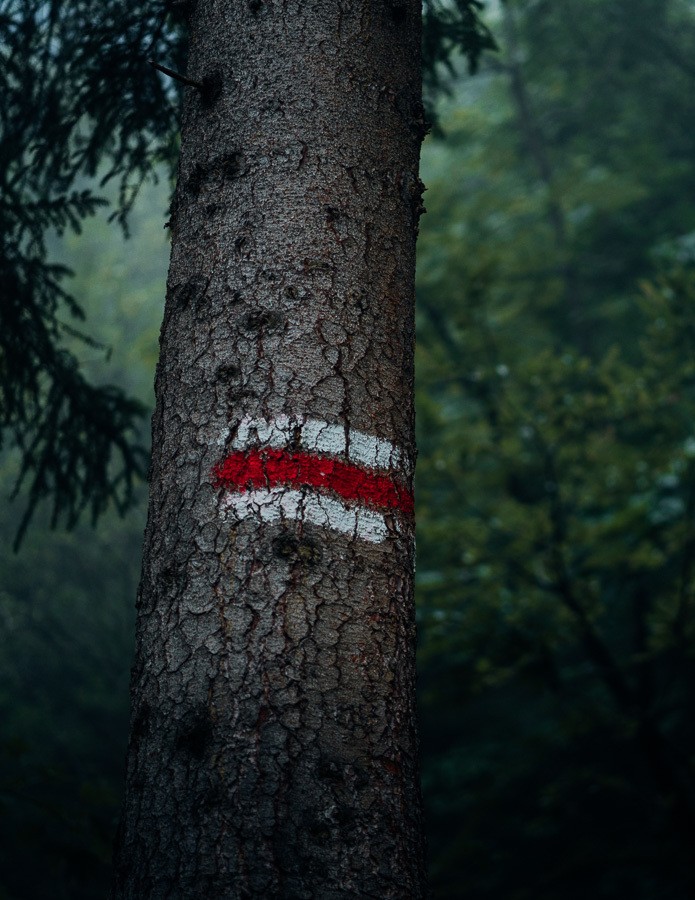
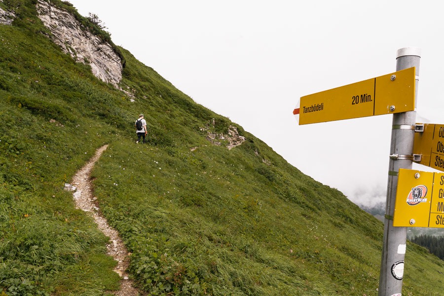
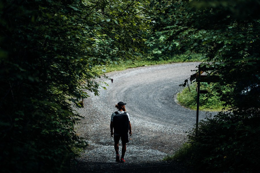
We began the day in the town of Wengen and caught a train to the Murren Schilthorn Bahn before riding that to Gimmelwald. We started early, arriving at Gimmelwald by 7 am. It seemed no-one was awake. We didn’t see a single person as we walked through Gimmelwald and began the trail, following the signs to Busenalp and Obersteinberg. You can follow the Obersteinberg signs the whole way as only sporadically did we see Tanzbodeli on the yellow signs.
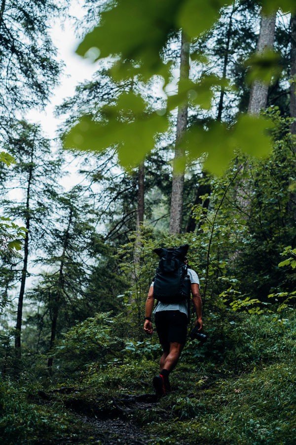
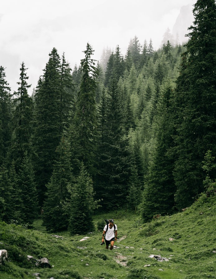
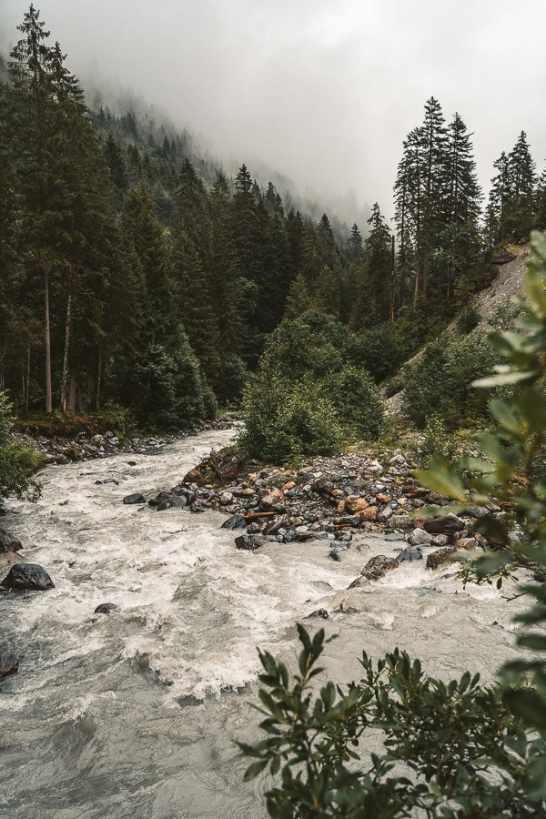
The trail begins with a small descent out of Gimmelwald down to the raging river below. We crossed the river over a small wooden bridge and said goodbye to the descent. It was time to climb. Over the next few kilometers, we made our way through the forest and put in a couple of hundred vertical meters per kilometer in distance traveled. It was steep. By the time we had left the forest, we still hadn’t seen another person or even an animal for that matter. It was a gloomy, strange atmosphere.
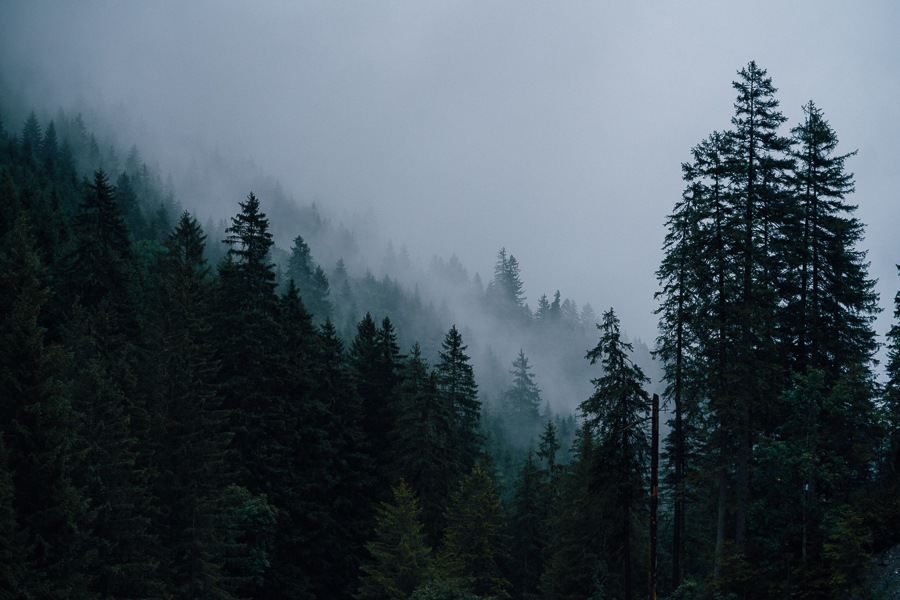
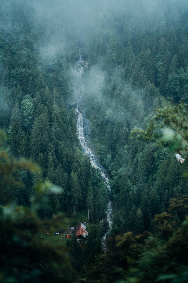
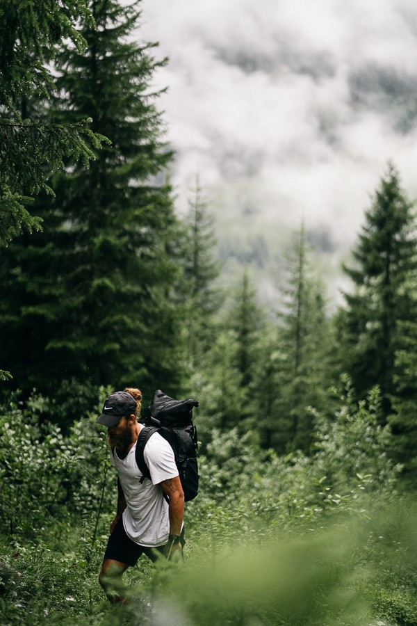
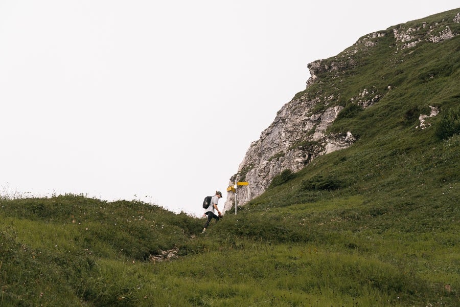
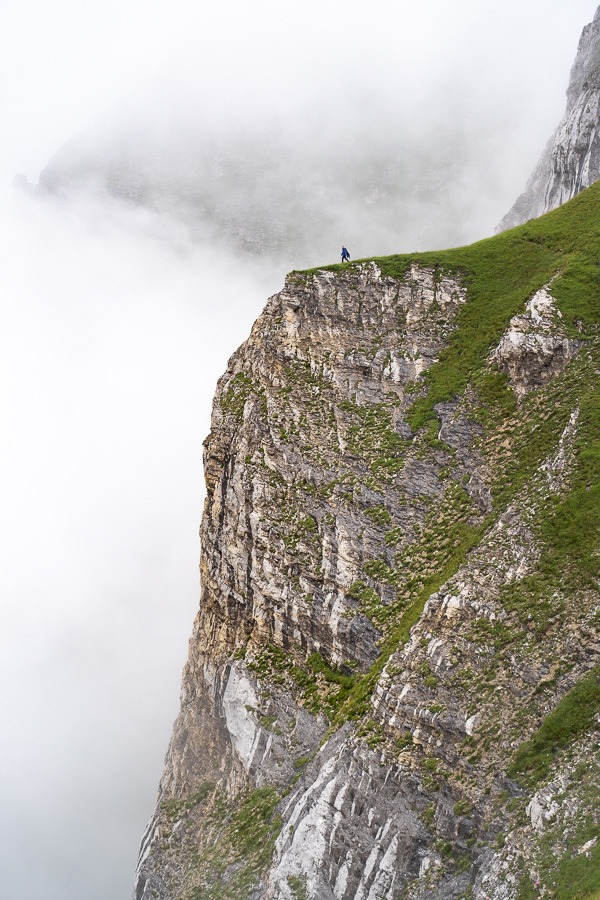
We were now out of the forest and making our way up the mountain of a hill in front of us. It was a little intimidating to look up to be honest. Bit by bit we made our way up the steep ascent to Tanzbodeli. The final part of the climb was a bit of a scramble but there was always some sort of path… even if at times it was more rock than path.
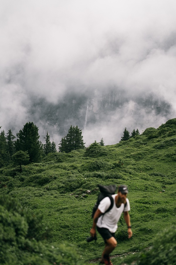
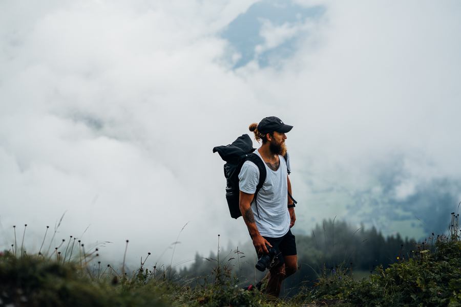
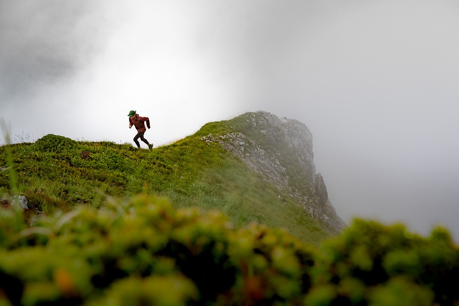
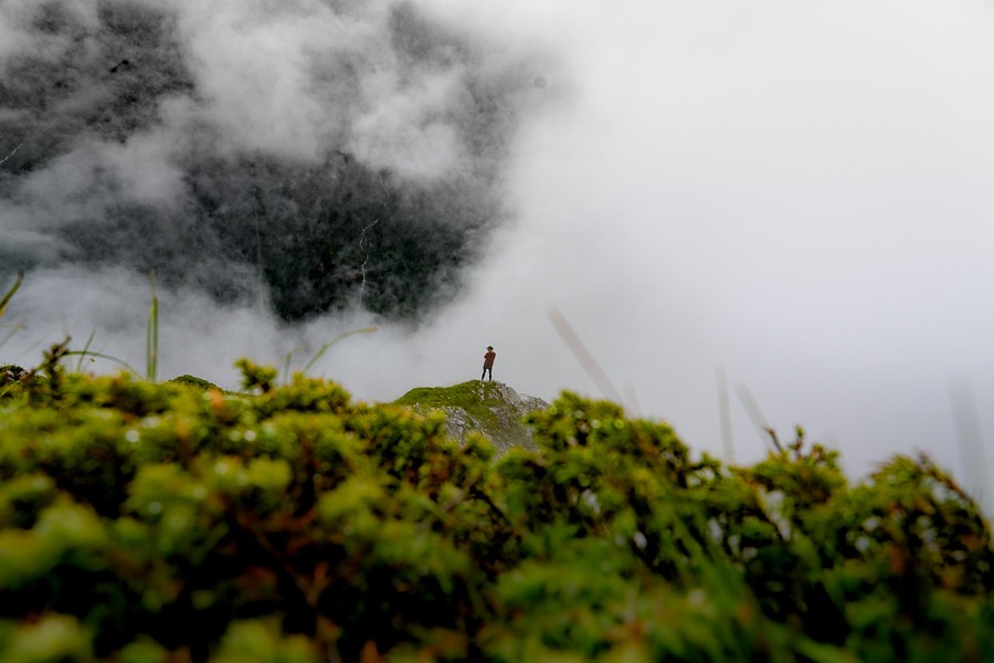
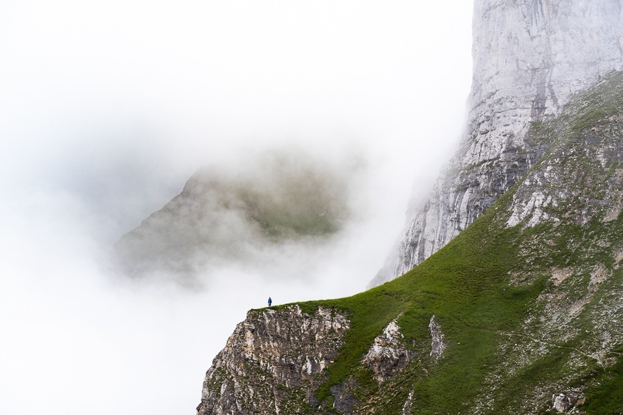
Finally, we had reached the summit, but we were inside a cloud. It was actually kind of cool as the atmosphere was incredible. We were the only ones in Jungfrau it seemed and we had no idea what the view looked like. We would find that out later on as the clouds cleared the following day to reveal the incredible view you can get from Tanzbodeli.
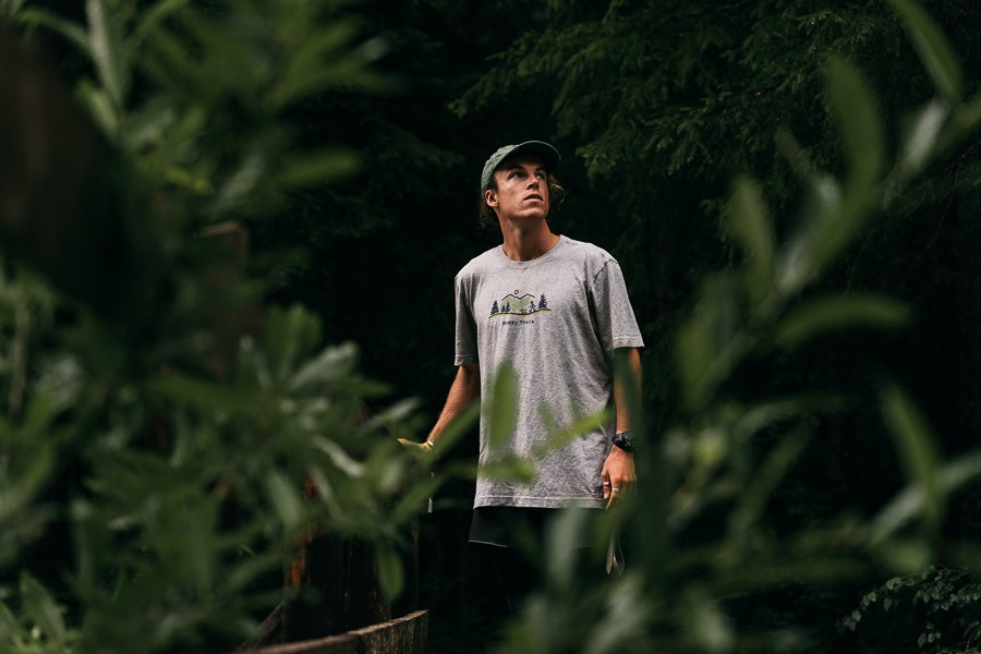
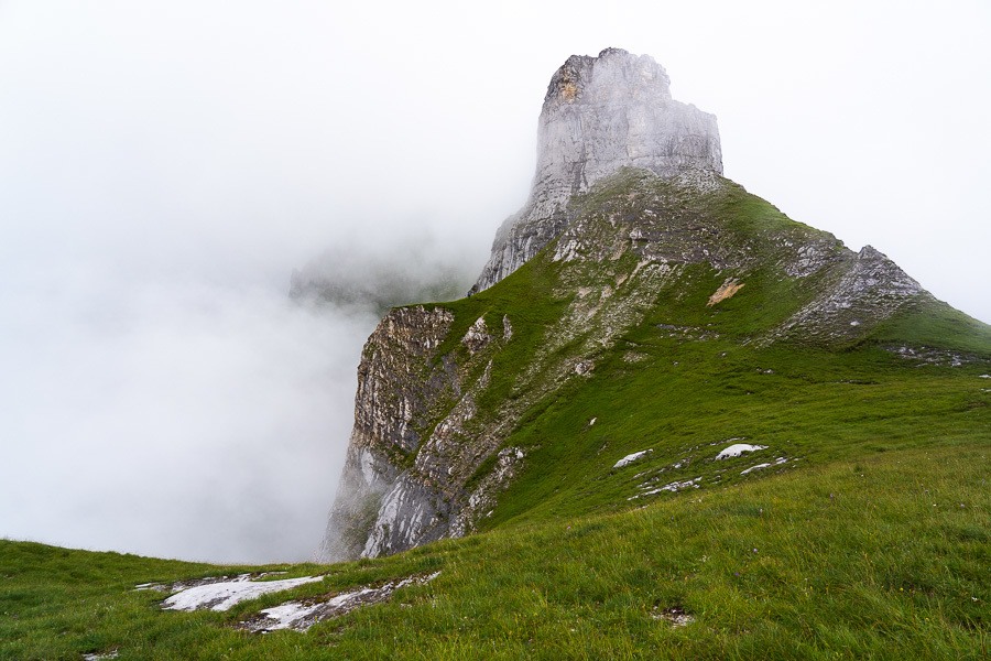
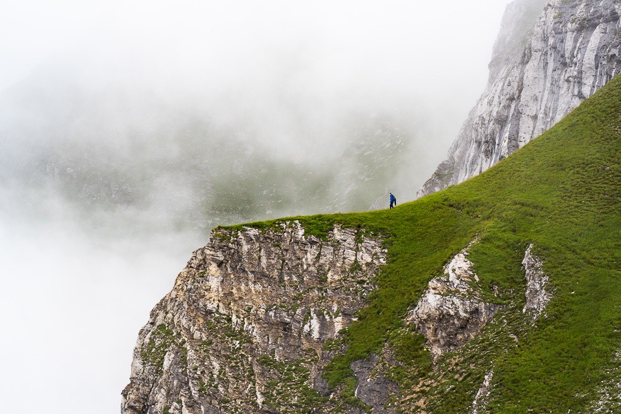
Josh started to climb the Spitzhorn, which is an incredibly rocky climb that I don’t advise! Nevertheless, off he went into the cloud hopefully to be seen again while I waited on the plateau, watching the clouds roll in and out amongst the Spitzhorn.

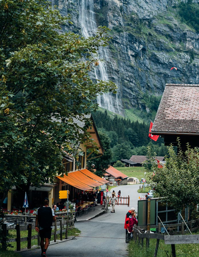
On a clear day, across the plateau you will see the Abeni Flue and Mittaghorn rising above Lauterbrunnen. At the end of the valley you will get great looks of the Breithorn, Grosshorn, Tschingelhorn and Ellstabhorn among others as the Schmadribachfall (Waterfall) plummets down into the valley. It’s a smorgasbord of glaciers and incredible peaks with a view that will rise into the top ten scenes of your life…. if the clouds aren’t there!
I’ve taken a few photos from Murren and Schilthorn the following day when it was clearer to show you what Tanzbodeli is like on a clear day. Just look at that huge wall behind Tanzbodeli that was hiding from us while we were at the summit.
TANZBODELI TO OBERSTEINBERG
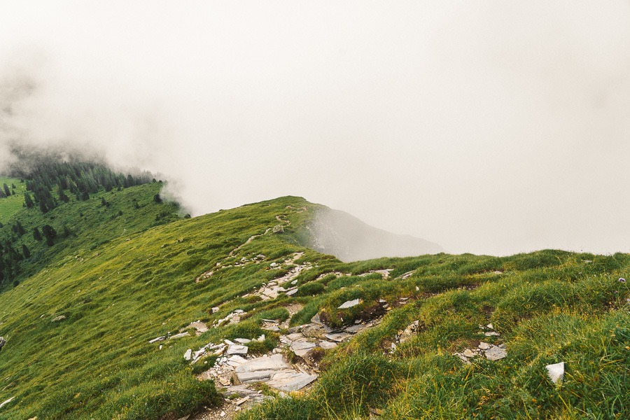
After enjoying Tanzbodeli we gathered our gear and headed back down to the junction of signs. You have to backtrack about 10 minutes from the summit and then head on to Obersteinberg. It’s about an hour-long walk underneath Tanzbodeli as you look down into Lauterbrunnen below.
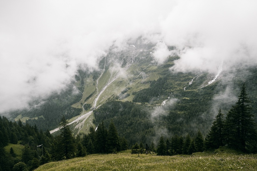
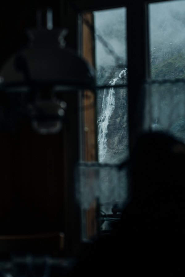
At Olbersteinberg you will find respite in the 1880 hotel and restaurant, which has amazing views of Schmadribachfall. The waterfall is 1000ft high and truly impressive to watch out of the window from the restaurant. Josh and I had a Rosti, eggs and toast and a coffee at the restaurant that was one of the cheapest mountain meals we had enjoyed so far. The dormitories at Obersteingberg Haus are $71 USD per night as of 2019.
OBERSTEINBERG TO STECHELBERG
From Obersteinberg you can make a 1-hour side-trip to Oberhornsee, a beautiful glacier lake. We were trying to escape the afternoon rain and continued down towards Stechelberg.
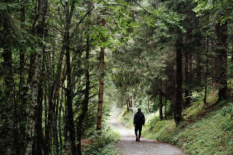
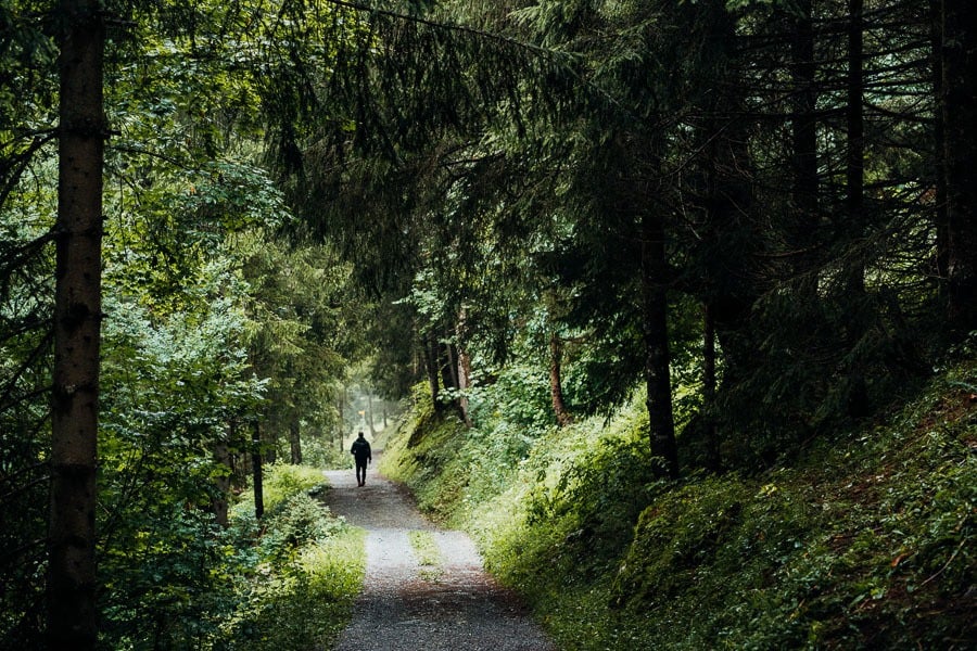
On the way down to Stechelberg, you have two options. There is a high route or the lower route. The high route is shorter and has great views of the mountain peaks before heading deep into the forest. The lower valley route gives you great views of the waterfall and leads you along the Weisse Lutschine River.
Both of the trails end in the same place, at the Hotel Stechelberg where you can catch the bus back to Lauterbrunnen.

I hope you enjoyed this guide about the Tanzbodeli & Obersteinberg Hike in Lauterbrunnen, Switzerland.
SWISS TRAVEL PASS or HALF-FARE CARD
OPTION 1: Buy the Swiss Half Fare Card: Switzerland trains, buses, and cable cars are EXPENSIVE! I found the best way to get around cheaply was to buy the Swiss Half-Fare Card before I arrived. It gives you 50% off every regular train, bus, and even many cable cars. It only costs $150 USD but pays itself off in just a few days with many train tickets in Switzerland costing close to $100 alone. If you are staying for more than 5 days, I suggest buying the Swiss Half-Fare Card.
OPTION 2: Buy the Swiss Travel Pass: The second option is to get the Swiss Travel Pass, which gives you unlimited train, bus, and (many) cable car rides but it’s pretty expensive at around $100 USD per day so if you don’t travel each day it isn’t worth it.
OPTION 3: Buy the FLEXI Swiss Travel Pass: The final (BEST) option is to get the FLEXI Swiss Travel Pass, which allows you to buy 8 days’ worth of transit but you can choose the night before if you want to activate the next day. That way you don’t need to travel every day to get your money’s worth, you can just activate the FLEXI Swiss Travel Pass on the days when you are doing sizeable transits. My advice is to book the Swiss Half-Fare Card or the FLEXI Swiss Travel Pass in advance before your trip so it’s ready to go when you arrive.
GET A SWISS TRAVEL PASS!


Enjoy UNLIMITED train, boat, and bus rides in Switzerland for up to 15 days. Click to book a flex Swiss Travel Pass or choose the Consecutive Swiss Travel Pass.
The Swiss Travel Pass starts at $260 for 3 days. Click here to check if it’s available on your travel dates.
MY SWITZERLAND HIKING GUIDES
I spent 100 days hiking in Switzerland and created a guide for different regions around the country. You can click on one of my Switzerland hiking guides below to help you plan your trip.
- The Complete Guide: 50 AWESOME HIKES IN IN SWITZERLAND
- The Via Ferrata Guide: 4 EPIC SWITZERLAND VIA FERRATA COURSES
- Lauterbrunnen Guide: 10 AWESOME HIKES NEAR LAUTERBRUNNEN
- Interlaken Guide: 15 AWESOME HIKES IN INTERLAKEN
- Grindelwald Guide: 12 AWESOME HIKES NEAR GRINDELWALD:
- Mürren Guide: 7 AWESOME HIKES IN MURREN
- Appenzell Guide: 9 AWESOME HIKES NEAR APPENZELL
- Chur Guide: 7 AWESOME HIKES NEAR CHUR

MY SWITZERLAND TRAVEL TIPS
- For Backpackers: SWITZERLAND BUDGET BACKPACKING GUIDE
- Travel Tips: 20 THINGS TO KNOW BEFORE VISITING SWITZERLAND
- Transport Tips: RENTING AND DRIVING A CAR IN SWITZERLAND
- Accommodation Guide: 30 BEST PLACES TO STAY IN SWITZERLAND

Wednesday 11th of September 2024
Wow, thanks for the detailed route instructions.
Can you extend this route to a 3 day hike in the area and sleep in mountain huts? We'd like to do a 3 day hike with our two boys (ages 9 and 11). This route looks amazing so I wonder if it can be a part of a 3 day hike.
Rassie Smith
Sunday 16th of June 2024
Thank you for your review and suggestion to hike this trail. My wife and I are currently in Murren and we chose to hike this one today. Amazing hike! Fortunately, we had great weather. We also did the Via Ferrata from Murren to Gimmelwald you suggested!
Naomi
Tuesday 24th of January 2023
Hi! Thanks so much for all this information!
My husband and I will be in Lauterbrunnen in June and this hike looks amazing! I’m definitely afraid of heights though…I’m good with distance and steepness as long as there’s not toooooo much exposure. I’m just curious how sketchy this trail feels? Especially that last bit before the dance floor🙃 Thanks!!
Aditya Pradeep
Thursday 30th of July 2020
Awesome guide with detailed pictures- as have been your other hikes in this region! I plan to do this exact hike from Gimmelwald next month and am very excited.
Is there a way to bail out midway via public transport if I find it too difficult?
Jackson
Friday 31st of July 2020
I think you will find it okay. It's slow and steady-going. Just leave early and take your time.