
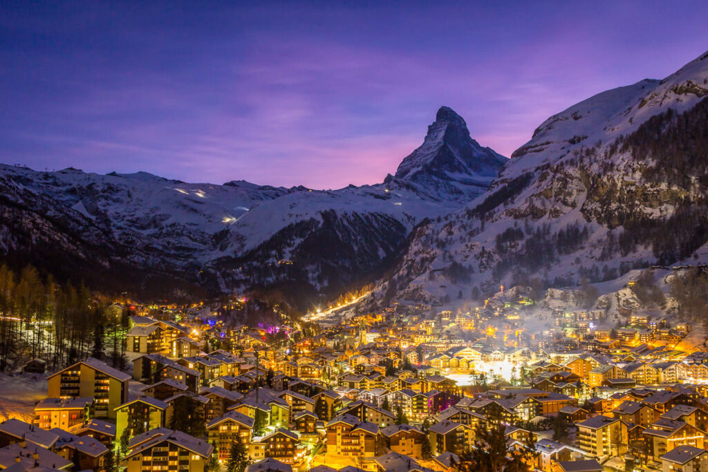
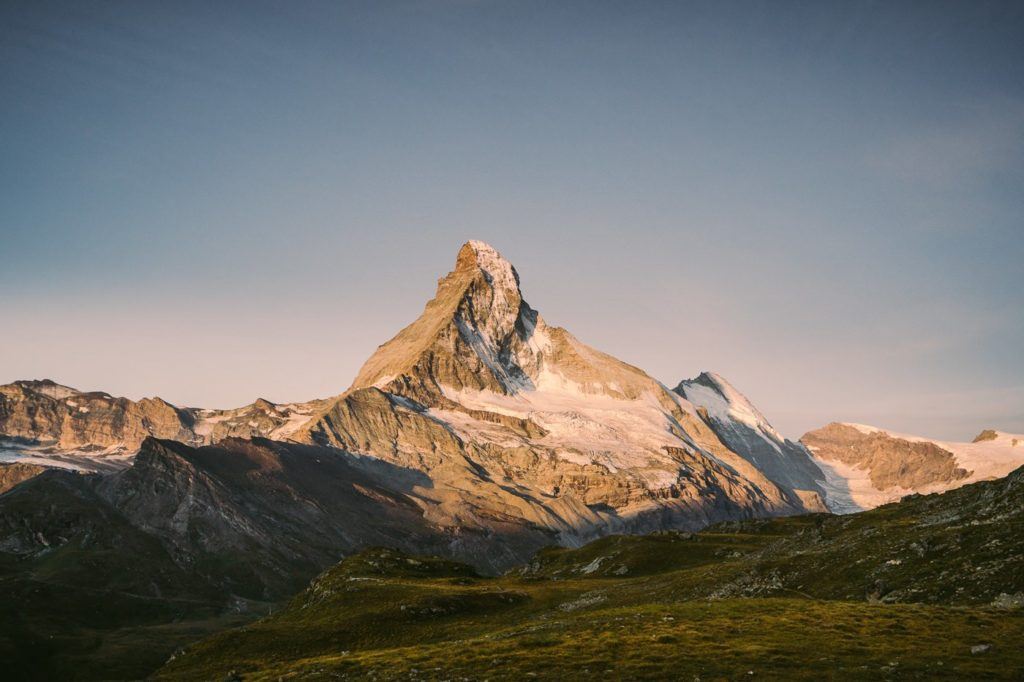
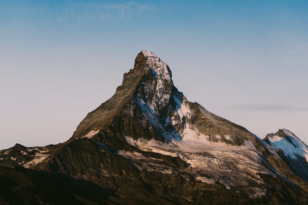
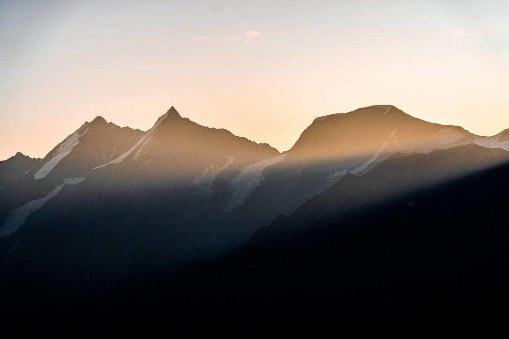
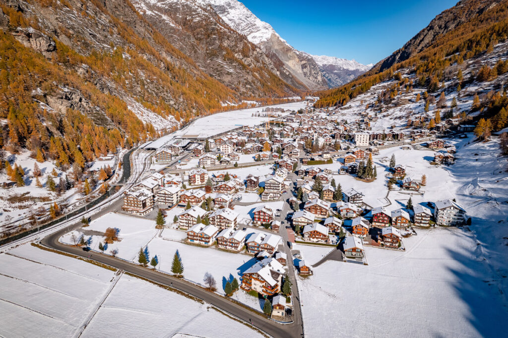
Zermatt is one of the most popular regions in Switzerland and is home to the famous Matterhorn peak, which is one of the most dangerous climbs in the world. It’s quite a beautiful quintessential Swiss town, which has tried to keep its traditional character by remaining a carless town and keeping the charm of the old chalets and cobblestone roads. Throughout my time hiking in Zermatt, I experienced some beautiful trails and I’ve put together this Zermatt Hiking Guide so that you can choose a hike or two (or six) for your visit to Zermatt. I’m sure you will find a great adventure on this list of my six favorite hikes in Zermatt.
6 AWESOME HIKES IN ZERMATT
In this blog post, you will find a description of each of the hikes in Zermatt and some photos I took as well as a link to the individual blog post I wrote about all of the hikes near Zermatt. You can click on that link for a more detailed review of the hike including maps, starting points, how to get there, photos, directions, difficulty, and a short story about my experience on that Zermatt hike. I visited Zermatt for 8 days and had an awesome experience. I was quite lucky with the weather in the summer month of September.
HORNLIHUTTE HIKE ‘MATTERHORN BASE CAMP’ IN ZERMATT
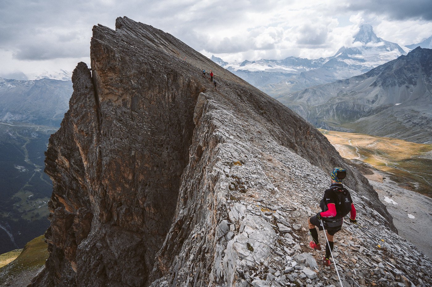
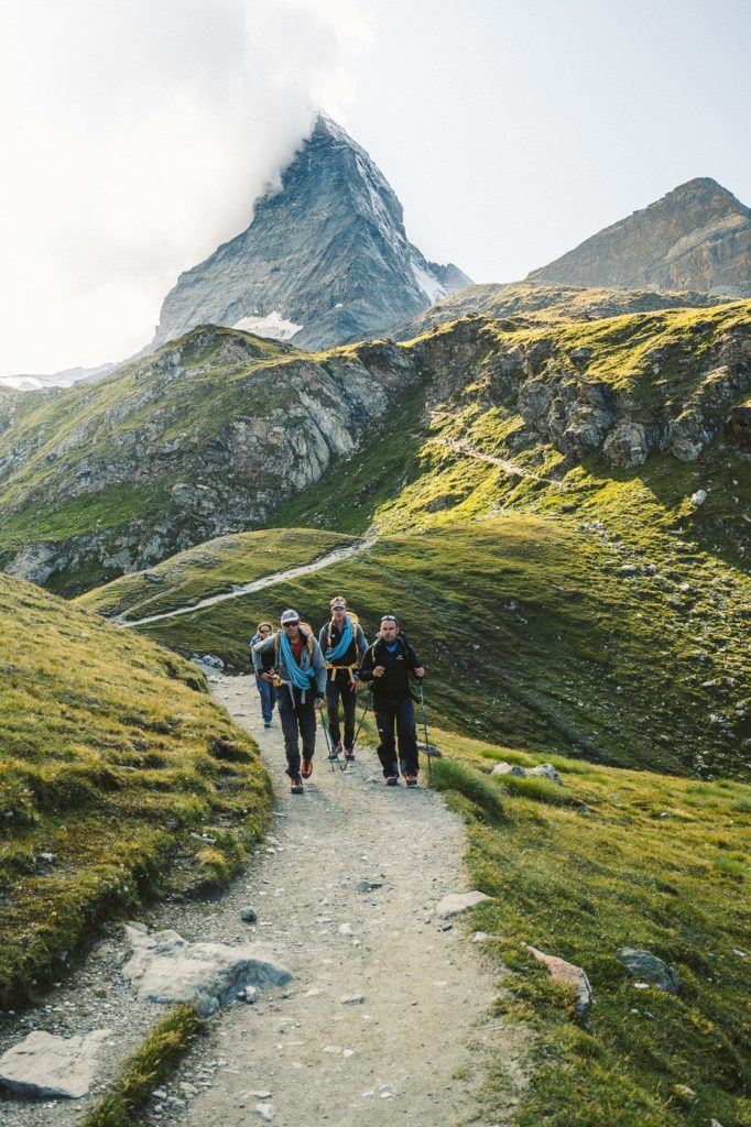
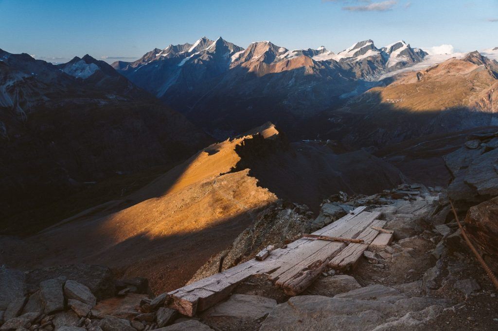
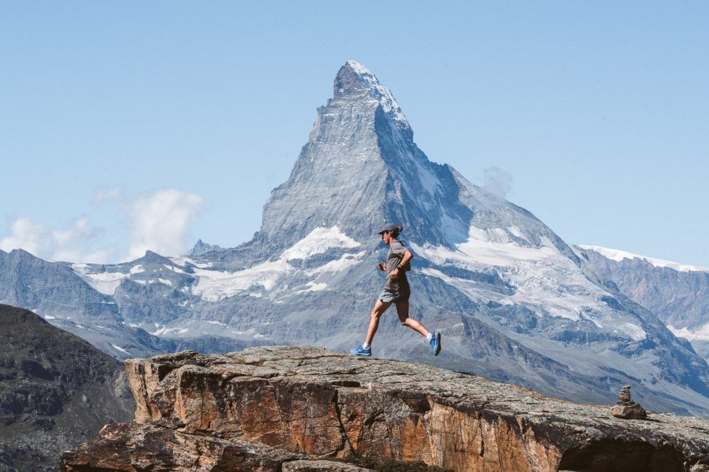
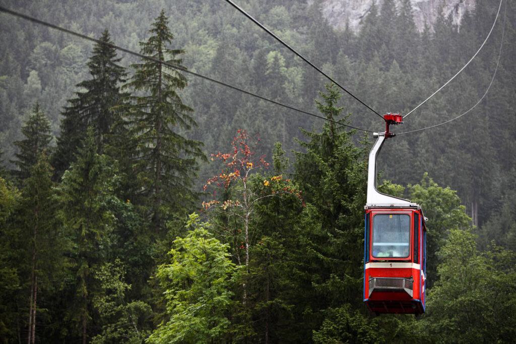
The Hornlihutte (Hornli Hut) is the most common base camp for the Matterhorn climb. However, hiking from Zermatt town to Hornlihutte is a great hike in its own right as I found out. I took the cable car to Schwarzsee and hiked up to Hornlihutte for sunset and then hiked all the way back down to Zermatt town in the dusk and then the dark for a total journey of 16 kilometers. At an altitude of 3,260 meters, the hut is a base camp for some and a summit for others.
- Hike Distance: Schwarzsee to Hornlihutte is 4km with 715 meters of incline. Obviously, you have to come back down to Schwarzsee so that is a minimum of 8km. However, if you go for sunset or miss the last 4:30 p.m. cable car, you will need to walk all the way back to Zermatt. My total hike distance with the walk back to Zermatt main street was 16.68km.
- Hike Duration: Schwarzsee to Honlihutte should take about 1.5 hours maximum. My entire journey came out to 4 hours with the walk back to Zermatt main street.
- Hike Difficulty: The hike difficulty for Hornlihutte was medium. From Schwarzsee to the start of the ridge, you are on a red and white marked trail that is quite simple, although even on that trail there are rocky sections and a few drop-offs although nothing dramatic. Once upon the ridge, it is a blue and white alpine trail. This means stop walking if you aren’t up for a bit of a challenge.
- Hike Incline: 967m total climb with over 1500m of decline (if you go back down to Zermatt main street)
Want more details and photos? View the full blog post here: HORNLIHUTTE HIKE ‘MATTERHORN BASE CAMP’ IN ZERMATT
THE 5 LAKES HIKE IN ZERMATT (MATTERHORN VIEWS)
The 5 Lakes hike is one of the most popular hiking trails in Zermatt because it is accessible to everyone and has minimal steep climbing. Along the route are five stunning lakes where you can create reflections of the Matterhorn at the right angle. It’s a great day out and relatively easy for the whole family.
From Zermatt town, you catch a train up the plateau (you do most of the incline in the train) and then complete the loop walk checking out each of the lakes on the trail. On a clear day, the Matterhorn reflects in several of the lakes, which is always a great crowd-pleaser. This is a much less intense hike than many due to the lower incline although there are still a few hills to contend with so don’t expect a complete walk in the park. It’s the perfect summer hike in Zermatt.
- Hike Distance: The entire loop is 6km
- Hike Duration: The hike should take about 3 hours if you stop at each lake and wander around a bit. Total walking time should be no more than 2 hours.
- Hike Difficulty: Very low difficulty. Suitable for families.
- Hike Incline: 241 meters
Want more details and photos? View the full blog post here: THE 5 LAKES HIKE IN ZERMATT (MATTERHORN VIEWS)

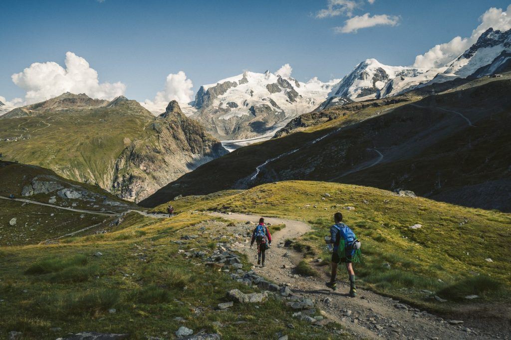
THE GORNERGRAT HIKE FROM RIFFELALP IN ZERMATT
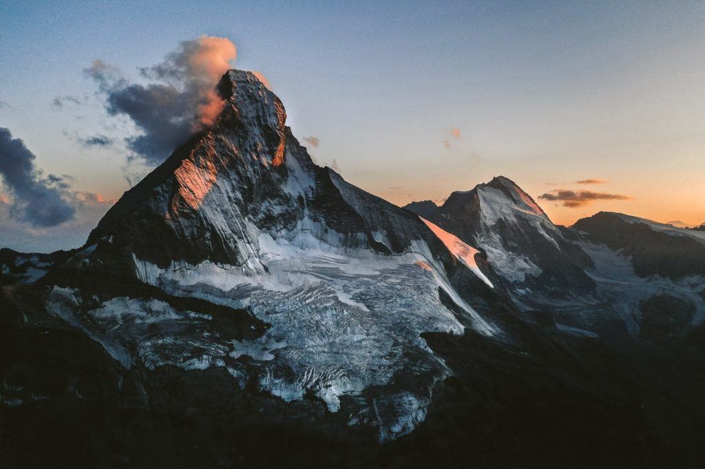
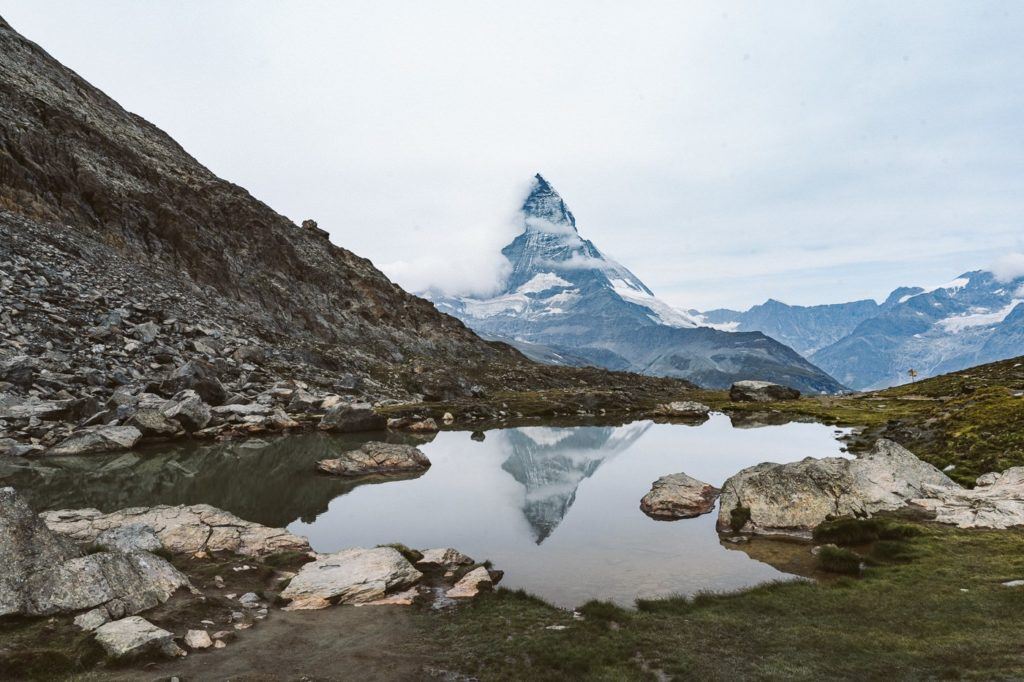
The hike from Riffelalp to Gornergrat takes you along one of the most scenic routes in Zermatt. The Matterhorn is in your sights for most of the journey as you pass by several lakes with perfect reflections of the mighty Matterhorn.
There are two highlights of this hike in Zermatt. The first is the reflections of the Matterhorn in the Riffelsee (lake). Many come all the way to Zermatt and spend big bucks on the train up here to see this very reflection.
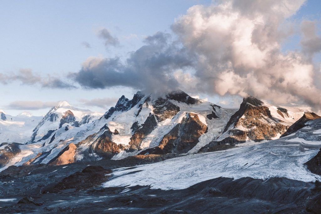
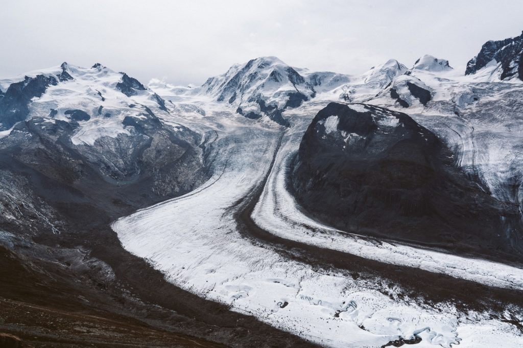
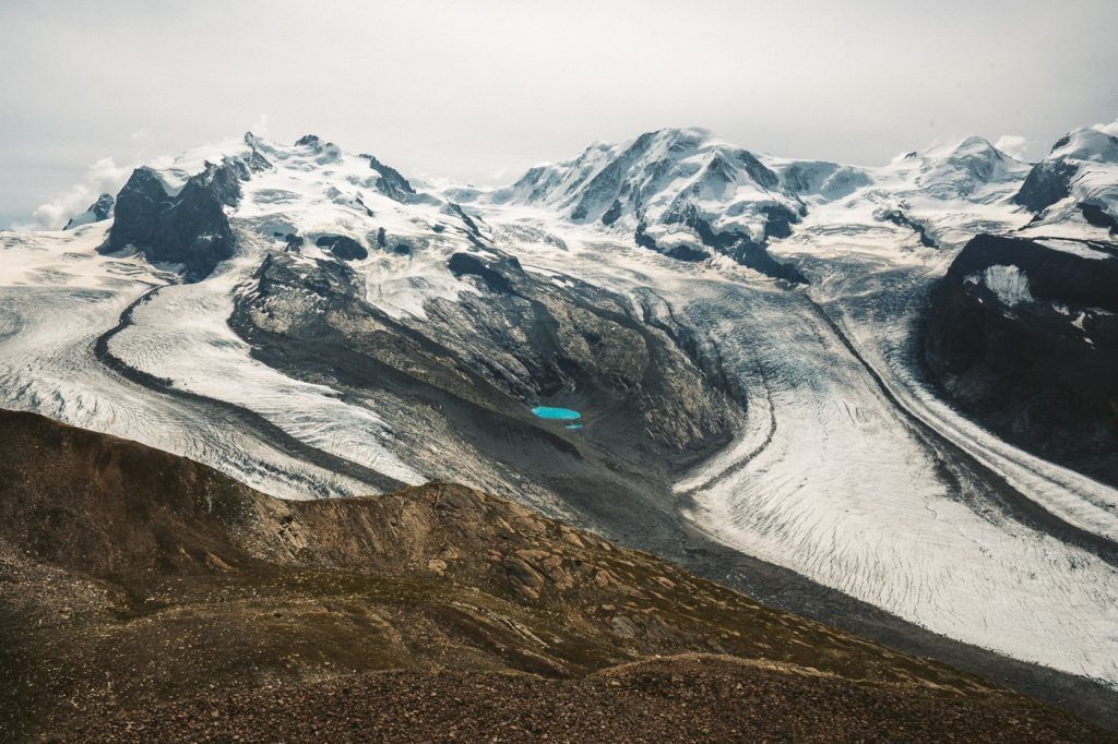
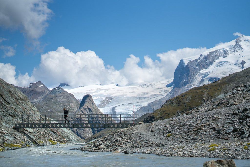
You can hike your way up if you prefer the challenge and it’s one of the best day hikes in Zermatt. The second highlight is looking out over the incredible Gornergrat Glacier, which is mindblowing in size and you really get an idea of the evolution of the glacier over time.
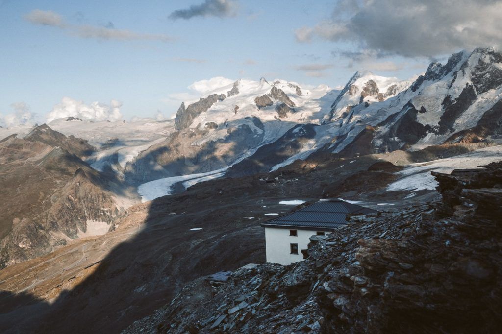
When you reach the Gornergrat Hotel you can relax, enjoy lunch, and take in the views of the epic Gorner Glacier (Gornergletscher), which is located directly below the hotel.
- Hike Distance: The total distance from the Riffelalp train station to Gornergrat Hotel via Riffelsee is 6 kilometers. You can then catch the Gornergratbahn back down to Zermatt. My total loop was 20km from Riffelalp to Riffelsee to Gornergrat to Hohtalli to Zermatt.
- Hike Duration: From Riffelalp to Gornergrat you are expecting it to take about 2 to 2.5 hours.
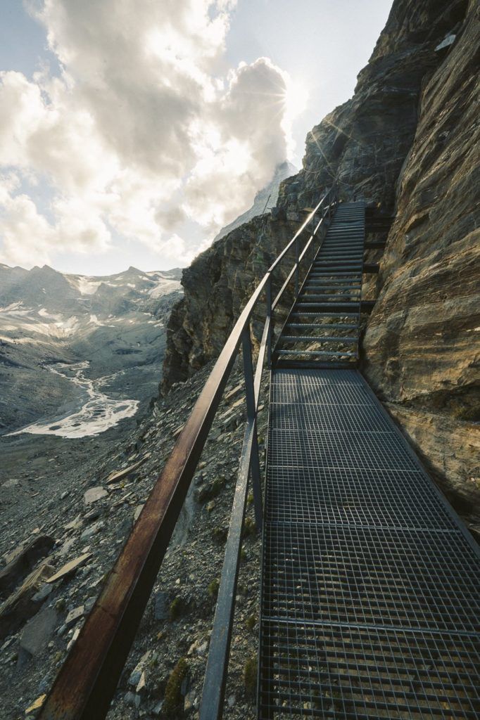
- Hike Difficulty: The hike difficulty for Riffelsee from Riffelalp was very low. There was some incline but the path was always very clear and quite flat. Suitable for children. From Riffelsee to Gornergrat the trail is quite steep but there are no sections with any real danger. From Gornergrat to Hohtalli (I’ll explain later in the blog), there was some exposure and rock scrambling.
- Hike Incline: From Riffelalp to Hotel Gornergrat Kulm the incline is 900m. The altitude at Hotel Gornergrat Kulm is 3,100 meters.
Want more details and photos? View the full blog post here: THE GORNERGRAT HIKE FROM RIFFELALP IN ZERMATT
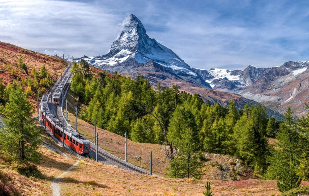
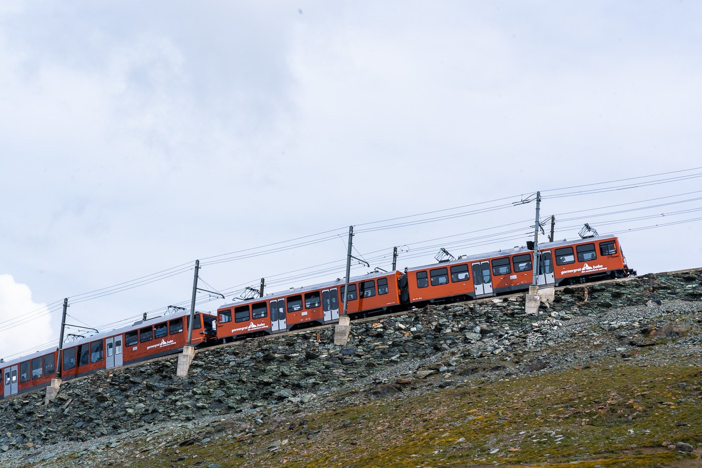
GORNERGRAT COGWHEEL TRAIN
Skip the line and book a ticket online for the Gornergrat Cogwheel. Cross stunning bridges, ride through galleries and tunnels, idyllic forests, past gorges, and mountain lakes as you climb the Gornergrat on the cogwheel train with the Matterhorn continually in view. At the summit, explore the picturesque alpine world of the Swiss Alps.
With a sunny observation deck that remains accessible throughout the year, the Gornergrat at 3,089 meters above sea level provides spectacular views. The Gornergrat is surrounded by 29 four-thousand-metre peaks including the highest Swiss mountain, the Dufourspitze, which has an altitude of 4,634 meters, and the third-largest glacier in the Alps, the Gorner Glacier. The mountainscape panorama you’ll experience is completely unique.
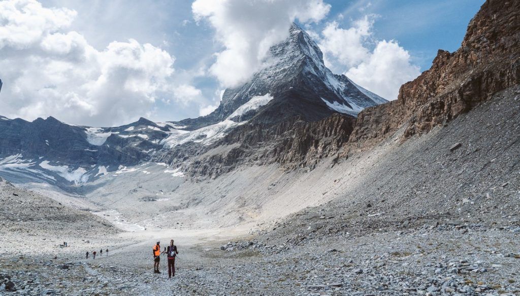
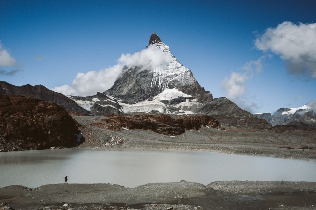
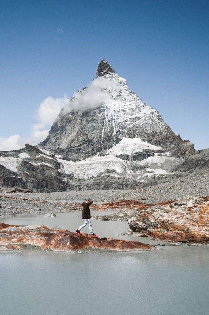
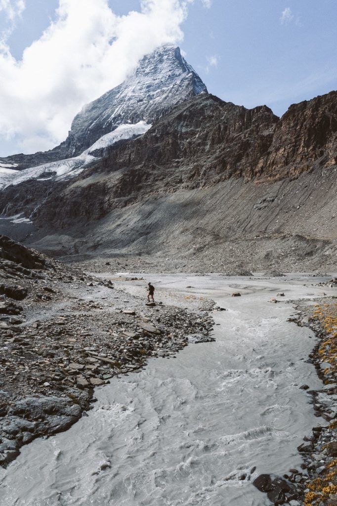
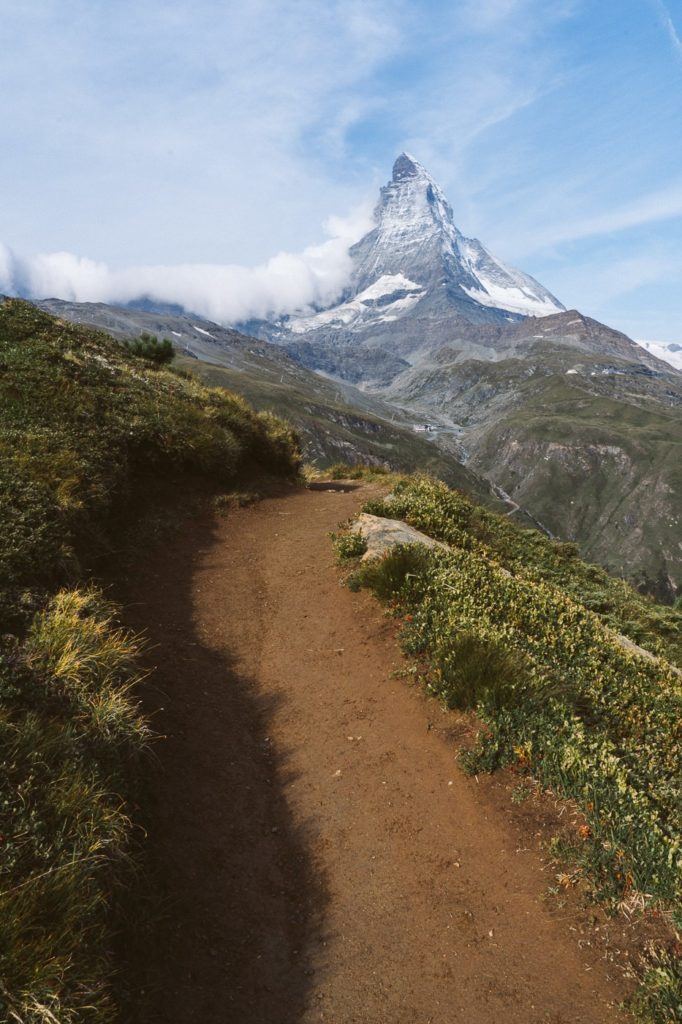
THE MATTERHORN GLACIER TRAIL HIKE IN ZERMATT
The Matterhorn Glacier Trail hike in Zermatt is a great walking trail that winds underneath the Matterhorn. It is one of the best day hikes in Zermatt and definitely one of the top places to see the Matterhorn from a very close distance without having to do any crazy incline or hiking. For an epic view of the Matterhorn with lots of lake reflection shots, this is my top recommendation for a hiking trail in Zermatt.
This hiking trail is one of the top picks for families and tourists who would like to experience the Matterhorn but aren’t looking for a huge adventure. With just 150m of the total incline, it’s one of the best easy hikes in Zermatt. By taking the cable car all the way up to the top, you actually do a point-to-point route instead of a loop so a lot of the trail is downhill and you finish at a different cable car station to get back to Zermatt town. It’s 500m downhill and 150m of uphill work so you can see it is less challenging the many other hikes in Zermatt.
- Hike Distance: 6.4km from Trockener Steg to Schwarzsee
- Hike Duration: 2-3 hours
- Hike Difficulty: Very low. The total incline is 150m and the decline is 500m Sometimes rocky trails but never any dangerous or exposed trail.
- Hike Incline: 150m total climb with 500m of decline.
Want more details and photos? View the full blog post here: THE MATTERHORN GLACIER TRAIL HIKE IN ZERMATT
MATTERHORN GLACIER PARADISE CABLE CAR
The Matterhorn Glacier Trail starts just beneath the Trockener Steg cable car station. You will begin the cable car journey on the Matter Glacier Paradise Cable Car, which leaves from the Zermatt Bergbahnen Station. You can skip the line if you book online here in advance.
The cable cars are open every day from 8:30 to 4:30 but you can check here on the website to double-check the updated timings.
The map below shows the pin for your starting and finishing point, the Zermatt Bergbahnen AG. You can purchase your tickets for the cable car here but do be warned there are some long lines for the first few cable cars of the day so arriving half an hour early is not a bad idea if you want to be among the first up on the trails.
COMBO HIKING TICKET
The combo hiking ticket is a great initiative that allows you to catch the cable car from Zermatt to Furi to Trockener Steg. You then follow the Matterhorn Glacier Trail, which finishes at Schwarzsee station. Your combo hiking ticket then includes the cable car down from Schwarzsee to Furi to Zermatt and the loop is completed.
The cost of the Combo Hiking Ticket is $70.50 for an adult or 50% off that fee if you have a Swiss Travel Pass or the Swiss Half Card. I have used both and still have my Swiss Half Card and highly suggest purchasing it if you are in Switzerland for any more than 3 days. It will save you money even with just 3 days of travel in Switzerland even though it is a yearly pass!
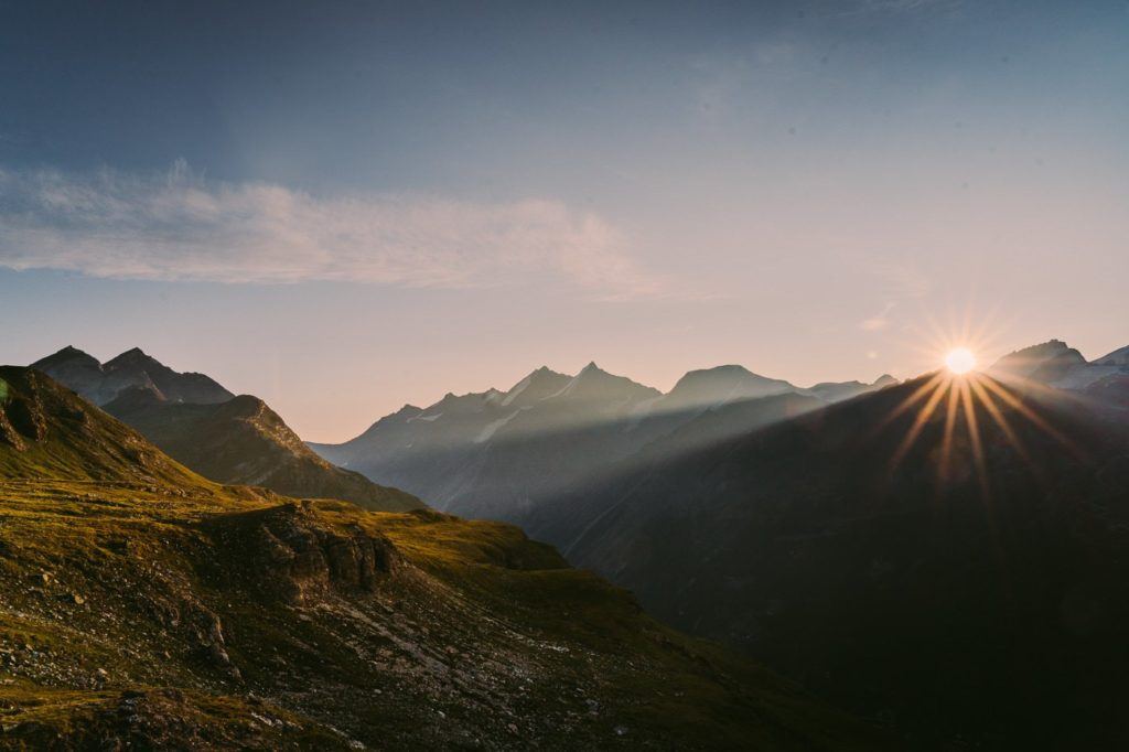
HOHBALMEN SUNRISE HIKE IN ZERMATT – MATTERHORN VIEWPOINT
The Hohbalmen sunrise hike in Zermatt is an aggressive way to start your day with a 1,100m climb to a beautiful viewpoint with clear views of Matterhorn. It isn’t the most popular hike in Zermatt, which is because it is a very aggressive hike and you can get similar views with much less effort on other trails. However, this is a beautiful viewpoint for sunrise and you won’t share this trail with many others. I really loved the early wake-up and the adventure up to this viewpoint and it was one hell of a workout.
- Hike Distance: The hike from Zermatt to Hohbalmen viewpoint and to return is 10km. However, there are lots of routes that continue from Hohbalmen that can make it a 20km loop. I just went up to the viewpoint and down and it was 10km.
- Hike Duration: The hike took me 2 hours and 50 minutes although it would be more likely to take 3-5 hours round-trip for an average pace of hiking.
- Hike Difficulty: The hike is not exposed and there are no dangers. The incline to the viewpoint is very aggressive with 1000m of incline within the first 4km, which is a lot to handle for many people…, especially before a coffee!
- Hike Incline: Starting point at Zermatt Town: 1608m – Hohbalmen Viewpoint: 2,673m
Want more details and photos? View the full blog post here: HOHBALMEN SUNRISE HIKE IN ZERMATT – MATTERHORN VIEWPOINT
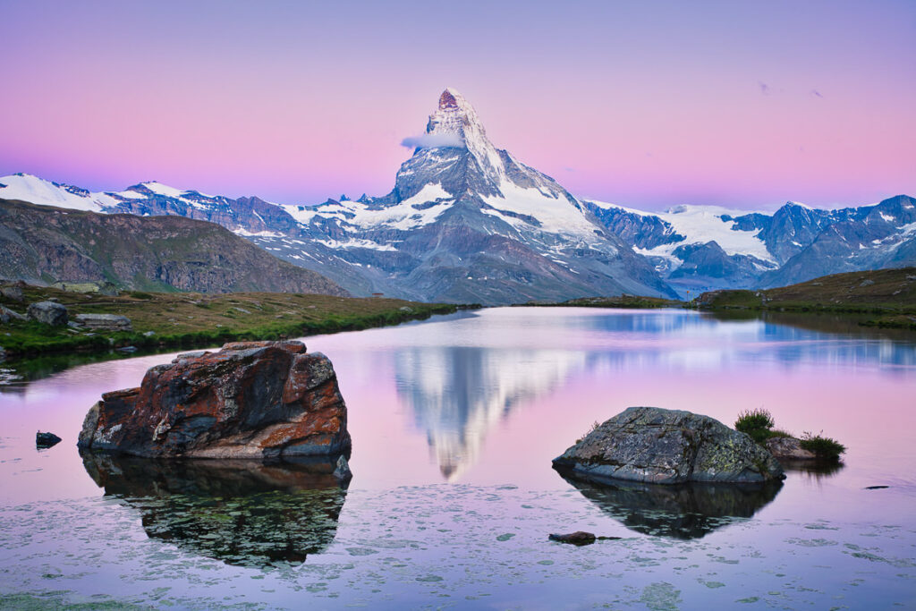
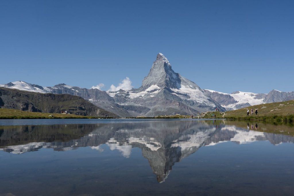
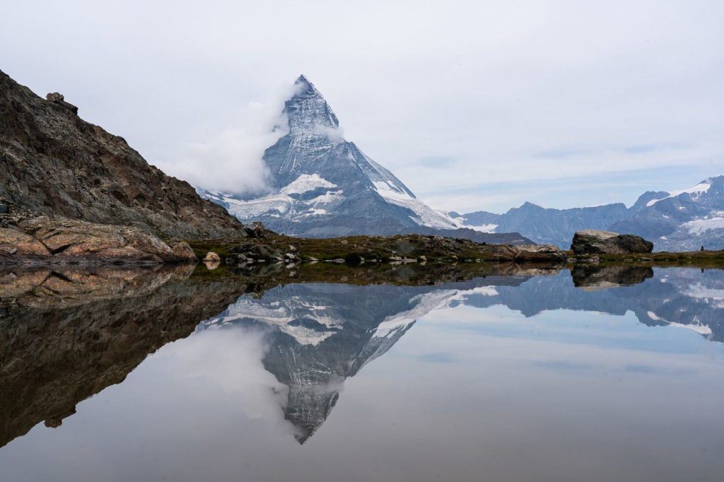
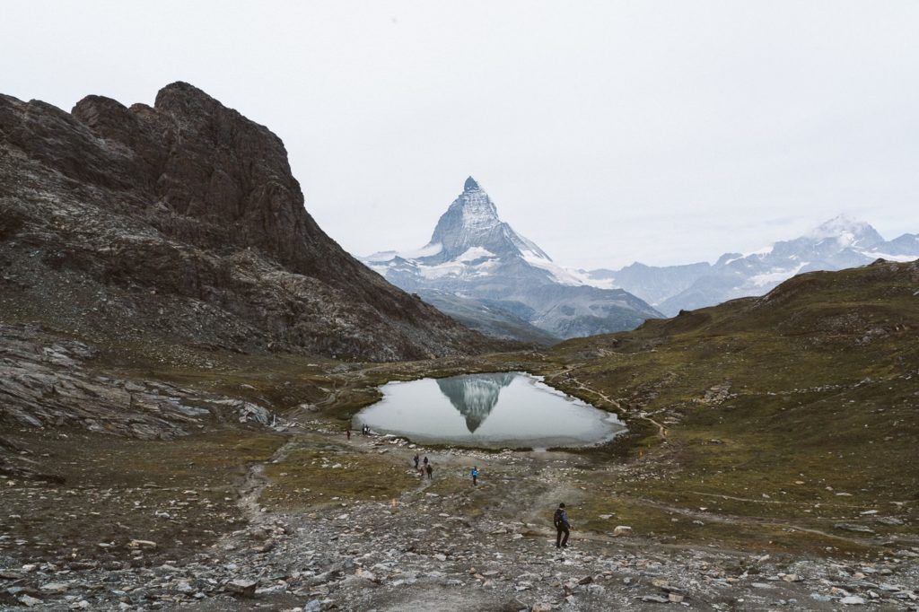
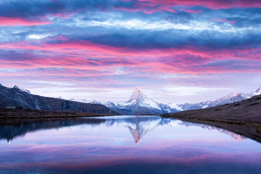
RIFFELSEE LAKE HIKE IN ZERMATT WITH MATTERHORN REFLECTION
The Riffelsee (Riffel Lake) Hike may just be the best spot in Zermatt to find the perfect reflection photo of the mighty Matterhorn. A train takes you to Riffelalp before you hike around the mountain with constant views of the Matterhorn until you end up at Riffelsee and witness the amazing reflection.
The Riffelsee is amazing at sunset or sunrise but quite difficult to get to at those hours as the train is usually finished. Therefore it is quite a mission to hike in the dark before sunrise or after sunset.
Adventurers love this challenge to see the alpenglow on the Matterhorn reflecting in the lake. There are usually some diehard photographers at the lake who have made the effort. Once you are up there at the lake it is one of the nicest walks in Zermatt in my opinion.
- Hike Distance: The total distance from Riffelalp train station to Riffelsee via the Riffelseeweg is just 4.1km. You can then catch the Gornergratbahn back down to Zermatt. However, I suggest you continue hiking up to Gornergrat and keep exploring. My total loop was 20km from Riffelalp to Riffelsee to Gornergrat to Hohtalli to Zermatt.
- Hike Duration: From Riffelalp to Riffelsee you are expecting it to take about 1.5 hours.
- Hike Difficulty: The hike difficulty for Riffelsee from Riffelalp was very low. There was some incline but the path was always very clear and quite flat. Suitable for children.
- Hike Incline: From Riffelalp to Riffelsee the incline is just under 600m of climbing. Riffelsee is at 2,762 meters above sea level.
Want more details and photos? View the full blog post here: RIFFELSEE LAKE HIKE IN ZERMATT WITH MATTERHORN REFLECTION
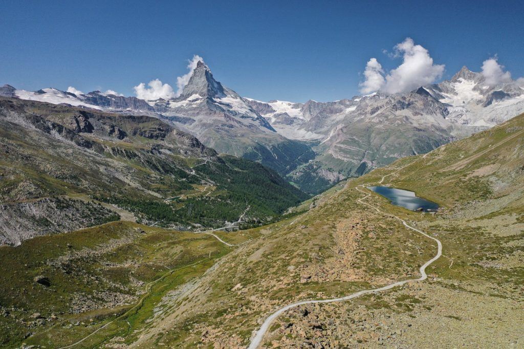
HOW TO GET TO RIFFELSEE
Riffelsee is an alpine lake that can be reached either via train or by hiking or with a combination. I took the most scenic route, which involved booking a ticket on the Gornergratbahn to Riffelalp and then hiking 4 kilometers to Riffelsee. However, there is a train station right next to Riffelsee and Gorngergrat Restaurant is just above Riffelsee so the majority of visitors don’t hike at all. They miss out on a lot of the action and beautiful Matterhorn views along the way.
Recommended option: Catch the Gornergratbahn and get off at Riffelalp. Then follow the Riffelseeweg along the edge of the mountain with 600m of incline over 4 kilometers to the Riffelsee.
THINGS TO KNOW FOR HIKING IN ZERMATT IN THE SUMMER
Zermatt in the summer is a completely different experience than during its snowy winter months. Here are more summer-specific details for hiking in Zermatt:
- Summer Hiking Season: In Zermatt, the main summer hiking season typically runs from June to September. During this period, most of the hikes in Zermatt are snow-free and accessible.
- Wildflowers: Summer brings a burst of alpine flowers to Zermatt’s meadows. Trails like the Edelweissweg and the trail from Schwarzsee to Zermatt showcase beautiful blossoms and offer great photo opportunities.
- Daylight Hours: With longer daylight hours in the summer, you can plan lengthier treks or multiple short hikes in a day. However, always remember to start early if you’re going on longer treks to ensure you get back before dark.
- Hydration: Summer hiking means warmer temperatures. Carry sufficient water with you, as the alpine sun can be intense, and staying hydrated is crucial.
- Sun Protection: The combination of higher altitudes and clear summer skies can lead to a higher risk of sunburn. Use high-SPF sunscreen, wear a wide-brimmed hat, and consider sunglasses with UV protection.
- Mountain Huts: Many mountain huts are open for the summer season. These provide not only food and shelter but also an authentic Swiss alpine experience. Consider stopping at one for a meal or even an overnight stay.
- Glacial Areas: Some hikes, like the Matterhorn Glacier Trail, will take you close to glacial areas. Even in the summer, these can be chilly and can have patches of snow. Wear sturdy shoes and carry layers.
- Crowds: Summer is a popular time to visit Zermatt, so expect more fellow hikers on the trails, especially the more famous ones. If you’re looking for solitude, consider starting early in the morning or exploring less popular routes.
- Safety: Summer in the mountains can sometimes bring afternoon thunderstorms. Always check the weather forecast before heading out and be prepared to change your plans if storms are predicted.
- Equipment: For most summer hikes in Zermatt, regular hiking boots, a good backpack, and trekking poles should suffice. However, if you’re planning to go on more challenging routes or cross glacial areas, consider consulting a local guiding company or mountain expert for advice on additional gear.
- Local Produce: Summer is also the season for local produce. After your hikes, indulge in some fresh Swiss cheese, chocolates, or berries. You might also come across markets or stalls selling local summer fruits like apricots from the Valais region.
I hope you enjoyed that list of epic hikes in Zermatt in my Zermatt Hiking Guide. If there are any hikes in Zermatt you think I need to check out on my next visit, please comment on them below!
HOW TO GET TO ZERMATT
Zermatt is a car-free village nestled in the Swiss Alps, making it a unique destination. To get there, most travelers opt for the efficient Swiss rail system. Starting from major Swiss cities like Zurich or Geneva, one can take a train to Visp or Brig, and then transfer to the Matterhorn Gotthard Bahn, a cogwheel train that will take you directly into the heart of Zermatt. Those driving by car can only go as far as Täsch, where they’ll need to leave their vehicle in one of the parking facilities and then take a short train ride or taxi into Zermatt. The journey showcases stunning alpine landscapes, ensuring the travel experience is as memorable as the destination itself.
3 BEST EASY HIKES IN ZERMATT
Zermatt offers a plethora of hiking trails, and for those seeking easier hikes that still offer stunning views and experiences, here are three of the best:
- Gornergrat to Riffelberg:
- Duration: About 1-1.5 hours.
- Description: This trail starts from the Gornergrat summit, which is easily accessible by the Gornergrat railway. It’s a downhill walk to Riffelberg, passing through alpine meadows with the Matterhorn looming large in the background. The path is wide, well-marked, and mostly descending, making it relatively easy.
- Highlights: Spectacular panoramic views of the Matterhorn and surrounding peaks, as well as the Gorner Glacier.
- Five Lakes Walk (5-Seenweg):
- Duration: About 2.5 hours.
- Description: The hike takes you past five beautiful mountain lakes: Stellisee, Grindjisee, Grünsee, Moosjisee, and Leisee. Each lake offers a unique view, with the Matterhorn’s reflection visible in some of them.
- Starting Point: The hike can begin at Blauherd, which is reachable by funicular and gondola. The trail is well-marked and not particularly strenuous.
- Highlights: Picturesque lakes, opportunities for picnics, and varied vistas of the Matterhorn.
- Zermatt to Zmutt:
- Duration: About 1.5-2 hours.
- Description: This gentle walk will take you from the village of Zermatt to the small hamlet of Zmutt. The trail winds through forests, alongside streams, and offers splendid views of the Matterhorn and the valley.
- Highlights: Traditional wooden houses in Zmutt, tranquil settings away from the bustle of Zermatt, and views of the Matterhorn from different perspectives.
While these hikes are easier than some of the alpine treks around Zermatt, always remember to wear good footwear, bring water and sunscreen, and check the weather before heading out. The beauty of Zermatt’s landscapes makes every hike worthwhile!
TWO BEST HIKES IN ZERMATT THAT DON’T NEED TRANSPORT
Zermatt’s location, at the foot of the Matterhorn, means there are beautiful hikes that can be started directly from the village without needing any additional transportation. Here are two of the best:
- Zermatt to Zmutt and Back:
- Duration: About 3-4 hours round trip.
- Description: Starting from Zermatt, this trail leads you to the charming hamlet of Zmutt, which is known for its traditional Valaisian houses. The hike is relatively easy, winding through forests, meadows, and alongside streams. It offers lovely views of the Matterhorn and the surrounding valley.
- Highlights: Zmutt’s centuries-old wooden houses, tranquil settings, and the Matterhorn from different angles.
- Hohenweg from Zermatt to Sunnegga:
- Duration: About 2-3 hours one way.
- Description: This panoramic high-altitude path starts directly from Zermatt and winds its way up to Sunnegga. The trail is well-marked and provides hikers with sweeping views of the village below, the Matterhorn, and several other 4,000-meter peaks. After reaching Sunnegga, you have the option to hike back to Zermatt or take the funicular down if you wish to save time and energy.
- Highlights: Panoramic views of the Alps, beautiful alpine flora, and multiple viewpoints of the Matterhorn.
Both of these hikes offer the convenience of starting right from Zermatt village, eliminating the need for additional transport. Always remember to check the weather, wear appropriate footwear, and carry essentials like water and snacks. Happy hiking!
SWISS TRAVEL PASS or HALF-FARE CARD
OPTION 1: Buy the Swiss Half Fare Card: Switzerland trains, buses, and cable cars are EXPENSIVE! I found the best way to get around cheaply was to buy the Swiss Half-Fare Card before I arrived. It gives you 50% off every regular train, bus, and even many cable cars. It only costs $150 USD but pays itself off in just a few days with many train tickets in Switzerland costing close to $100 alone. If you are staying for more than 5 days, I suggest buying the Swiss Half-Fare Card.
OPTION 2: Buy the Swiss Travel Pass: The second option is to get the Swiss Travel Pass, which gives you unlimited train, bus, and (many) cable car rides but it’s pretty expensive at around $100 USD per day so if you don’t travel each day it isn’t worth it.
OPTION 3: Buy the FLEXI Swiss Travel Pass: The final (BEST) option is to get the FLEXI Swiss Travel Pass, which allows you to buy 8 days’ worth of transit but you can choose the night before if you want to activate the next day. That way you don’t need to travel every day to get your money’s worth, you can just activate the FLEXI Swiss Travel Pass on the days when you are doing sizeable transits. My advice is to book the Swiss Half-Fare Card or the FLEXI Swiss Travel Pass in advance before your trip so it’s ready to go when you arrive.
GET A SWISS TRAVEL PASS!


Enjoy UNLIMITED train, boat, and bus rides in Switzerland for up to 15 days. Click to book a flex Swiss Travel Pass or choose the Consecutive Swiss Travel Pass.
The Swiss Travel Pass starts at $260 for 3 days. Click here to check if it’s available on your travel dates.
MY SWITZERLAND HIKING GUIDES
I spent 100 days hiking in Switzerland and created a guide for different regions around the country. You can click on one of my Switzerland hiking guides below to help you plan your trip.
- The Complete Guide: 50 AWESOME HIKES IN IN SWITZERLAND
- The Via Ferrata Guide: 4 EPIC SWITZERLAND VIA FERRATA COURSES
- Lauterbrunnen Guide: 10 AWESOME HIKES NEAR LAUTERBRUNNEN
- Interlaken Guide: 15 AWESOME HIKES IN INTERLAKEN
- Grindelwald Guide: 12 AWESOME HIKES NEAR GRINDELWALD:
- Mürren Guide: 7 AWESOME HIKES IN MURREN
- Appenzell Guide: 9 AWESOME HIKES NEAR APPENZELL
- Chur Guide: 7 AWESOME HIKES NEAR CHUR

MY SWITZERLAND TRAVEL TIPS
- For Backpackers: SWITZERLAND BUDGET BACKPACKING GUIDE
- Travel Tips: 20 THINGS TO KNOW BEFORE VISITING SWITZERLAND
- Transport Tips: RENTING AND DRIVING A CAR IN SWITZERLAND
- Accommodation Guide: 30 BEST PLACES TO STAY IN SWITZERLAND

John D
Friday 19th of April 2024
Thanks for the info. To summarise: if i'm looking for the hardest hike, the one with the biggest altitude gain and that takes me the highest/closest to the Matterhorn, which one would it be and how long does it take? Thanks!
Rob
Saturday 28th of May 2022
Hello
Is there a hiking route from Grindelwals to Zermatt?