
The Rugghubelhutte Mountain Hut Hike, nestled within the Swiss Alps, provides an adventurous route brimming with breathtaking vistas and a rewarding destination. Perched at an elevation of about 2,290 meters, the Rugghubelhutte hut serves as a sanctuary for hikers, offering stunning panoramic views of the Engelberg Valley and the Uri Alps. The trail winds through verdant meadows, quiet forests, and rugged terrain, with the remarkable sight of the towering Titlis.
RUGGHUBELHUTTE HIKE: COMPLETE GUIDE
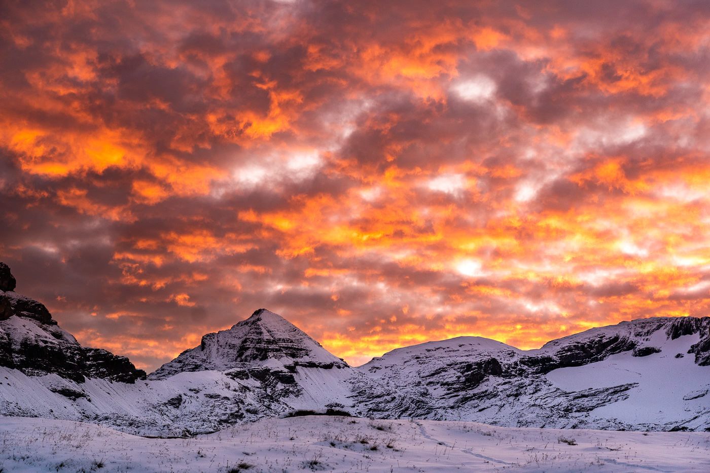
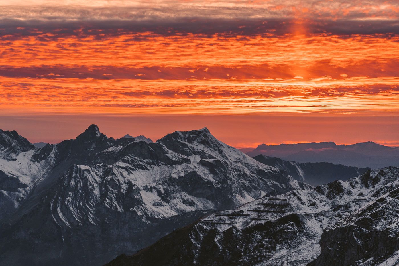
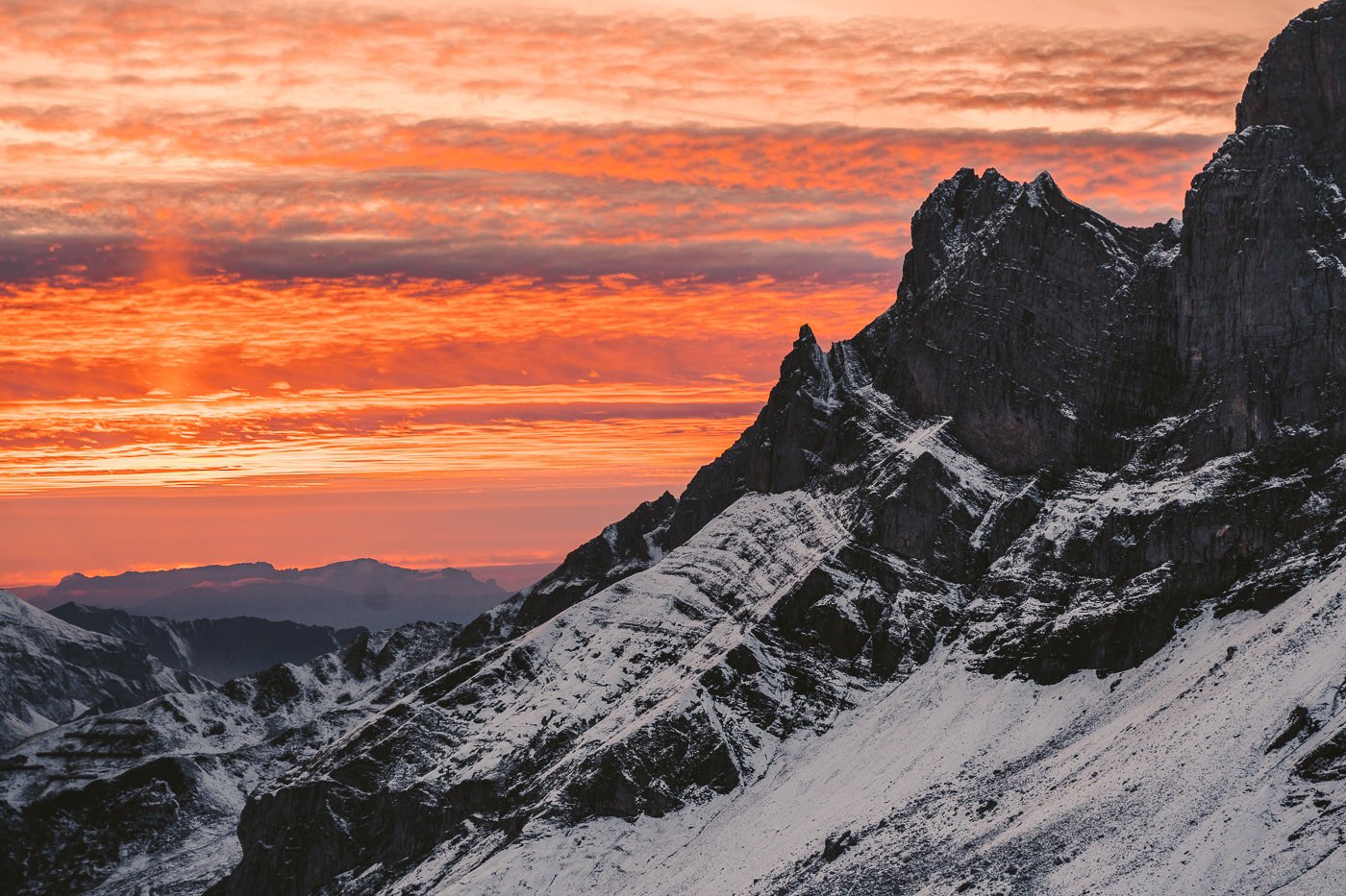
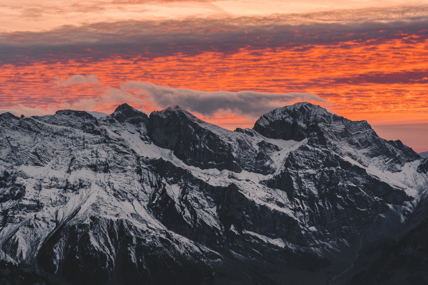
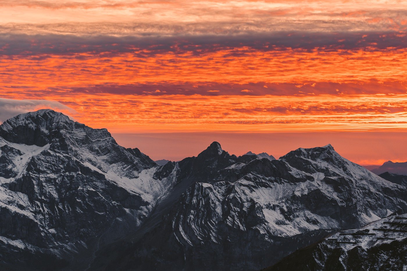
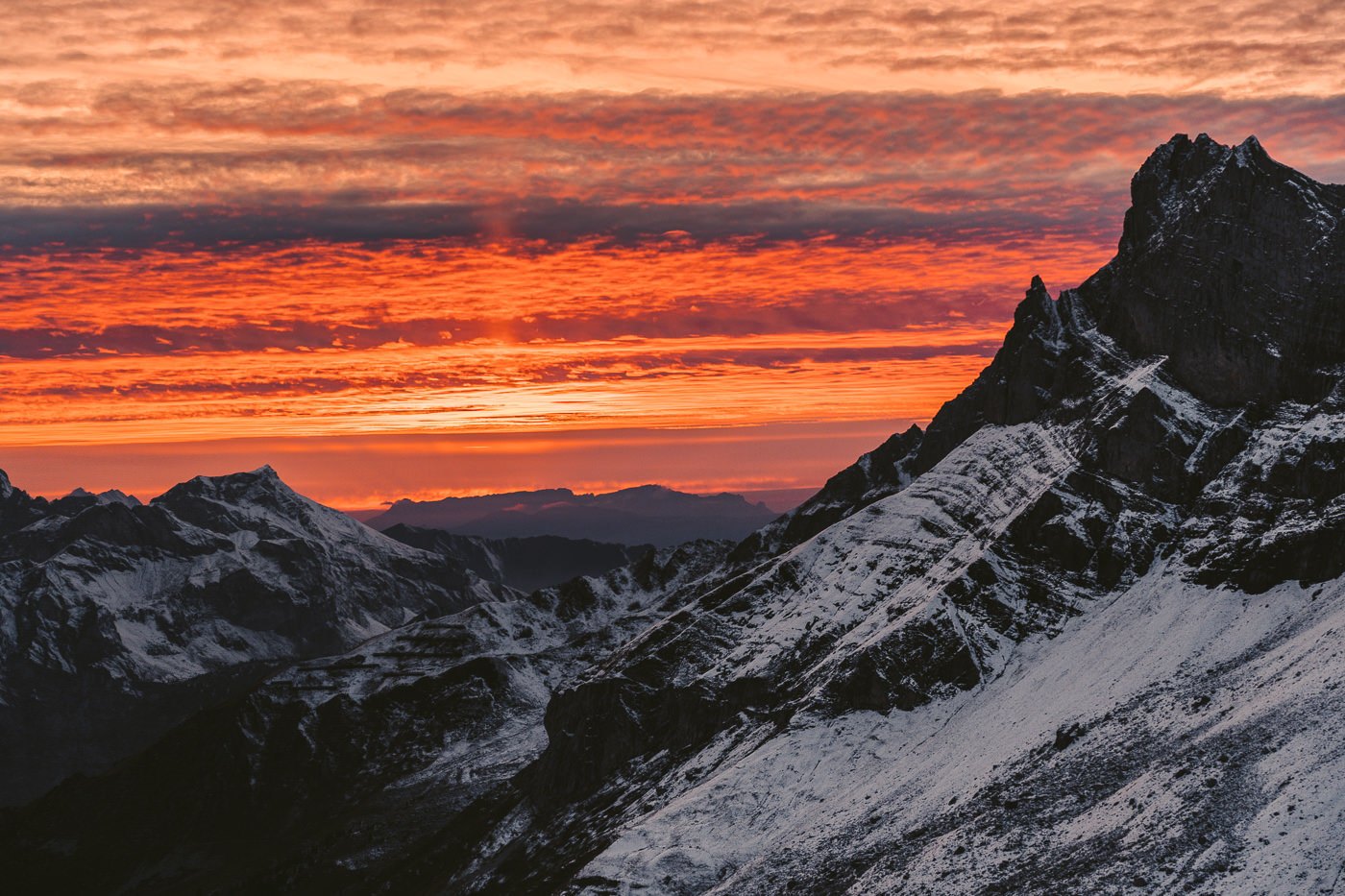
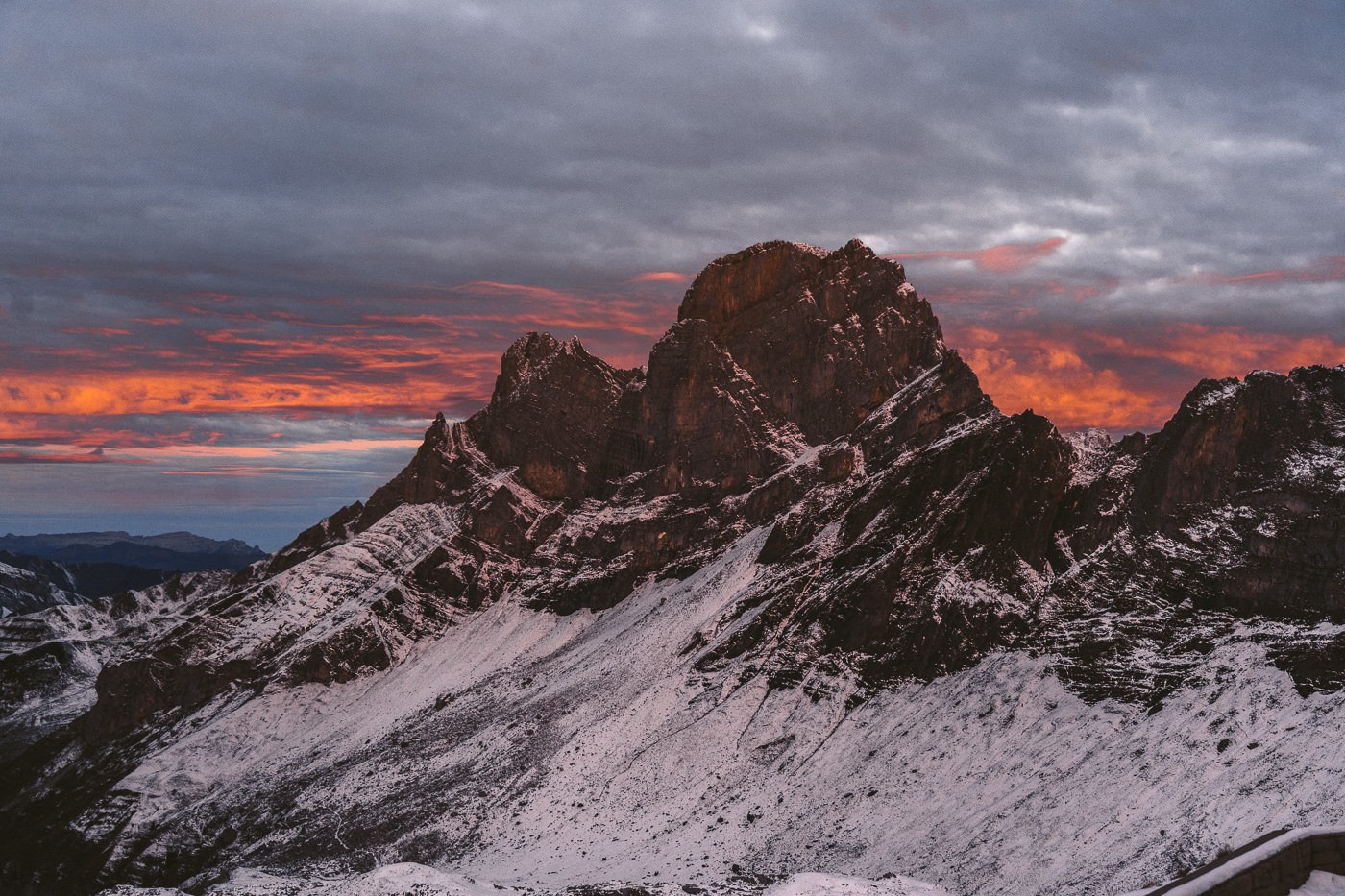
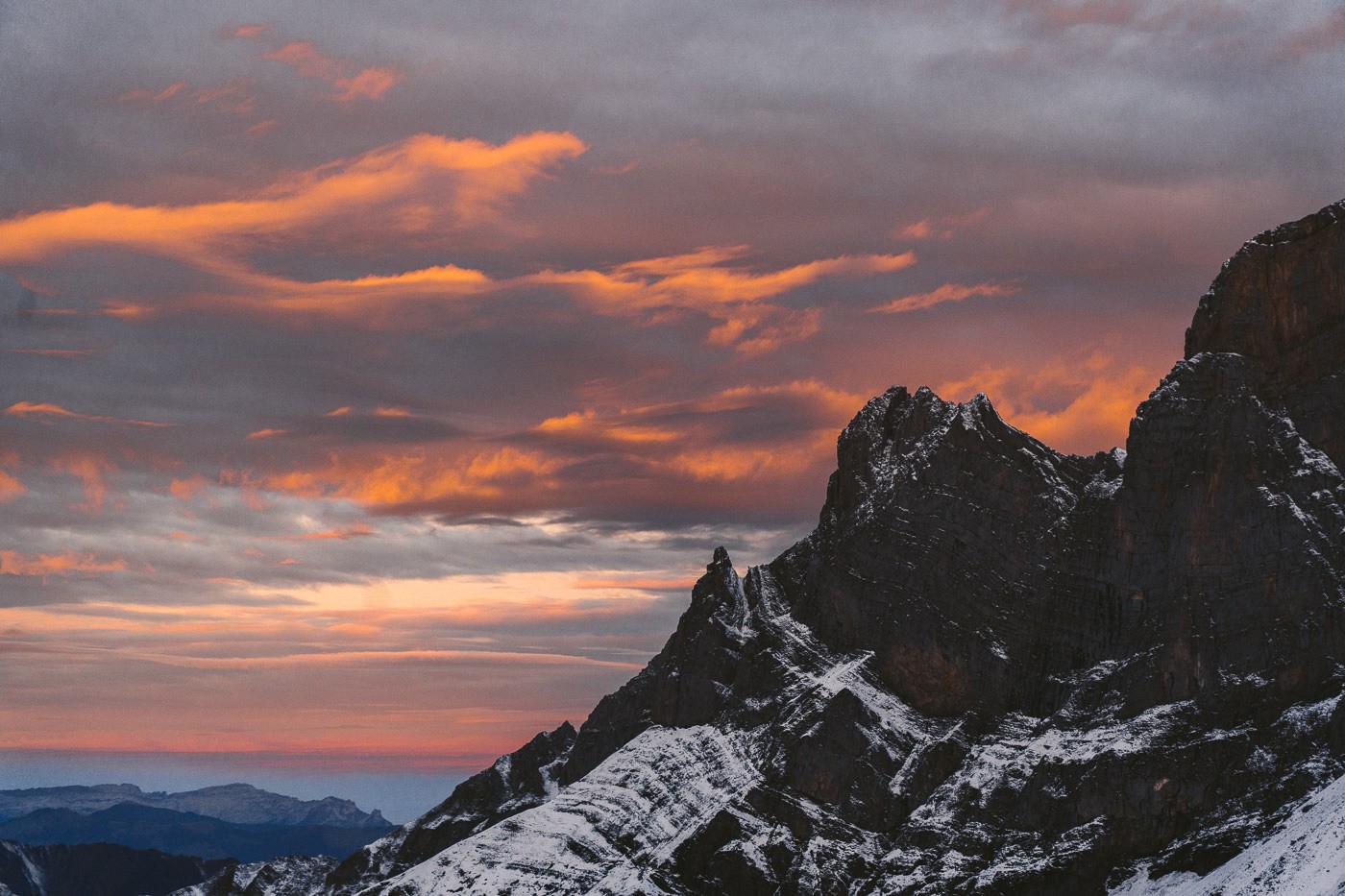
The hike to and from Rugghubelhutte is an adventure but dropping your bag down, enjoying a good meal in the mountains, and witnessing sunrise and sunset from the patio of the mountain hut is an experience I will never forget. I hiked up from Engelberg and was gifted an incredible, fiery red sunset, and then after a great dinner and night of rest, the sunset produced another glowing display in the sky.
RUGGHUBELHUTTE HIKE DETAILS
Hike Distance: The total distance of the hike depends on, which route you choose. I’ve listed the three most popular options below. Note that you will need a cable car to get to Ristis and Bannalpsee but not from Engelberg. I chose to hike up from Engelberg and then on the way down I went up to Rotgratli and continued on down to Bannalpsee, effectively seeing all the spots on the route (except Engelberger Rostock summit).
- Engelberg to Rugghubelhutte: 10km
- Ristis to Rughubelhutte: 6km
- Bannalpsee to Rughubelhutte: 10km
Hike Duration: Again it depends on where you start from. My journey from Engelberg to Rugghubelhutte took 3 hours at a medium pace. The journey -through knee-deep snow- back to Bannalpsee took 3.5 hours but would be much, much quicker on a dry day.
Hike Difficulty: In the summer the hike difficulty is quite low. On the way up there are no exposed sections. The incline is quite a bit from Engelberg with 1200m of ascent to contend with but other than that a lot of the trail is actually a road so I would put this one at a low difficulty level.
Hike Incline: Total incline for the hike from Engelberg to Rugghubelhutte was 1,320m and the elevation up to Rotgratli and down to Bannalpsee was 450m of climbing.
YOU WILL ALSO LIKE MY SWITZERLAND HIKING GUIDE: 50 AWESOME HIKES IN SWITZERLAND
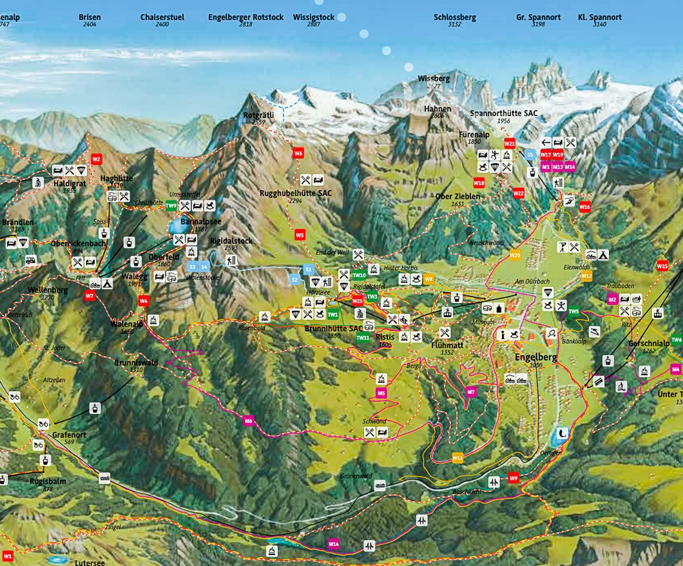
RUGGHUBELHUTTE HIKING MAP
On the map below you can see Rugghubelhutte SAC right in the middle. What you will notice is that there are many options to get there. You can come via Engelberg, Ristis, Brunnihutte or even start at Bannalpsee and do the Walenpfad hike and continue on to Rugghubelhutte. Important to note is that you can get a cable car to Brunnihutte and Ristis if you don’t want to hike from Engelberg.
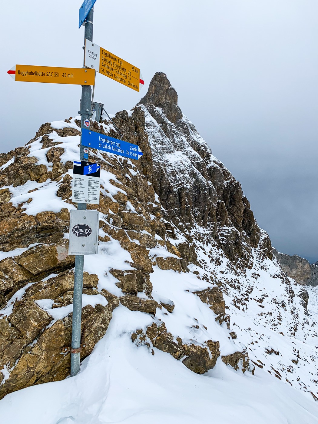
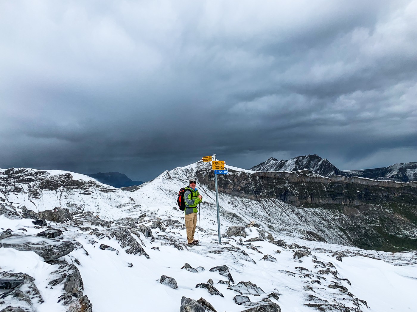
Another thing to notice on the map is the red line above Rugghubelhutte SAC that leads to Rotgratli, which is the saddle that then leads onto the path to Bannalpsee. This is the route I took home and then caught a cable car from Bannalpsee and caught a bus and train back to Engelberg. Above Rotgratli is two blue lines for the T4 summit climbs to Engelberger Rotstock and Wiggistock. I can’t tell you much about them as they were too dangerous with fresh snow for me when I was up at the hut but in dry weather, they are known to be very doable summits for those with T4 difficulty experience.
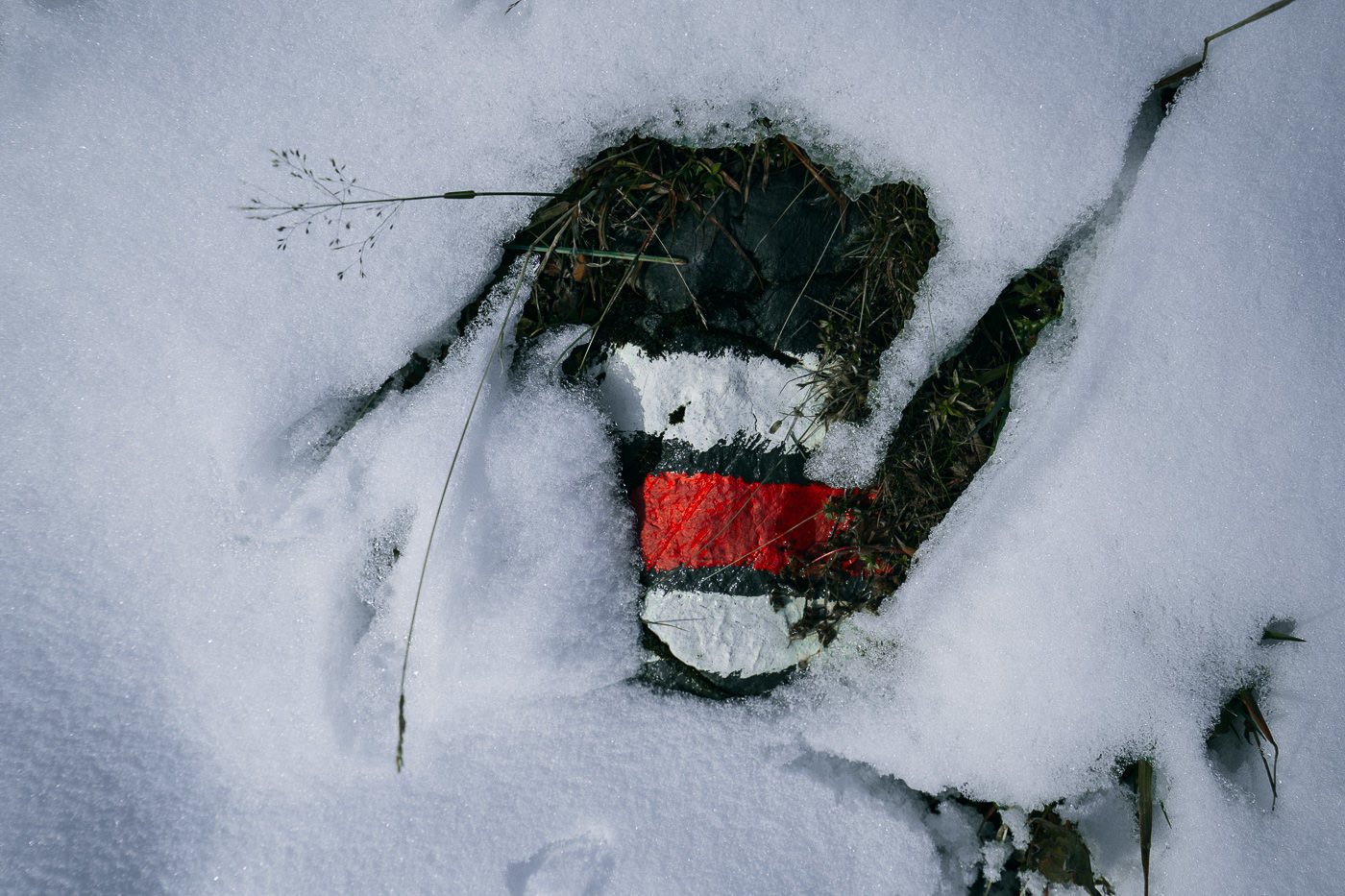
At the bottom of this hiking post, I will add both of the GPX maps, from my exact hike so you can see where I went and check it out or follow it as well if you want but I mostly just followed the signs, which are quite visible the whole hike. Although on the way up I think I made a wrong turn or two before arriving at Ristis.
MY RUGGHUBELHUTTE DRONE VIDEO
I filmed this video from the Rugghubelhutte at sunset and sunrise although most of the good footage was during the sunrise. The drone struggled for connection over the ridge but for the most part, was great.

MY EXPERIENCE HIKING TO RUGGHUBELHUTTE
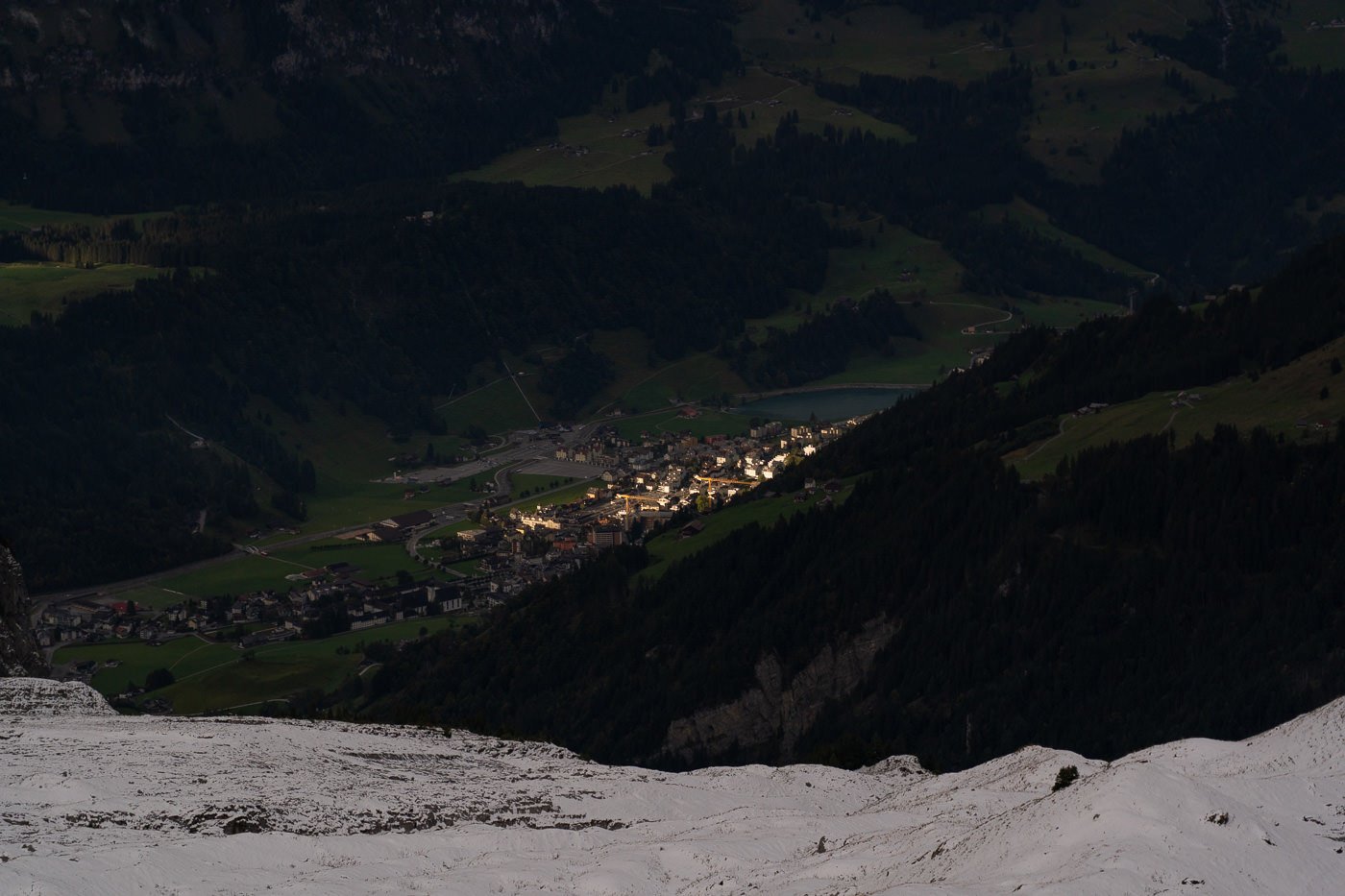
The adventure began in the heart of Engelberg Town. I grabbed some supplies and headed off up into the winding neighborhoods that overlook the quiet town of Engelberg. This first part of the hike is a little strange as you are walking along the road as cars drive past you. It doesn’t last for too long though as you soon head off into the hills.
There are many ways to reach the Ristis Station and I think I may have taken a long way around but in the end, it doesn’t really matter too much. The fact of the matter is that no matter how you get to Rugghubelhutte, you need to pass by the Ristis Station (unless you are coming from Bannalpsee via Rotgratli).
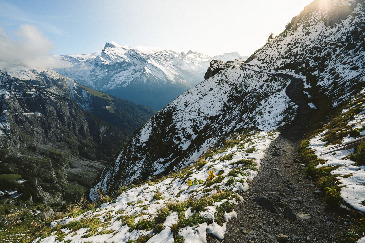
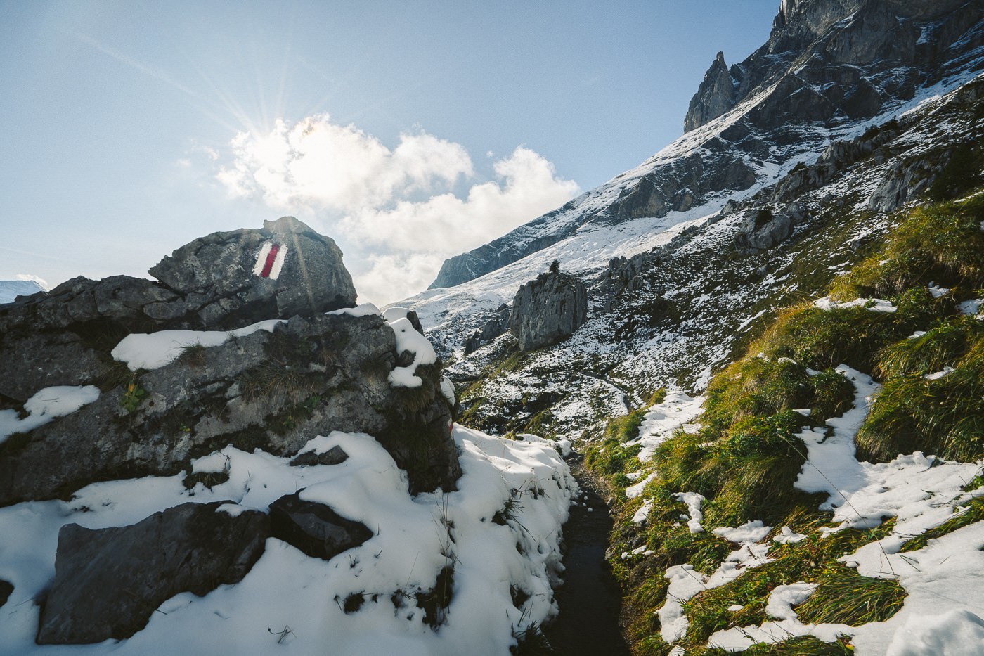
The first few kilometers were spent alone in the steep fields as I climbed my way out of Engelberg. Although the afternoon light was harsh, it was actually a great view of the town for the entire first part of the journey. I was following the red and white markers and the yellow hiking signs.
However, be warned that in the first part of the hike, there are no signs of Rugghubelhutte. You should follow the signs to Ristis and then from there you can start following the Rugghubelhutte signs.
I constantly found myself back on roads throughout a lot of the journey up to Rugghubelhutte, which made me think hiking from Bannalpsee via Rotgratli would have been more adventurous. If I went again, I would try and find a way to bypass Ristis and all of the paved roads on my way up from Engelberg.
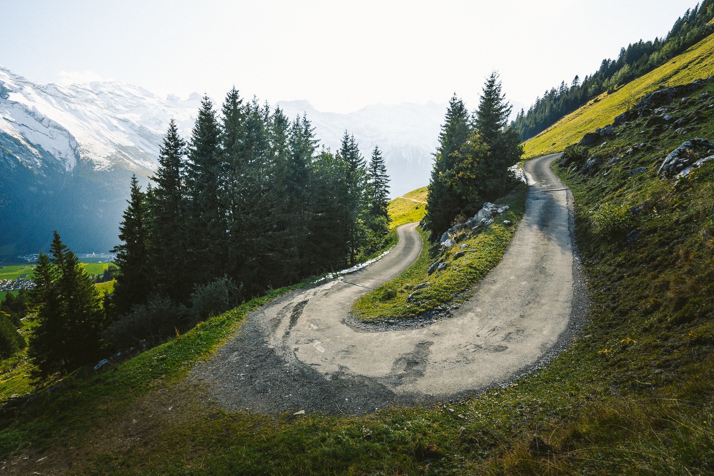
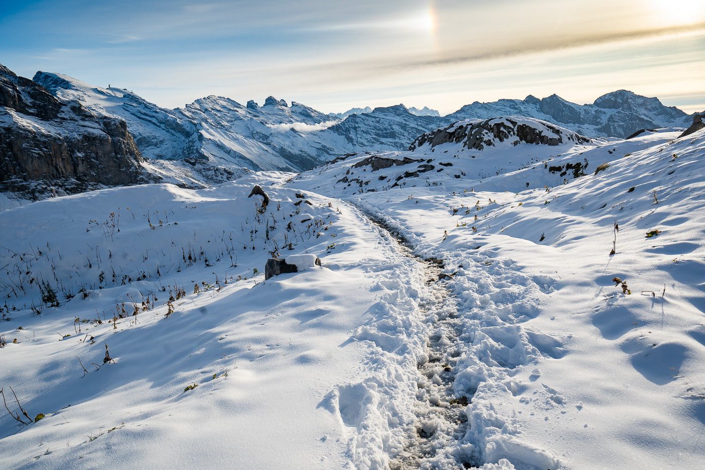
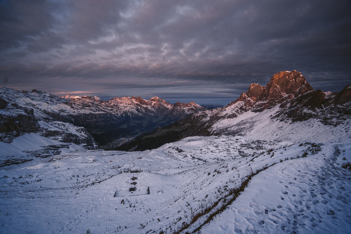
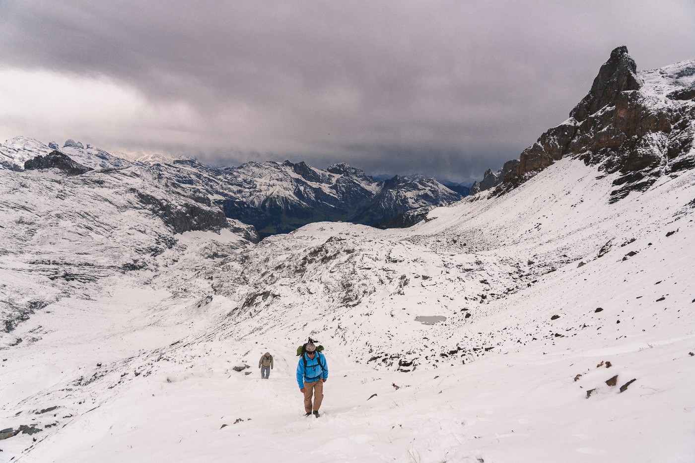
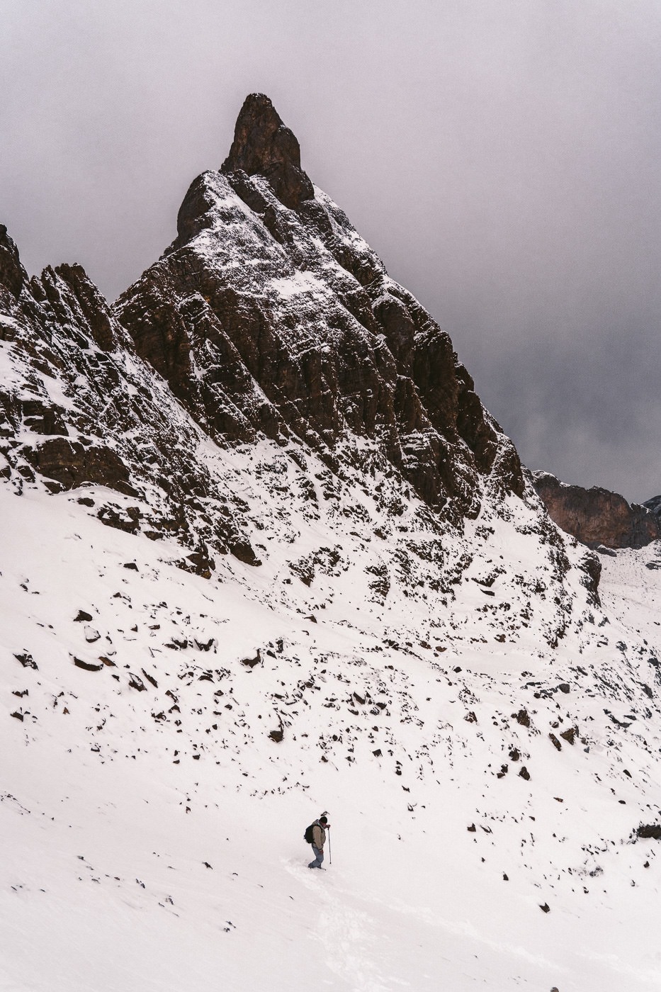
After about 1.5 hours, I finally left the paved roads for good and now followed a small hiking trail that continued the ascent up towards Rugghubelhutte. It wasn’t long before the snowfall from two days earlier started to creep its way onto the trail and I was immersed in a white, winter wonderland in early October. On the hike up, despite the snowfall, I didn’t have to walk through much thick snow and was able to keep mostly dry. This last 4 km of the trail is incredibly beautiful, especially when covered in a blanket of snow.
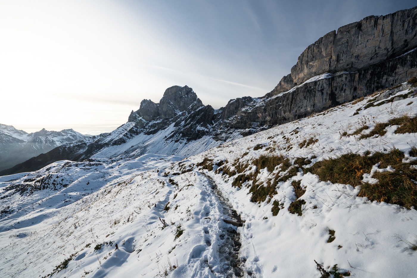
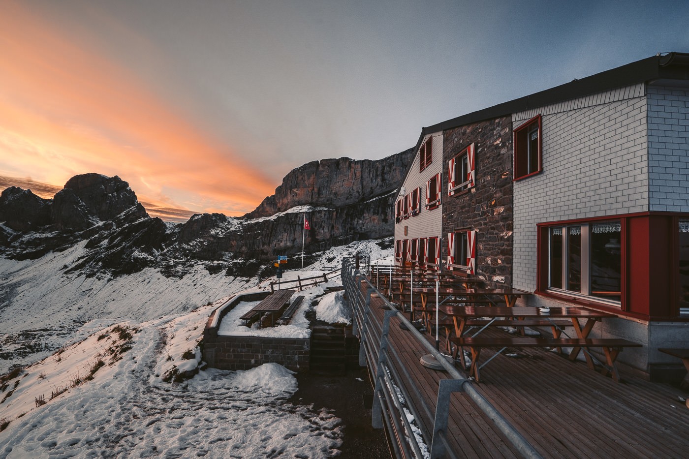
After three hours of hiking from Engelberg, I arrived on the doorstep of Rugghubelhutte about an hour before sunset. Perfect timing. A few families and a couple of other hikers filled the hut with some atmosphere.
However, being early October, the hut season was coming to a close. This meant that it was not near capacity and I had an entire dorm room to myself, which I’ve experienced in many other mountain huts at this time of year in Switzerland. On weekends the huts can still get busy but if you go on a weekday in mid-September onwards they aren’t very busy.
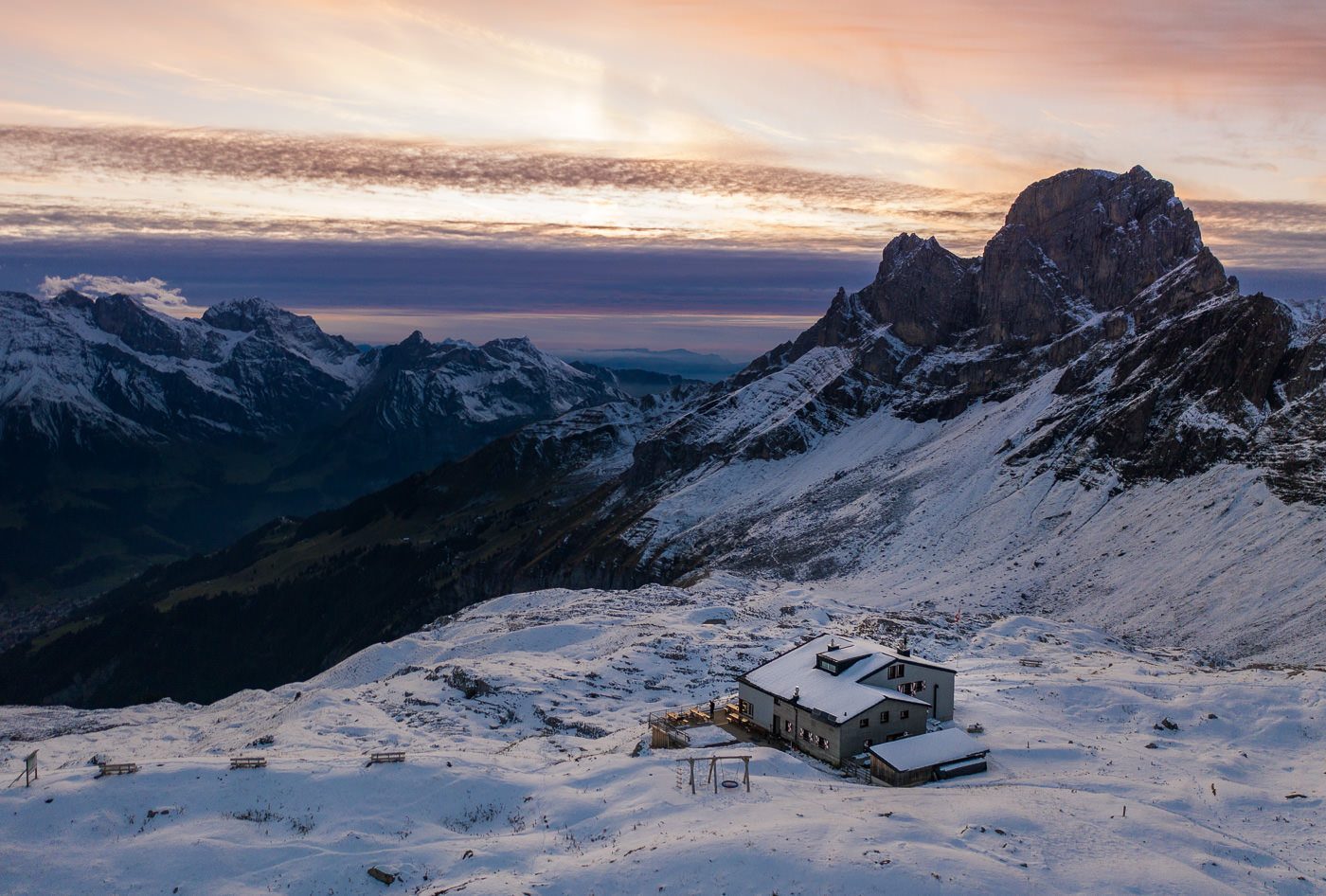
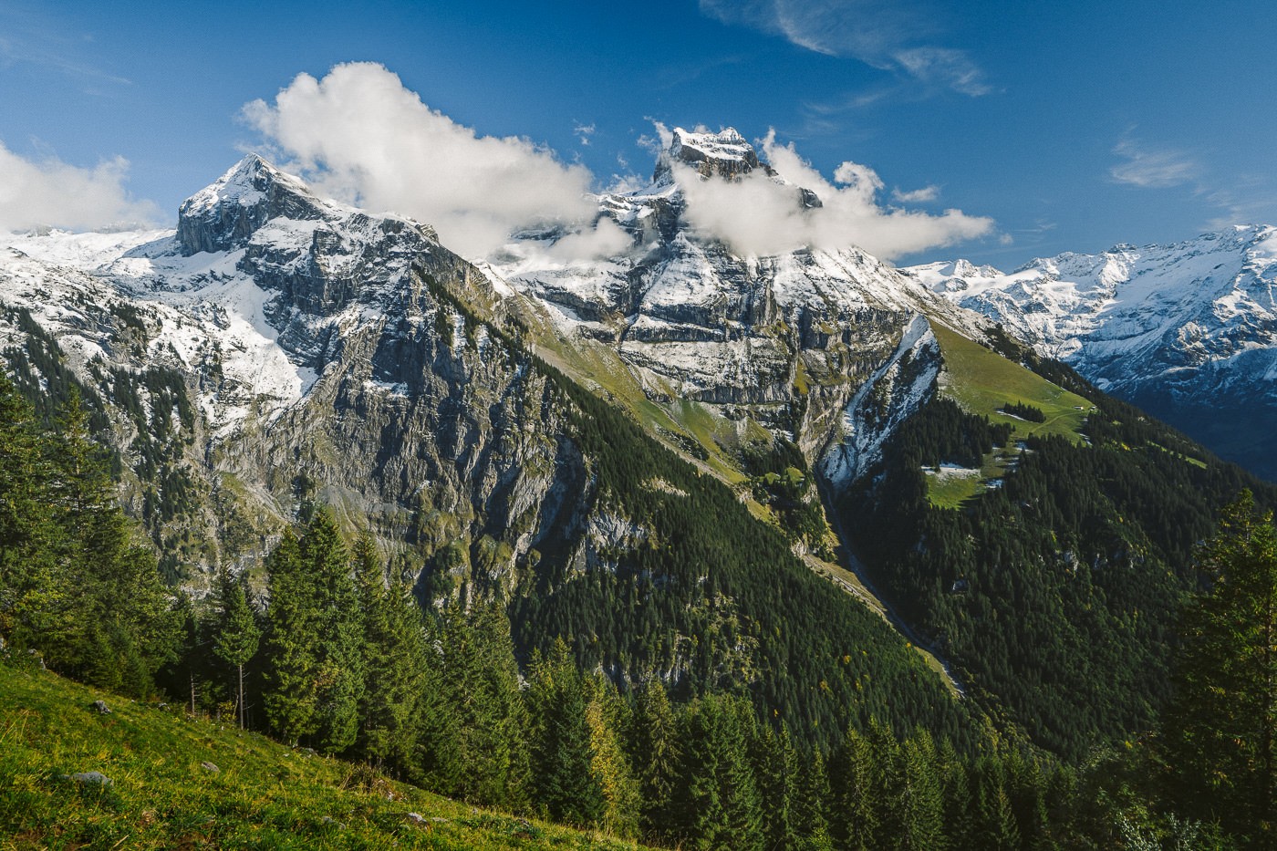
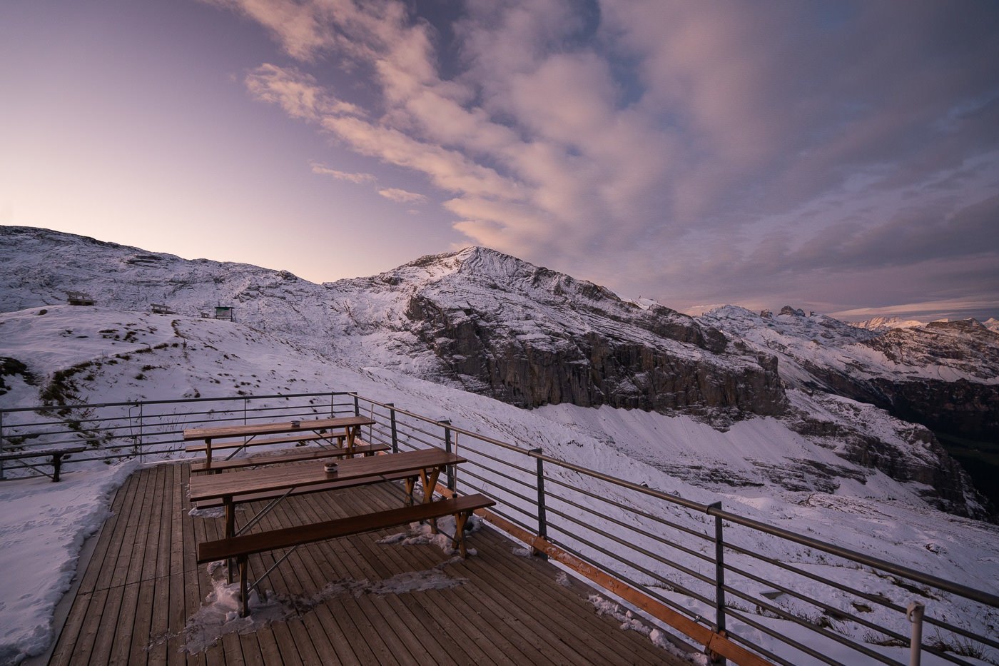
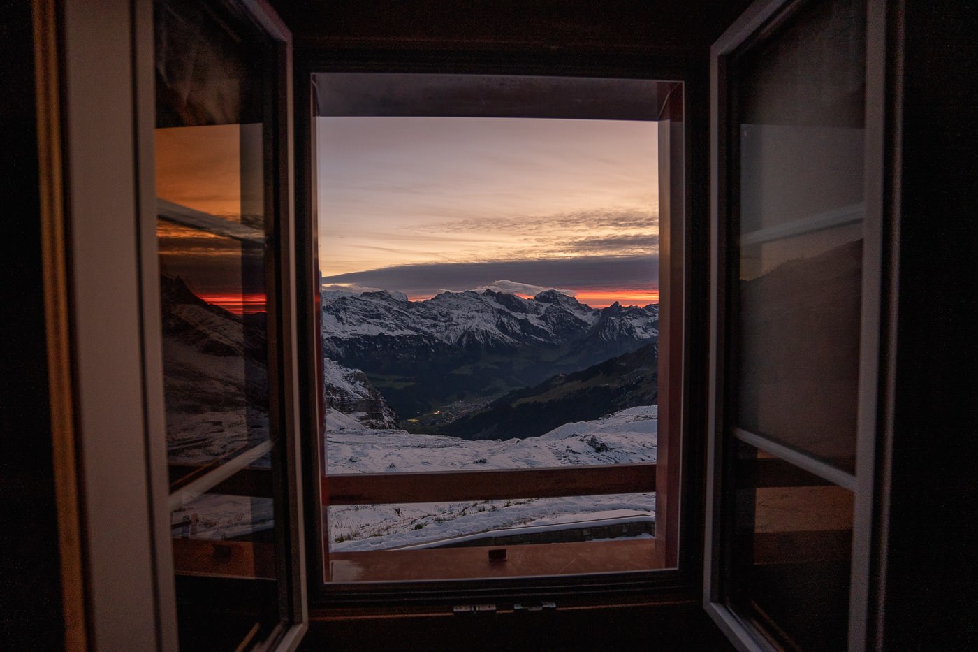
Not long after my arrival, the sky started to make some moves and it would be an hour-long show. The hut is set at 2,296 meters above sea level and has views down to Engelberg. Surrounded by mountains, the hut is somewhat in the middle of a giant alp amphitheater, isolated and far away from the small civilization of Engelberg below.
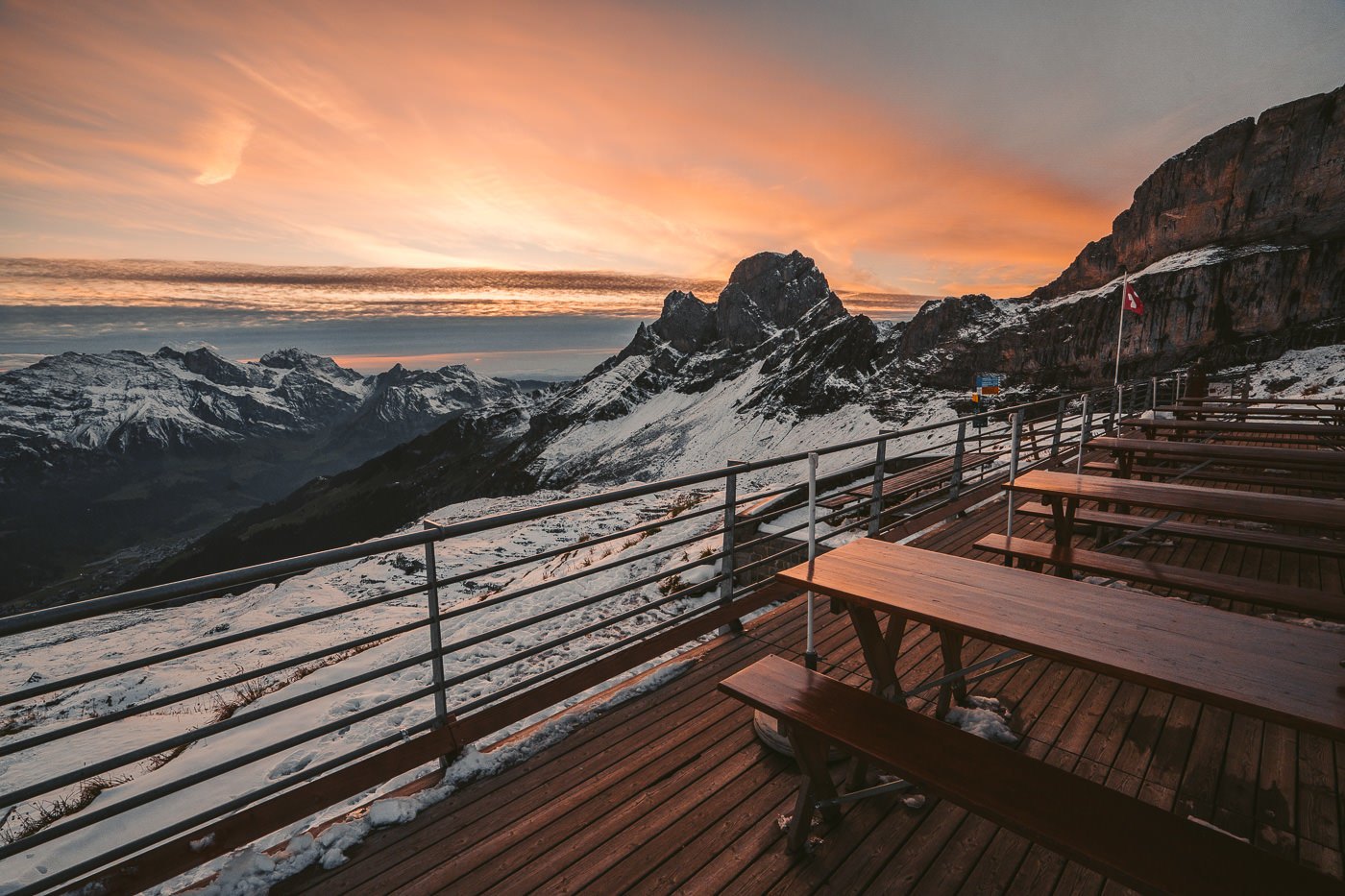
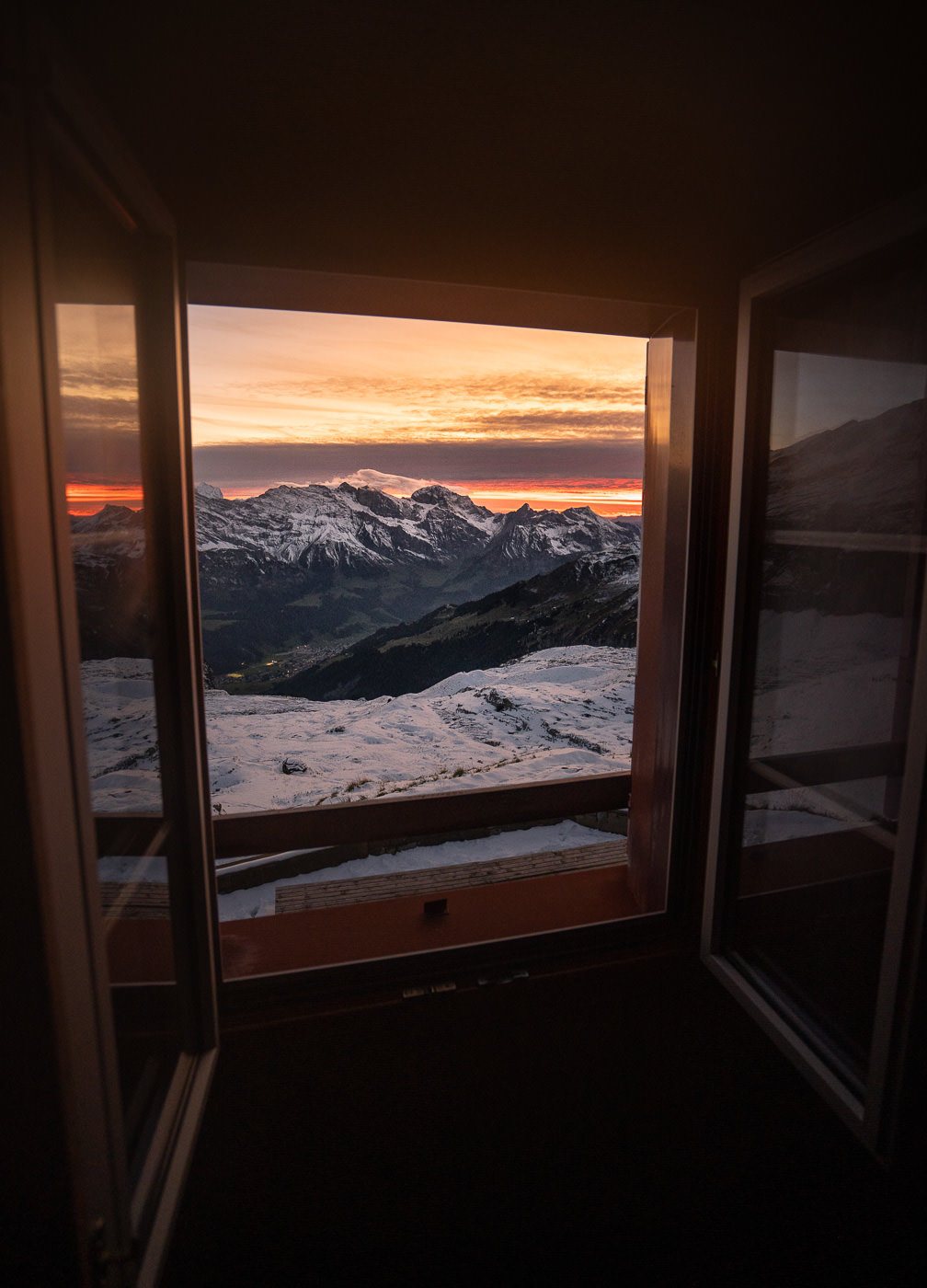
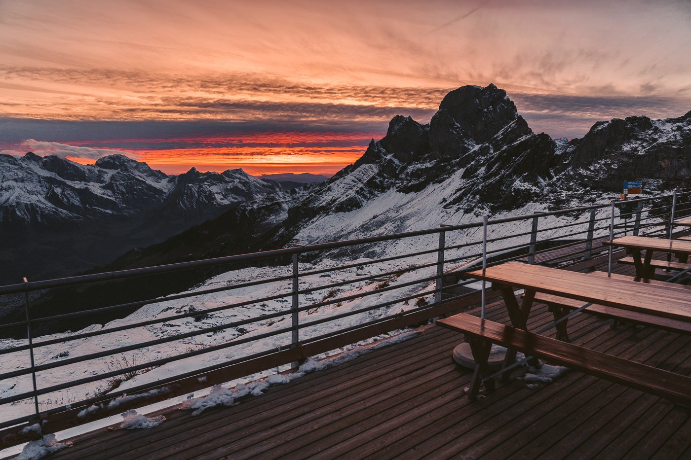
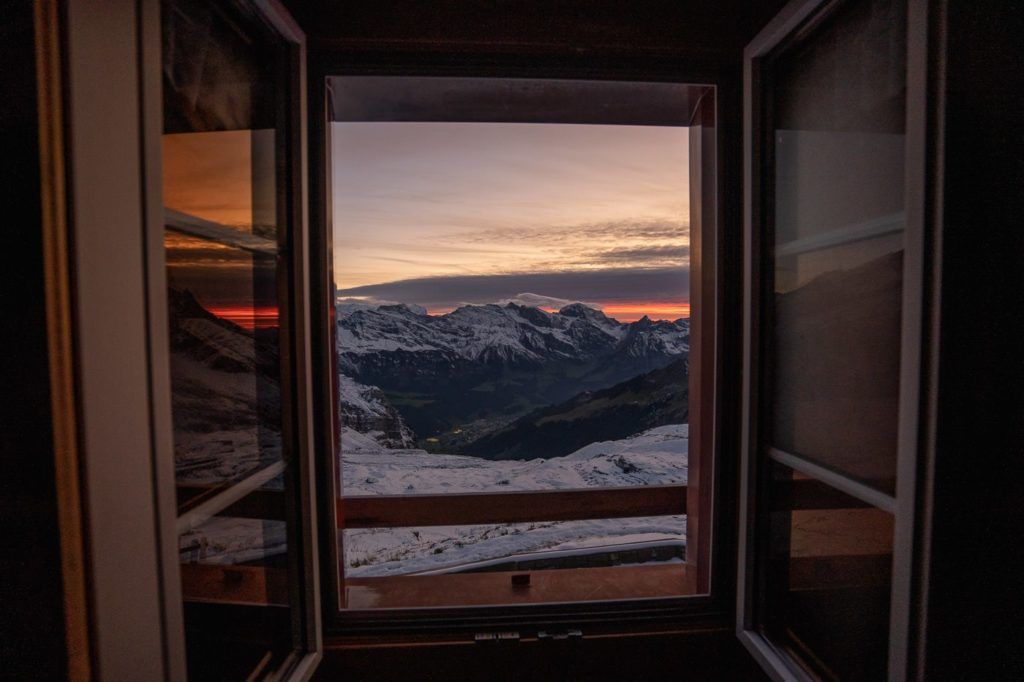
After a great meal, I was off to sleep in my ‘private’ dorm room. I woke up half an hour before sunrise, put on every piece of clothing I had carried up with me, and grabbed a coffee before sitting outside on the patio watching the morning arrive.
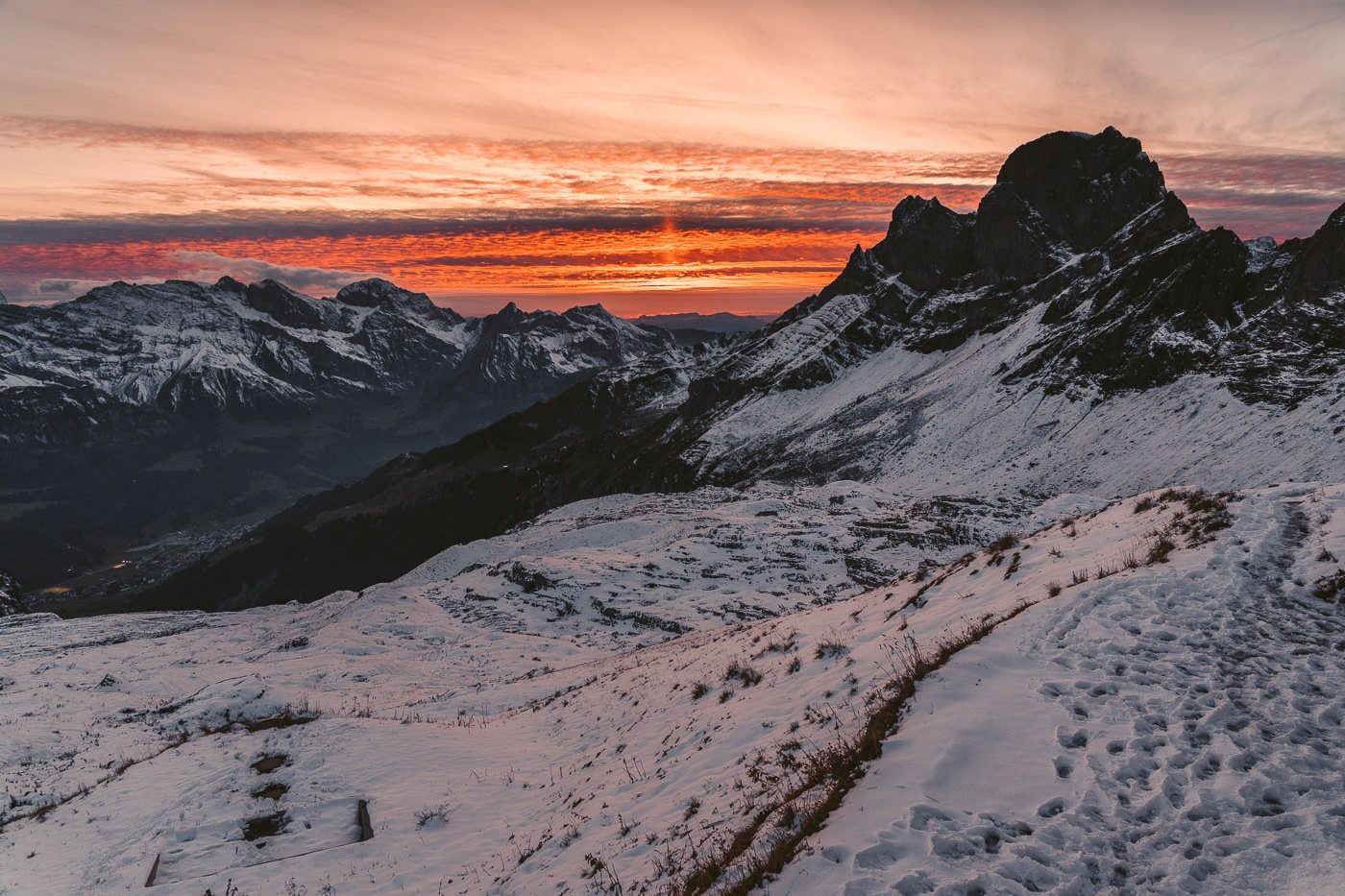
I thought it couldn’t get much better after the fiery red sunset but the sunrise wasn’t to be outdone. Pastels soon turned into fire as the sky blew up. I actually spent most of the sunrise filming a drone video but still captured some stills in between the flying.
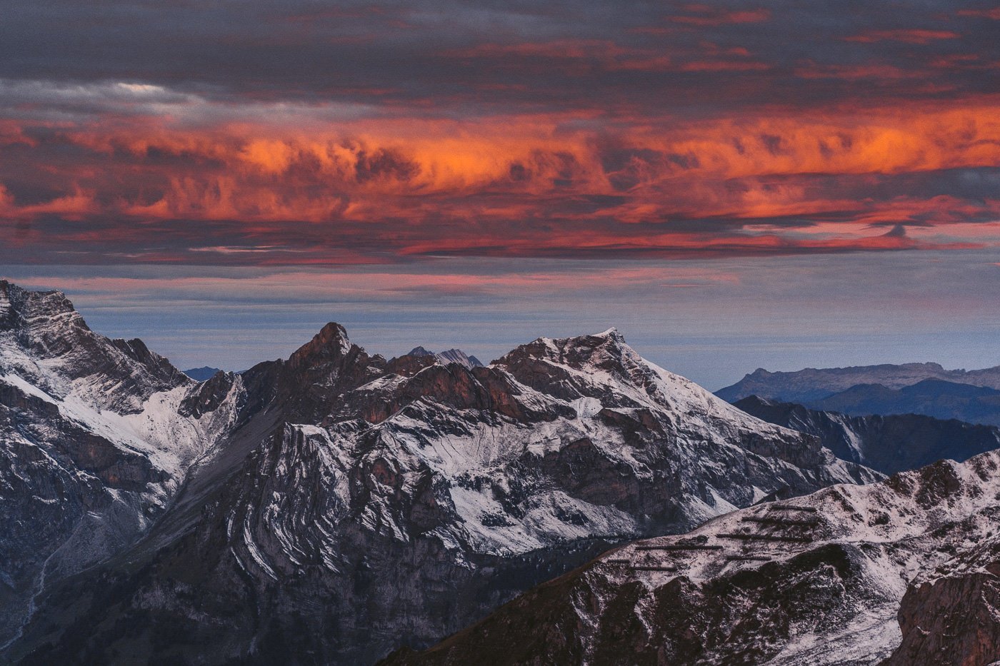
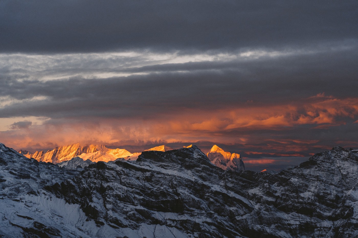
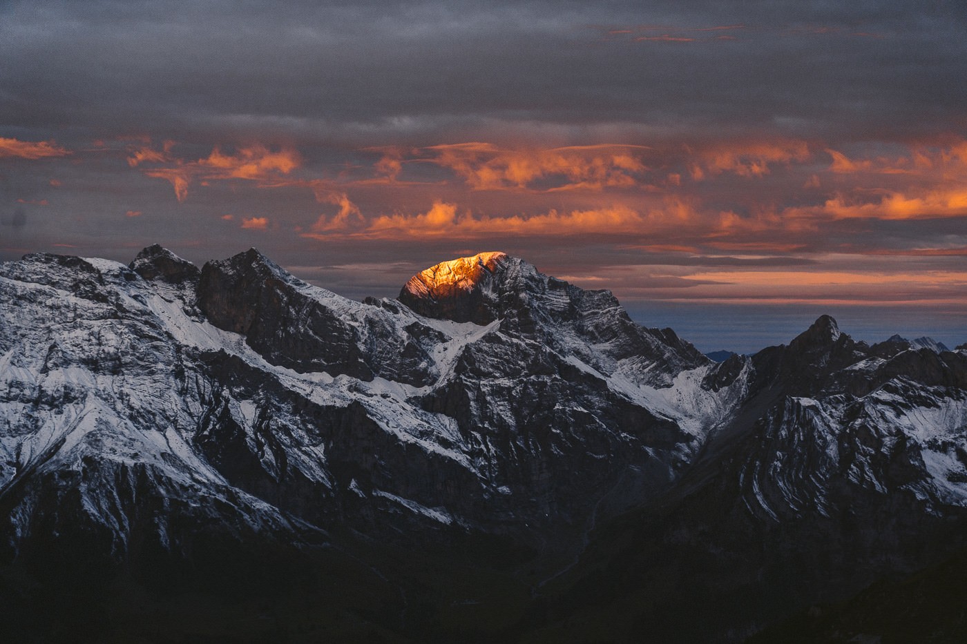
The sunrise and sunsets are why I love mountain huts. You really have a great chance to capture these moments when you have the mountain hut as a base. Often it would be too cold, too high, too dark or too difficult for many adventurers to be in these situations but the mountain hut makes it possible.
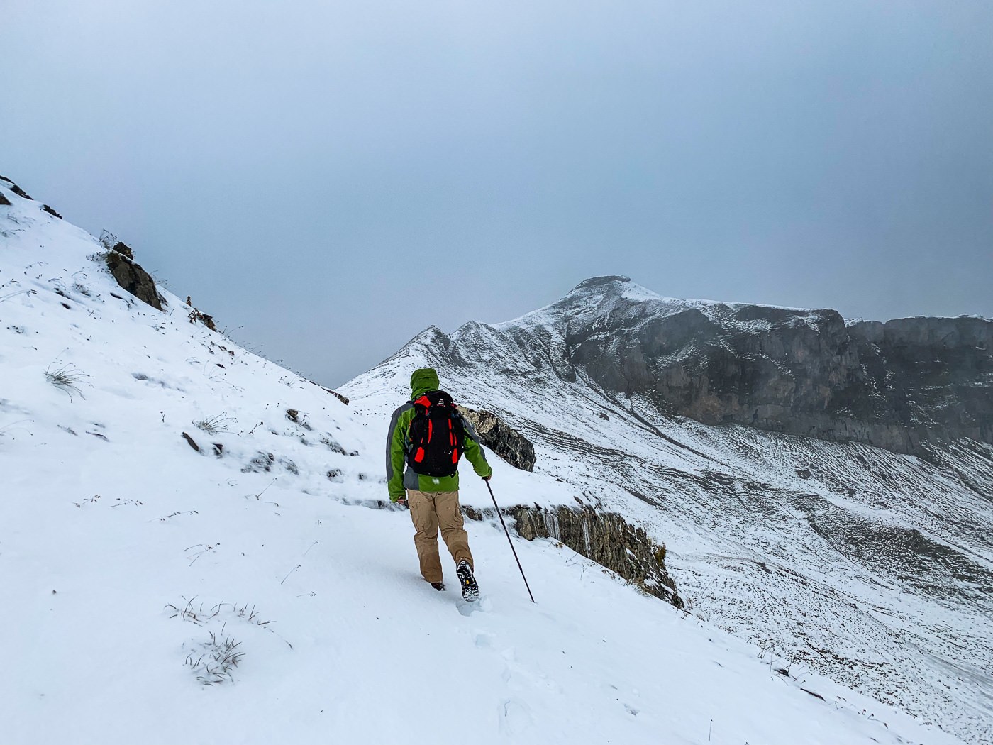
After breakfast, I had some decisions to make. I could head back down the same way but that is one of my least favorite things to do so I was looking for an alternative. My other option was to head up to Rotgratlipass and then hike down to Bannalpsee. The weather seemed okay and I actually set off in shorts assuming I would get hot after a few minutes.
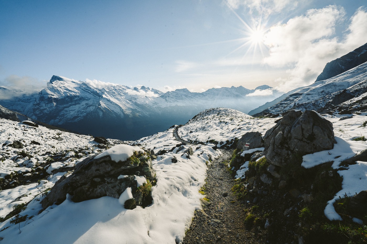
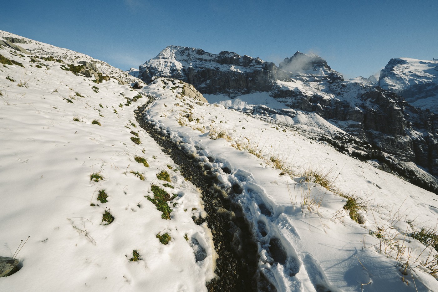
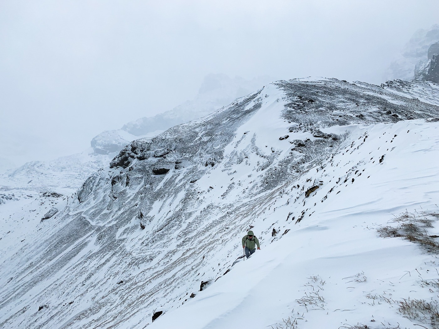
The hike up to Rotgratlipass takes about an hour if there is snow and it was quite thick. At this point, only one lady had taken the path since the 4 feet of snow had fallen two days ago. I followed her footsteps up to Rotgratlipass.
However, about 2/3 of the way in she was coming back down towards me. She said that it was fine to go up to Rotgratlipass but no one had been down the other side and it was 3-4ft of snow on the trail. You couldn’t see the trail markers or the trail. I decided to continue up to Rotgratlipass and then would likely head back to the hut and then return the way I came.
Shortly after, two experienced Germans came up behind me on the trail and they intended to hike down from Rotgratlipass to Bannalpsee so I thought I’d just follow them. As we reached the Rotgratlipass the weather was starting to get wild and a storm was rolling in. It was 7 km further to Bannalpsee at this point so I figured I would just follow the guys.
From this moment on I put my camera away as it was snowing and often incredibly windy. At one point there was a snowstorm for about 15 minutes and I thought if it sticks around we are in big trouble.
Nevertheless, I trusted the Germans who had trail-finding experience. I kept close and followed in their footsteps. It was really my first snow hike and I was a little underprepared gear wise but it was also a bit unexpected.
For my first snow hike, it was like being thrown into the deep end. Speaking of deep, my knees were often beneath the snow as we ‘found’ the trail.
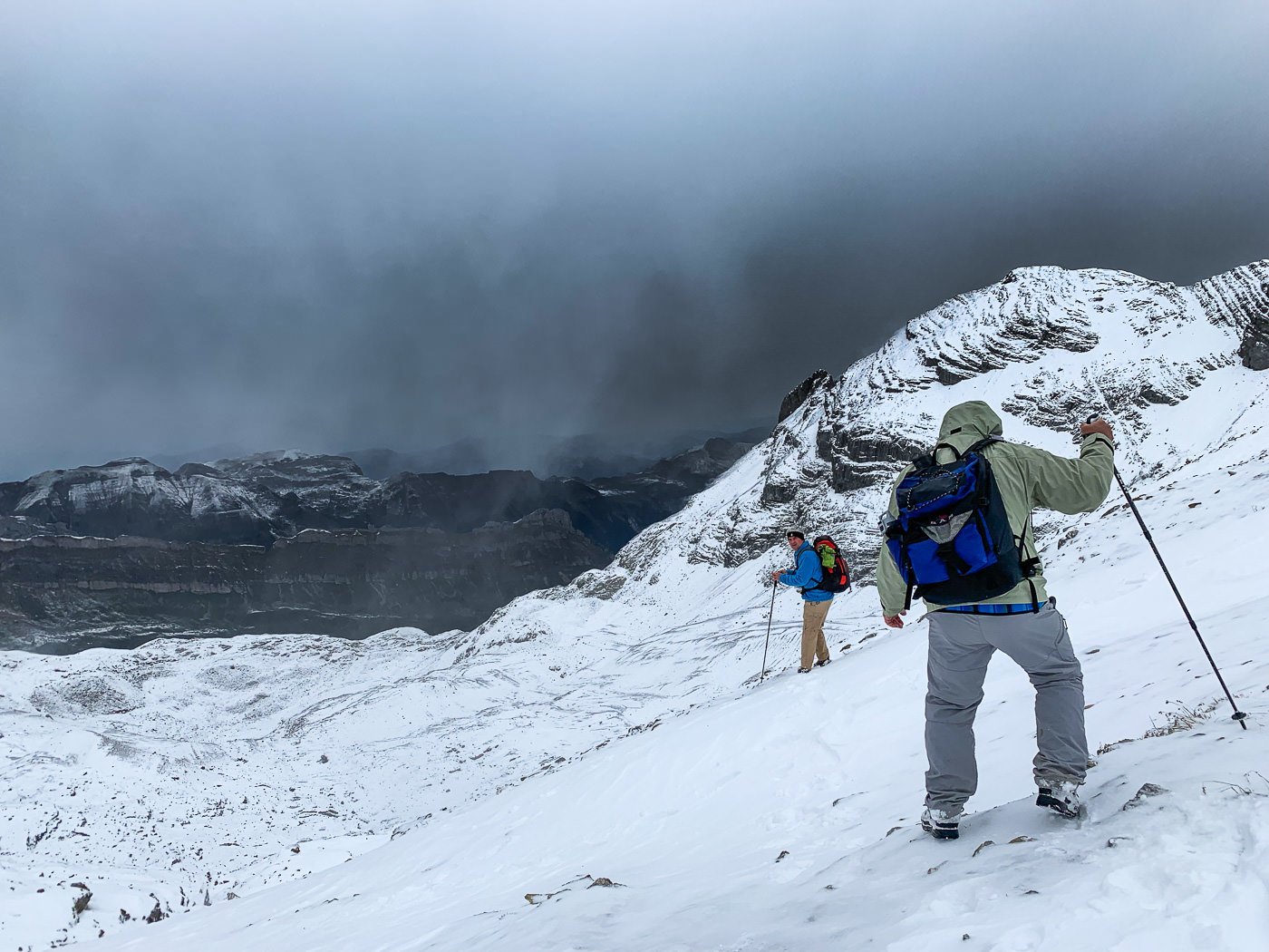
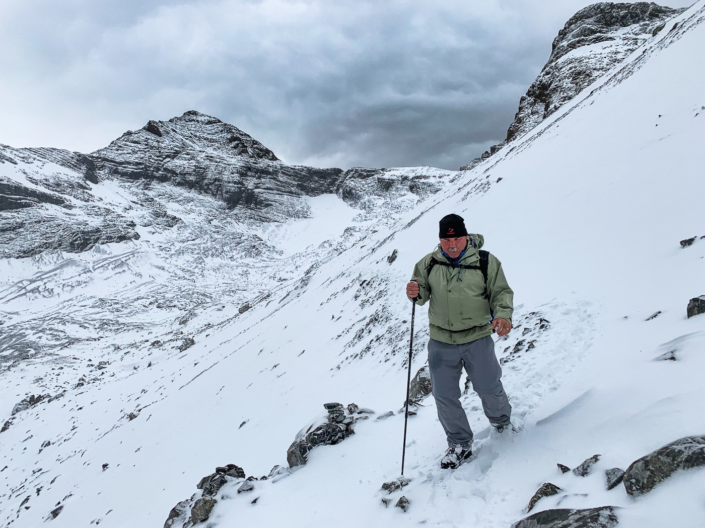
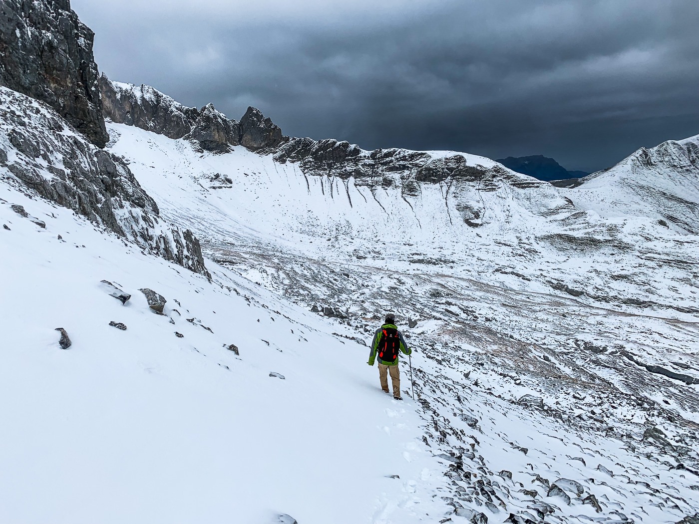
At times, I was pretty nervous with steep drop-offs and heavy winds but thanks to my German friends, we made it through the trail before the worst of the weather came. It was 10 km from Rugghubelhutte to Bannalpsee via Rotgratlipass and took us 3.5 hours but in dry conditions, I could imagine this being no more than a 2.5-hour route.
Despite the conditions, it was a beautiful route, and on the day we explored this region, it felt like a true adventure. I highly recommend coming down from Rugghubelhutte via Rotgratli and ending up at Bannalpsee.
There are two summits above Rotgratli called Engelberger Rotstock and Wiggistock, which are rated T4 difficulty. The conditions didn’t permit me to attempt to summit but it would be a great addition to the adventure if you have clear weather.
HOW TO BOOK A NIGHT AT RUGGHUBELHUTTE
In order to book a night (or more) at Rugghubelhutte, you will need to send an email, make a phone call or fill out the form on their website. They are not on other booking platforms, this is how the hut is booked.
- To email Rugghubelhutte t you can contact them here: info@rugghubel.ch
- To visit the website to make a booking you can do so here: www.rugghubel.ch
- To make a booking via phone you can do so with this number: +41 637 20 64
WHAT IS INCLUDED WHEN YOU STAY AT RUGGHUBELHUTTE
The way mountain huts generally work is that you reserve a bed and also your half-board is included, which means you get a great dinner and breakfast service. Depending on the hut you can also get tea and drinking water but some do charge for this pending availability. You can choose to stay overnight without half-board but understand that there is no ‘cafe’ around the corner. I think the only reason you would choose not to have half-board is if you arrived very late and left very early missing dinner and breakfast.
Rugghubelhutte has a total of 94 beds, throughout twelve rooms. They have simple multi-bed rooms or private 2-bed rooms including extras.
During the winter months from November to about mid-June, guests can use the winter room and a room with 20 beds.
MY HIKING MAP FROM ENGELBERG TO RUGGHUBELHUTTE
You can download my map here for use on your Garmin, smartwatch or another app.
MY HIKING MAP FROM RUGGHUBELHUTTE TO ROTGRATLI TO BANNALPSEE
You can download my map here for use on your Garmin, smartwatch or another app.
SWISS TRAVEL PASS or HALF-FARE CARD
OPTION 1: Buy the Swiss Half Fare Card: Switzerland trains, buses, and cable cars are EXPENSIVE! I found the best way to get around cheaply was to buy the Swiss Half-Fare Card before I arrived. It gives you 50% off every regular train, bus, and even many cable cars. It only costs $150 USD but pays itself off in just a few days with many train tickets in Switzerland costing close to $100 alone. If you are staying for more than 5 days, I suggest buying the Swiss Half-Fare Card.
OPTION 2: Buy the Swiss Travel Pass: The second option is to get the Swiss Travel Pass, which gives you unlimited train, bus, and (many) cable car rides but it’s pretty expensive at around $100 USD per day so if you don’t travel each day it isn’t worth it.
OPTION 3: Buy the FLEXI Swiss Travel Pass: The final (BEST) option is to get the FLEXI Swiss Travel Pass, which allows you to buy 8 days’ worth of transit but you can choose the night before if you want to activate the next day. That way you don’t need to travel every day to get your money’s worth, you can just activate the FLEXI Swiss Travel Pass on the days when you are doing sizeable transits. My advice is to book the Swiss Half-Fare Card or the FLEXI Swiss Travel Pass in advance before your trip so it’s ready to go when you arrive.
GET A SWISS TRAVEL PASS!


Enjoy UNLIMITED train, boat, and bus rides in Switzerland for up to 15 days. Click to book a flex Swiss Travel Pass or choose the Consecutive Swiss Travel Pass.
The Swiss Travel Pass starts at $260 for 3 days. Click here to check if it’s available on your travel dates.
MY SWITZERLAND HIKING GUIDES
I spent 100 days hiking in Switzerland and created a guide for different regions around the country. You can click on one of my Switzerland hiking guides below to help you plan your trip.
- The Complete Guide: 50 AWESOME HIKES IN IN SWITZERLAND
- The Via Ferrata Guide: 4 EPIC SWITZERLAND VIA FERRATA COURSES
- Lauterbrunnen Guide: 10 AWESOME HIKES NEAR LAUTERBRUNNEN
- Interlaken Guide: 15 AWESOME HIKES IN INTERLAKEN
- Grindelwald Guide: 12 AWESOME HIKES NEAR GRINDELWALD:
- Mürren Guide: 7 AWESOME HIKES IN MURREN
- Appenzell Guide: 9 AWESOME HIKES NEAR APPENZELL
- Chur Guide: 7 AWESOME HIKES NEAR CHUR

MY SWITZERLAND TRAVEL TIPS
- For Backpackers: SWITZERLAND BUDGET BACKPACKING GUIDE
- Travel Tips: 20 THINGS TO KNOW BEFORE VISITING SWITZERLAND
- Transport Tips: RENTING AND DRIVING A CAR IN SWITZERLAND
- Accommodation Guide: 30 BEST PLACES TO STAY IN SWITZERLAND

Pradish P
Saturday 5th of October 2019
These landscapes are simply mesmerizing. BTW Nice video