
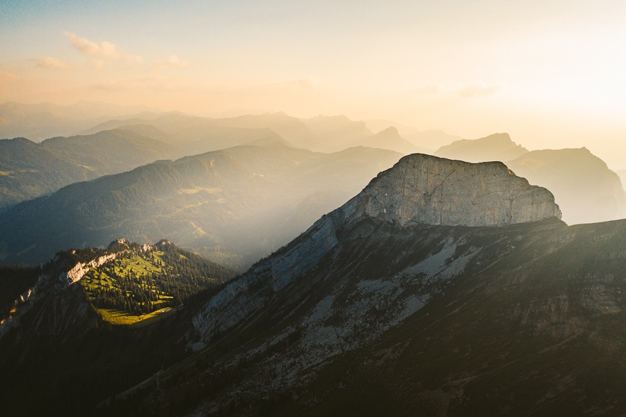
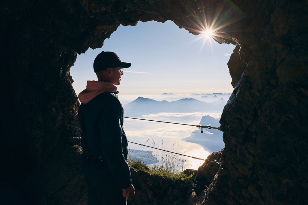
Hiking to the summit of Mount Pilatus, a peak that soars 2,128 meters above sea level, from its base is a challenging yet rewarding undertaking. The most popular trail begins in Alpnachstad and is one of the world’s steepest cogwheel railway routes when not being hiked. The journey up takes about 4 to 5 hours and covers a distance of roughly 5.4 kilometers, with an ascent that’s steep and strenuous but incredibly scenic. The summit rewards you with an awe-inspiring vista of the Swiss Alps, Lakes Lucerne, and a multitude of other natural wonders.
HIKING TO MOUNT PILATUS: COMPLETE GUIDE
In this blog post, I’ll share everything you need to know about the Mount Pilatus Hike. I’ll detail how to get there, the routes you can take, the Mount Pilatus cable car availability, what is at the summit, and share all my photos.
MOUNT PILATUS HIKE DETAILS
- Hike Distance: Alpnachstad to Mount Pilatus: 8km – Alpnachstad to Tomlishorn: 1km – Tomlishorn to Kriens 13km
- Hike Duration: Alpnachstad to Mount Pilatus 3.5 hours + 30 minutes to Tomlishorn + 3 hours to Kriens.
- Hike Difficulty: Steep but safe and not technical. Moderately tough because of the incline but a path the whole way.
- Hike Incline: Starting point at Alpnachstad: 464m – Mount Pilatus height: 2,073m – Mount Tomlishorn height: 2,128m
HOW TO GET TO MOUNT PILATUS
Mount Pilatus is located in central Switzerland near Lucerne. It can be reached by car or train quite easily and because of its centrality is a great hike from most locations.
- From Zurich to Mount Pilatus (Alpnachstad): To travel to Mount Pilatus from Zurich the train will take 1.5 hours while driving in a car will take one hour.
- From Lucerne to Mount Pilatus (Alpnachstad): To travel to Mount Pilatus from Lucerne is even shorter with just a 15-minute car ride or 25 minutes on the train.
There are multiple ways to access Mount Pilatus such as from the Kriens hiking route or booking a ticket on the cable car and the Alpnachstad hiking route. For this blog post, I will detail our experience hiking up from Alpnachstad and down to Kriens on the other side. This is not a loop hiking route.
If you have the Swiss Half-Card you will receive a huge discount on your train and Mount Pilatus cable car tickets. I bought mine when I arrived in Switzerland and it has saved me over a thousand dollars throughout my trip.
MOUNT PILATUS CABLE CAR
The cable car station is located near the parking lot and you can buy a one-way or return ticket. Here you can use your Swiss Half-Fare Card so you only need to pay half of the ticket price. The cable car runs every 15 minutes from 7:30 am to 6 pm. To be sure of the current operating times you can check here.
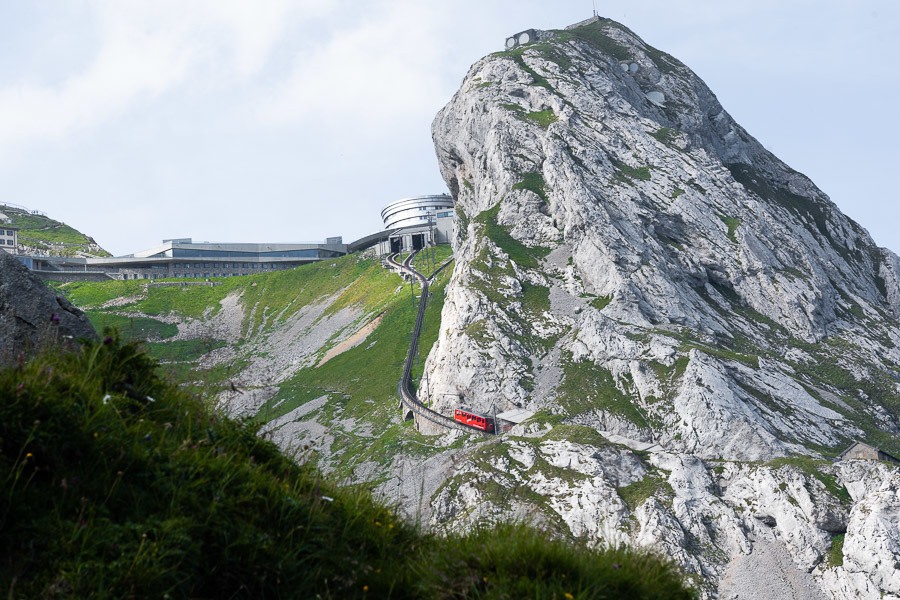
The Mount Pilatus Cable Car provides a thrilling and scenic journey to the top of one of Switzerland’s most iconic mountains. Departing from Kriens, a suburb of Lucerne, the cable car initially travels to Fräkmüntegg, where passengers can choose to take a detour on Switzerland’s longest summer toboggan run or continue the ascent. It is the steepest cog-wheel train in the world at 48% incline, which makes for a very interesting ride up … and down!
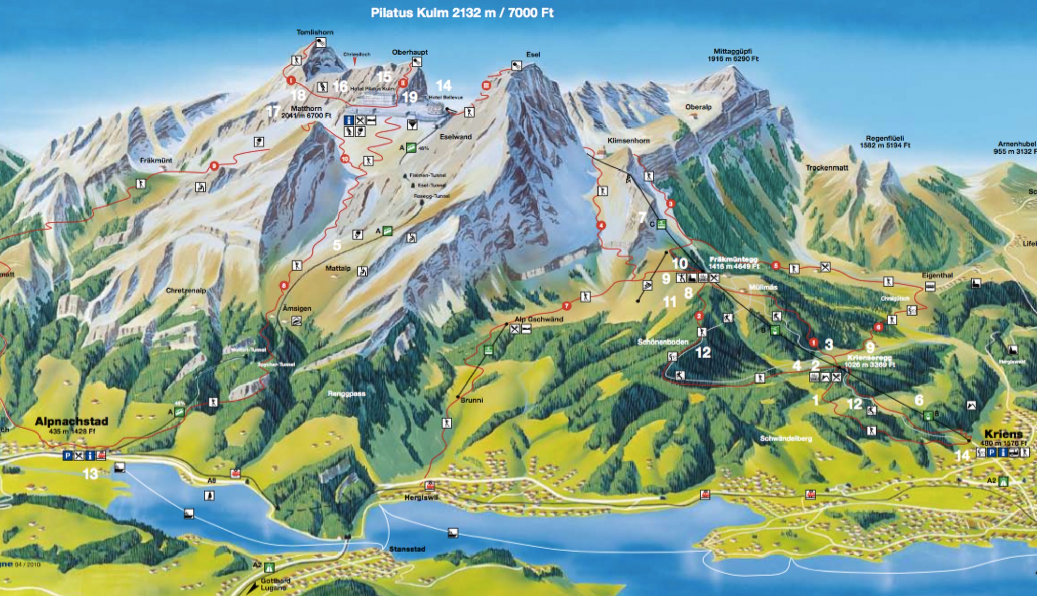
OUR MOUNT PILATUS HIKING ROUTE
Our hike up to Pilatus took a few detours up to all of the peaks along the way like Matthorn, Esel, Oberhaupt, and Tomlishorn. None of these are required but are all short detours of less than 30 minutes so you may as well explore the area while you are up there. The map below will show your route clearly and all of the different spots you can visit. This is a massive route and I advise taking the cable car back down to Alpnachstad or Kriens from the summit after hiking up. We stayed up for sunset and paid the price by missing the last cable car down so our entire day was about 35km.
- Alpnachstad Train Station to Amsigel
- Amsigel to Matthorn
- Matthorn to Esel
- Esel to Tomlishorn
- Tomlishorn to Oberhaupt
- Oberhaupt to Klimsenhorn
- Klimsenhorn to Kriens
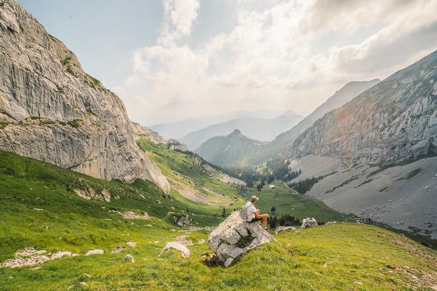
ALPNACHSTAD TO AMSIGEL
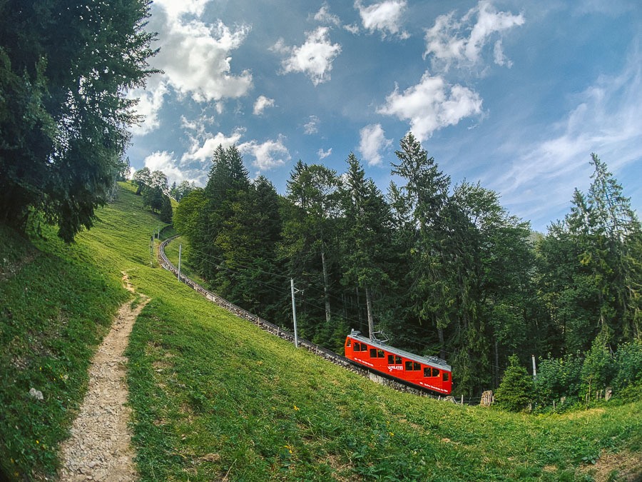
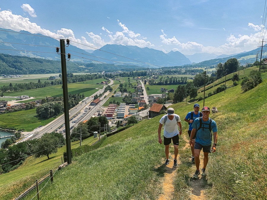
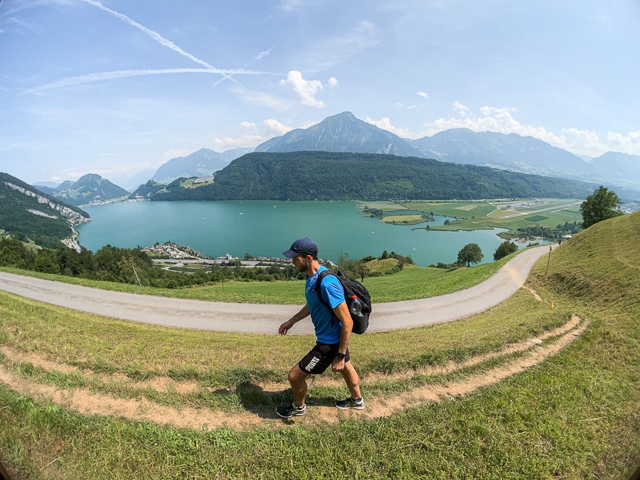
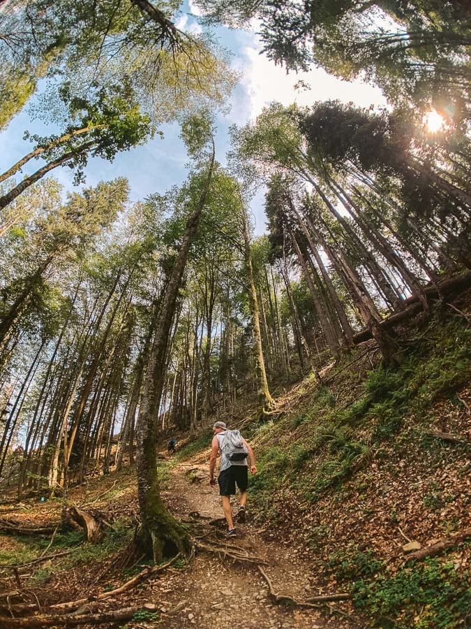
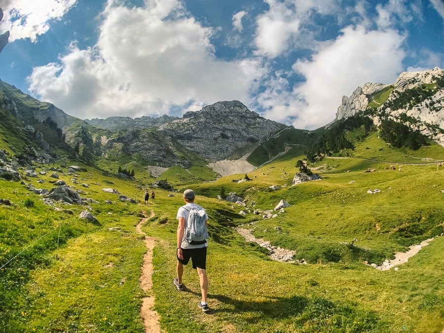
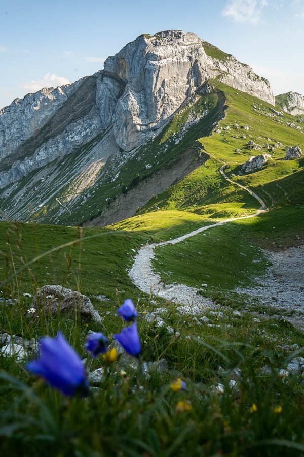
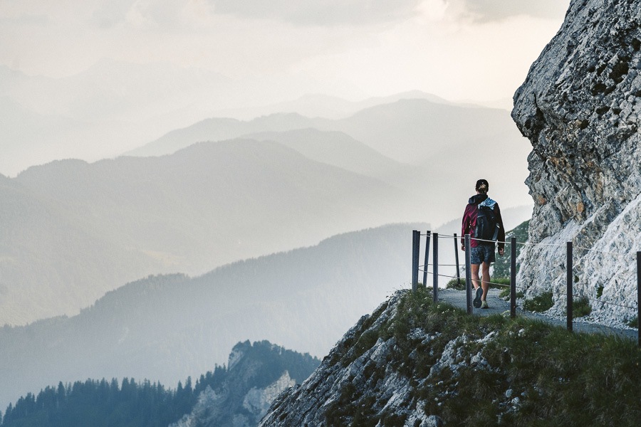
Once departing the train in Alpnachstad, we found the entrance to the hiking route just behind an old shed and began the walk up the mountain. It was steep from the first moment and we were enjoying great views of the lake before we had even been hiking for long. This part of the trail was hot with a steady incline.
The trail quickly wound up alongside the cable car, which sporadically cruised past full of passengers glad they were inside the carriage rather than sweating it out on the trail. Our path had now ventured inside the forest and we had some respite from the sun, although the humidity was tough as the 34-degree day began to take its toll. The incline was relentless and we put in a solid effort to emerge from the forest to Amsigel after about an hour.
AMSIGEL TO MATTHORN
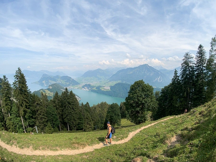
At Amsigel, there was a small shop with supplies and a trough, where we filled up our water from the tap. That’s a great little winner when in Switzerland. There is almost always quality drinking water no matter where you are. The forest was now long behind us as we continued up the hill in the open sun. The bright red cable car continued to slide past us every now and again, almost taunting us as we battled on.
The scenery was opening up and we were now surrounded by huge cliffs rather than trees, it was a welcome change and a truly beautiful setting.
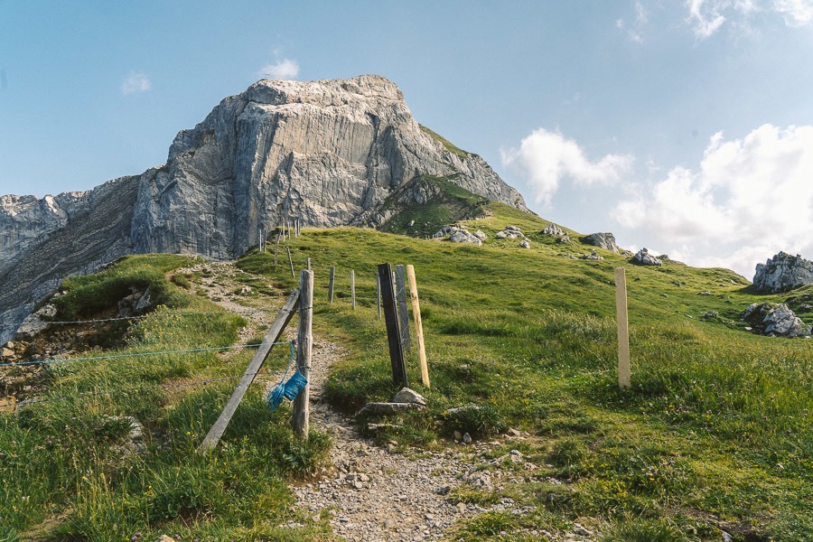
You will find yourself at an intersection at the top of the picture above. Here you can either head right and go straight up to Pilatus or do as we did and visit Matthorn.
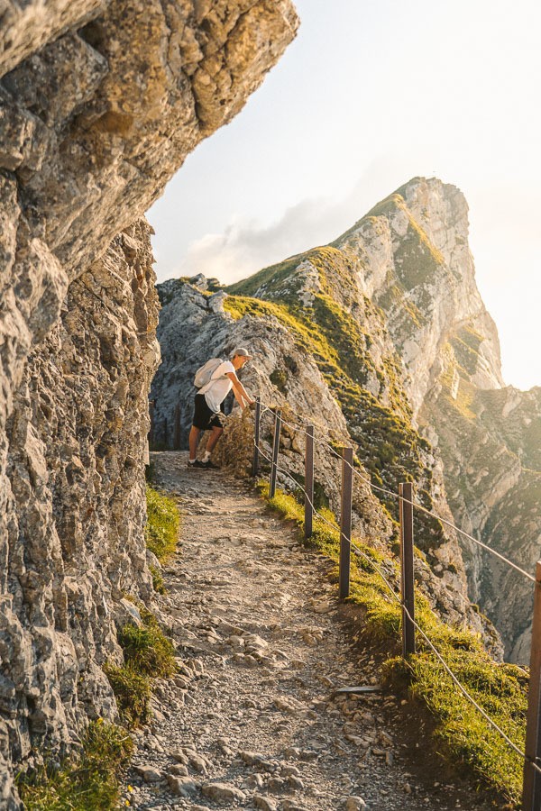
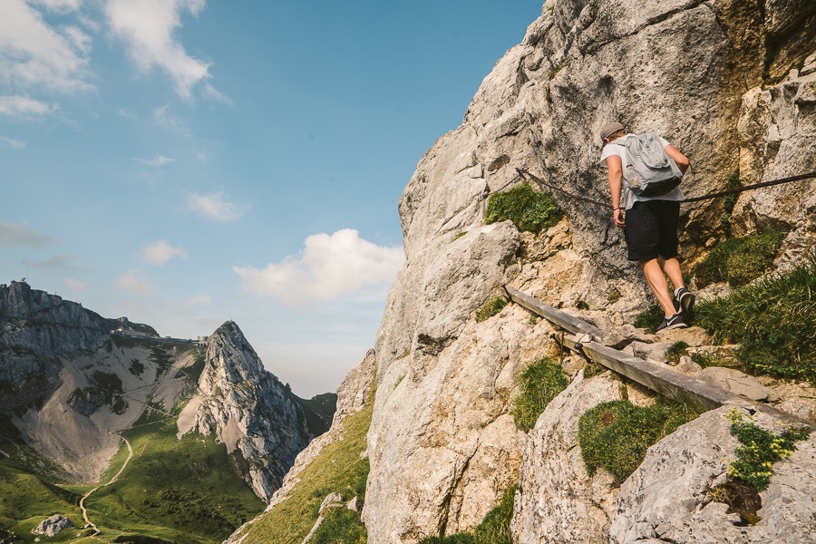
I highly suggest visiting Matthorn as the view is quite different and you actually look back towards Pilatus. The climb up isn’t dangerous or technical but there are parts where you need to hold onto a chain and walk on a bit of a ledge. Nothing too drastic but definitely to be noted for those looking for easy paths.
Once you reach the summit of Matthorn you have panoramic views. You get a great understanding of where you came from and what lies before you for the rest of the journey. We took a lunch break here as the sun beamed down.
Note to drone pilots (as I found out): this position is to close to Lucerne airport to fly and the drone won’t let you take off. You can fly from Tomlishorn as I found out later in the day.
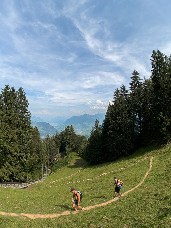
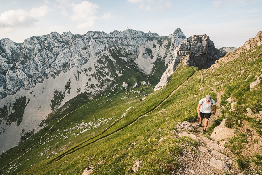
MATTHORN TO ESEL
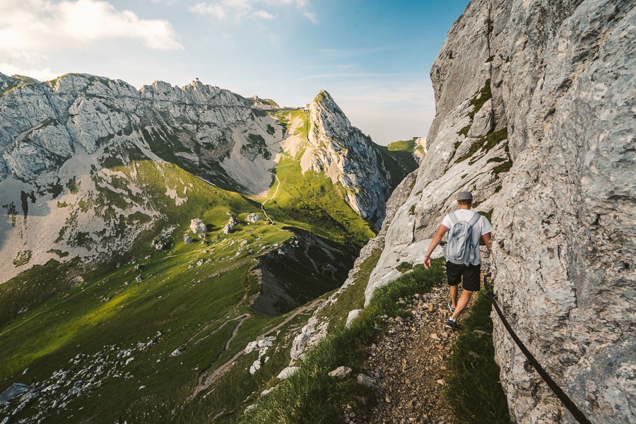
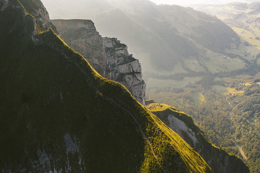
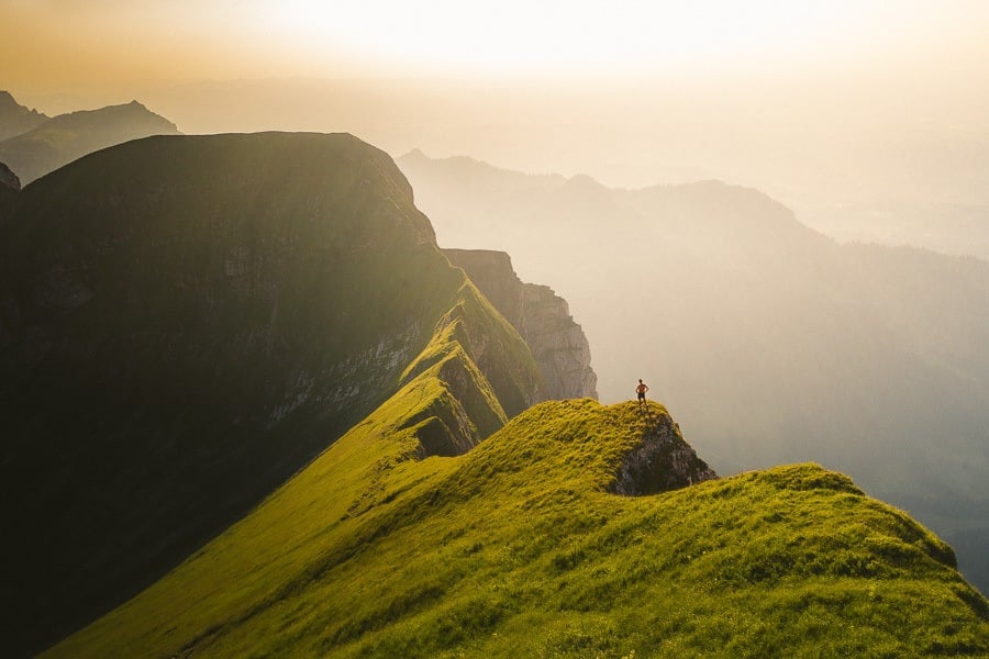
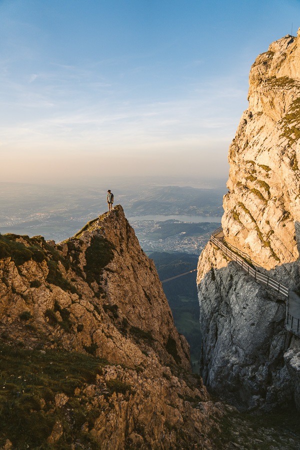
After our lunch break, we headed back down from Matthorn and made the crossing up to Pilatus and over to Esel. This is no easy journey with the switchbacks slowly leading you up to the gravel mountain. It’s incredibly steep and even though it is just several hundred meters it seemed to take at least half an hour.
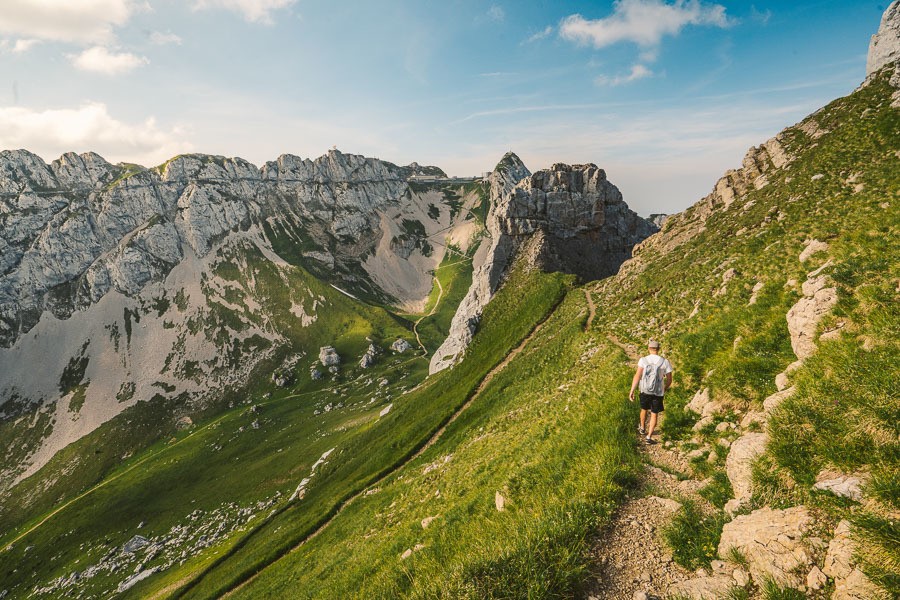
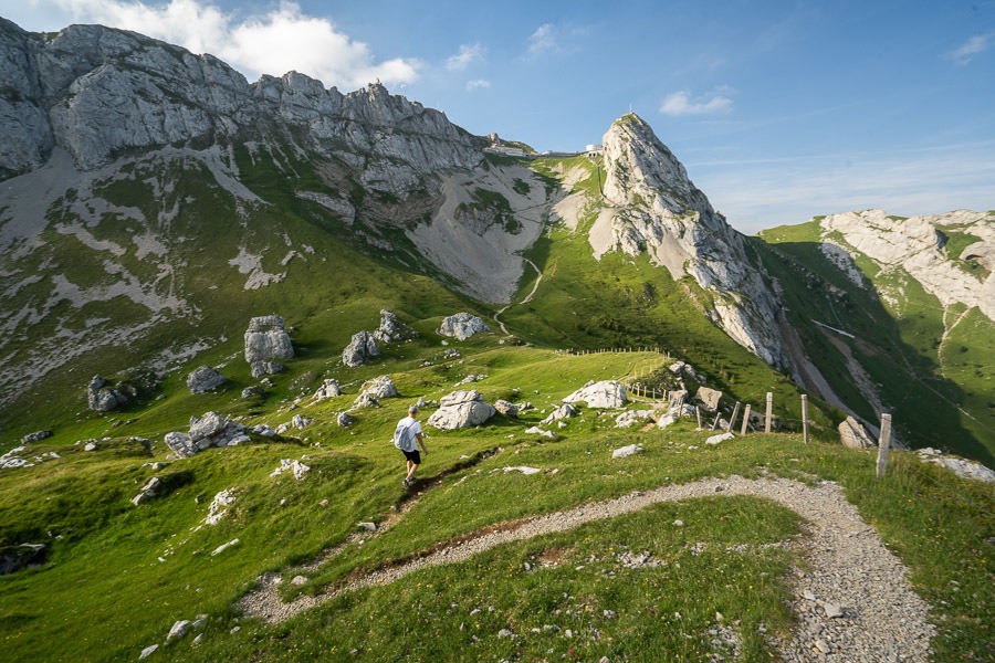
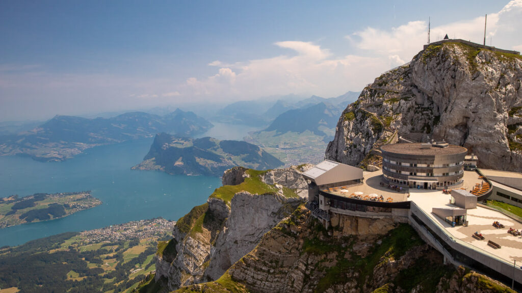
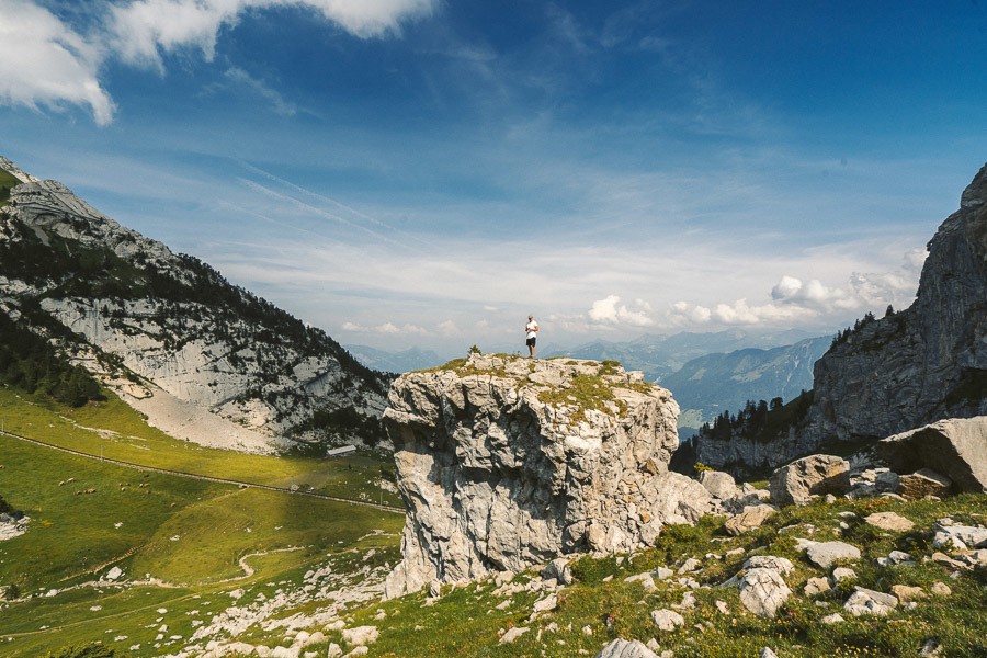
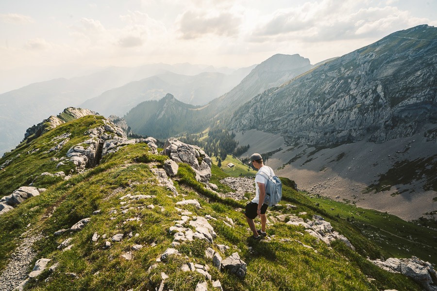
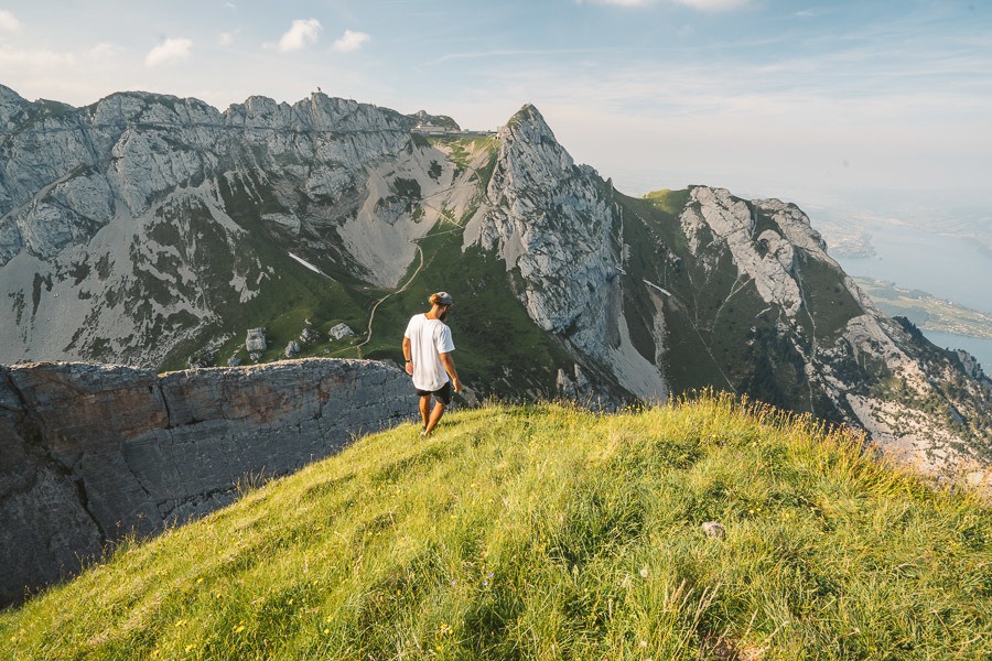
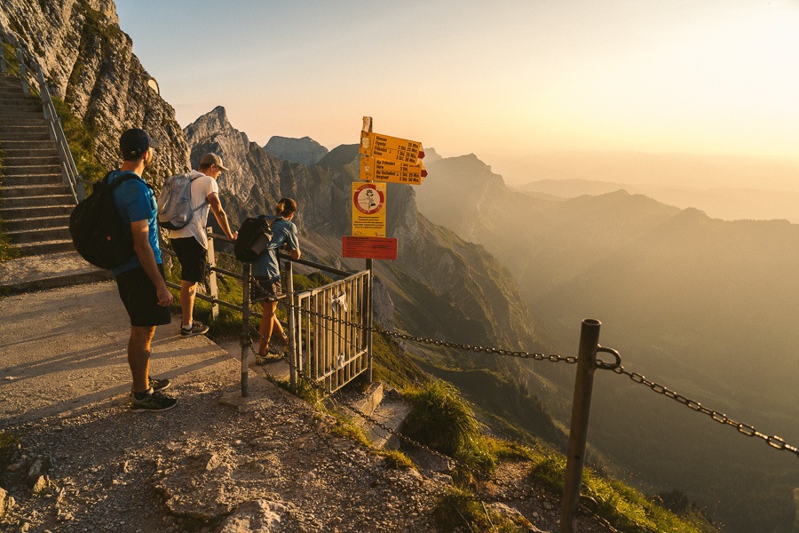
Once at the top of Mount Pilatus you will be at the Bellevue Hotel, which would be a crazy place to stay for the sunset and sunrise. From here you can continue on to Tomlinson, head down to Kriens or head up to Esel viewpoint as we did. It’s just a short journey up the stairs on your right, which by now will be pretty hard on your legs as they have done some significant climbing already.
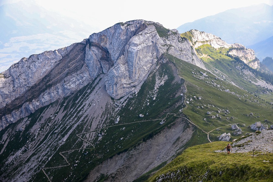
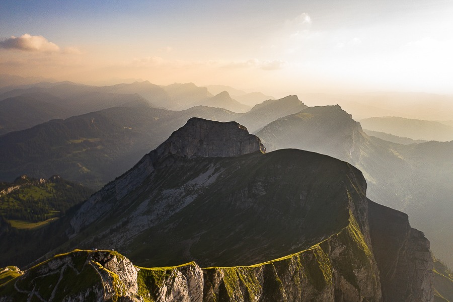
Esel looks back out over the trail up to Pilatus and over toward Matthorn. You can also get a nice angle down towards the town of Kriens.
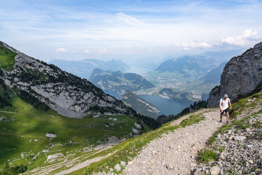
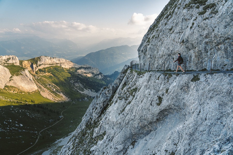
ESEL TO TOMLISHORN
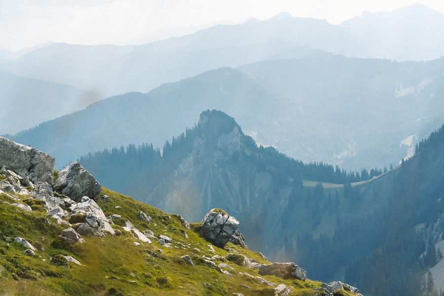
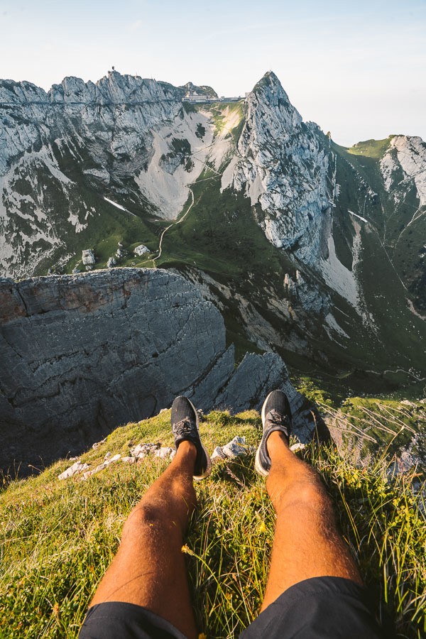
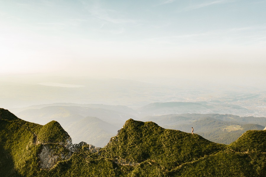
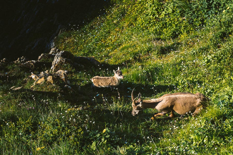
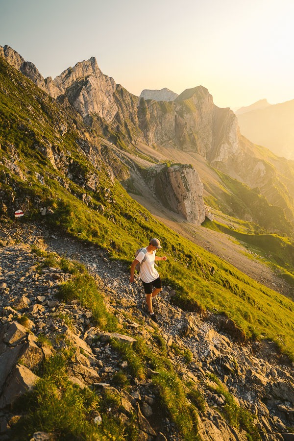
This is probably the easiest and shortest leg of the journey. You pretty much just walk along the ridge toward Tomlishorn. Without too much incline, you will duck under several arches and caves on your way to Tomlishorn, which looks out over one of the most epic ridges in the region. Josh ventured down to the ridge and encountered a goat, while I flew the drone for some new perspectives.
TOMLISHORN RETURN TO OBERHAUPT
It was full swing golden hour now and we quickly hurried back towards the Bellevue. It only took about 20 minutes to return despite the sign suggesting it would be fifty minutes.
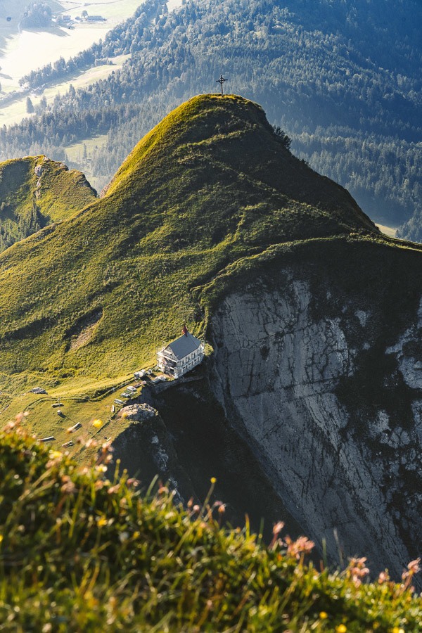
There is one more small viewpoint above the Bellevue called Oberhaupt. Here we were lucky enough to time our run to witness a wing-suit flyer jump off the viewpoint and fly down into the valley below. It was crazy watching him psyche himself up before sending off the edge. A few small goats also made their way along the cliff as we also caught glimpses of Klimsenhorn Church in the distance.
OBERHAUPT TO KLIMSENHORN
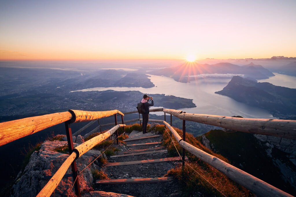
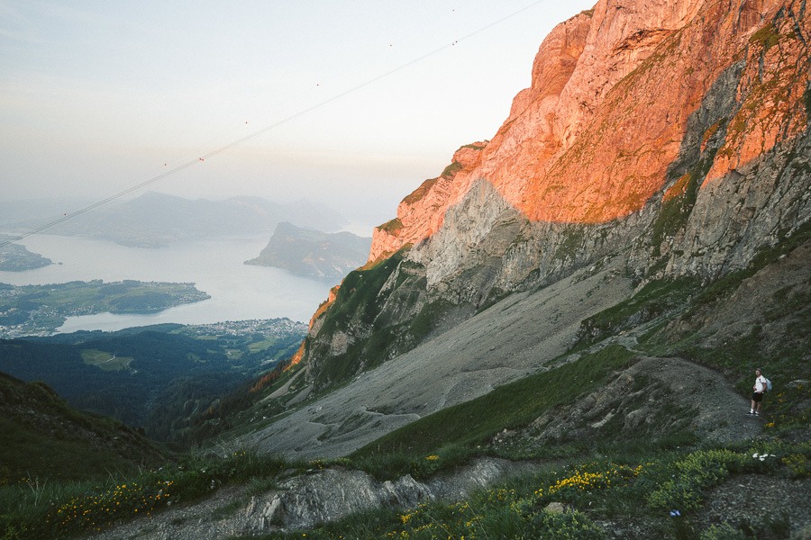
By now it was the end of the golden hour, the last cable car had gone down at 6 pm. It was now at 9 pm. We had a long journey ahead of us but the golden hour at the top of Pilatus was worth it.
We began the walk down towards Kriens, which involves heading past Klimsenhorn church as pictured above. I don’t really advise this to anyone as we actually made it to Kriens at midnight after walking through the forest in the dark but that is just the price we had to pay for staying up for sunset in the mountains.
It is a 3-hour walk down to Kriens town that involves some slightly technical downhill work.
KLIMSENHORN TO KRIENS
This part of the journey begins with gravel switchbacks that are very, very slippery. You will likely share this track with the mountain goats. It was now really starting to get dark and we were almost jogging our way through some rough terrain.
After an hour we made our way down to what we found out was Krienseregg, which is the cable car that will take you to Kriens. Of course, at 10:30 pm it was well and truly closed. We began to head towards Kriens and our map sent us into the forest. It was pitch black but we followed the red and white signs with our phone lights.
We had already walked 30km’s by this point and the map told us we had another 12 to go. It was a blood adventure this one!
We were making a good pace through the forest. I highly suggest not doing this one solo as you will poop your pants. It is genuinely a horror film type of forest where you weave in and out of trees. We finally made it to Kriens around midnight with very tired legs having completed a marathon equivalent distance of 44 km and over 2,500m of total incline climbed throughout the day.
One and a half hours of trains left and we made it back to our place outside of Zurich at 2 am and we were just happy that the trains were still going!
I definitely advise heading down on the last cable car unless you want a massive effort like us. Otherwise, if you are keen to hit the golden hour, just be prepared for a long, dark, tiresome journey that will more than likely be worth it. Pilatus was a memory I will never forget. A great adventure with the boys to one of Switzerland’s great regions.
NO DRONES AT MOUNT PILATUS
Mount Pilatus, while an enchanting destination with its breathtaking vistas and natural beauty, has specific restrictions when it comes to drone usage due to its proximity to local air traffic. The mountain’s close distance to the Lucerne-Beromünster Airport and other local flight paths creates potential hazards and safety concerns for both drone operators and pilots. In order to prevent any incidents and maintain safe airspace, authorities have made it mandatory to refrain from flying drones in this area. I could only get the drone to take off from near Tomlishorn.
THINGS TO KNOW ABOUT MOUNT PILATUS
- Dragon Mythology: Mount Pilatus is steeped in legend, with many local tales about dragons with healing powers living on the mountain. The mountain’s name is also sometimes linked to Pontius Pilate; one legend suggests his body was thrown into a lake on the mountain’s peak, causing storms until his body was removed.
- World’s Steepest Cogwheel Railway: The Pilatus Railway, which travels from Alpnachstad to the Pilatus Kulm summit, is the steepest cogwheel railway in the world. The railway operates from May to November, depending on snow conditions.
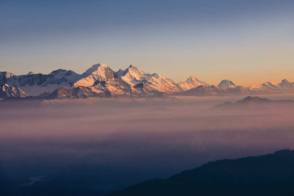
- Impressive Alpine Panorama: From the summit of Mount Pilatus, you can see 73 Alpine peaks on a clear day, offering a spectacular panoramic view that stretches across Switzerland.
- Year-round Destination: Mount Pilatus offers a range of activities throughout the year, from hiking, mountain biking, and paragliding in the summer, to snowshoeing and winter hiking in the colder months.
- Aerial Cableway “Dragon Ride”: The final ascent to the summit in the aerial cableway, known as the “Dragon Ride”, offers panoramic floor-to-ceiling views and gives passengers the feeling of flying. The name refers to the mountain’s legendary dragon mythology.
MOUNT PILATUS IN WINTER
Visiting Mount Pilatus in winter is a unique and mesmerizing experience. The snow-covered peaks and panoramic views of the Swiss Alps are simply breathtaking. Here’s what you need to know:
- Accessibility: The cogwheel railway from Alpnachstad to Pilatus Kulm closes in the winter due to snow, but you can still reach the summit by taking the gondola and aerial cableway from Kriens. The “Dragon Ride” cableway provides fantastic views and operates year-round, weather permitting.
- Winter Hiking and Snowshoeing: There are several winter hiking and snowshoeing trails at Pilatus. The trail from Pilatus Kulm to Tomlishorn is a popular choice, offering stunning views of the winter landscape. Always check trail conditions before setting out.
- Hotel Pilatus-Kulm: For a unique experience, consider staying overnight at the historic Hotel Pilatus-Kulm. The hotel, situated right at the summit, offers stunning views and gives you the chance to enjoy the mountain in the quiet early morning and late evening hours.
- Sledding: Depending on snow conditions, there’s usually a fun sledding run from Fräkmüntegg to Kriens.
- Restaurants and Facilities: The restaurants at Pilatus Kulm remain open during the winter months, offering warm meals and drinks. The panoramic views from the dining area are an added bonus.
SWISS TRAVEL PASS or HALF-FARE CARD
OPTION 1: Buy the Swiss Half Fare Card: Switzerland trains, buses, and cable cars are EXPENSIVE! I found the best way to get around cheaply was to buy the Swiss Half-Fare Card before I arrived. It gives you 50% off every regular train, bus, and even many cable cars. It only costs $150 USD but pays itself off in just a few days with many train tickets in Switzerland costing close to $100 alone. If you are staying for more than 5 days, I suggest buying the Swiss Half-Fare Card.
OPTION 2: Buy the Swiss Travel Pass: The second option is to get the Swiss Travel Pass, which gives you unlimited train, bus, and (many) cable car rides but it’s pretty expensive at around $100 USD per day so if you don’t travel each day it isn’t worth it.
OPTION 3: Buy the FLEXI Swiss Travel Pass: The final (BEST) option is to get the FLEXI Swiss Travel Pass, which allows you to buy 8 days’ worth of transit but you can choose the night before if you want to activate the next day. That way you don’t need to travel every day to get your money’s worth, you can just activate the FLEXI Swiss Travel Pass on the days when you are doing sizeable transits. My advice is to book the Swiss Half-Fare Card or the FLEXI Swiss Travel Pass in advance before your trip so it’s ready to go when you arrive.
GET A SWISS TRAVEL PASS!


Enjoy UNLIMITED train, boat, and bus rides in Switzerland for up to 15 days. Click to book a flex Swiss Travel Pass or choose the Consecutive Swiss Travel Pass.
The Swiss Travel Pass starts at $260 for 3 days. Click here to check if it’s available on your travel dates.
MY SWITZERLAND HIKING GUIDES
I spent 100 days hiking in Switzerland and created a guide for different regions around the country. You can click on one of my Switzerland hiking guides below to help you plan your trip.
- The Complete Guide: 50 AWESOME HIKES IN IN SWITZERLAND
- The Via Ferrata Guide: 4 EPIC SWITZERLAND VIA FERRATA COURSES
- Lauterbrunnen Guide: 10 AWESOME HIKES NEAR LAUTERBRUNNEN
- Interlaken Guide: 15 AWESOME HIKES IN INTERLAKEN
- Grindelwald Guide: 12 AWESOME HIKES NEAR GRINDELWALD:
- Mürren Guide: 7 AWESOME HIKES IN MURREN
- Appenzell Guide: 9 AWESOME HIKES NEAR APPENZELL
- Chur Guide: 7 AWESOME HIKES NEAR CHUR

MY SWITZERLAND TRAVEL TIPS
- For Backpackers: SWITZERLAND BUDGET BACKPACKING GUIDE
- Travel Tips: 20 THINGS TO KNOW BEFORE VISITING SWITZERLAND
- Transport Tips: RENTING AND DRIVING A CAR IN SWITZERLAND
- Accommodation Guide: 30 BEST PLACES TO STAY IN SWITZERLAND

Kris
Wednesday 9th of October 2024
Hi, I have a few questions - Does the cog railway stop at Amsigel ( so you could start the hike from there up to Mattahorn and then onto Mount Pilatus? ) Approx what is the distance from Amsigel to Mt Pilatus via Mattahorn? Can you then catch a cable car down from Mt Pilatus or the Bellvue Hotel and where would that cablecar take you too? Thank you
Lea
Saturday 9th of July 2022
Thank you for the detailed and helpful guide! I'm a solo female traveller planning to do the hike up alone (and probably take a cogwheel/cable car down), would you recommend it? Also, are all the paths and tracks marked and signposted all the way up?
Thank you, Jackson!
Bram
Wednesday 28th of August 2024
Hi @Lea, I am also a solo traveller who has the same plan like you, but then in a month. I was wondering if you did this hike alone and if it is recommendable/doable. Would love to hear from you
Matthew Robinson
Wednesday 24th of November 2021
Huge thank you for all the incredible info and inspiration shared in these guides!! I'm planning a trip for this coming summer, so this has been a great source. Out of curiosity, do you have the GPX file for this hike? Some of the trails don't show up on Garmin in the course builder, so I'm having a hard time plotting the route. Thanks!!
Patrick
Saturday 11th of July 2020
This is the sort of info I need, as I hope to go to Switzerland soon, and stay in Lucerne, so all this will guve me the build I need. Patrick
Jackson
Tuesday 14th of July 2020
Awesome glad you enjoyed it. Pilatus is a great workout!
Keith Lim
Thursday 1st of August 2019
Amazing hikes! It’s impossible to get tired of nature. Keep up the good work on the great content and keep them coming. Gonna bookmark this for my trip to Switzerland!
Jackson
Sunday 4th of August 2019
Thanks so much