
Le Moleson to Teysachaux is a fun but challenging day hike that involves a little bit of rock-scrambling to reach epic panoramic views of Gruyeres in the Fribourg region. The hike can be done in its entirety or by using a cable car to head up and down the majority of the incline, meaning you can enjoy the variable ups and downs of the ridge between Le Moleson and Teysachaux without having to work too hard!
Le Moleson Hike to Teysachaux
- Hike Distance: Without cable car from Le Moleson Summit to Teysachaux Summit and Return was 13km
- Hike Duration: 3 hours of moving time. With breaks and photos, the total time was 5 hours.
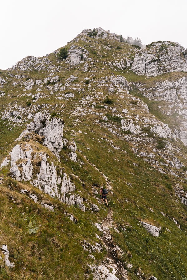
- Hike Difficulty: Steep in parts. The parking lot to Moleson was very safe with no drop-offs or climbing. The final climb up to Teysachaux was technical with moderate rock clambering required but no moments of exposure as it was climbing up a linear incline. Minimal chance of falling off of the cliff face. That section of trail was rocky but only lasted for 15-20 minutes.
- Hike Incline: Total elevation throughout the hike 719m
HOW TO GET TO LE MOLESON & TEYSACHAUX HIKING TRAIL
As always in Switzerland, there are many ways to go about getting to Moleson and Teysachaux. I will detail exactly how I did it and also make recommendations that include the cable car and the best plan of attack now that I know the routes and logistics having been up there.
- In my opinion, the ideal way to enjoy this trail is to take the cable car up to Le Moleson Gruyeres Summit and then hike to Teysachaux along the ridge. You can then return to Le Moleson along the ridge and catch the cable car down. That would be a 2-3 hour hike without an overwhelming amount of incline. (We actually tried to do this but parked in the wrong spot where there was no cable car so we had to hike up and down!)
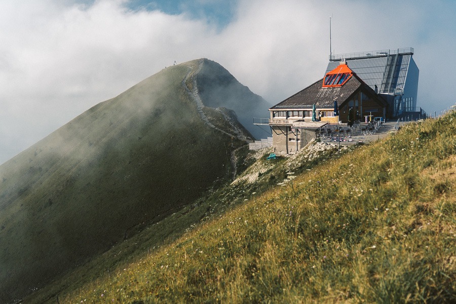
The cable car leaves from Plan-Francey at 1,520 m. The 60-passenger cars take you to the summit of Le Moléson at 2,002m.
You can check the cable car prices and timetable here.
ALTERNATIVE OPTION
- Another option is to hike up to Le Moleson Gruyeres from Plan Francey and then do the same ridge hike to Teysachaux as mentioned above. You can also try Via Ferrata up this route, which is basically climbing up ladders and steel hand-holds bars. You will need proper gear for this activity though.
- The third option is what we ended up doing, sort of by mistake. We hiked up a route from in-between Le Moleson and Teysachaux and then visited both summits. I have detailed our route and adventure on the map below.
Below I’ve added the GPX map recorded from my Garmin Watch and uploaded it to Strava. I recorded the descent from Teysachaux on a different activity but we went down the same route we came up so you have the full route there.
As you can see we came up from the parking lot and turned left to go to Moleson. We then went back past our intersection and visited Teysachaux. We then came down from Teysachaux and descended back to the parking lot.
Le Moleson to Teysachaux GPX Map: Download Here
MY EXPERIENCE HIKING LE MOLESON TO TEYSACHAUX TRAIL
We originally planned to take the cable car from Plan-Francey but somehow ended up at a random parking lot next to a restaurant. It turned out to be Gros-Plane. There are two routes to Le Moleson from Gros Plane so we just decided to forego the cable car idea and hike up, along the ridge, and down. Our short hike had turned into a long one!
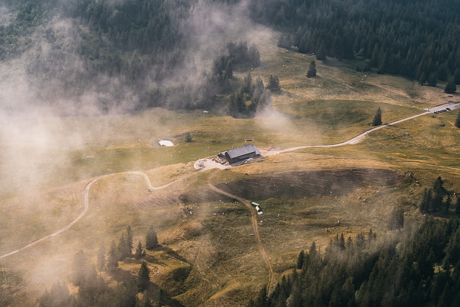
The hike begins down the hill and through a small valley, which you can see a photo of below (I took this photo of the valley and restaurant from up on the ridge).
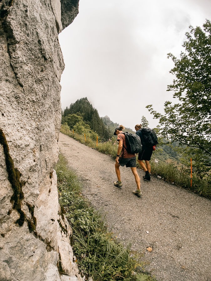
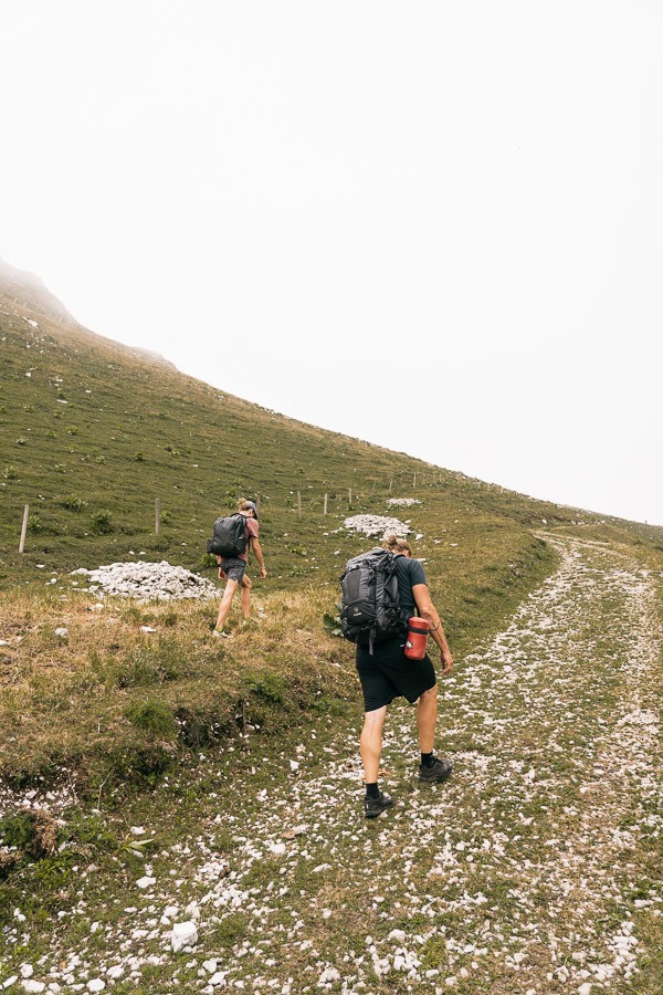
The trail is on a wide dirt road for the first thirty minutes before you join a paved road that heads up to the right. There are yellow signs the whole way so you cannot really get lost if you stay in these main paths and follow the signs. Once you hit the paved road, the trail starts to get quite steep. It is a gradual incline but unrelenting until you reach the ridge.
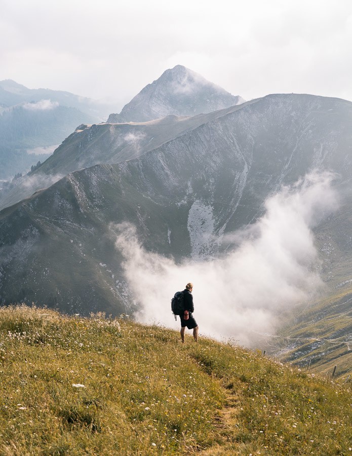
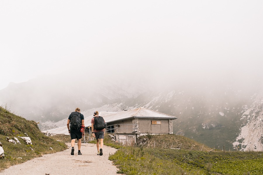
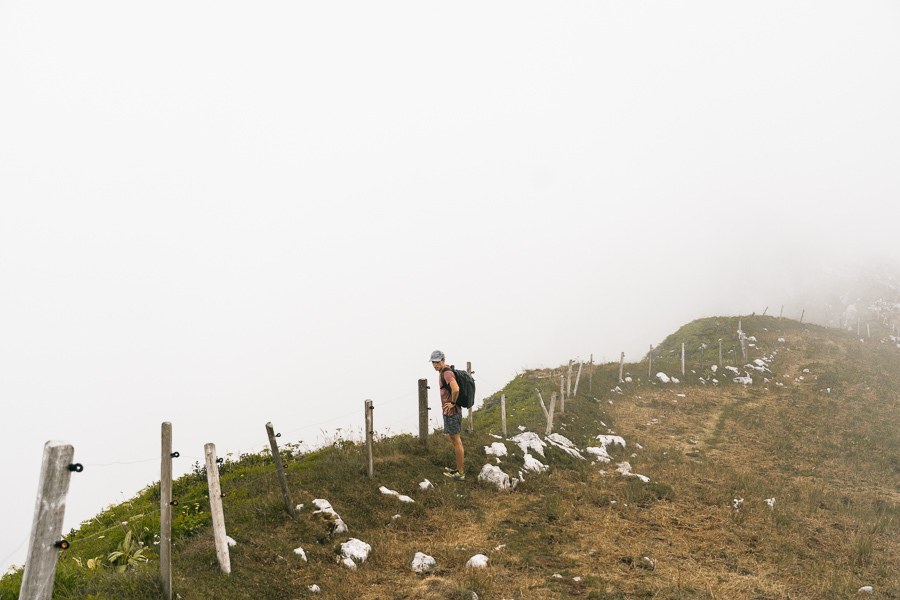
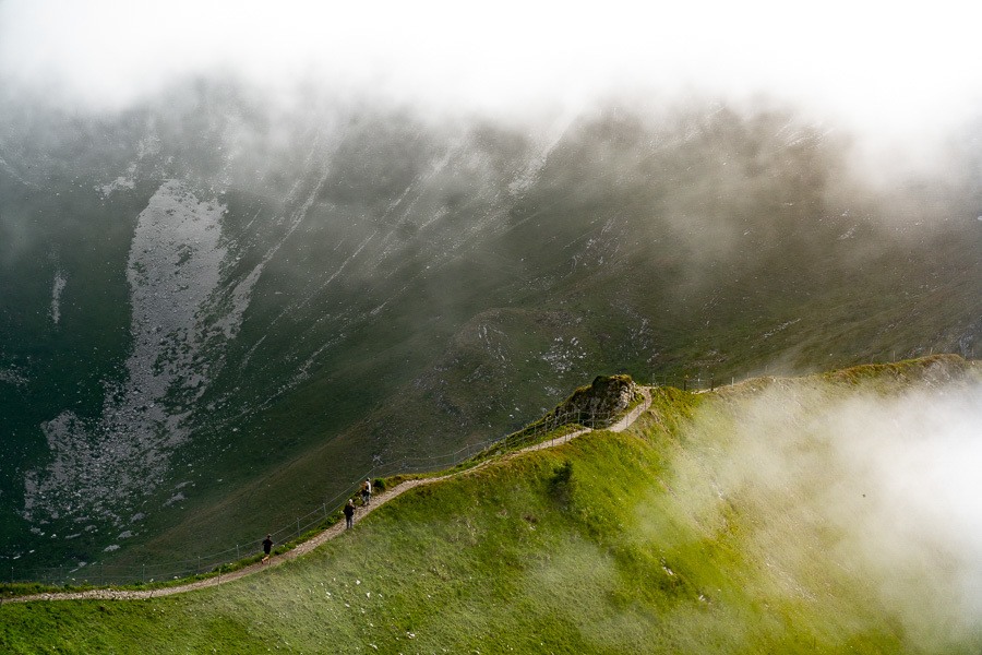
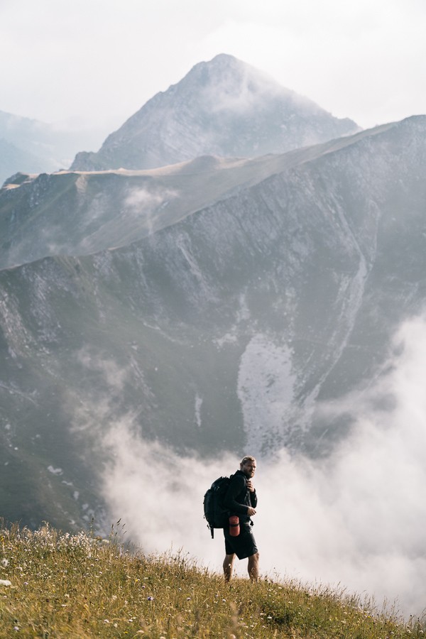
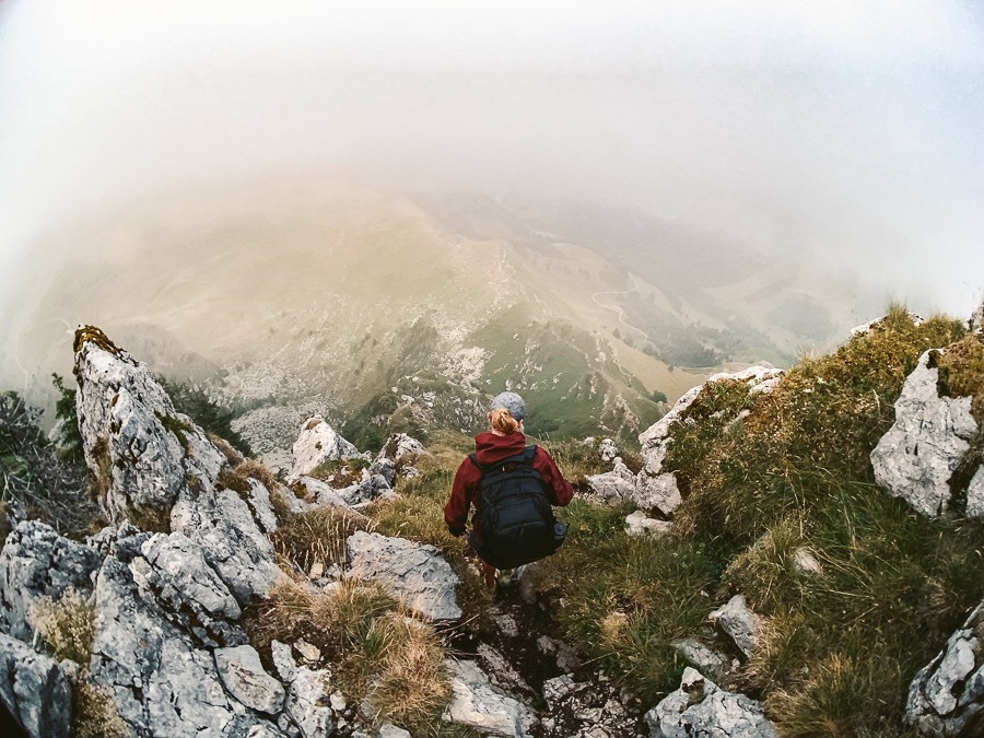
The trail soon reaches farming areas with a few cabins and you sense you are getting quite close to the ridge. On this day there was a huge fog and we realized we may never see the view. That is how it is sometimes but you never know if you don’t go and sometimes the fog can be quite interesting in itself.
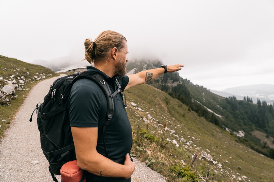
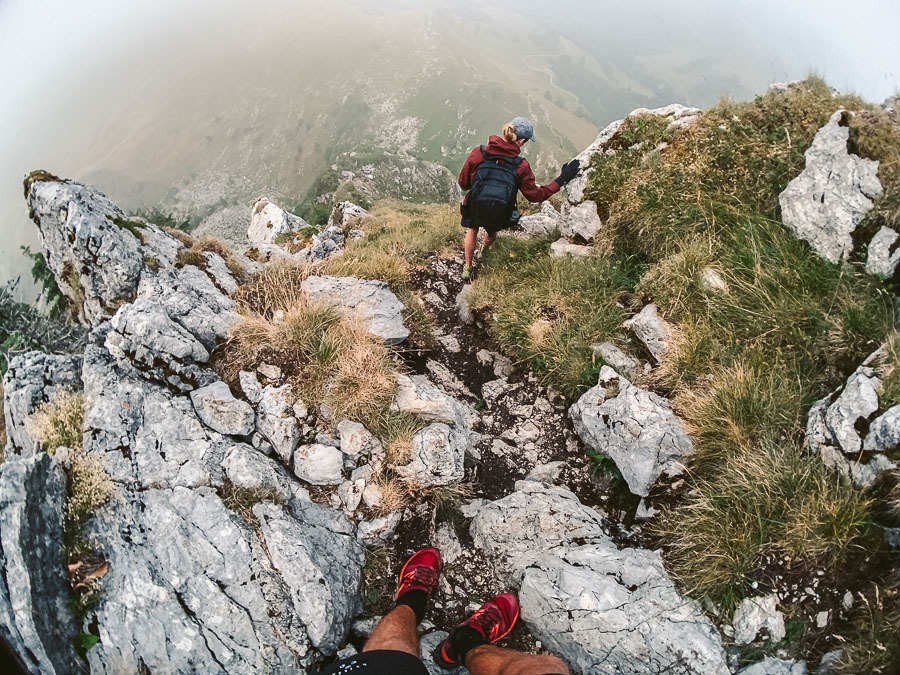
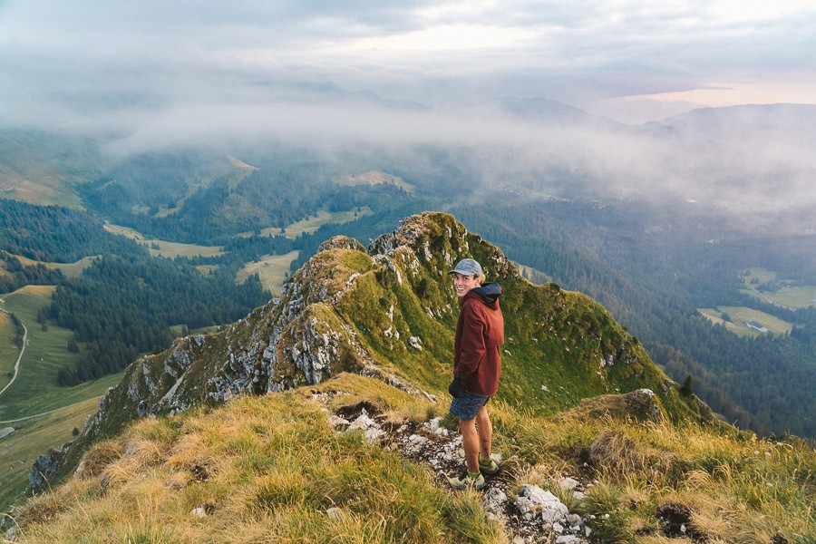
The final ascent to the ridgeline leaves the paved road and is now just a worn grass path. Dodging cow poop and potholes we meandered our way up to the ridgeline. Here we were greeted by a big cloud of fog although we knew there was an epic view behind the white wall of nothing.
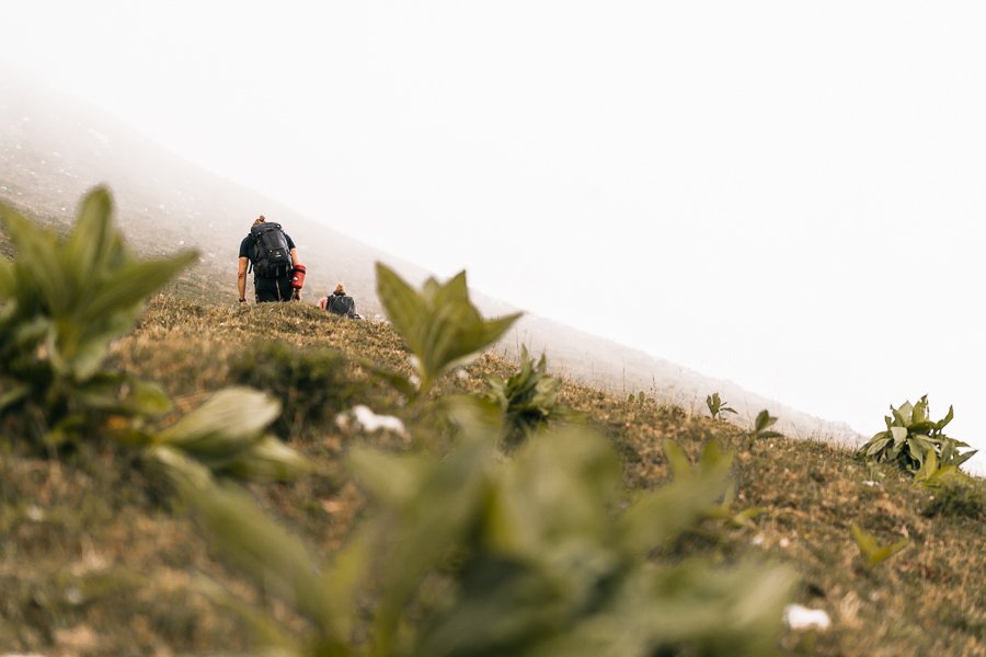
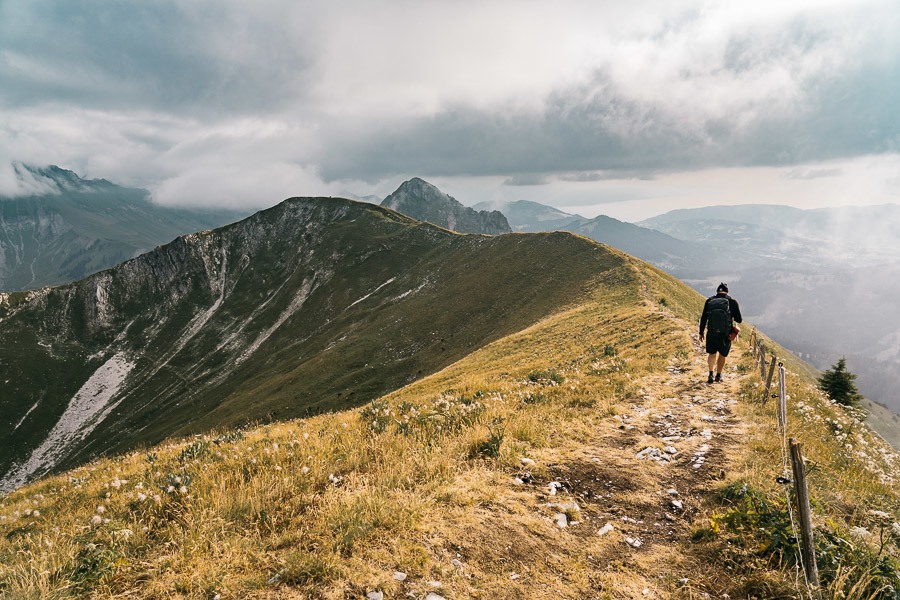
At this point, we were now quite near the base of Teysachaux to the right and just a couple of kilometers to the left we would find Le Moleson. We decided to head left past all the cows and hopefully find Le Moleson Summit and the restaurant.
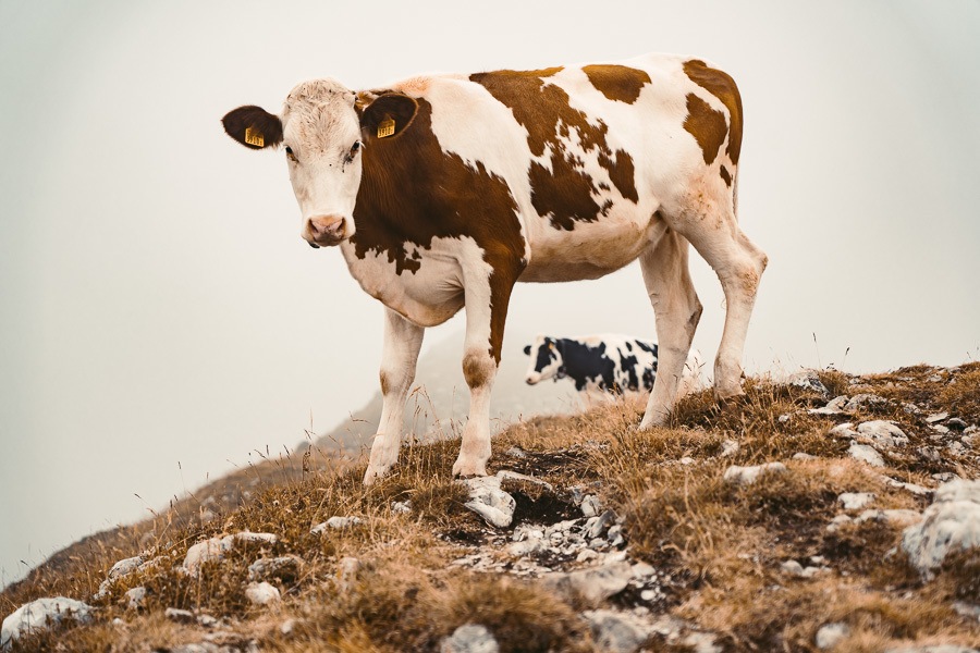
It wasn’t long before we arrived at Le Moleson summit after a few ups and downs along the ridge. There wasn’t much going on inside the fog other than a few cows blocking our way. A bit defeated, we sat at the restaurant and had a coffee. Here we debated taking the cable car down and walking along the road back to our car, our returning the same way.
All of a sudden the clouds begin to part a little and we decided to miss the last cable car and see if we could get lucky with the fog clearing on the way back and possibly head up Teysachaux as we had intended to do.
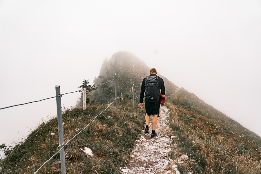
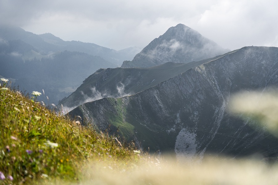
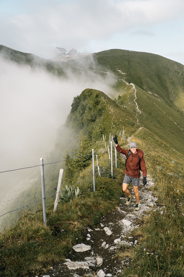
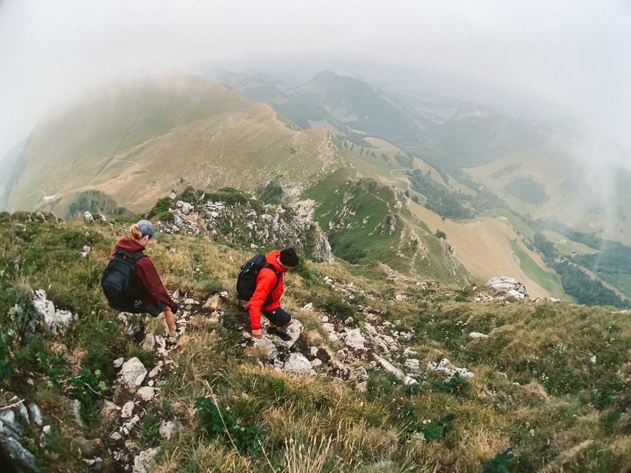
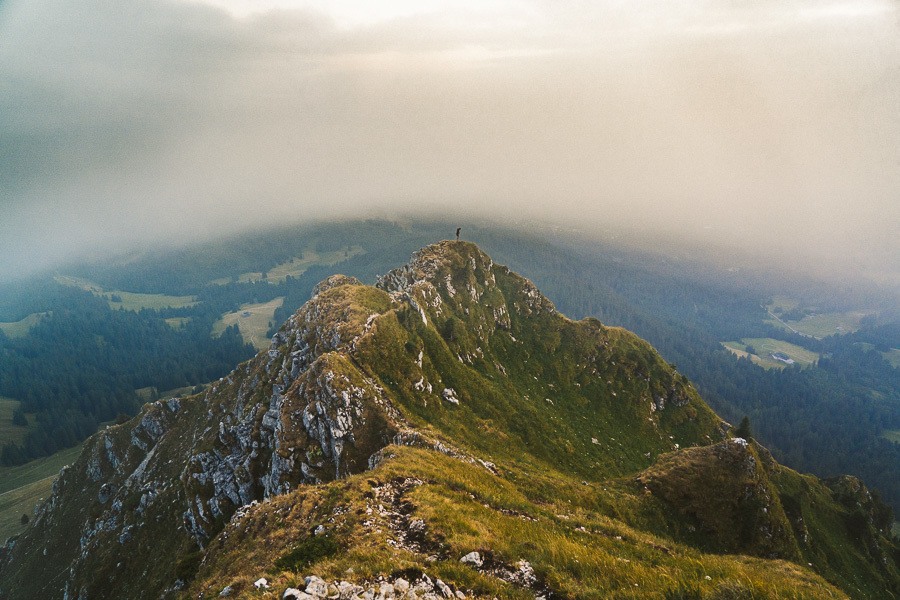
The fog was now clearing and the trail was starting to look epic as fog poured down one side, while the ridge became clear. We were so glad we had persisted through the fog as we were now being rewarded with great views in all directions.
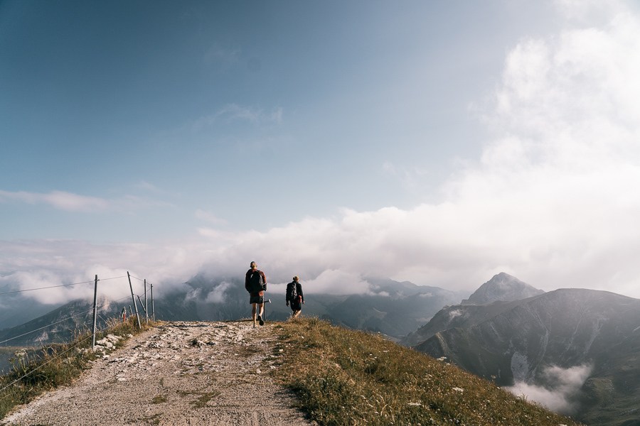
The walk back to Teysachuax takes less than 45 minutes if you walk directly without stopping for photos. It’s mostly downhill and on a pretty good trail. You could do the round trip from Le Moleson summit to Teysachaux and back in under 2.5 hours quite easily. We obviously took longer taking photos and also just taking our time and enjoying the scenes.
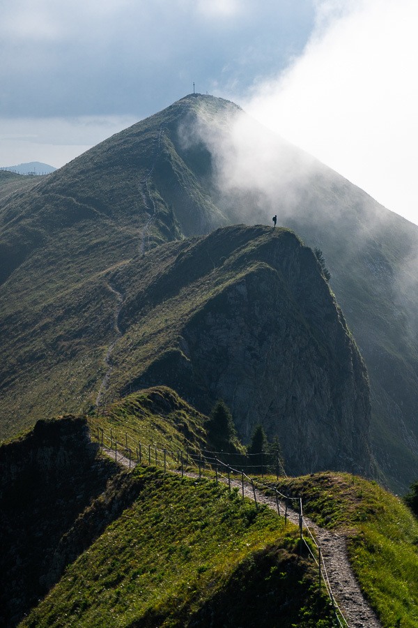
We had now made it back to the intersection of our initial ascent. Here we had the parking lot down the hill, Le Moleson where we had just come from, and in the final direction was Teysachaux. From this point, the climb to Teysachuax is only about 5-10 minutes of walking away.
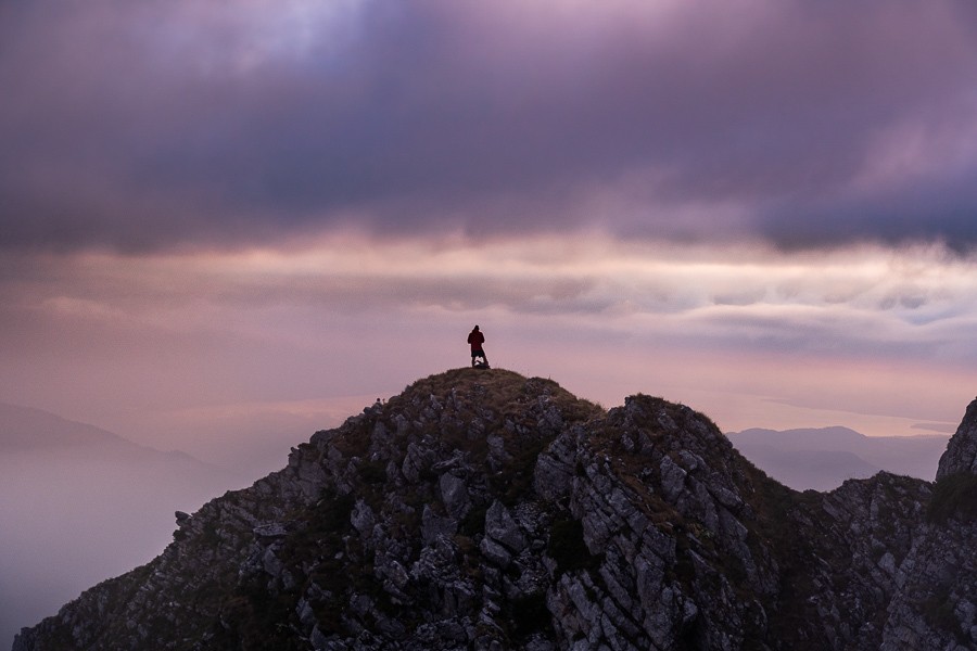
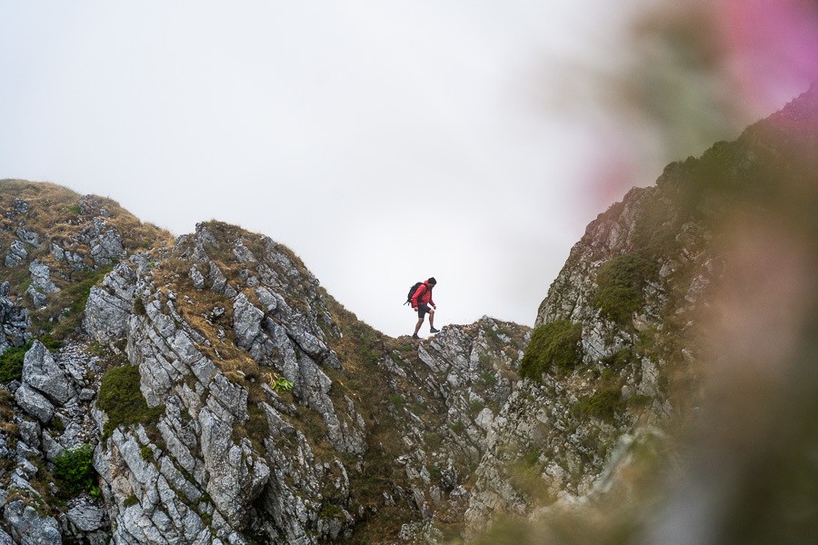
Once you arrive at the base of the climb, it may seem a little intimidating but once you get going, it really is just a clamber-up with no huge drop-offs. You are never really exposed to an overhang or a drop-off as the trail continually leans into the incline. You will find yourself using your hands as you clamber up.
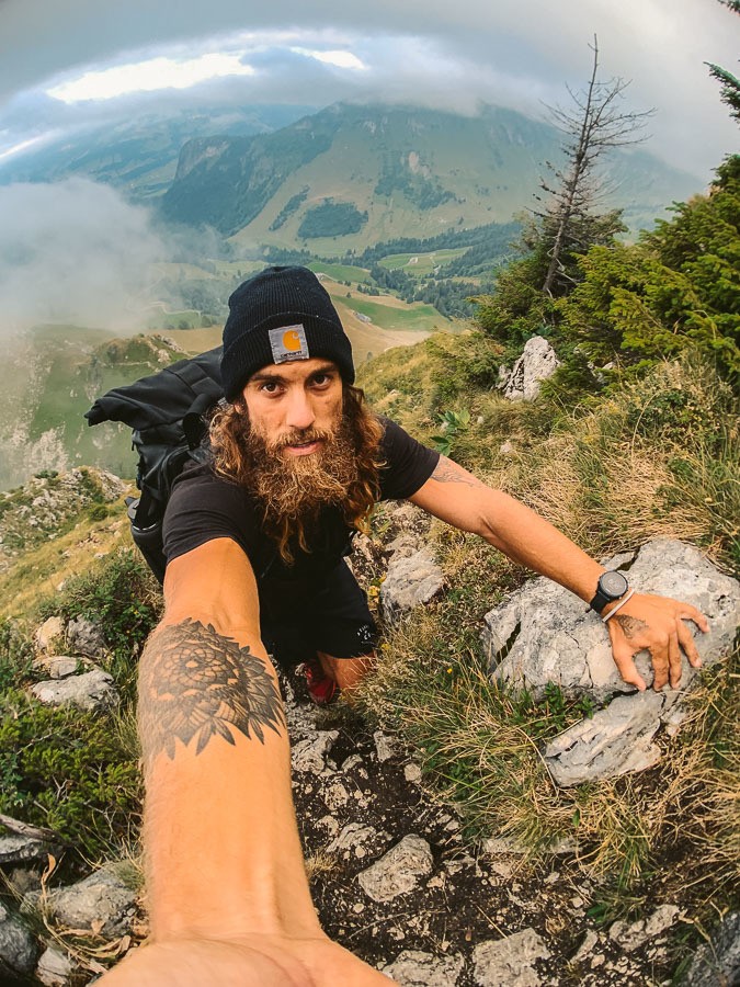
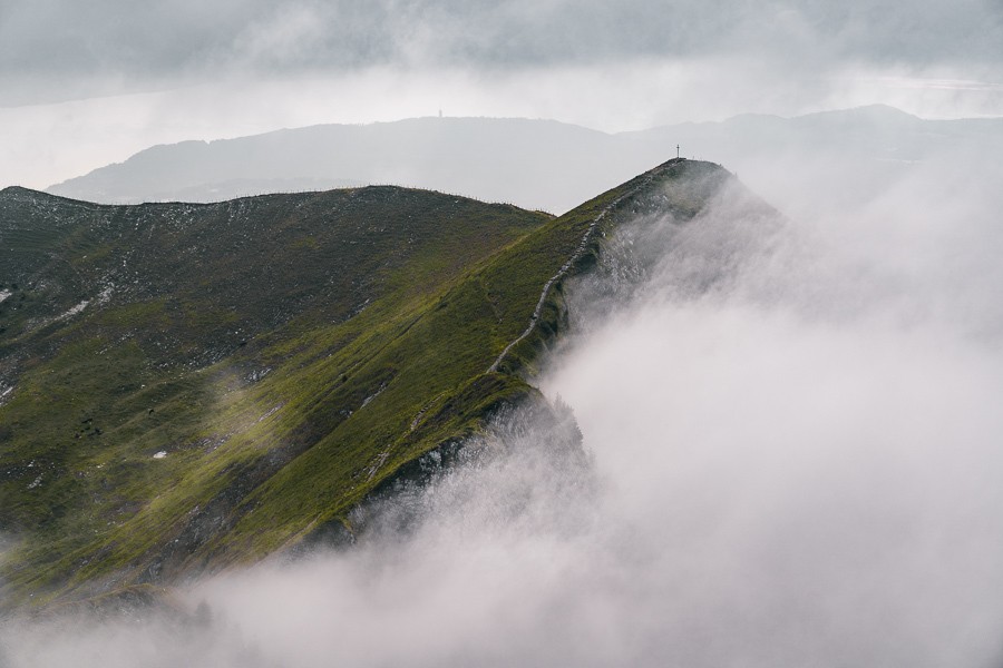
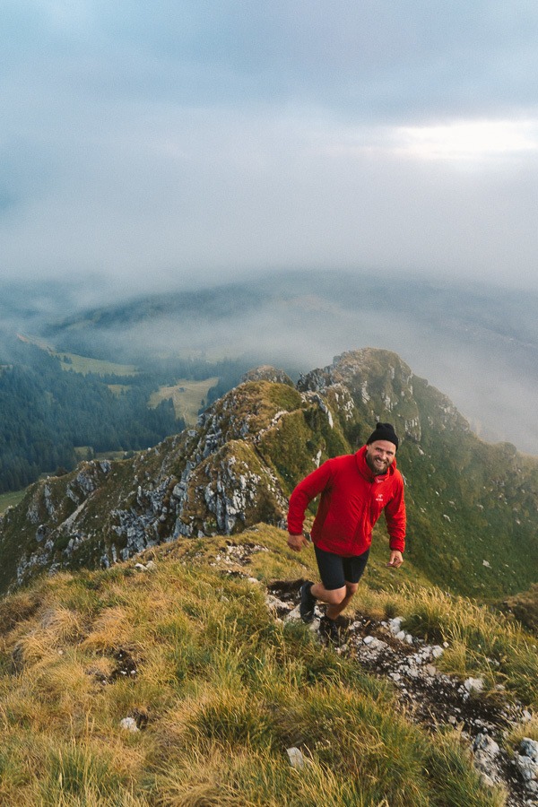
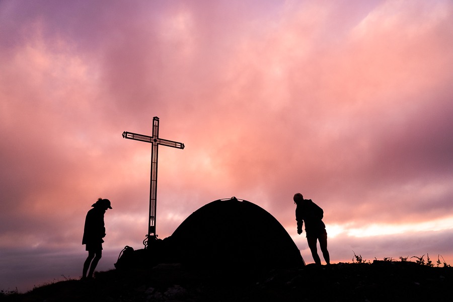
Once at the top of Teysachaux, we had amazing views of the lakes and peaks in all directions. In winter this summit of this mountain is covered in snow. That night, two others were camping up top, which would have been an epic spot to wake up for sunrise.
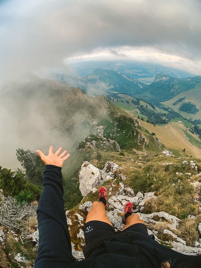
We hung out on top of the mountain beneath the cross enjoying the beautiful but cloudy sunset as we explored the little ridges on the far side of Teysachaux.
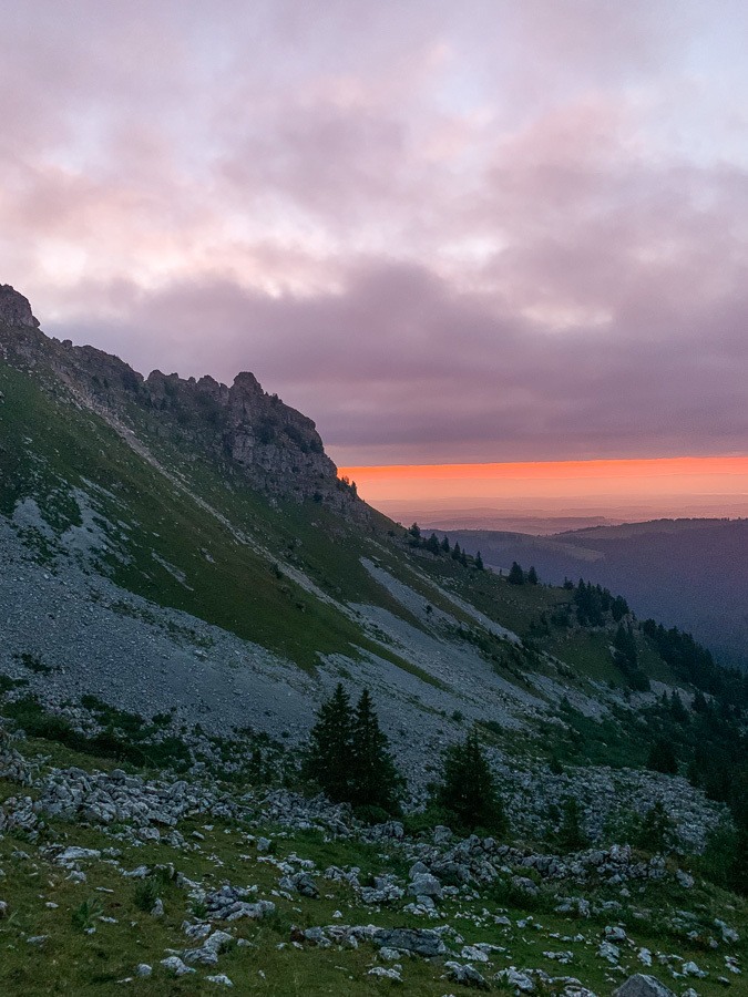
It was now getting dark, so we quickly made our way down the Teysachaux climbs in the last light before using our torches to make our way back down the hill to Gros-Plane where we had parked our car. It was a great adventure with lots of nice views without too much incline (especially if you take cable cars!) This was the lingering sunset on the way down.
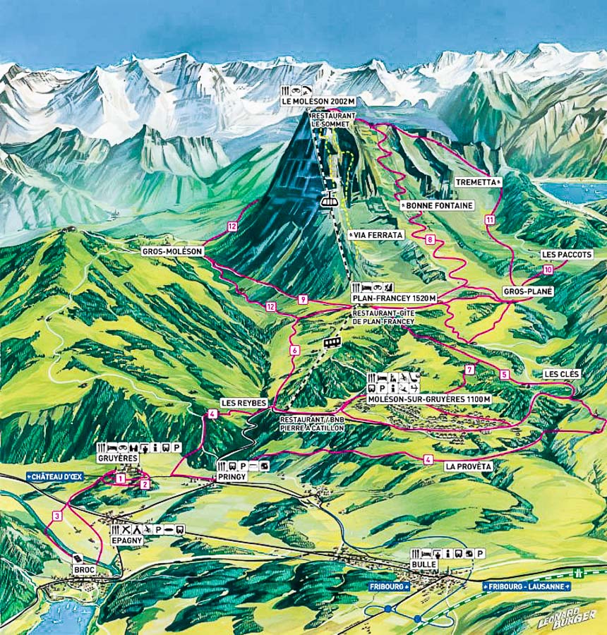
LE MOLESON & TEYSACHAUX MAP
Below, the map gives you a better understanding of the different routes up and down the mountain to reach Le Moleson.
LE MOLESON CABLE CAR
The cable car leaves from Plan-Francey at 1,520m. The 60-passenger cars take you to the summit of Le Moléson at 2,002 m, where a superb panorama awaits without any stair. As you head up on the southeast side of the mountain, the horizon expands beyond the borders of La Gruyère to reveal many other regions. There are a restaurant and toilet facilities at the summit where the cable car arrives.
If you have the Swiss Half-Card you will receive a huge discount on your tickets. I bought mine when I arrived in Switzerland and it has saved me over a thousand dollars throughout my trip.
Departures every 20 minutes at 9.10 am, 9.30 am, 9.50 am, etc…
Mon: 9h10 – 17h50
Tue: 9h10 – 17h50
Wed: 9h10 – 17h50
Thu: 9h10 – 17h50
Fri: 9h10 – 23h*
Sat : 9h10 – 23h*
Sun: 9h10 – 17h50
You can check the cable car prices and timetable here.
SWISS TRAVEL PASS or HALF-FARE CARD
OPTION 1: Buy the Swiss Half Fare Card: Switzerland trains, buses, and cable cars are EXPENSIVE! I found the best way to get around cheaply was to buy the Swiss Half-Fare Card before I arrived. It gives you 50% off every regular train, bus, and even many cable cars. It only costs $150 USD but pays itself off in just a few days with many train tickets in Switzerland costing close to $100 alone. If you are staying for more than 5 days, I suggest buying the Swiss Half-Fare Card.
OPTION 2: Buy the Swiss Travel Pass: The second option is to get the Swiss Travel Pass, which gives you unlimited train, bus, and (many) cable car rides but it’s pretty expensive at around $100 USD per day so if you don’t travel each day it isn’t worth it.
OPTION 3: Buy the FLEXI Swiss Travel Pass: The final (BEST) option is to get the FLEXI Swiss Travel Pass, which allows you to buy 8 days’ worth of transit but you can choose the night before if you want to activate the next day. That way you don’t need to travel every day to get your money’s worth, you can just activate the FLEXI Swiss Travel Pass on the days when you are doing sizeable transits. My advice is to book the Swiss Half-Fare Card or the FLEXI Swiss Travel Pass in advance before your trip so it’s ready to go when you arrive.
GET A SWISS TRAVEL PASS!


Enjoy UNLIMITED train, boat, and bus rides in Switzerland for up to 15 days. Click to book a flex Swiss Travel Pass or choose the Consecutive Swiss Travel Pass.
The Swiss Travel Pass starts at $260 for 3 days. Click here to check if it’s available on your travel dates.
MY SWITZERLAND HIKING GUIDES
I spent 100 days hiking in Switzerland and created a guide for different regions around the country. You can click on one of my Switzerland hiking guides below to help you plan your trip.
- The Complete Guide: 50 AWESOME HIKES IN IN SWITZERLAND
- The Via Ferrata Guide: 4 EPIC SWITZERLAND VIA FERRATA COURSES
- Lauterbrunnen Guide: 10 AWESOME HIKES NEAR LAUTERBRUNNEN
- Interlaken Guide: 15 AWESOME HIKES IN INTERLAKEN
- Grindelwald Guide: 12 AWESOME HIKES NEAR GRINDELWALD:
- Mürren Guide: 7 AWESOME HIKES IN MURREN
- Appenzell Guide: 9 AWESOME HIKES NEAR APPENZELL
- Chur Guide: 7 AWESOME HIKES NEAR CHUR

MY SWITZERLAND TRAVEL TIPS
- For Backpackers: SWITZERLAND BUDGET BACKPACKING GUIDE
- Travel Tips: 20 THINGS TO KNOW BEFORE VISITING SWITZERLAND
- Transport Tips: RENTING AND DRIVING A CAR IN SWITZERLAND
- Accommodation Guide: 30 BEST PLACES TO STAY IN SWITZERLAND
