
A Sunday morning on the Gastlosen hiking trail was a quintessential Swiss experience. There were epic, panoramic mountain views, friendly hikers of all ages on the trail, ‘bonjour’ being thrown around every few steps, coffee and cake back at the cabin restaurant and it was all topped off by the owner playing the Fribourg anthem on the Alpine Horn. It was a morning not to be forgotten.
Gastlosen Hike: The Swiss Dolomites
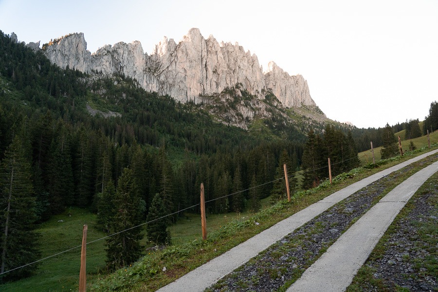
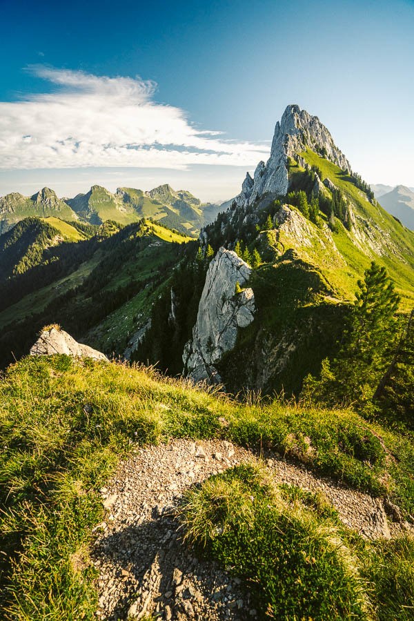
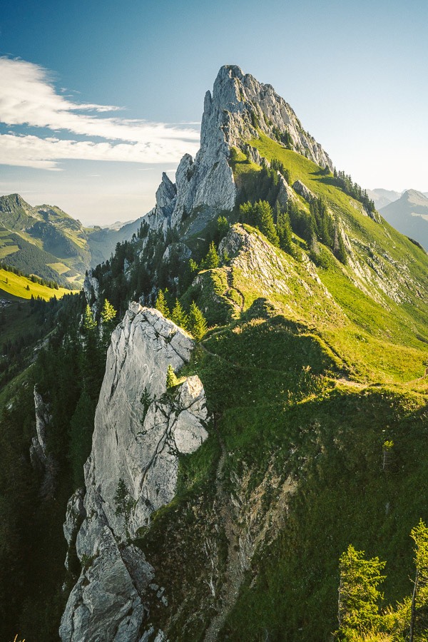
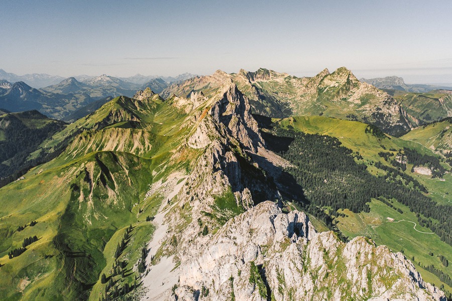
I must address the Dolomites reference in the title. While the Gastlosen hike isn’t quite the Dolomites, we couldn’t help but draw parallels as the resemblance of the jagged, narrow, cliff face had us likening the scenery to the famous, ‘Dolomiti’, one of Italy’s biggest attractions.
The regular way to hike at Gastlosen is to do the circular, panoramic route. However, we did the much more entertaining and challenging summit of Wandflue. In this blog post, I’ll share the details of our hike so you can explore the beautiful Gastlosen trails yourself.
GASTLOSEN HIKING TRAIL DETAILS
- Hike Distance: From the parking lot to the summit and return the hike is almost 10 kilometers exactly.
- Hike Duration: 2.5 to 3 hours of moving time.
- Hike Difficulty: The trail begins on a wide, steep path. Then progresses to a dirt and rocky path, which is still steep. Progresses again to rock, grass, and gravel where some hands may be required but it is not extremely technical. 700m of the incline in 5km so it is quite steep.
- Hike Incline: Total elevation throughout the hike was 800m total incline on the out and back loop.

HOW TO GET TO GASTLOSEN HIKING TRAIL
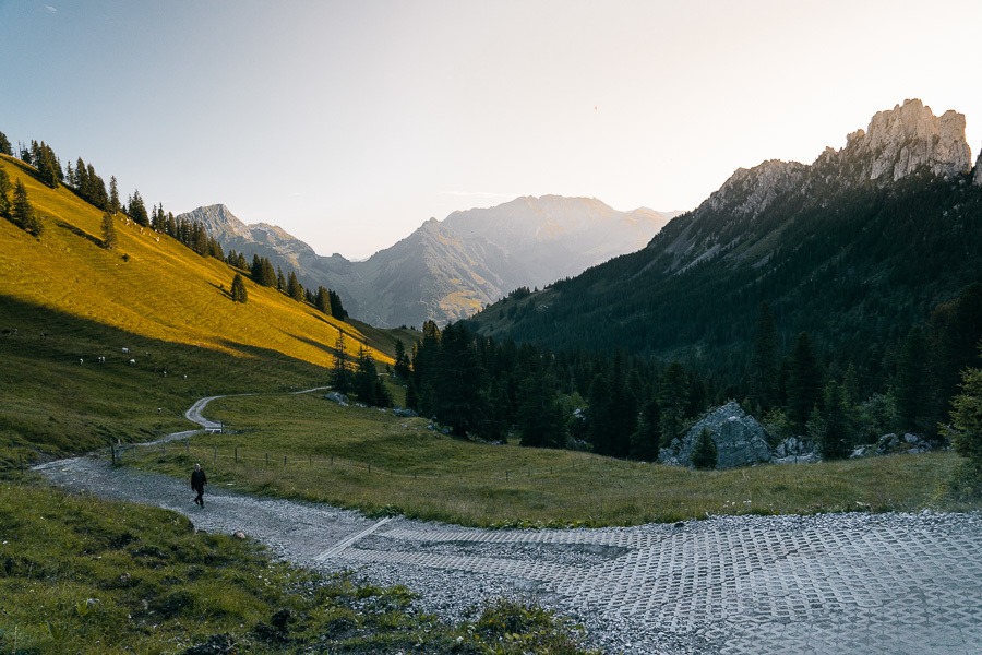
The Gastlosen Hike starts at the parking lot in Musersbergli. Here you will park and begin the first 2-kilometers of the trek until you reach the Chalet du Soldat, where you can stop for a coffee before heading up to the Wandflue Summit. I’ve attached my GPX map below, which you can download here for use on your Garmin, smartwatch or another app.
MY EXPERIENCE HIKING IN GASTLOSEN (WANDFLUE SUMMIT)
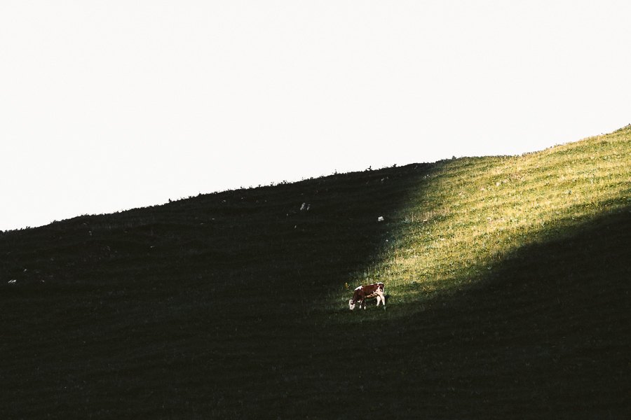
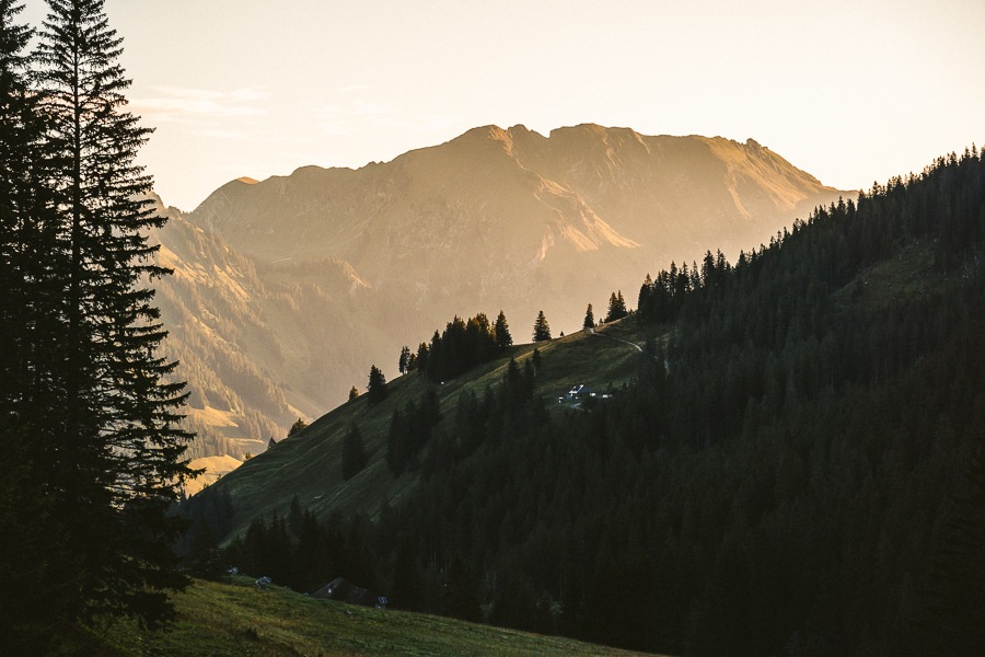
Packed in the car, we drove from Fribourg at dawn as we watched the pinks and purples paint the sky throughout the drive. By the time we arrived at the parking lot at Musersbergli, the pastels had finished and the first light of the day was starting to find a way through the cracks and gaps in the cliffs above. One cow (must be my spirit animal, was already searching for that morning sunshine to warm up)
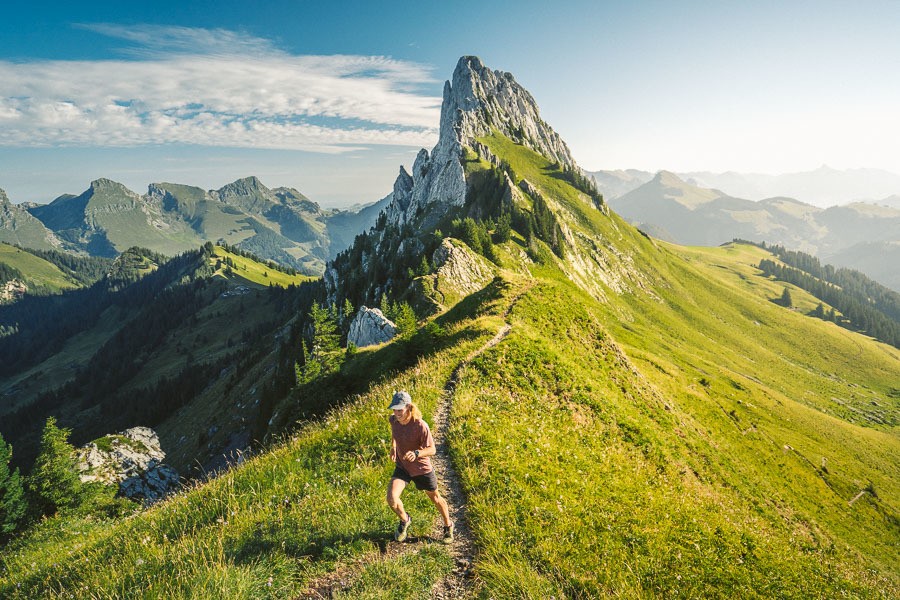
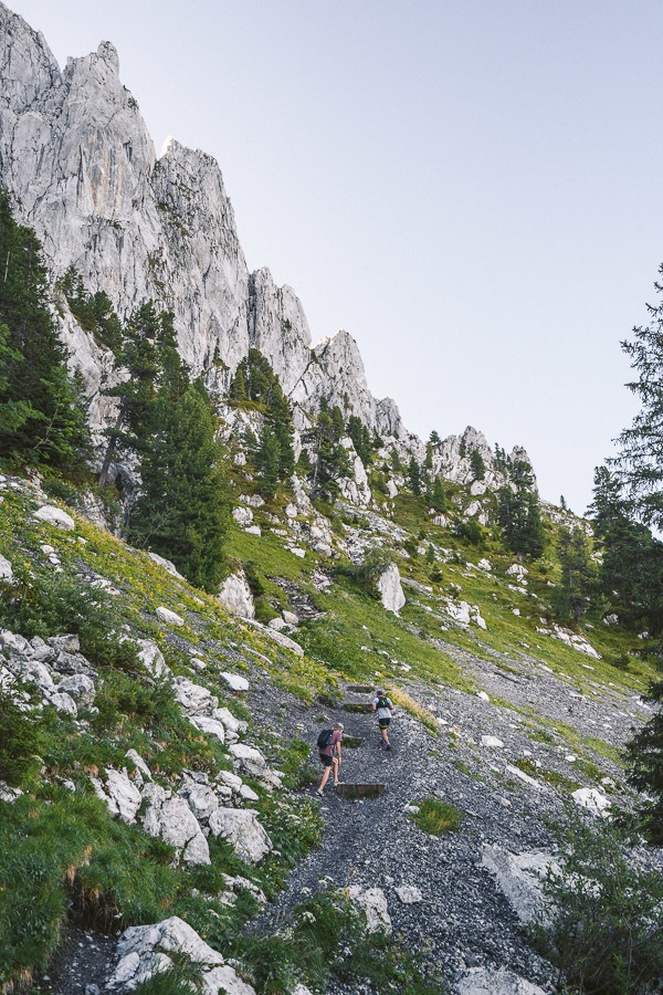
The trail to Wandflue is 5km out and 5km back. With 700m of the incline in the first 5km, it is genuinely a steep encounter from the first moments until the summit. The wide, winding path is sure underfoot until you reach the chalet with views up the Gastlosen mountain range on your right throughout the early moments of this trail.
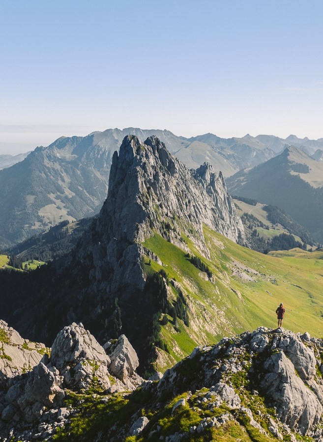
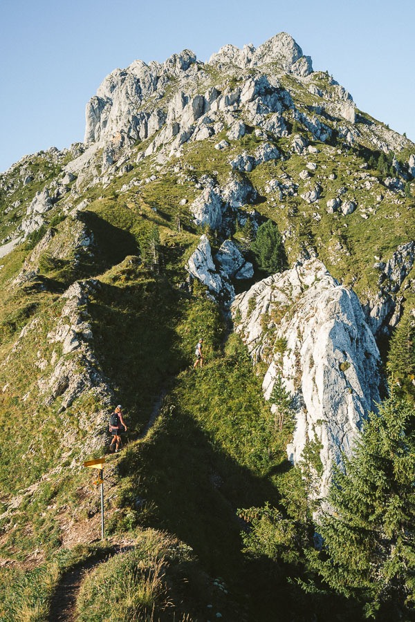
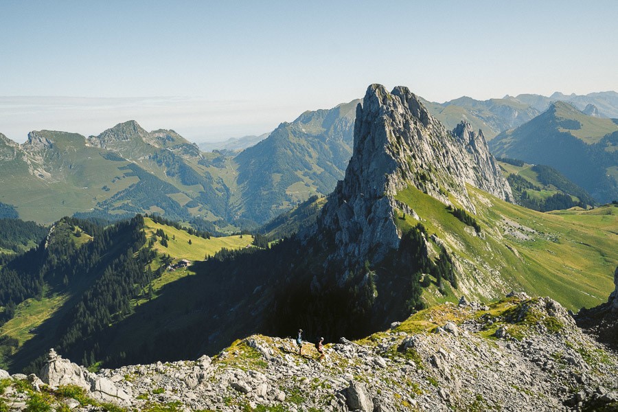
A group of rock climbers headed up to the bottom of one of the walls to begin a day of challenging vertical climbs on one of the most unique climbing destinations in Switzerland. We were attempting something far less impressive. Our aim was to reach the Wandflue summit, which looks back down along the ridge. Most hikers do a panoramic lap around Gastlosen, which is still quite a hike but to the summit of Wandflue is a bit more of a scramble.
We reached the Chalet after about 40 minutes although it may take some slightly longer with the steep incline. Allow for an hour maximum for this segment of the trail. At the chalet, you can enjoy coffee, beers, cakes and more but we opted to continue on our way and stop by the chalet when we returned.
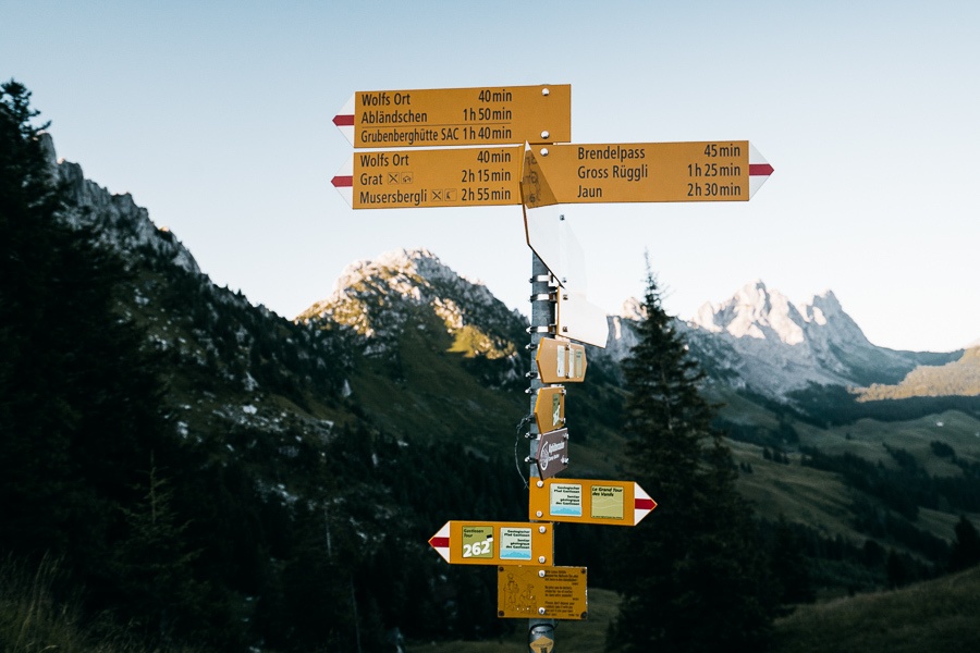
As you stand beside the chalet there are a big set of signs. We headed up following ‘Grat’ but there is never any Wandflue sign, you just kind of head up there at the right moment. I’ll show you when later on.
This part of the trail is steep again but now you are walking along a dirt track in amongst shrubs with lots of rocks to navigate. Good trail shoes become key on this terrain.
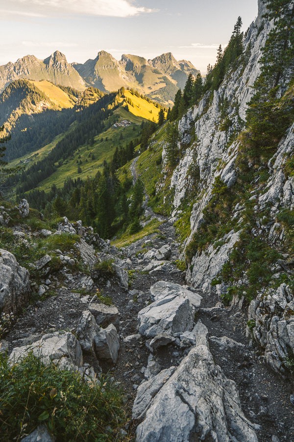
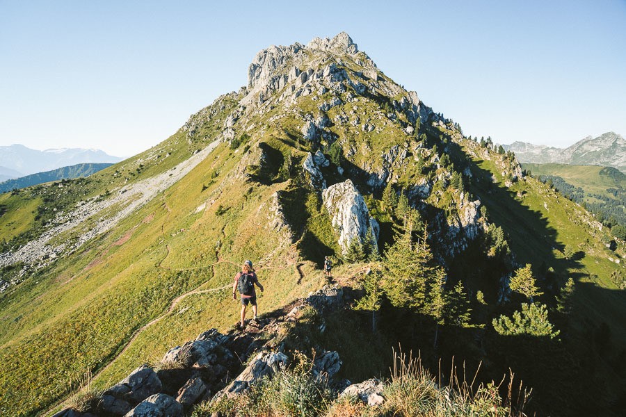
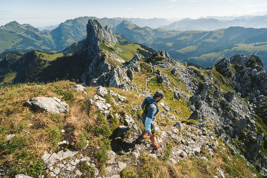
Once you reach the plateau you can now either follow around the corner to the left and do a lap of Gastlosen or you can continue up the hill to Wandflue. Be warned, there is really no trail to Wandflue other than the footsteps of those before you.
There are no markings or signs and there are multiple routes up. It isn’t something crazy but definitely a level-up from the early parts of the trail. Be ready to use your hands. Also, be ready to look back frequently as Gastlosen ridgeline gets more and more beautiful as you rise higher and higher.
With caution, we made our way up the gravel and rocks toward the Wandflue summit. The views got better every ten steps as more and more of the panoramic surround became visible. From the mid-section plateau, it takes only 15-20 minutes of steep climbing to reach the cross at the summit of the Wandflue.
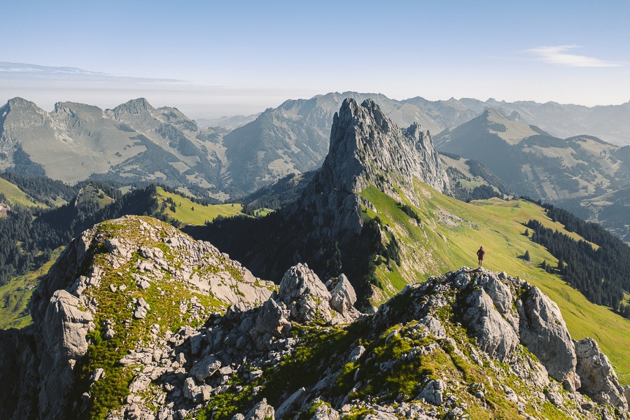

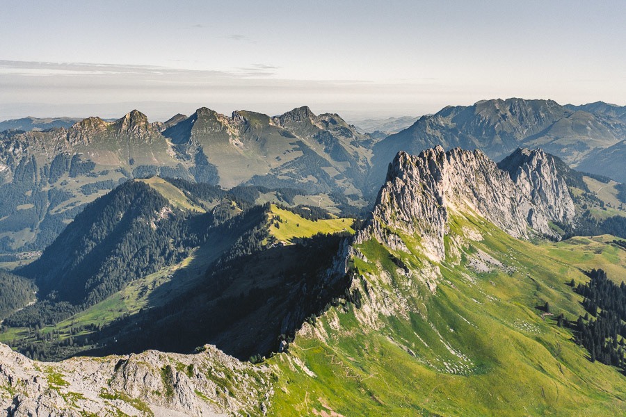
The journey down from the summit was probably my favorite part. This is because you had a great view in front of you for the entire journey and really had a great opportunity to admire the Gastlosen Ridge. Don’t admire it too much though as you will need your full concentration on your feet as you practice some fancy footwork on the decline with slippery rocks, gravel and slick grass challenging your agility and balance.
We made it back to the Chalet after four hours of adventuring with a 50-minute break at the Wandflue summit. It was time for a citron tart, coffee and a chance to look out over the valley and enjoy this beautiful region. Truly recommend this trail and region in general with its unique rock formations and beautiful panorama views.
I hope you enjoyed this guide about the Gastlosen hiking trail in Switzerland.
SWISS TRAVEL PASS or HALF-FARE CARD
OPTION 1: Buy the Swiss Half Fare Card: Switzerland trains, buses, and cable cars are EXPENSIVE! I found the best way to get around cheaply was to buy the Swiss Half-Fare Card before I arrived. It gives you 50% off every regular train, bus, and even many cable cars. It only costs $150 USD but pays itself off in just a few days with many train tickets in Switzerland costing close to $100 alone. If you are staying for more than 5 days, I suggest buying the Swiss Half-Fare Card.
OPTION 2: Buy the Swiss Travel Pass: The second option is to get the Swiss Travel Pass, which gives you unlimited train, bus, and (many) cable car rides but it’s pretty expensive at around $100 USD per day so if you don’t travel each day it isn’t worth it.
OPTION 3: Buy the FLEXI Swiss Travel Pass: The final (BEST) option is to get the FLEXI Swiss Travel Pass, which allows you to buy 8 days’ worth of transit but you can choose the night before if you want to activate the next day. That way you don’t need to travel every day to get your money’s worth, you can just activate the FLEXI Swiss Travel Pass on the days when you are doing sizeable transits. My advice is to book the Swiss Half-Fare Card or the FLEXI Swiss Travel Pass in advance before your trip so it’s ready to go when you arrive.
GET A SWISS TRAVEL PASS!


Enjoy UNLIMITED train, boat, and bus rides in Switzerland for up to 15 days. Click to book a flex Swiss Travel Pass or choose the Consecutive Swiss Travel Pass.
The Swiss Travel Pass starts at $260 for 3 days. Click here to check if it’s available on your travel dates.
MY SWITZERLAND HIKING GUIDES
I spent 100 days hiking in Switzerland and created a guide for different regions around the country. You can click on one of my Switzerland hiking guides below to help you plan your trip.
- The Complete Guide: 50 AWESOME HIKES IN IN SWITZERLAND
- The Via Ferrata Guide: 4 EPIC SWITZERLAND VIA FERRATA COURSES
- Lauterbrunnen Guide: 10 AWESOME HIKES NEAR LAUTERBRUNNEN
- Interlaken Guide: 15 AWESOME HIKES IN INTERLAKEN
- Grindelwald Guide: 12 AWESOME HIKES NEAR GRINDELWALD:
- Mürren Guide: 7 AWESOME HIKES IN MURREN
- Appenzell Guide: 9 AWESOME HIKES NEAR APPENZELL
- Chur Guide: 7 AWESOME HIKES NEAR CHUR

MY SWITZERLAND TRAVEL TIPS
- For Backpackers: SWITZERLAND BUDGET BACKPACKING GUIDE
- Travel Tips: 20 THINGS TO KNOW BEFORE VISITING SWITZERLAND
- Transport Tips: RENTING AND DRIVING A CAR IN SWITZERLAND
- Accommodation Guide: 30 BEST PLACES TO STAY IN SWITZERLAND

Holly
Wednesday 13th of April 2022
Hello! Thank you for documenting this. Very helpful.
I was wondering what month you were exploring this area. We'll be there around August, is there weather usually good then?
Claudiu Purdel
Monday 8th of March 2021
I'm thrilled by this blog: very useful information and amazing photos. I wish I had found this blog & trips info - before my first hiking vacation in Switzerland. Congrats for a very well structured blog & quality info / pics
Antonio
Sunday 10th of November 2019
Amazing write-up. I love the pictures! Have you been to Zermatt?
Cheers and keep it up with amazing work! :)
Jackson
Monday 11th of November 2019
yep I've been to zermatt. put zermatt in the search bar of the blog and you will see the 6-7 hikes I did there.