
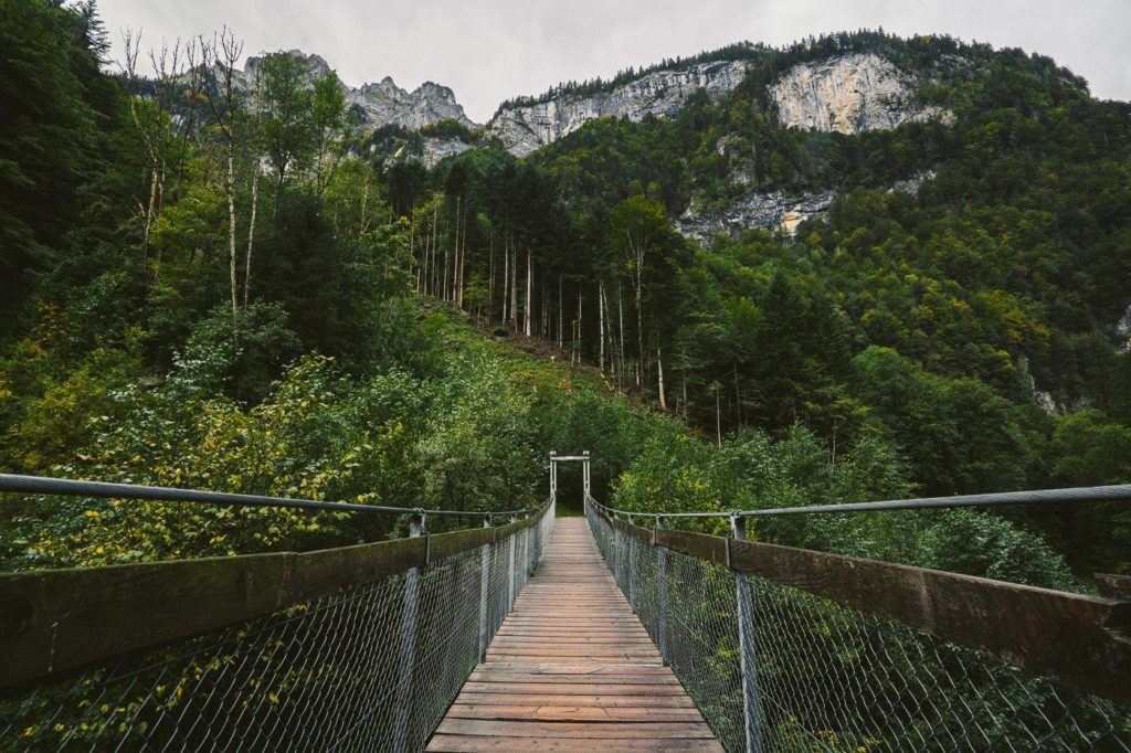
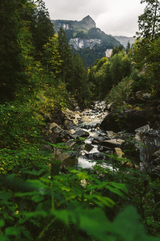
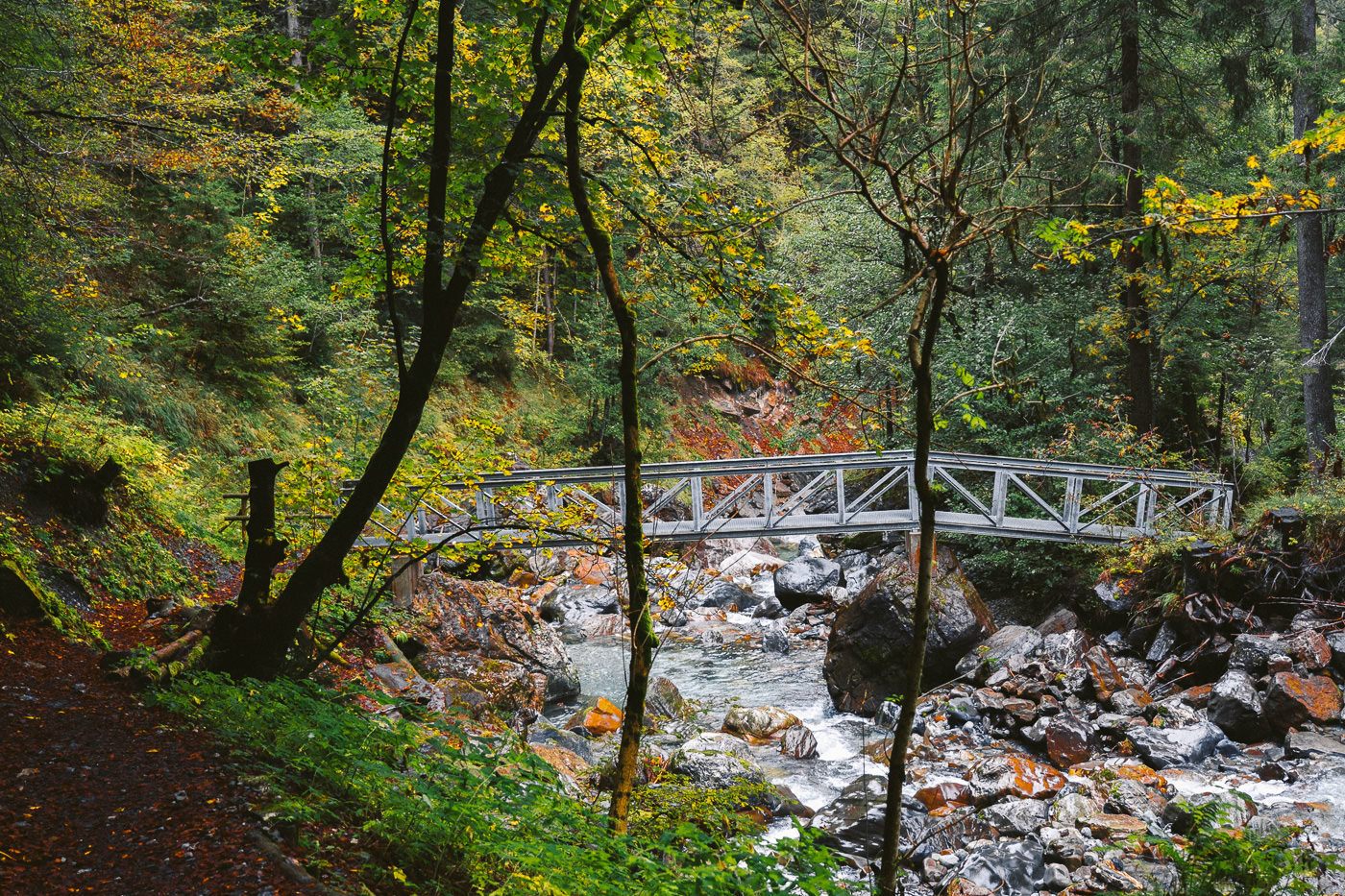
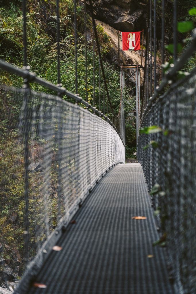
The Aa Gorge Trail (Aaschlucht) is a mystical trail that leads you through a dense forest. 10+ bridge crossings over the river make it an exciting journey!
AA GORGE HIKING TRAIL DETAILS
- Hike Distance: The total distance of the Aa Gorge Trail is 8.9 kilometers from Engelberg Train Station to Grafenort Train Station.
- Hike Duration: The hike should take about two hours.
- Hike Difficulty: Difficulty is very low. Suitable for children, families, and dogs. It can be a bit slippery but other than that there are no dangers. Some parts of the trail are exposed down to the river but the path is wide and relatively flat.
- Hike Incline: The trail has 435 meters of incline if you begin at Grafenort and finish at Engelberg. In reverse, you only have 9 meters of incline if you start at Engelberg and it is mostly a downhill walk.
HOW TO GET TO THE AA GORGE TRAIL
The trail can either begin at Grafenort or at Engelberg.
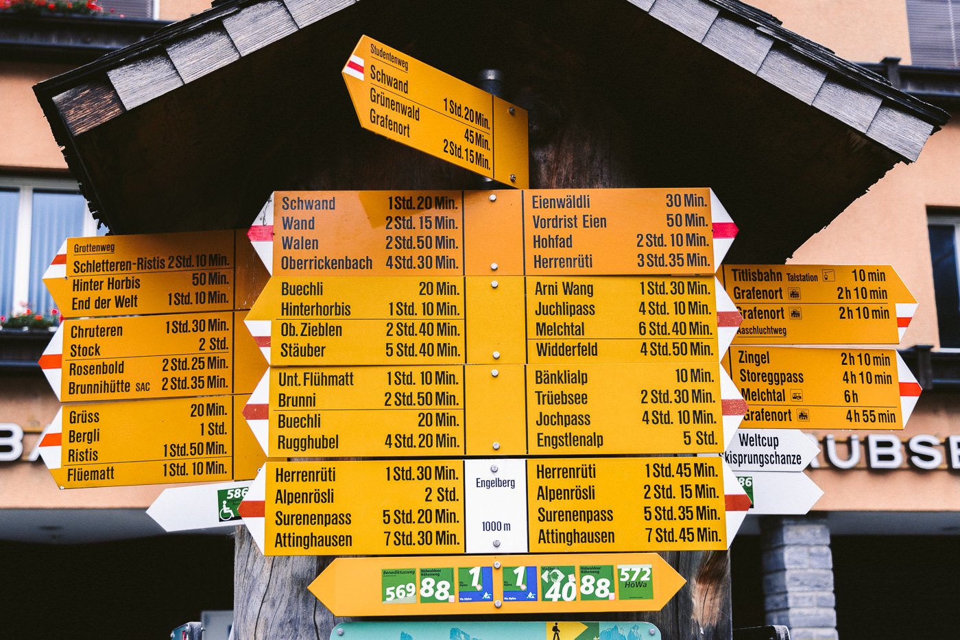
- If you start at Engelberg, head to the train station and then you will find the ‘town sqaure’ next to the Bellevue Hotel. Here there is one of the craziest Swiss signs ever with more than 20 different directions offered! Follow the Aaschlucht sign all the way to Grafenort. First, you head across the bridge and past the Titlis cable car area and continue following the yellow signs. When you get to Grafenort, just catch the train back to Engelberg.
- If you begin at Grafenort, first catch the train to the Grafenort from Engelberg and then when you get off at the station the hike begins behind the church and you will follow the Aaschlucht signs. The trail will lead you all the way back to Engelberg town square.
MY EXPERIENCE ON THE AA GORGE TRAIL
I began the hike from Engelberg and planned to catch the train back from Grafenort. I’d done a big overnight hike the day before to Rugghubelhutte, so I didn’t mind a downhill stroll through the forest although it would’ve only been 400 meters of incline if I began at Grafenort.
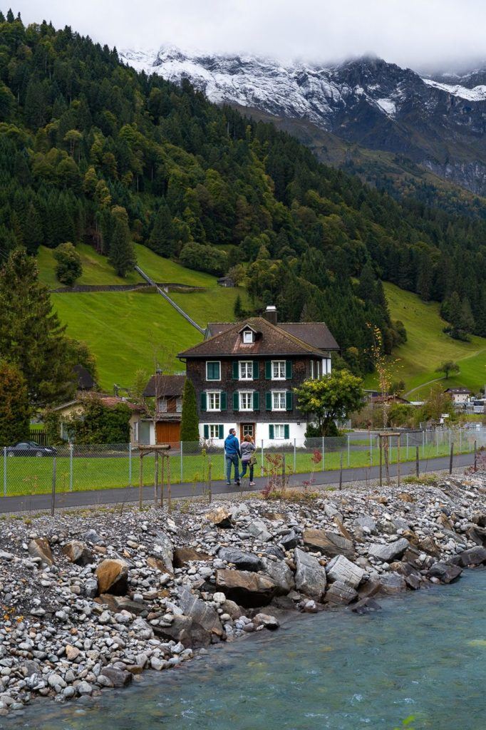
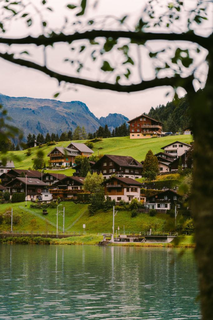
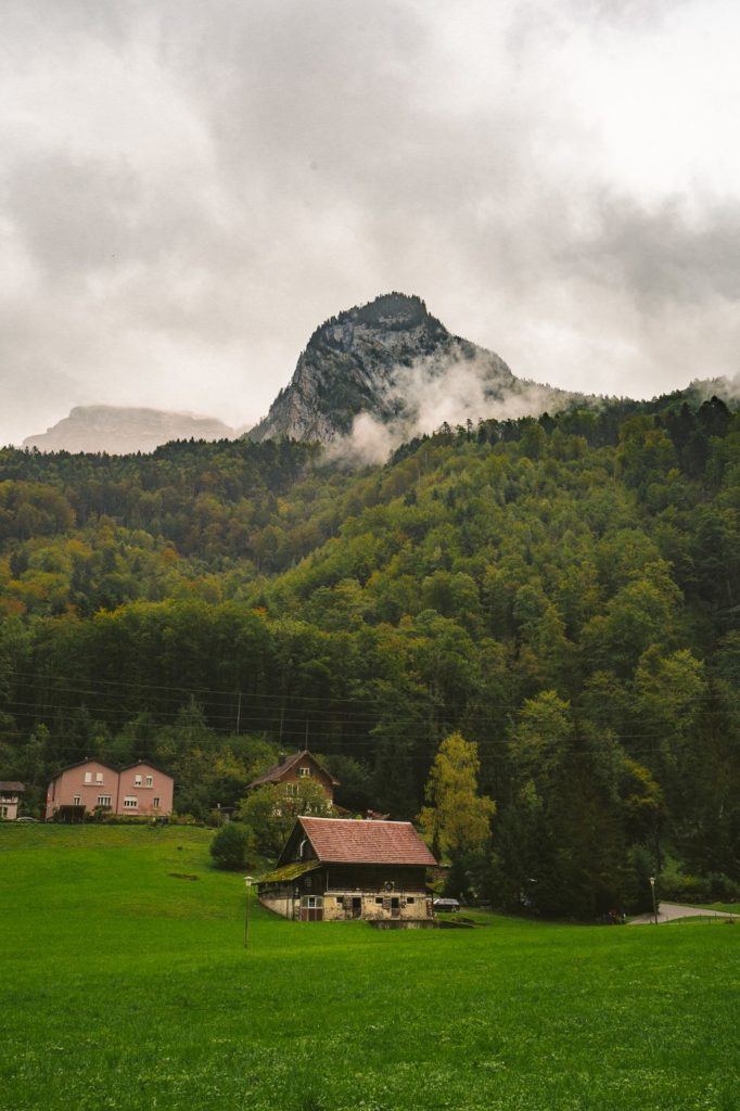
The trail begins in the town square and then takes you across the first of many bridges past the Titlis cable car. At this point, it is very much a walk on a path in suburbia but don’t you worry that will change. The trail leads you along the left-hand side of the Eugenisee Lake where locals are fishing, ducks are running away from me and the backdrop of Swiss chalets is an idyllic scene.

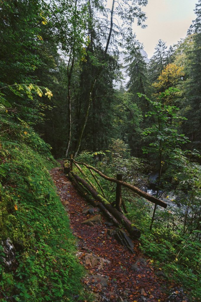
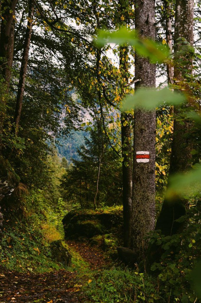
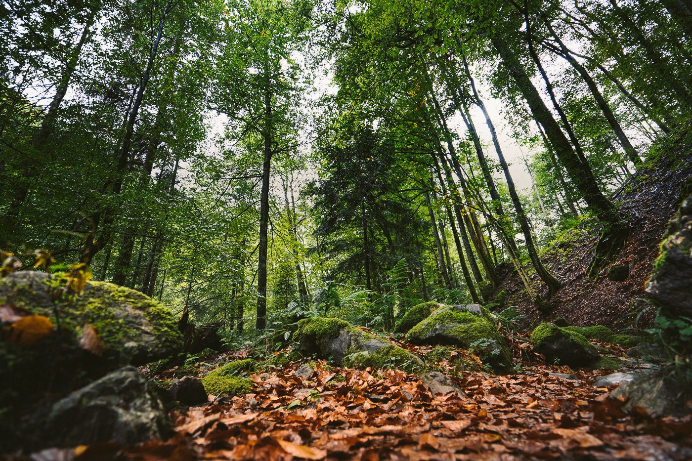
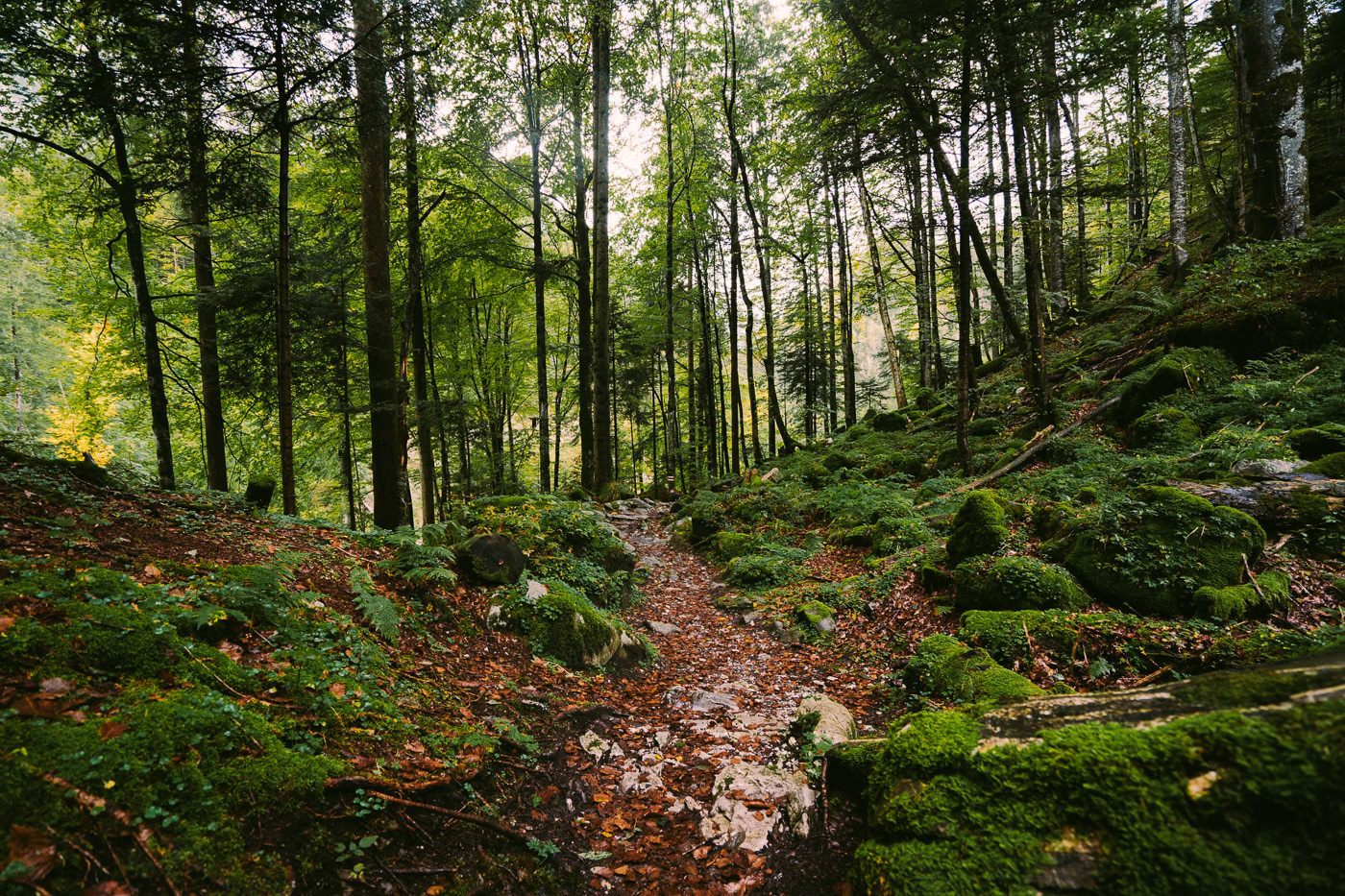
After rounding the lake you will then cross over close to the main road but you never actually cross the road, stay on the left of the main road and head into the forest. It is well-signed with yellow signs. From this point on you leave behind the town, streets, and cars and enter the mystical world of the forest. On the day I did the trail there was light rain creating a magical atmosphere amongst the trees.
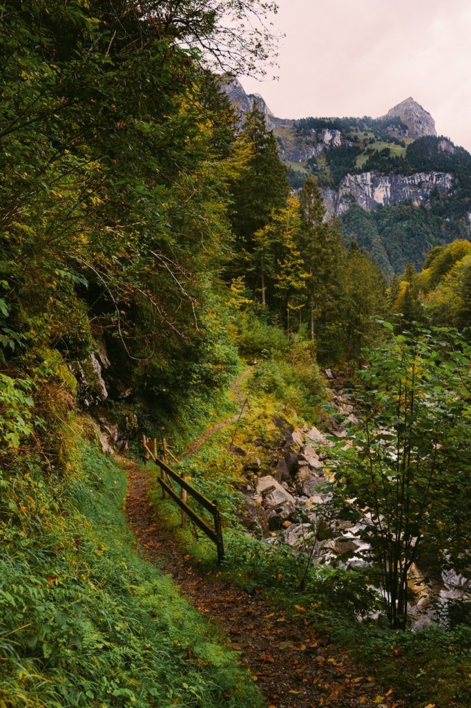
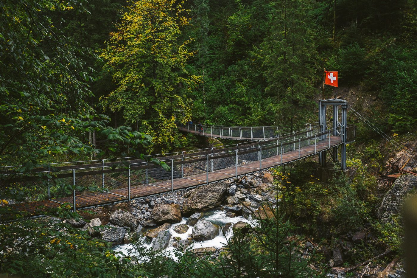
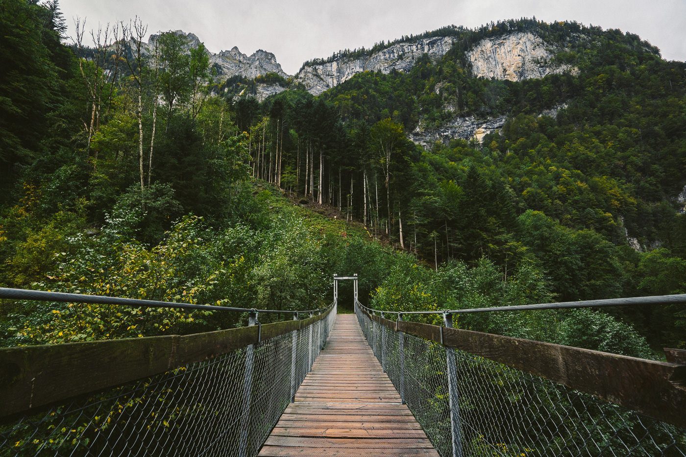
Along the trail, there were countless bridges. I mean it, I really lost count of how many bridge crossings there were. Some were small while others were long suspension bridges.
It was unexpected but all of the bridges turned out to be my favorite part of the hike. Because of the rain, the river was raging below me but I’m not sure how full it is during the middle of summer.
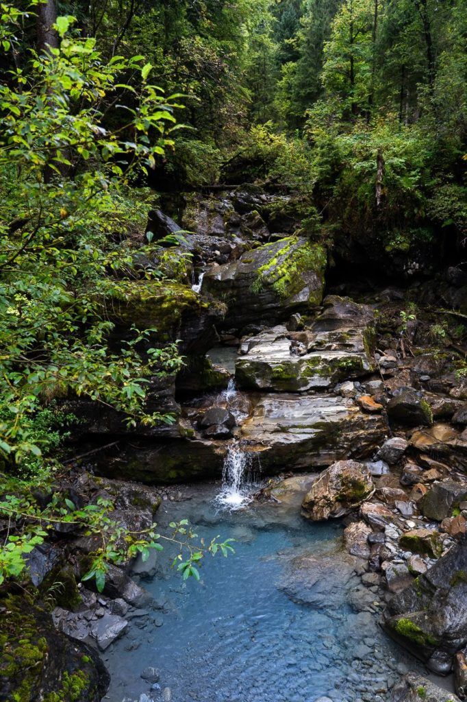
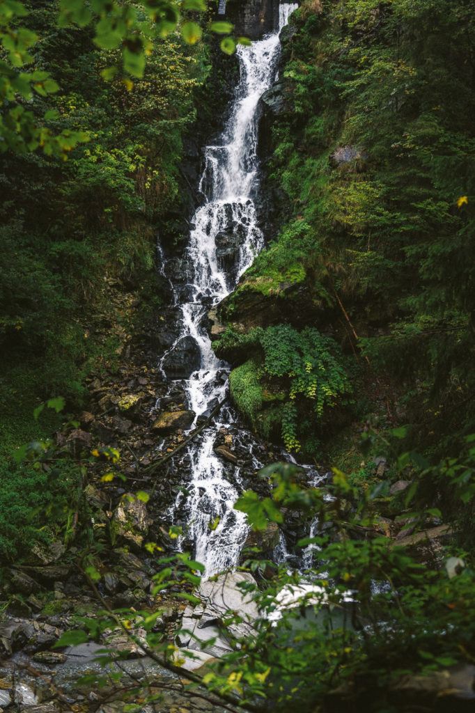
In many parts of the river where there was no strong flow, the water was still, crystal clear and had a beautiful blue tinge to it. If it wasn’t freezing cold it almost would have been tempting to go for a dip, which maybe is possible in the summer under one of the many waterfalls.

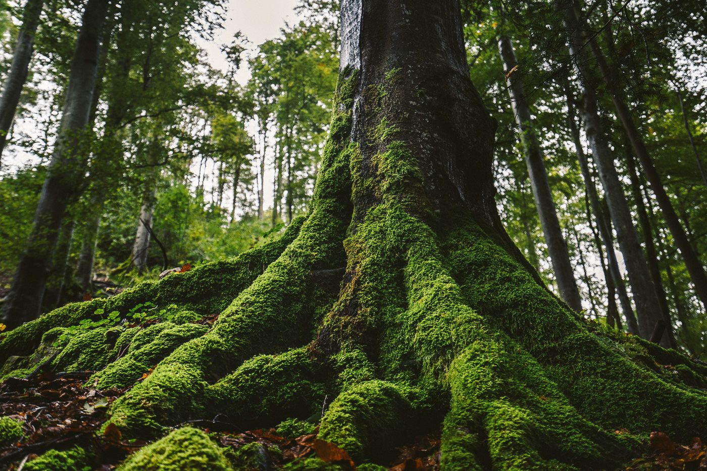
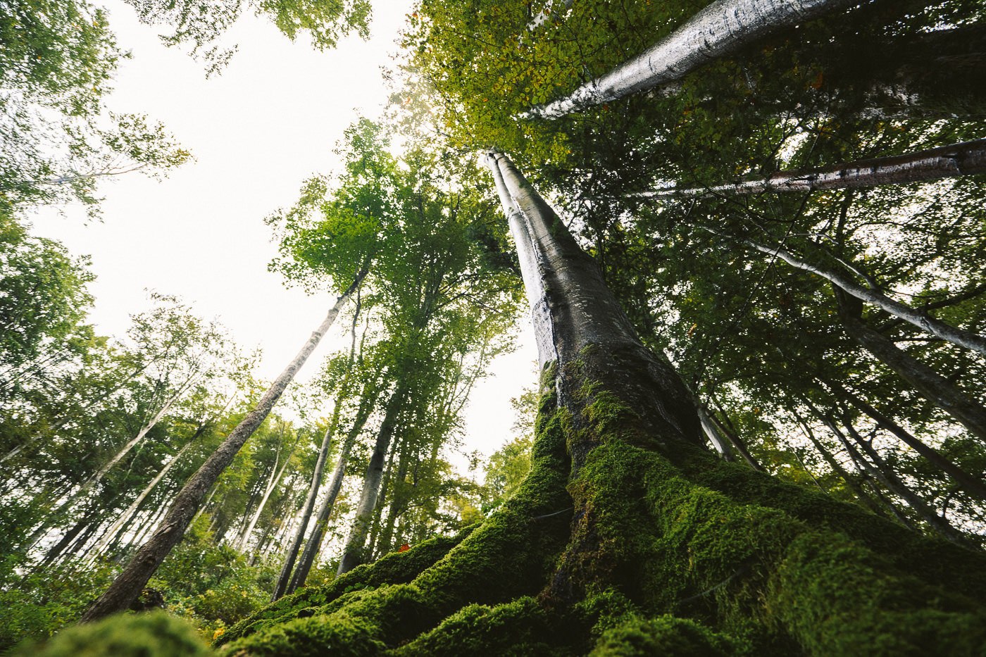
The trail gets even a little wilder at the halfway mark. The path becomes a little more natural and winds amongst the tree roots of the giants that loom above. The entire place seemed to glow gree with the trees, rocks, and roots all covered in a moss that shined from this mist and the rain.
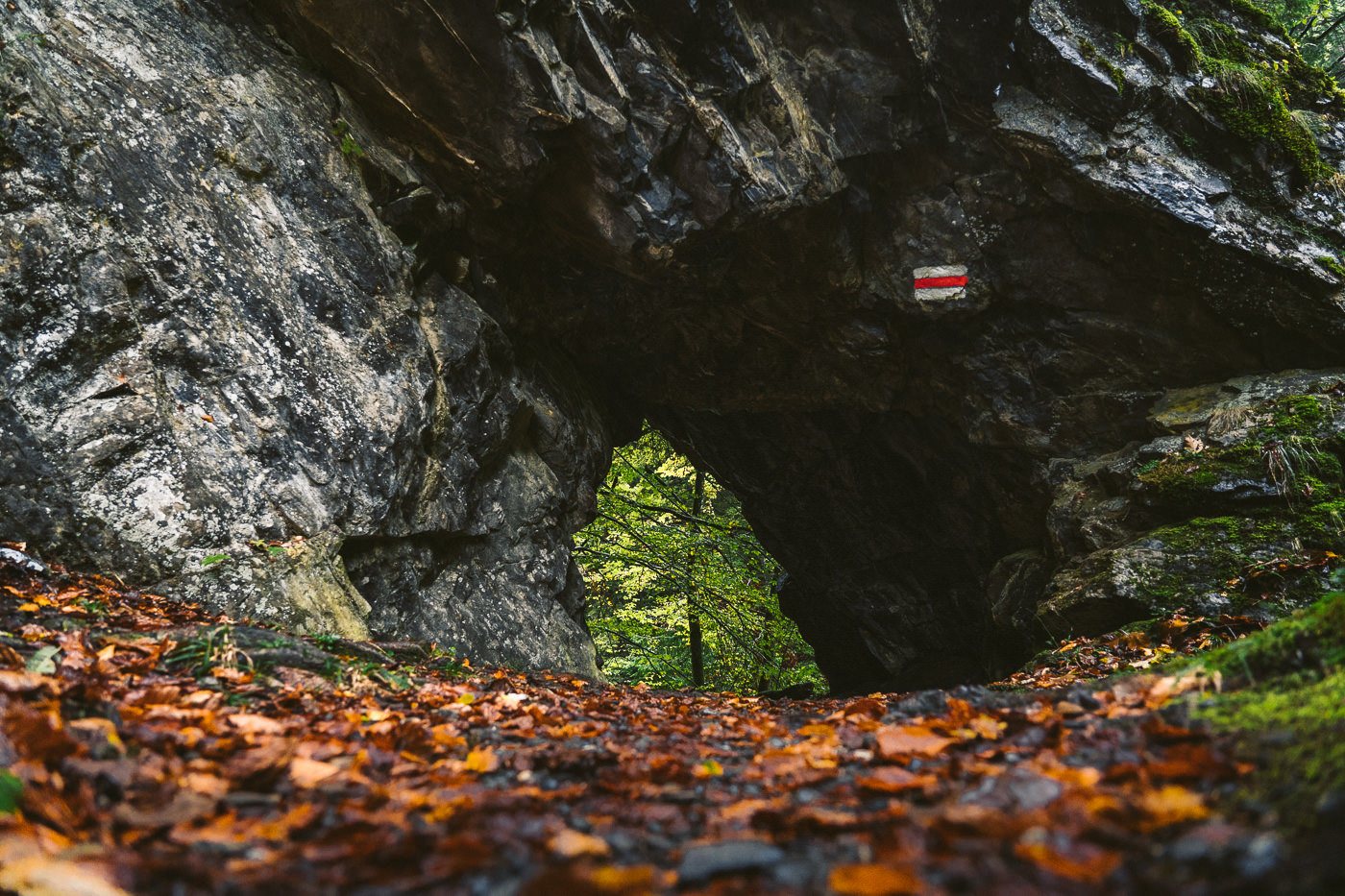
There are a few more surprises in store on this trail. Firstly, you have to make your way through a small cave and then on the other side, there is a huge waterfall! Well, it is actually a waterfall created by the stormwater system but in its lower elements, the waterfall seems to have been overtaken by nature.
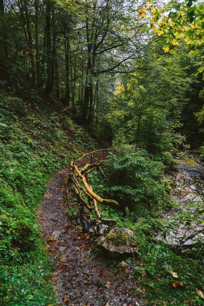
There are a few more bridges to navigate after the waterfall. By now the trail has flattened out a lot and you are nearing the final stretch to Grafenort.
All along this trail, there were little pit stops. Some had swings, benches, and games for children while other spots seemed to be set up for full bbq dinners. Maybe on a sunnier day!
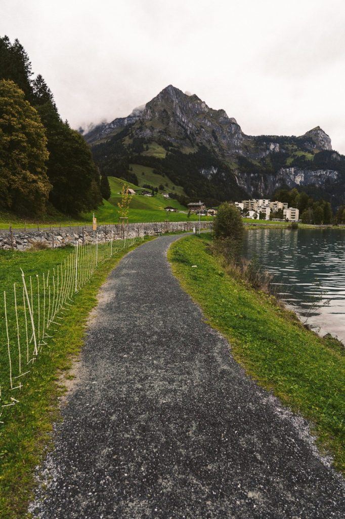
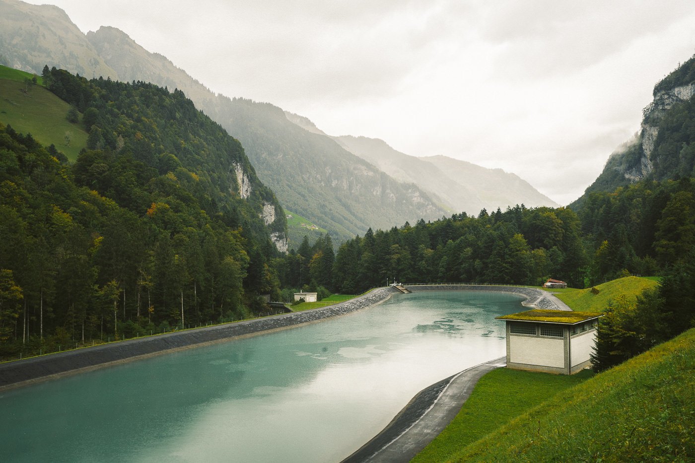
With only a couple of kilometers left the trail veers out of the forest and you are back on a paved path once again. However, it is still a very peaceful walk back to Grafenort once you reach the dam. I actually thought the dam was very picturesque and the blue color even looked beautiful in the rain.
The trail finishes up right at the Grafenort train station so there’s no need for any maps or directions. It’s important to check the timetable before you schedule your hike because often the train is only running once an hour. I did the hike on a Saturday and that was the case. It’s nice to give yourself 2 hours or 3 hours on the trail and keep on track timewise along the way otherwise you could get to the end of the trail and sit at the station for 58 minutes if you just missed the previous train.
I hope you enjoy the Aa Gorge hiking trail from Engelberg to Grafenort!
SWISS TRAVEL PASS or HALF-FARE CARD
OPTION 1: Buy the Swiss Half Fare Card: Switzerland trains, buses, and cable cars are EXPENSIVE! I found the best way to get around cheaply was to buy the Swiss Half-Fare Card before I arrived. It gives you 50% off every regular train, bus, and even many cable cars. It only costs $150 USD but pays itself off in just a few days with many train tickets in Switzerland costing close to $100 alone. If you are staying for more than 5 days, I suggest buying the Swiss Half-Fare Card.
OPTION 2: Buy the Swiss Travel Pass: The second option is to get the Swiss Travel Pass, which gives you unlimited train, bus, and (many) cable car rides but it’s pretty expensive at around $100 USD per day so if you don’t travel each day it isn’t worth it.
OPTION 3: Buy the FLEXI Swiss Travel Pass: The final (BEST) option is to get the FLEXI Swiss Travel Pass, which allows you to buy 8 days’ worth of transit but you can choose the night before if you want to activate the next day. That way you don’t need to travel every day to get your money’s worth, you can just activate the FLEXI Swiss Travel Pass on the days when you are doing sizeable transits. My advice is to book the Swiss Half-Fare Card or the FLEXI Swiss Travel Pass in advance before your trip so it’s ready to go when you arrive.
GET A SWISS TRAVEL PASS!


Enjoy UNLIMITED train, boat, and bus rides in Switzerland for up to 15 days. Click to book a flex Swiss Travel Pass or choose the Consecutive Swiss Travel Pass.
The Swiss Travel Pass starts at $260 for 3 days. Click here to check if it’s available on your travel dates.
MY SWITZERLAND HIKING GUIDES
I spent 100 days hiking in Switzerland and created a guide for different regions around the country. You can click on one of my Switzerland hiking guides below to help you plan your trip.
- The Complete Guide: 50 AWESOME HIKES IN IN SWITZERLAND
- The Via Ferrata Guide: 4 EPIC SWITZERLAND VIA FERRATA COURSES
- Lauterbrunnen Guide: 10 AWESOME HIKES NEAR LAUTERBRUNNEN
- Interlaken Guide: 15 AWESOME HIKES IN INTERLAKEN
- Grindelwald Guide: 12 AWESOME HIKES NEAR GRINDELWALD:
- Mürren Guide: 7 AWESOME HIKES IN MURREN
- Appenzell Guide: 9 AWESOME HIKES NEAR APPENZELL
- Chur Guide: 7 AWESOME HIKES NEAR CHUR

MY SWITZERLAND TRAVEL TIPS
- For Backpackers: SWITZERLAND BUDGET BACKPACKING GUIDE
- Travel Tips: 20 THINGS TO KNOW BEFORE VISITING SWITZERLAND
- Transport Tips: RENTING AND DRIVING A CAR IN SWITZERLAND
- Accommodation Guide: 30 BEST PLACES TO STAY IN SWITZERLAND

Kelly
Thursday 21st of October 2021
WOW, thank you SO much for this blog (the entire Suisse blog!) This may be a silly question, but do you think this hike is good for fall foliage? Wondering if those trees will turn some great colors... Looks like they were slightly starting to, but hard to tell if it's mostly a mossy forest?