
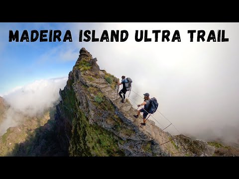
Hiking the Madeira Island Ultra Trail was one of the toughest trails I’ve ever done. 115 kilometers from Porto Moniz to Machico, visiting many of the island’s tallest peaks along the way. 8000 meters of incline made the four-day journey a brutal adventure through some of Madeira’s most beautiful regions. In this blog post, I’ll share everything you need to know about Madeira long-distance hiking, Madeira thru-hiking, and the multi-day MIUT route.
TOP 3 PLACES TO STAY IN MADEIRA
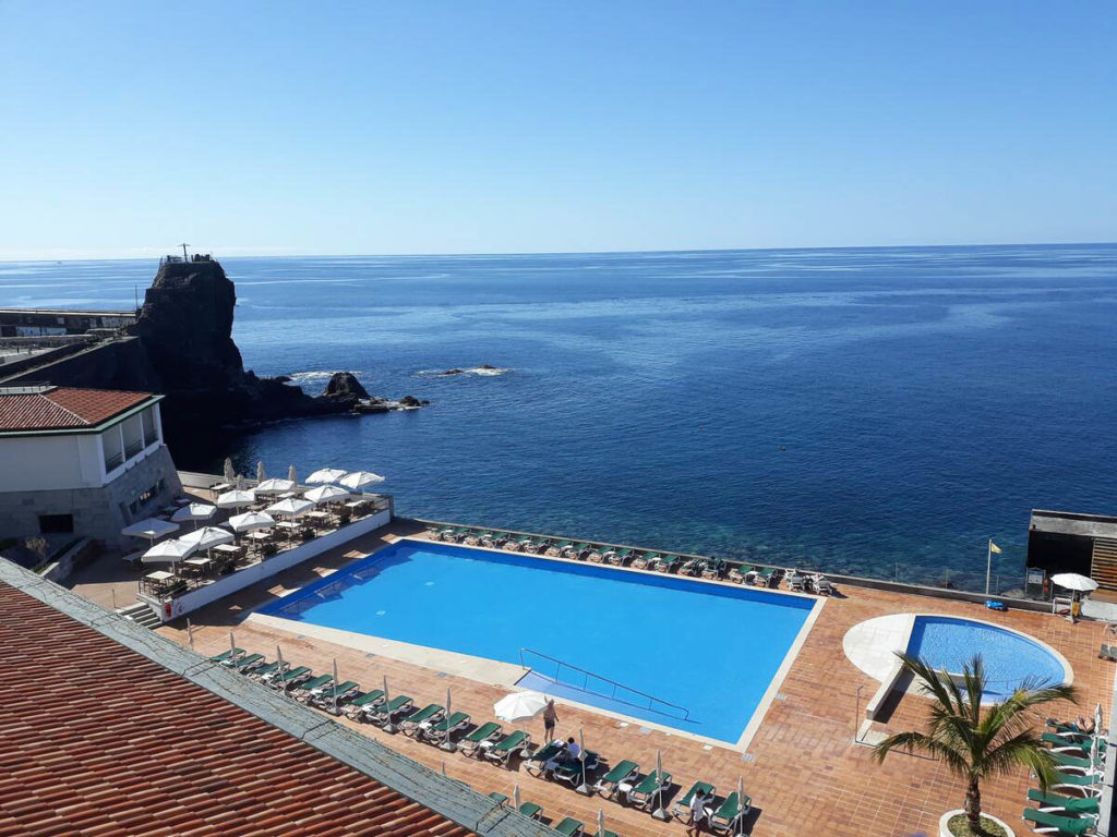
- Ultimate Luxury: Les Suites at Cliff Bay best location and view
- Best Value: Hotel Alto Lido – Funchal rooftop swimming pool under 100 Euros
- Budget Hostel in Funchal: Santa Maria Hostel is easily the top hostel in Funchal
MADEIRA ISLAND ULTRA TRAIL THRU-HIKE (MIUT)
We packed our camping gear including tents, sleeping bags, sleeping mats, hiking gear, and food for the four-day journey across the island. For three nights we camped, had a fire, and recovered overnight for the next day of hiking.
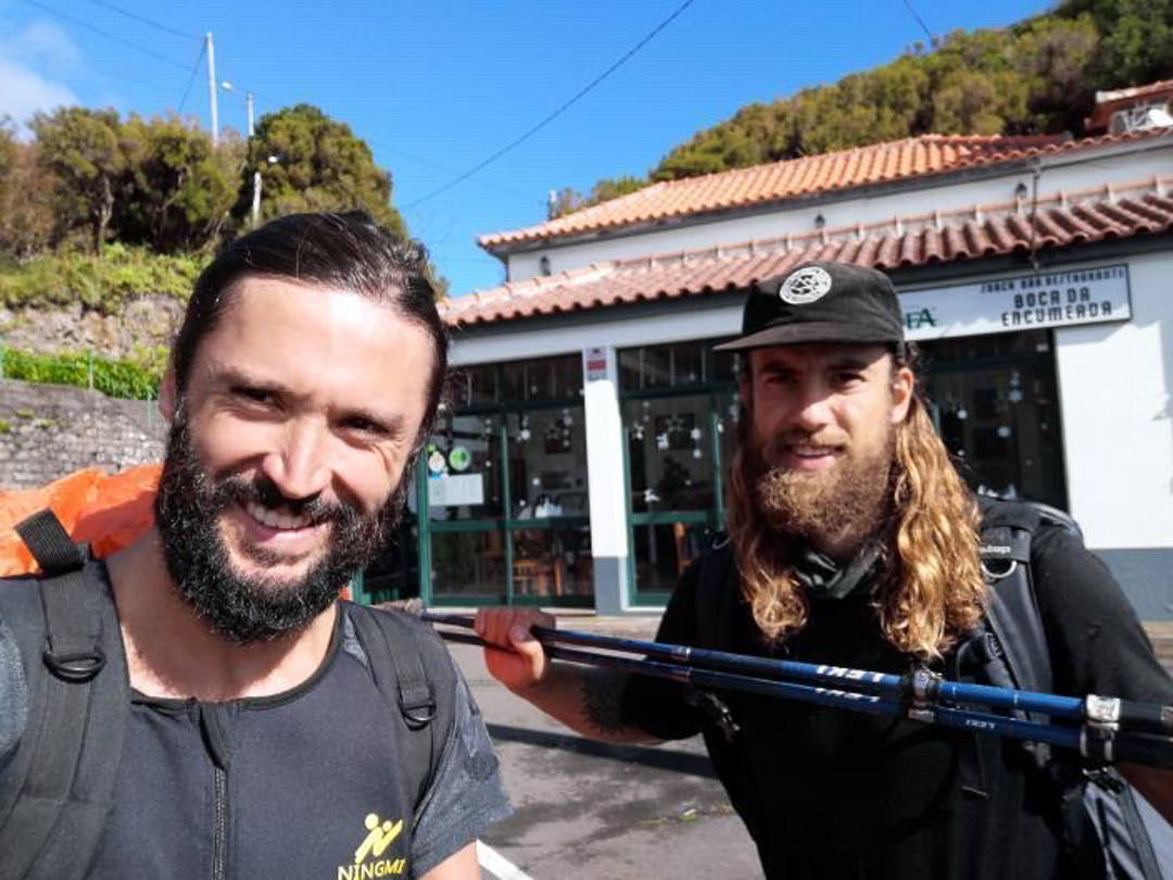
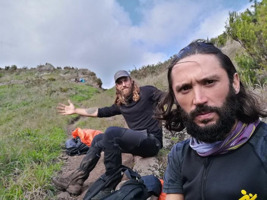
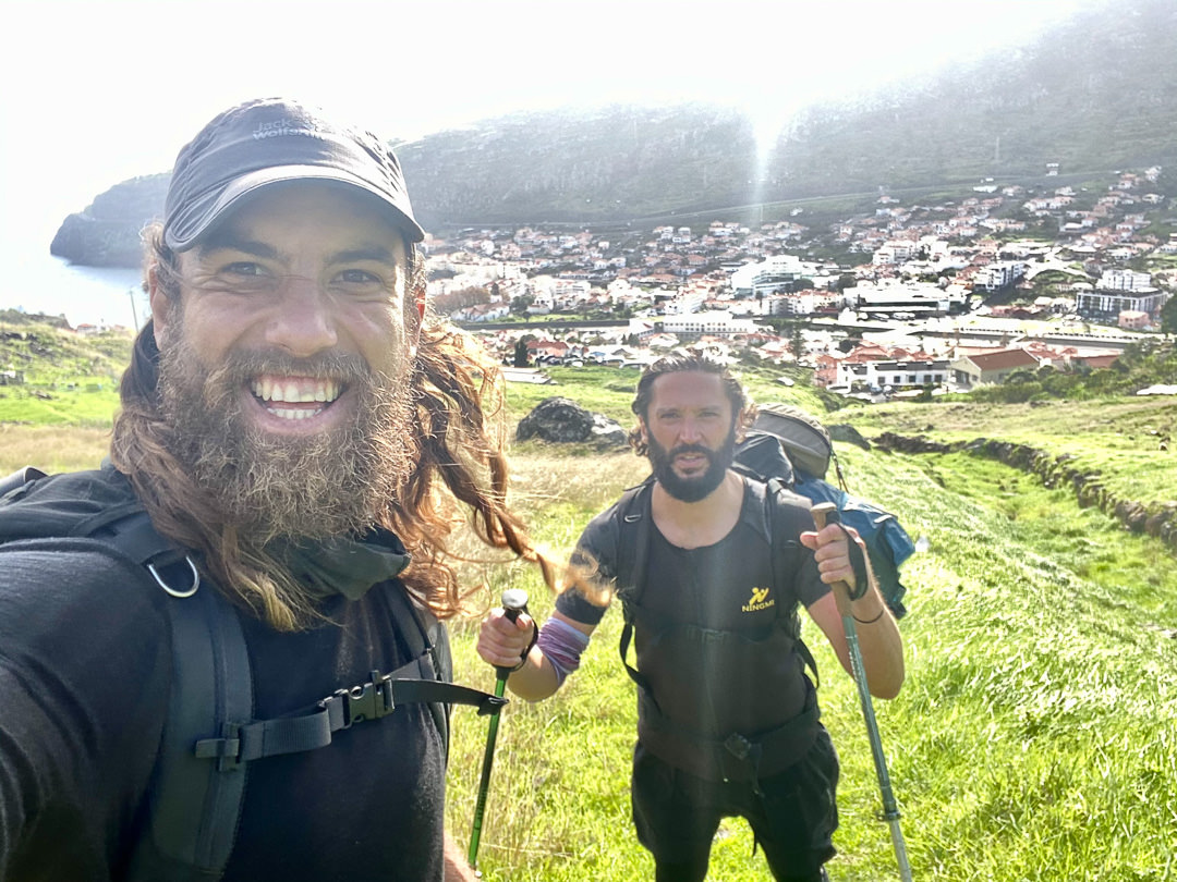
A GUIDE: I did this hike with my local guide (also a great friend) called João. He’s lived in Madeira his whole life and knows all of the unique trails (not just the popular ones). Want to contact João to be your guide for the Madeira Island Ultra Trail, Caminho Real 23 (7-day trek), or any of the hikes I’ve done on Madeira? You can contact him on Instagram here: João Let’s Hike or by email: joaoletshike@gmail.com
Below, you will find the video I created while we were hiking. I hope it gives you an insight into the journey and what the Madeira Island Ultra Trail is all about.
Madeira Island Ultra Trail Journal
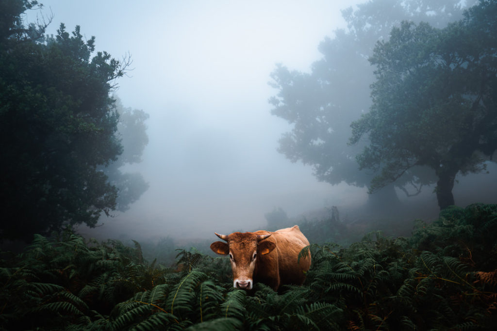
These are the journal notes I wrote each night from inside my tent before falling asleep. Photos are mainly from prior adventures and hikes in each spot as I didn’t shoot many photos during the actual MIUT hike itself due to the fast-paced nature of the thru-hike.
DAY 1
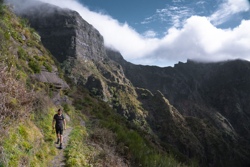
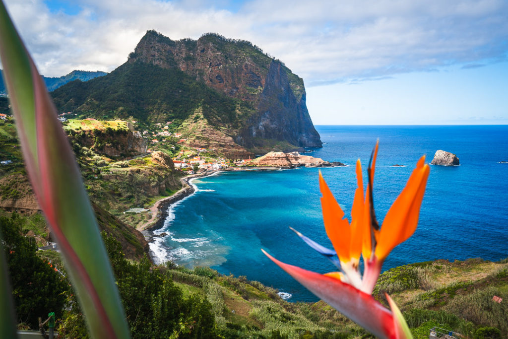
The journey began with an eerie atmosphere out of Porto Moniz. At 730am, half an hour before sunrise we strolled out of the town center with Christmas lights flashing in the background. Immediately the ascent was brutal with an uphill battle out of the town. Looking down over the city lights during the blue hour was a great start to our long journey.
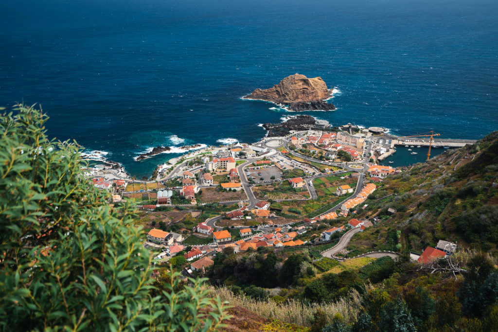
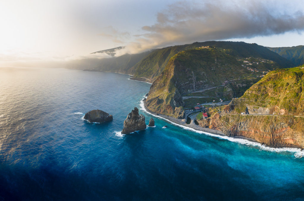
We reached the top of Porto Moniz and began the descent into the neighboring town of Ribeira da Janela. This was a beautiful Sunrise descent as we looked down from the trail to see the unique rock formations along the coast. That was the easiest of the three climbs for the day done and dusted.
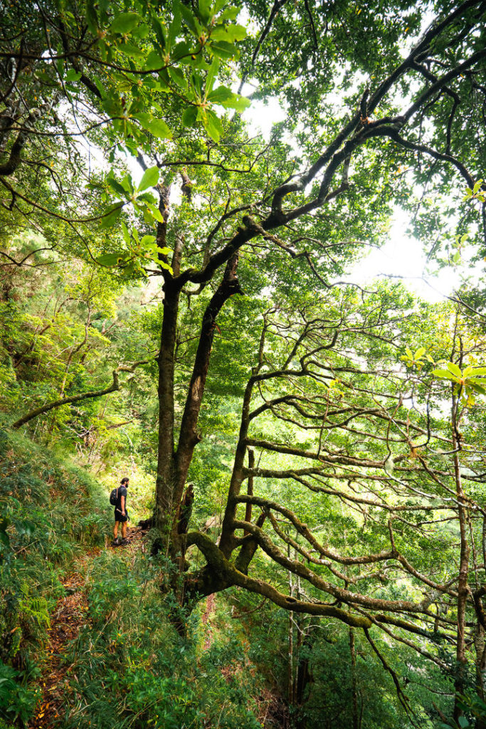
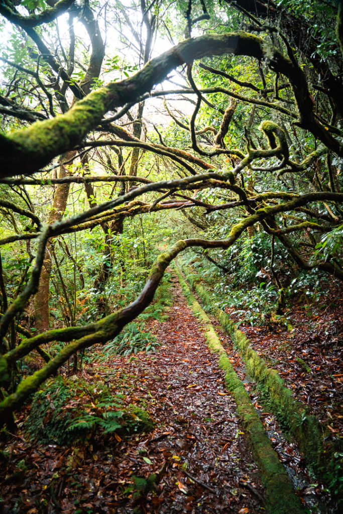
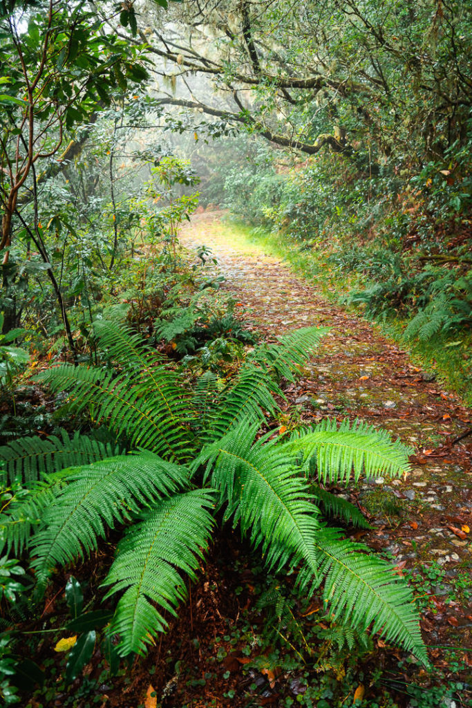
We now climbed out of the town through the suburbs along ancient pathways, handmade with stones. Sunday mass was in full swing at the local church as we powered by on our way up the hill with hymns sounding out in the background. Our first taste of a real trail was Ribeira da Janela and we enjoyed the lush forest, which often engulfed the trail.
We eventually emerged from the forest to reach the mystical land of Fanal. However, the sun was out in full force and the usual atmospheric fog was nowhere to be seen. On an island that often rains on hikers, we were glad to be dry by midday. We wound our way onto the Vereda do Fanal, passing centuries-old Laurrisilva trees, which beckoned us with their twisted branches. We had reached the top of the second climb.
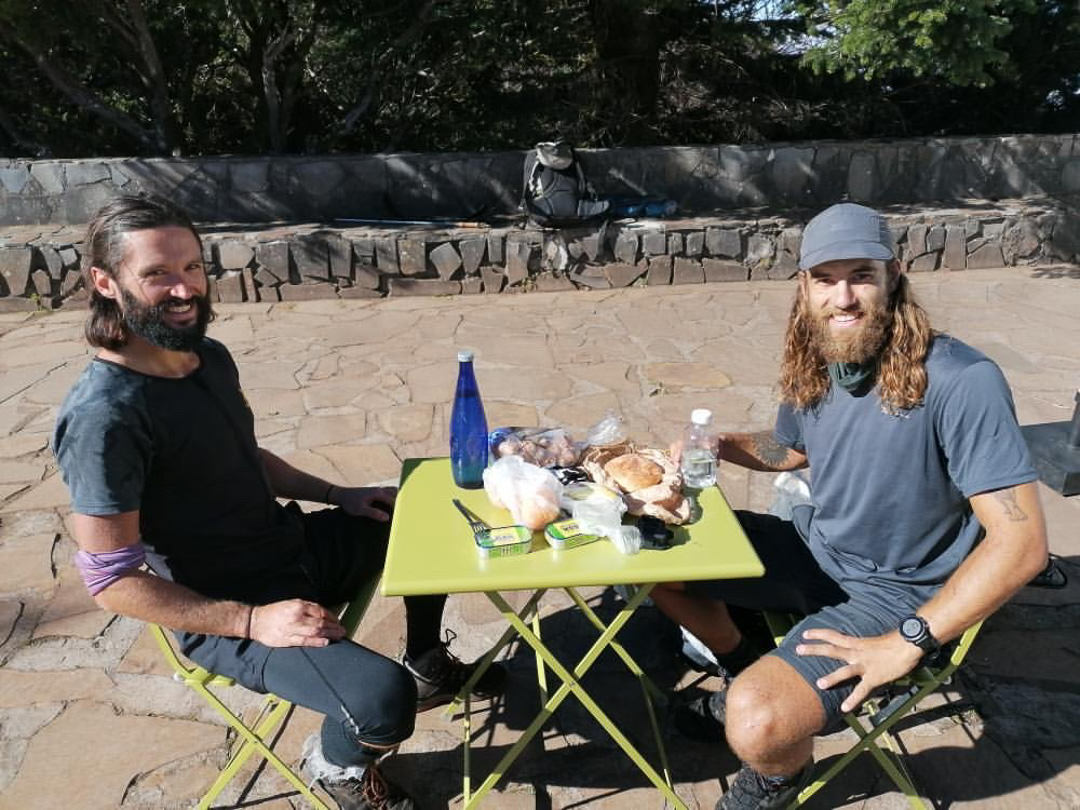
The big descent of the day was down into the ‘sanctuary’ of Chao da Ribeira. Almost 1000m of descent down mossy stairs and muddy trails had our knees in overdrive. Reaching the base of Chao da Ribeira it was time for lunch. Some packed sandwiches and chocolate were the fuel of choice.
Now it was time for the third and final climb of the day. It was the big ascent with a 1300m climb up Terra Cha to Paul Da Serra. Thick fog and humidity made the journey up the jungle stairs a dark and sweaty grind. This was the toughest part of the day but we managed to keep moving and push onwards till we left the thick forest cover behind to breathe fresh air at Paul da Serra.

We set up Camp at Paul da Serra, just off the trail with fire, water, and camping sites. With aching muscles, we had both completed our biggest day ever of incline and distance on the trail, especially when carrying a full load. With day one behind us, it only gets easier now with smaller daily incline totals and less intense distances. Heading into the center of the island should be a scenic journey and one we are looking forward to.
DAY 2
Throughout the night, we slept to the sound of rain pattering against our tents. A quick morning scramble amidst the rain had us packed and loaded to go just after 8 am, which was the sunrise. A foggy morning at Paul da Serra meant there was no rise of the sun to be seen.
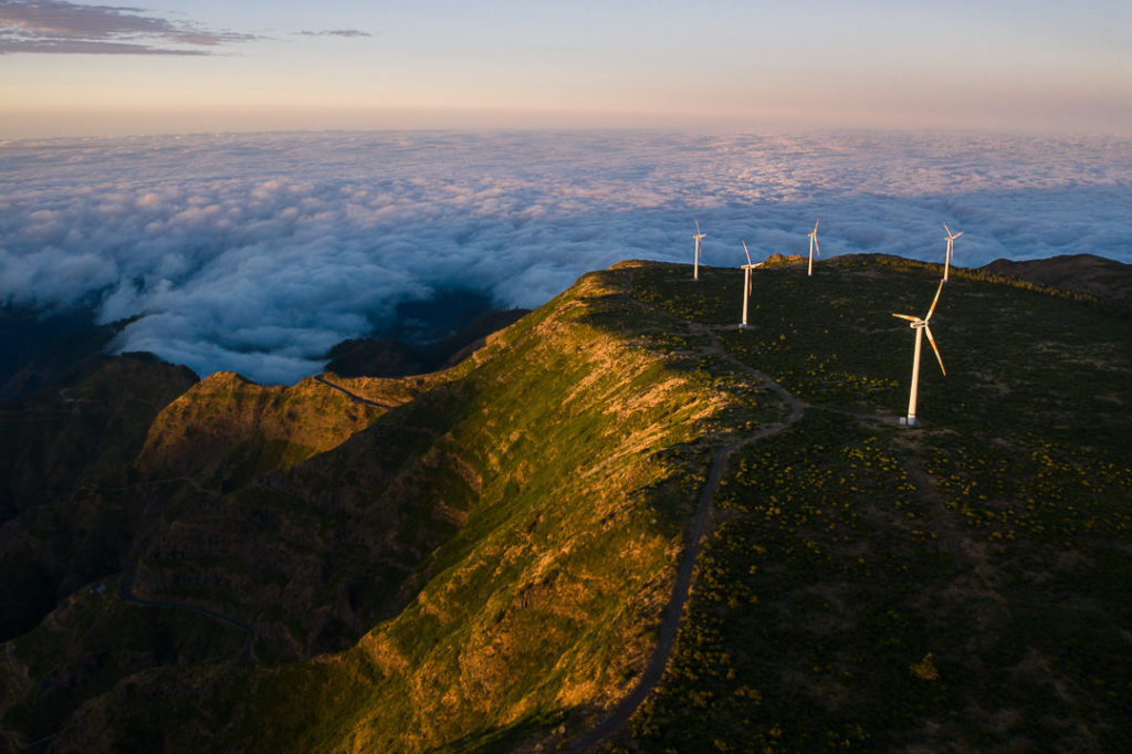
The day began with a long descent, much welcomed by the heavy legs of our 3,300-meter climb the day before. The rain subsided and we walked our way through the cloud on a gravel road, seemingly in the middle of nowhere. Every now and again, a giant wind turbine would appear through the clouds to surprise us.
We joined the Folhadal trail and entered a very scenic and lush section of forest passing by mossy walls and through dark tunnels. Our descent was still in full swing as we dropped down hundreds of stairs, giving our knees the warm-up they didn’t need.

My favorite part of the day was a section of trail called ‘Amazonias’, which is an amazing area of Laurissilva Forest. Greens glistened as far as the eye could see as the sun streamed through between the branches. It was almost too beautiful to pass through at such a pace.
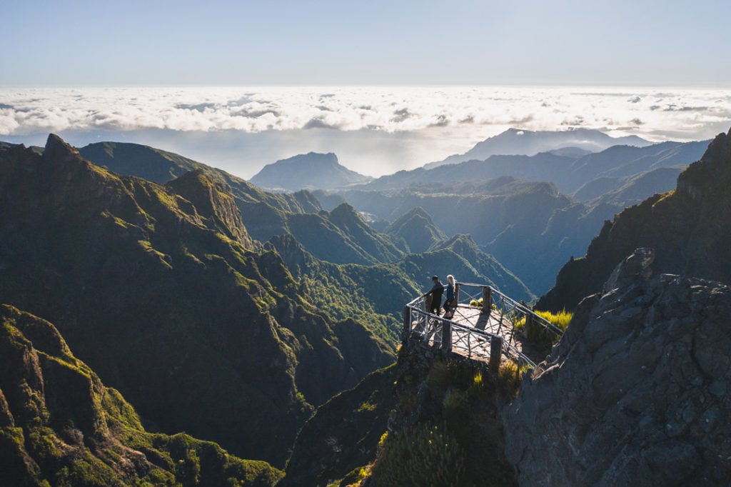
We made it down to Rosario for a snack break. Sitting above the highway, we watched the cars pass by beneath us before beginning our first climb of the day up towards Encumeada. This climb became tougher and tougher as we encountered an endless confrontation of stairs. Finally, just after midday, we reached the Encumeada lookout to mark the midway point of the day.

Our journey now led us down the mountain again until we met our demon of the day, a giant water pipe. The trail headed us directly up alongside the pipe on a brutal gradient. We reached this section in the hottest part of the day and battled our way up the incline.
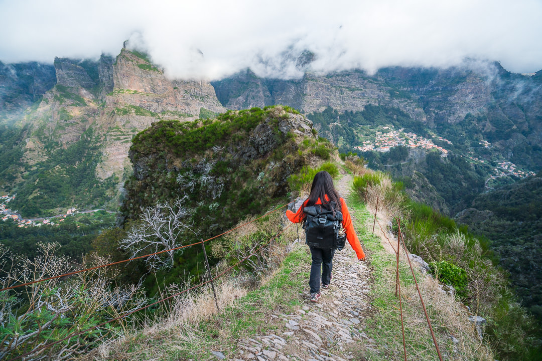
Turning away from the pipe, we joined the Caminho da Real Encumeada which led us on a scenic but steep journey to Relvinha. This was a hard and relentless uphill battle in the last heat of the day with no cover to hide behind.
From Relvinha, we made the steep descent down into a Nun’s Valley with a mild sunset causing some light hues on the peaks across the valley. With toes slowly being crushed by constant descents, we finally dropped into Nun’s valley just before dark. However, we still needed to loop up to the town and back to follow the trail as it is routed.
This extra few kilometers and meters of incline put a sting on our day and had us reach our camping spot in the dark. We camped by the river, amidst a small farm. Our tents were hidden behind a stone wall as we listened to the thunderous stream while we fell asleep after another huge day.
With 63 kilometers behind us and more than 5000 meters of incline covered, we are well and truly at the halfway mark. With the last day being entirely downhill, we feel like we are on a roll and just need to make it through tomorrow unscathed to have a successful journey. Spirits are high and bodies are dry.
DAY 3
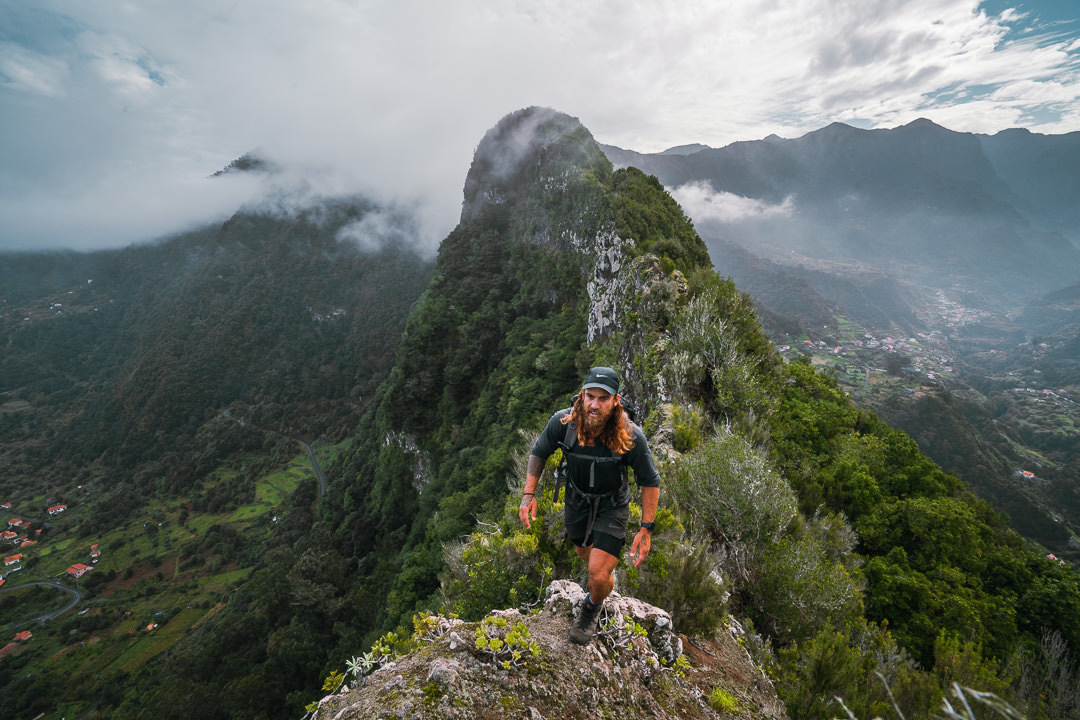
Sleeping on a local farm was a great idea until the resident rooster decided to give us an early wake-up call. Nevertheless, we packed up and set off for a brutal morning assault of 1400 meters climb to Pico Ruivo, the tallest point on Madeira Island.
Our muscles were slow to get going on this morning, but we marched our way up through the Eucalyptus Forest and then began to wrap around the ridges of the central massif. Unfortunately, the trail hasn’t been cleared so it was a tough section for us needing to slash a lot of invasive plants away with the machete. We lost a lot of time and both emerged with bloody scratches covering our limbs.

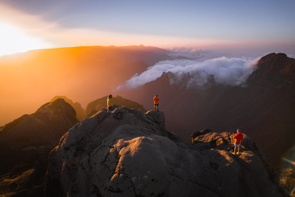
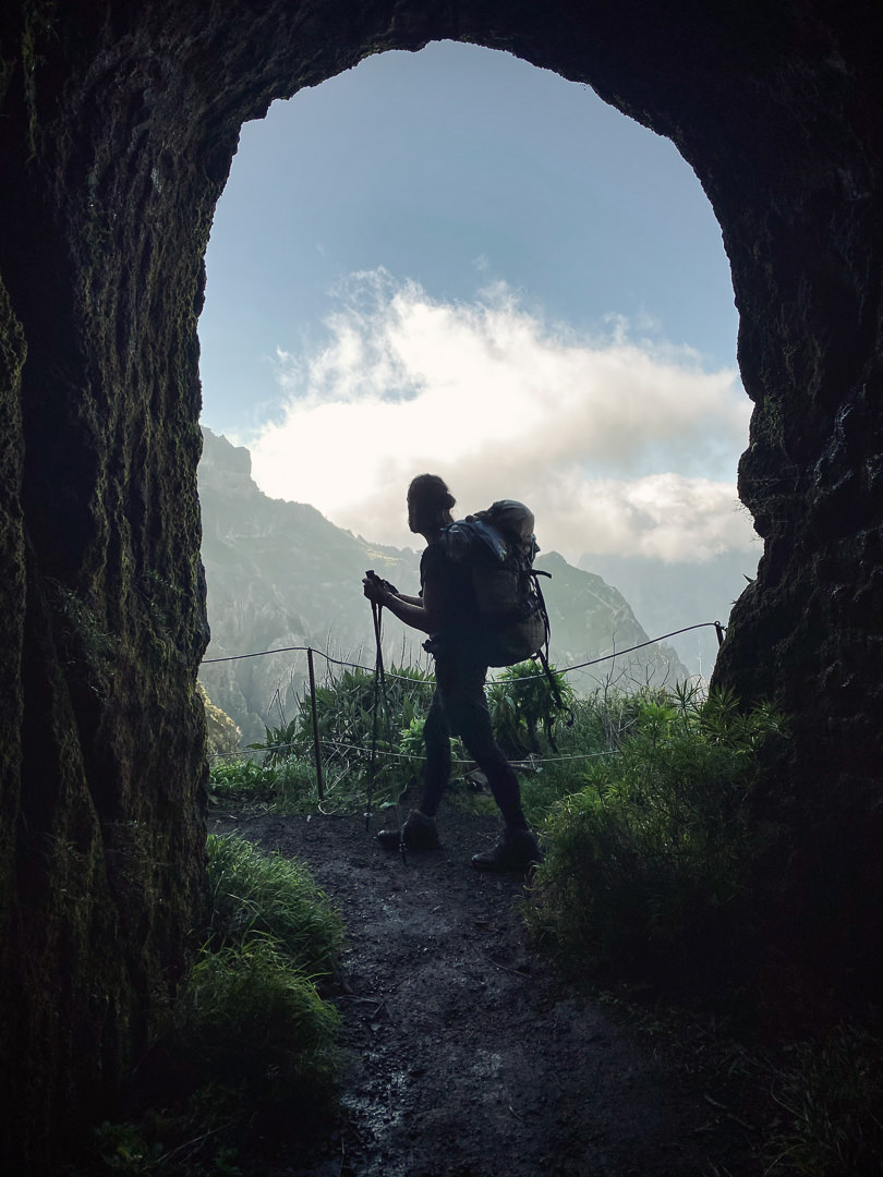
Once out of the thorn disaster, we persevered up the climb to Pico Ruivo where we had a huge lunch and enjoyed the sunshine for a brief moment. The packs were thrown back on as we descended to Pico do Gato passing many tourists along the way.
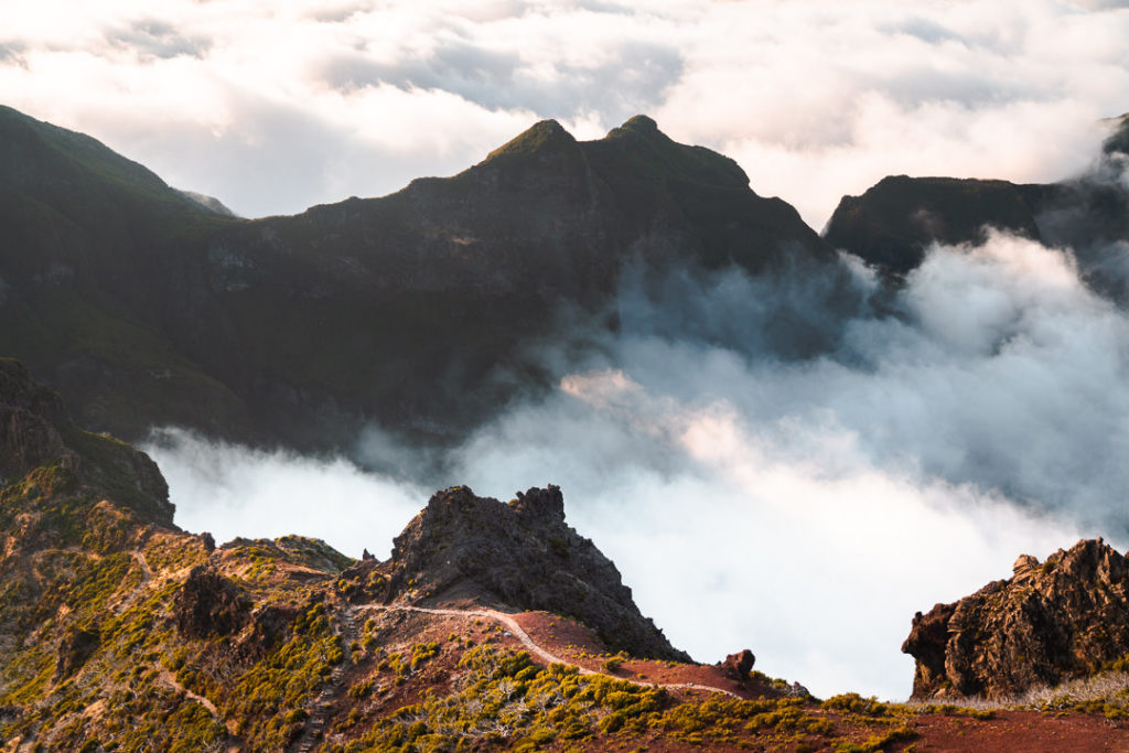
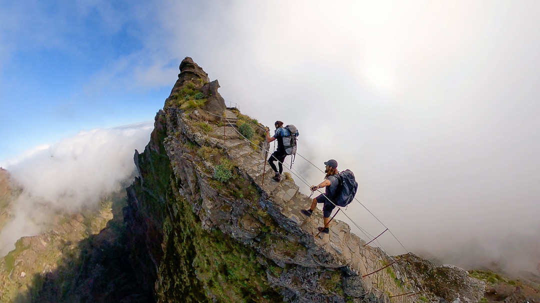
The final climb of the day was the famous section of trail up to Pico do Arieiro. There were a few puzzled faces from tourists as we walked past with huge packs but we kept a good pace and made it to the summit by late afternoon.
The descent from Pico do Arieiro wound us through some interesting fields but nothing came close to the scenery we had just witnessed along the Pico to Pico track. As the fog rolled in we made a rush to the campsite of the night at Ribeira Frio making it just in time to set up our tents in the last light of the day.
It’s our last night of camping before we make the final 29-kilometer journey to Machico on day four. We’ve racked up 7,300 meters of incline so far and the legs are feeling surprisingly good. Let’s hope they hold on for one more day of descent.
DAY 4
A chilly night at the campsite in Ribeira Frio had us waking up to the sound of light rainfall on the tents. We decided to get an early start on a long day so at 7 am we made a quick scramble to pack up camp and get going into the forest in the dim light of the morning. There were 30 kilometers on the agenda with about a vertical kilometer to climb so it was one of the easiest days of the journey but by this stage our legs were heavy.
The morning session was dark and foggy as we climbed our way through the muddy tracks towards Chao das Feiteiras. Knowing it was the last climb of the journey gave us the motivation to reach the top of the hill near Poiso.
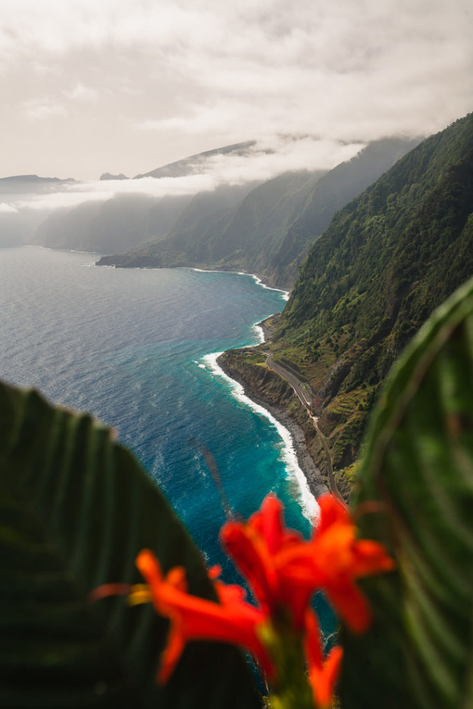
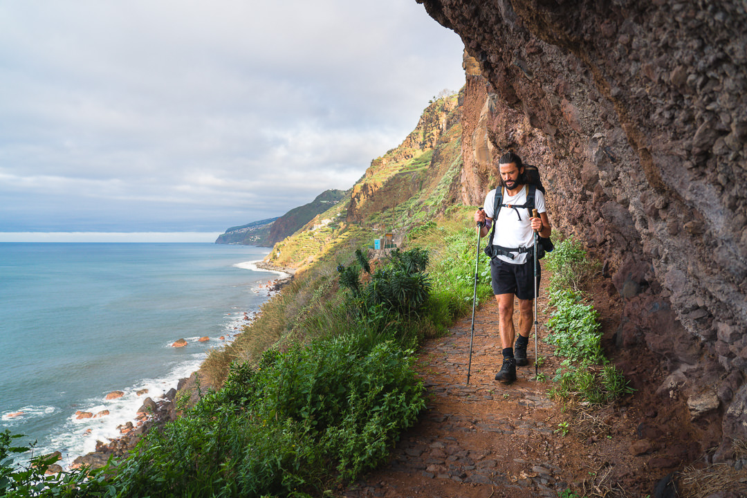
Once we hit downhill, we started to cruise towards Vereda do Larano on the coast. We were knocking the kilometers off quicker than ever because it was our first solid block of downhill and flat terrain throughout the whole trip. We wanted to make it to Larano for lunchtime and after some solid walking that is exactly what we did. Because it was winter, the downhill trails were quite muddy slowing us down a bit but we still made good time.
Keeping up with our good luck, we had sunshine at Vereda do Larano although it was quite windy. This beautiful section of trail runs along the coast and is one we have done many times before so it felt good to be in familiar territory and to be so close to the finish line in Machico.

Once we turned off Larano and headed down the track to Canical it was all about the final push. The sun was strong and the legs were heavy but we just kept powering through, hoping to make it to Machico in time for a late afternoon swim. The final hill the runners sprint down is incredibly steep and would be an amazing sprint finish. A herd of goats looked on as we laughed and grimaced our way down the grassy slope into the town of Machico.
Walking the final stretch through Machico, we came to terms with our return to civilization. It felt weird, we had become adept at the mountain life after four days off the grid. As we made our way down the promenade of Machico and finally stopped at the finish line of the pier, we had done it. We finished. Four days, three nights, 126 kilometers, 8200 meters of incline, and all with a 15kg backpack. An incredible journey and one that we will never forget.
DO YOU NEED A GUIDE FOR THE MADEIRA ISLAND ULTRA TRAIL?
The answer to this question depends on many factors such as your hiking experience, camping experience, and experience with Madeira. If you are not 100% comfortable in all three of those areas I would go with a guide. I did this hike with my good friend who is a local Madeiran hiking guide: João Let’s Hike
João has decided to run tours of both the Caminho Real 23 around the island and also the Madeira Island Ultra Trail that we did in 2020 and 2021. If you are interested in either of those treks just shoot him a message on Instagram or via email
- Instagram: João Let’s Hike
- Email: joaoletshike@gmail.com
Firstly, you will need to navigate. Even with the map it isn’t easy and it helps a lot to know most of the routes in advance like João does and I also have a good grasp of the Madeiran geography and hiking routes.
The hiking aspect to consider is that this is damn hard. 7500 meters of elevation in four days. Ask yourself if you have ever done that before? I hadn’t. It’s also 115 kilometers in distance. This is serious stuff. So while it may not seem like a dangerous trek, it’s tough. I’ve trekked to Everest Base Camp and this was much, much harder especially with all of the gear. A guide makes sure that everything is running smoothly and lets your focus on getting through the mission without having to lead the crew.
It’s not a safe hike. There are lots of moments of exposure, some landslides on the trail, and tough areas to get through. It’s not something I would say is death-defying but there were many points along the route you could have a deadly accident. Having a guide in these sections means they will be vigilant and know when everyone needs to pay extra attention.
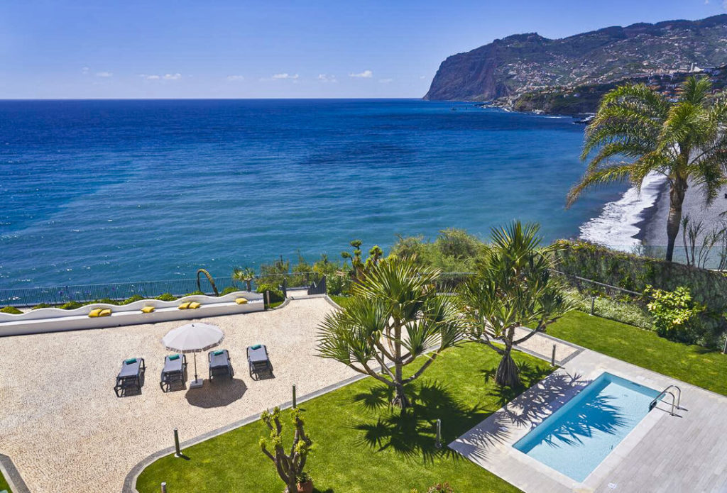
WONDERING ABOUT WHERE TO STAY ON MADEIRA?
Throughout my six months on Madeira Island, I stayed in multiple accommodations. My favorite regions to stay in were Funchal and Canico de Baixo. I’ve created several guides to help you find the right region for you and a great hotel or apartment.
- The ultimate guide: WHERE TO STAY ON MADEIRA: WHICH REGION IS RIGHT FOR YOU?
- If you want luxury: BEST 5-STAR LUXURY HOTELS ON MADEIRA ISLAND
- To feel at home: TOP 10 BOUTIQUE HOTELS ON MADEIRA ISLAND
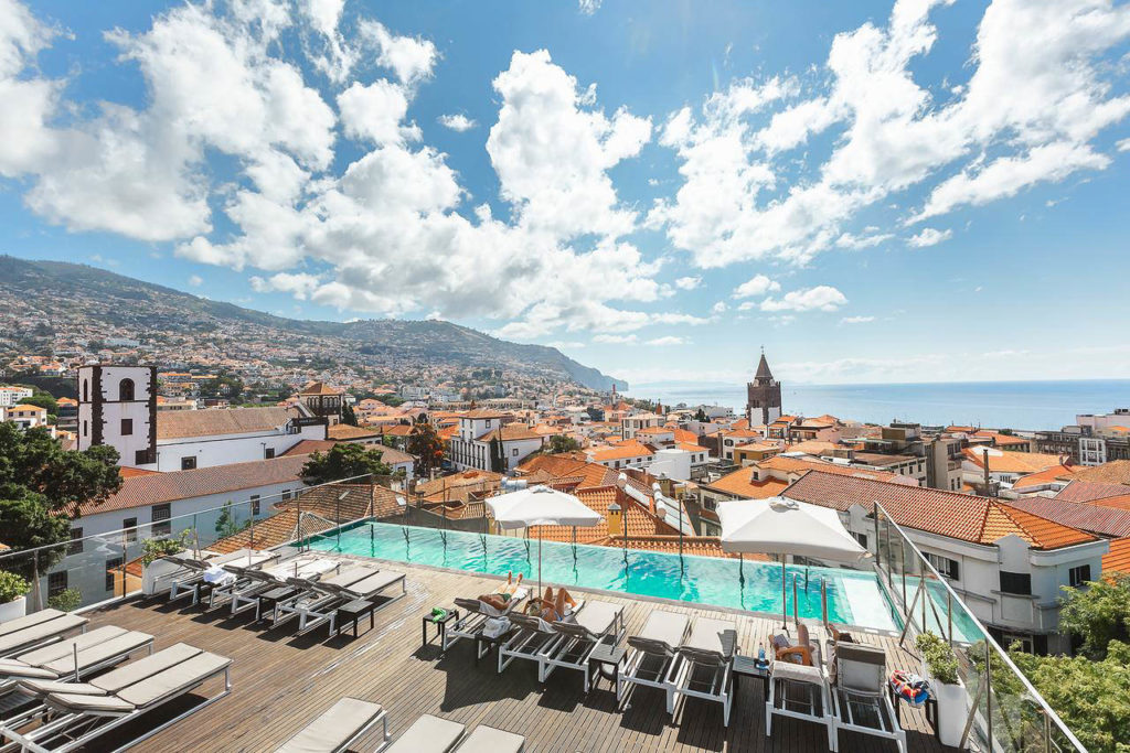
- If you want to base in Funchal: WHERE TO STAY IN FUNCHAL: 15 TOP-RATED HOTELS
HAVE YOU READ MY OTHER MADEIRA BLOGS?
I spent six months exploring Madeira and the nearby island of Porto Santo. These are some of my most popular guides about the region that you may be interested in.
- My favorite hikes: 65 AWESOME HIKES ON MADEIRA
- My favorite levada walks: 25 BEAUTIFUL LEVADA WALKS ON MADEIRA
- The best waterfalls on the island: 25 EPIC WATERFALLS ON MADEIRA
- Guide to the best Accommodation: WHERE TO STAY ON MADEIRA
- Hardest hike: THE MADEIRA ISLAND ULTRA TRAIL IN 4 DAYS (115KM)
- Longest hike: CAMINHO REAL 23: MADEIRA’S ROYAL PATH (180KM)
J
Wednesday 22nd of October 2025
The article date is "September 7, 2025" but the photos are from 2020. This trail has been impossible for more than a year, the bad fires have pushed Madeira to close most of the central trails. There's no relevant information here.
Eli
Saturday 25th of October 2025
@J, You are right, Im just planning the trek and its not possible to connect east and west and north and south of the island around the main peaks. We will have to go around and spend much time on crossovers. The trails will be open next year.
Petri
Friday 8th of December 2023
Thanks so much for sharing! Would it be possible to do this end of March?
Dan
Wednesday 24th of August 2022
I reached this site when googling for information on Madeira and glad I did.
You're passionate, professional and your website + YouTube channel are top notch.
It's refreshing to see things organized so well and I appreciate your excellent work. Thanks!
Dan
Wednesday 24th of August 2022
Hi.
Am planning on doing an extended version of the MIUT next April, keeping it lightweight.
Would you say bringing crampons is not necessary? Unless it's snowy, I don't use them anyway, but am uncertain yet what to expect here.
Thanks!
Jackson
Tuesday 6th of September 2022
no crampons necessary
Liepa
Saturday 12th of February 2022
Hi there! Super cool video and thanks for sharing your experience! I'm considering doing this in April and was wondering if you had any more info regarding camping? I found some campsites along the way but no info on how to book or approx how much they cost. I'm happy to wild camp but I'm gathering that's not allowed. Thanks!
Émile Desnoyers
Tuesday 4th of April 2023
@Émile Desnoyers,
Hi, I want to do a similar hike with one of my friend and we planned wild camping, do you need any authorisation?
Émile Desnoyers
Tuesday 4th of April 2023
@Jackson,
Jackson
Monday 28th of March 2022
We wild camped and didn't cause a scene so no-one bothered us. There was just one 'camping spot' on night 2 that we used near Riberia Frio :)