The Caminho Real da Encumeada is an incredible, mountainous trail that leads you along an ancient path with views of Madeira’s highest peaks! I really love this trail because it is one of the King’s Paths, which were commissioned by the King to help link certain parts of the island together. This means the path has ancient stonework for most of the route. The Caminho Real da Encumeada is a scenic hike through the mountains but also a journey back in time, walking the steps of Madeira’s brave ancestors.
CAMINHO REAL DA ENCUMEADA HIKE DETAILS
- Hike Distance: The total distance of my hike was 24 kilometers for the out-and-back route or just 12 kilometers if you opt to do the trail just one way.
- Hike Duration: The hike duration was just under 6 hours and our total moving time was 6 hours, which was a pretty quick pace.
- Hike Difficulty: This hike is one I would list as moderate. There is a defined path for the entire route. A few landslides can be expected here and there depending on the time of year but nothing was too dramatic to walk over when I did the hike. The toughest part of the hike is just the distance of 24 kilometers and the incline of more than a vertical kilometer. If you can get dropped at one end and picked up at the other end it would be an easy 12-kilometer hike.
- Hike Incline: Total incline for the hike was 1,135 meters for the out-and-back route or just 400 meters for the one-way route.
- My hiking guide: I did this hike with a local guide (also a great friend) called João. He’s lived in Madeira his whole life and knows all of the unique trails (not just the popular ones). This trail requires some local knowledge of the directions so I recommend a guide. Want to contact João to be your guide for this hike or any of the hikes I’ve done on Madeira? You can contact him on Instagram here: João Let’s Hike or by email: joaoletshike@gmail.com
- My Strava Map Upload: Caminha Real da Encumeada
HOW TO GET TO THE CAMINHO REAL DA ENCUMEADA HIKE
The Caminho Real da Encumeada is essentially a 12-kilometer stretch of trail. You can either do the hike as an out and back or plant a car at either end. There isn’t really a defined loop option although we looked for one. The idea of a dropping a car at one end isn’t great either as it is a long drive around. In the end we decided to suck it up and do the out and back option. In the end it took us under 6 hours from start to finish so it wasn’t too bad. I have linked the pin location to the starting point on the map below. The starting point is the Posto Florestal da Boca Corrida parking lot.
TOP 3 PLACES TO STAY IN MADEIRA
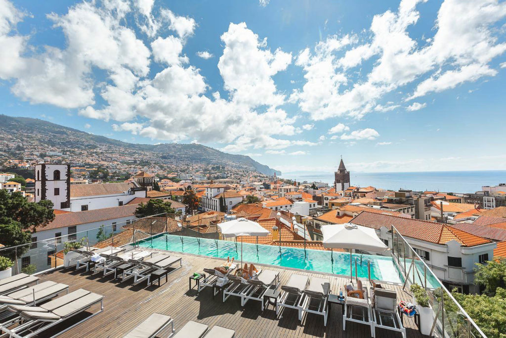
- Ultimate Luxury: Les Suites at Cliff Bay best location and view
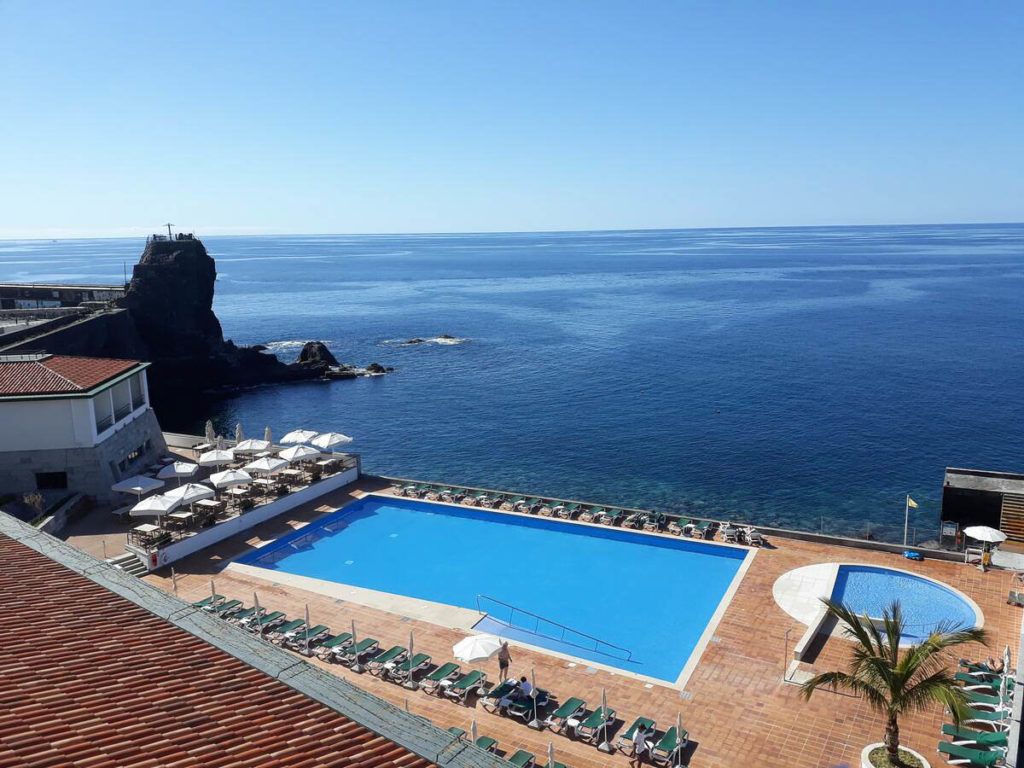
- Best Value: Hotel Alto Lido – Funchal rooftop swimming pool under 100 Euros
- Budget Hostel in Funchal: Santa Maria Hostel is easily the top hostel in Funchal
MY EXPERIENCE ON THE CAMINHO REAL DA ENCUMEADA HIKE
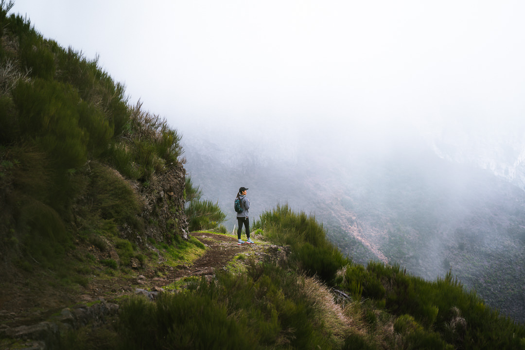
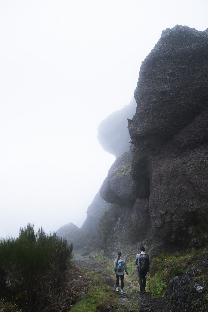
We headed up through Jardim da Serra from Funchal to find the parking lot looking out over a wonderful vista of Madeira’s highest peaks. Unfortunately, the famous clouds of Madeira were covering their peaks but later the wind would blow away the clouds to reveal a truly majestic scene. We headed off up the stairs to the left of the parking lot where hikers will find a big information sign about the Caminho Real da Encumeada route.
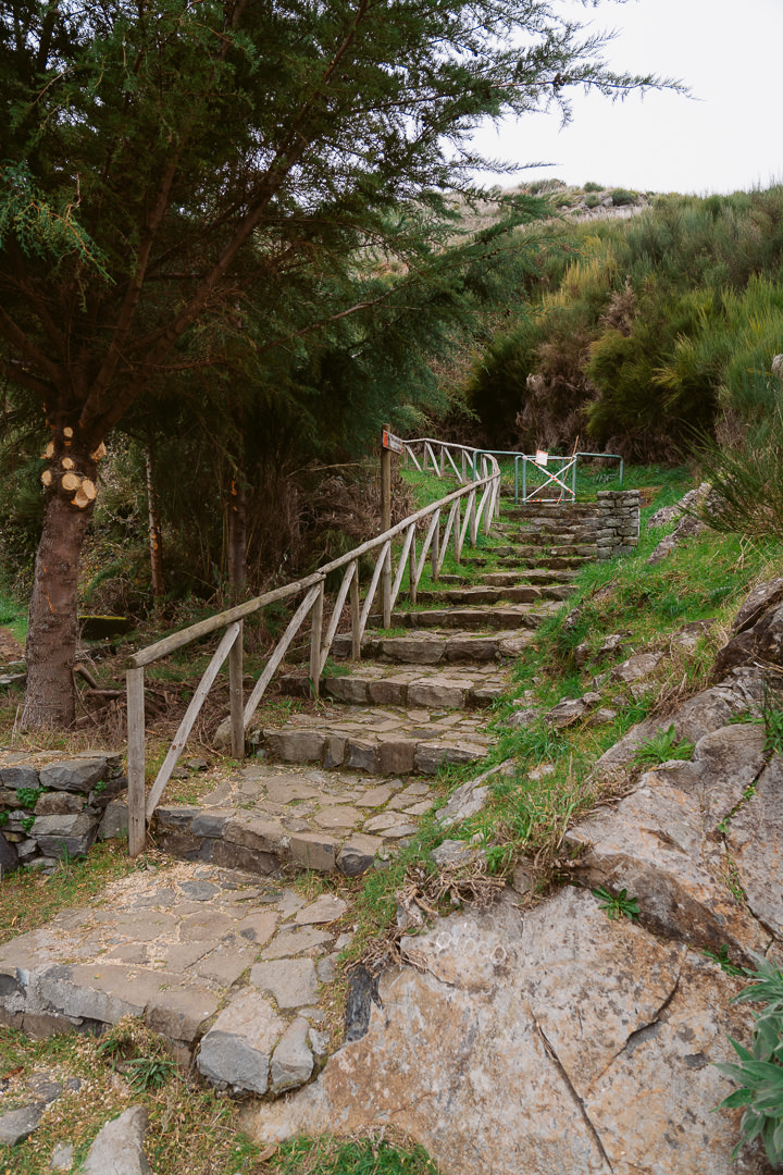
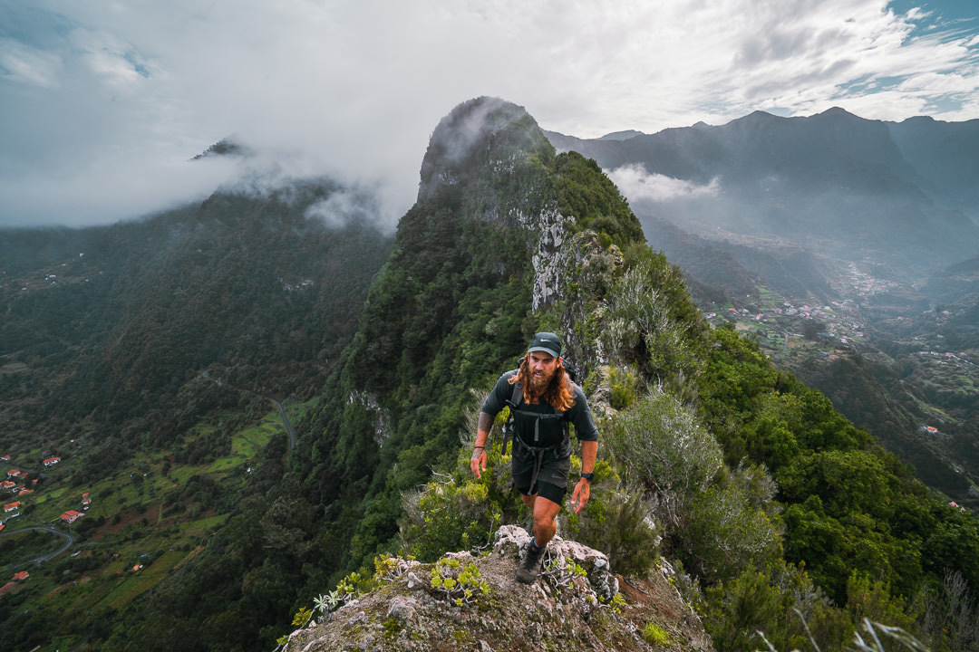
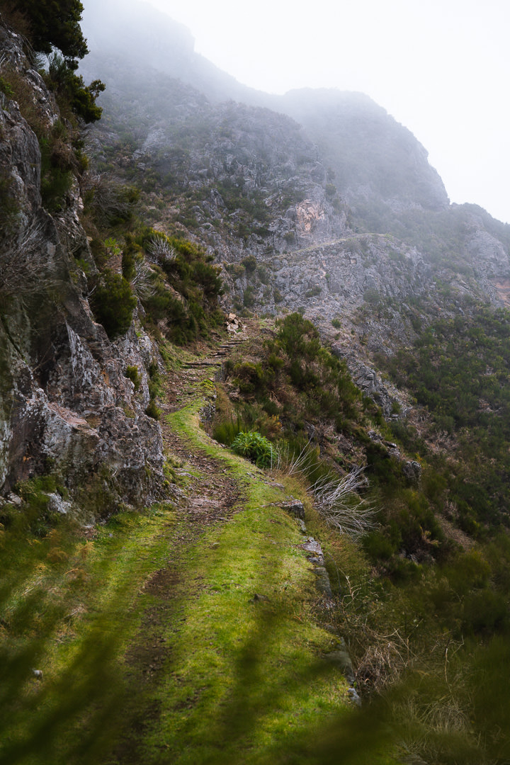
This trail is unique because the path is made from ancient stones. It’s a ‘Royal Path’ that was commissioned by the King in the mid-1800s. There are several other Royal Paths on Madeira including the famous Caminho Real no23, which covers the entire perimeter of the island, often in spectacular cliff-side fashion. On the Caminho Real da Encumeada, you will form a great appreciation for the men who labored in perilous mountains to create a path of transit and transport, connecting different regions of the island. It is said that there was a ‘grocery store’ existing along this pathway, which acted as a trading area as such for travelers to pass by while crossing the island.
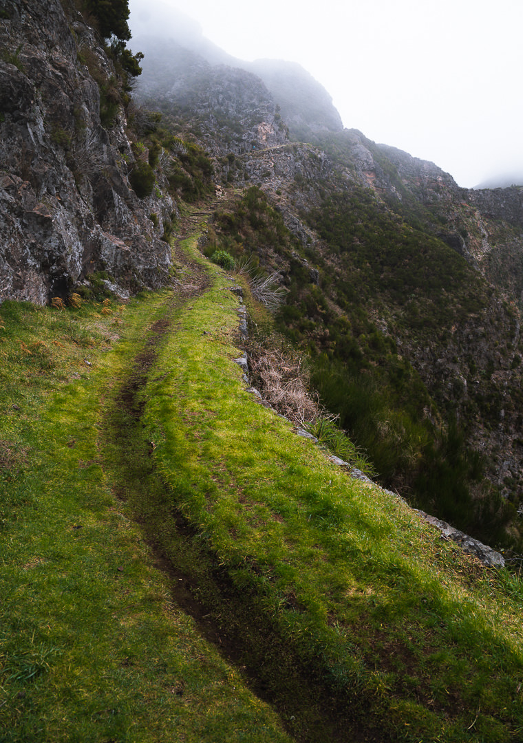
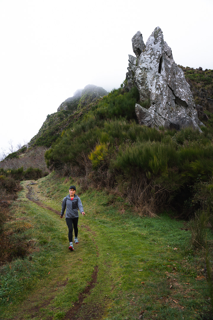
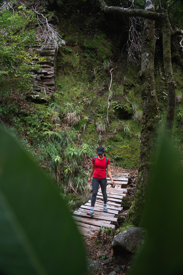
The early parts of the trail are magnificently carved out of the mountain and nowadays a lush layer of grass, glows vibrantly along the trail below the dark cliffs of the mountains.
BEST RENTAL CAR COMPANY ON MADEIRA

When you book your Madeira Rental Car online, I personally recommend and always use Discover Cars. They search for both local and international companies, so you get the best deal! MUST Read: Guide to Renting a Car on Madeira
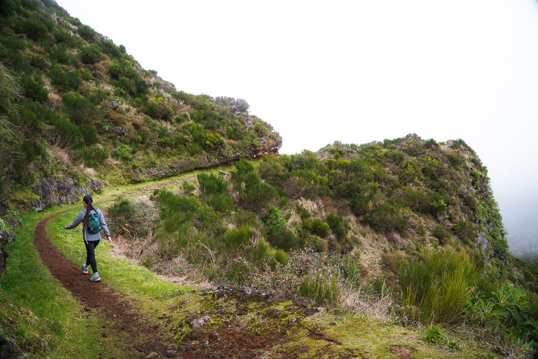
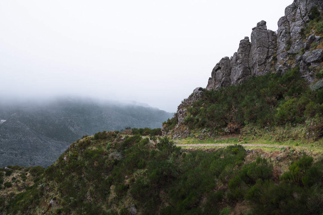
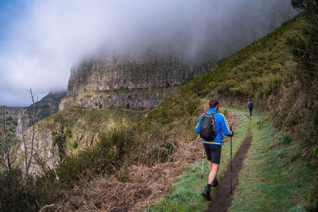
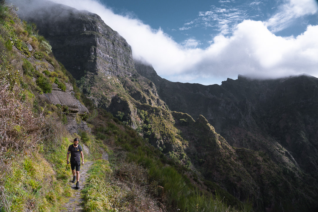
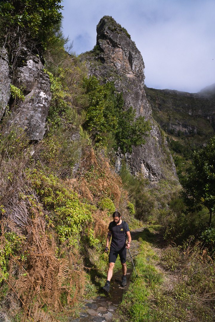
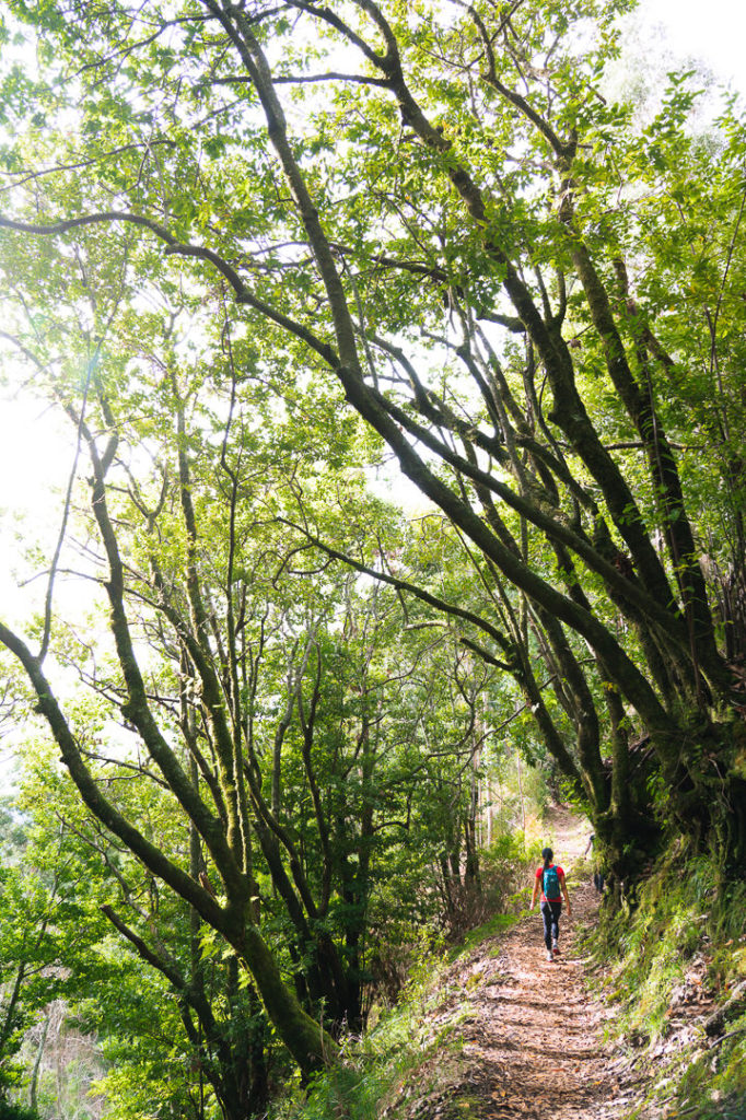
The trail is quite moderate with only gradual undulations throughout the early stages. On this day, a thick fog created a dramatic atmosphere as we passed by Relvinhas, which is the exit down to Curral das Freiras (Nun’s Valley). Along this trail, you will find many unique and often dramatic rock formations. Many of them overhang the trail and are the reason for the rocks and boulders you will find scattered throughout the route. It is advised not to do this hike during or just after a storm as rockfall and landslides do impact this trail. While hiking on a day of fair weather doesn’t guarantee your safety, it certainly increases your odds of avoiding falling rocks or landslides. That is a general rule for hiking on Madeira.
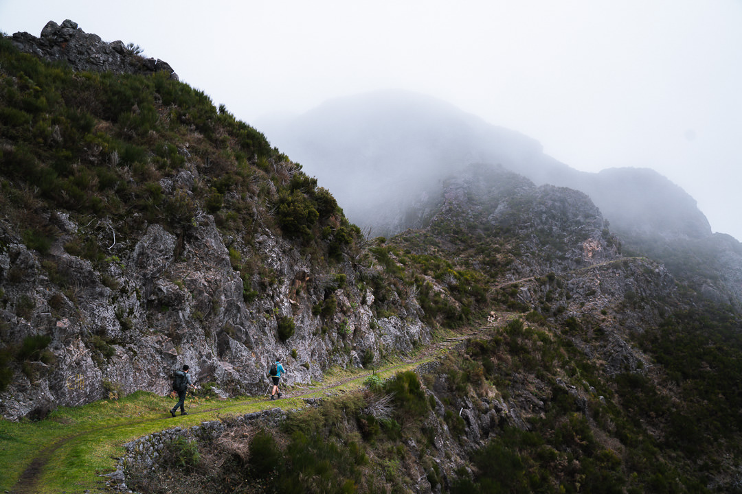
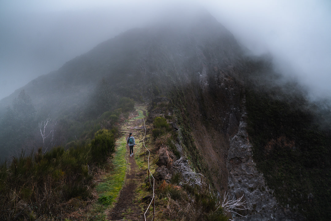
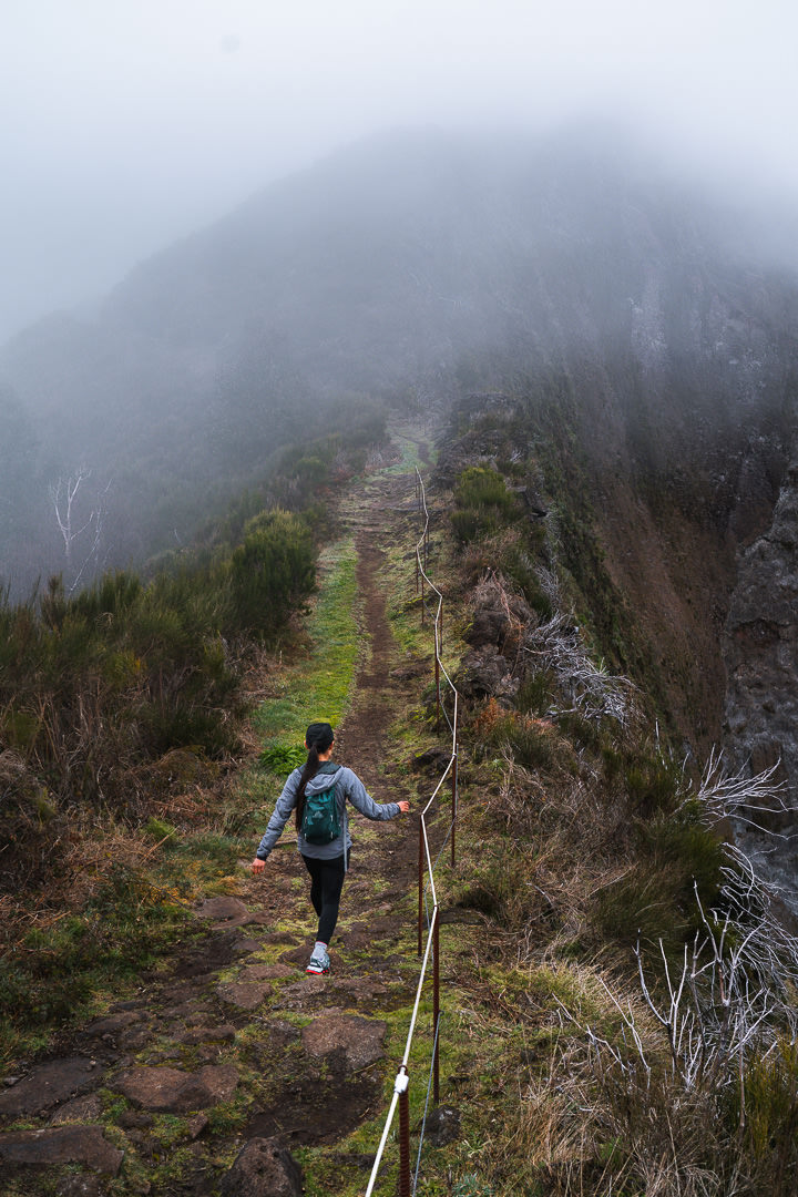
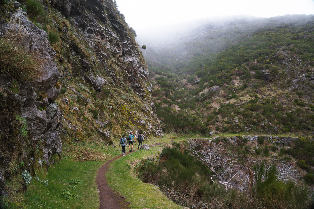
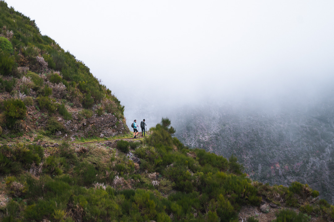
The hike doesn’t veer down towards Nun’s Valley and instead careers you around the ridge, always overlooking the valley of Ribeira Brava. Up above you will have a glimpse of the Encumeada Viewpoint as you turn around each corner. The trail is on a steady decline in this section and you will start to worry about ascending back up this relentless gradient. Luckily it is quite gradual although the consistency of the slope will test you on the way back. We were lucky enough to enjoy some sunshine as we watched the clouds clear to allow us a few moments to enjoy the incredible views across the valley. There are some notable drop-offs in this part of the trail but usually, you will find railings where necessary and a wide track with safety on the inside. If you take care, there should be no issues.
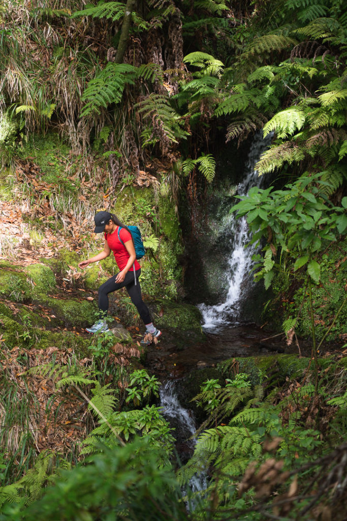
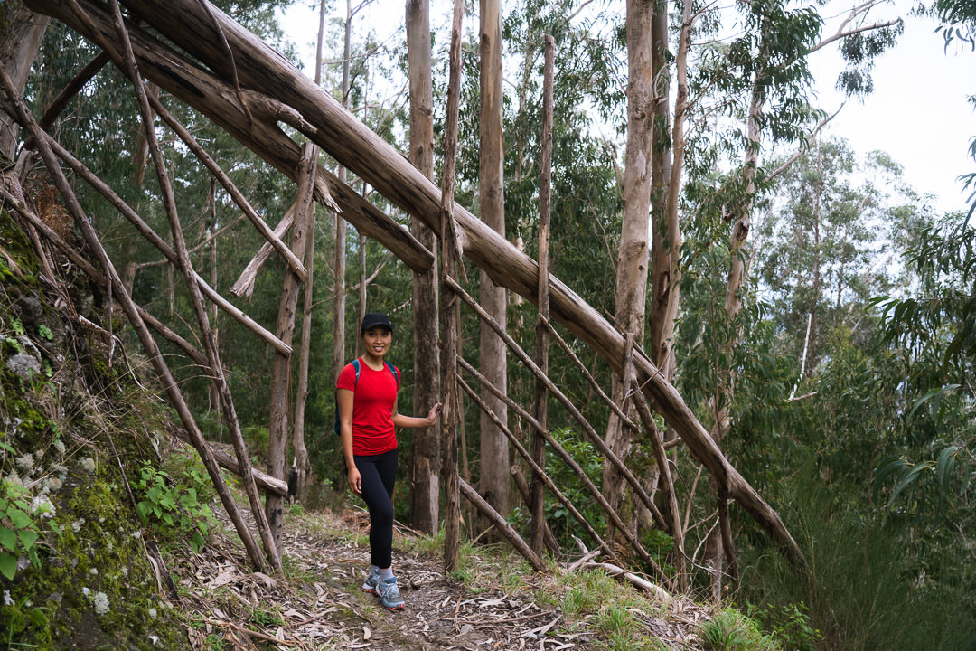
The trail descends down into a small forest, which crosses several bridges and eventually sends you through a Eucalyptus plantation. This is a great part of the route to enjoy the shade and cover after being fully exposed for multiple kilometers up on the ridge. Once you reach the Eucalyptus trees, you can know that you are almost a the end of the trail (as per this route).
You will know when you have reached the halfway point of the trail when you find the wooden archway. A fallen tree has been converted into a natural doorway. Just after the doorway is a large water pipe running up the hill. It’s actually part of the Madeira Island Ultra Trail, and a section we remember fondly from our cross-island trek.
There are a few pieces of information to share with you at this point. Firstly, the trail does continue on further from here but the views are not spectacular and it is just a further descent into the lower areas of Encumeada. For me, there was no reason to continue and we called this our halfway mark, had lunch and then retraced our steps to the start. If you did want to do just a through-hike and catch the bus or be picked up, continue walking another 1-kilometer or so from this point to reach the road, bus stop and parking.
At this stage you have done just under 400m of incline and 12 kilometers of distance. On the way back you will have almost 800 meters of incline and another 12 kilometers to cover. Keep that in mind for your timing. I have left my map up in the ‘hike details’ section of this blog post so you can download the GPX file to follow if you need although it is a well-signed straight forward route.
I hope you enjoyed this guide to the Caminho Real da Encumead hike on Madeira Island. Stay safe and happy hiking!
WONDERING ABOUT WHERE TO STAY ON MADEIRA?
Throughout my six months on Madeira Island, I stayed in multiple accommodations. My favorite regions to stay in were Funchal and Canico de Baixo. I’ve created several guides to help you find the right region for you and a great hotel or apartment.
- The ultimate guide: WHERE TO STAY ON MADEIRA: WHICH REGION IS RIGHT FOR YOU?
- If you want luxury: BEST 5-STAR LUXURY HOTELS ON MADEIRA ISLAND
- To feel at home: TOP 10 BOUTIQUE HOTELS ON MADEIRA ISLAND
- If you want to base in Funchal: WHERE TO STAY IN FUNCHAL: 15 TOP-RATED HOTELS
HAVE YOU READ MY OTHER MADEIRA BLOGS?
I spent six months exploring Madeira and the nearby island of Porto Santo. These are some of my most popular guides about the region that you may be interested in.
- My favorite hikes: 65 AWESOME HIKES ON MADEIRA
- My favorite levada walks: 25 BEAUTIFUL LEVADA WALKS ON MADEIRA
- The best waterfalls on the island: 25 EPIC WATERFALLS ON MADEIRA
- Guide to the best Accommodation: WHERE TO STAY ON MADEIRA
- Hardest hike: THE MADEIRA ISLAND ULTRA TRAIL IN 4 DAYS (115KM)
- Longest hike: CAMINHO REAL 23: MADEIRA’S ROYAL PATH (180KM)