
The journey from Encumeada to Pico Ruivo takes you on a wild adventure along steep stairways, to the top of peaks, and through the incredible forests of Madeira Island. If you are lucky, you will emerge through the cloud cover to summit of Pico Ruivo, which is the highest point on the entire island. The route is not for the faint-hearted with an out-and-back journey of 20-kilometers and almost 2000 meters of vertical climbing.

TOP 3 PLACES TO STAY IN MADEIRA
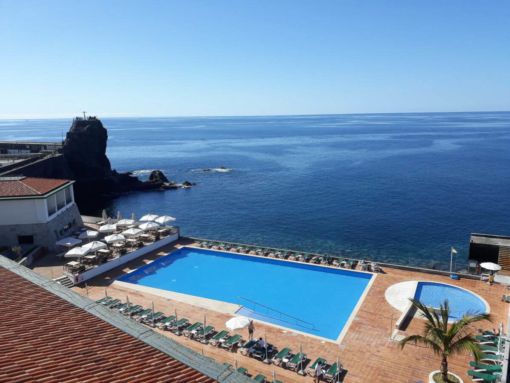
- Ultimate Luxury: Les Suites at Cliff Bay best location and view
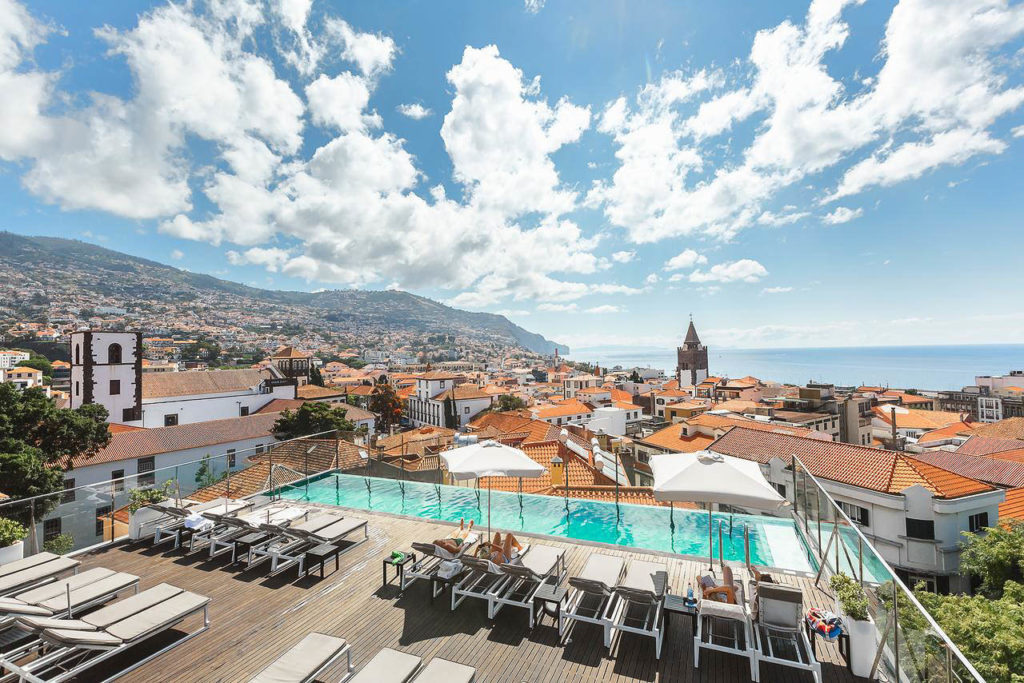
- Best Value: Hotel Alto Lido – Funchal rooftop swimming pool under 100 Euros
- Budget Hostel in Funchal: Santa Maria Hostel is easily the top hostel in Funchal
ENCUMEADA TO PICO RUIVO HIKE DETAILS
- Hike Distance: The total distance of my hike was 21.75 kilometers. However, you could just do the hike one way and have a friend pick you up at Pico Ruivo so you don’t have to hike back to Encumeada.
- Hike Duration: The hike will take you about 6-8 hours because there is a considerable incline and the terrain is often uneven stairs or slippery, rugged surfaces.
- Hike Difficulty: This hike is one I would list as moderately difficult for a number of reasons. Firstly the incline is 1,817 meters, which is very steep for most hikers. Secondly, it’s quite long on top of the incline with 21.75 kilometers to cover. The terrain is a mixture of rocky stairs to nice grass paths to slippery descents. You have to be prepared for it all. There are a few moments of exposure but there wasn’t anything very technical on this hike that requires any mountaineering skills.
- Hike Incline: Total incline for the hike was 1,817 meters
- My hiking guide: I did this hike without a guide but it was after many months of becoming familiar with Madeira. I did most of my hikes with a local guide (also a great friend) called João. He’s lived in Madeira his whole life and knows all of the unique trails (not just the popular ones). Want to contact João to be your guide for this hike or any of the hikes I’ve done on Madeira? You can contact him on Instagram here: João Let’s Hike or by email: joaoletshike@gmail.com
- My Strava Map Upload: Encumeada to Pico Ruivo
HOW TO GET TO THE ENCUMEADA TRAILHEAD
This is a pretty straightforward one to find as the hike begins directly from the Encumeada Viewpoint (Miradouro da Encumeada). This is a little viewpoint area with a souvenir shop, cafe, and parking lot. The cafe is a good place for a beer or coffee after the hike. The trail begins just down the road from the cafe where you will see an official sign on the right-hand side of the road painted in red and yellow. The hike was easy to follow using Maps.me app. When you are at the cafe, just route to Pico Ruivo on the app and you can follow the app directly although there are a number of signs along the way.
I’ve pinned the location of the viewpoint below so you can plan your route to the starting point of the hike.
BEST RENTAL CAR COMPANY ON MADEIRA
When you book your Madeira Rental Car online, I personally recommend and always use Discover Cars. They search for both local and international companies, so you get the best deal! MUST Read: Guide to Renting a Car on Madeira
MY EXPERIENCE ON THE HIKE FROM ENCUMEADA TO PICO RUIVO
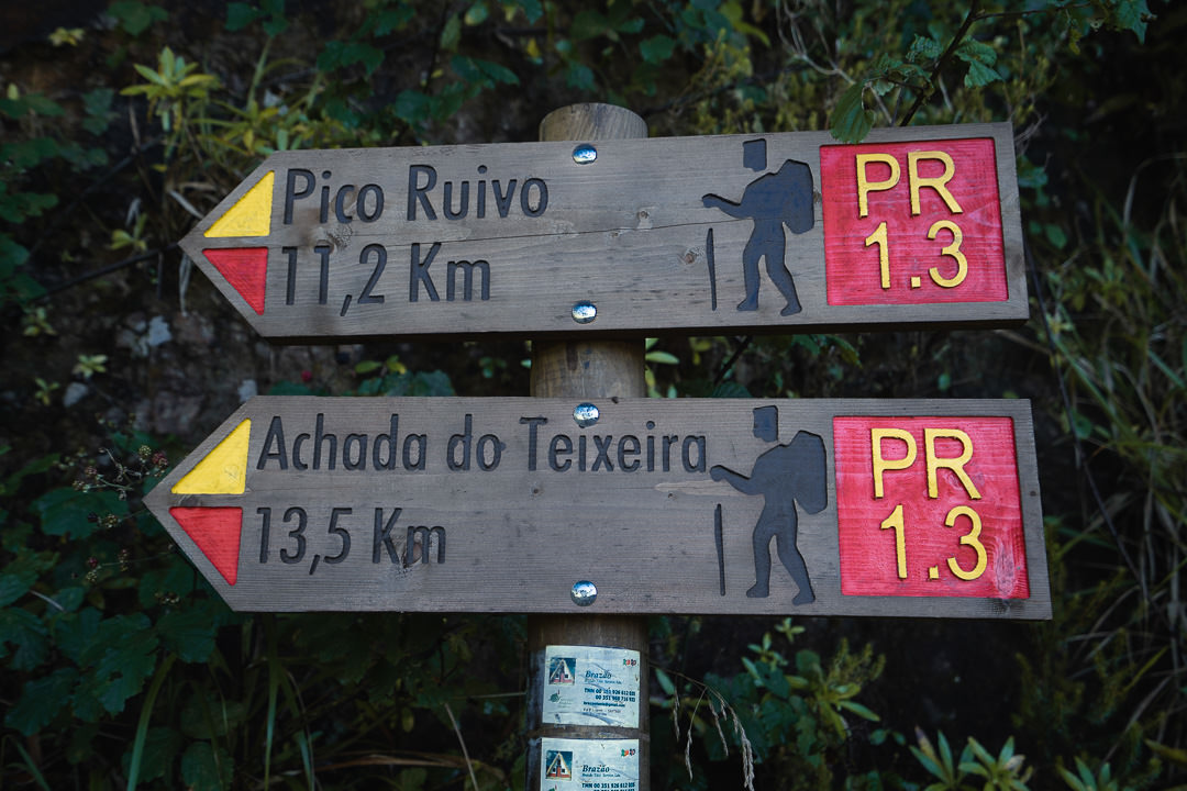
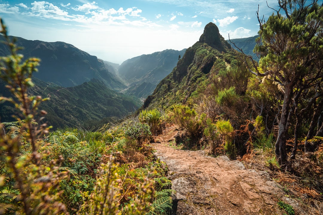
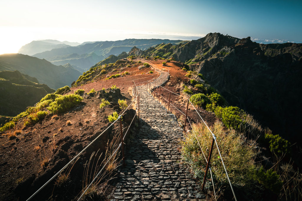
To begin the trail, you park at the cafe/souvenir store and then walk down the hill until you see the red and yellow sign on your right. It says Pico Ruivo and Achada do Teixeira on the side and that is exactly where we are headed.
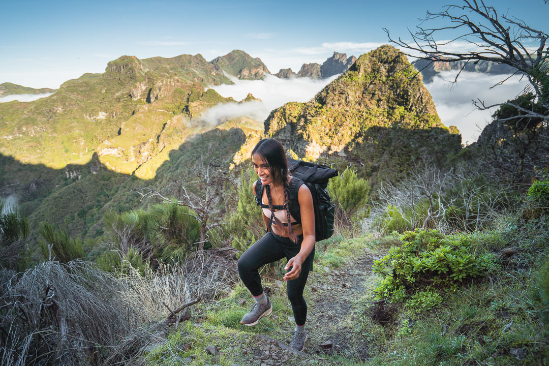
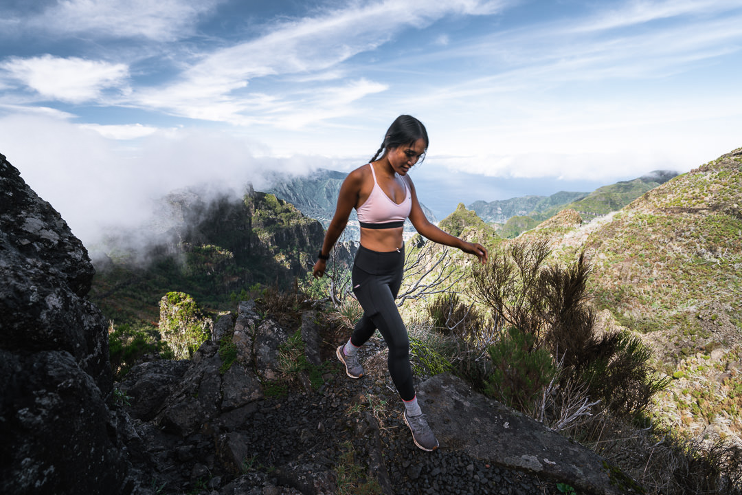
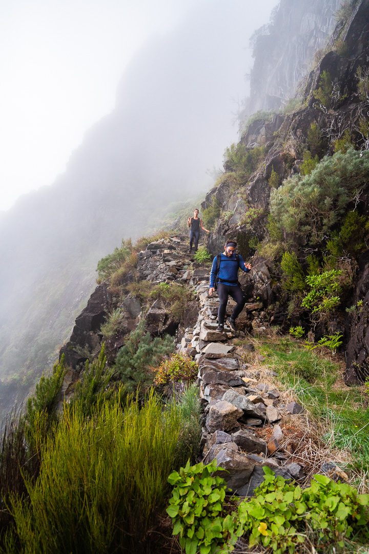
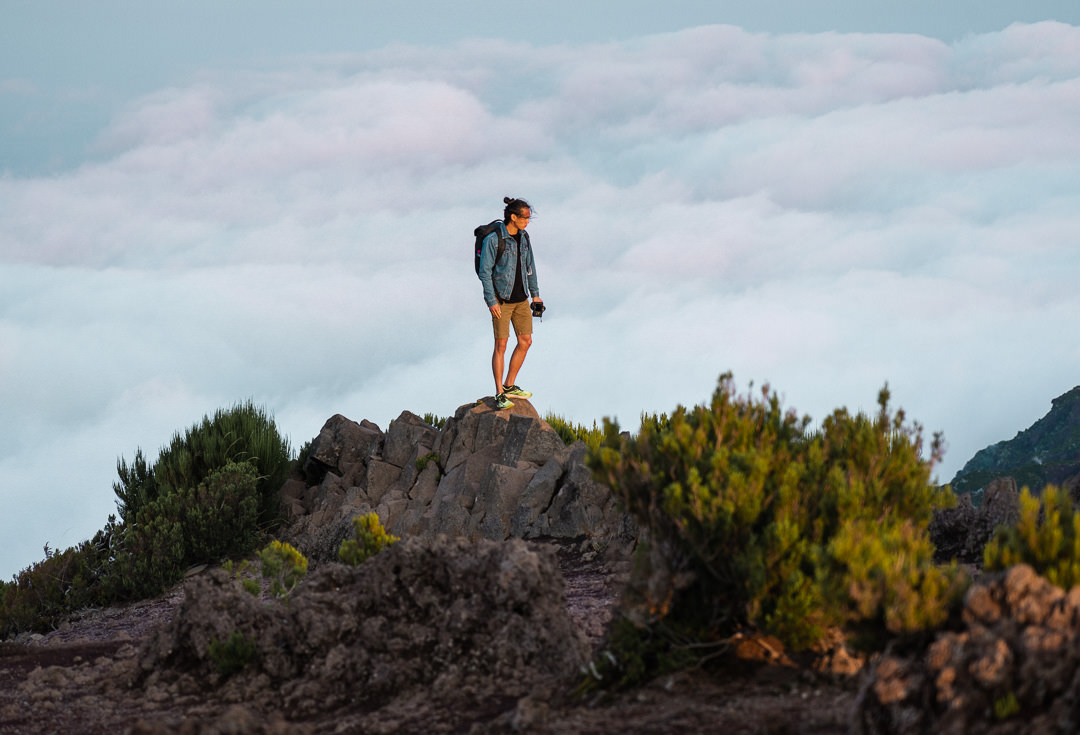
The trail is an uphill battle from the very first moment. You are not eased into the hike, you immediately start climbing stairs at a rate of about 150m incline per kilometer for the first couple of kilometers. You can see in the photo below I’m looking down from the stairs and you can spot the cafe where you begin the hike all the way down there in the distance.
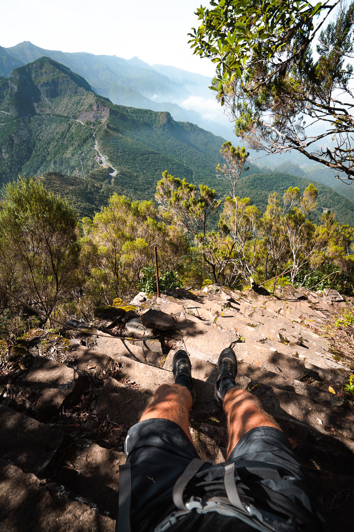
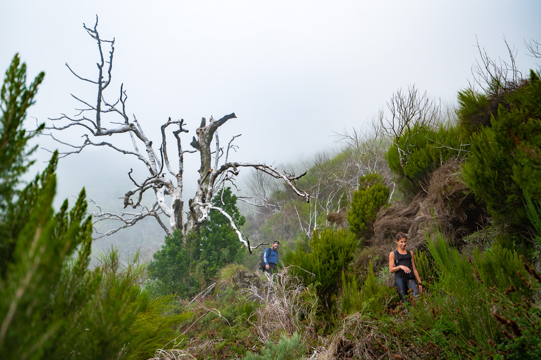
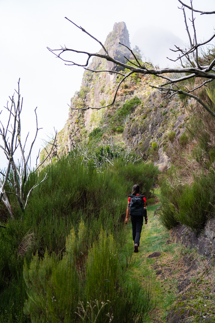
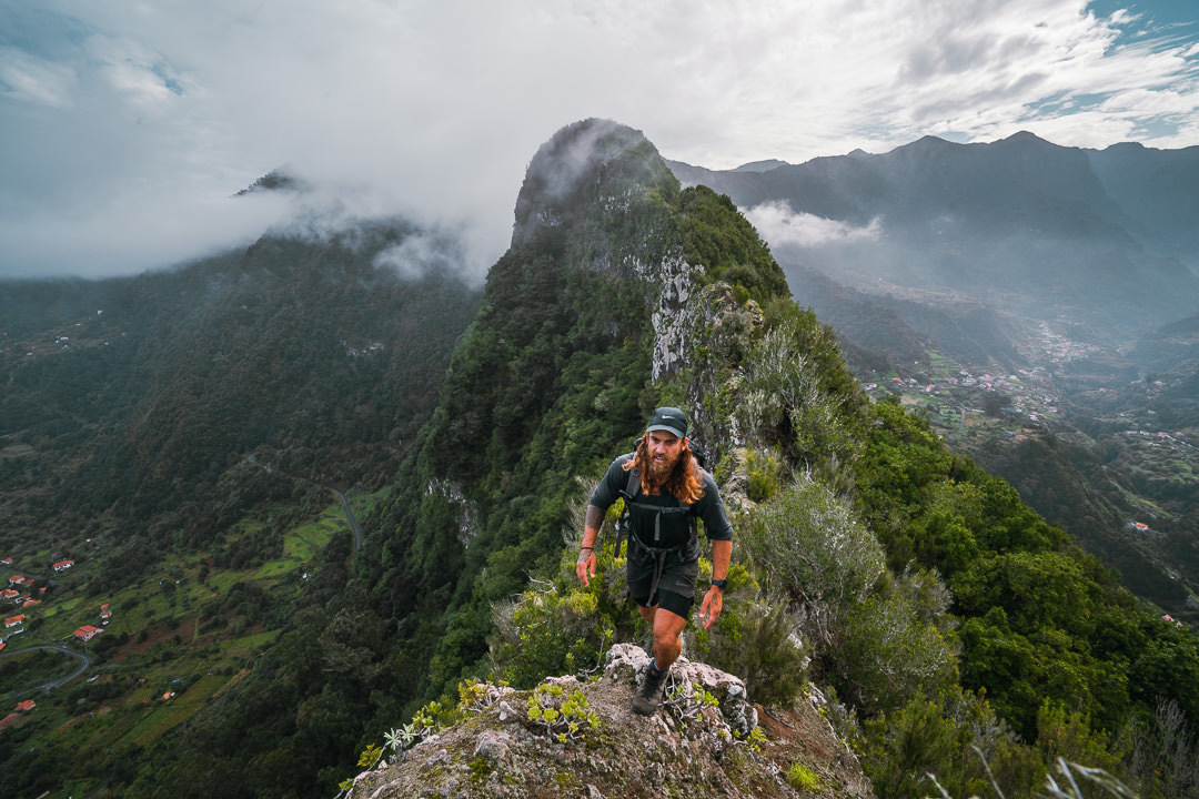
I found this trail really challenging and fun at the same time because you have to keep mentally focused with the stairs and uneven surfaces but the landscape is also constantly evolving with drop-offs and views throughout the valley.
After the initial stairs, there is a bit of a grassy plateau before you begin to enter the rocky terrain at the base of the mountain peaks. This was the first time I was hiking on grass after months of trails in Madeira. There were often tree arches and it felt very wild even though the route was maintained and trimmed back to keep it clear for runners and hikers.
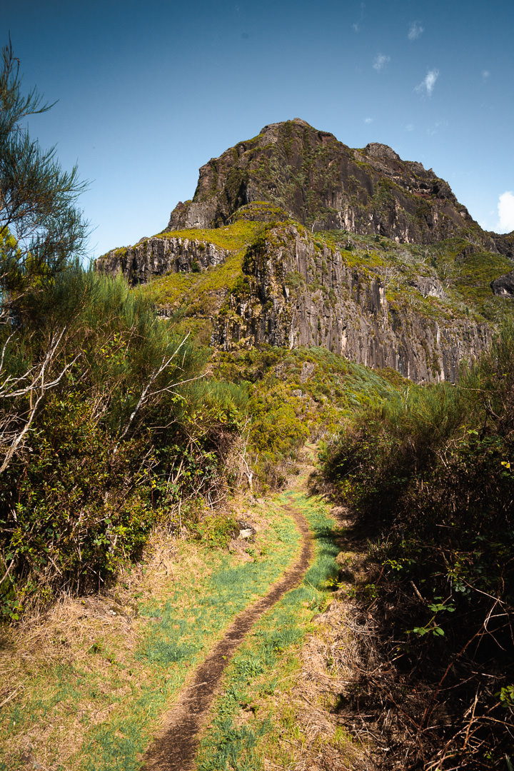
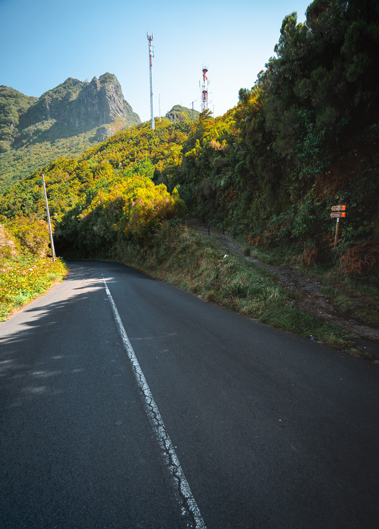
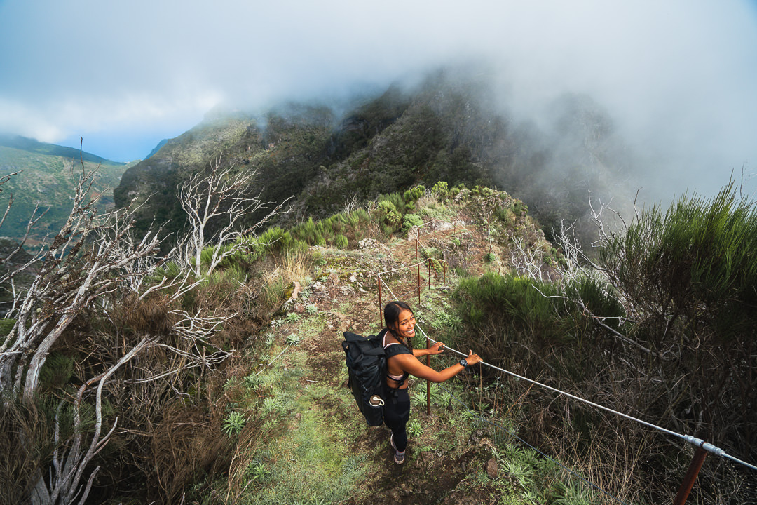
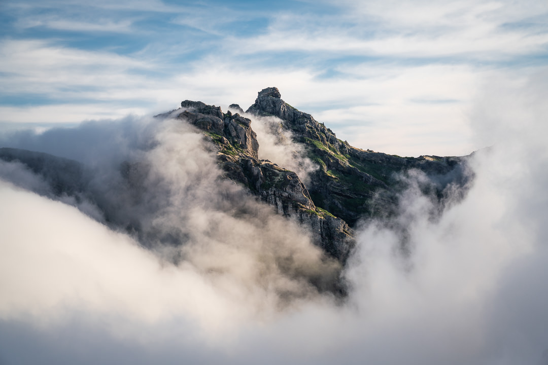
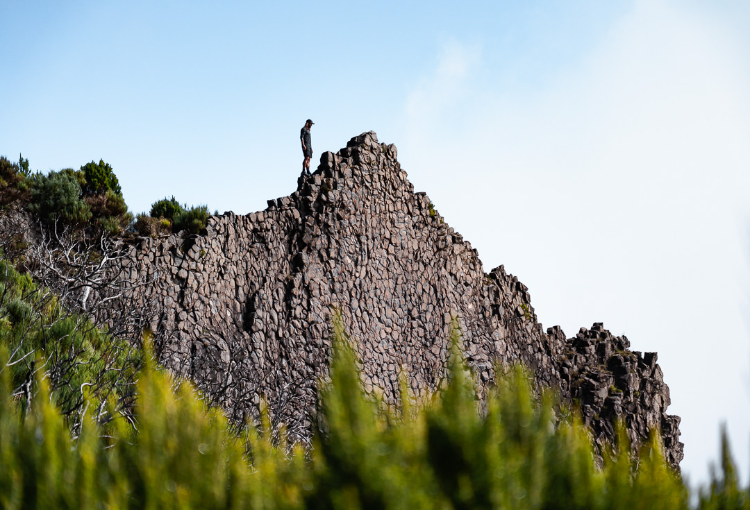
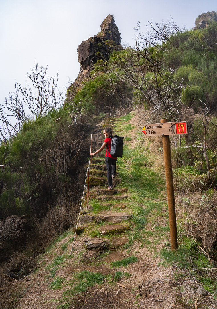
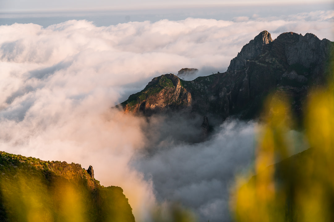
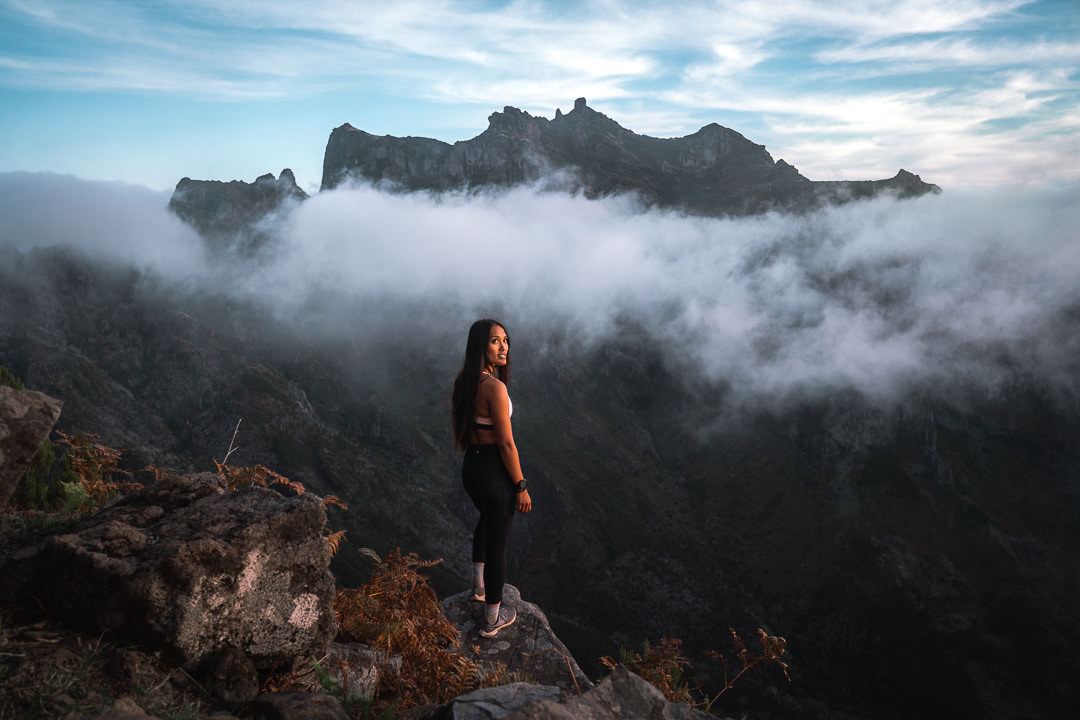
You’ll reach a fork in the road after about 4 kilometers. It’s clearly marked on the online maps but if you continue straight you will end up at Pico Grande. If you take the left route you will veer off towards Pico do Jorge and eventually Pico Ruivo, which is the correct route. The trail undulates, dropping you into the forest and then teasing you with a small viewing window every so often. It can be completely covered in clouds or exposed to the hot sun. This trail is one of those routes that can look completely different in a variety of weather conditions.
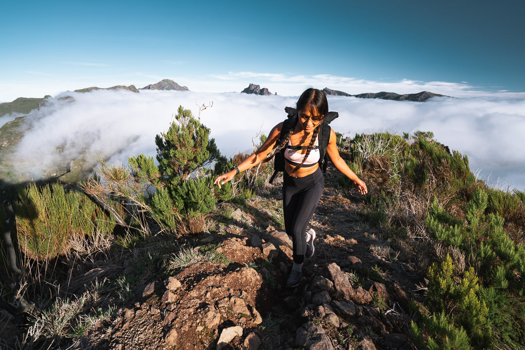
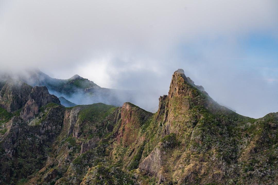
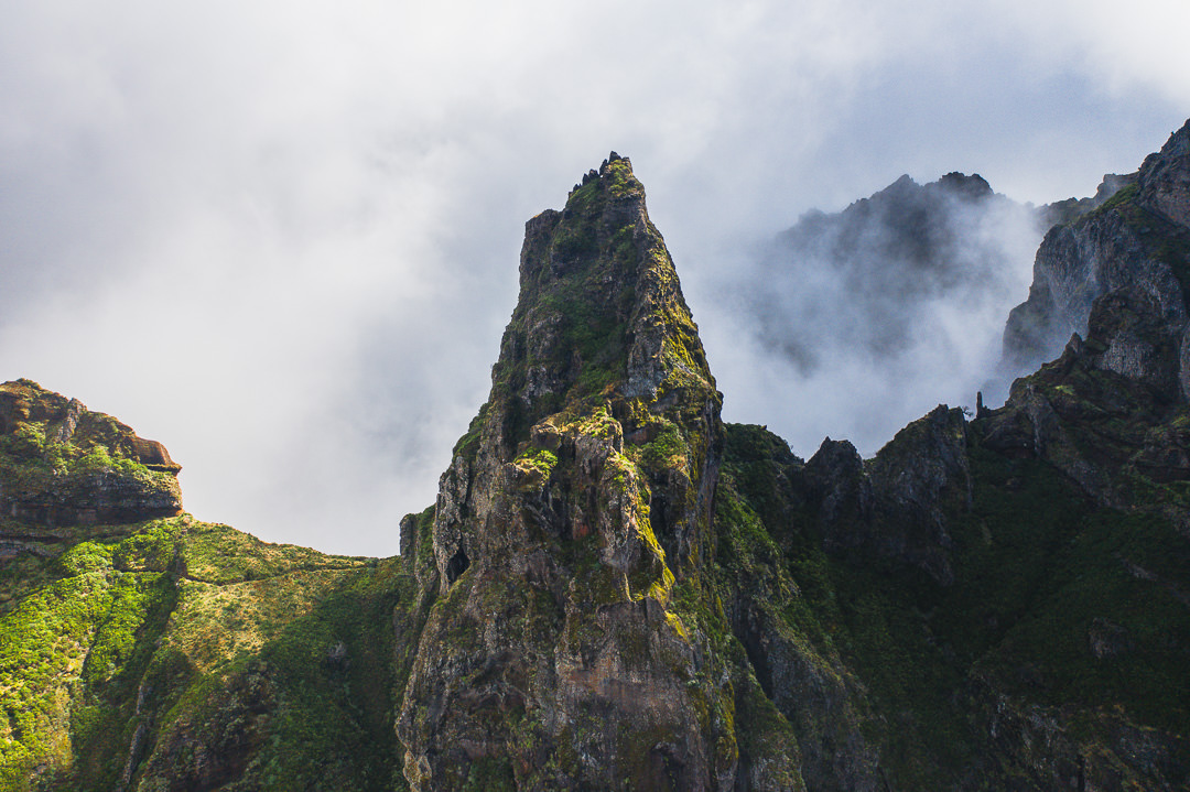
On the way to Pico Ruivo, we had almost 1300 meters of incline and 500 meters of incline on the ‘downhill’ return. It’s very much a trail of undulation but this makes it quite exciting as you cross a number of valleys and ridges along the way. At the halfway point, you will come across Pico do Jorge and Pico das Torrinhas, which offer a number of unique rock formations. Once you reach Pico do Jorge, you will be more than halfway to Pico Ruivo, which is just over 10 kilometers from your starting point.
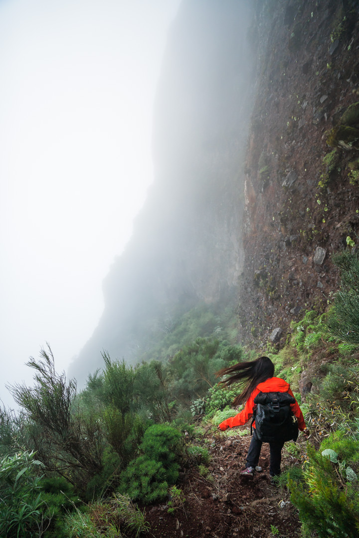
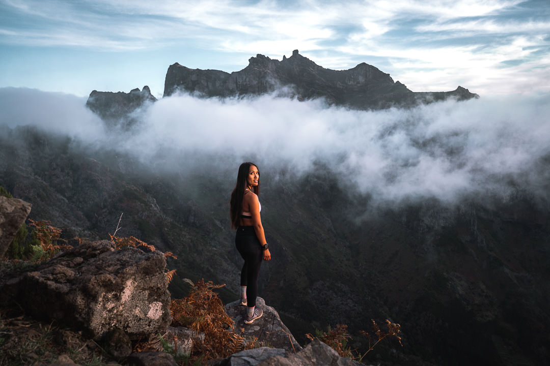
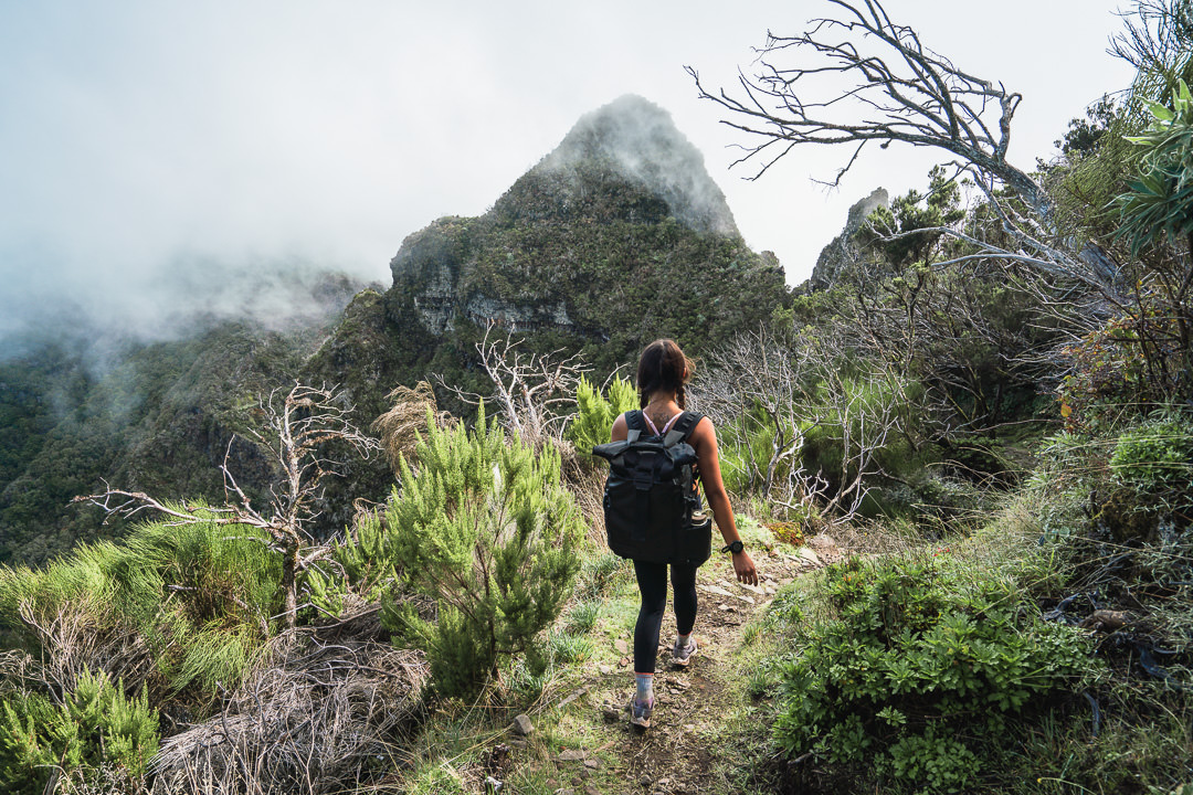
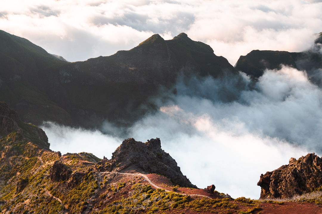
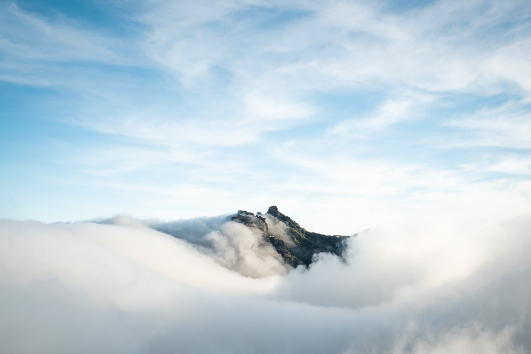
The final few kilometers up to Pico Ruivo are consistently uphill and often in the clouds. On the day we hiked, we were inside the clouds for much of the journey until we finally poked our heads out into clear skies at the summit of Pico Ruivo, which made us appreciate the view even more.
I’ve been to Pico Ruivo summit from many different routes and therefore I have photos in lots of different lighting and cloud conditions. These photos are some of what you can expect depending on what time you reach the summit.
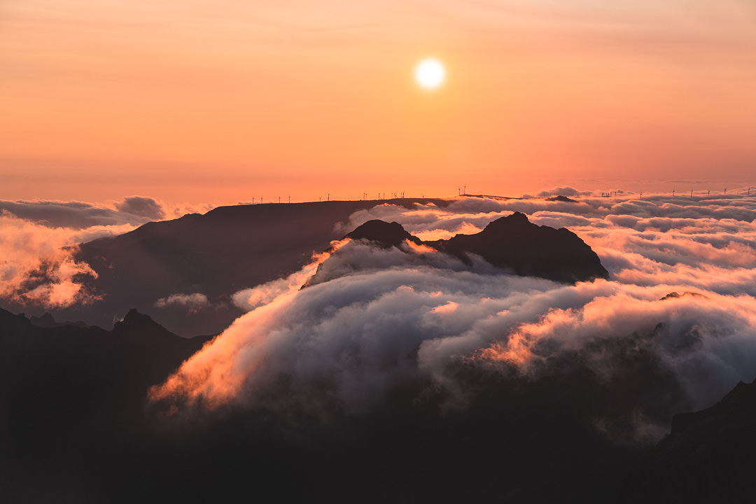
If you have nice friends, you can arrange for them to pick you up at Achada do Teixeira parking lot. This would mean doing the 2.5-kilometer hiking and finishing your day there. If you are running this show solo like we were, you are now in for another 10-kilometer journey back to Encumeada. Despite it being ‘downhill’, you will have more than 500 meters of incline to contend with. It took us just over three hours to get back to Encumeada at quite a good pace so don’t leave your run too late. We had epic cloud conditions during the golden hour on our return back to Encumeada to complete the hike.
I hope you enjoyed this guide about the hike from Encumeada to Pico Ruivo. Happy hiking and stay safe out there.
WONDERING ABOUT WHERE TO STAY ON MADEIRA?
Throughout my six months on Madeira Island, I stayed in multiple accommodations. My favorite regions to stay in were Funchal and Canico de Baixo. I’ve created several guides to help you find the right region for you and a great hotel or apartment.
- The ultimate guide: WHERE TO STAY ON MADEIRA: WHICH REGION IS RIGHT FOR YOU?
- If you want luxury: BEST 5-STAR LUXURY HOTELS ON MADEIRA ISLAND
- To feel at home: TOP 10 BOUTIQUE HOTELS ON MADEIRA ISLAND
- If you want to base in Funchal: WHERE TO STAY IN FUNCHAL: 15 TOP-RATED HOTELS
HAVE YOU READ MY OTHER MADEIRA BLOGS?
I spent six months exploring Madeira and the nearby island of Porto Santo. These are some of my most popular guides about the region that you may be interested in.
- My favorite hikes: 65 AWESOME HIKES ON MADEIRA
- My favorite levada walks: 25 BEAUTIFUL LEVADA WALKS ON MADEIRA
- The best waterfalls on the island: 25 EPIC WATERFALLS ON MADEIRA
- Guide to the best Accommodation: WHERE TO STAY ON MADEIRA
- Hardest hike: THE MADEIRA ISLAND ULTRA TRAIL IN 4 DAYS (115KM)
- Longest hike: CAMINHO REAL 23: MADEIRA’S ROYAL PATH (180KM)
Nathaniel
Monday 14th of December 2020
G'day Jackson! Just stumbled across your Blog a week before coming to Madeira for ten days, and what a joy it is to have found it! Amazing posts and great detail on the hikes so thanks very much for that! I wonder if you could highlight your type 5 unmissable hikes on Madeira? My partner and I are both pretty experienced hikers and love a long slog.. I'll keep my eyes open for you while we're there too because I think I've garnered enough info from your page to warrant owing you a beer or three!
Cheers mate!
All the best, Nathaniel
Jackson
Wednesday 16th of December 2020
Hey mate, just got back from a camping trip but did see your email so will get back to you shortly. Top 5 (without knowing your hiking level of course) Caldeirao do Inferno/Caldeira Verde, Pico do Arieiro to Pico Ruivo, Pico Grande, Quebrada do Negro, Caminho Real Encumeada.
Cheers mate
Luis Vasconcelos
Monday 16th of November 2020
There's a hike that crosses all Island, but only for crazy runners. Always nice to be on the top, the landscape is brutal in therms of cliffs deep
Pema
Monday 16th of November 2020
What a fun adventure! So glad I got to join for your biggest day hike on Madeira ?