
The Pico Canãrio hike is a physical challenge that will provide uniquely epic views of Madeira from perspectives you’ve never seen. Even after five months on the island, some of the landscapes surprised me. This loop is a strenuous 26-kilometer route with 1800 meters of incline. If you’re up for a battle through the forest you will be rewarded on this incredible journey throughout Madeira’s central massif.
PICO CANÃRIO HIKE DETAILS
- Hike Distance: The total distance of my hike was 26.2 kilometers for the loop trail.
- Hike Duration: The hike duration was 9.5 hours and our total moving time was 7 hours, which was a pretty decent pace.
- Hike Difficulty: This hike is one I would list as difficult. The main element that will have people struggling is the distance of 26.2 kilometers in conjunction with 1800 meters of elevation. It’s just a big ask in one day for many hikers. Start early and you will see it is possible. The trail itself is not very easy to find and I was following my local hiking guru friends who led the way. There are a few sections with some exposure but always with ropes. Obviously, with this length and elevation, it is for serious hikers only so it goes without saying you should have experience with tricky terrains, stairs, ropes, and other factors one might not find on a basic levada.
- Hike Incline: Total incline for the hike was 1,823 meters.
- My hiking guide: I did this hike with a local guide (also a great friend) called João. He’s lived in Madeira his whole life and knows all of the unique trails (not just the popular ones). This trail requires some local knowledge of the directions so I recommend a guide. Want to contact João to be your guide for this hike or any of the hikes I’ve done on Madeira? You can contact him on Instagram here: João Let’s Hike or by email: joaoletshike@gmail.com
- My Strava Map Upload: Pico Canãrio hike
HOW TO GET TO THE PICO CÃNARIO HIKE
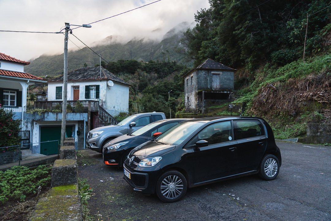
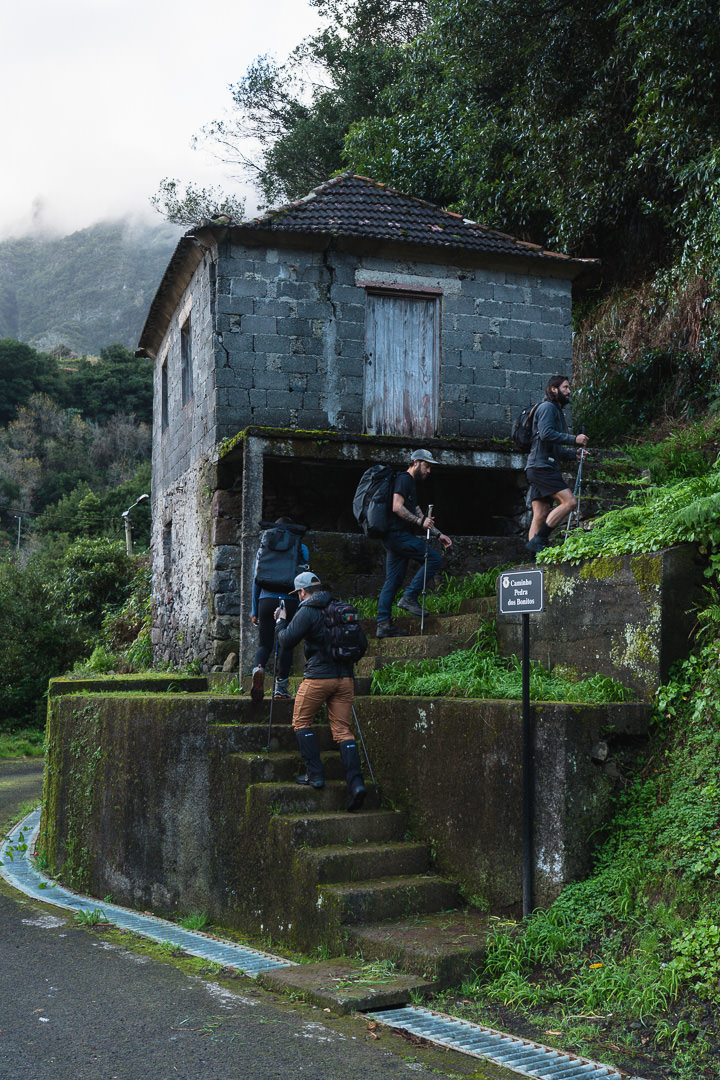
The Pico Canãrio hike is a bit of an odd one because there is no ‘great’ way to reach it without having a long journey. There are many options but if you are up for a strenuous loop hike, this is probably the most scenic and epic. We began our day in the depths of Boaventura in the town of Fajã do Penedo, where we passed up above Levada dos Tornos and battled all the way up through the forest to reach Pico Canario. I’ve added my GPS above in the hike details, which you can download to follow but a local guide is definitely recommended for this route.
TOP 3 PLACES TO STAY IN MADEIRA
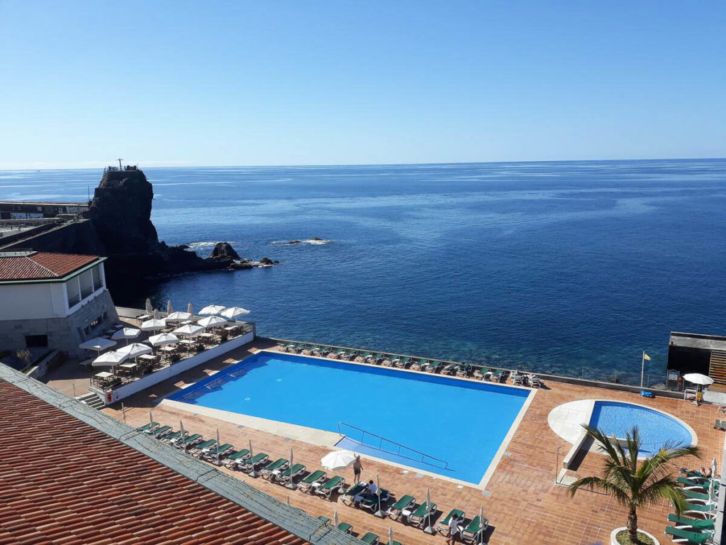
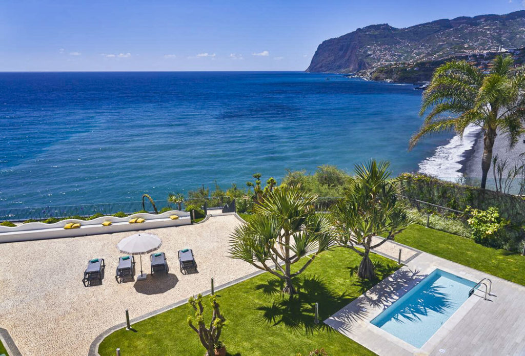
- Ultimate Luxury: Les Suites at Cliff Bay best location and view
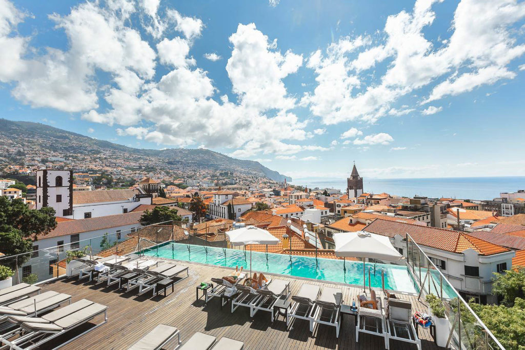
- Best Value: Hotel Alto Lido – Funchal rooftop swimming pool under 100 Euros
- Budget Hostel in Funchal: Santa Maria Hostel is easily the top hostel in Funchal
MY EXPERIENCE ON THE PICO CÃNARIO HIKE
After five months on Madeira, there was a hike that had been on my mind for a while. I’d heard murmurs about Pico Canãrio but it didn’t seem to be a popular trek or never seemed to happen. Finally, after the snowstorms of January, some clear weather and renewed energy had us setting off for Pico Canãrio. Despite finding some maps to follow on Wikiloc, we had our local guru hiker Jorge (from Madeira Wonder Hikes) setting the path for us.
The plan was to begin in upper Fajã do Penedo and trek up through the forest of Boaventura, passing Levada dos Tornos before ascending to Pico Canãrio via Vereda das Faias. It’s all available on the map I linked to above but I would suggest a local guide for this long and steep hike with many turns and hidden paths in the early stages.
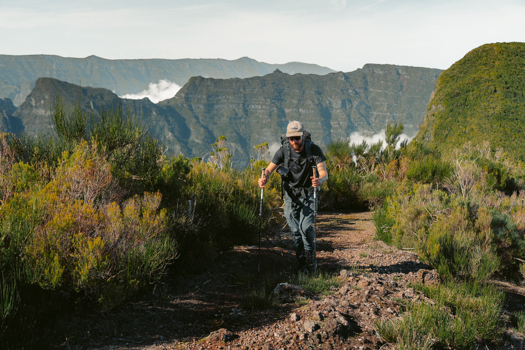
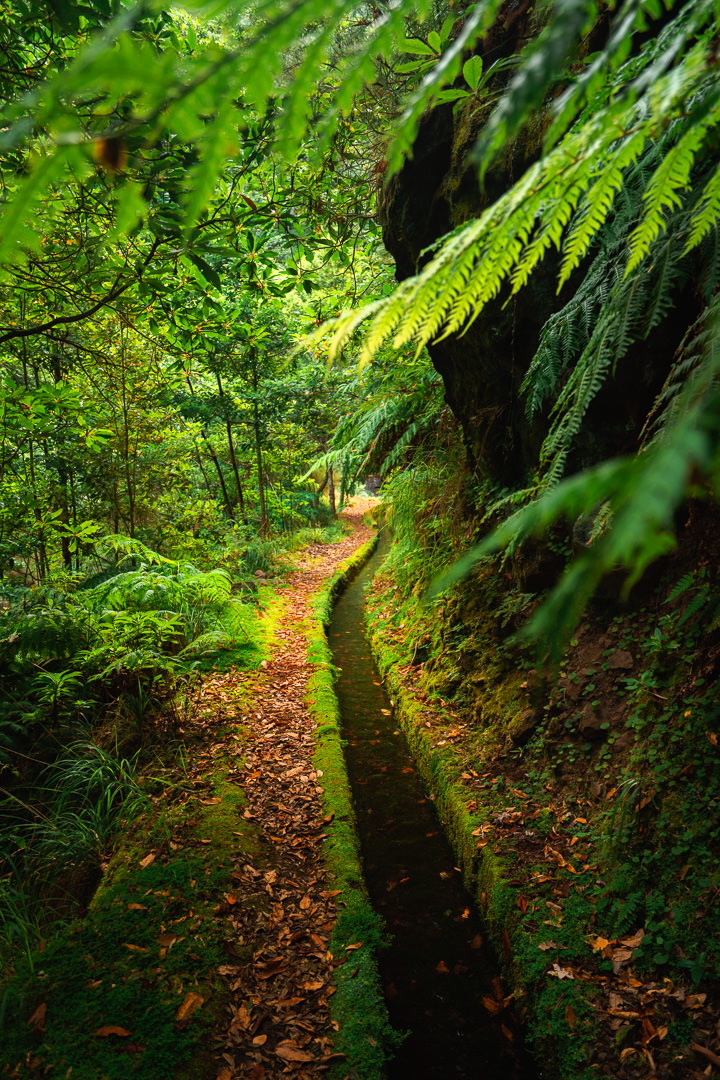
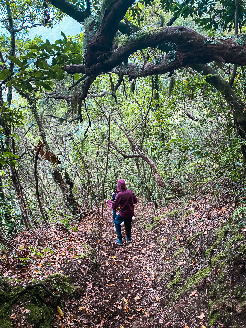
The trek is initially quite steep and has a relentless incline up through the dense forest. You need to have your caffeine hit before starting this trek because there is no warm-up period. You just head uphill for 300 meters straight away until reaching the levada.
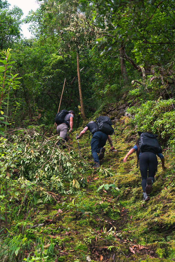
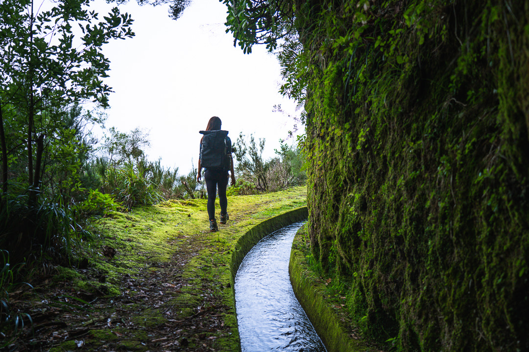
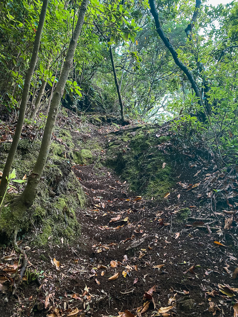
The levada is a short-lived break from the incline of the forest. After just a few hundred meters on the levada you dip off to the right and begin climbing again. It’s a beautifully lush forest but as you power uphill, the strain on your legs will distract you from the vibrant green scenery.
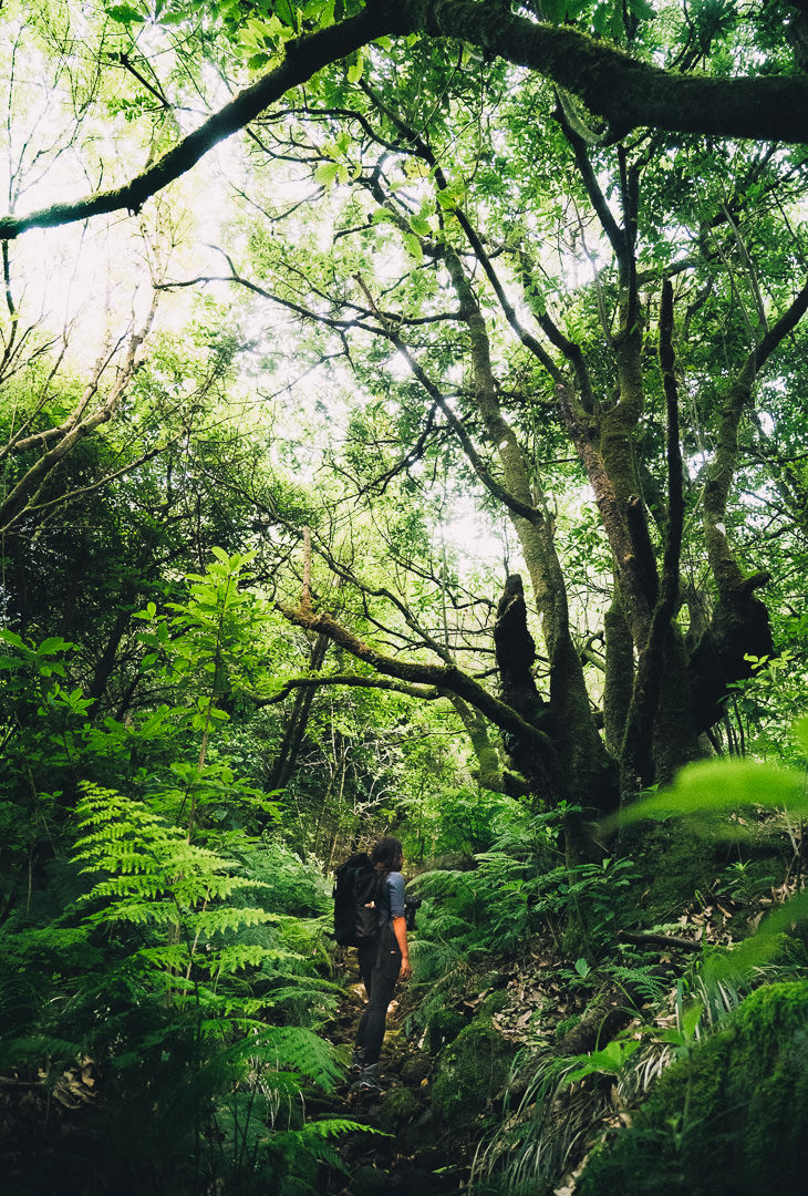
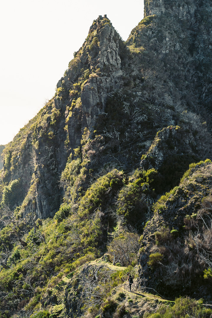
It’s a genuinely steep route, which will challenge many hikers. It’s not often you do 1800 meters of vertical gain in one day! The track through the forest is mostly a dirt path but it is not well defined. As I mentioned, we followed our local guide so if you don’t have a guide or a local showing the way, you will have to have eagle eyes on the GPS and hope it has recorded very accurately! The trail follows up the river, which is a rocky mess before you arrive at Vereda das Faias. Here you get your first glimpses of the view from above the canopy.
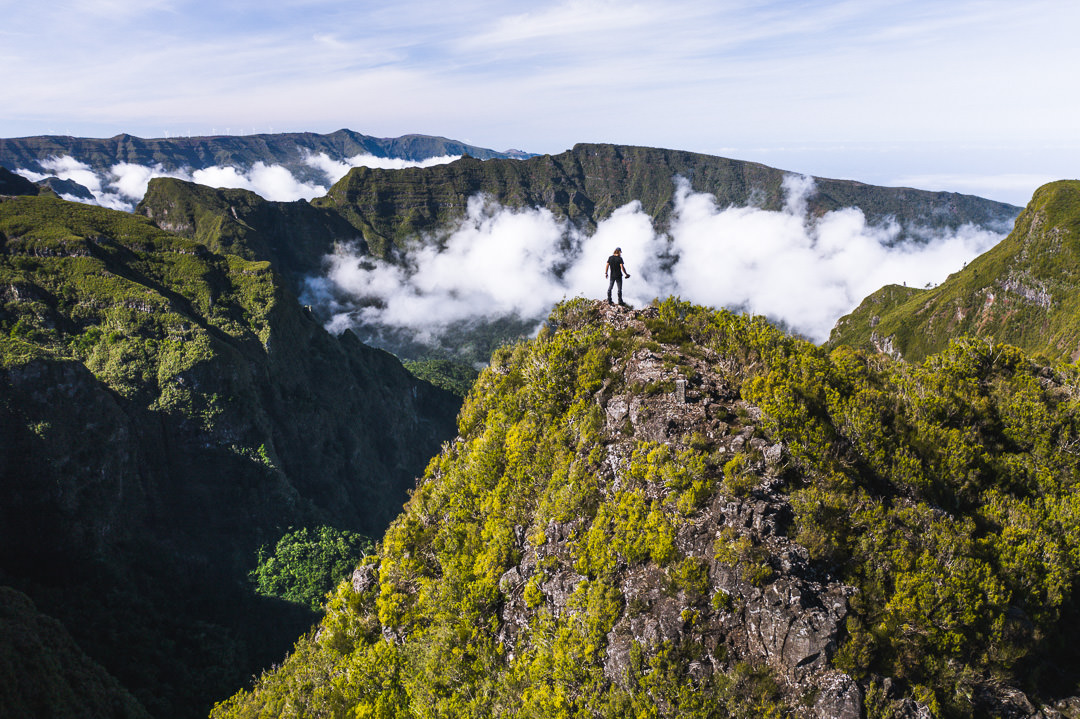
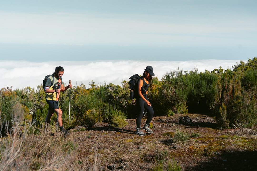
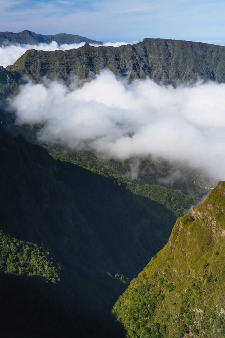
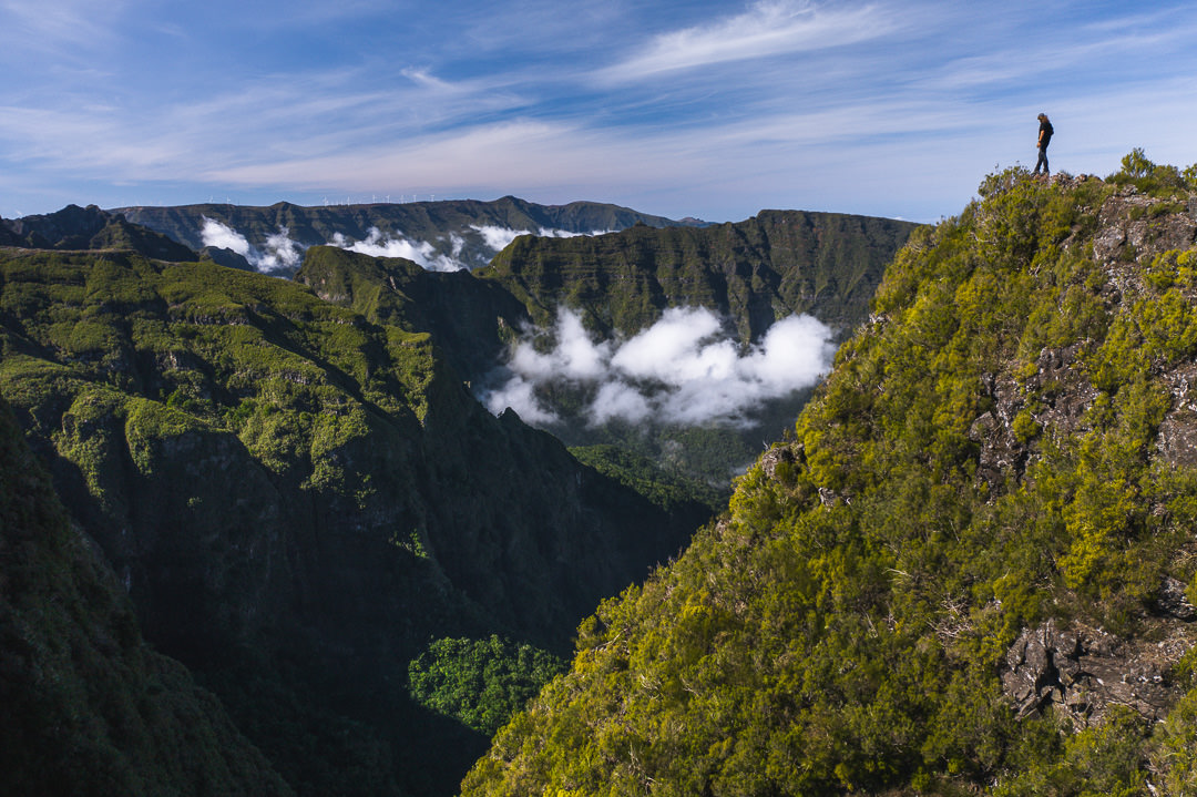
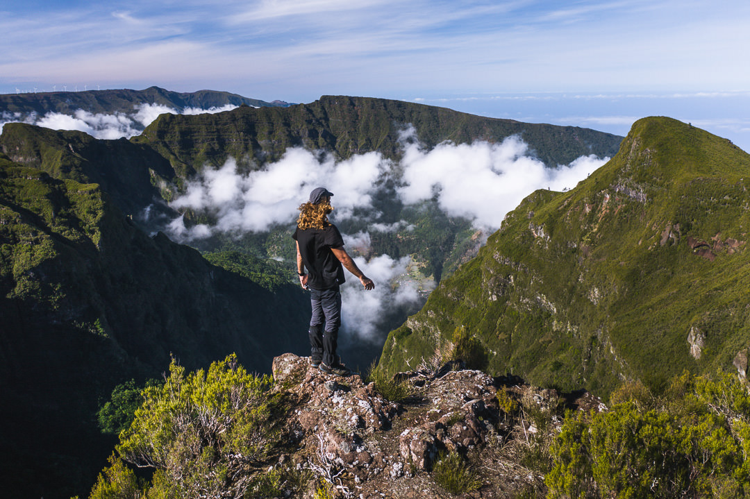
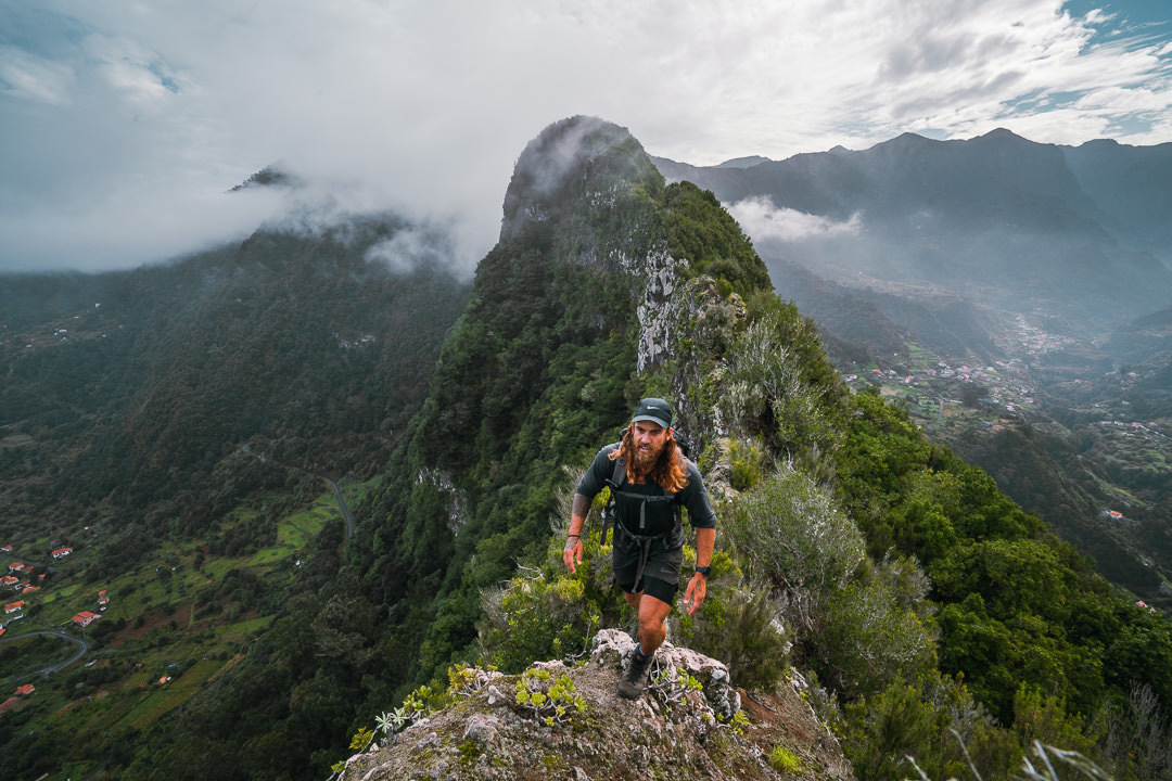
On the day we trekked, it was incredibly clear and we emerged above the trees to see a small layer of clouds above the ocean while the sun poured down over us.
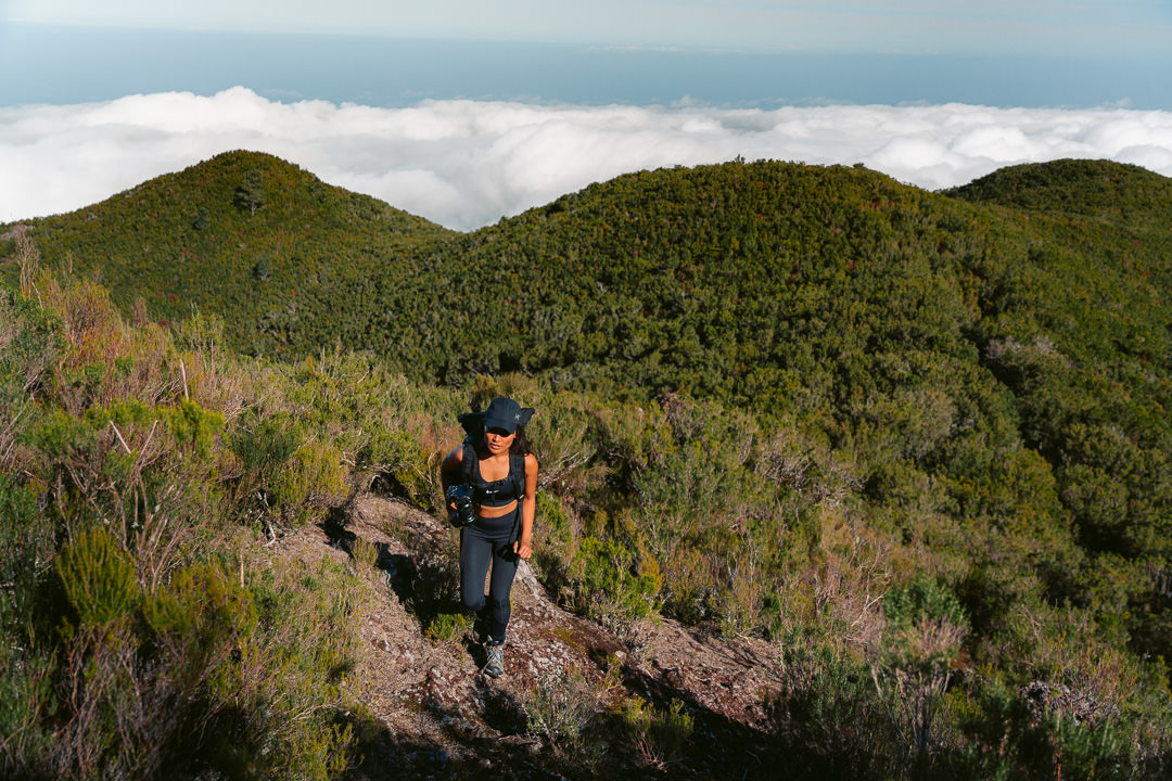
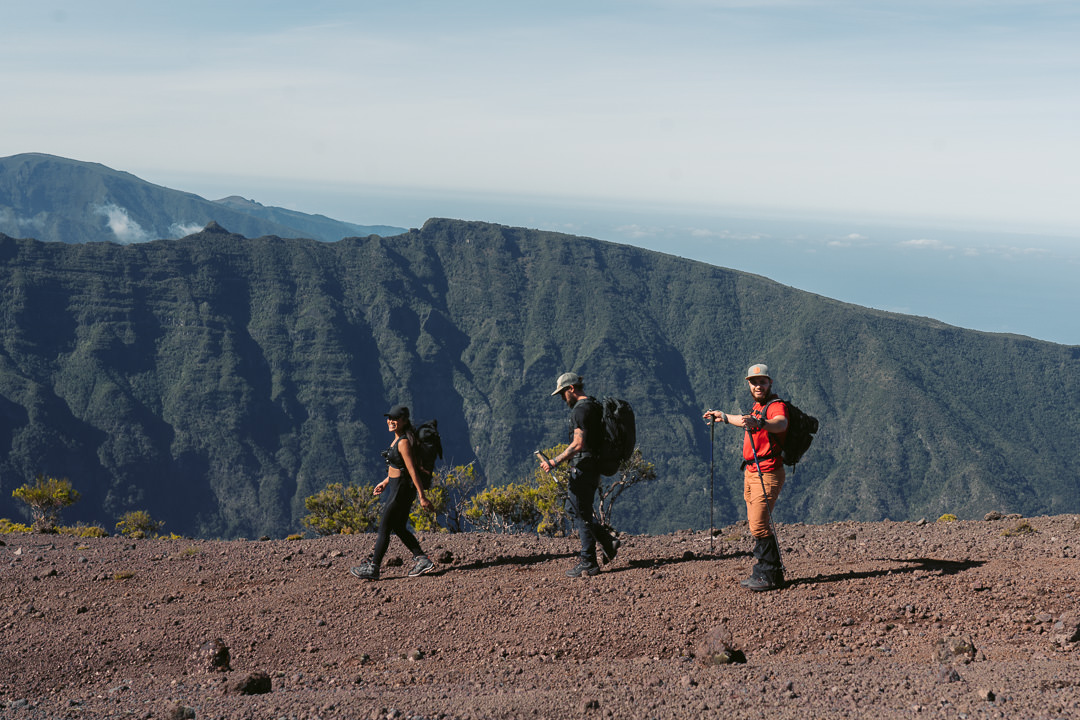
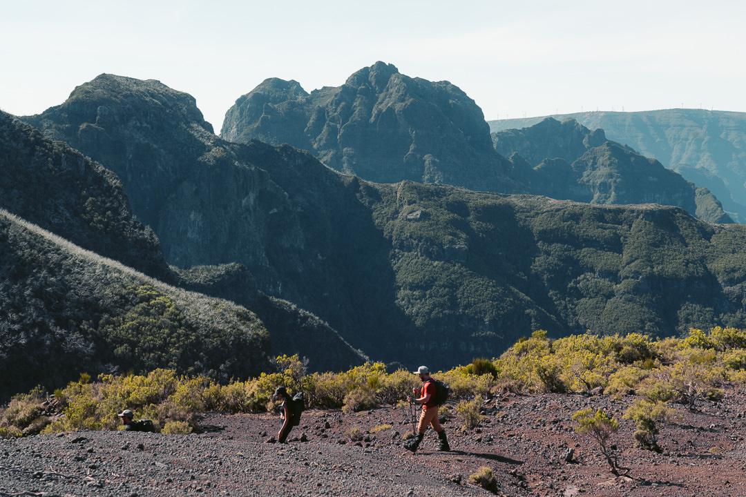
Pico Canãrio isn’t a peak with a defined summit. It isn’t a prominent, pointy peak that you can spot from a mile away. Instead, my local friends informed me that the area is known as Pico Canario and the trail enters the region rather than summiting to a viewpoint. This red-rock, barren expanse at the top of the hill gave you every sense that this was a volcanic island. After emerging from the lush forest, it was a stark contrast to be sliding down dusty red rocks.
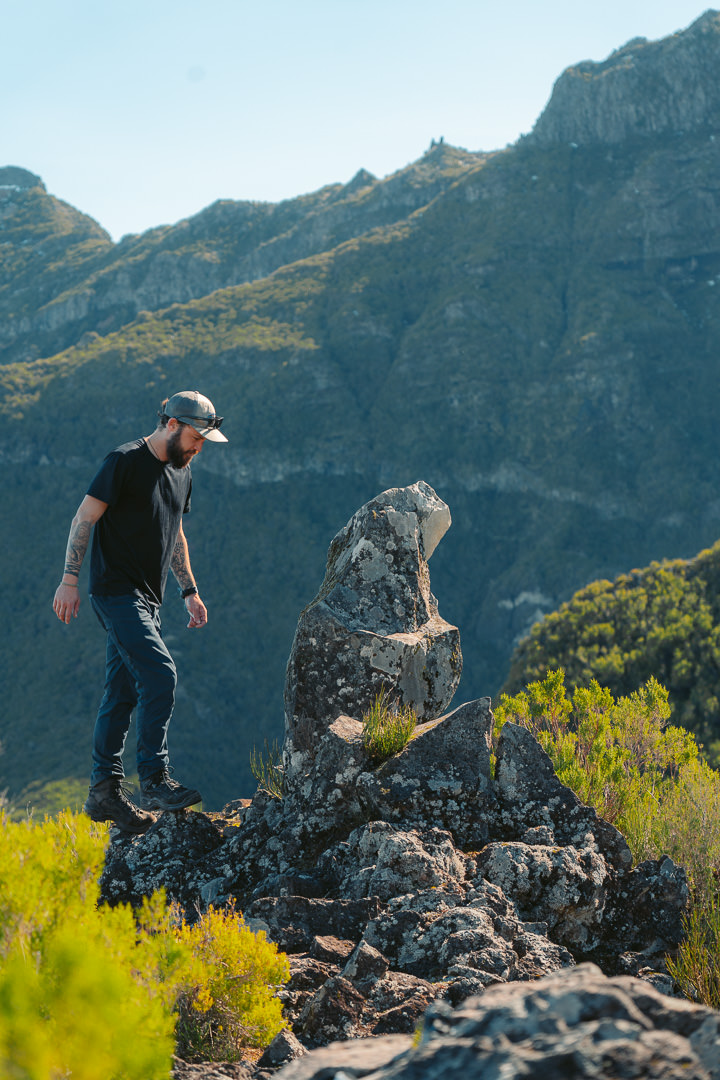
While there may be no prominent summit, there is a great point to stop for a lunch break. There is a small stone that resembles a canary. I’m still not convinced this is the origin of the name or if it was a joke from the local guys but I’ll go with it until proven otherwise. Either way, this is where we stopped to bask in the sun and have a well-deserved lunch break. The views on either side of our lunch spot were just off the charts.
BEST RENTAL CAR COMPANY ON MADEIRA
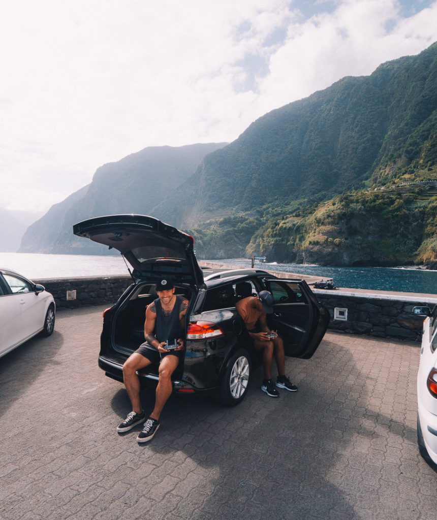
When you book your Madeira Rental Car online, I personally recommend and always use Discover Cars. They search for both local and international companies, so you get the best deal! MUST Read: Guide to Renting a Car on Madeira
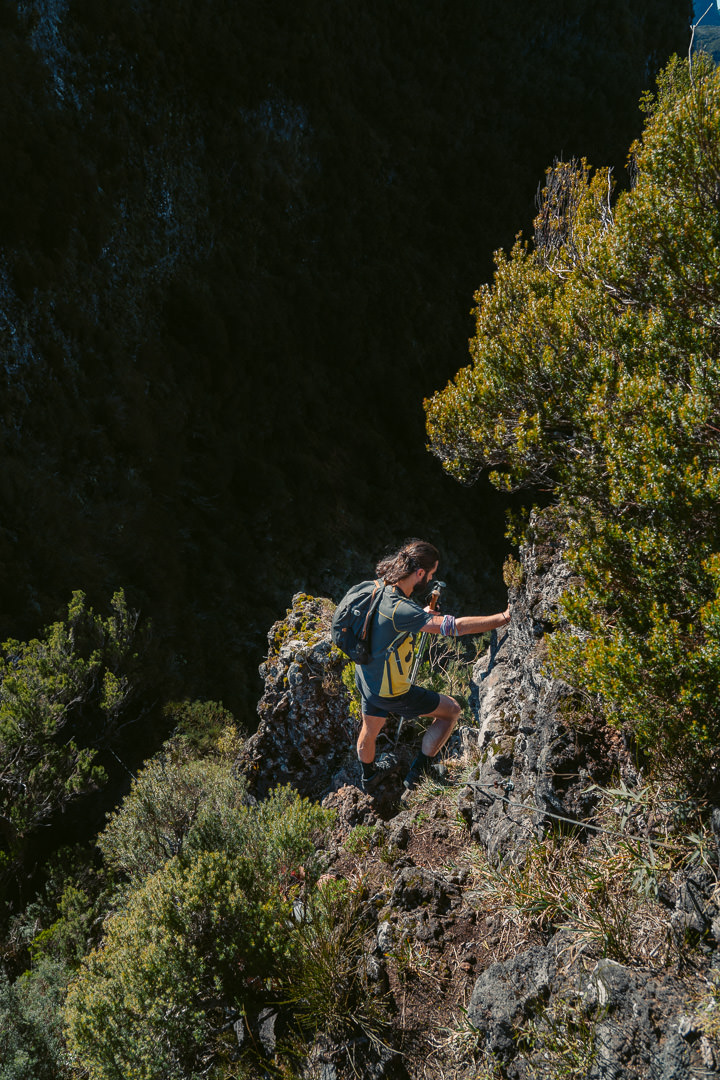
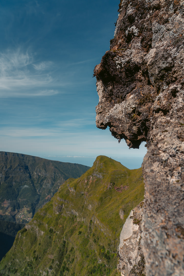
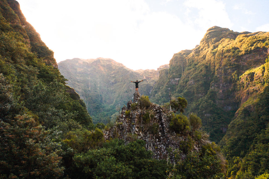
The journey now takes you down through a saddle and across towards the Encumeada to Ruivo Trail. This part of the trip has some exposure and there are a few rope/boulder sections to pass. It’s nothing too dramatic but you need to be comfortable using a rope to lower yourself down a steep set of rocks. As you are making your way down this saddle section with the ropes, keep an eye out for the human rock formation. It’s not easy to find and it’s actually only 1 meter away from your face as you climb down.
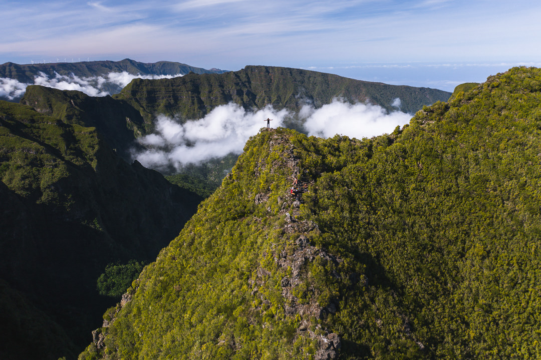
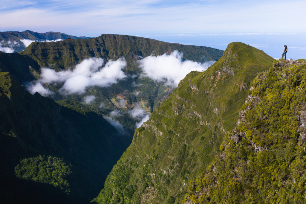
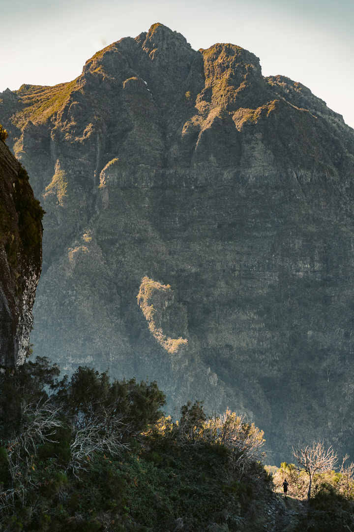
The trail now winds up the path towards the Encumeada to Pico Ruivo trail. Along this portion of the route, you will have glimpses of the tallest peaks on the island and you can even spot the satellite at Pico do Arieiro.
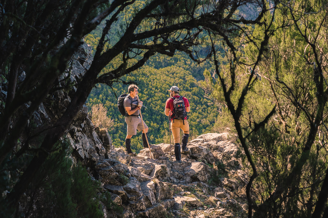
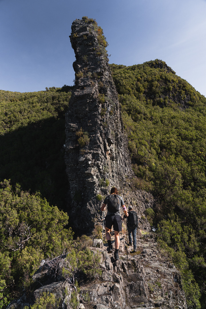
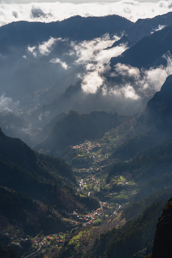
Views of Nun’s Valley start to appear as you near your way down to the main trail. Once you reach the Encumeada to Pico Ruivo trail, it is time for the descent to begin. 1800 meters of elevation on the climb is one thing but you also need to descend the same distance so your knees and shock absorbers are in for a workout. This part of the trail is very spectacular with huge cliffs towering behind the trail over the hikers.
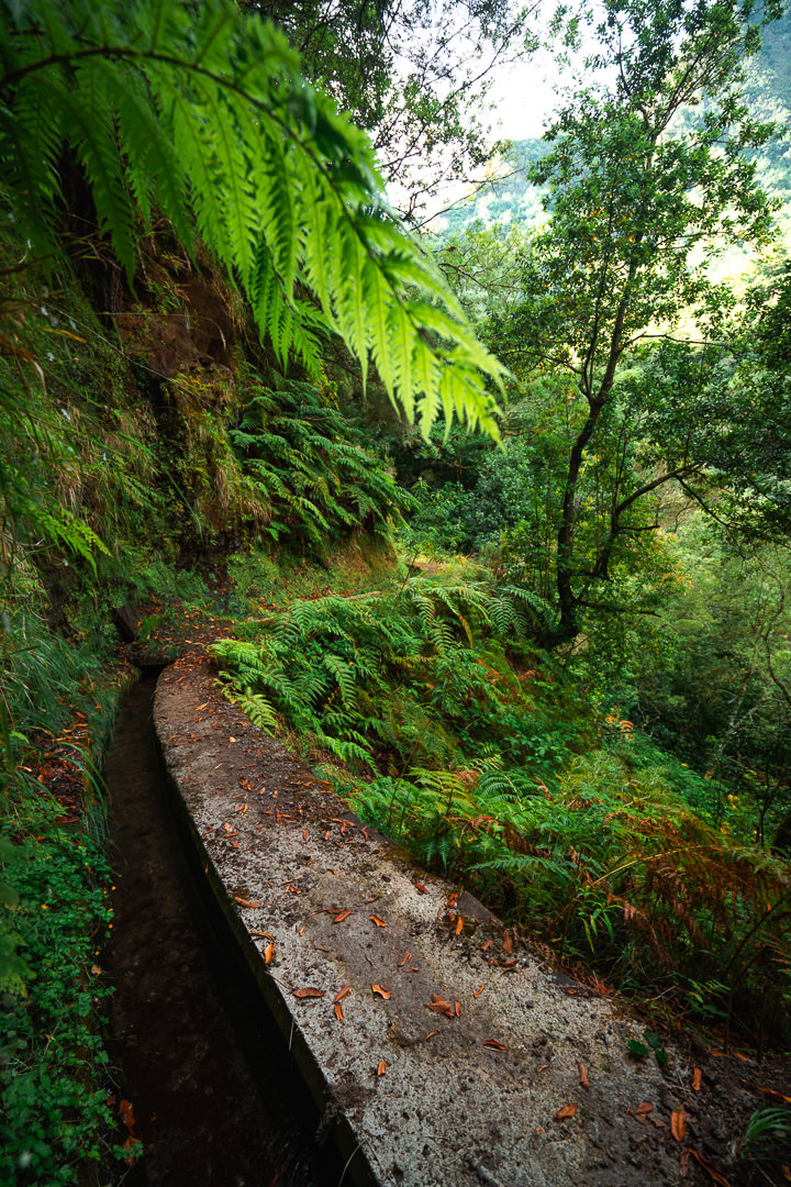
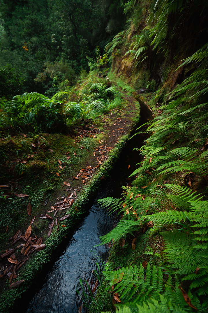
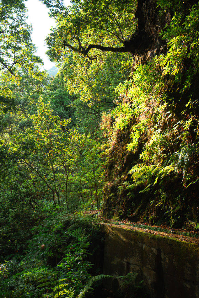
The trail descends along the cliffside as it slowly lowers you back down towards Boaventura. The track winds back and forth along forest switchbacks until spitting you out on Levada dos Tornos. You will now follow this scenic path for almost eight kilometers alongside the levada until reaching a small dirt path that drops you back to the parking lot where you began. Levada dos Tornos is a beautiful hike and one I have done before, so I added the photos from my first time along this section of the trail.

The final descent is just 20 minutes down the trail you first ascended up from the parking lot. By this stage the legs are heavy but the finish line is in sight. We had been going for more than nine hours at this stage!
After nine and a half hours of total time on the trail, we made it back to the parking lot. Tired but accomplished we watched the last bit of sunset disappear from the sky as we packed up our gear. I hope you enjoyed this guide to the Pico Canãrio hike. Happy hiking and stay safe out there!
WONDERING ABOUT WHERE TO STAY ON MADEIRA?
Throughout my six months on Madeira Island, I stayed in multiple accommodations. My favorite regions to stay in were Funchal and Canico de Baixo. I’ve created several guides to help you find the right region for you and a great hotel or apartment.
- The ultimate guide: WHERE TO STAY ON MADEIRA: WHICH REGION IS RIGHT FOR YOU?
- If you want luxury: BEST 5-STAR LUXURY HOTELS ON MADEIRA ISLAND
- To feel at home: TOP 10 BOUTIQUE HOTELS ON MADEIRA ISLAND
- If you want to base in Funchal: WHERE TO STAY IN FUNCHAL: 15 TOP-RATED HOTELS
HAVE YOU READ MY OTHER MADEIRA BLOGS?
I spent six months exploring Madeira and the nearby island of Porto Santo. These are some of my most popular guides about the region that you may be interested in.
- My favorite hikes: 65 AWESOME HIKES ON MADEIRA
- My favorite levada walks: 25 BEAUTIFUL LEVADA WALKS ON MADEIRA
- The best waterfalls on the island: 25 EPIC WATERFALLS ON MADEIRA
- Guide to the best Accommodation: WHERE TO STAY ON MADEIRA
- Hardest hike: THE MADEIRA ISLAND ULTRA TRAIL IN 4 DAYS (115KM)
- Longest hike: CAMINHO REAL 23: MADEIRA’S ROYAL PATH (180KM)
Brian Skinner
Friday 28th of July 2023
I was astounded to learn about his travels to this point and the way that he chooses to live an exciting life penalty kick online.