
The Levada dos Tornos hike in Boaventura has a great mix of waterfalls, viewpoints, and lush greenery within the UNESCO Laurisilva Forest. It’s a great hike that gives you a variety of scenery along the 13-kilometer point-to-point route through the valley in Boaventura. In this blog post, I will share with you the hiking details, directions, photos, and how to turn this point-to-point route into a circular hiking loop returning on a lower levada.
LEVADA DOS TORNOS HIKE DETAILS
- Hike Distance: The total distance of the hike is 13 kilometers if you follow the official route as a point-to-point trail. If you convert it to a circular loop (as I did) it’s an 18-kilometer loop hike.
- Hike Duration: The 13-kilometer point-to-point route can be done in under four hours but if you do my circular loop route it will be closer to five hours.
- Hike Difficulty: The trail is moderate on the difficulty scale. It’s not dangerous by any means but there are a few components that make it a little interesting. You have uneven surfaces beside the levada with big drop-offs at times where there is no railing. You need to take care during these sections. There is a wide path but you have no railing or safety fence so you need to stay vigilant. On the return section of the loop route, there are more exposed sections and a few narrow paths that take you under waterfalls. The circular route I will provide should only be for those who are comfortable with heights although there was nothing ‘technical’ about the route. We did the hike with two small dogs but they are used to hiking. If you are not up for a high level of adventure, some steep drop-offs, and an experienced hiker you should just do the official levada section and then turn back and complete this route as an out-and-back. Turning this hike into a loop route like we did is definitely possible but turns the danger and adventure up quite a few notches.
- Hike Incline: Total incline for the hike is 350 meters if you complete the circular loop or just 180 meters if you do the official point-to-point trail.
- My hiking guide: I did this hike with a local guide (also a great friend) called João. He’s lived in Madeira his whole life and knows all of the unique trails (not just the popular ones). This trail requires some local knowledge for the directions and has some dangerous moments so I recommend a guide. Want to contact João to be your guide for this hike or any of the hikes I’ve done on Madeira? You can contact him on Instagram here: João Let’s Hike or by email: joaoletshike@gmail.com
- My Strava Map Upload: Levada das Tornos, Boaventura
TOP 3 PLACES TO STAY IN MADEIRA
- Ultimate Luxury: Les Suites at Cliff Bay best location and view
- Best Value: Hotel Alto Lido – Funchal rooftop swimming pool under 100 Euros
- Budget Hostel in Funchal: Santa Maria Hostel is easily the top hostel in Funchal
HOW TO GET TO THE LEVADA DOS TORNOS IN BOAVENTURA
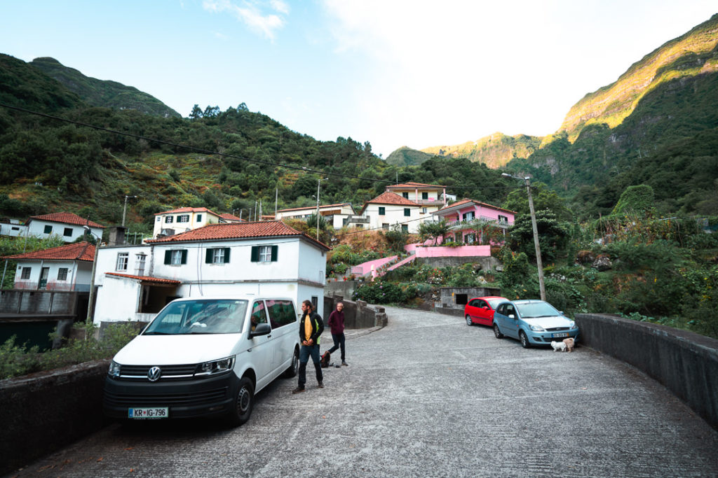
The Levada dos Tornos trailhead is at the end of the road in the valley of Boaventura. To reach the valley from Funchal it takes just over 45 minutes thanks to the tunnels. I’ve added the pin on the map below, which will help you to plan your transit to the trailhead. I also added my Strava map link above so you can check out exactly where we walked. Once we arrived at the pin location, it was a small village with just a handful of houses on a steep hill. There was no designated parking for the hikers so we just parked out of the way on the road. Not many people come to the village as it is a dead-end at the top of the valley.
BEST RENTAL CAR COMPANY ON MADEIRA
When you book your Madeira Rental Car online, I personally recommend and always use Discover Cars. They search for both local and international companies, so you get the best deal! MUST Read: Guide to Renting a Car on Madeira
MY EXPERIENCE ON THE LEVADA DOS TORNOS HIKE IN BOAVENTURA
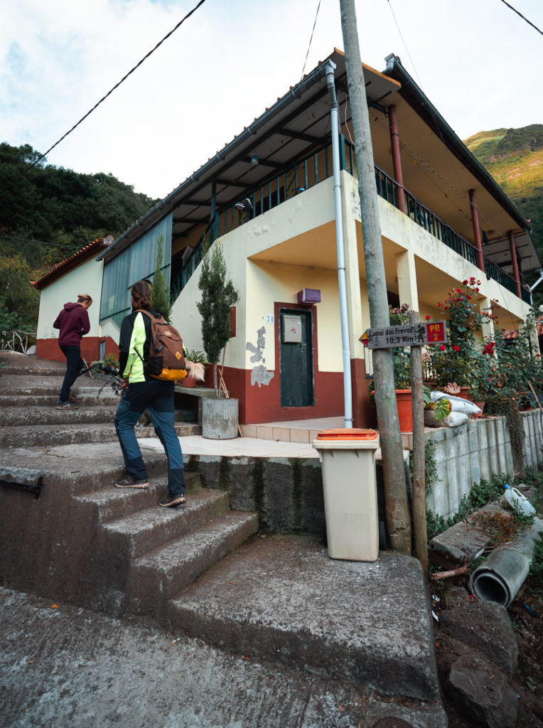
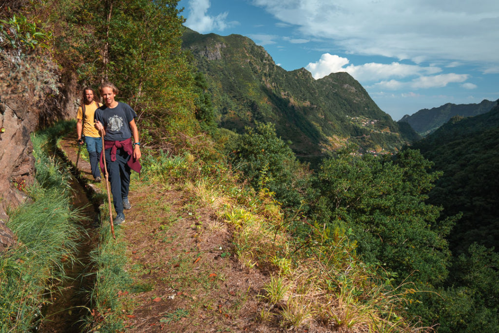
A handful of houses perched on the hillside at the top of the valley in Boaventura marked the end of the road. When we arrived, not a soul was to be seen and it would remain that way for the entire 18-kilometer journey. We parked the car on the street and headed up the hill to find the trailhead sign next to one of the highest houses.
The Levada dos Tornos route is officially a 12.9-kilometer route according to the Madeira hiking map. It suggests walking from the top village and finishing in the town lower in the valley called Faja do Penedo. This is fine if you have someone picking you up or a second car to plant at the bottom of the trail. However, most people only arrive in one car so you need to either do the hike as an out-and-back or as we did as an (adventurous) circular loop.
Basically, we followed the route exactly but when we reached the Levadeiros House, we turned back around for 1-kilometer and took the shortcut trail down the hill we had seen on the way. This led us to a lower, rougher levada. It led us back to the car without having to return on the same trail or venture all the way to Faja do Penedo and hike back on the road. I will explain how that all worked later in the blog but thought it was valuable information to know because it’s always hard to figure out how to do these point-to-point trails if you have only one car.
The trail began with almost two hundred meters of incline straight out of the blocks. Make sure you have had your morning coffee because this one burns the quads and calves from the first minute. However, once you level up about 200-meters the rest of the trail is relatively flat. You just need to make it up the first climb then you can relax for the rest of the journey and take in the sights.
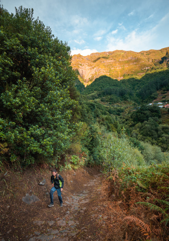
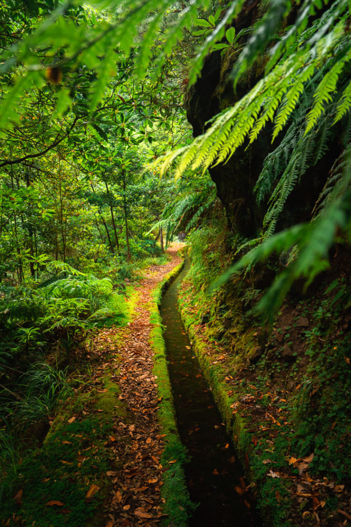
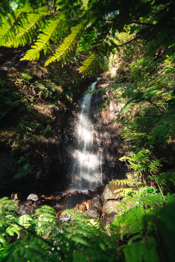
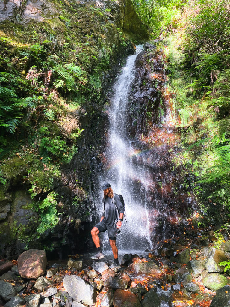
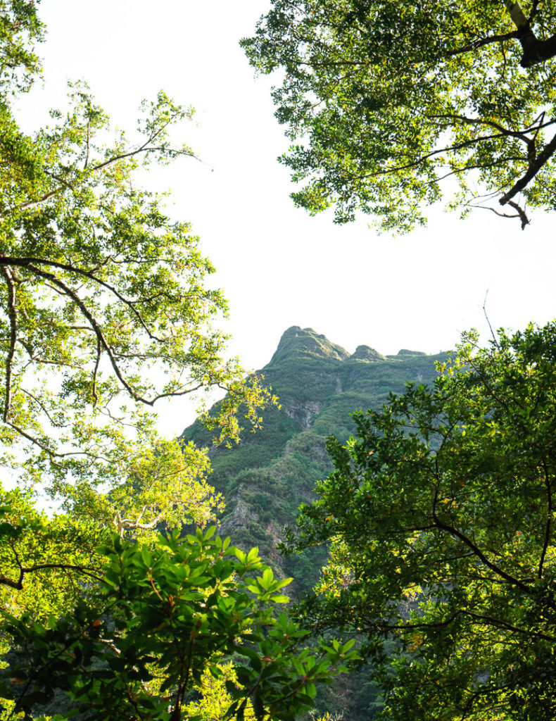
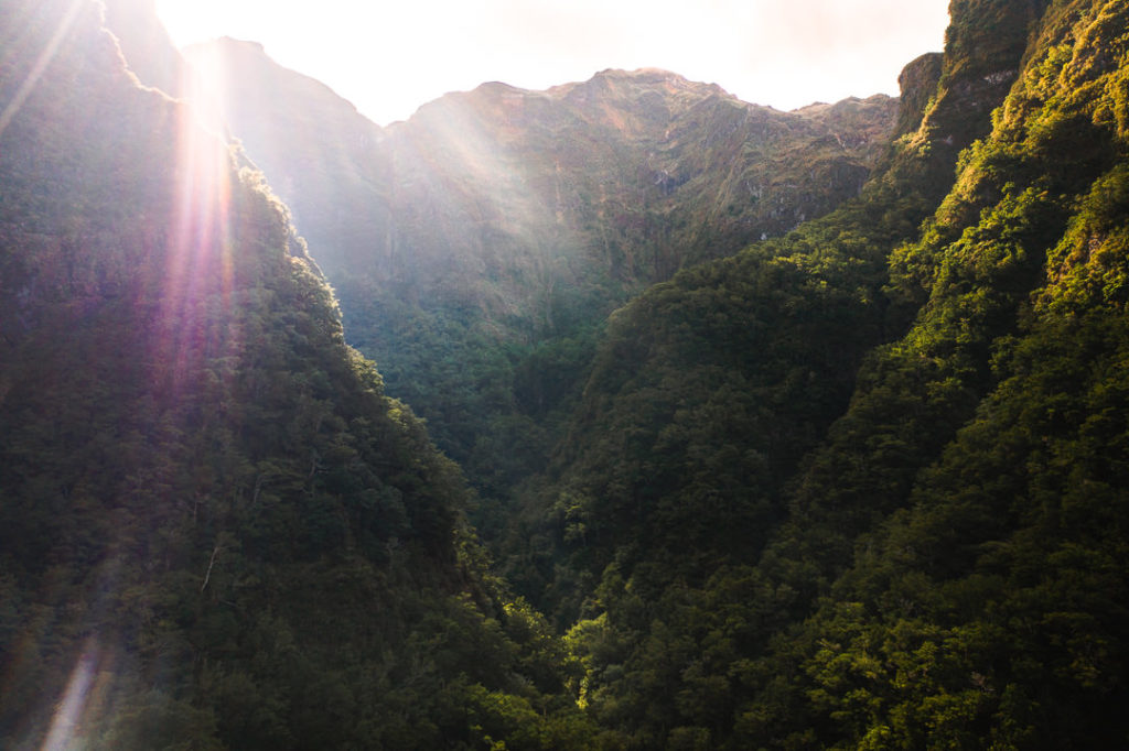
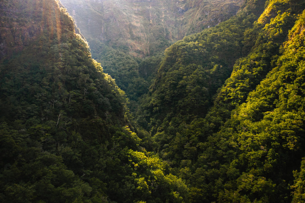
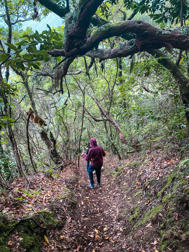
The trail takes you from the top of the valley and leads you down to the lower areas. However, the first part of the trail actually leads up into the higher parts of the valley to visit a waterfall. You then have to backtrack to the spot where you started and then you will head down the valley. The waterfall isn’t huge but it is beautiful in the morning light so it’s worth the extra four kilometers you will spend going there and back to where you began. The trail on the way to the waterfall is incredibly lush, which created a wild start to the morning hike.
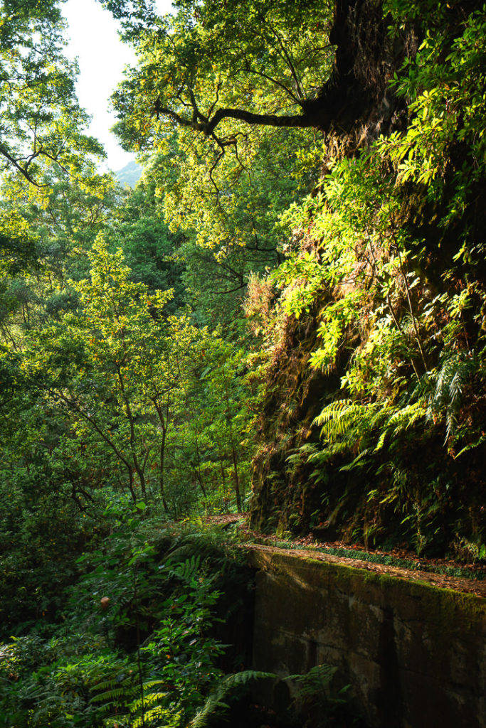
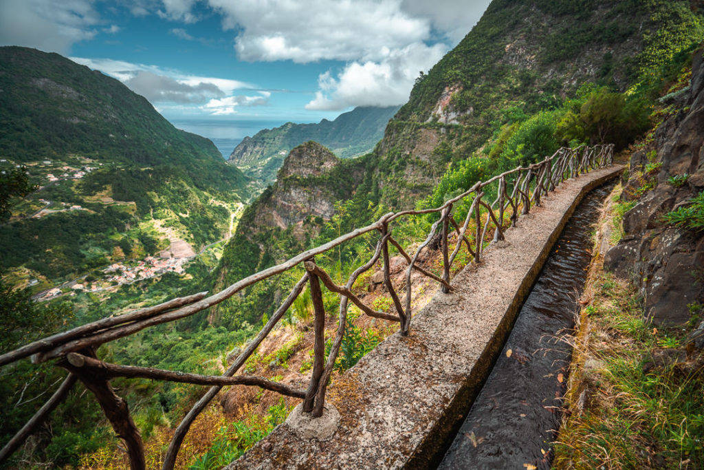
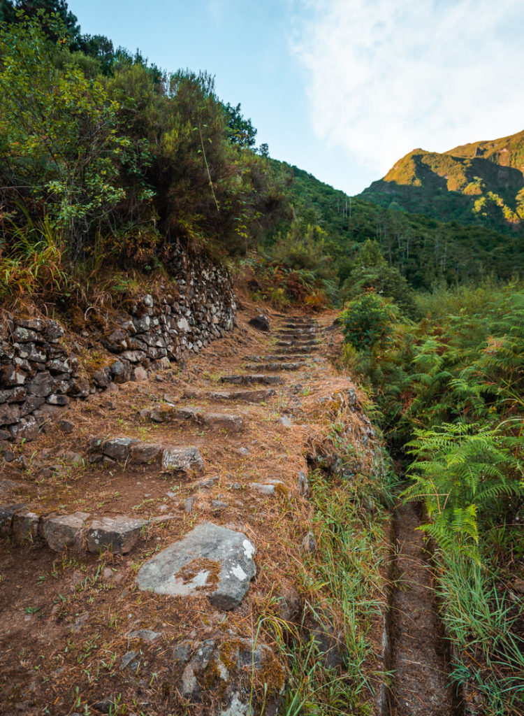
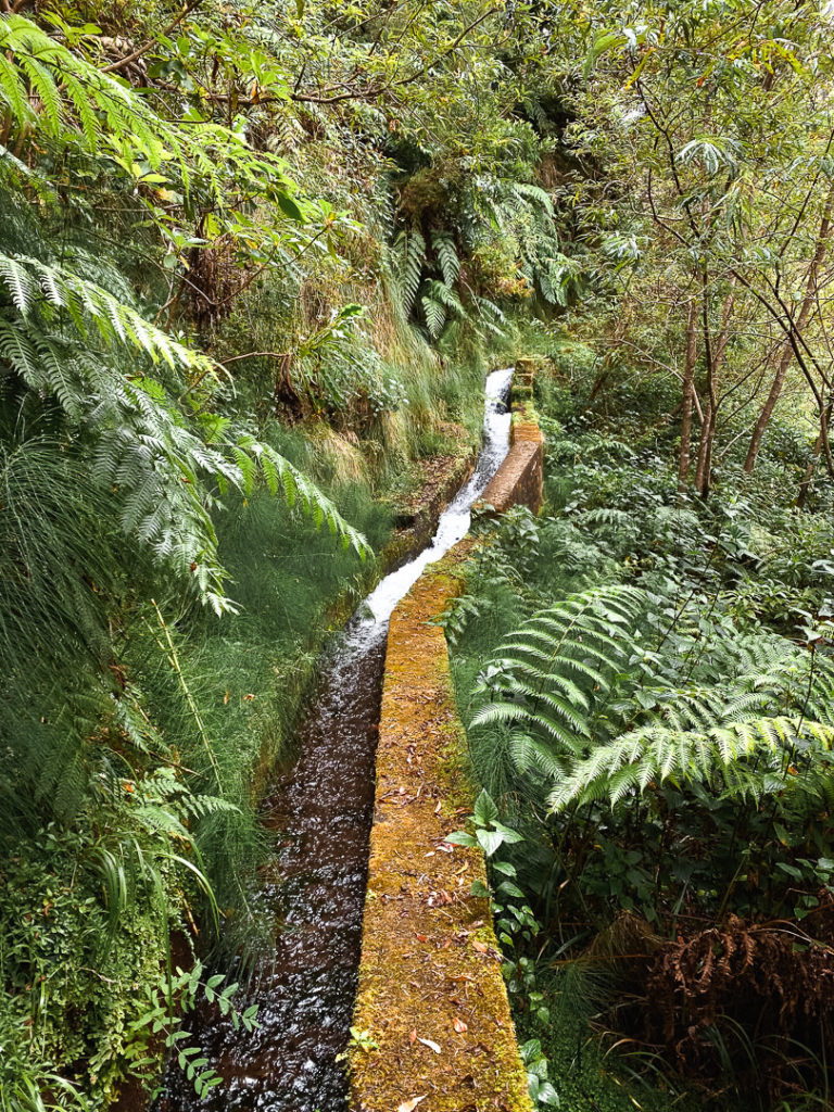
After visiting the waterfall, you will end up back at the intersection that you reached after ten minutes on the trail. You then head along the levada, down the valley towards the coast. The trail now follows the levada for the entire hike so you no longer need to consult the map (until you make your circular loopback). During this part of the trail you will often be in the thick, lush Laurisilva Forest where waterfalls can be found next to the trail. However, a moment later you will find a break in the trees for sweeping views of the valley.
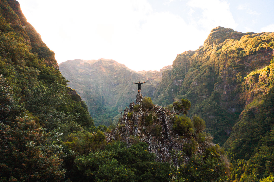
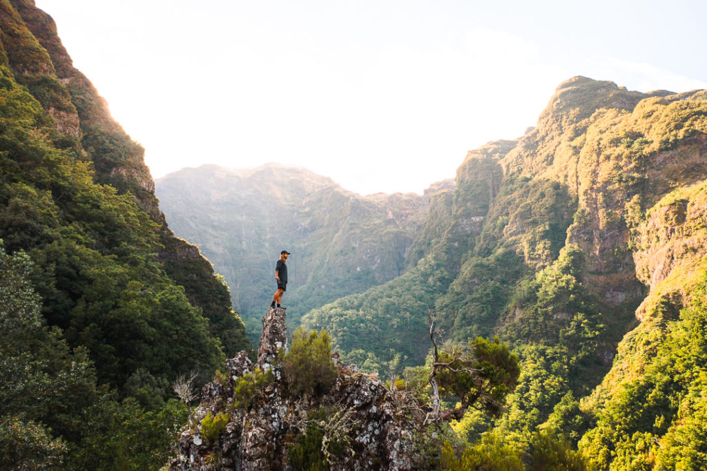
At the eight-kilometer mark, there was a small trail to the left of the levada and when I explored it there was a rocky outcrop. It was basically asking to be climbed, although some of the rocks were a little crumbly. If you do choose to walk up onto this lookout take extra care as many of the rocks are ready to give way. Up on top of the rock, there were great views to the peaks at the top of the valley where the sun was just breaking through on our sunrise hike.
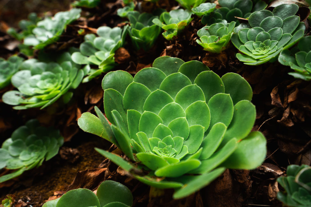
As we continued onwards, the cliff-side levada became more scenic as the views down to the coast opened up frequently. It was hard to know whether to look at the walls scattered with succulents or down towards Faja do Penedo as the morning light hit the town.
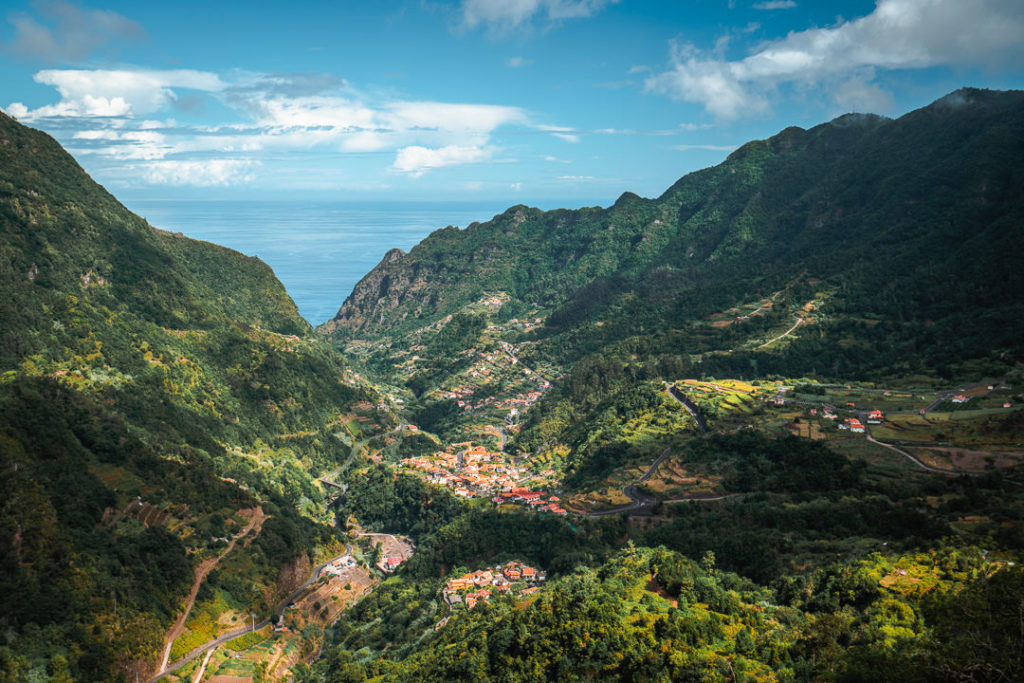
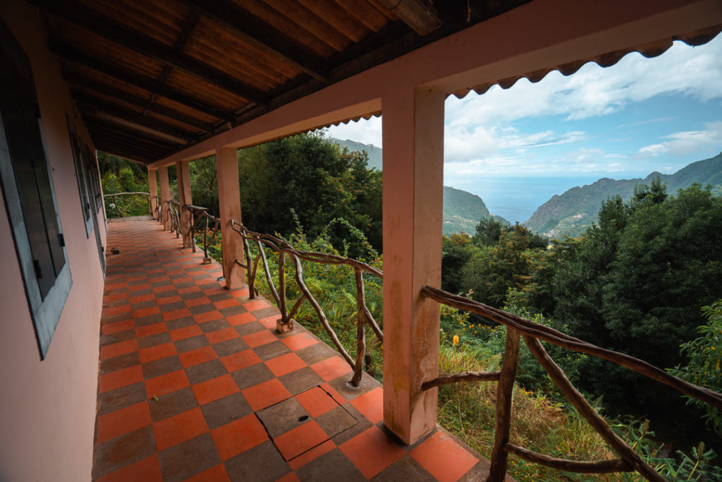
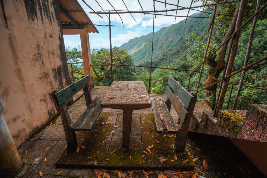
We decided to continue following the levada all the way to the Levadeiro’s House, which is about 12 kilometers into the journey. We took refuge here and had our lunch on the old cement tables while deciding how we wanted to return to the car at the top of the valley. We could either walk down into Faja do Penedo and hope someone would give us a ride back. If they didn’t we would have to walk along the road or a dirt path near the road.
The other option was to go back 1 kilometer where we had found a small dirt path that went down the steep slope attaching our top levada with a lower levada, which we believed would take us back up the valley. The advantages of this second option were that we would be in nature the entire circular loop, we wouldn’t have to descend and ascend as much as going down to the town and back up and it would be the shortest possible route. We finished our lunch at the tables and decided to give the lower levada a chance.
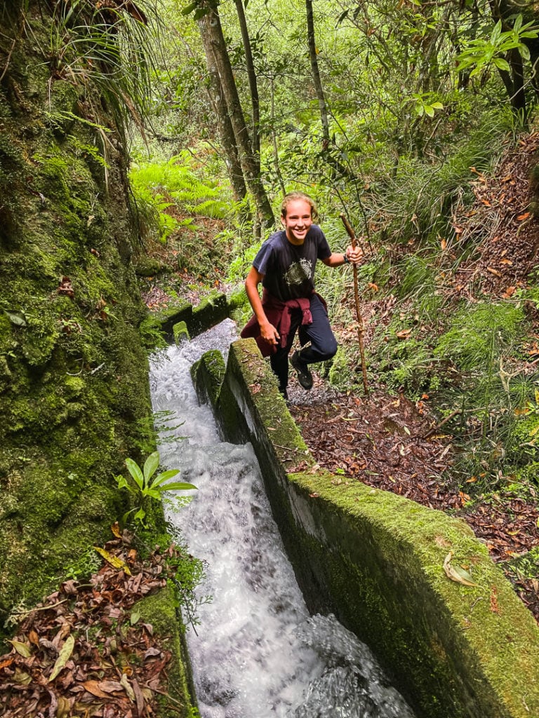
As we headed down the steep, dirt path we figured it must have been created by the Levadeiros who wanted a quick way up to their house and levada for easy-access. It was relatively well-maintained but only for those with sure-footing as it was hard to grip and very steep. It started raining while we were in this section so I took the rest of the photos for the hike just on my phone, which you may notice in the quality.
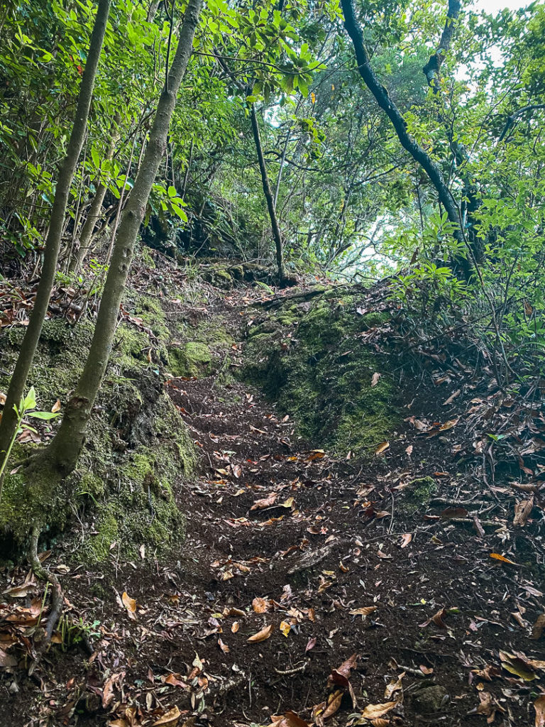
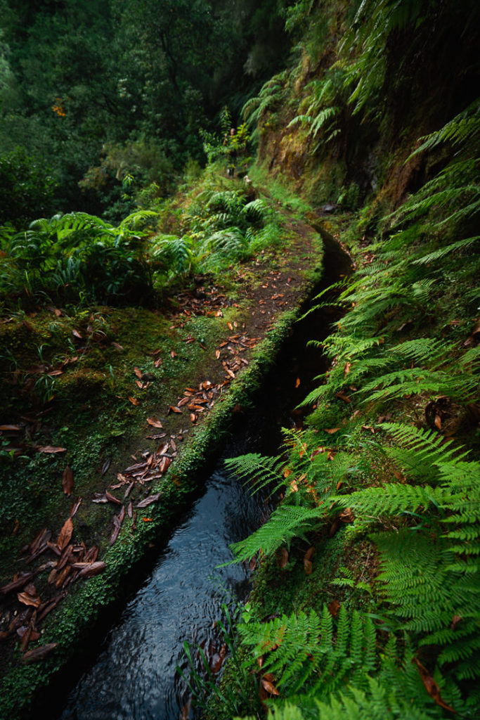
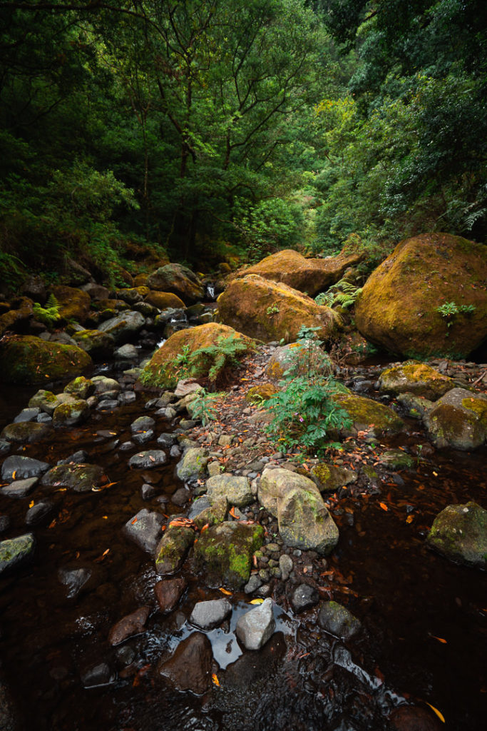
With a bit of persistence, we reached the lower levada although it wasn’t super easy to find and not so accurately depicted on the maps. When we did find it, the levada was clear enough for us to decide to follow it back through the valley. It isn’t an official trail and doesn’t even show up on Maps.me or other apps so it’s not very well maintained but was wide enough to walk through.
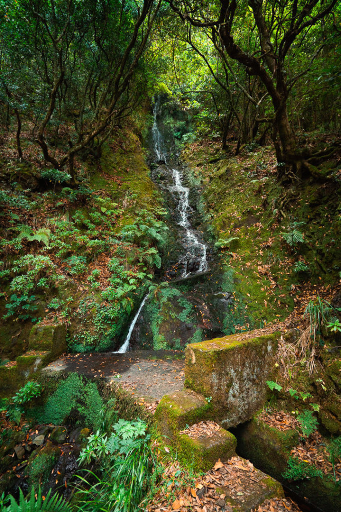
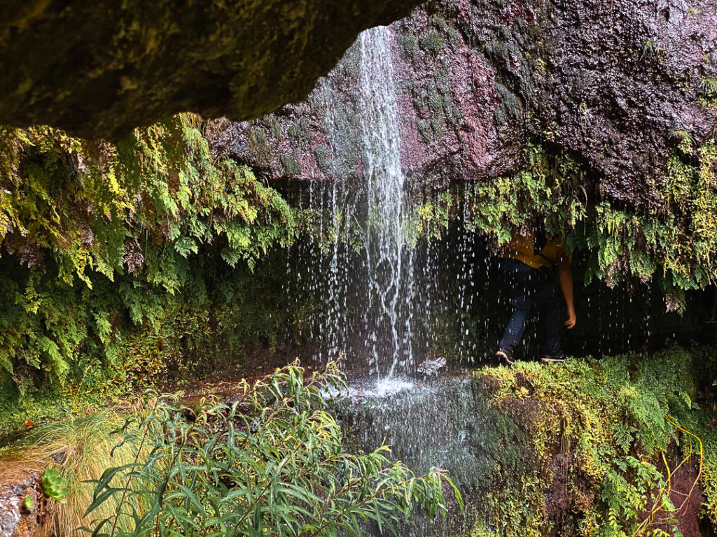
I will warn you there were several sections on this route that had large drop-offs of more than 20 meters while you were walking on a narrow levada. I didn’t find it very dangerous but there were lots of moments you could fall very seriously. The best part of this levada was when we had to crouch through a narrow overhanging rock while simultaneously ducking behind a waterfall. We didn’t expect this to be on the trail but it ended up being a highlight for us.
We were pretty stoked that our circular route worked out and after 18 kilometers and 320 meters of incline, we made it back to the top village where we had parked the car. Overall it was a fantastic journey with great weather and lots of exciting and scenic moments on the trail. I’d recommend this for those who want a levada walk but something a little more adventurous than many of the more ‘tame’ levada walks on the island of Madeira.
I hope you enjoyed this guide about the Levada dos Tornos hike in Boaventura on Madeira Island.
WONDERING ABOUT WHERE TO STAY ON MADEIRA?
Throughout my six months on Madeira Island, I stayed in multiple accommodations. My favorite regions to stay in were Funchal and Canico de Baixo. I’ve created several guides to help you find the right region for you and a great hotel or apartment.
- The ultimate guide: WHERE TO STAY ON MADEIRA: WHICH REGION IS RIGHT FOR YOU?
- If you want luxury: BEST 5-STAR LUXURY HOTELS ON MADEIRA ISLAND
- To feel at home: TOP 10 BOUTIQUE HOTELS ON MADEIRA ISLAND
- If you want to base in Funchal: WHERE TO STAY IN FUNCHAL: 15 TOP-RATED HOTELS
HAVE YOU READ MY OTHER MADEIRA BLOGS?
I spent six months exploring Madeira and the nearby island of Porto Santo. These are some of my most popular guides about the region that you may be interested in.
- My favorite hikes: 65 AWESOME HIKES ON MADEIRA
- My favorite levada walks: 25 BEAUTIFUL LEVADA WALKS ON MADEIRA
- The best waterfalls on the island: 25 EPIC WATERFALLS ON MADEIRA
- Guide to the best Accommodation: WHERE TO STAY ON MADEIRA
- Hardest hike: THE MADEIRA ISLAND ULTRA TRAIL IN 4 DAYS (115KM)
- Longest hike: CAMINHO REAL 23: MADEIRA’S ROYAL PATH (180KM)
Grete Hints
Sunday 24th of January 2021
Attention readers!! I think this trail should not be made in this circular way as is written in this post. If you consider yourself average hiker, then cross this idea off immediately. We did it today and I think it was a stupid decision by us to trust this blog post. Sorry Jackson, but all three of us who did it, agree that it's irresponsible to suggest this as a good way to do this. :/
Firstly, Jackson (the author) is very experienced and has a lower sense of danger. So I would suggest marking the second part of the trail dangerous and difficult.
First part of it was totally okay, easy to find and follow. All good, just, stick with it. :) We followed the instructions of the post and here's what happened: after steep muddy downhill, we found the second levada - but, as the blog said, it is NOT maintained, therefore there were landslides that we had to climb over. Secondly, several VERY very steep sections where you only have the edge of levada under your feet.
The part with climbing under waterfall... most exciting for Jackson, most horrifying for us. It's a stretch where a person has to crawl on a 30cm levada edge, at the same time it's slippery (because of the waterfall), then crawl under the waterfall, and during all that crawling there's a VERY steep fall on the right side, and on left there's just low wall and levada. We were quite frightened, but the clock was against us and only way would have been over 10km back.
Thirdly, this blog doesn't mention how hard it is to find a way back to the village. There's a steep river valley between levada and the main road. At one point, we reached a crossroads with river and a levada - we had to cross the river (we used MapsMe, and there also was a local, so that was a good sign). And then the levada went to the big river, and if I remember correctly, levada ended there. MapsMe showed a road going next to the river to the village, but it's not seen from the river. We didn't have another option, so we again crossed the river and followed a very small, barely noticeable way through the grass towards what we thought should be the end. Luckily, we found the way and finished just in time.
It might be adventurous for some, but from the second author suggest something, they should think about the point of view by their large audience. Secondly, there is a responsibility, even when saying "i's on your own decision" - if something happens, you can't really wipe your hands clean from it. People trust the author who has done it and says "it's not dangerous".
Don't do the second levada. Stay on official trails and maintained levadas.
For reference - we have been in Madeira for 2 months and have hiked every week several times, so it was not our first. But our first time to go off-trail, and I regret it.
Stay safe
Jackson
Monday 25th of January 2021
Hi Grete,
I'm sorry you had a rough time on this trail. I never delete comments but I will correct yours where it is misleading in many places.
1. I rate hikes based on the difficulty for a broad spectrum of people. Because it was hard for you doesn't mean it will be hard for everyone. That is the same principle for me. That's why I try and say why it was difficult or show photos, distances, inclines etc rather than basing it on my opinion.
2. I mentioned a number of factors were in this route and then you have commented here saying about your shock and horror when you came across these factors on the trail. I can only write so much to try and help people choose if a hike is suitable for them. You say there were huge drop-offs and no railing in parts, which were both clearly mentioned in the article, even with photos.
3. We did this hike with a small fluffy white dog and a young boy of the father who I was hiking with. As I mentioned it had moments of danger or difficult sections but your suggestions make it seem like the most dangerous hike on the island, one you would never dare to a fluff-ball or a child on.
4. You mentioned you enjoyed the official levada section, which is an indication of the type of hikes you may suggest in the future.
5. It is your own decision. You need to base your decisions on your own experience because the information I have given in this article is accurate and explains the difficulties you will encounter. Just because it is hard for you does not mean others should stay at home. We had great fun on this adventure and I've taken others here since then who have also enjoyed it. You've asked me not to recommend something because it was okay for me but you have done exactly that by telling people 'DON'T DO IT' because you find it tough and dangerous. That's not the outlook I have on this blog. I give people as much info and photos as possible and then let them go for it if they feel comfortable. Remember, no-one gave me a full set of photos and information before I went. I didn't have anyone to blame, I just go on these hikes and if they are too difficult I turn back, which I've done many times in the past.
I hope you enjoy the rest of your time in Madeira and choose hikes you are comfortable with or book a local guide such as Madeira Wonder Hikes.
Luis Vasconcelos
Monday 14th of September 2020
Still missing the best levadas/hikes Ponta São Lourenço Caldeirão verde/inferno
Jackson
Tuesday 15th of September 2020
East is coming later... ;)