
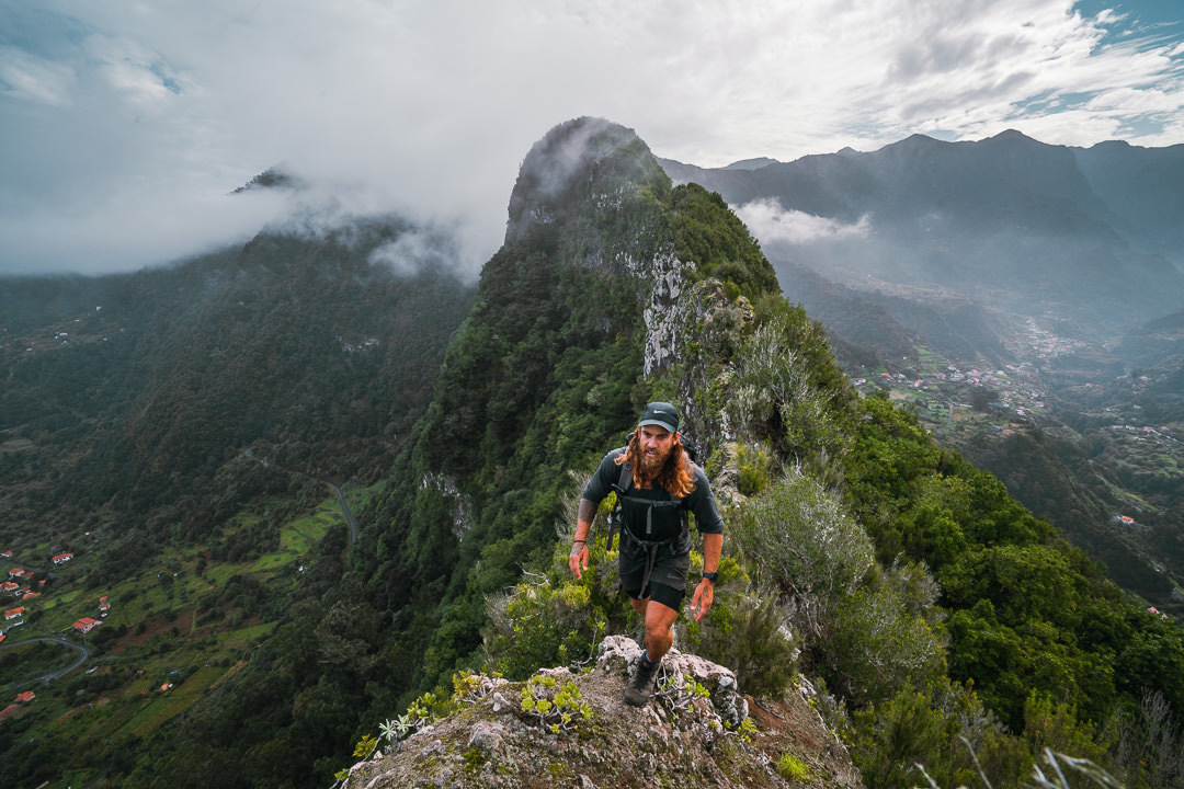
Espigão Amarelo is one of my favorite coastal hikes on Madeira. It truly has it all. Beginning on the famous Vereda do Larano, this trail takes a secret detour up onto the gnarly ridge of Espigão Amarelo. Five hundred meters of up and downs through the forest then drop you back at the end of Vereda do Larano where you can turn back to complete the loop.
However, in this blog post, I will detail how we made it all the way to Caniçal via Boca do Risco and then even on to Miradouro Ponta do Rosto. This trail ended through some Mars-like landscapes with red rocky terrain but truly had it all from cloud forests, cliff-edge coastal views, and vast plains.
ESPIGÃO AMARELO HIKE DETAILS
- Hike Distance: The total distance of my hike was 14.4 kilometers for the route from Vereda do Larano on the Porto da Cruz side all the way to Ponta do Rosto. But completing the regular loop back along Vereda do Larano would be about 10 kilometers in total, which is the suggested route. I’ll detail the options in the blog post below.
- Hike Duration: The hike duration was just under 5.5 hours for our route and our total moving time was 4 hours, which was a pretty decent pace. Again, there are multiple route and duration options for this hike.
- Hike Difficulty: This hike is one I would list as moderately difficult. The directions will be a challenge for many with a real need for a local friend or a local guide to make the unsigned turns, particularly on the ridge. There is a defined path for most of the route but up on the ridge, there is often not much other than a few crumpled leaves to follow. The Espigão Amarelo ridge is a place for experienced hikers only with regular drop-offs and very steep, muddy, slippery inclines. It’s a vertical kilometer of incline so that is not to be ignored either. I’d suggest this for seasoned hikers looking for a challenge. Regular hikers can enjoy the scenic and leisurely Vereda do Larano, which offers spectacular views also without the rigor of this route. The toughest part of the hike is just the distance of 24 kilometers and the incline of more than a vertical kilometer. If you can get dropped at one end and picked up at the other end it would be an easy 12-kilometer hike.
- Hike Incline: Total incline for the hike was 1042 meters for the point-to-point route I did. But probably about 600-700m if you looped back along Vereda do Larano.
- My hiking guide: I did this hike with a local guide (also a great friend) called João. He’s lived in Madeira his whole life and knows all of the unique trails (not just the popular ones). This trail requires some local knowledge of the directions so I recommend a guide. Want to contact João to be your guide for this hike or any of the hikes I’ve done on Madeira? You can contact him on Instagram here: João Let’s Hike or by email: joaoletshike@gmail.com
- My Strava Map Upload: Espigão Amarelo Hike
HOW TO GET TO THE TRAILHEAD THE FOR ESPIGÃO AMARELO HIKE
The Espigão Amarelo hike begins at the trailhead of Vereda do Larano. It then follows Vereda do Larano for two kilometers before turning right up a rocky hill where it begins on the ridge. I will detail that in the blog below and I’ve also put a pin location on the map below showing the trailhead where you can park.
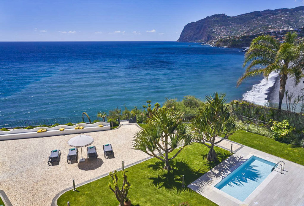
TOP 3 PLACES TO STAY IN MADEIRA
- Ultimate Luxury: Les Suites at Cliff Bay best location and view
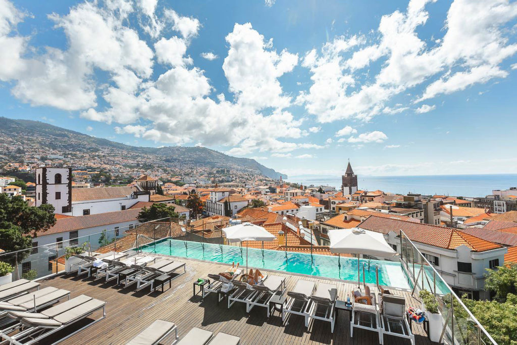
- Best Value: Hotel Alto Lido – Funchal rooftop swimming pool under 100 Euros
- Budget Hostel in Funchal: Santa Maria Hostel is easily the top hostel in Funchal
HOW TO GET TO THE TRAILHEAD THE FOR ESPIGÃO AMARELO HIKE
There are three main options for this hike. They all include the Espigão Amarelo ridge section but after you complete that it really depends on how long of a route you are looking for and what practicality you will embed into your adventure.
- Option 1 (Most Practical and Basic): Once you hit the end of Vereda do Larano a the T-Junction with Levada do Caniçal, you simply turn back and take Vereda do Larano back to the parking lot a the start of the trail. This is still an epic hike and will be about 10 kilometers with 700m of vertical gain.
- Option 2: (Adventure along the coast): Once you hit the end of Vereda do Larano a the T-Junction with Levada do Caniçal, continue along the coast up the hills and you will enjoy coastal views all the way through to the Mars-like red rocky area before the windmills at Caniçal. There is a parking lot on the edge of the windmill area where you can have your second car parked or call your Uber. This route would be about 10 kilometers with 900 meters of vertical gain.
- Option 3: (Adventure along the coast to Ponta do Rosto): This third option is my route and you can see it on my Strava map linked above. Basically, once we reached the windmills at Caniçal, we walked straight around the fence as it didn’t extend all the way to the ocean. This is not advised and very likely considered a trespass although no signs were there and we didn’t jump any fences at any point so maybe it is an open track for walkers. Cannot confirm that. We passed through the solar panels and under the wind turbines then found an old coastal track that led us to the final kilometer on the road to join Miradouro Ponta do Rosto as our final stop for the day. We then caught an Uber for 18 Euros back to the starting point of Vereda do Larano near Porto da Cruz.
Now that you know the options, I will explain the experience of my hike, which was option three.
BEST RENTAL CAR COMPANY ON MADEIRA
When you book your Madeira Rental Car online, I personally recommend and always use Discover Cars. They search for both local and international companies, so you get the best deal! MUST Read: Guide to Renting a Car on Madeira
MY EXPERIENCE ON THE ESPIGÃO AMARELO HIKE
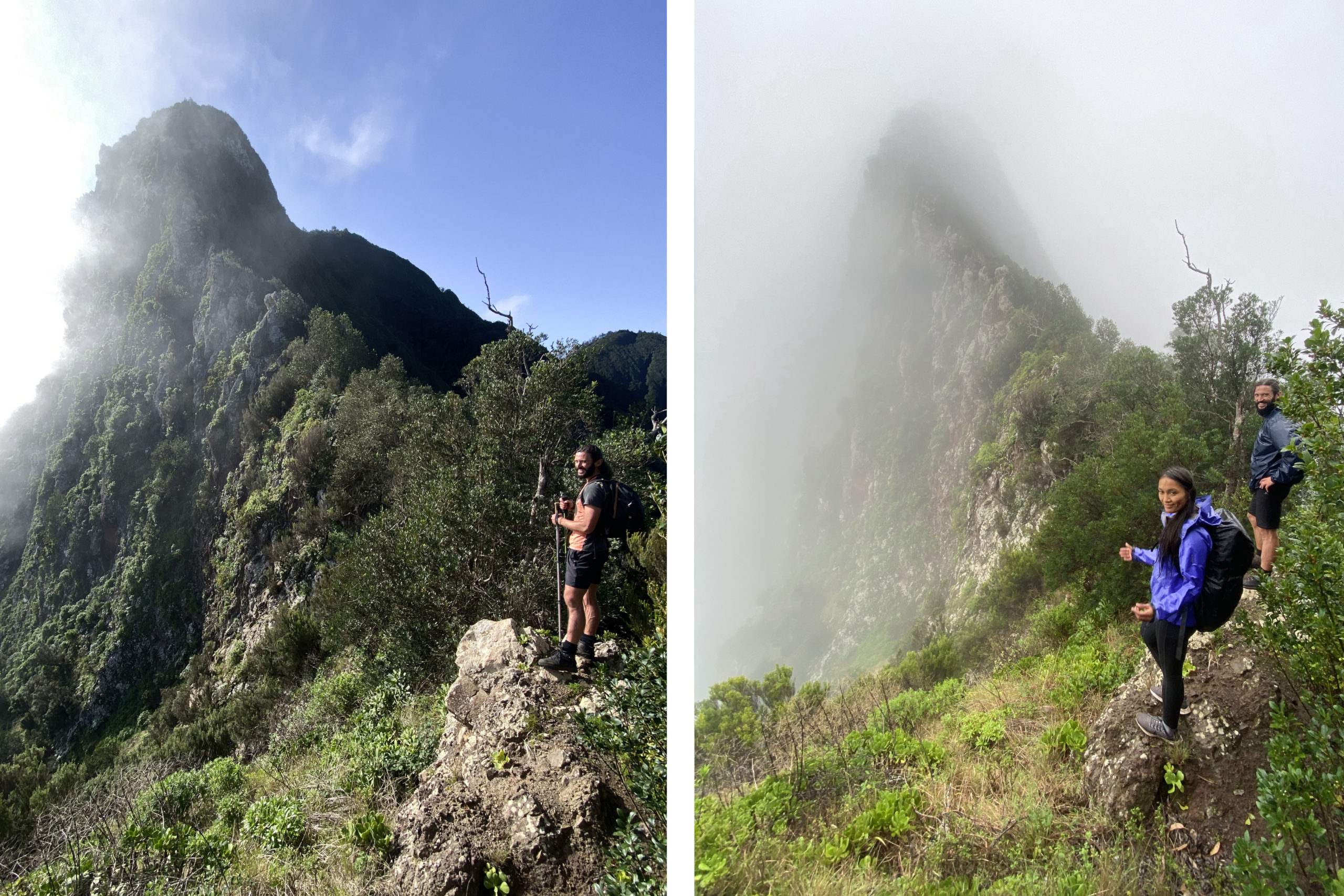
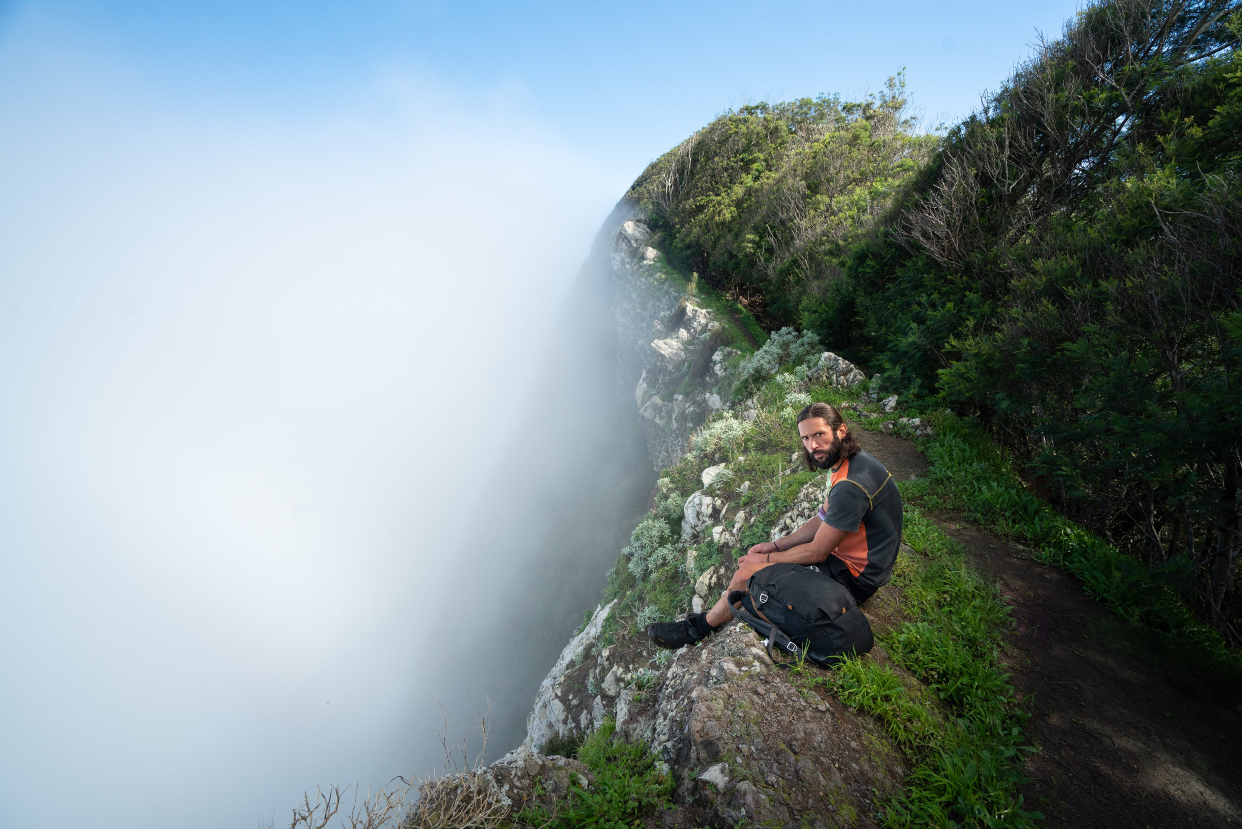
This trail was actually one that I had been trying to do for a long time and it had become a bit of an obsession. This happens to me often when I do a hike in bad conditions and can’t wait to go back in more favorable weather. The first time I did this hike, a storm smashed us after 10 minutes and it was a grueling affair I cannot advise. Below you can see the difference between attempt one to attempt two in the same location.
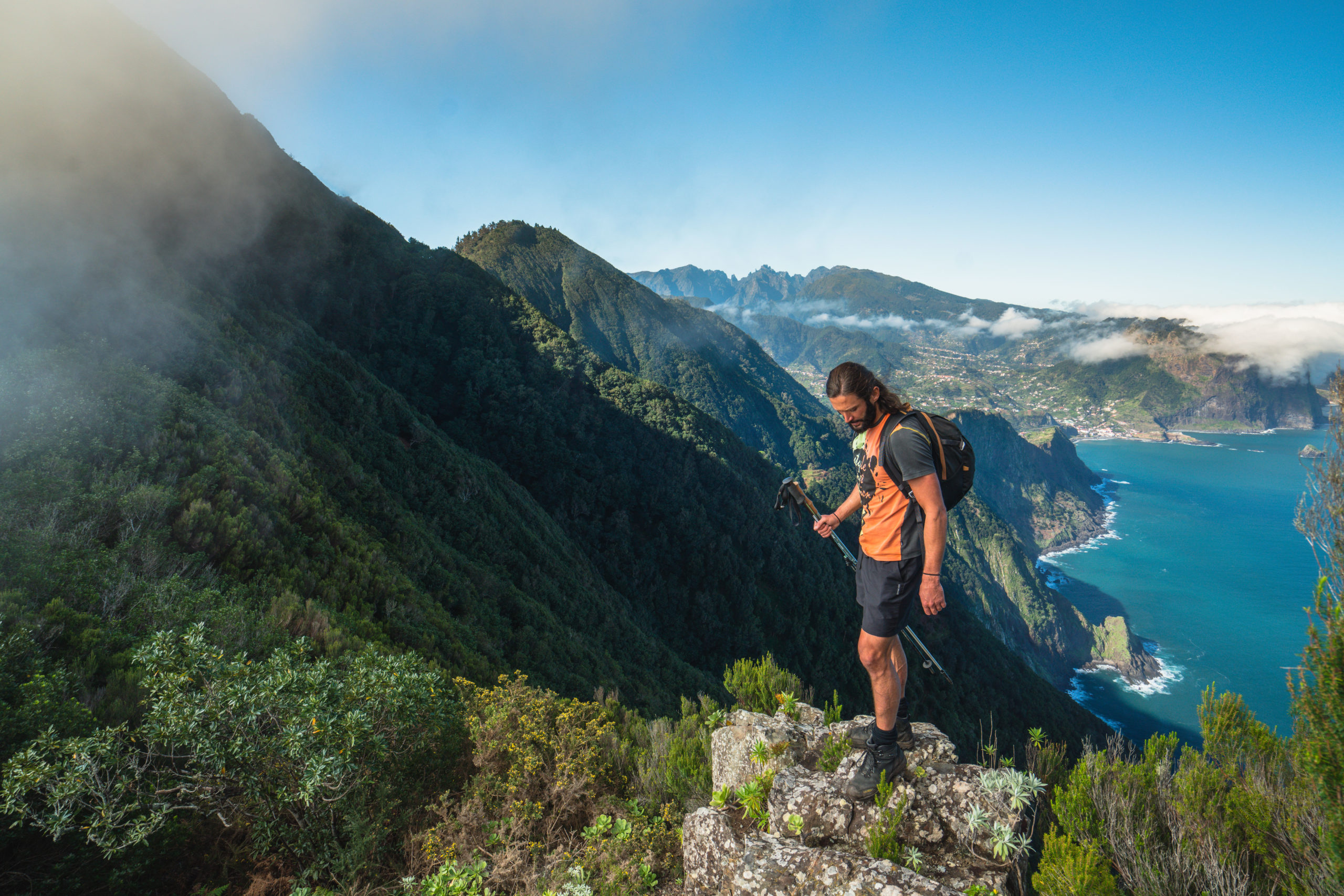
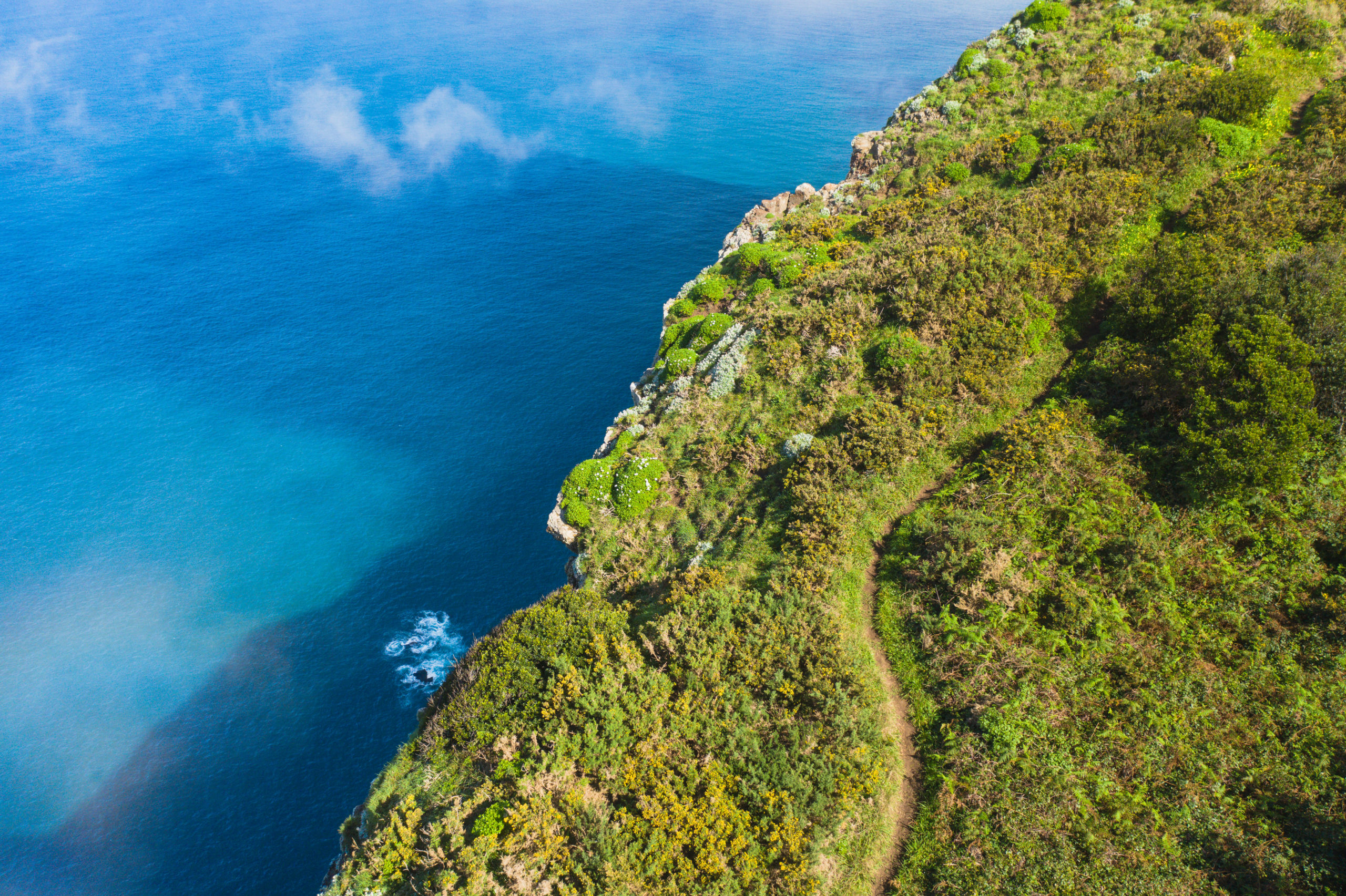
The trail begins from the Porto da Cruz side of Vereda do Larano. For two kilometers you will follow this stunning coastal track, which is a beautiful route in itself. The drop-offs to the glistening ocean below are a dramatic scene but the railing and a wide track make this a safe path and popular among leisurely walkers.
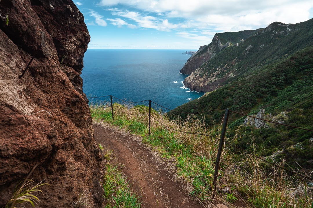
Don’t be too distracted by the views or you will miss the turn-off. You won’t find a sign or even what looks like a trail. A few crumbly, faint cuts into the red rock on the right-hand side will indicate the spot. It occurs just after the 2-kilometer mark on the trail. Even in my photo below, it is hard to identify where to ‘stairs’ begin. This rocky incline leads you up through the grass and onto the ridge. It isn’t well defined but usually, you can see where others have been before you. There aren’t many alternate routes and it is basically straight up.
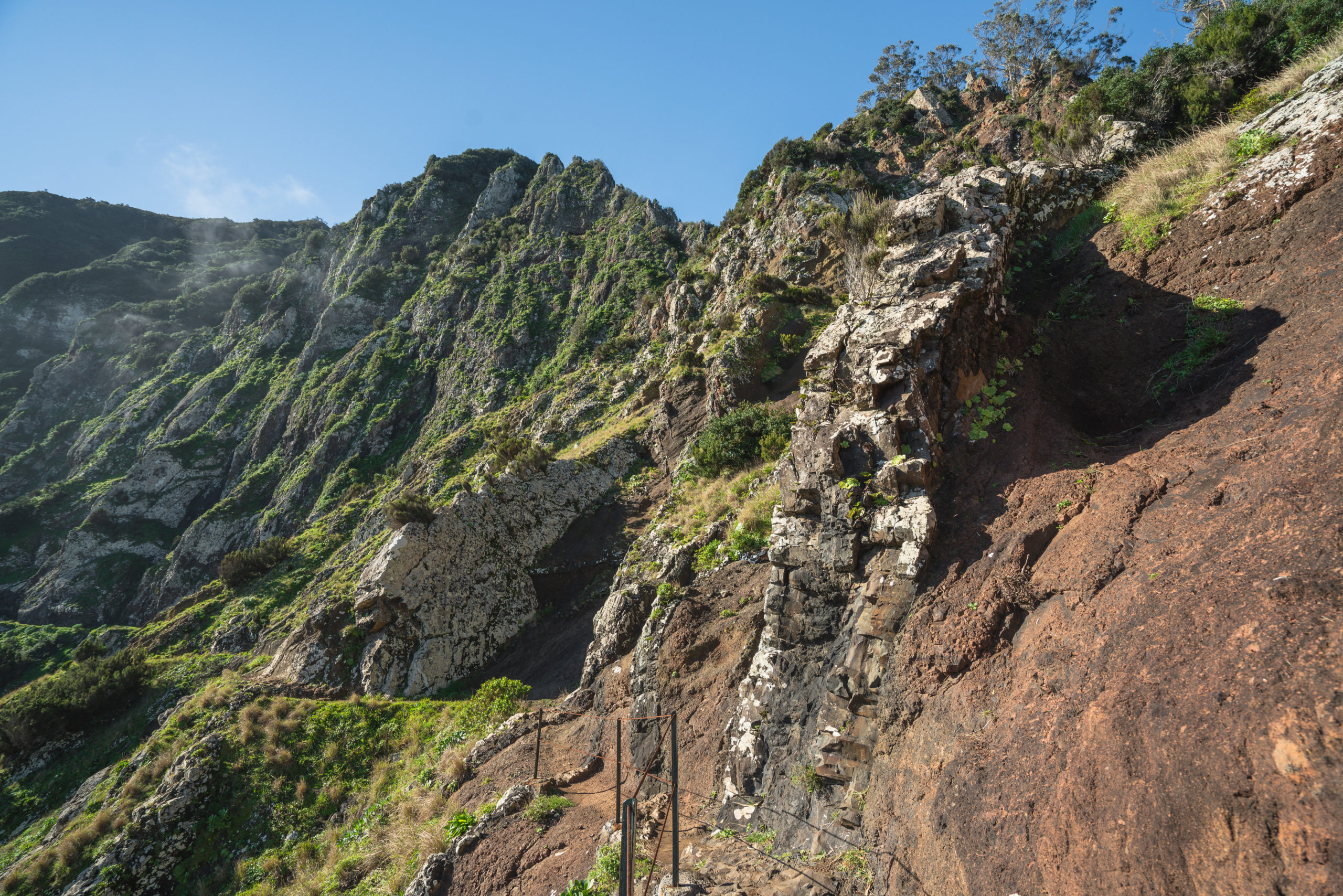
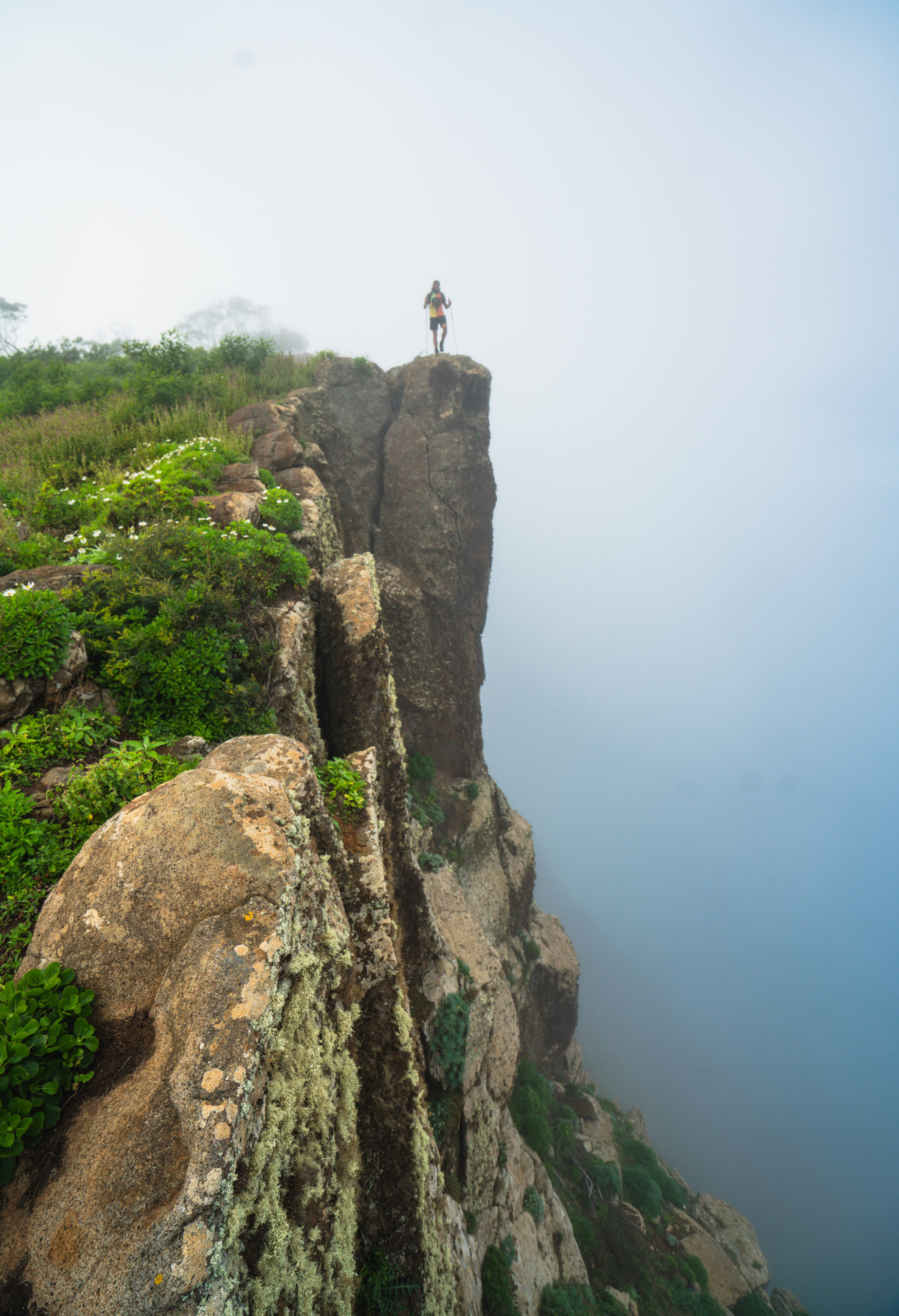
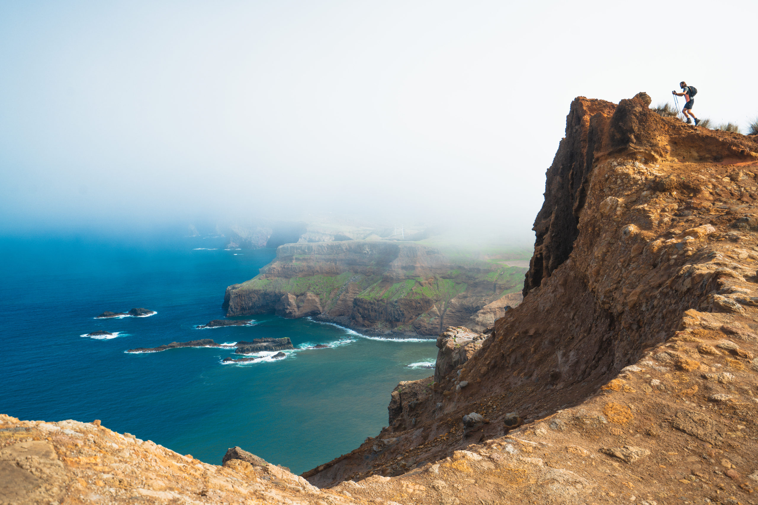
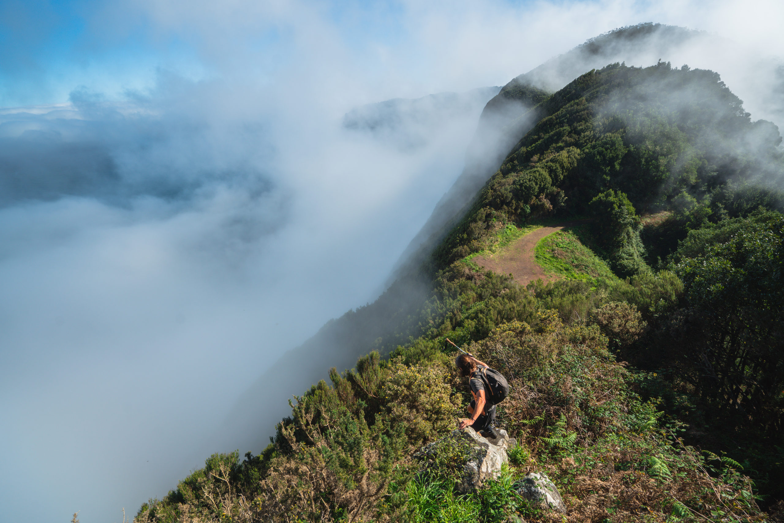
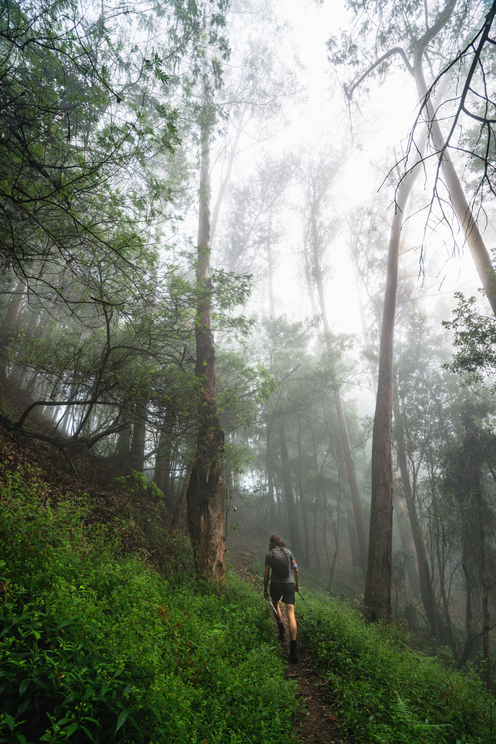
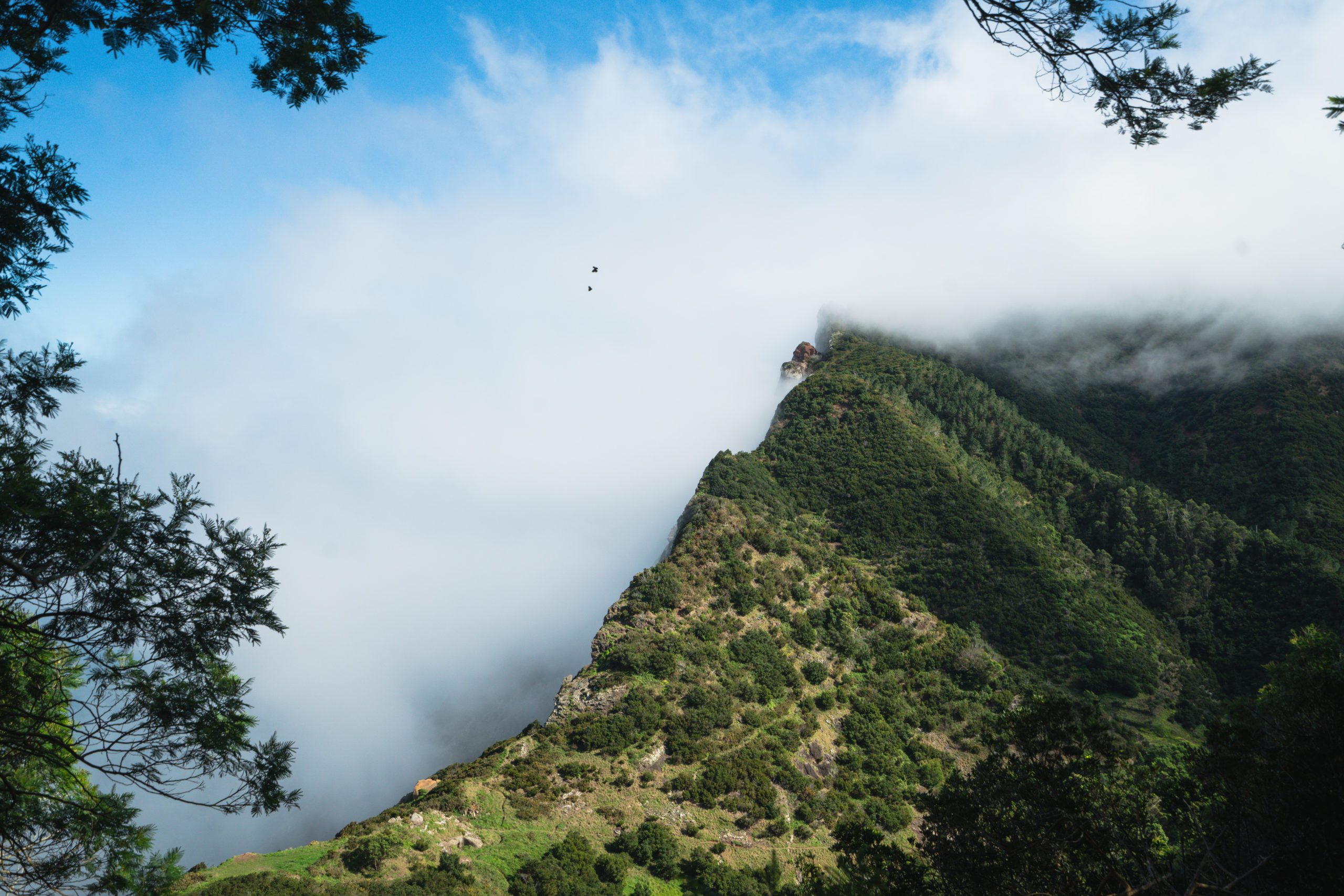
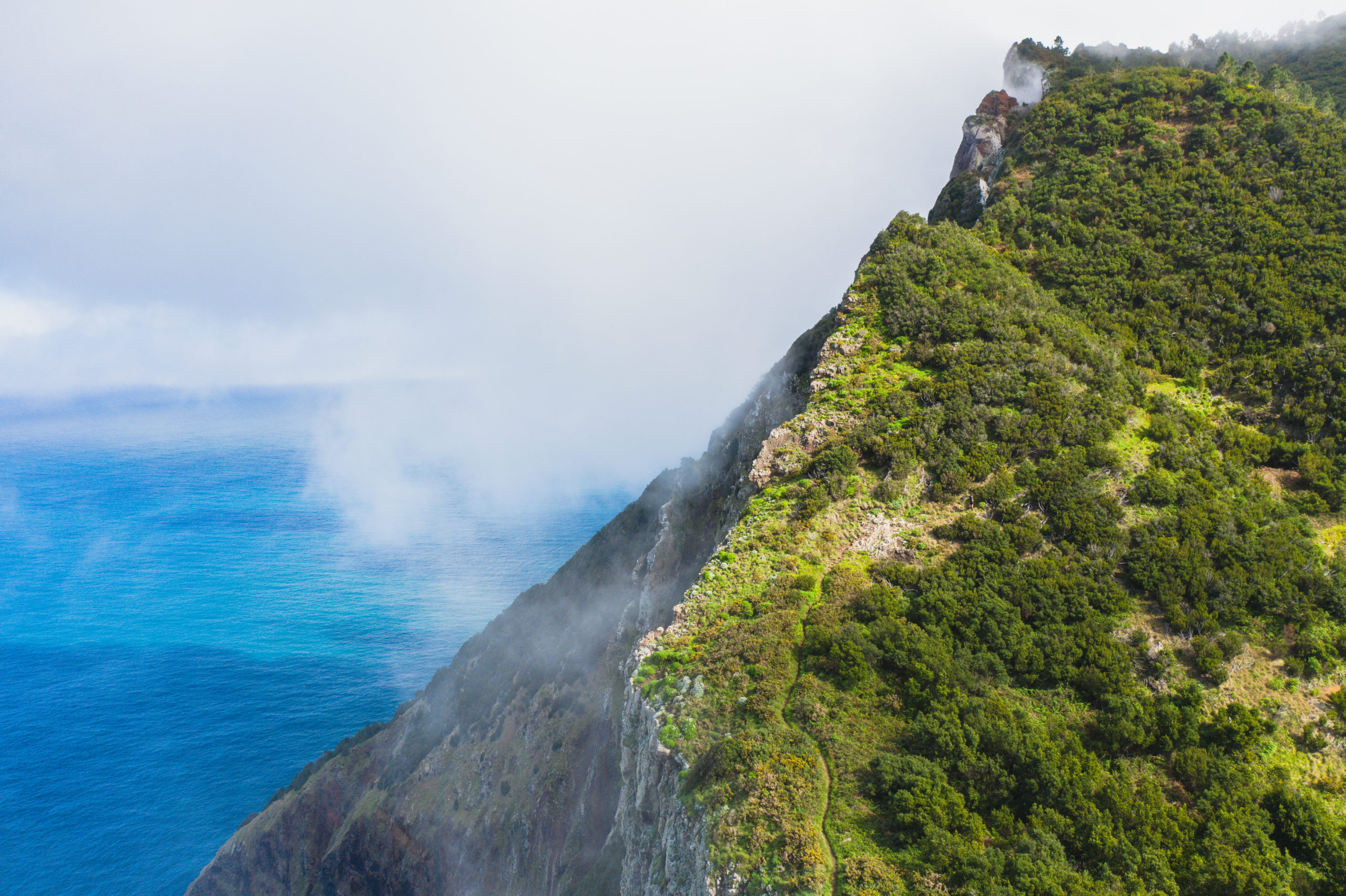
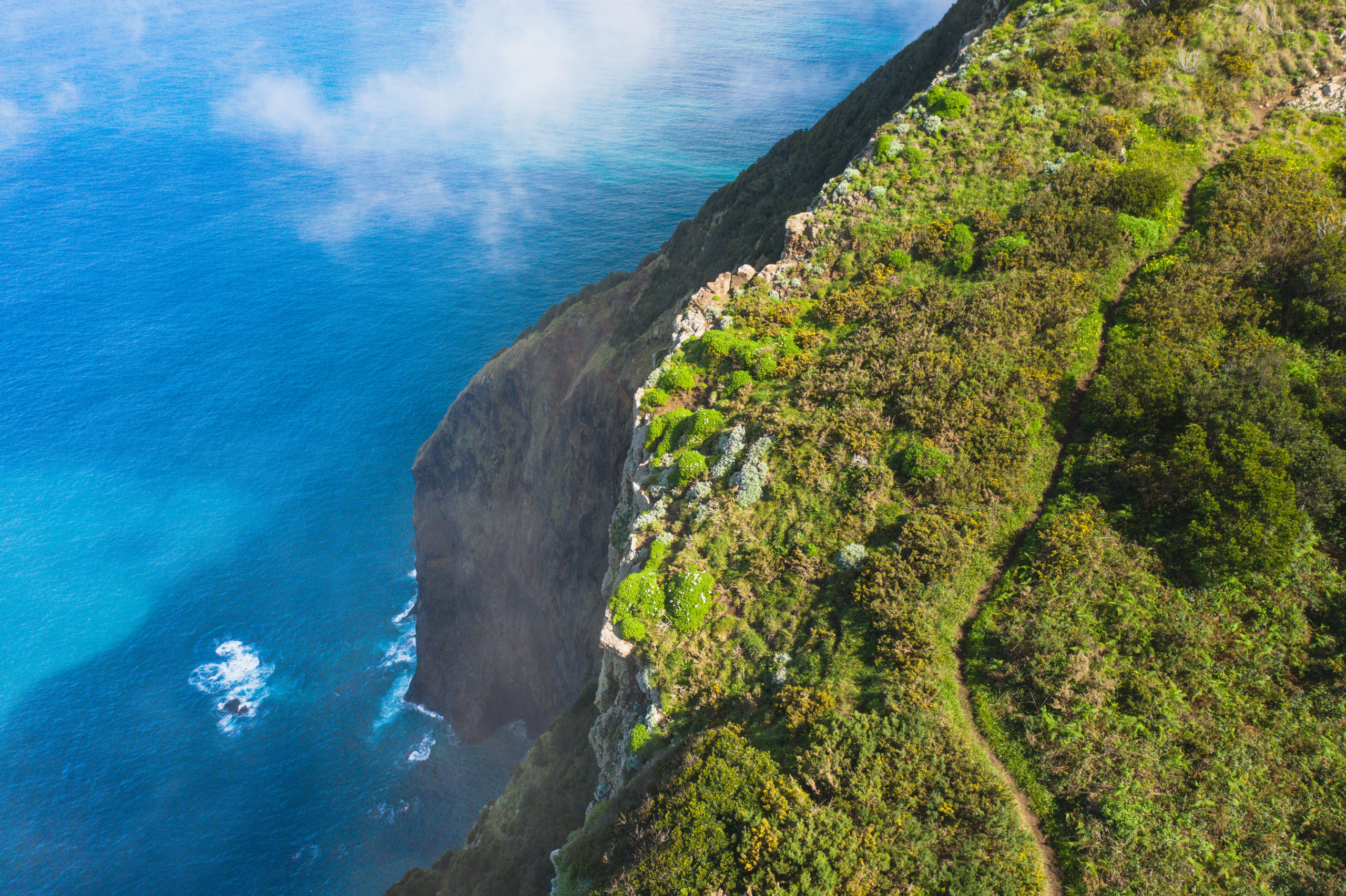
The trail now zig-zags on and off the ridge, often taking the underside of the ridge for safety on the Porto da Cruz side. Again, it is not easy to follow but is possible. I do suggest this hike only be done with a local or a guide as the route is unclear in many parts. There is some rock scrambling and bouldering required but no technical skills or gear are necessary. Often you will be completely in the depths of the forest and then pop out for a glimpse of the ocean below and the entire coastline. With the clouds floating up and down it can be truly beautiful at times.
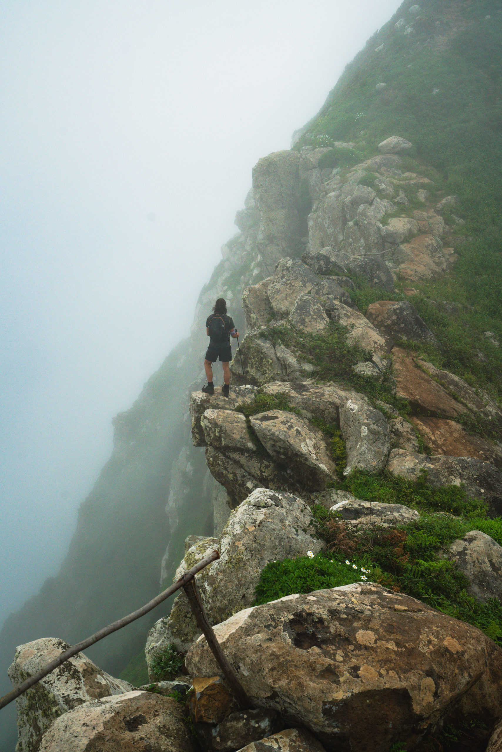
After several steep, muddy, and very slippery sections within the forest, you will reach the summit. There are no views and there is nothing to see it’s the climb up and down that are the spectacles here. Reaching the summit simply means you don’t have to keep climbing up. You now take a left and traverse back down the slope, to reach the road. This section is probably the hardest to follow.
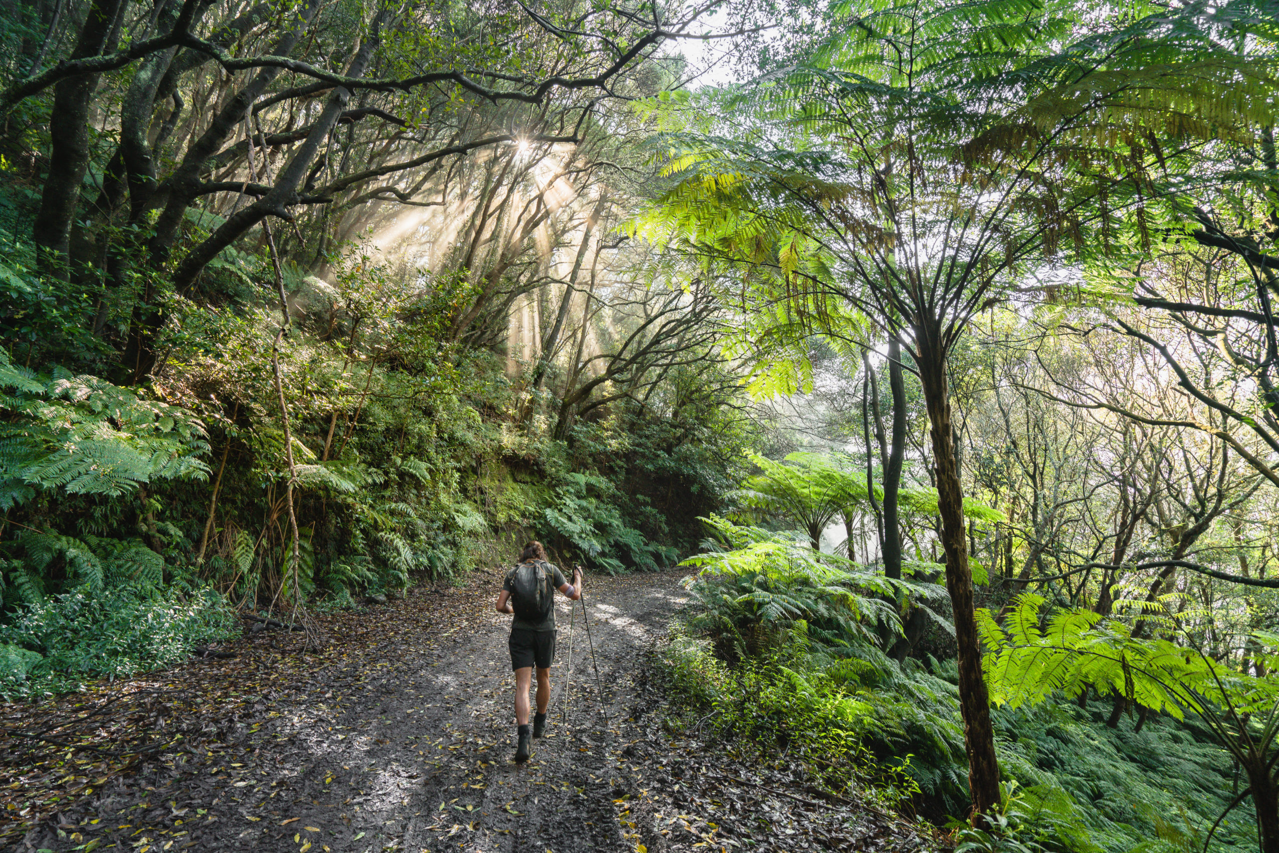
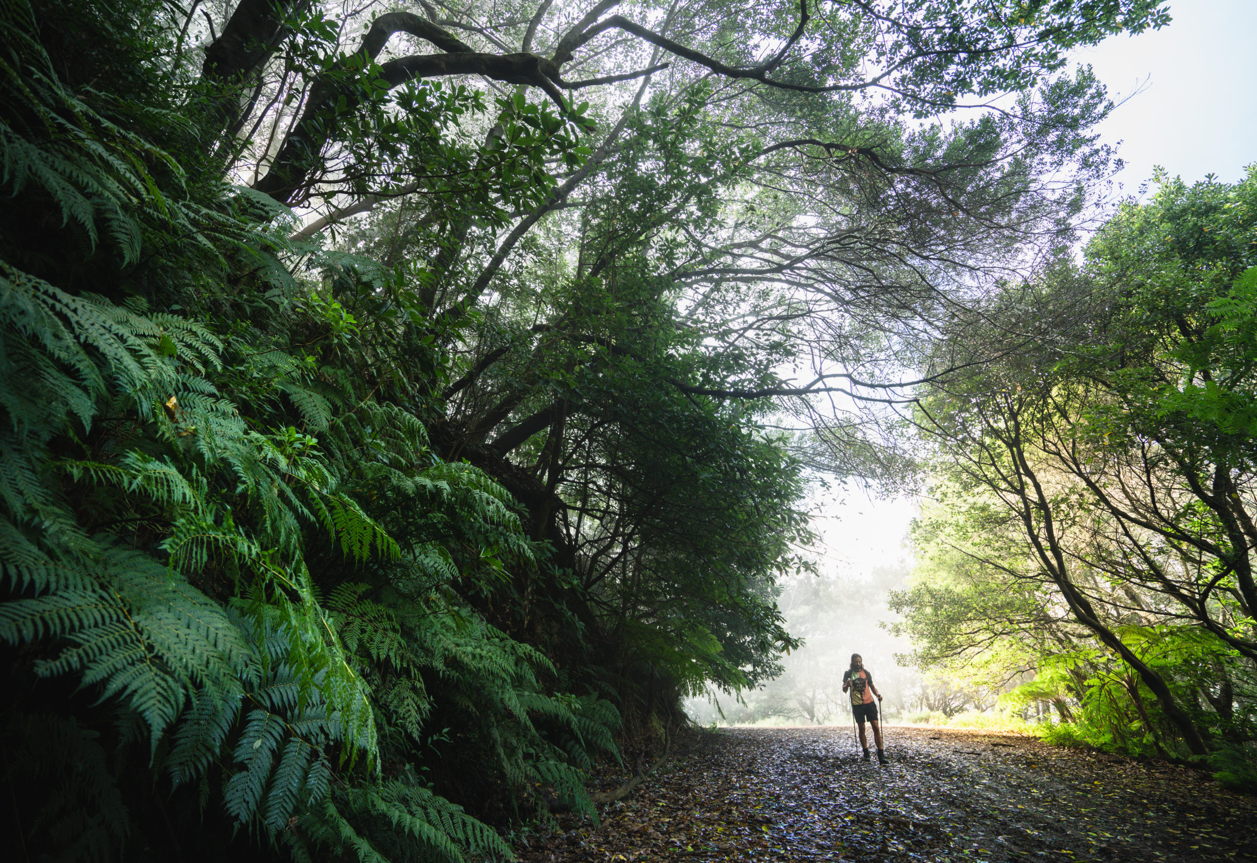
In the photo above, you will see a road. You need to take that road, continuing in the same direction. This road is a beautifully, lush route that winds you behind the ridge before you again join back up with the Boca do Risco mountain bike track.
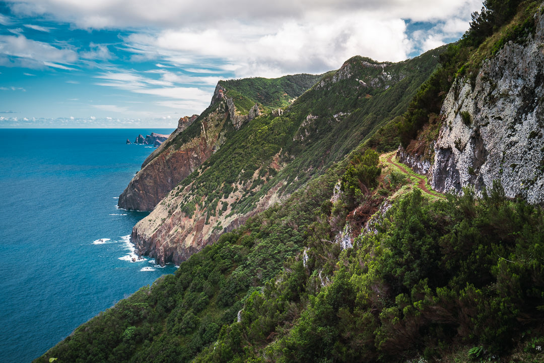
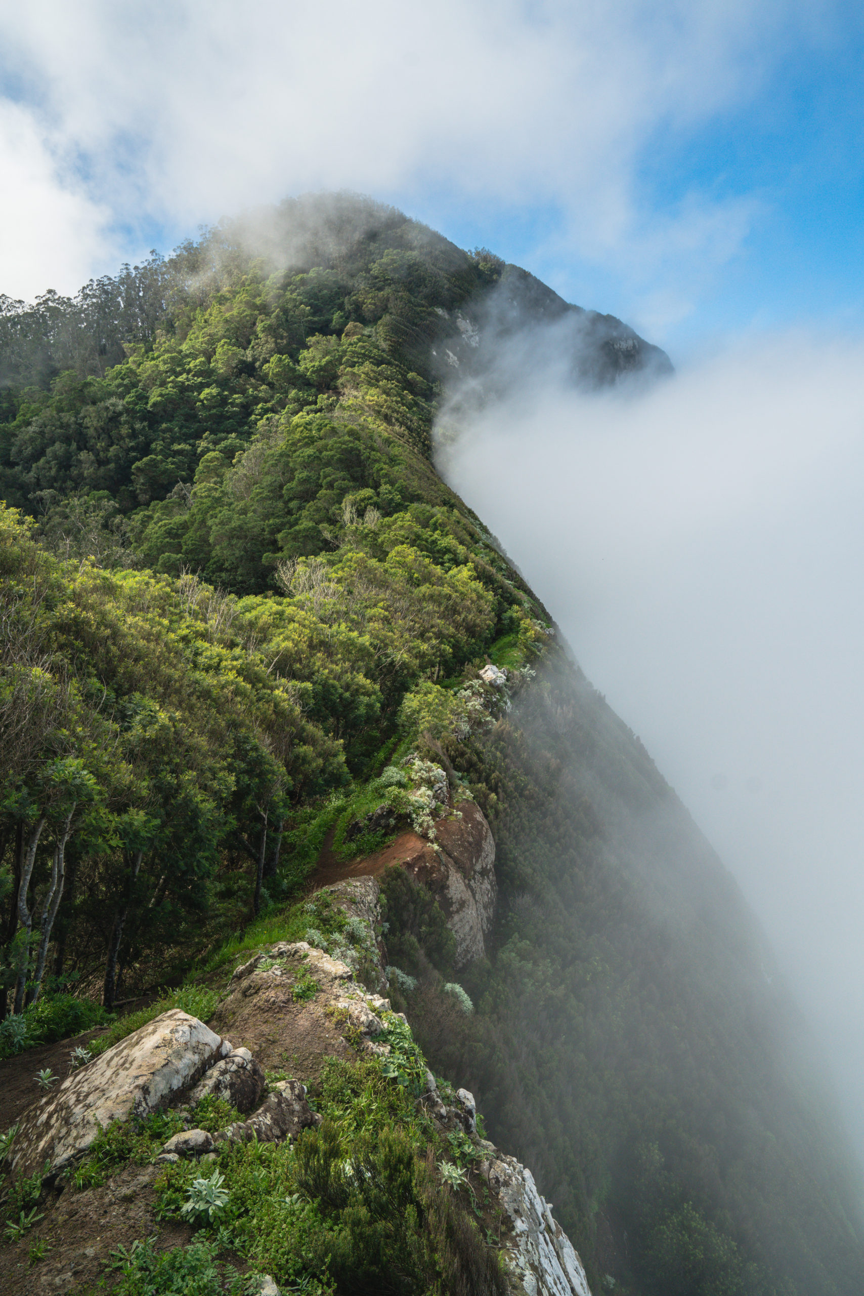
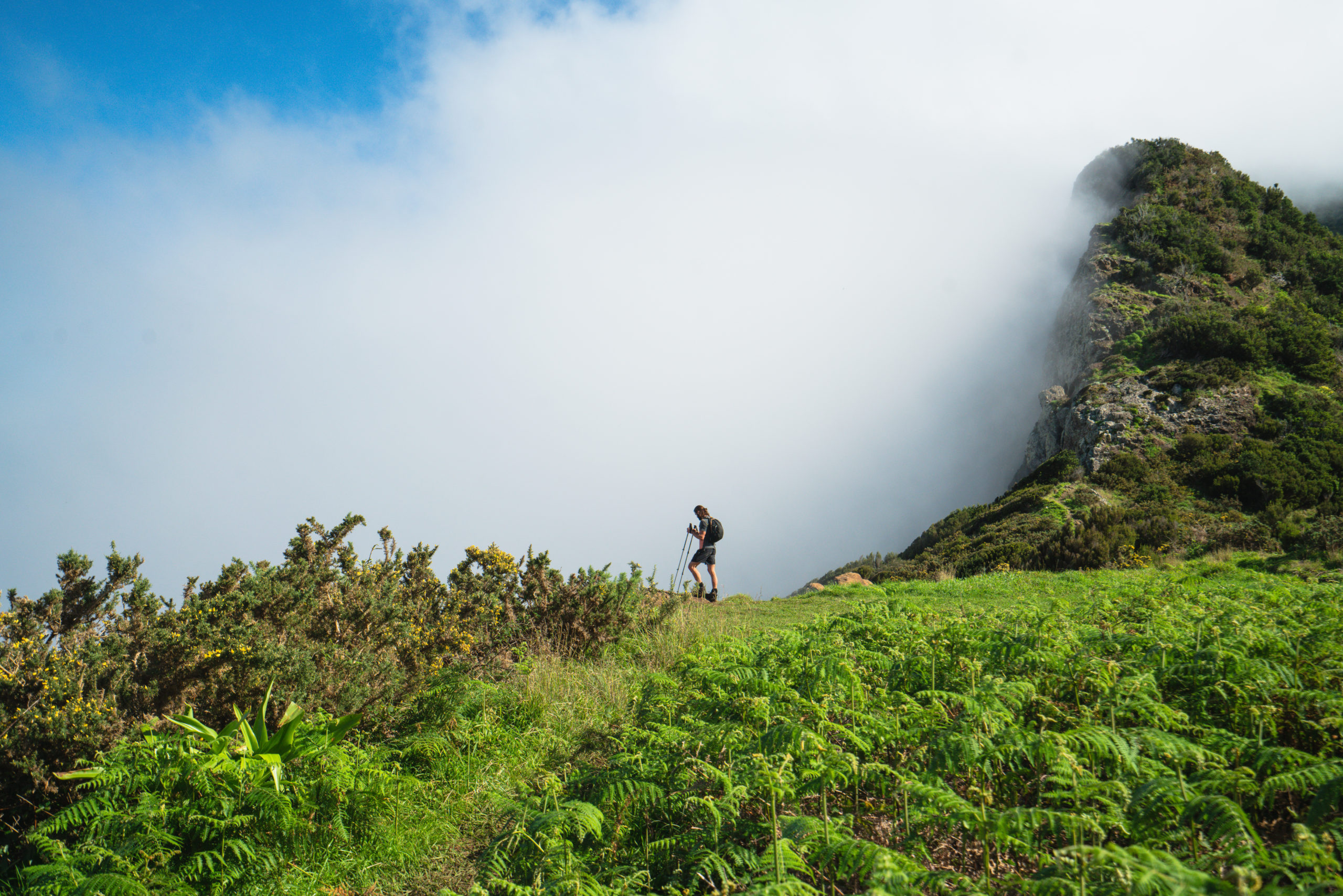
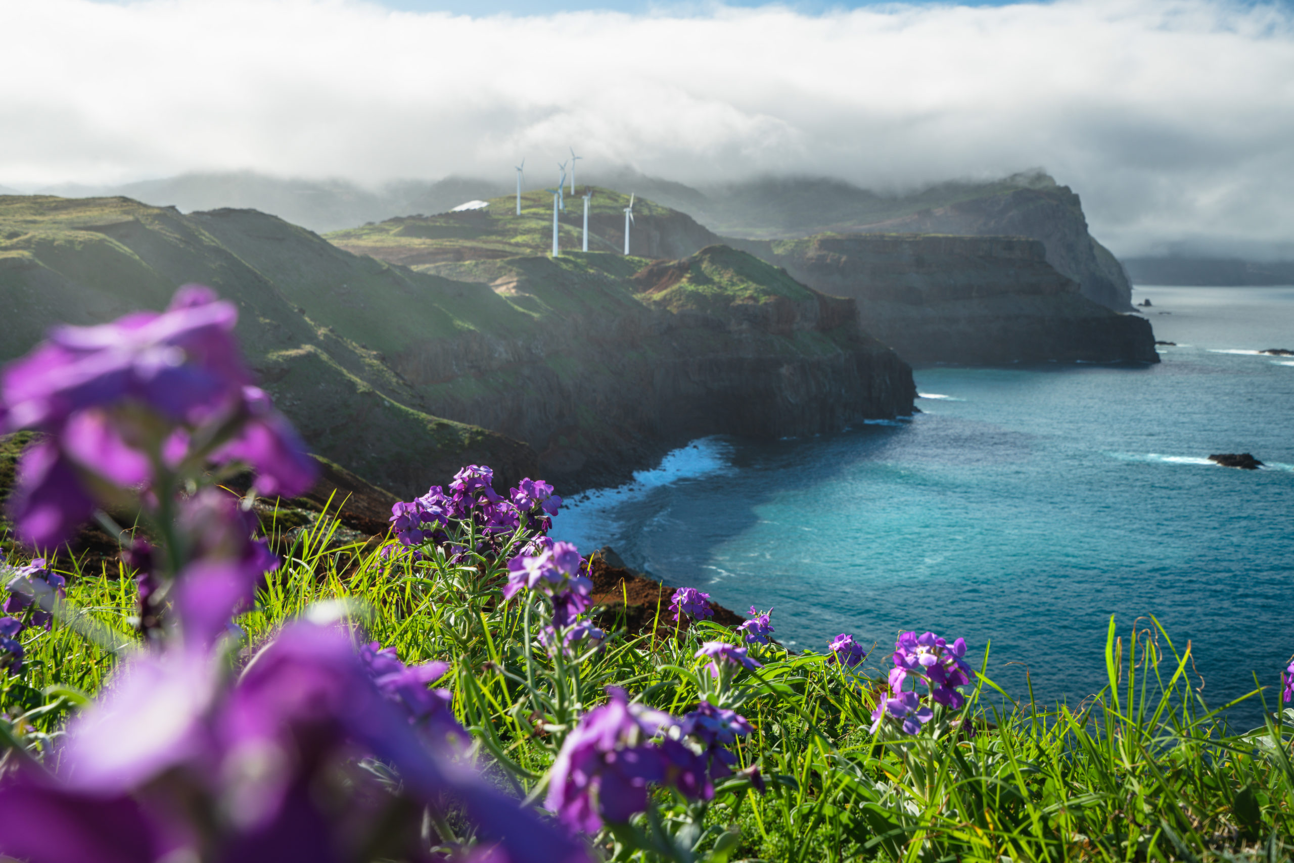
Once you emerge back to the cliff-side track, you will have some of the best views of the entire trail. Unfortunately for us, it was cloudy here. It’s common on this side of the island to be cloudy even if it is supremely clear in Funchal. We stopped here to watch the clouds flow upwards and to enjoy a lunch break after 7 kilometers.
As. you follow the narrow dirt track down the ridge, you will meet the T-junction of Levada do Caniçal and Vereda do Larano and Vereda da Boca do Risco. It’s at this point that you can circle back to where you came along the scenic Vereda do Larano or continue on up the Vereda da Boca do Risco. Of course, you could exit via Levada do Caniçal but it’s not so exciting compared to the coastal tracks. There are some nice viewpoints here to enjoy before hitting the hills in part two of this coastal route.
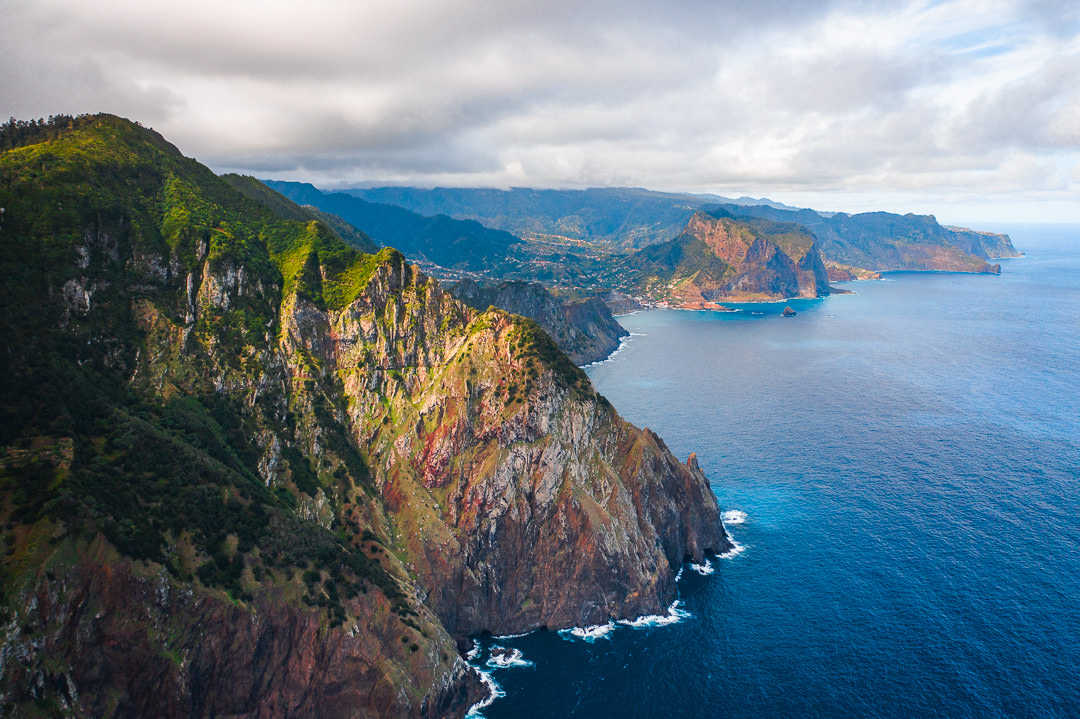
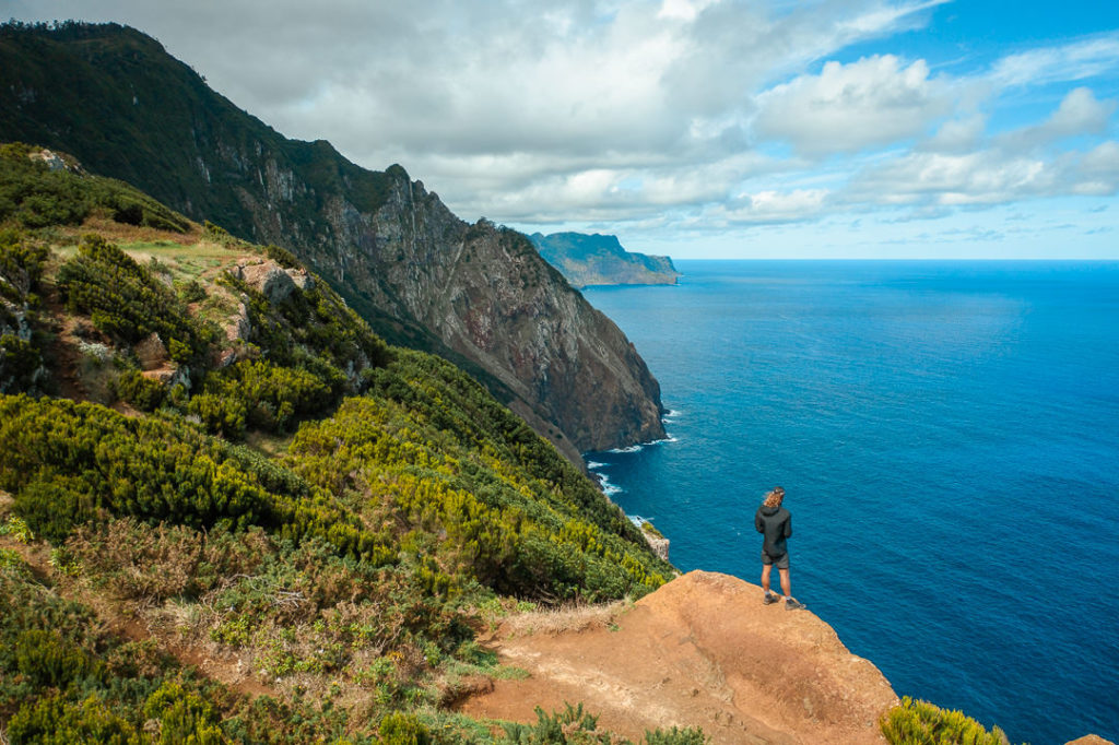
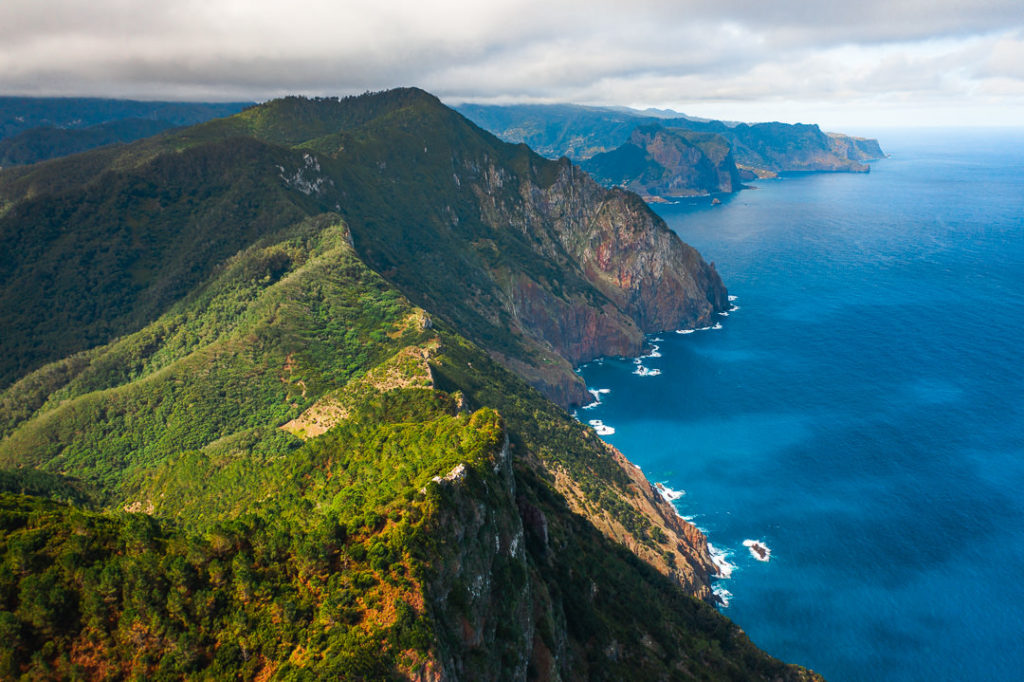
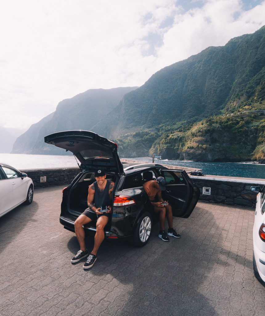
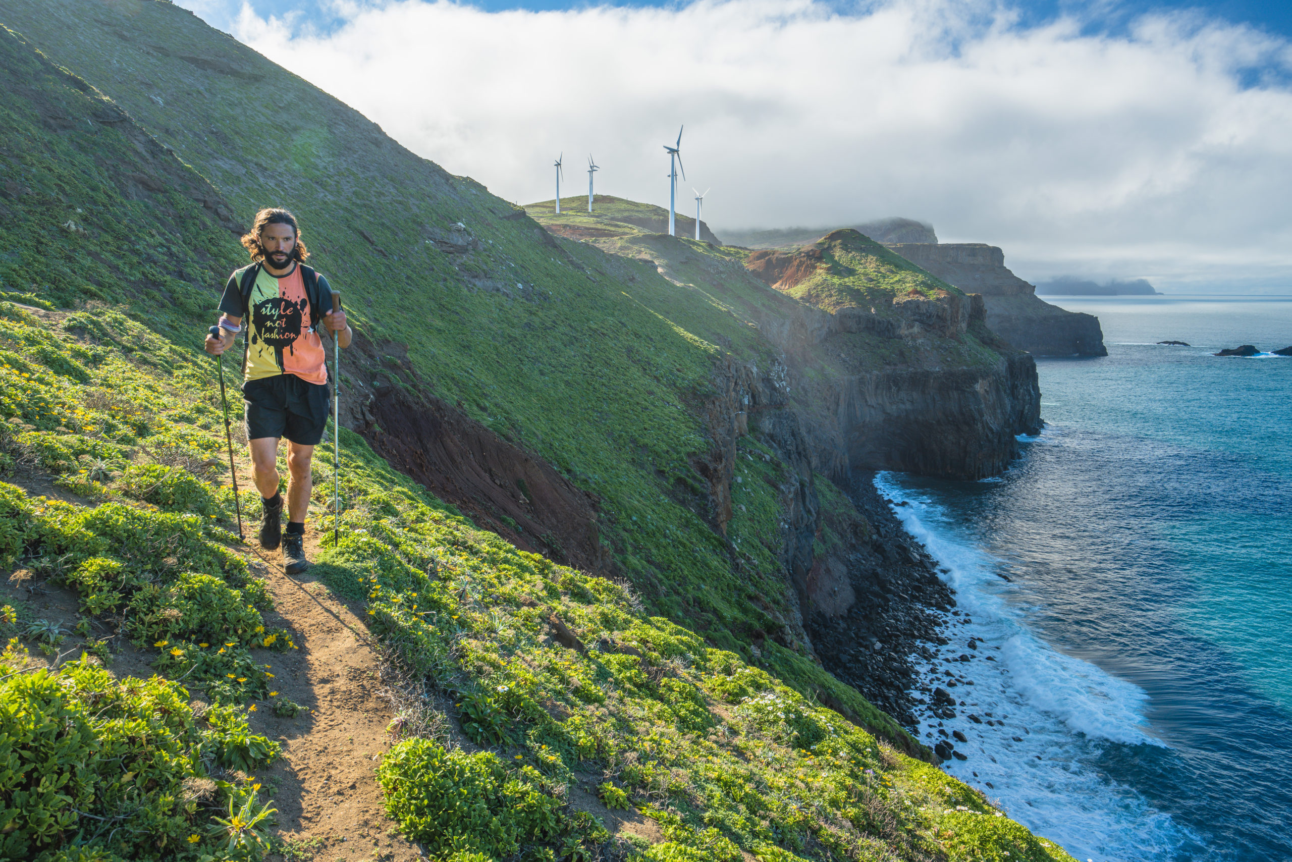
The track now gets quite hilly and we gained a few hundred vertical meters over the next couple of kilometers. While the route is near the cliff edge, it’s always a few meters back from the drop so there’s never really a risk of falling unless you go too close for a view or a photo. I flew the drone here and caught some nice shots when the clouds momentarily cleared. The contrast of the green grass in the winter against the vibrant blue water is beautiful.
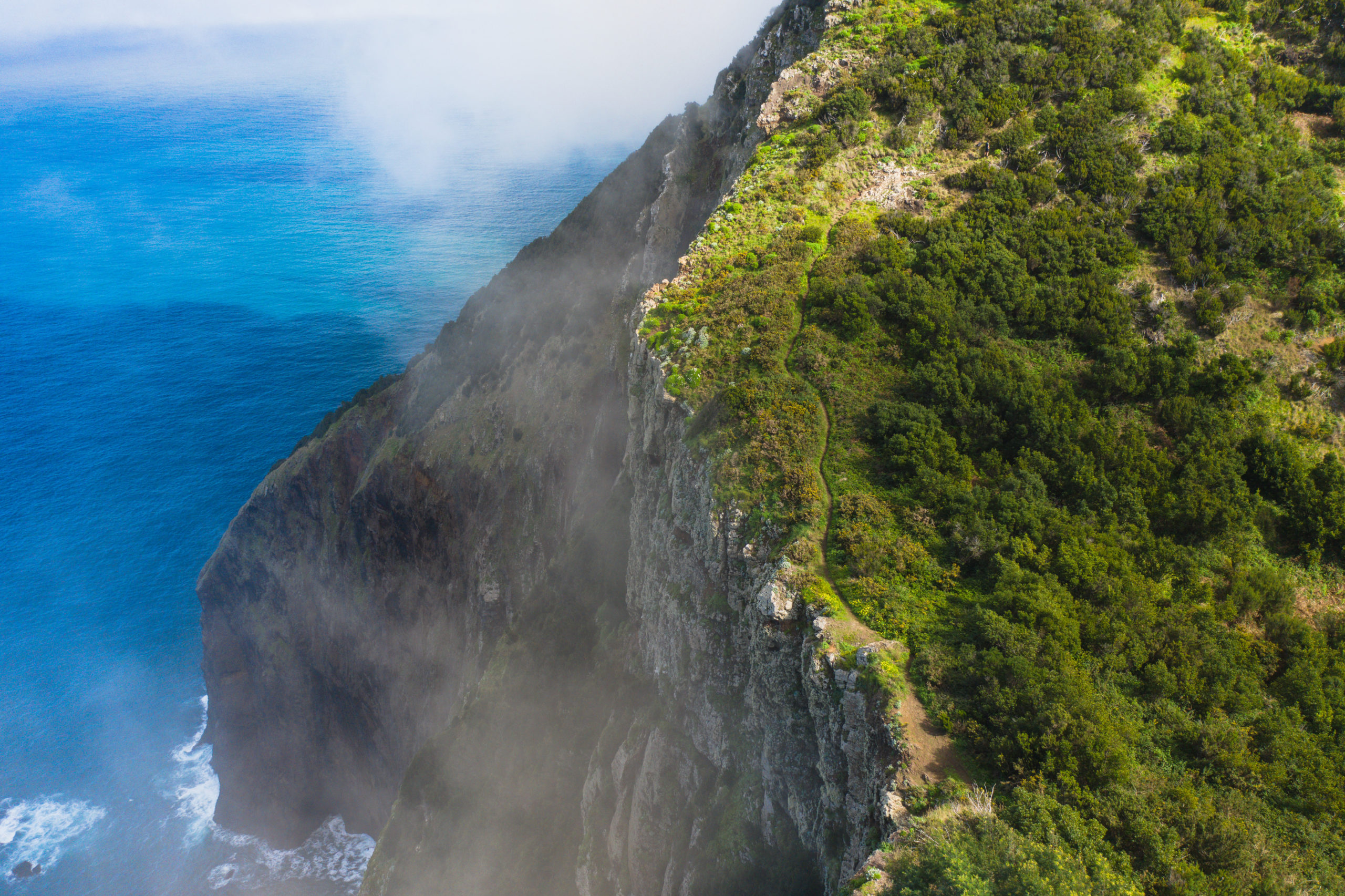
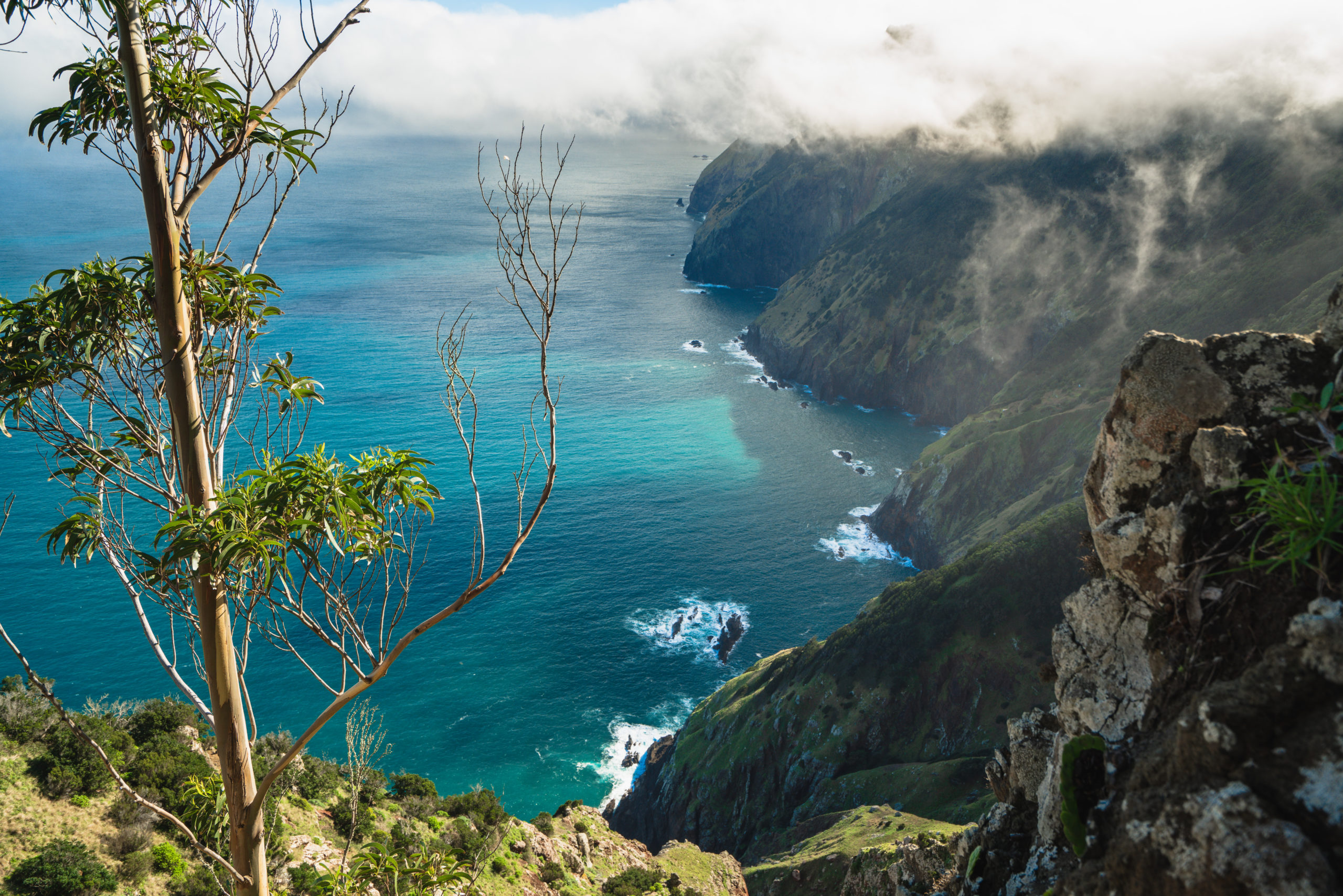
We kept following the trail via the Maps.me app as close to the coast as possible but often it dipped in away from the coast for a few hundred meters before coming back. It was cloudy in this section for us so we didn’t enjoy too many views but I can tell you, it’s similar to the photos above so on a clear day it will be prime through here. You will encounter some unique rock formations over the edge of the cliff and there are some pretty dense forests that pop up out of nowhere. It was a diverse section of trail that we really enjoyed despite the lack of visibility.
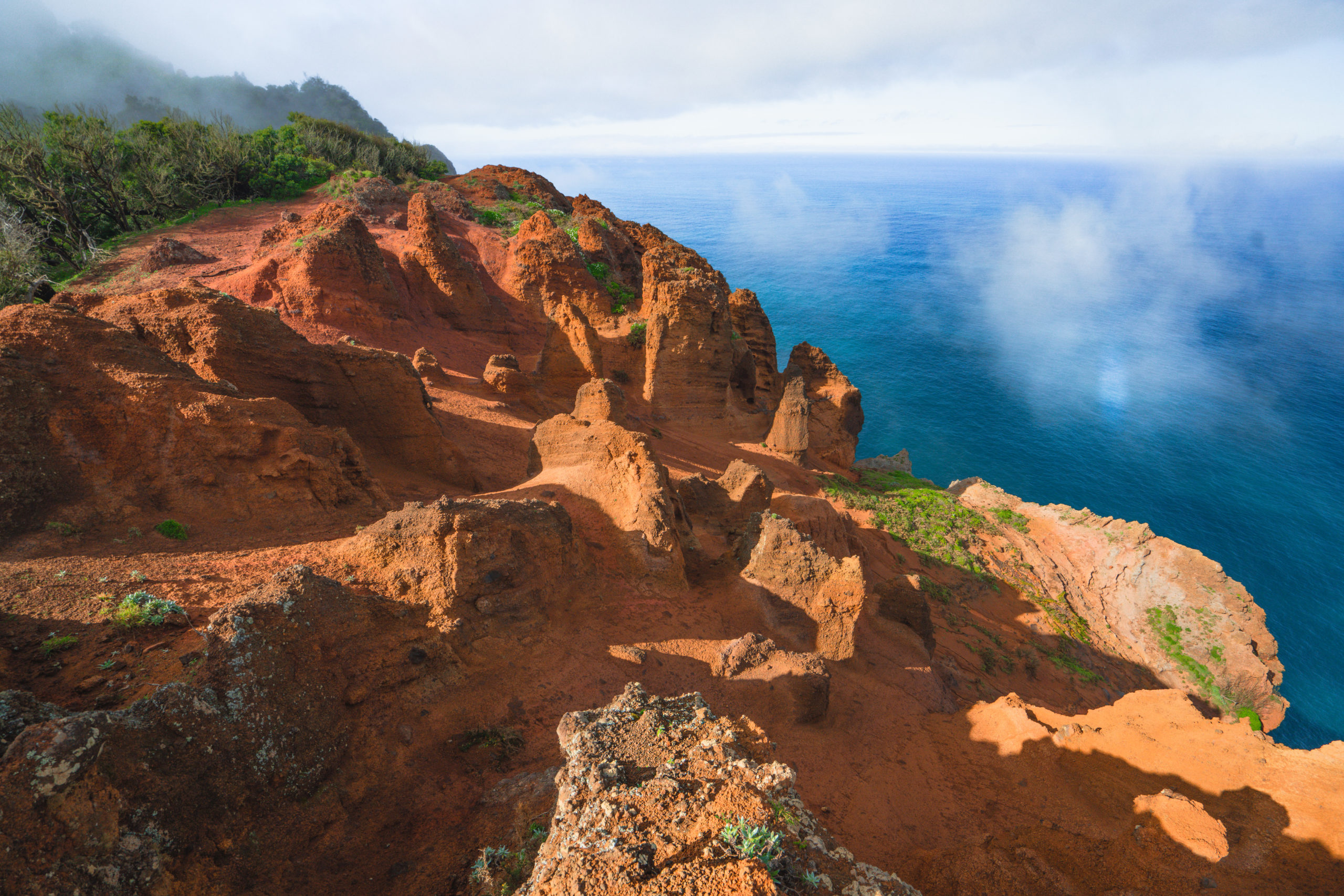
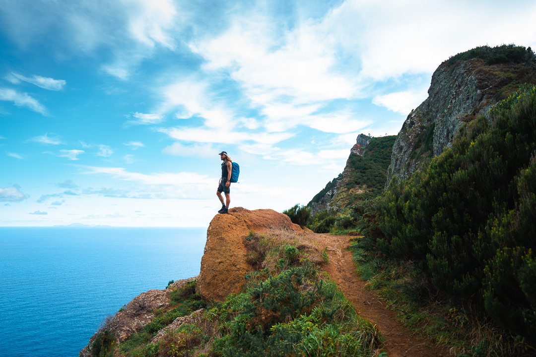
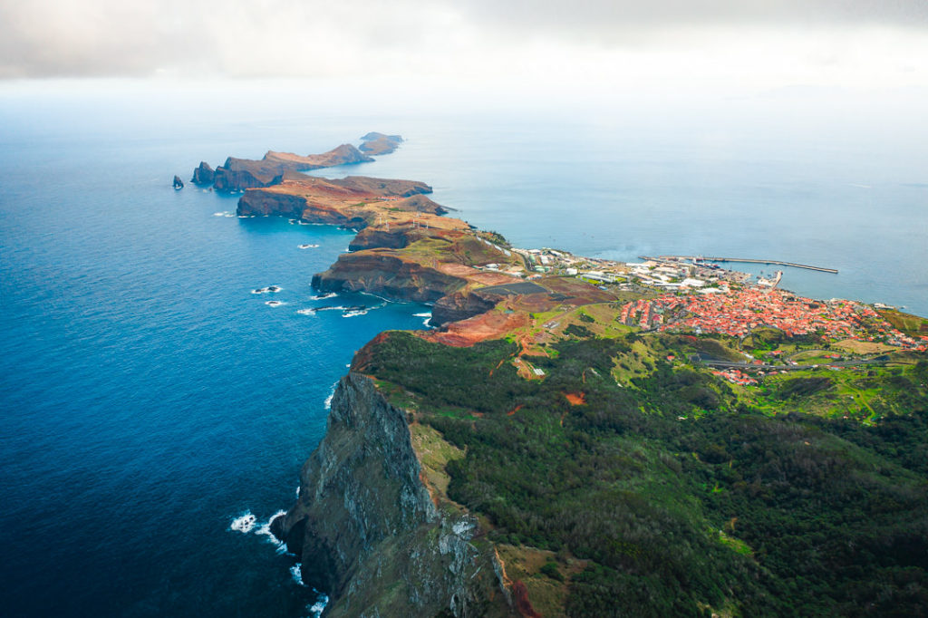
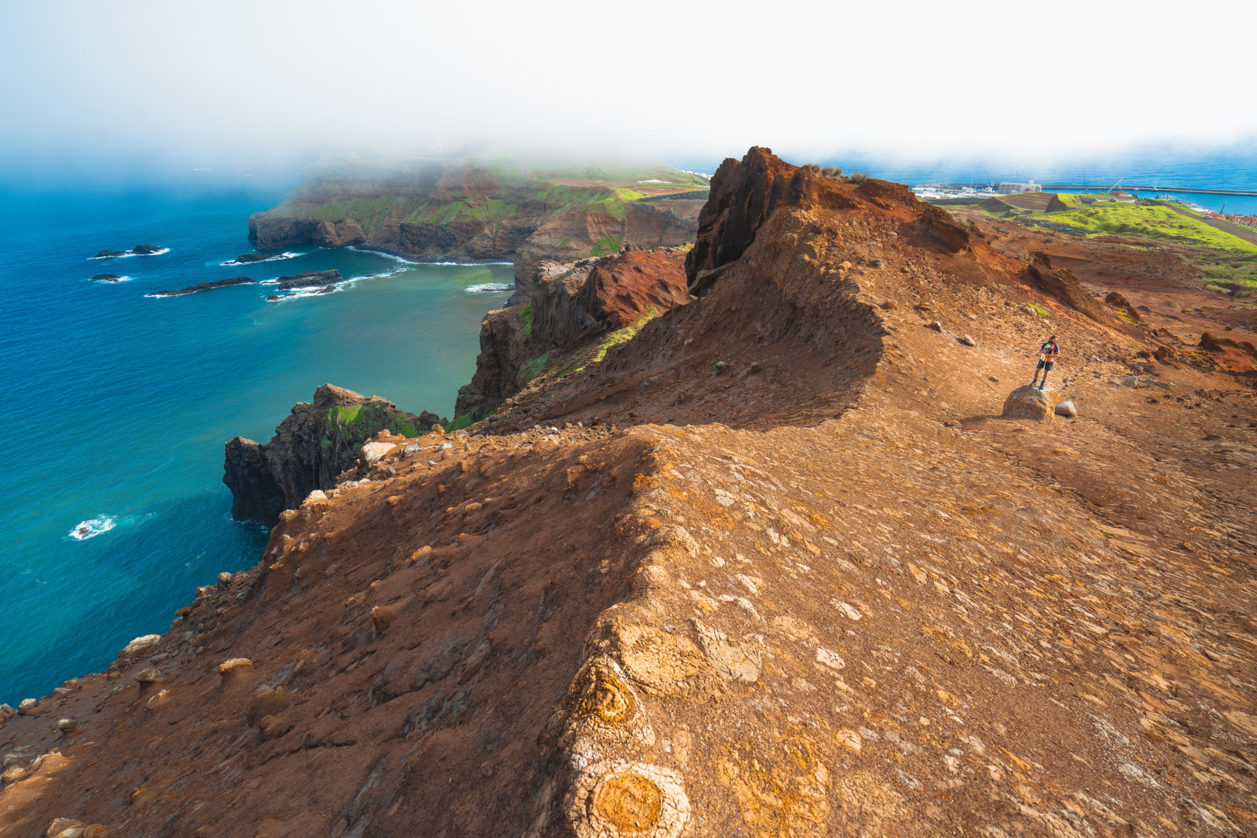
One of the highlights of this trail is the red-rock area that looks a little bit like you’ve left Madeira and entered another planet. Vibrant reds contrast heavily against the rich blue of the ocean as cone-like rock formations spurt out of the ground through years of erosion.
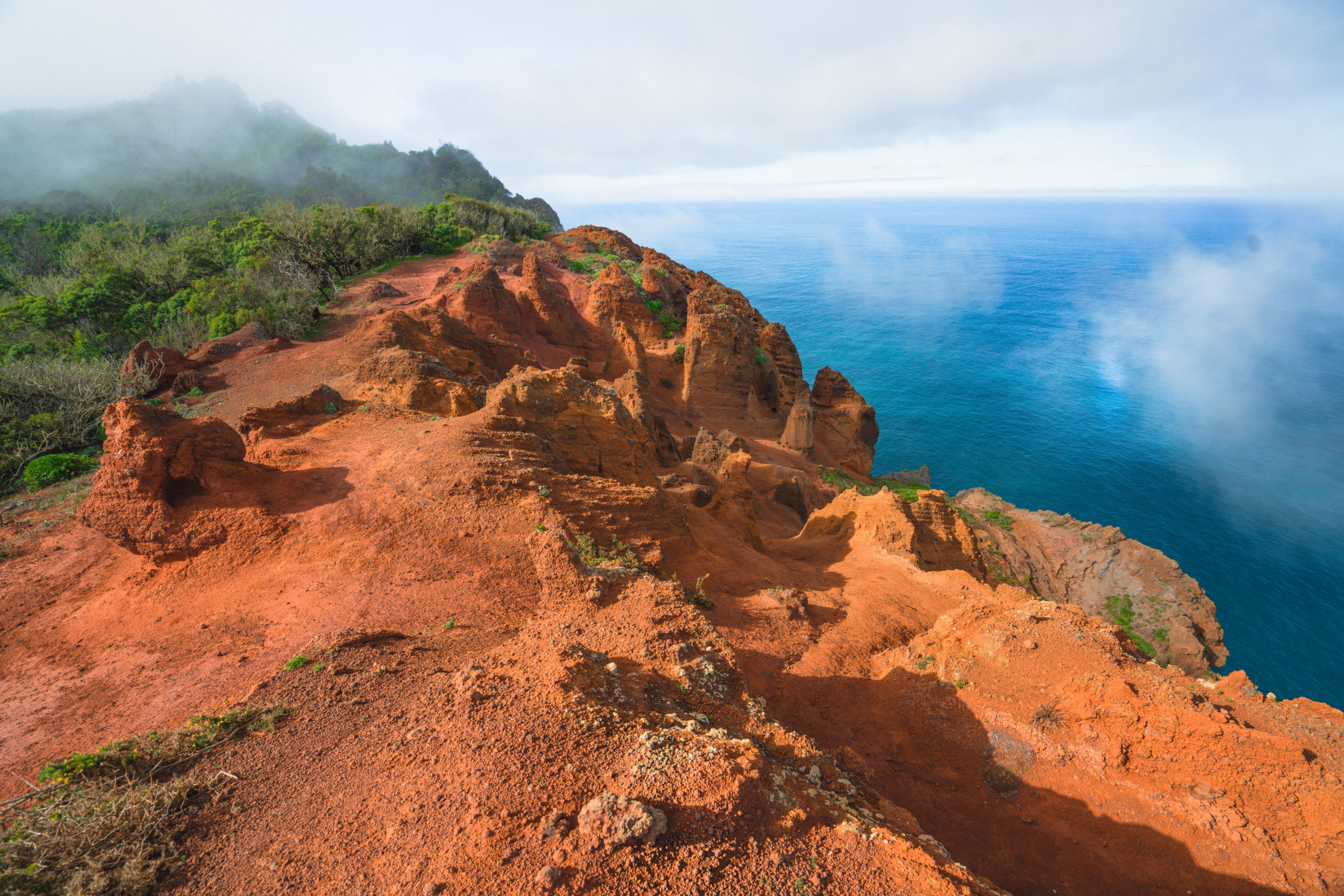
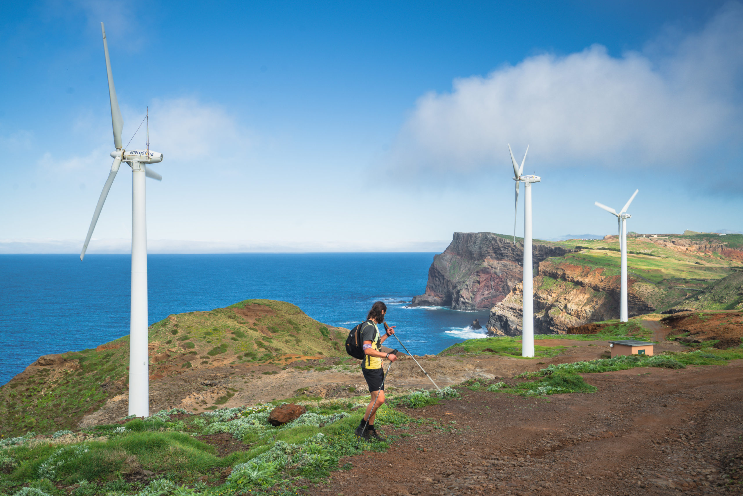
The outer space vibes continue as you near the solar panel and wind turbine region of Caniçal. Strange designs on the rocks here and a gravel surface had me forgetting we were on Madeira and almost reminded me of Porto Santo Island. It was dry and felt like we were in the middle of a desert, not on a tropical island. At this point, you should probably veer off to the right and end at the parking lot. However, we kept going along the coast to try and reach Ponta do Rosto.
The fence didn’t go quite all the way to the coast with a 1-meter gap almost suggesting the trail (that showed up on Maps.me) was actually allowed. Often in times like this it is a go for it and apologize later if you are in the wrong situation. I imagine they don’t want the public near the solar panels or wind turbines but we hiked through without touching a thing so no harm was done. I’ll leave that to your discretion. We followed along the coast and through the wind turbines, finally finding an old coastal track that was pretty degraded but led us up to the road with less than 1 kilometer left before making it to Ponta do Rosto. This was a beautiful stretch of coastline in the late afternoon sun and it was nice to only walk on a man-made road for the final stretch.
You can have a second car here, get picked up, or in our case call an Uber. It was 18 Euros for the ride back to the Porto da Cruz side of Vereda do Larano so not too bad when split between two people as a fee for an epic route. It beats doing an out-and-back or a loop route along Vereda do Larano in my opinion but that will be up to you.
I hope you enjoyed this guide to the eastern coastal tracks on the island, specifically Espigão Amarelo. Stay safe and happing hiking.
WONDERING ABOUT WHERE TO STAY ON MADEIRA?
Throughout my six months on Madeira Island, I stayed in multiple accommodations. My favorite regions to stay in were Funchal and Canico de Baixo. I’ve created several guides to help you find the right region for you and a great hotel or apartment.
- The ultimate guide: WHERE TO STAY ON MADEIRA: WHICH REGION IS RIGHT FOR YOU?
- If you want luxury: BEST 5-STAR LUXURY HOTELS ON MADEIRA ISLAND
- To feel at home: TOP 10 BOUTIQUE HOTELS ON MADEIRA ISLAND
- If you want to base in Funchal: WHERE TO STAY IN FUNCHAL: 15 TOP-RATED HOTELS
HAVE YOU READ MY OTHER MADEIRA BLOGS?
I spent six months exploring Madeira and the nearby island of Porto Santo. These are some of my most popular guides about the region that you may be interested in.
- My favorite hikes: 65 AWESOME HIKES ON MADEIRA
- My favorite levada walks: 25 BEAUTIFUL LEVADA WALKS ON MADEIRA
- The best waterfalls on the island: 25 EPIC WATERFALLS ON MADEIRA
- Guide to the best Accommodation: WHERE TO STAY ON MADEIRA
- Hardest hike: THE MADEIRA ISLAND ULTRA TRAIL IN 4 DAYS (115KM)
- Longest hike: CAMINHO REAL 23: MADEIRA’S ROYAL PATH (180KM)
Stephanie van der Beek
Tuesday 2nd of February 2021
What an amazing article and truly beautiful pictures. Compliments for this blog and information you share with us.
Jackson
Thursday 4th of February 2021
Obrigado!