
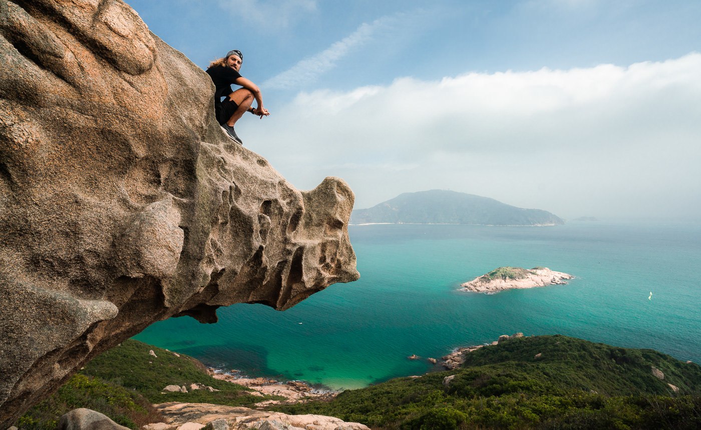
The Rhino Rock hike takes you to one of the most incredible rock formations in Hong Kong, bearing an uncanny resemblance to a Rhinoceros. It’s a very short hiking trail in Stanley that is less than 1kilometers each way. With stunning views of the coast, this is a great mini-adventure for a sunny day! The Rhino Rock hiking trail is also known as Che Pau Teng.
RHINO ROCK HIKE COMPLETE GUIDE
In this blog post, I’ll share everything you need to know about the Rhino Rock Hike including where it is, how to get there, and when it’s best to visit.
RHINO ROCK TRAIL DETAILS
- Hike Distance: The total distance of the hike is just two-kilometers in total.
- Hike Duration: While getting out and back from the Rhino Rock will take just 30-minutes round-trip, it’s fun to hang out at the rock for at least 20-minutes to take some photos and soak in the view.
- Hike Difficulty: This is quite an easy hike, although you need to navigate some small boulders. The trail is more or less well-defined although I got a bit lost as the ribbons go in many directions. Overall it’s a tame adventure but not necessarily straightforward.
- Hike Incline: My total hike incline was 185m but some of that was probably my climbing and exploring. Expect very minimal uphill on this short trail.
TOP 3 PLACES TO STAY IN HONG KONG
- Best Value Hotel: Metropark Hotel Causeway Bay – 4-star hotel for less than $100
- Best Value Luxury Hotel: Hotel ICON – $150 for a 5-star hotel with an epic pool
- Best Hiking/Adventure Base: Hotel Stage – Located in Kowloon and right next to lots of epic hikes.
Check out my full guide here: BEST AREAS TO STAY HONG KONG
HOW TO GET TO RHINO ROCK TRAILHEAD
The Rhino Rock Trail begins at the Stanley Fort bus stop. You can put that into Google Maps and take the car or public transport there directly. From the city you have two options:
- Catch the train to Sai Wan Ho station and then catch the number 14 bus
- Catch the number 6A bus directly from Central Exchange Square.
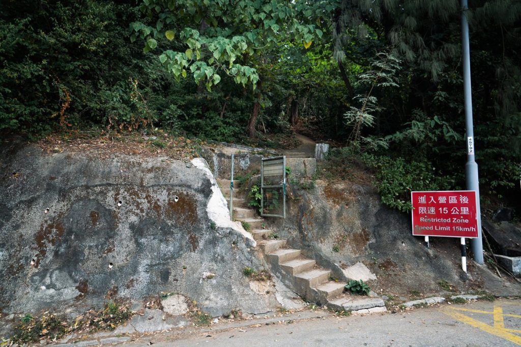
Both options take you to the same Stanley Fort Bus stop, which is the last stop on the route. Once you get off the bus you will see the stairs (pictured below) next to the security entrance to the fort.
MY EXPERIENCE ON THE RHINO ROCK TRAIL IN STANLEY, HONG KONG
If you are staying in Central, it will be a bit of a journey to get down to Stanley. It can take 60-90 minutes to reach the trailhead. I suggest pairing this short adventure with another nearby hike called Violet Hill (Twin Peaks). It’s much longer and will give you a full day of hiking as the Rhino Rock trail will hardly tire you out.
So, the bus drops you off at the Stanley Fort bus stop. As soon as you get off the bus, the army security will be eyeing you off but you can quickly shuffle across the road to the stairway entrance, which is right next to the security booth at their main entrance gate. Don’t be alarmed by the rifles, it is a legal trail despite it’s proximity to the Stanley Fort base. I even flew my drone (not over there base but Rhino Rock is still within a few hundred meters of the base) and there was no commotion.
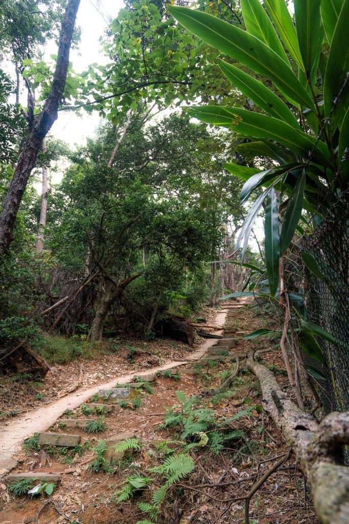
The hike is pretty much a 1-kilometer of the trail until you reach Rhino Rock. It begins with 150m of straight incline. That means despite the tiny distance of this hike, you will still get a quick burn in the legs as you power through the only tough section of trail.
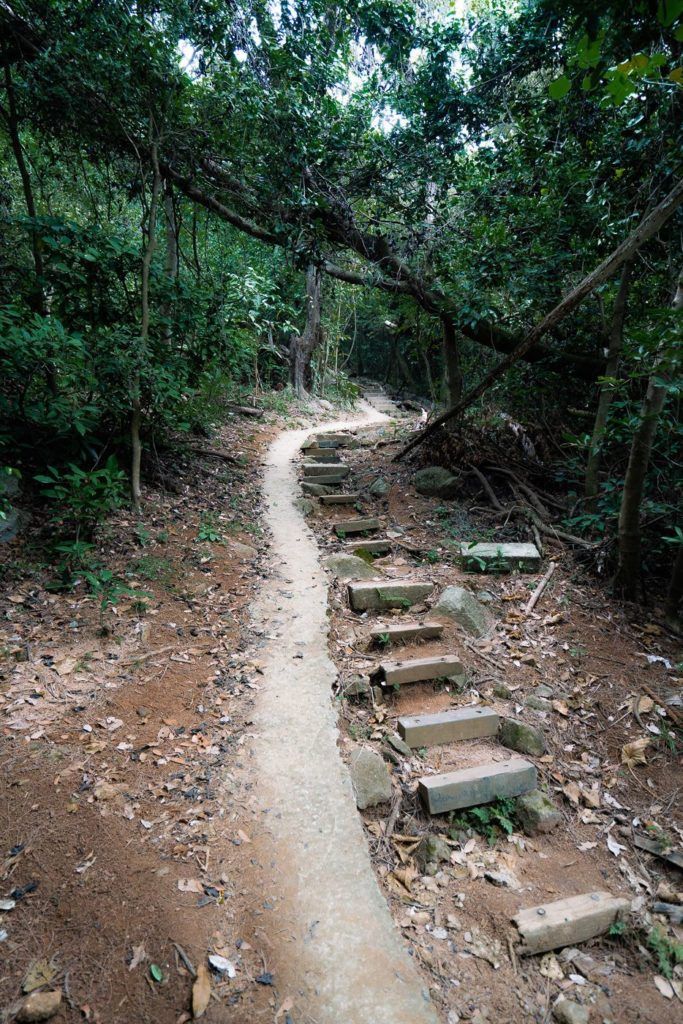
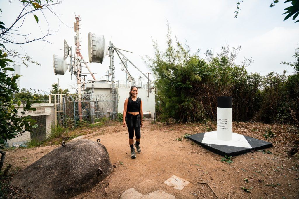
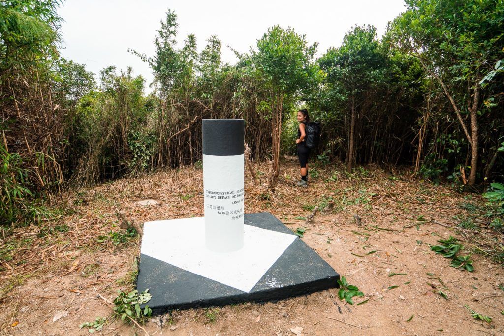
At this point, you cannot get lost, just follow the path. However, after about 600m, you will reach a trigonometric marker (basically a white pillar/pole). You will need to divert off the path here and head into the bushes on your right-hand side.
The gap into the bushes is marked with ribbons and I have taken a picture below to show you where to go. Most of these white poles are at summits and great views over Hong Kong but this one offers no such views.
MY 4 FAVORITE HONG KONG TOURS
- Victoria Peak Tram & Sky Terrace: If you visit Hong Kong, you have to visit Victoria Peak!
- Aqua Luna Victoria Harbor Cruise: Sail Hong Kong’s Victoria Harbour on a traditional Chinese wooden junk boat.
- Hong Kong Disneyland Park: An awesome experience for all ages!
- M+ Museum Ticket: Most popular museum in Hong Kong!
Click the orange button below to view all of the top-rated tours on Klook
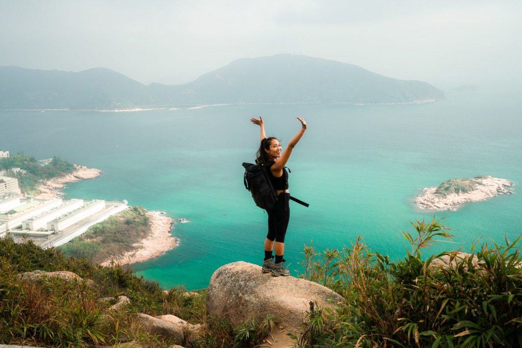
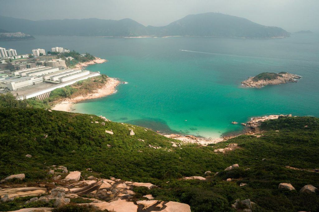
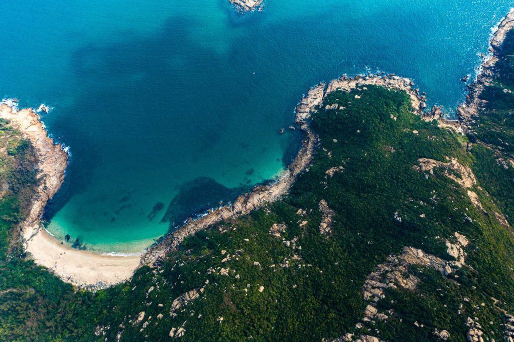
Only a couple of minutes later, you will emerge through the bushes and get your first view of the beautiful coastline. This is what it’s all about. Hong Kong has some seriously ‘tropical-vibes’ beaches. Wait till you see the turquoise color of this water!
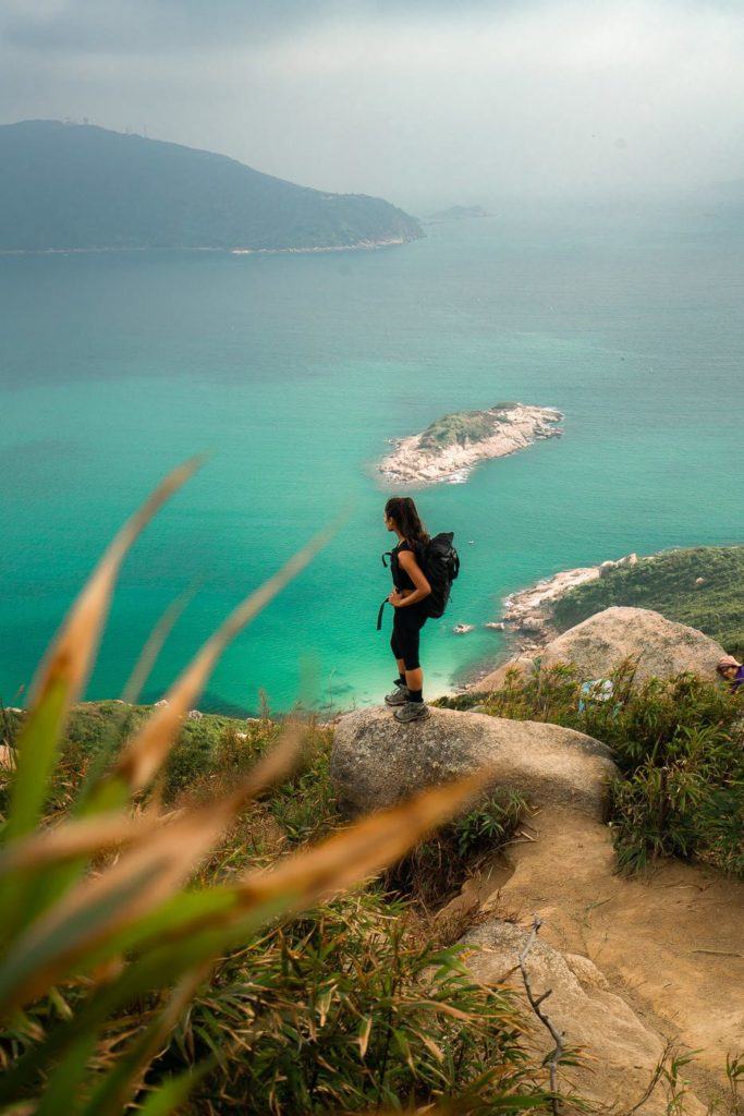
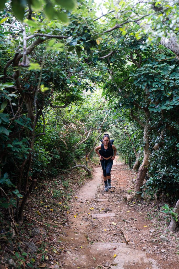
The trail is marked by ribbons but you know how it goes, every tree seems to have a ribbon tied to it and it can be quite easy to get lost. Luckily it is a small area and ‘lost’ means just a few yards off the trail. We never tried to veer off the trail but at a certain point, we couldn’t see a way forward. It didn’t bother us as we kept finding epic little viewpoints.
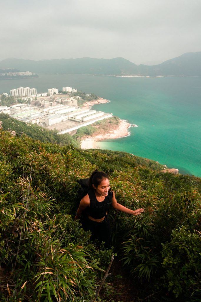
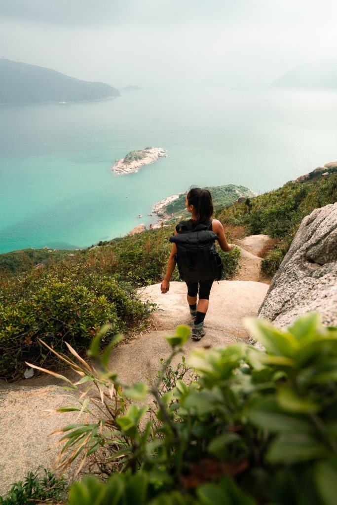
Don’t worry if the trail is looking a bit too adventurous, it is actually a pretty simple dirt trail when you can manage to stay on it. There is very little and very basic bouldering required to navigate this route. There were lots of older hikers enjoying the trail on the day I visited.
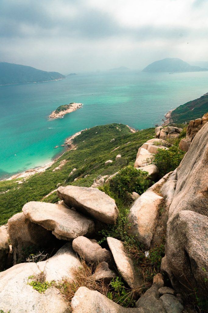
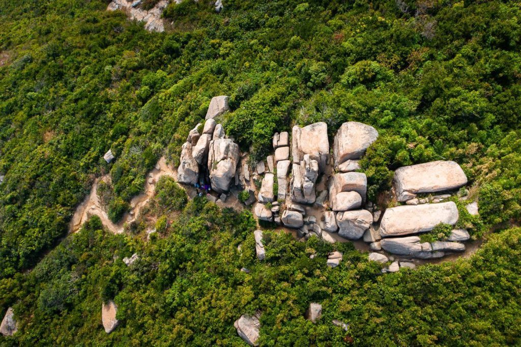
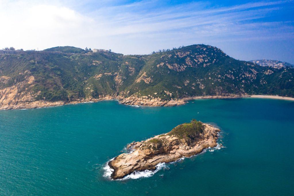
After we managed to get back on track, we followed the path for another 10-minutes. It was quite fun turning around each corner trying to spot the ‘Rhino Rock’. Besides the famous Rhino-shaped rock, there are lots of other really beautiful rock formations. I’ve attached a drone photo below to give you an idea of how the trail actually looks like and shows the wild nature of this coastal region.
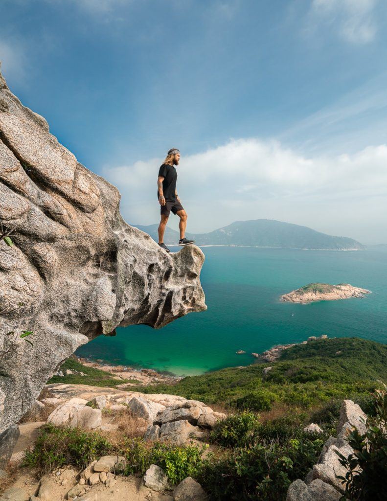
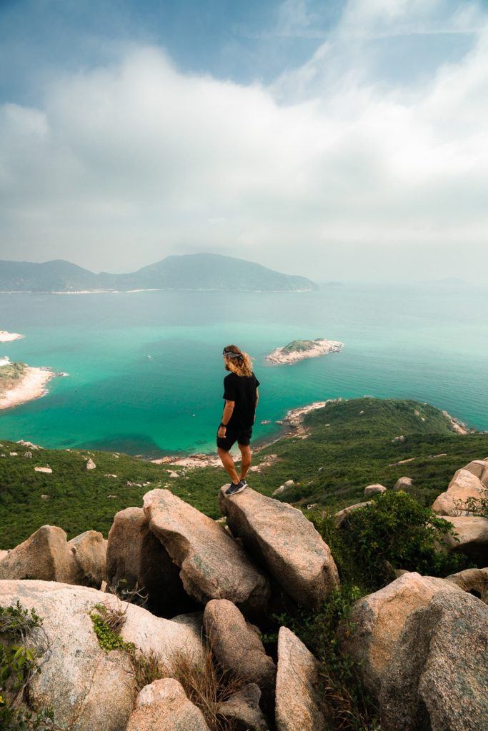
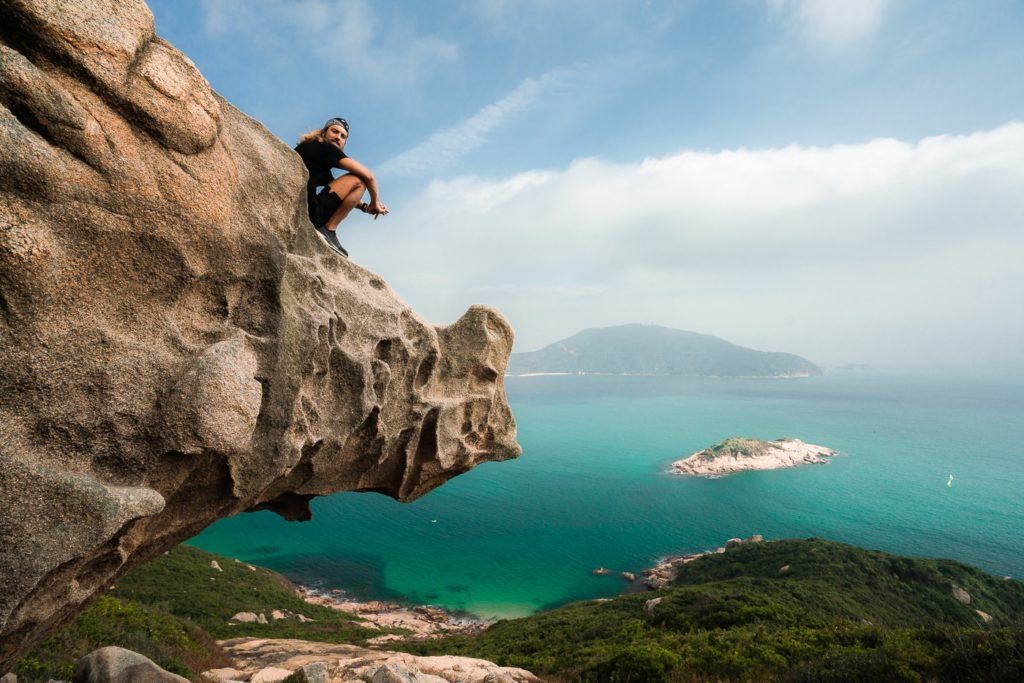
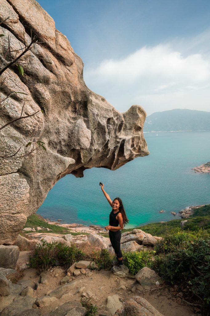
The hunt was over! We located the Rhino Rock (not as dramatic or hard as I’m making it seem) and it was one of those landmarks that get hyped up a bit… and lives up to the hype. It really does resemble a Rhino so much and when you see it in person, the ridges and holes in the rock almost seem to resemble the eyes, wrinkles, and features of a giant rhinoceros.
While it’s not necessary, you can climb the rhinoceros by walking around to the backside of the ‘head’. There is a tree with a small rope to help you up. It’s not a huge cliff but falling off the ‘horn’ would still result in a terrible accident so do take care if you venture up top.
The sun was out for us and the scenes were just incredible. The Rhino Rock was glowing and the coast was looking beautiful.
The army base is next door so flying the drone is probably not suggested. I tend to be an ask for forgiveness if you are caught kind of person and if I’m not harming or endangering anyone, I usually chuck up the drone for a look. The best photos here are taken from down low with the digital camera but the drone gave me a nice look at the coast despite the fog.
We made the incredibly short journey back to the trailhead and caught the bus into Stanley before heading off to attack Violet Hill Hike, which gave us a bit more of a physical test than Rhino Rock hike. It’s a great little adventure though and a fun photo spot.
I really suggest visiting Rhino Rock in the morning as that is when the sun is shining on this side of the cliff. In the afternoon you may not have much light for photos and just to enjoy the sun.
I hope you enjoy the Rhino Rock and let me know in the comments below if you get out to Hong Kong and find this strange rock formation.
5 BEST HIKES IN HONG KONG
I wrote a massive guide about the 21 Best Hikes in Hong Kong, but if you are only in Hong Kong for a week or less here are the five most epic routes.

HAVE YOU READ MY OTHER HONG KONG ARTICLES?
- A complete guide to the best things to do: 27 AWESOME THINGS TO DO IN HONG KONG
- My favorite hikes in Hong Kong: 21 AWESOME HIKES IN HONG KONG
- How to plan your Hong Kong trip: 3-DAY HONG KONG ITINERARY FOR ADVENTURE-LOVERS
- The biggest ever guide for where to stay in Hong Kong: WHERE TO STAY IN HONG KONG: BEST AREAS & HOTELS
- My favorite EASY hikes: 10 EASY HIKING TRAILS IN HONG KONG
- The most luxurious places to stay: THE TOP 10 LUXURY HOTELS IN HONG KONG (5-STAR LIST)
- The ultimate adventure: EPIC HONG KONG HELICOPTER TOUR FROM THE PENINSULA HOTEL
- The toughest overall hike: WEST DOG’S TEETH HIKE ‘HARDEST HIKE IN HONG KONG’
- Best waterfall hike: TAI MO SHAN HIKE: THE HIGHEST PEAK IN HONG KONG

sienna
Wednesday 26th of January 2022
The article advertised Rhinos rock as “easy” and with only “small boulders” needing to be navigated. After completing the hike I believe this to be false. Although I enjoyed the hike and the views it offered, I invited some friends along who are definitely not confident hikers like myself. There were a number of large boulders and the path was made up of a steep dirt track - very easily to slide and slip on. I ask that the article is modified to reflect this.
Kevin
Tuesday 14th of January 2020
Awesome Blog mate, always helpful