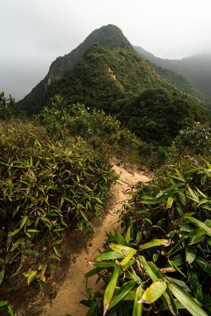
The Ma On Shan is one of the most epic but challenging hikes in Hong Kong with 866m of incline leading you all the way from Ma On Shan to Sai Kung. The trail climbs hundreds of stairs and rocky paths before you make it to the Ma On Shan summit. The hike then winds along the ridge, all the way to Sai Kung.
MA ON SHAN HIKING GUIDE
In this blog post, I’ll share everything you need to know about the Ma On Shan hike including where it is, how to get there, and when it’s best to visit.
MA ON SHAN HIKE DETAILS
- Hike Distance: The hike distance was 10.85km from start to finish if beginning at the train station. If you begin at the Ma On Shan Country Park the hike is just 7km.
- Hike Duration: Total moving time was just under three hours but total expedition time was about five hours including viewpoint breaks and photo stops.
- Hike Difficulty: The hike was relatively safe with no major exposure/drop-offs on the trail for the most part. There were a few sections where the rope was used but it was very basic climbing with rope as a backup rather than a requirement. It was very steep in parts of course but it was more a consistent climb up rocky steps. The major component of difficulty was the 856m of incline. At the final viewpoint, there is a safe way down or a shorter way down. If you take the shortcut it is quite unsafe with danger/road-closure signs. It’s not necessary but was a fun adventure to go this way.
- Hike Incline: The total hike incline was 866-meters
TOP 3 PLACES TO STAY IN HONG KONG
- Best Value Hotel: Metropark Hotel Causeway Bay – 4-star hotel for less than $100
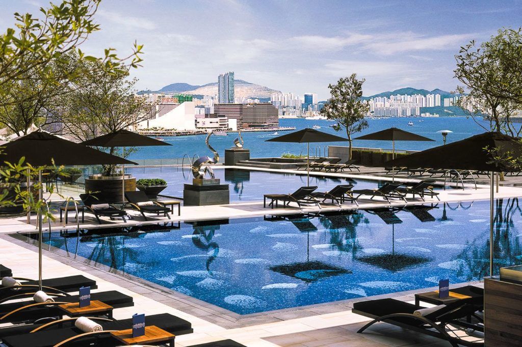
- Best Value Luxury Hotel: Hotel ICON – $150 for a 5-star hotel with an epic pool
- Best Hiking/Adventure Base: Hotel Stage – Located in Kowloon and right next to lots of epic hikes.
Check out my full guide here: BEST AREAS TO STAY HONG KONG
HOW TO GET TO THE MA ON SHAN HIKE
To reach the starting point of the Ma On Shan hike you will need to:
- Take the train to the Ma On Shan MTR Station
- Catch the village bus NR84 from On Luk Street (it never arrived for me/comes once every 1.5 hours also)
- Or walk to Ma On Shan Campsite
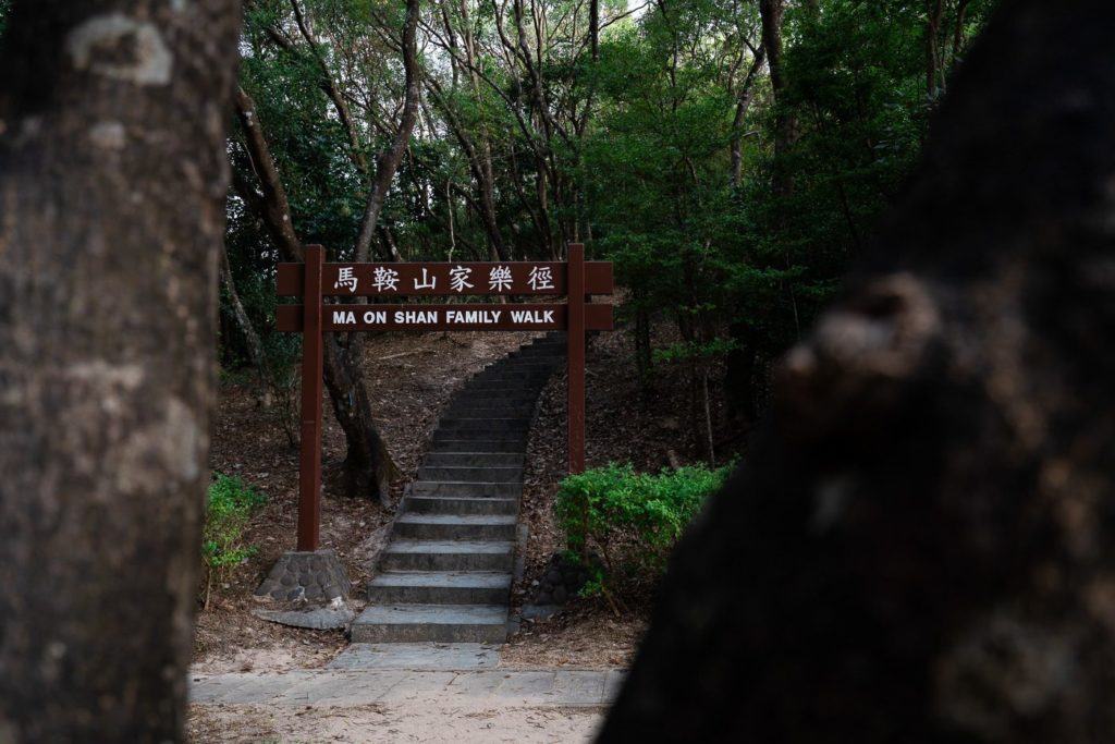
- Begin the hiking trail from Ma On Shan Campsite by starting off underneath the Ma On Shan Family Walk archway.
The hike will finish at Lo Che Road. Here you can catch the 1A to the Choi Hung MTR Station
Below I have attached my GPX Map so you can see the exact route I took on the hike. If you would like to download the GPX map to your smart-watch or device you can Click Here to download.
MY EXPERIENCE ON THE MA ON SHAN HIKE
My day began in Tsim Sha Tsui where I caught the train to Ma On Shan MTR Station. Here, I should have been able to catch the NR 84 from On Luk Street, but it never came. It was listed as coming every 1.5 hours but never arrived. I waited for 20-minutes for it and then decided just to walk. It never passed me on the way up.
The walk from the Ma On Shan MTR took me about 45-minutes to walk the 3-kilometers with 300m of incline. It led me all the up the paved road the Ma On Shan Country Park.
The Country Park was beautiful and very large. It had benches, play equipment, and even an outdoor gym. This is technically the start of the hike. On the left-hand side of the park is an archway that says Ma On Shan Family Walk. This is a small loop trail but it also extends out to be the launch-pad of the Ma On Shan ridge hike.
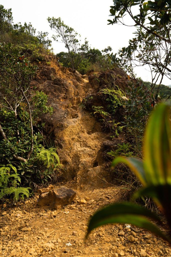
So follow this route for about 10-minutes until you reach an intersection with danger signs and pointing further up the mountain to Ma On Shan summit.
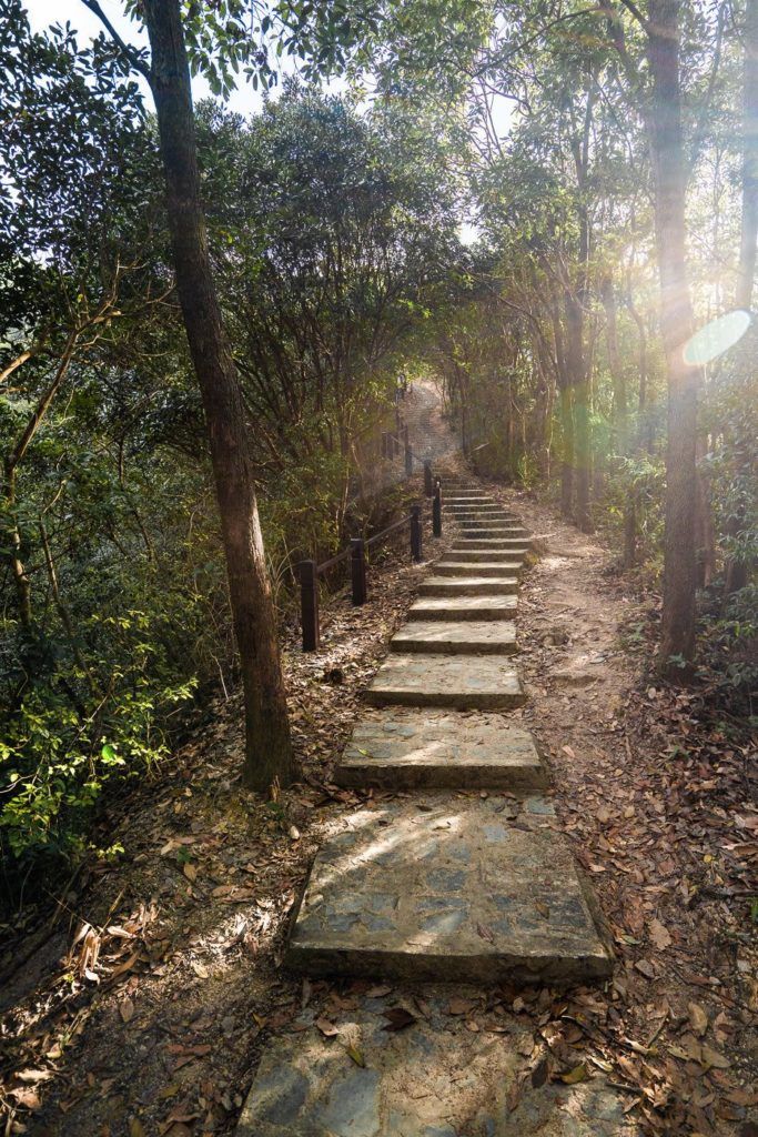
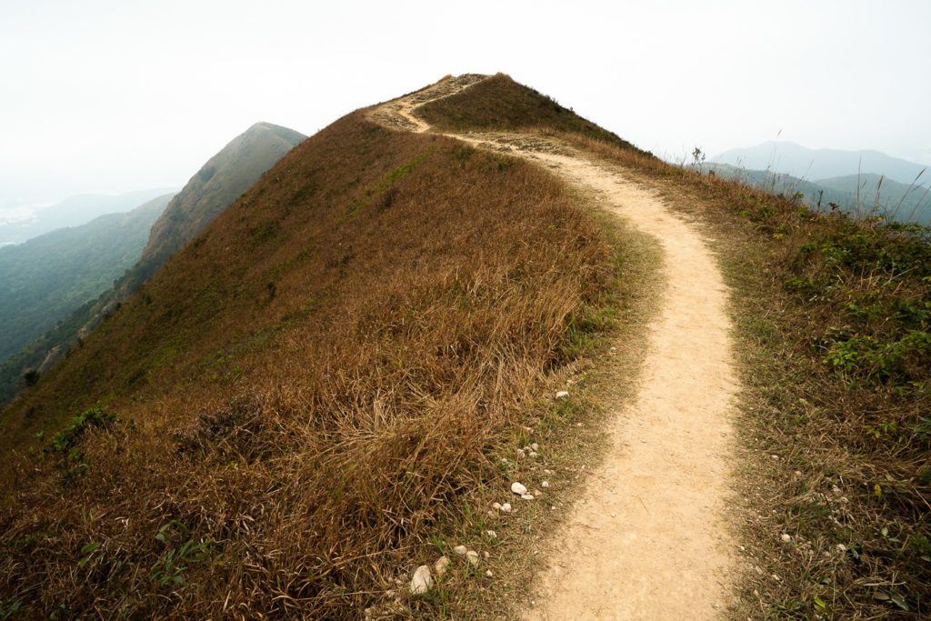
The trail is steep from the beginning with lines of stairs leading the way. When there aren’t stairs, you will have to wind your way up the trail on the dirt and rocks, occasionally fighting off the overgrown shrubs on either side. This part of the trail is a real test of fitness and by the time you reach the first viewpoint just 30-minutes into the hike, you can expect to be saturated in sweat.
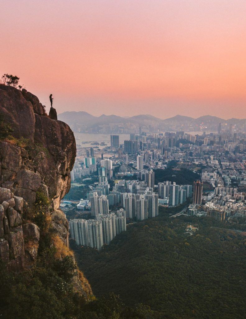
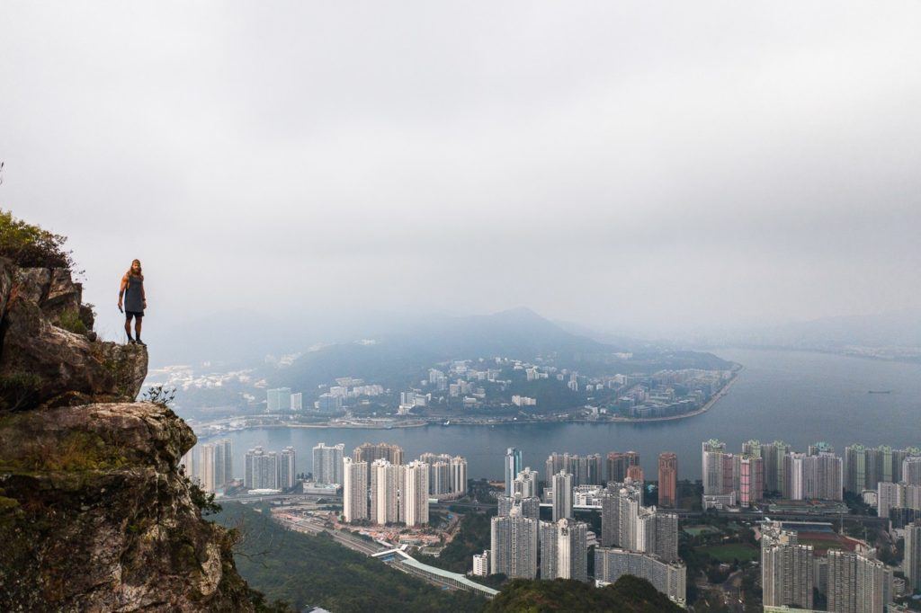
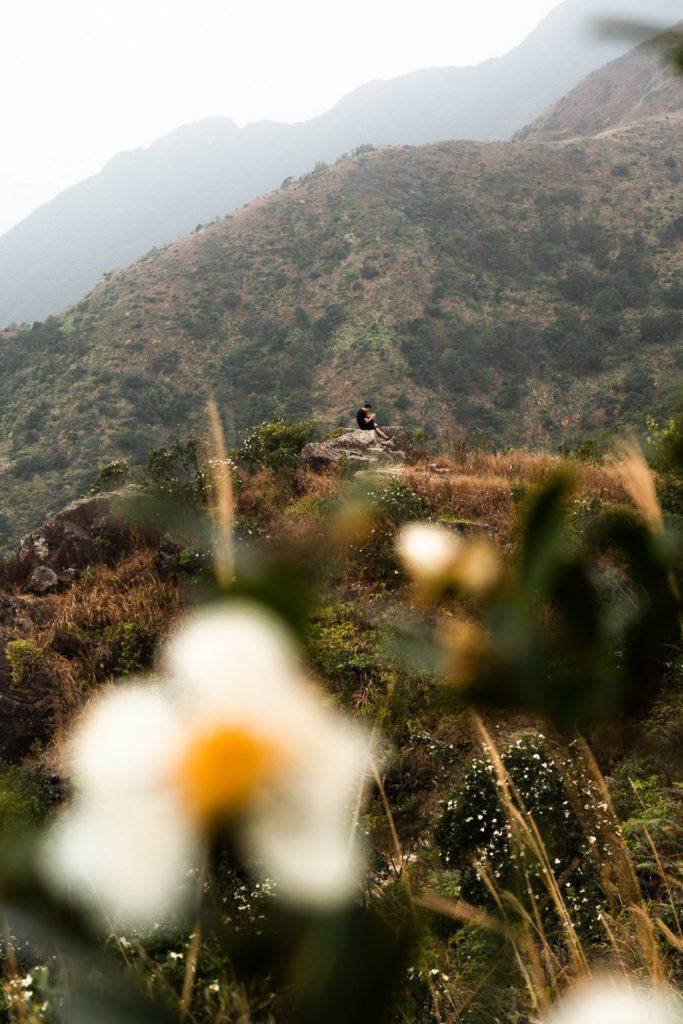
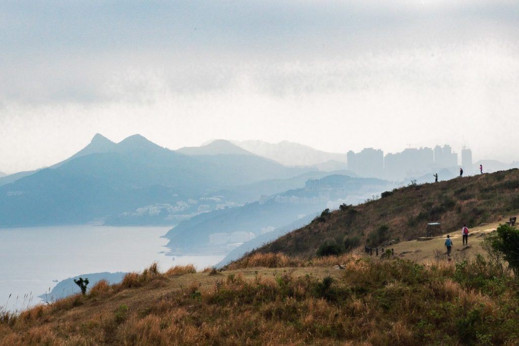
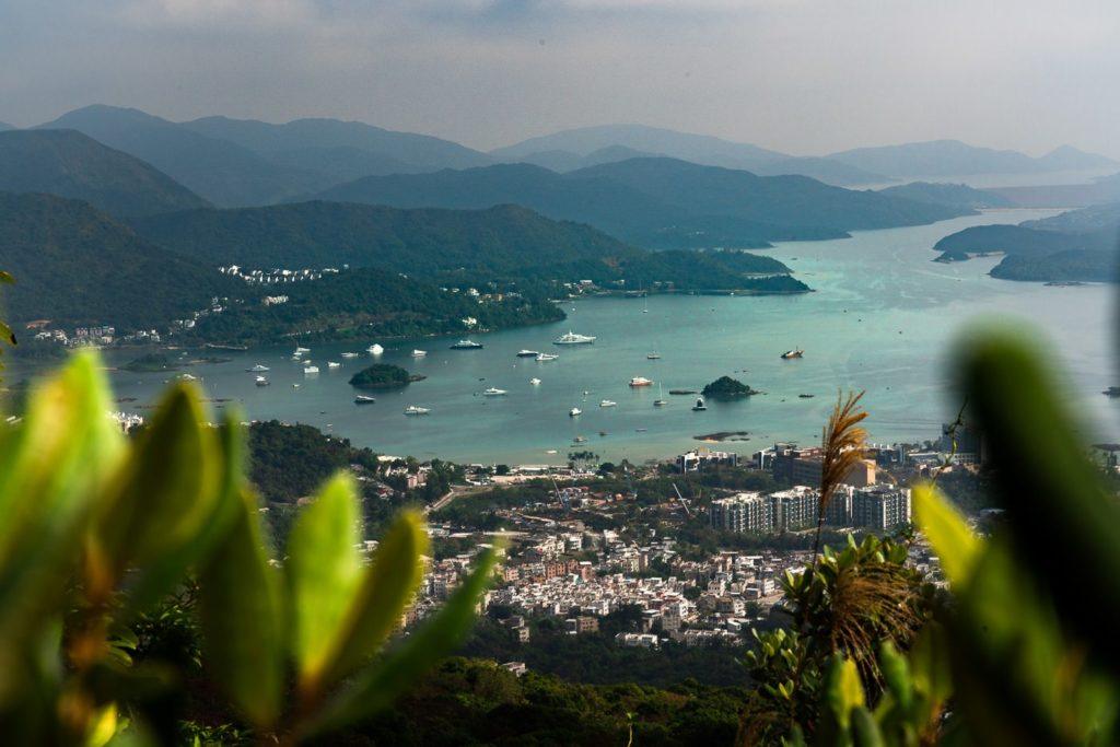
I loved the first viewpoint and thought it was possibly the most spectacular spot on the trail. It’s almost worth just hiking to the viewpoint and back down if you are short for time. A rocky ledge looks out over Ma On Shan and Sha Tin and it really has that jungle vibe as you look down on the metropolis below.
MY 4 FAVORITE HONG KONG TOURS
- Victoria Peak Tram & Sky Terrace: If you visit Hong Kong, you have to visit Victoria Peak!
- Aqua Luna Victoria Harbor Cruise: Sail Hong Kong’s Victoria Harbour on a traditional Chinese wooden junk boat.
- Hong Kong Disneyland Park: An awesome experience for all ages!
- M+ Museum Ticket: Most popular museum in Hong Kong!
Click the orange button below to view all of the top-rated tours on Klook
The uphill assault now continues and the trail becomes a little more precarious than on the way to the first viewpoint. There is one section where you can use a rope to climb up but it is quite basic and not rock climbing by any sense of the imagination. Full concentration is required in these parts as you push on towards the summit.
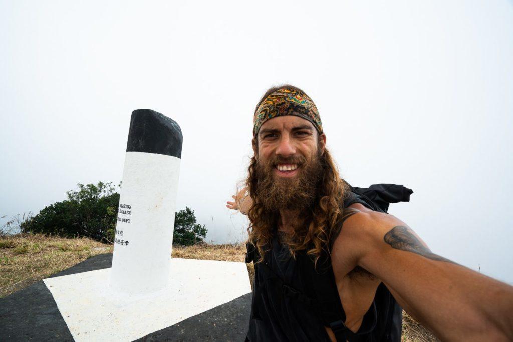
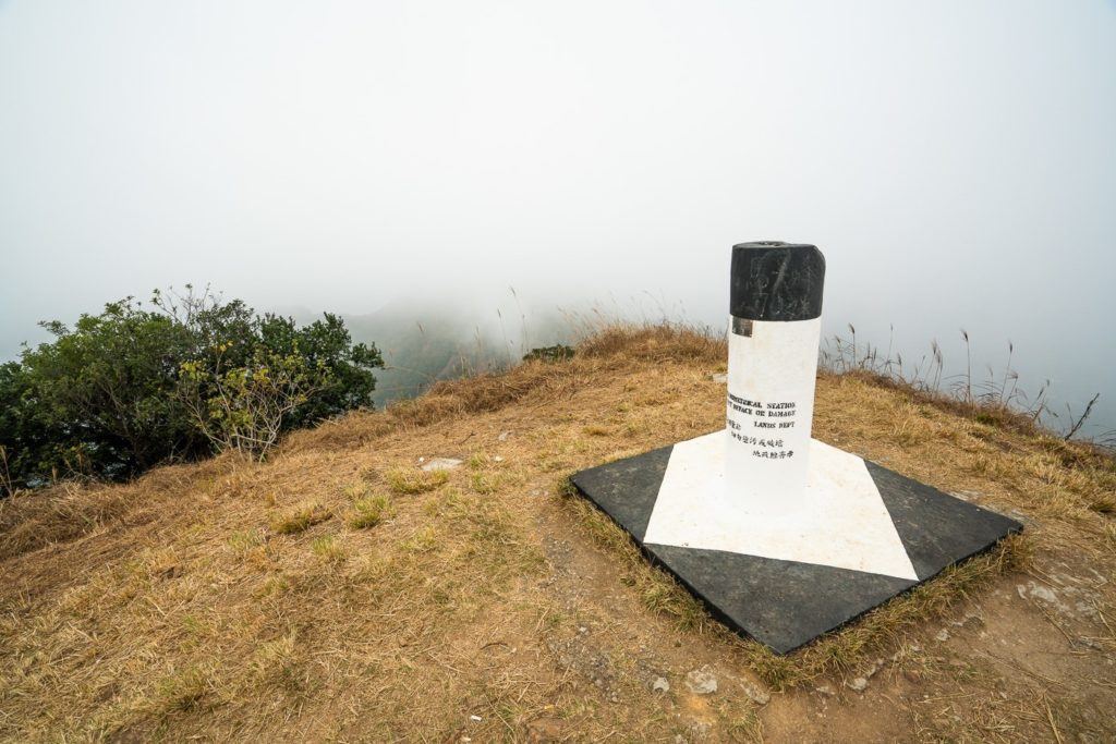
After 5-kilometers, I reached the Ma On Shan summit, which sits at 702-meters above sea-level. Unfortunately for me on this day it was engulfed in clouds but the journey up until the last 100m had been clear to see the views in all directions. On a clear day, this will be a great viewpoint.
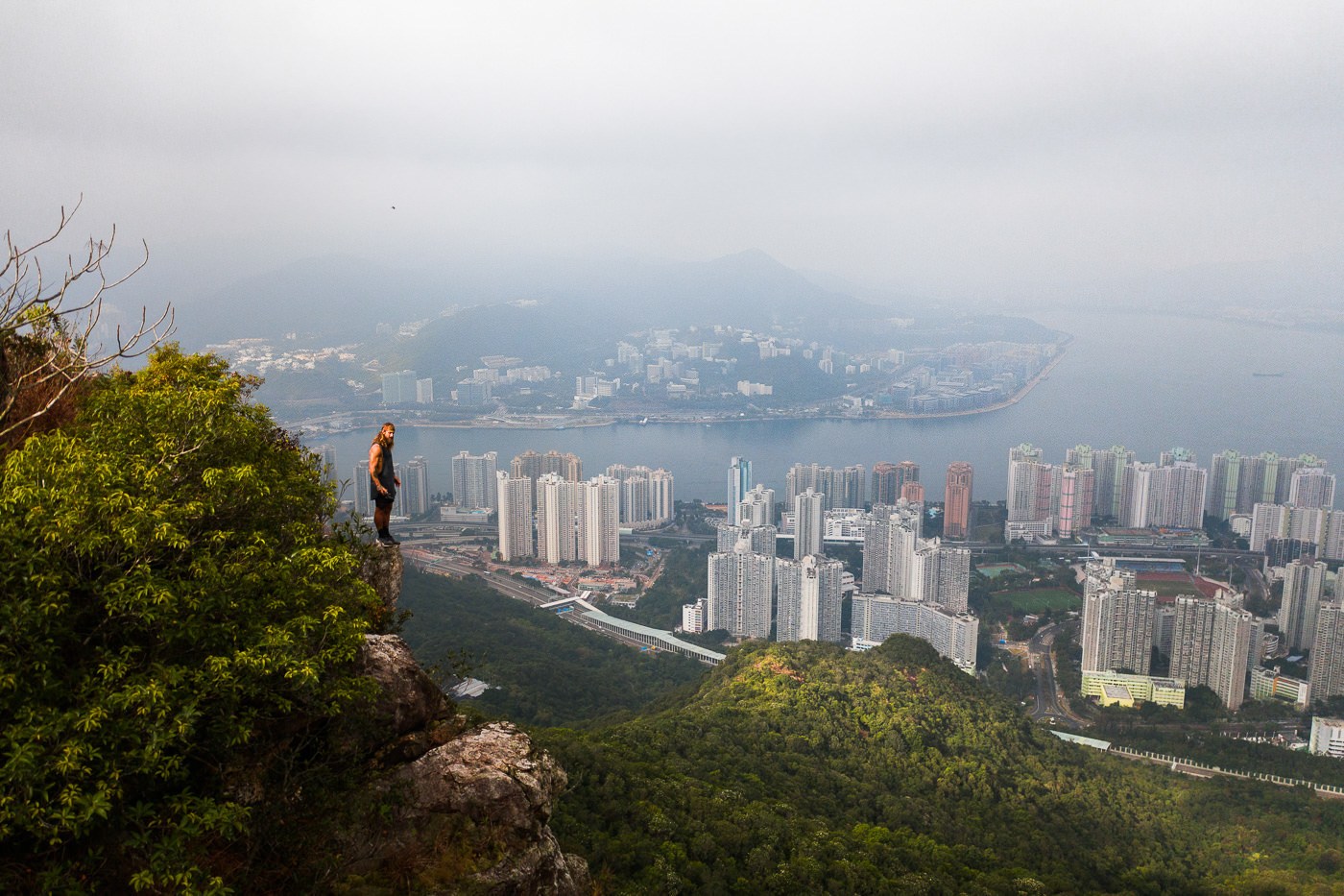
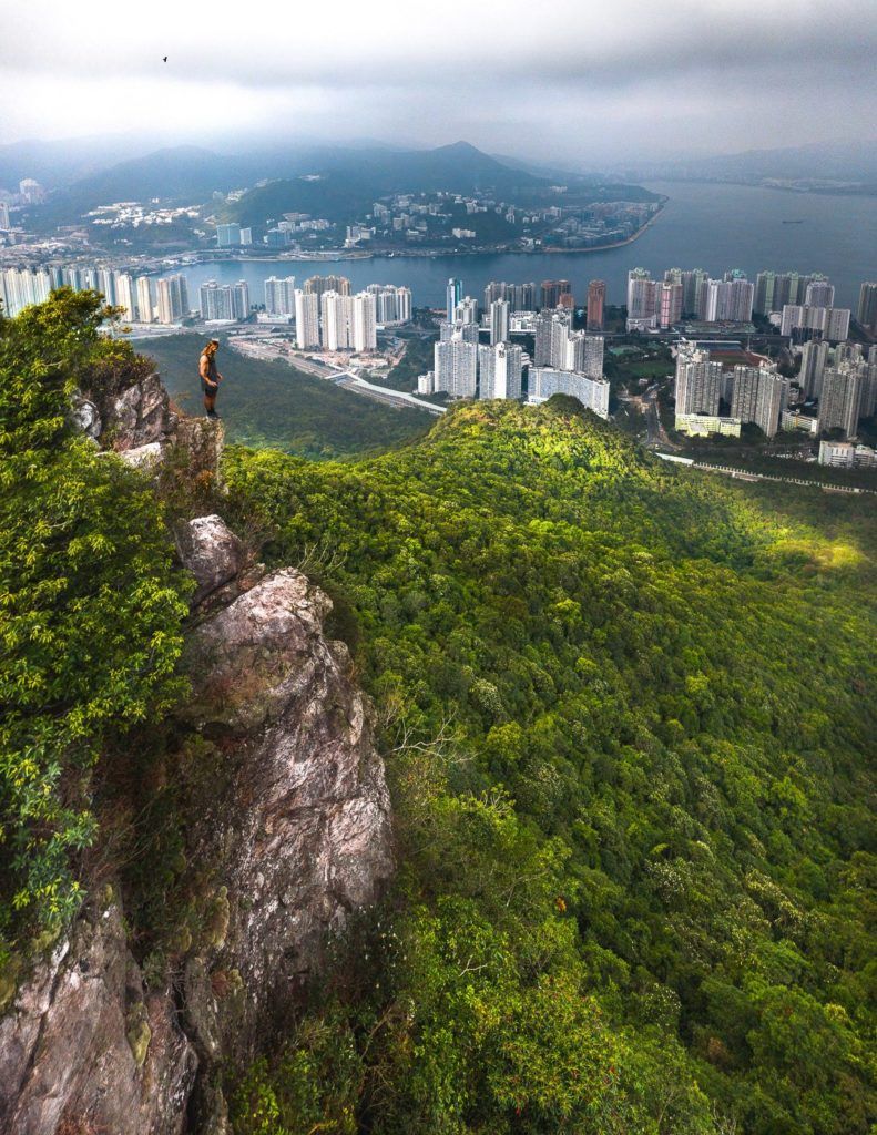
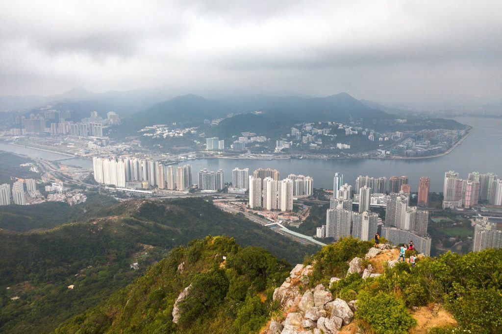
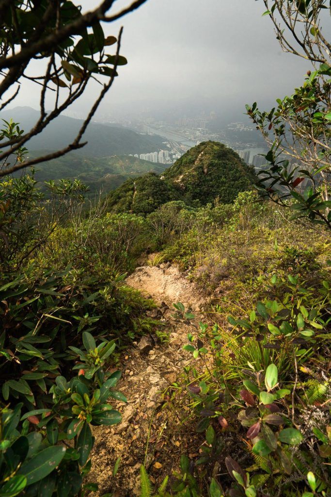
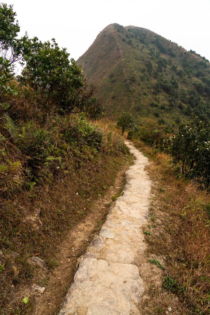
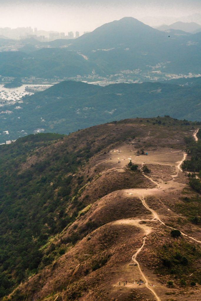
At this point, you can return the way you came, or continue on along the ridge to the second major peak in the region. The other peak comes close to Ngong Ping along the MacLehose Trail Section 4. The ridge now is quite rocky and slippery but there is nothing too dangerous about it when you take it as slow as you are comfortable with and make your way down.
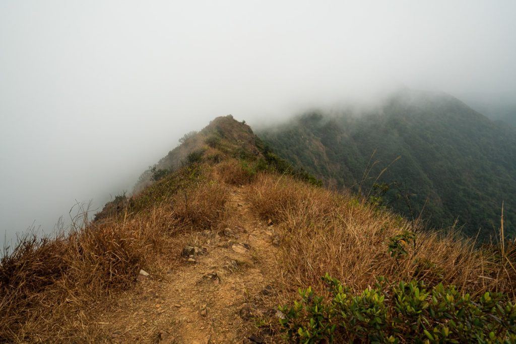
There are several great viewpoints along the MacLehose Trail Section 4. I stopped at several along the way before reaching the major hill above Ngong Ping. Here I watched the paragliders get ready, campers packin up their gear and enjoyed a great view out over the Sai Kung region.
The final stretch down from Ngong Ping viewpoint is pretty basic, well-marked and a clear way to the bottom. Once I arrived at the end of the trail and re-entered civilization, I walked all the way back to the main road and caught the 1A bus to Choi Hung MTR Station to begiun my journey home.
I hope you enjoyed this guide to the Ma On Shan Hike in Hong Kong.
THINGS TO KNOW ABOUT THE MA ON SHAN HIKE
- Trail Difficulty: The Ma On Shan hike is considered moderately challenging, with steep sections and rugged terrain. Hikers should have a good level of fitness and be prepared for a strenuous ascent and descent.
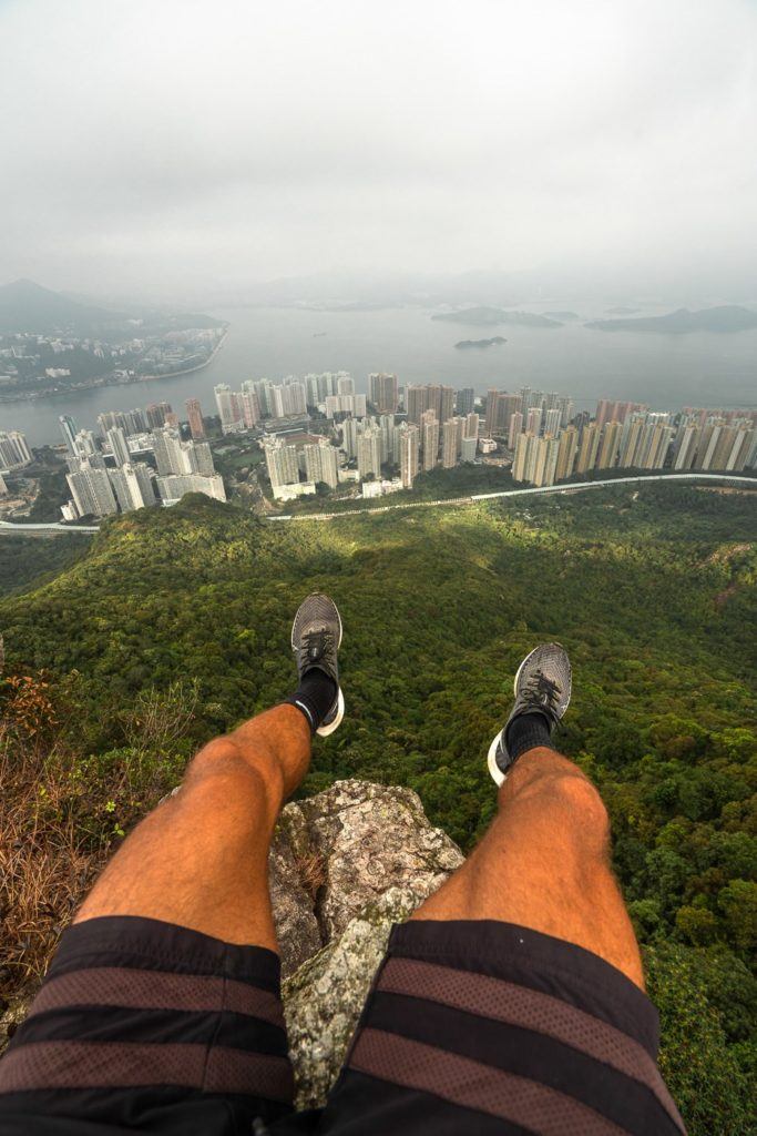
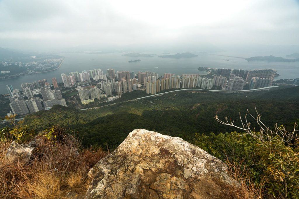
- Scenic Views: The hike offers breathtaking views of Hong Kong’s picturesque landscapes, including panoramic vistas of the city skyline, lush green hills, and the sparkling waters of Tolo Harbour. It’s a feast for the eyes and a perfect opportunity for nature lovers and photography enthusiasts.
- Trail Length and Duration: The Ma On Shan hike covers a distance of approximately 10 kilometers. On average, it takes about 4 to 5 hours to complete, depending on your pace and the time spent admiring the views. Start early to avoid the midday heat and allow ample time for the hike.
- Access to Starting Point: To access the starting point of the Ma On Shan hike, you can take the MTR to Ma On Shan Station. From there, follow the signs to the hiking trailhead. Public transportation options, including buses and minibusses, are available for convenience.
- Preparation Tips: Wear comfortable hiking shoes and suitable clothing for outdoor activities. Bring sufficient water, snacks, sunscreen, and a hat to protect against the sun. It’s advisable to check the weather forecast before your hike and pack accordingly. Consider using a hiking app or map to stay on the designated trail.
By keeping these key points in mind, you can make the most of your Ma On Shan hike, enjoying the scenic beauty, embracing the physical challenge, and creating lasting memories in the natural splendor of Hong Kong.
5 BEST HIKES IN HONG KONG
I wrote a massive guide about the 21 Best Hikes in Hong Kong, but if you are only in Hong Kong for a week or less here are the five most epic routes.

HAVE YOU READ MY OTHER HONG KONG ARTICLES?
- A complete guide to the best things to do: 27 AWESOME THINGS TO DO IN HONG KONG
- My favorite hikes in Hong Kong: 21 AWESOME HIKES IN HONG KONG
- How to plan your Hong Kong trip: 3-DAY HONG KONG ITINERARY FOR ADVENTURE-LOVERS
- The biggest ever guide for where to stay in Hong Kong: WHERE TO STAY IN HONG KONG: BEST AREAS & HOTELS
- My favorite EASY hikes: 10 EASY HIKING TRAILS IN HONG KONG
- The most luxurious places to stay: THE TOP 10 LUXURY HOTELS IN HONG KONG (5-STAR LIST)
- The ultimate adventure: EPIC HONG KONG HELICOPTER TOUR FROM THE PENINSULA HOTEL
- The toughest overall hike: WEST DOG’S TEETH HIKE ‘HARDEST HIKE IN HONG KONG’
- Best waterfall hike: TAI MO SHAN HIKE: THE HIGHEST PEAK IN HONG KONG