

The Wahiawa Hills Trail in Oahu, Hawaii, is a 5-mile hiking trail that takes hikers on a journey through a beautiful forest region of Oahu. This moderate-level trail takes hikers across streams, past waterfalls, and through lush forests, making it an ideal choice for anyone looking for an outdoor adventure. Whether you’re a seasoned hiker or just looking for a fun way to experience Hawaii’s natural wonders, the Wahiawa Hills Trail is definitely worth exploring.
WAHIAWA HILLS TRAIL
In this blog post, I’ll share everything you need to know about hiking the Wahiawa Hills Trail in central Oahu, Hawaii. It’s an easy(ish) loop with a few little tricks and turns, highlighted by a couple of interesting river crossings.
WAHIAWA HILLS TRAIL DETAILS
- Hike Distance: The Wahiawa Hills Trail in Oahu, Hawaii, spans 4.8 miles (7.5 kilometers) from start to finish, taking hikers through a diverse range of landscapes, including lush tropical forests, streams, and waterfalls.
- Hike Duration: On average, it takes hikers around 3 to 4 hours to complete the entire trail, depending on your fitness level and the number of breaks you take to admire the scenery.
- Hike Difficulty: The Wahiawa Hills Trail is rated as moderate in difficulty due to some steep sections, rocky terrain, and uneven ground. Hikers will also need to cross streams and navigate through muddy patches, so sturdy footwear is recommended. While the trail is suitable for most hikers, beginners or those with mobility issues may find some sections challenging.
- Hike Incline: The Wahiawa Hills Trail has an incline of approximately 450 meters, with a maximum elevation of 450 meters above sea level. Hikers should be prepared for some steep climbs and descents along the way.
TOP 3 PLACES TO STAY ON OAHU


- Ultimate Luxury: Lotus Honolulu – Diamond Head View, Great Waikiki Location
- My Favorite: Aston Waikiki Beach – Best value in Waikiki & Great location
- Value Hotel Waikiki: Surfjack Hotel is easily the best value (luxury) hotel in Waikiki
WAHIAWA HILLS TRAIL DIRECTIONS
If you’re staying in Waikiki and want to hike the Wahiawa Hills Trail, the easiest way to get there is by car. From Waikiki, head towards the H1 West Highway and take exit 8A towards Wahiawa. Follow the signs for Whitmore Avenue and turn right onto California Avenue, which will eventually turn into Puninoni Street. The trailhead is located at 2681 Puninoni Street, and there is limited parking available along the road.
MY EXPERIENCE ON THE WAHIAWA HILLS TRAIL
The Wahiawa Hills Trail is a great forest loop in central Oahu. It’s just a 20-minute drive from Haleiwa Town, which means it’s a great adventure to combine with some North Shore vibes after the hike.
I set off on this hike expecting a moderate forest loop but it was actually a bit more of an adventure than I expected. A few steep and slippery descents as well as two river crossings made this hike a little more wild than expected. However, overall it was a forest loop suitable for most hikers with average fitness.
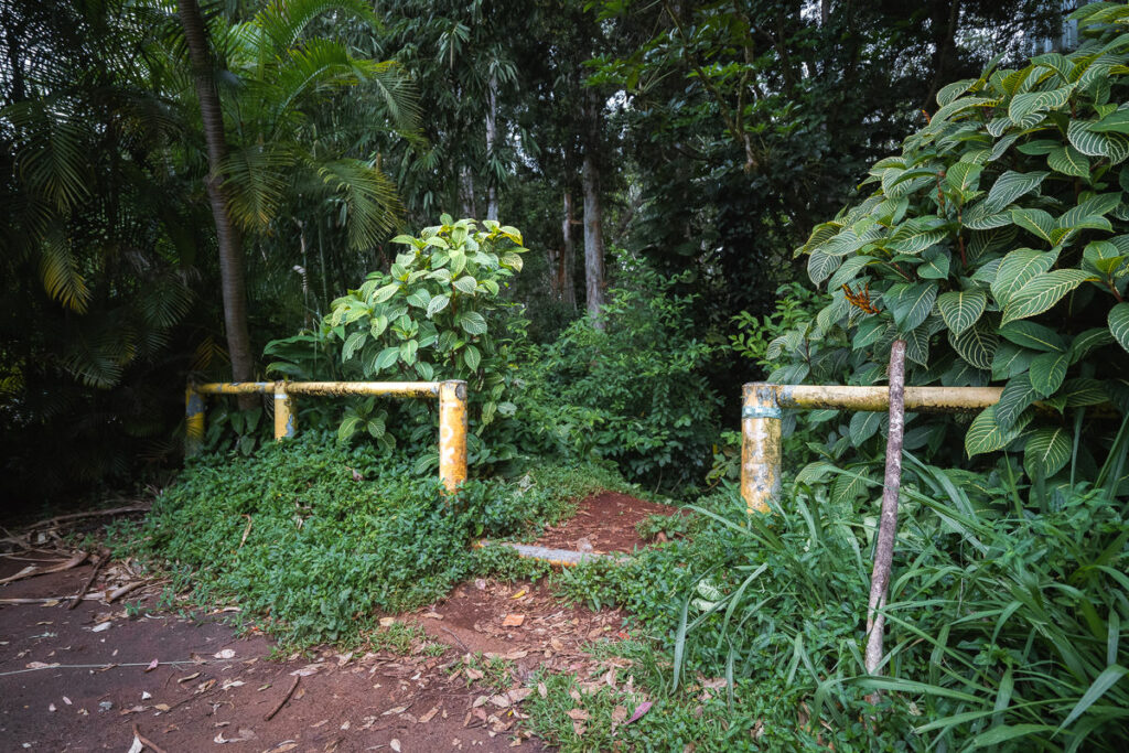
The trail starts off in the suburbs at Puninoni Street. Here you will see a signed entrance. There isn’t much parking but there is always the possibility of parking in the local neighborhoods.
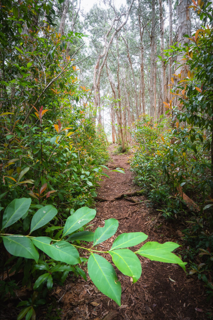
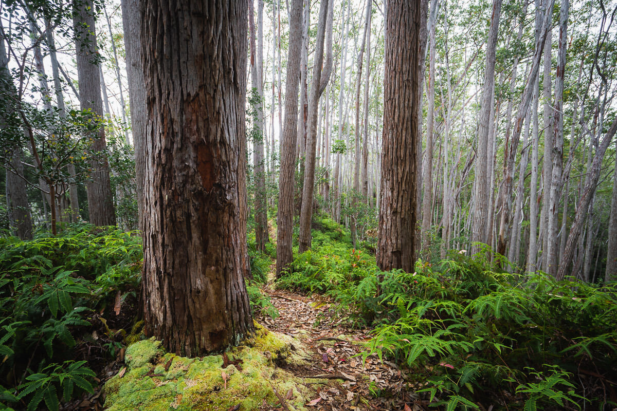
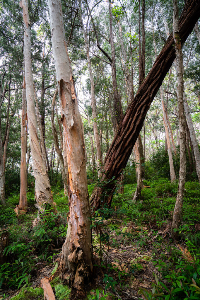
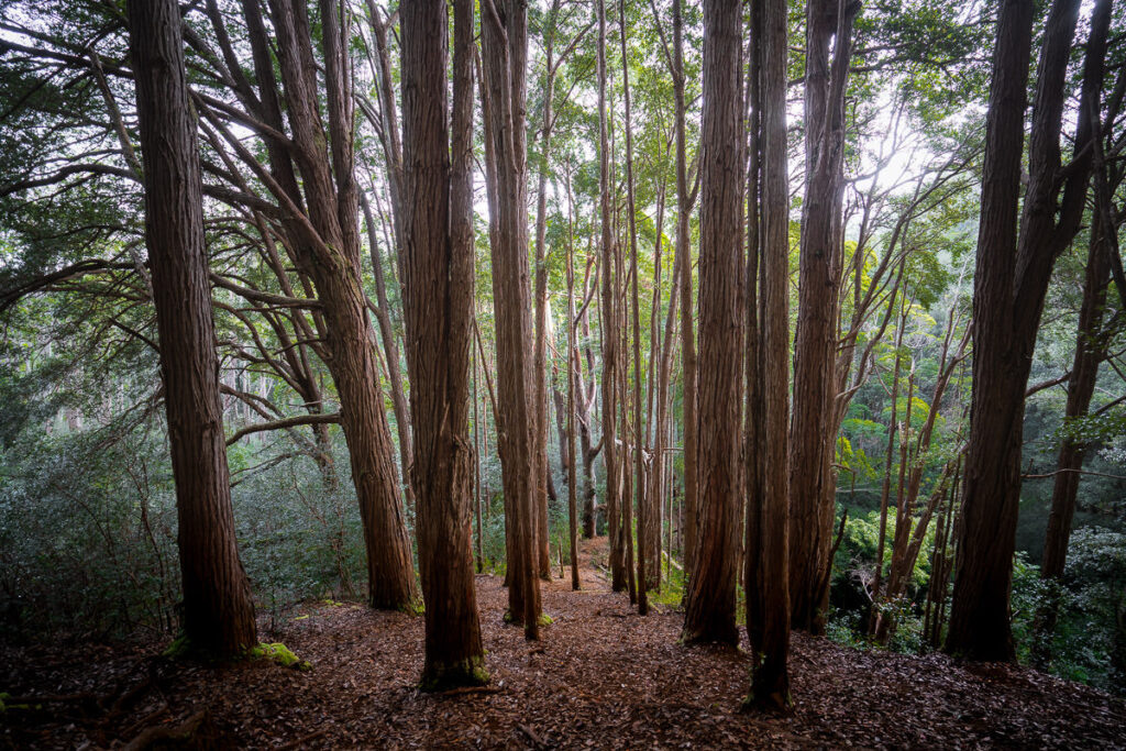
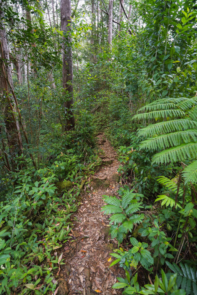
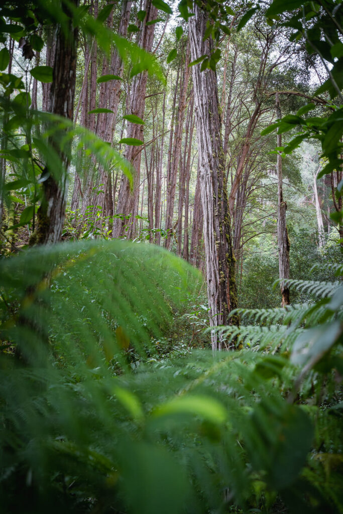
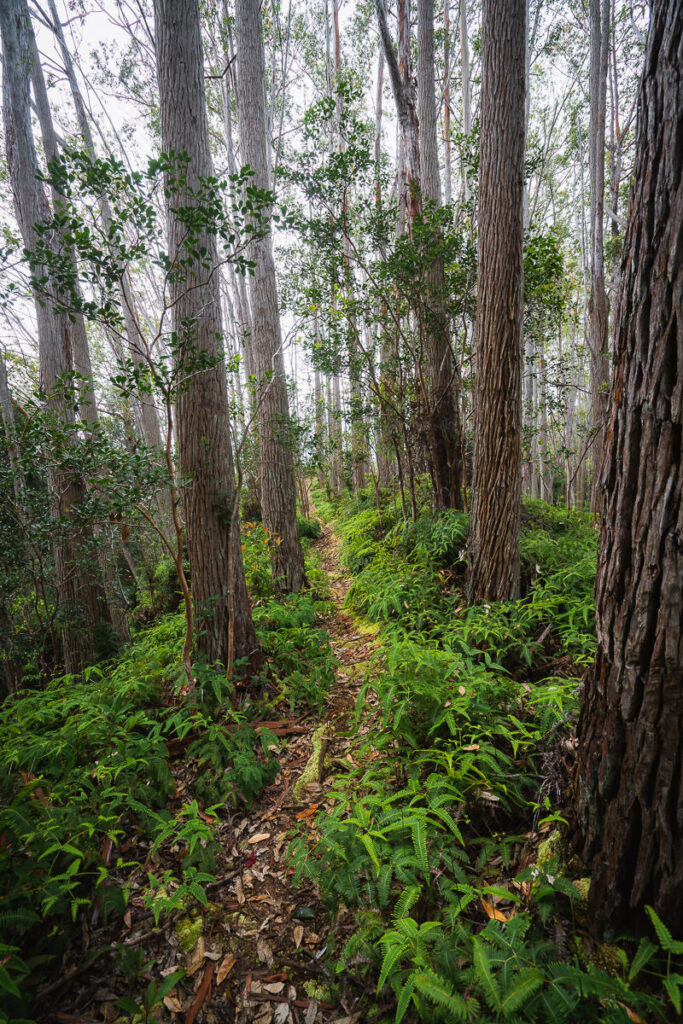
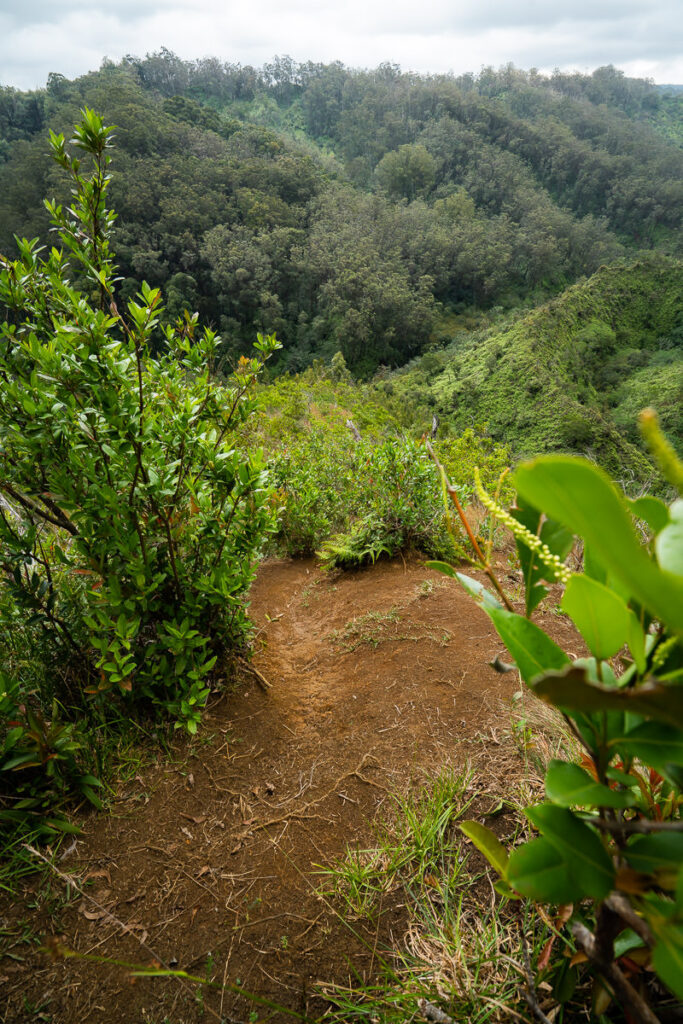
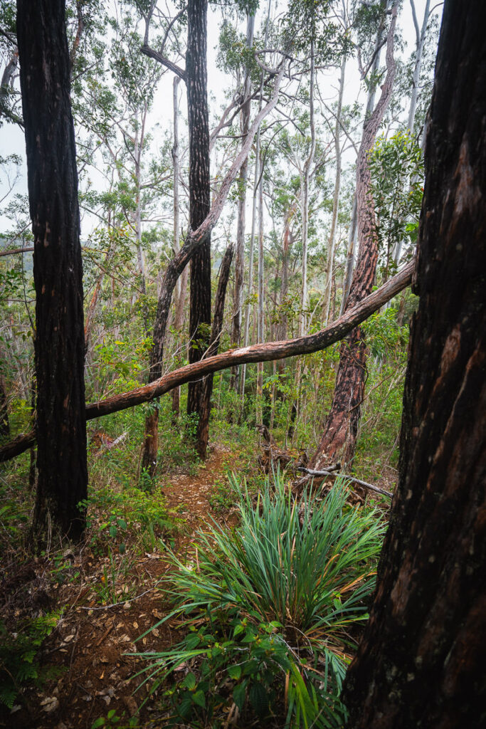
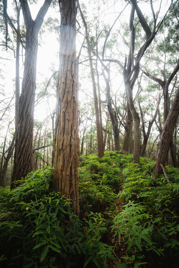
The trail immediately immerses hikers into the forest, where giant stringy bark trees tower over the trail. The path is not obvious throughout this route so it is best to stay on course by using a GPX track or a local hiking app.

After just a few hundred meters in the forest, the trail has a very steep descent. In wet weather, this can be slippery but I visited after a few days without rain so enjoyed easier conditions. That was until it rained during the end of my hike.
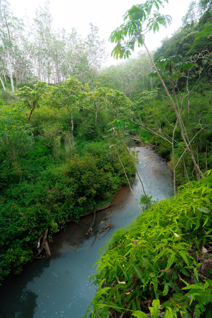
Often hard to notice but always winding through the trees, the path now delves down towards the river for one of the three crossings.
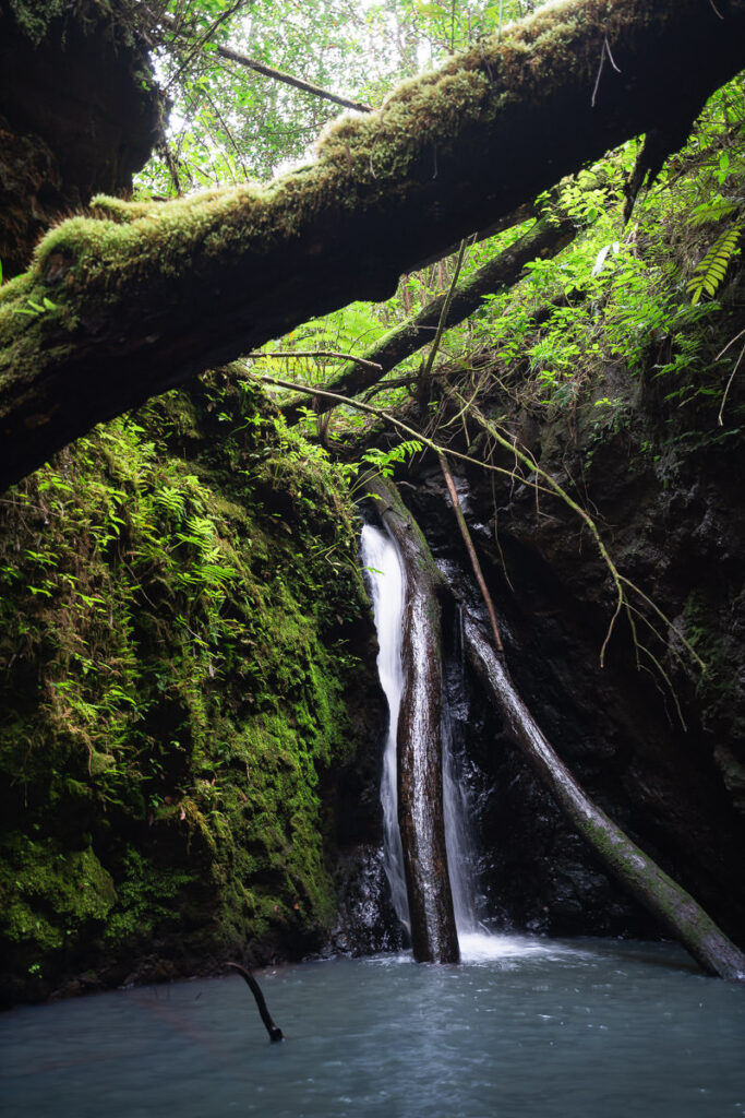
This first river crossing is the simplest of the three as there are a few stones, which are conveniently placed for making the crossing. However, don’t cross the river until you visit the small waterfall down the trail to the right. It’s a shot 30-yeard out-and-back walk and you will hear the waterfall from the crossing.

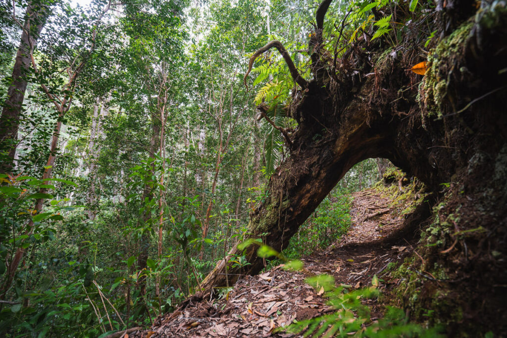
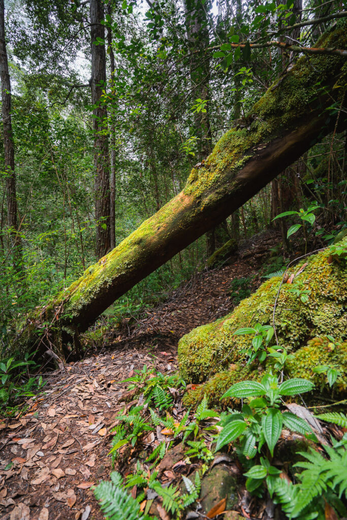
The route now heads across the river and begins to wind its way uphill. There are lots of landslides and fallen trees throughout this part of the hike with some ducking and weaving necessary.
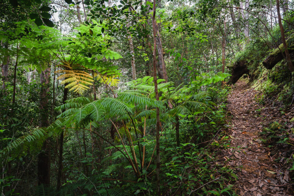
Through the forest, the trail continues to lead hikers uphill in truly serene surroundings. I passed just one fellow hiker on this route and it’s a very quiet and calm atmosphere compared to many of the hikes near Waikiki.
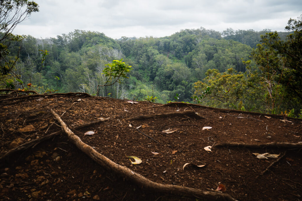
There’s no true ‘summit’ on this route but at around the halfway mark, you will reach a nice plateau with a view.
The trail now begins to descend to the river. It’s quite slippery and very steep. It actually started to rain on me right here during my hike, which was inopportune timing given how slick the clay becomes when wet.
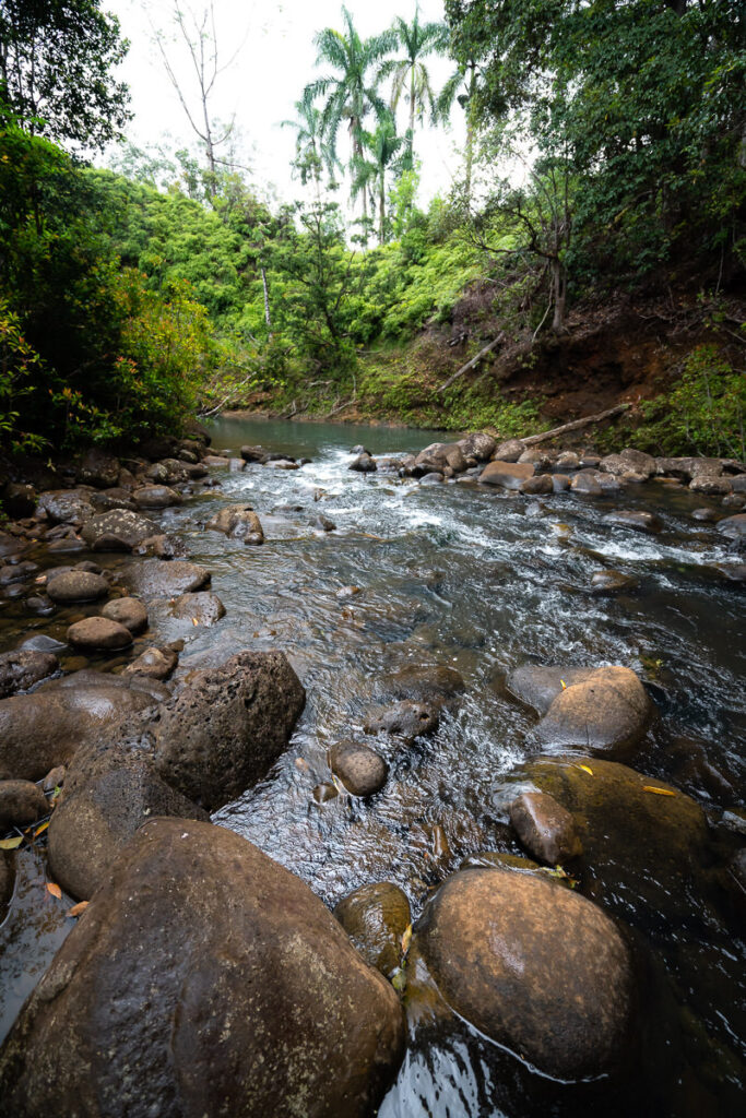
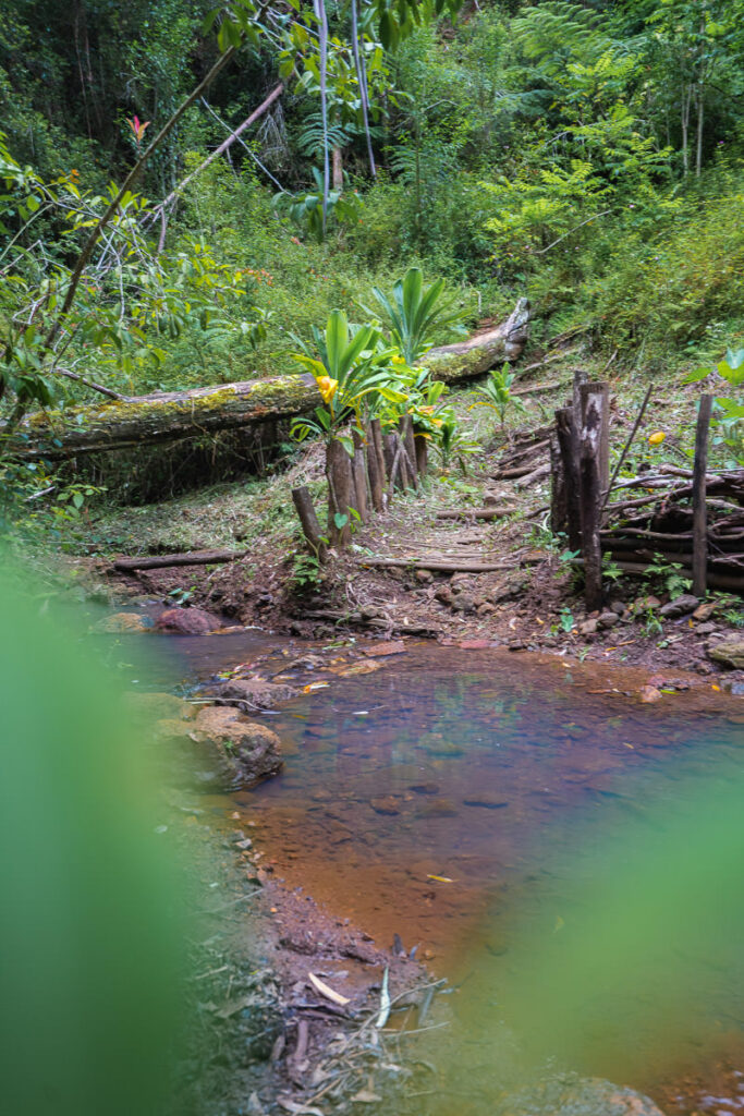
Down at the water’s edge, it can actually be quite hard to find the ‘correct’ crossing. The AllTrails map led me to a part of the river that was quite high and I had to remove my shoes and socks to cross. Obviously, the water levels will vary throughout the year, but it’s a factor to be mindful of. I noticed a crossing that came before mine although it also looked as if the stones were slightly submerged. When it doubt, just walk through the river and wet your shoes or take them off. Don’t try and jump on the slippery rocks.
The trail continues to ascend through the forest from the river and climbs up and over another hill. The scenery is so dense that it is quite disorientating in the forest to find your bearings. Be wary of this and the importance to use a map or at least having Maps.me downloaded on your phone.

There was one last river crossing before the final ascent. This crossing was also too deep and I had to remove my shoes again! I didn’t expect to see such a beautiful river in this area when I began the hike but it is quite stunning, like a tropical lagoon.
The trail now joins back up with the start of the loop and retraces the first kilometer of the hike back to the parking lot. The loop has been completed and the Wahiawa Hills Trail is done. I hope you enjoyed this hiking guide and the photos.
WHERE TO STAY ON OAHU
- Hilton Hawaiian Village Beach Resort (Overall Favorite): In the heart of Waikiki, this high-end resort is right on the beach with a private lagoon.
- Sheraton Waikiki (Luxury): A luxury resort with the most amazing infinity pool on the island, which overlooks the beach.
- Ewa Hotel Waikiki: (Value): Ewa Hotel is just one block back from the beach and is just over $150 USD.
- Waikiki Beachside Hostel (Budget Choice): A budget alternative, which is still in an amazing location.
- Disney Aulani Resort (Family Choice): This is a resort your kids will never forget. It honestly feels like you are living in a theme park.
MORE OAHU BLOG POSTS
I lived on Oahu for two years and loved adventuring from the beaches to the mountains to the waterfalls! These are my most popular blog post and guides from the beautiful island of Oahu to help you plan your trip!
- What to pack for Hawaii: THE HAWAII PACKING LIST: WHAT TO PACK
- A helpful guide to choosing accommodation: WHERE TO STAY ON OAHU
- Most epic hike on Oahu: THE STAIRWAY TO HEAVEN OAHU, HAWAII
- The best Waterfalls: AMAZING WATERFALLS ON OAHU, HAWAII
- Ultimate Cliff Jumping Guide: 11 BEST CLIFF JUMPING SPOTS ON OAHU
- Guide to Swimming with Sea Turtles: WHERE TO SEE TURTLES ON OAHU
- The best Waterfall Hikes: TOP WATERFALL HIKES ON OAHU
- Best Tours: 20 BEST TOURS ON OAHU
- The Ultimate Guide to Oahu: 80 AWESOME THINGS TO DO ON OAHU


AD
Sunday 7th of January 2024
Beautiful post. Mahalo for sharing this hike! It's now an addition on the hiking list.