
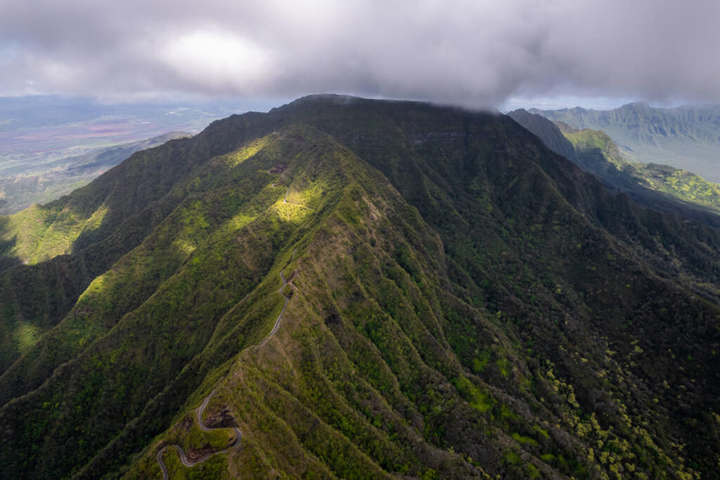
Mount Ka’ala hike is a steep and challenging trail on the west side of Oahu. The summit of Mount Ka’ala is the highest point on Oahu at an elevation of 1,227 meters or 4,026 feet. The round-trip hike has a distance of 7 miles (12km) and 3600ft (1100m) in elevation gain. The muddy scramble has many rope-assisted sections and due to the steep incline and technical nature of the climb, it can take hikers 4-6 hours to complete.

MOUNT KA’ALA HIKE: HIGHEST POINT ON OAHU
In this blog post, I will share everything you need to know about hiking Mount Ka’ala, the highest point on Oahu. I’ll provide the directions, information about the trail, and my experience of the hike
3 MOST POPULAR OAHU TOURS
- Doors-Off Oahu Helicopter Flight Tour: My number one recommendation is to do a heli-flight (doors off) and be blown away when you see Oahu from the air.
- North Shore Shark Cage Tour: The biggest adrenaline rush you can have in Hawaii is beneath the surface with sharks!
- Turtle Canyon Snorkel Cruise by Catamaran: The number 1 MOST POPULAR snorkel tour on Oahu. GUARANTEED Turtles!
MOUNT KA’ALA HIKE DETAILS
- Hike Distance: The total distance of the Mount Ka’ala Hike is 7.4 miles (11.9 kilometers), round trip.
- Hike Duration: The hike usually takes around 4-6 hours to complete, depending on your pace and how long you stay at the summit.
- Hike Difficulty: The Mount Ka’ala Hike is considered a difficult hike due to steep inclines, rugged terrain, and variable weather conditions. Hikers should be in good physical condition and have experience hiking in challenging environments elsewhere in Oahu.
- Hike Incline: The total incline for the Mount Ka’ala Hike is around 3,600 feet (1,100 meters), making it a strenuous climb but well worth the effort for the breathtaking panoramic views of Oahu’s landscape.
HOW TO GET TO MOUNT KA’ALA
The journey from Waikiki to the Mount Ka’ala trailhead is about one hour depending on traffic. To reach the Ka’ala Hiking Trailhead from Honolulu, you need to take the H-1 freeway west until it ends and becomes Farrington Highway. Continue on Farrington Highway for about 16 miles until you reach the town of Waianae. Turn right onto Plantation Road and continue for about 3 miles until you reach the entrance to the trailhead, which will be on your right.
MOUNT KA’ALA THE HIGHEST POINT ON OAHU
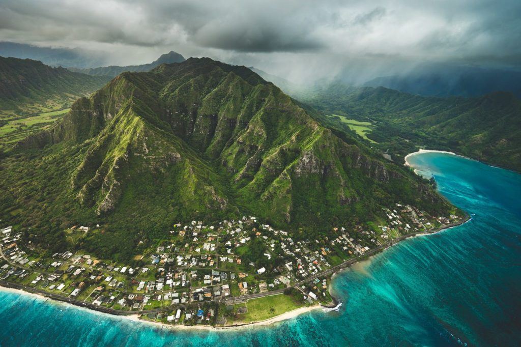
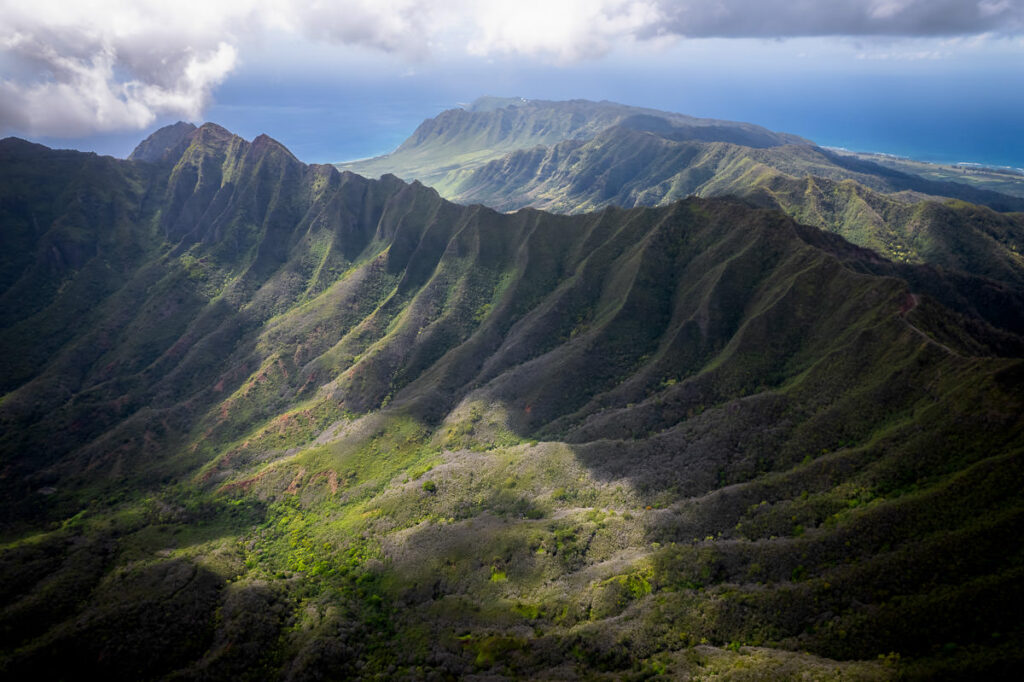
Mount Ka’ala, standing at 4,026 feet (1,227 meters) above sea level, is the highest point on Oahu. The Koolau Mountain Range, the other major range on the island, also has prominent peaks such as K1, which has an elevation of 3,150 feet (960 meters). Mount Ka’ala’s neighboring peak, Mount Kamaileunu also has an elevation of 3200 feet (975 meters). The Waianae Range is a popular hiking destination for adventure seekers due to the challenging terrain and stunning views of the Pacific Ocean. The peaks in the Waianae Range offer hikers the opportunity to witness the island’s natural beauty from a different perspective, away from the bustling cities and tourist spots.
SAFETY AT MOUNT KA’ALA
The Mount Ka’ala parking lot is well known for being a theft hotspot. Leave absolutely nothing in your car, not even a phone charger, or phone mount. Completely clear the car and consider using a wheel lock for the steering wheel. It is common for hikers to return to their car to find a smashed window so the best prevention is to leave nothing of value in sight for potential thieves.

MY EXPERIENCE ON THE MOUNT KA’ALA HIKE
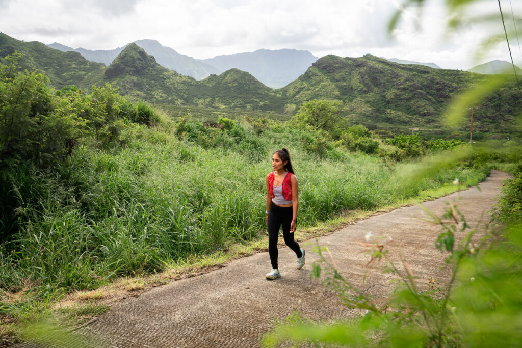
The west side of Oahu has some of the best hikes on the island. However, due to the distance from Honolulu and the town center, they are often overlooked. The star attraction on the west is Mount Ka’ala Hike, which takes hikers to the summit of Oahu’s highest peak. I had wanted to do this hike for a long time. When a rainy down downtown came, it was time to push out west in search of better weather and the highest point on Oahu.
The drive takes about an hour out west and can be worse in morning traffic so try to get an early start on this one. This parking lot at Mount Ka’ala has a bit of a reputation and a few friends scared me into thinking my windows were in big danger. Luckily, we visited on a quiet Monday morning and our car survived any break-ins in the parking lot. It’s far away from traffic, a main road, and any authorities, so I can see how it would be an easy break and enter. I advise leaving nothing in the car whatsoever.
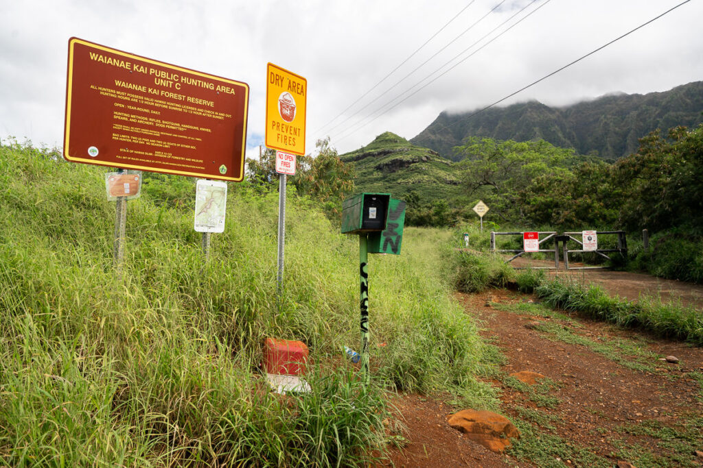
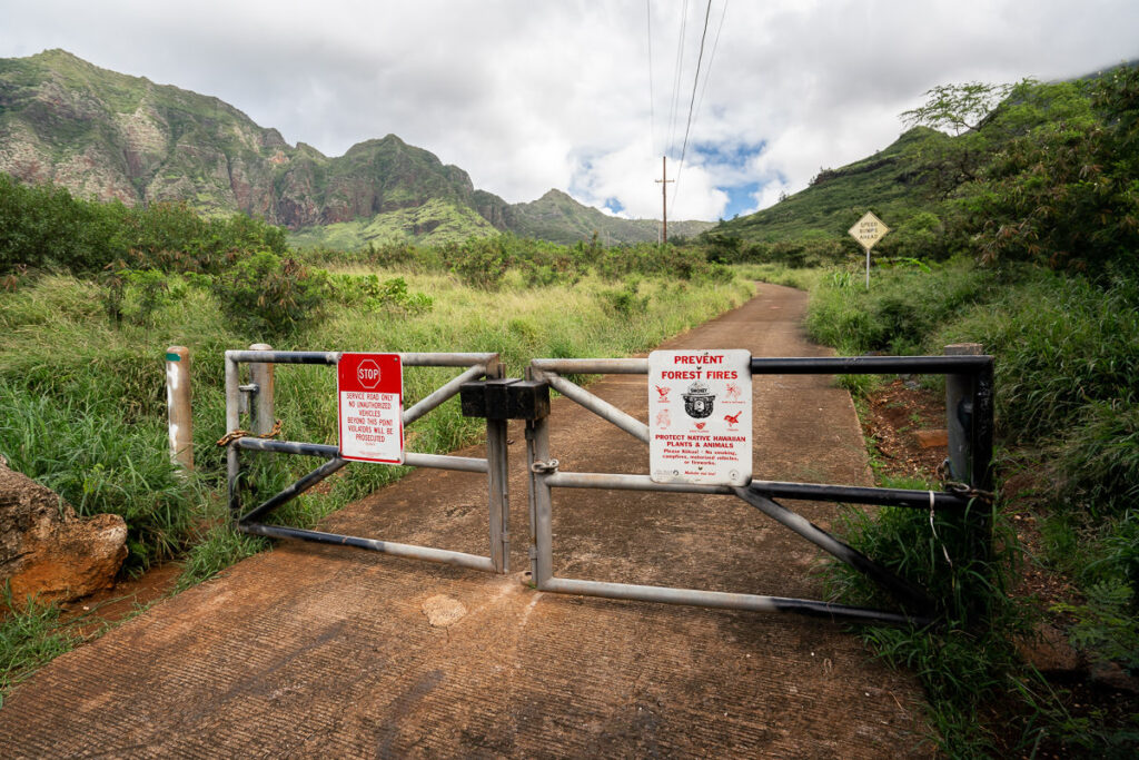
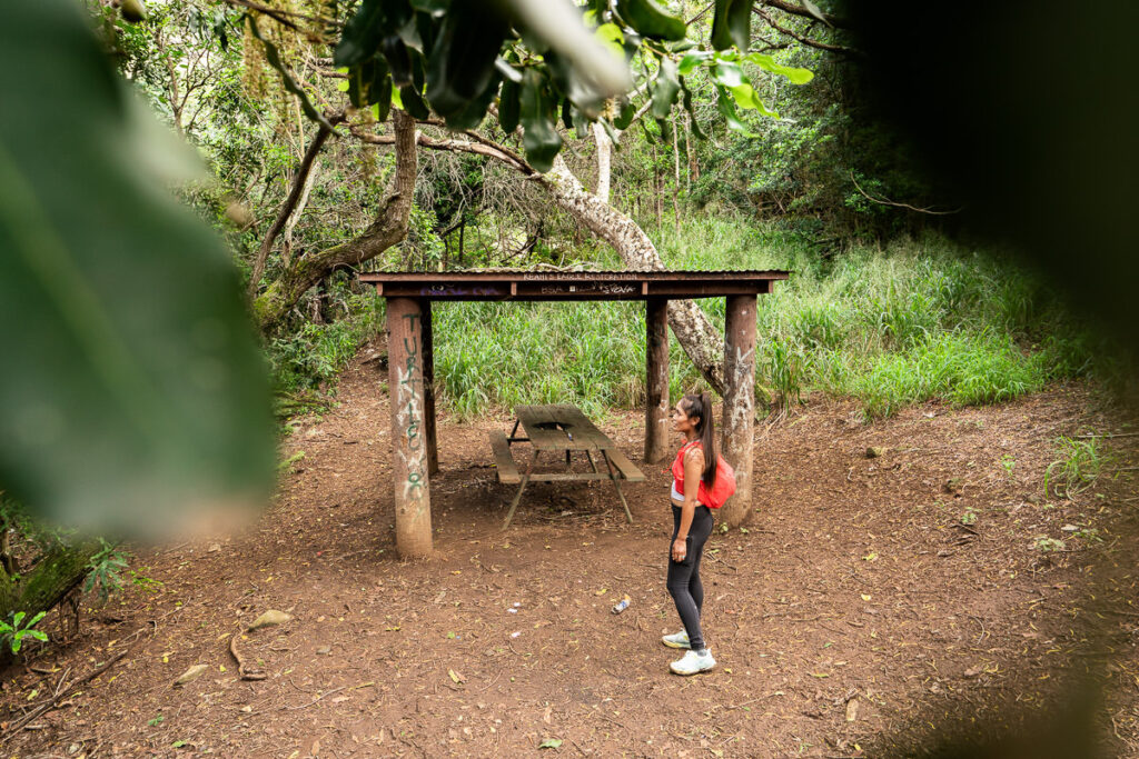
The trailhead is well-signed and it’s clear where to park and start hiking. We did see a few hunters who must have side-road access or permission to move through the locked gates but for most hikers, the regular parking spot is where you will begin the hike.
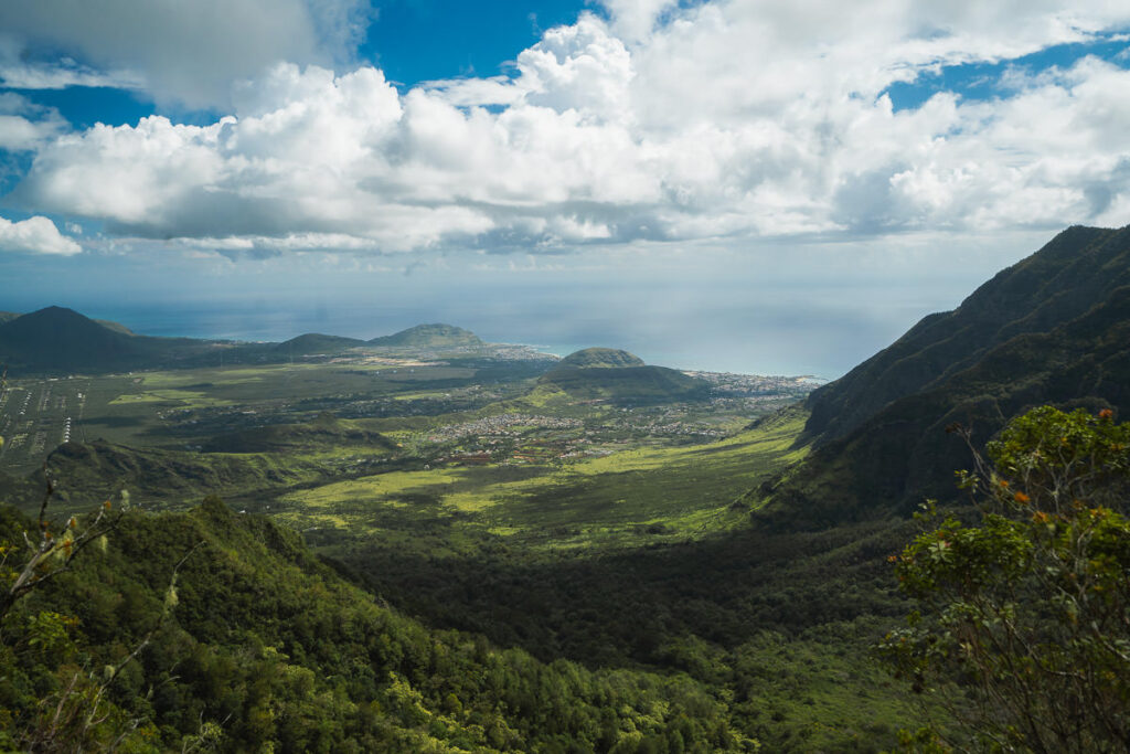
The trail begins on a paved road and unfortunately, this lasts for about 20-30 minutes of uphill grind, fully exposed to the hot sun. The silver lining is that the mountain backdrop is already beautiful in these early moments despite the Mount Ka’ala hike only just beginning.
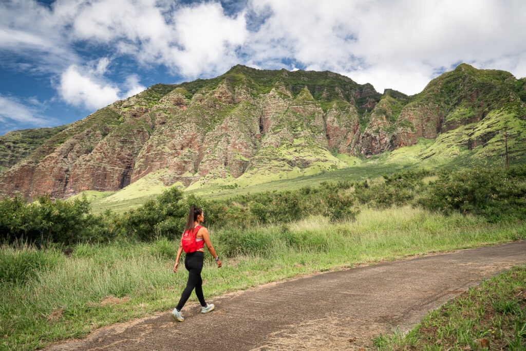
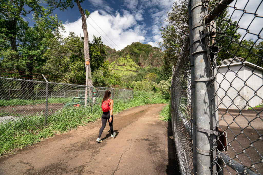
After about 30 minutes the paved road finishes, you pass through the fenced-off water department zone and enter into the first dirt trail of the hike.
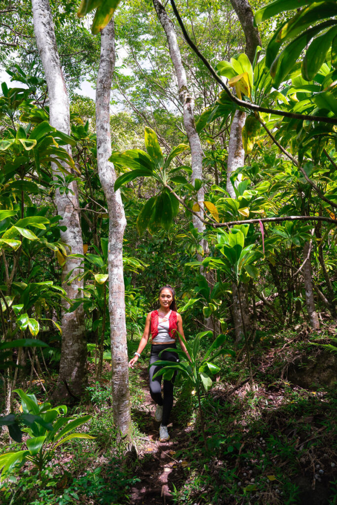
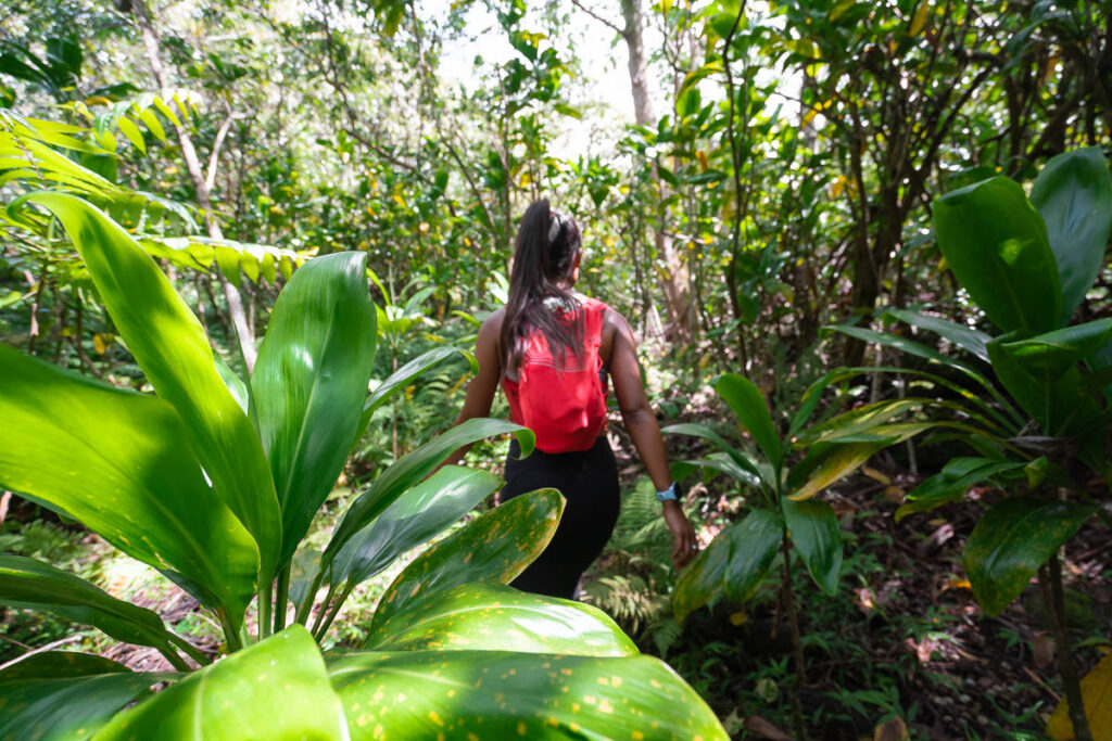
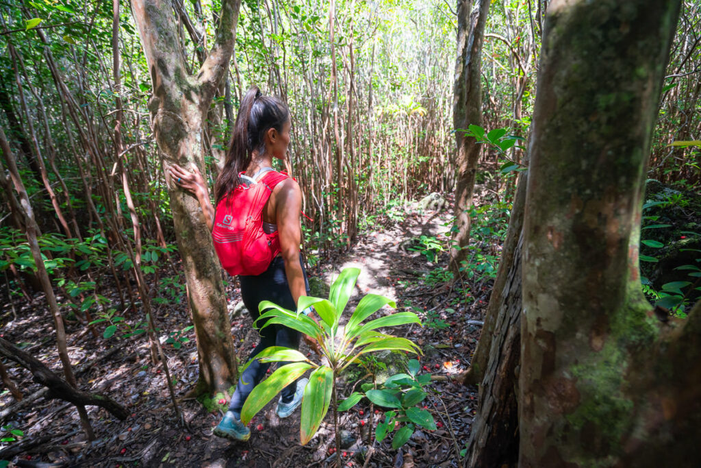
The trail eases you into the forest. First, we begin on a wide dirt road before the trail narrows and the regular rocks and roots of Oahu begin to appear. Naturally, the first few kilometers are quite fast, and then the incline and technical terrain starts to pick up and the pace slows down. The first few kilometers are really the only ‘runnable’ kilometers unless you are really pushing it. There is one very clear turn-off to the left of the trail, which is marked by a bit of a rough sign as seen below.
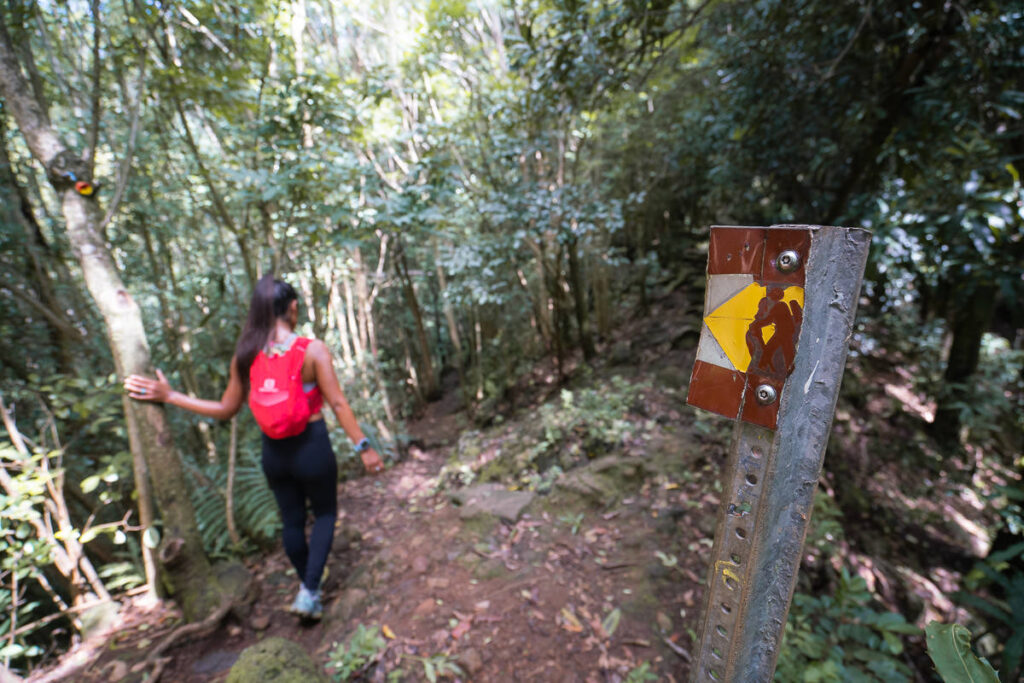
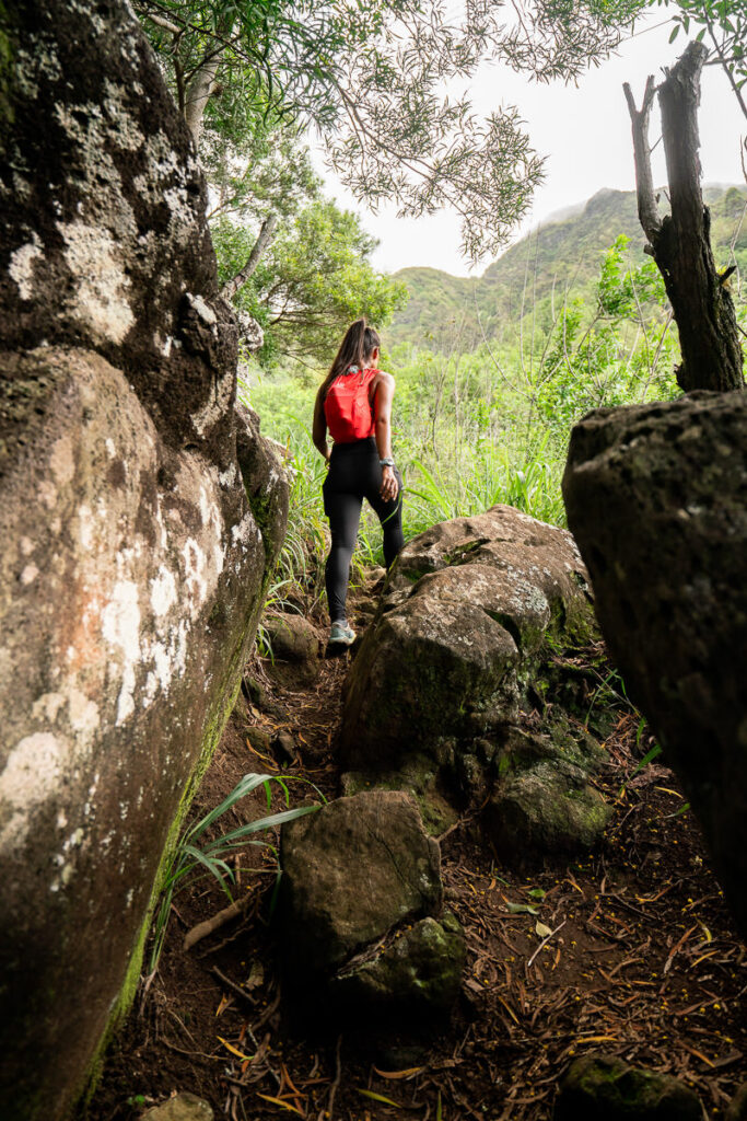
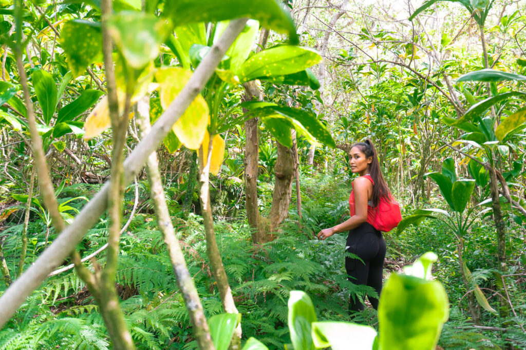
This early part of the trail (just before the major incline begins) is a beautiful tropical region like a few others on Oahu. It felt as though we were walking through a wall of green with tropical plants overflowing onto the trail.
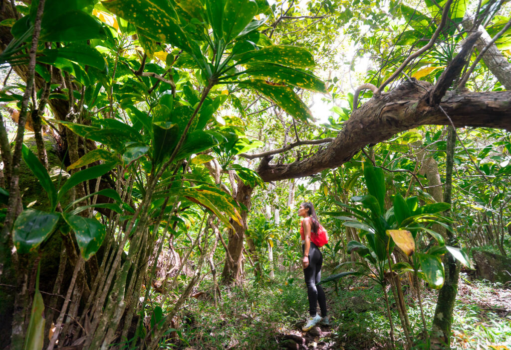
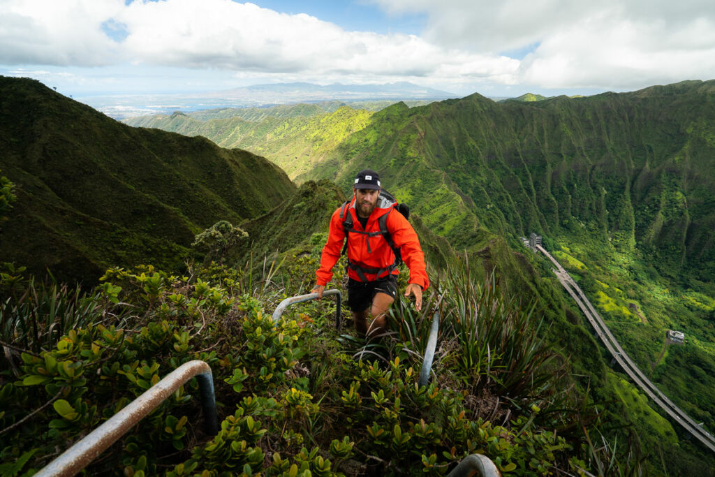
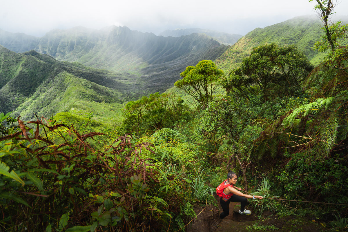
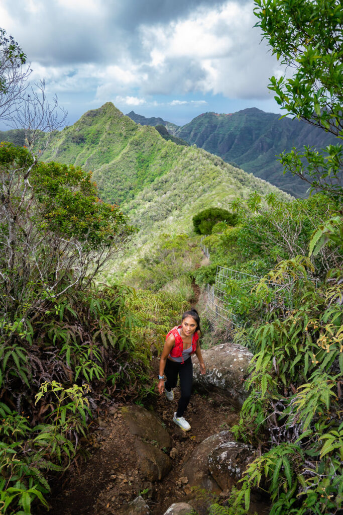
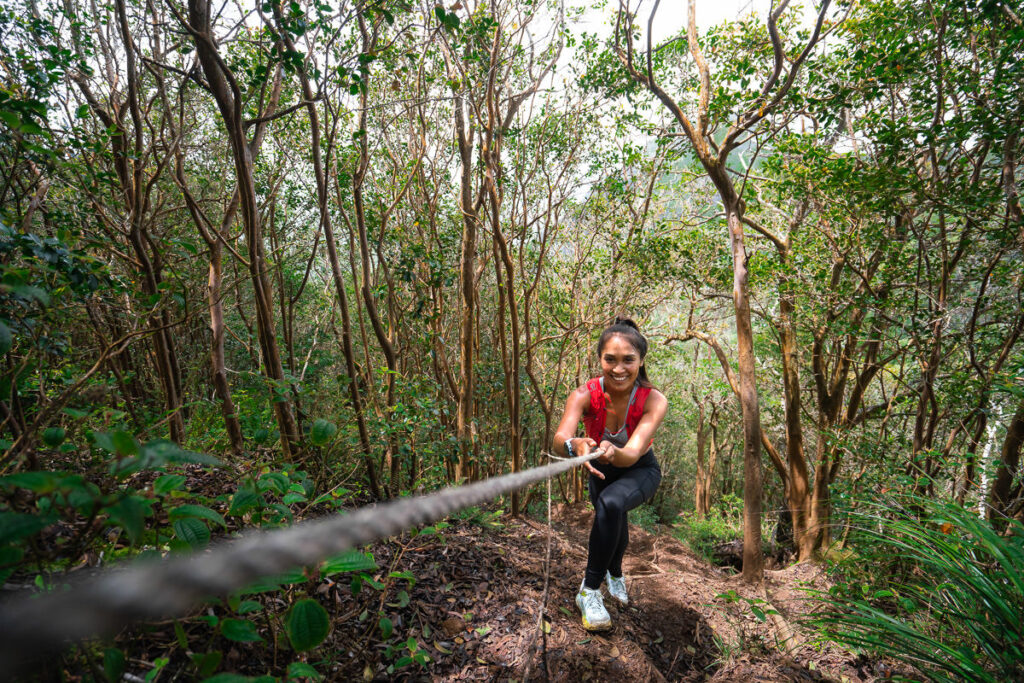
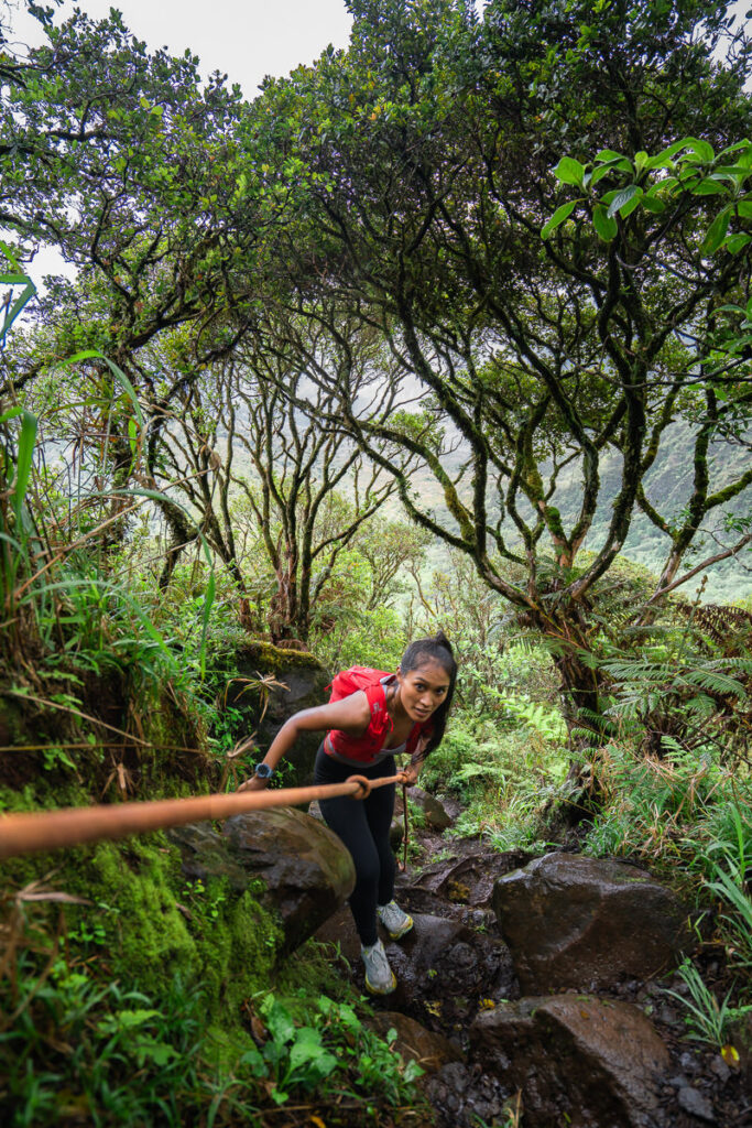
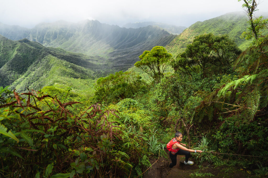
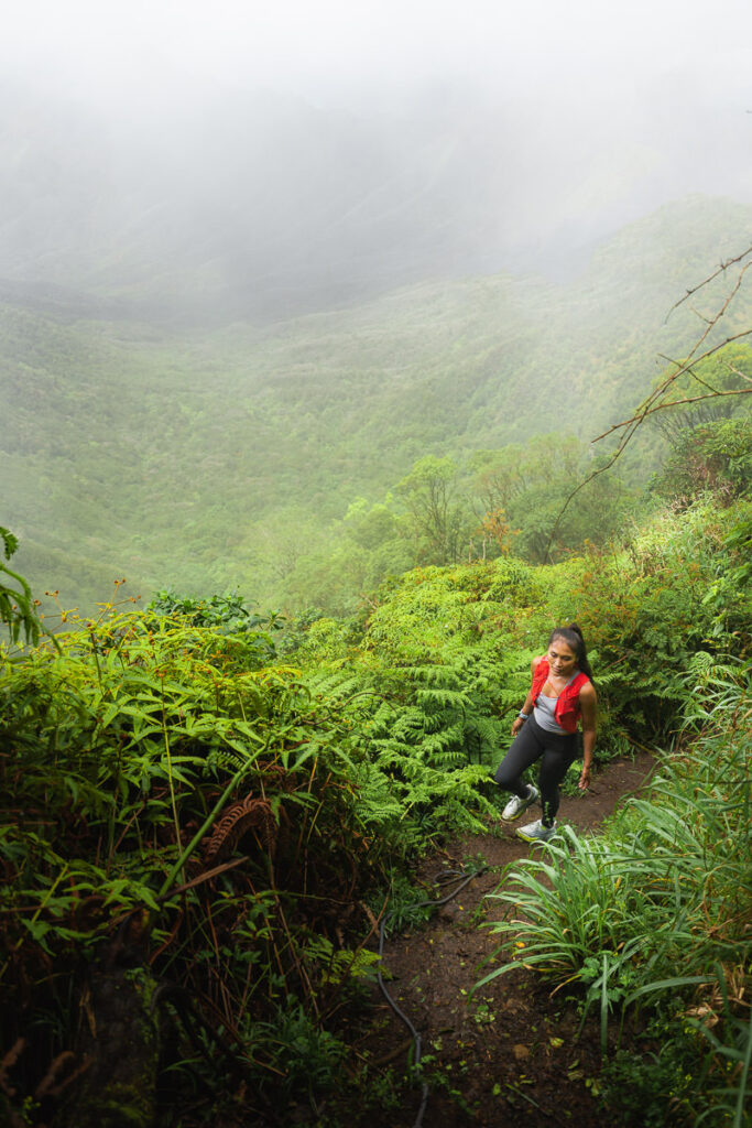
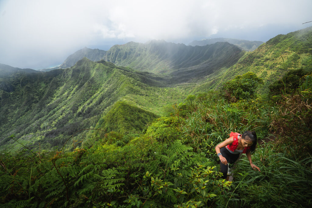
The trail emerges from this lush, green tropical zone to begin the steep and muddy climb. For the next hour or so, you will just be clambering up the hill to meet the ridge. After heavy rain, expect a slippery ascent although there are many rope installations to help in the tricky sections.
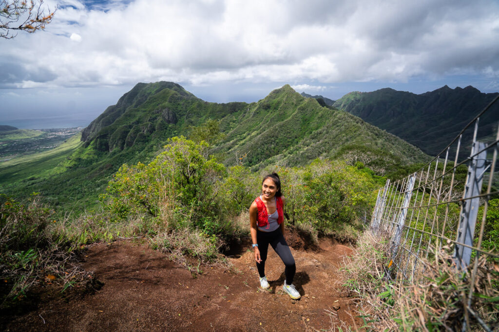
After about 700m of incline, you will reach the ridge that is marked by the fenceline. It is a bit of a relief to reach this mark as you emerge from the humidity beneath the canopy and get some fresh air that blows across the ridge. Turn right up the ridge and continue climbing toward the top of the mountain.
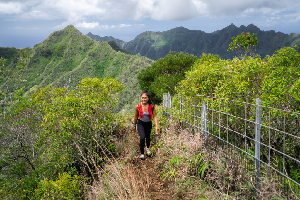

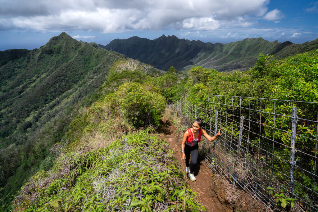
You’ll encounter a few more rope sections through this area including a nice little set of stairs that have been installed. Some of the rope sections are a little technical and can be tricky in wet conditions so take care and move slowly through these parts.
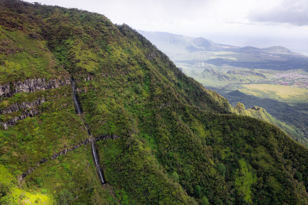
Stopping for a drinks break, we thought we could hear a waterfall in the valley below. Turns out we were right but only the aerial view from the drone would reveal the waterfall.
The final climb up to the plateau of the bog immersed us in the clouds. All of a sudden, the view disappeared and the temperature dropped. These were probably my favorite views of the entire hike as the clouds wisped through revealing parts of the view before engulfing us moments later.
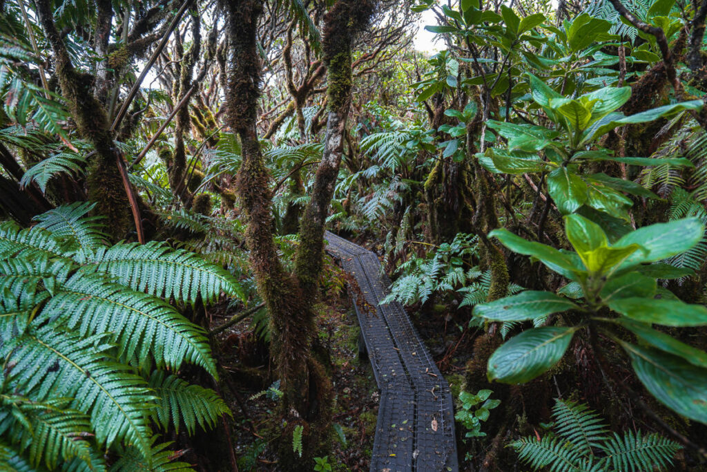
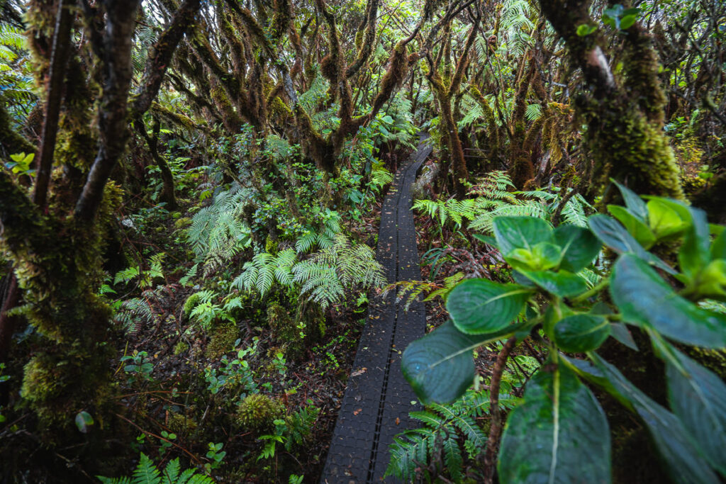
The trail reaches a plateau of sorts, where it flattens out as you hike towards the summit. For the start of the plateau, the trail is just a regular dirt path. However, the trail soon leads you along a boardwalk a bog, which is incredibly muddy. This bog is an important ecosystem of native plants and creatures such as snails, butterflies, and insects. The boardwalk has been installed so that you do not step off the trail at any point and make no contact with the native plants. Aside from being an important ecosystem, it’s a stunning section of the trail.
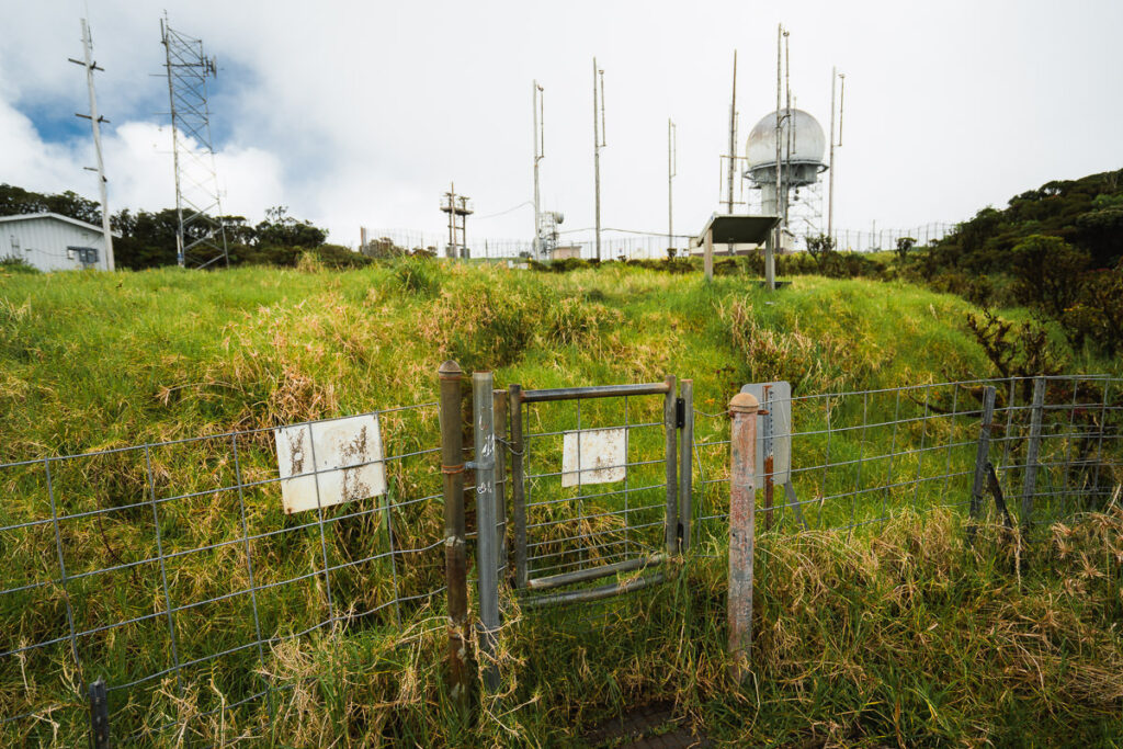
Out of the bog, we emerge to finally reach the summit. Make sure you reach all the way to the top though! The trail leads you to a small gate in front of the weather station that you are permitted to enter.
After walking through the small gate, there is a small bench that is a good spot for lunch. However, before lunch, you need to reach the highest point.
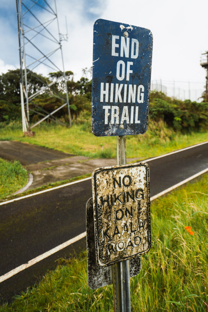
Continue on to the sign that says ‘END OF HIKING TRAIL’. Don’t worry you aren’t going much further. Turn left onto the road and walk towards the weather station. There will be a small gate on the left of the weather station.
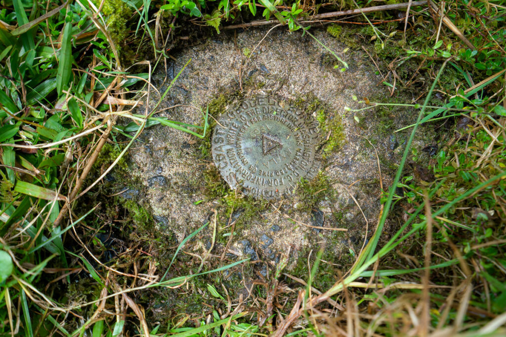
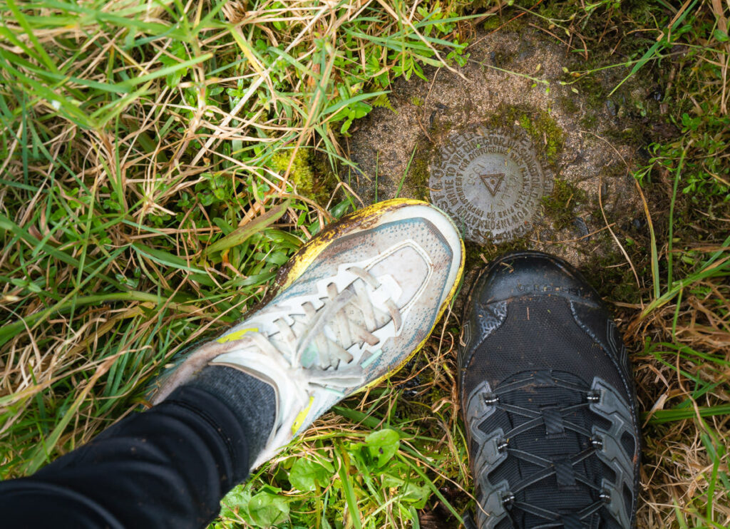
The Mount Ka’ala summit plaque was hidden when we were looking for it. It was actually quite confusing. Hidden under the grass just 10-20 yards past the small gate is a small plaque that marks the highest point on Oahu. It’s one of those photo opportunities you can’t miss, so do your best to locate it.
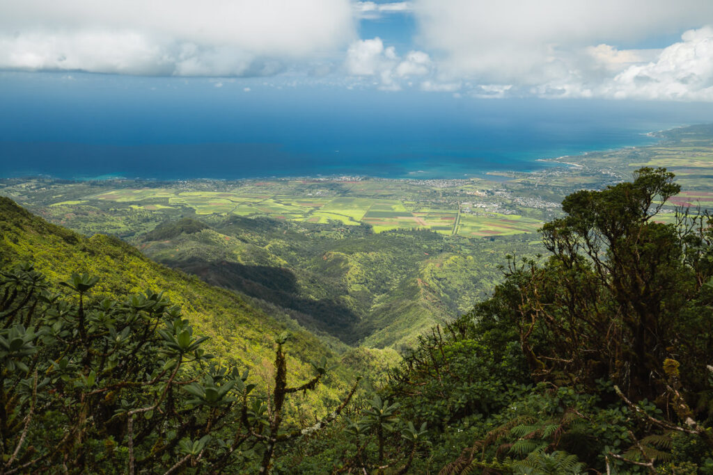
The view from the summit toward the west coast is quite impressive although not the best summit view on Oahu. This hike had some great views but many other ridge hikes on Oahu would be considered more dramatic or jaw-dropping.
After touching the summit and enjoying the view, we took some lunch and then began the hike down. It is a slippery and technical descent but nothing too major. There are no big drop-offs on this hike but still a few spots you could get into trouble so do be cautious. We gladly arrived back to our car, which had survived our absence. The entire journey took us six hours but we took many photos as you can see, flew a drone, and ate lunch for half an hour at the summit. The Mount Ka’ala hike can easily be completed in four hours by a strong hiker.
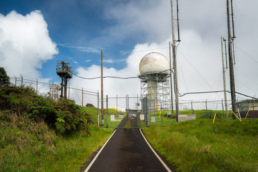
WHAT IS AT THE SUMMIT OF MOUNT KA’ALA
The Federal Aviation Administration (FAA) has a tracking station situated at the summit of a mountain. However, this station is not accessible to the general public, and it is safeguarded by the US Army stationed at Schofield Barracks, situated at the base of the mountain. I’ll share more later in the post about how you can hike, safely around the exterior of the fence to reach the summit plaque. The tracking station can be easily identified from a distance due to its distinct white, dome-shaped structure.
The weather station is operated by the National Oceanic and Atmospheric Administration (NOAA). This station collects weather data and provides vital information about the climate and weather patterns of the area. The station consists of several buildings, including a dome-shaped structure that houses a radar system, a weather monitoring station, and an observatory.
Besides the weather station, the summit also has a small picnic area where hikers can rest, refuel, and enjoy the scenic views. There is also rainwater at the summit if you need to filter water in an emergency but is generally for the worker’s supply and not for public use.
DRIVING TO THE SUMMIT VIA MOUNT KA’ALA ROAD?
Mount Ka’ala Road is a winding road that leads to the summit of Mount Ka’ala. This road is primarily used by government agencies and authorized personnel such as military personnel, researchers, and employees of the National Oceanic and Atmospheric Administration (NOAA). The road is not open to the public or hikers and comes from a different direction than the popular hiking route.
I hope you enjoyed this guide to hiking Mount Ka’ala, the highest point on Oahu.
WHERE TO STAY ON OAHU
- Hilton Hawaiian Village Beach Resort (Overall Favorite): In the heart of Waikiki, this high-end resort is right on the beach with a private lagoon.
- Sheraton Waikiki (Luxury): A luxury resort with the most amazing infinity pool on the island, which overlooks the beach.
- Ewa Hotel Waikiki: (Value): Ewa Hotel is just one block back from the beach and is just over $150 USD.
- Waikiki Beachside Hostel (Budget Choice): A budget alternative, which is still in an amazing location.
- Disney Aulani Resort (Family Choice): This is a resort your kids will never forget. It honestly feels like you are living in a theme park.
MORE OAHU BLOG POSTS
I lived on Oahu for two years and loved adventuring from the beaches to the mountains to the waterfalls! These are my most popular blog post and guides from the beautiful island of Oahu to help you plan your trip!
- What to pack for Hawaii: THE HAWAII PACKING LIST: WHAT TO PACK
- A helpful guide to choosing accommodation: WHERE TO STAY ON OAHU
- Most epic hike on Oahu: THE STAIRWAY TO HEAVEN OAHU, HAWAII
- The best Waterfalls: AMAZING WATERFALLS ON OAHU, HAWAII
- Ultimate Cliff Jumping Guide: 11 BEST CLIFF JUMPING SPOTS ON OAHU
- Guide to Swimming with Sea Turtles: WHERE TO SEE TURTLES ON OAHU
- The best Waterfall Hikes: TOP WATERFALL HIKES ON OAHU
- Best Tours: 20 BEST TOURS ON OAHU
- The Ultimate Guide to Oahu: 80 AWESOME THINGS TO DO ON OAHU