
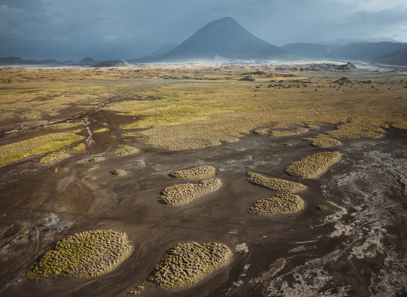
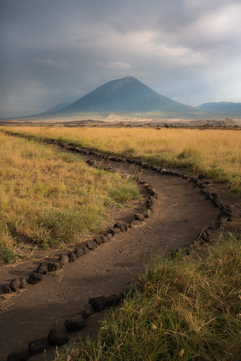
Ol Doinyo Lengai, also known as ‘Mountain of God’ in the Maasai language, is the only active volcano in Tanzania and the third highest peak in the country. Located in the Gregory Rift, which is just south of the nearby Lake Natron in the Arusha region of Tanzania.
The volcano is a popular hiking destination for those looking for a unique challenge. It’s one of the steepest hikes I’ve done in my life with 1600m of elevation in just five kilometers. The peak reaches 2,962m and is an interesting geological destination with the carbonatite rock derived from magma, a unique feature in this region.
The hike takes anywhere from 6-10 hours and the summit attempt often begins in the middle of the night to reach the peak of the volcano. This early start is to enjoy the sunrise from the summit and to avoid the harsh heat of the region, which can often reach 50 degrees celsius.
BOOK YOUR OL DOINYO LENGAI CLIMB: I did my Ol Doinyo Lengai climb with Altezza Travel and it was an incredible trip. If you want to book with Altezza, they offer a 5% discount to my readers when you use the code JACKSON5 to book your trek.

OL DOINYO LENGAI VOLCANO HIKE DETAILS
- Hike Distance: The total distance of the hike is 11.2km out and back (return trip)
- Hike Duration: This depends a lot on your speed and it can range a lot due to the extreme slope and terrain. The hike can be completed in about 6-12 hours depending on how long you spend at the summit and your hiking pace.
- Our elapsed time was 11 hours but we spent four hours waiting for good weather conditions and had lots of breaks. Our actual moving time was just 5.5 hours as we had a decent hiking pace. Our guide told us he took an 80-year-old up the summit and it took 20 hours round-trip.
- Hike Difficulty: This trail is quite difficult due to the extreme incline. In just five kilometers you will ascend more than 1600 meters and this is at elevation. The hike will reach 2960m by the time you are at the summit so expect to be short on breath. The other difficulty factors are that you will probably begin at midnight or early so hiking without sleep is tough.
- At the summit it can be freezing so there are also weather factors to consider. It’s short, which means it is mostly a mental battle and most people are capable of achieving it at their own pace. Give yourself a chance and have a ‘no-quit mentality and you will make it I’m sure.
- Hike Incline: 1600 meters.
- My Strava Map Upload: Ol Doinyo Lengai Hike
YOU MIGHT ALSO LIKE MY OTHER GUIDES
- For the Mountain Lovers: 14 BEST HIKES IN TANZANIA
- The Top Waterfalls: 12 AWESOME WATERFALLS IN TANZANIA
- What to do in Tanzania: 25 AWESOME THINGS TO DO IN TANZANIA
WHERE IS THE OL DOINYO LENGAI VOLCANO HIKE
Ol Doinyo Lengai Volcano is in the Lake Natron region. Several Maasai villages and lake-side lodges are found nearby and your guide for the hike will most likely be a Maasai. Most people hiking Ol Doinyo Lengai do so as part of an extended stay in the region including a Lake Natron lodge. I’ve included the pin location below so you can see where the volcano is situated in regards to Arusha but you will need a 4×4 and most likely a guide to reach this area.
GUIDES AND PERMITS FOR OL DOINYO VOLCANO HIKE
To enter Ol Doinyo Lengai, you will need to have done prior organization and it isn’t a hike you can do independently. Firstly, you will need to pay the park fees and permit to enter the Lake Natron Area.
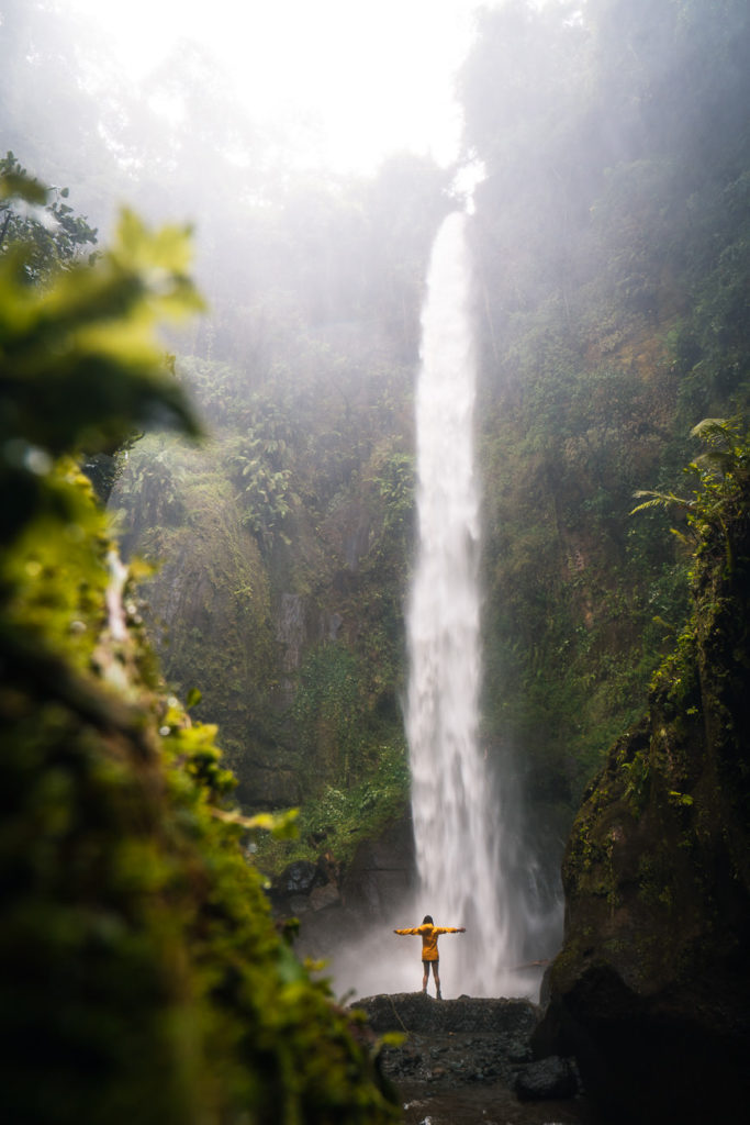
As I mentioned earlier, most people visit several attractions in the area to get value out of their permits including Lake Natron and the nearby Ngare Sero Waterfall, which were part of a four-day expedition I did with Altezza Travel. It included the Empakaai Crater hike, Olmoti Crater hike, Ngare Sero Waterfall, and climbing Ol Doinyo Lengai.
In addition to the park permit, you will also need to employ the services of one of the Maasai guides. This was organized by our lodge, Lake Natron Luxury Camp, and cost $100 per person (plus tip) or if you stayed at their lodge for three nights it was included for free.
BOOK YOUR OL DOINYO LENGAI CLIMB: I did my Ol Doinyo Lengai climb with Altezza Travel and it was an incredible trip. If you want to book with Altezza, they offer a 5% discount to my readers when you use the code JACKSON5 to book your trek.
The last part to consider about reaching Ol Doinyo Lengai Volcano is that you will need a 4×4 vehicle, which is capable of handling the tough terrain of the region. I hiked Ol Doinyo Lengai as part of a four-day expedition of several hikes in the region with Altezza Travel and we had a driver with a 4×4 vehicle for the entirety of our trip.
MY EXPERIENCE HIKING OL DOINYO LENGAI VOLCANO
The Ol Doinyo Lengai volcano climb was part of a four-hike expedition in Tanzania with Altezza Travels. After completing the Empakaai Crater hike and Olmoti Crater hike in Ngorongoro, we headed to Lake Natron.
We were meant to summit Ol Doinyo Lengai the first night we arrived, but a prediction of bad weather saw us delay our hike to one day later. That gave us a spare day to cool off at the Ngare Sero Waterfall hike and explore the natural springs and flamingos of Lake Natron.
From our lodging, Lake Natron Luxury Camp, we had constant views of Ol Doinyo Lengai and we took our chances to snap a few photos of the volcano we would be summitting in the coming hours.

After waiting out the storm we were all set to go on our second night staying at Lake Natron. There are a few logistics to know about when climbing Ol Doinyo Lengai (The Mountain of God).
THINGS TO KNOW ABOUT HIKING OL DOINYO LENGAI
- The hike normally begins at about midnight as it takes most hikers six hours to reach the summit for sunrise.
- Hiking during the night helps you avoid the heat on the way up and also the strong afternoon heat on the way down.
- You’ll be hiking through the night without sleep unless you can nap before beginning the trek.
- The trek is incredibly steep with a short 5km to the summit but 1600m of incline is very challenging
- The terrain is rocky, slippery, and often quite hard to manage. I slipped many times and so did our guide. We all bit the dust at some point.
- The summit is very cold and you will need warm clothes for the summit.
- You carry all your gear. This is not Mount Kilimanjaro where you have a porter. Your food, 3L of water, cameras, and gear is on your own back.
- 2.5L to 3L of water is recommended
So with those main points regarding the logistics, I’ll get back to my experience on the Mountain of God. After discussions with our Maasai guide Wilson, we decided to leave our camp at 11:30 am and begin the trek at about 12:30.
We managed to nap for a few hours before leaving, which makes it much easier to survive. After a bumpy 30-minute drive from Lake Natron Luxury Camp, we had reached the foot of the mountain. The drive actually helps you a bit as you gain a few hundred meters of elevation in the car.
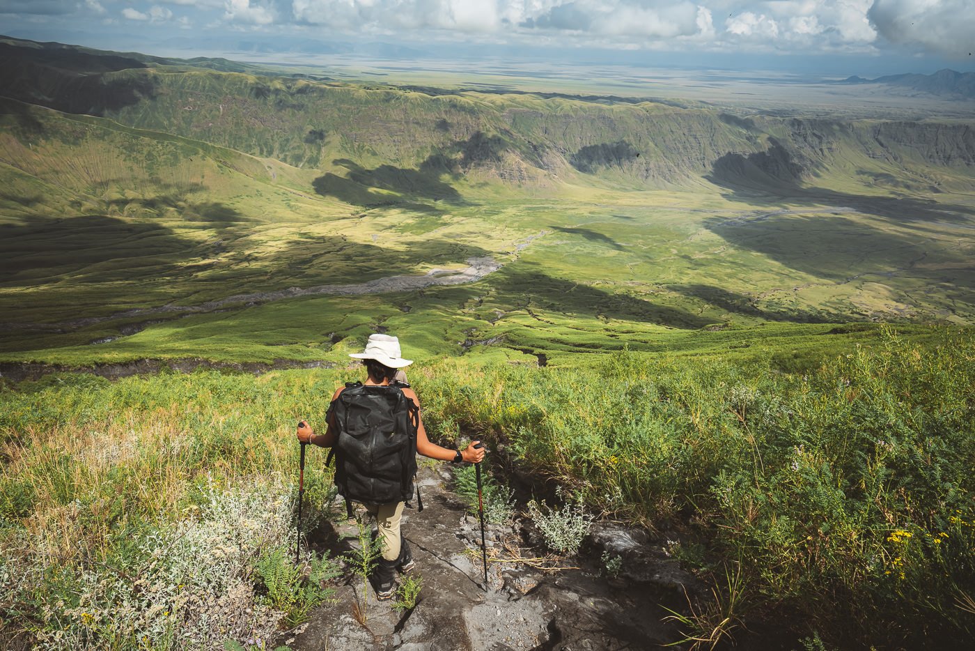
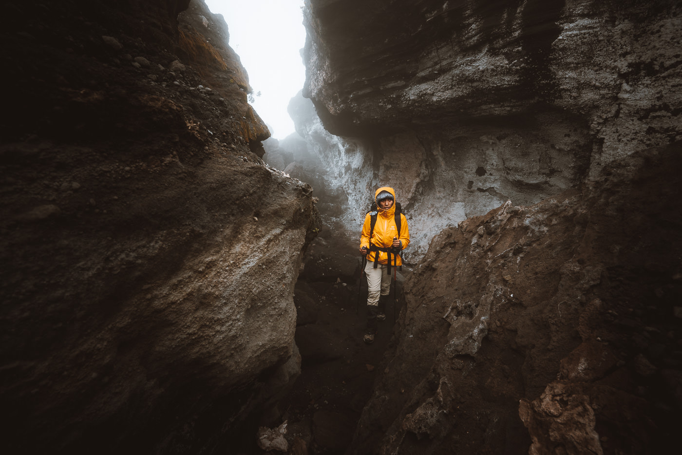
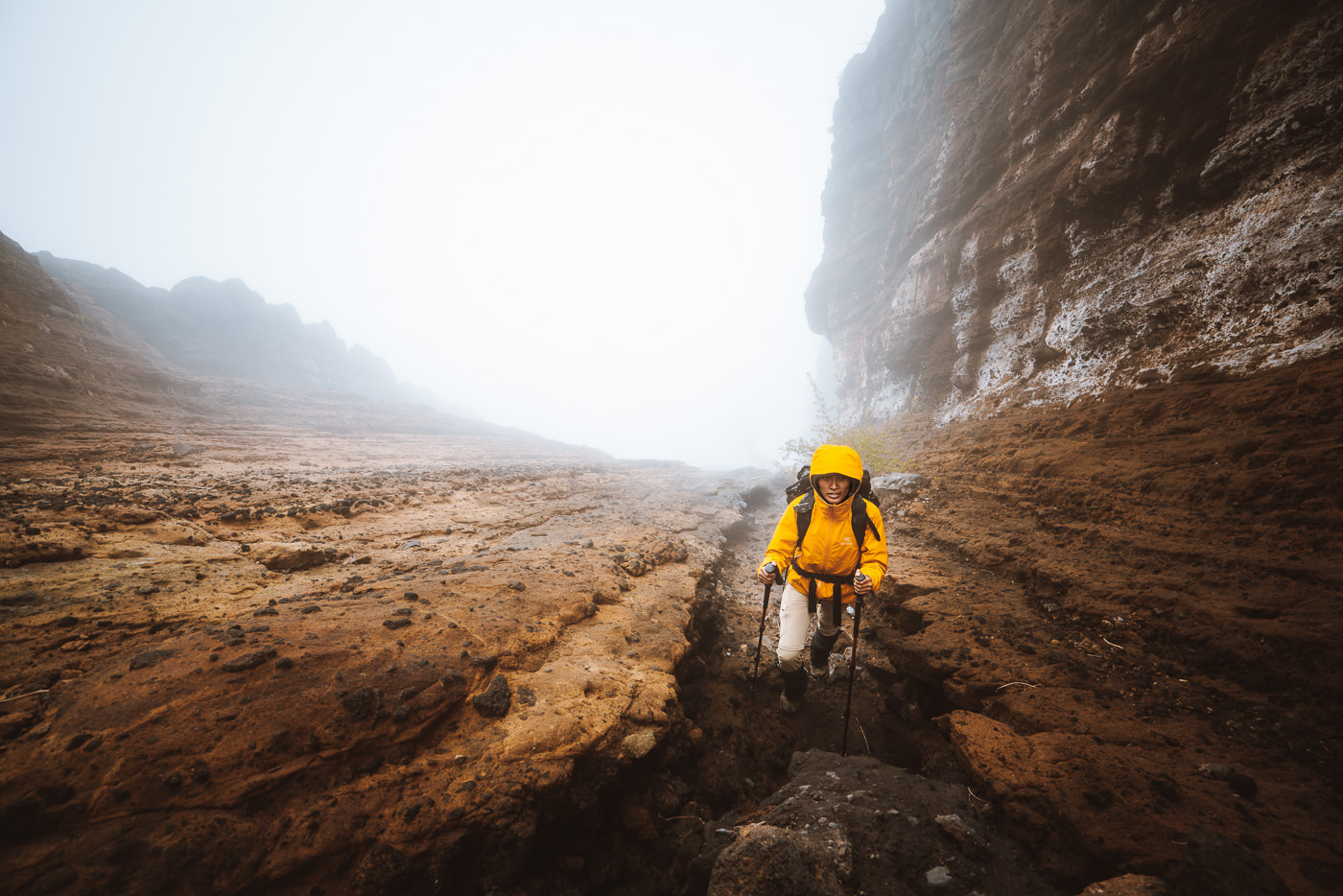
The trail begins by beating its way through thick prickly bushes with a steady incline. It’s quite a rough way to start a hike but this mountain doesn’t really care. It’s brutal and unforgiving. The first 2km is quite a moderate gradient and we did the first two kilometers in an hour.
I was left wondering how it was going to take us a further five hours to complete just three kilometers. The answer was that it wouldn’t we were going much quicker than normal and would sleep in a cave to pass some time higher up.
Note: The photos in the ascent portion of this blog were taken on the descent because obviously, it was too dark on the ascent for photos.

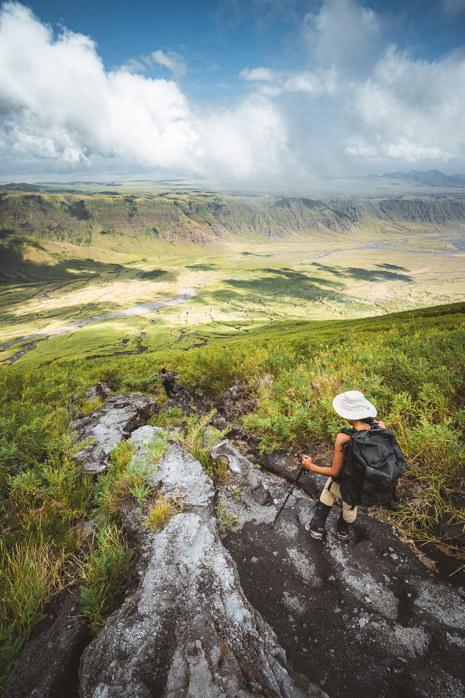
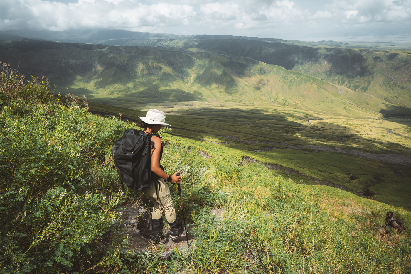
After the first couple of kilometers, the trail really ramps up the intensity. Don’t be surprised to trek in a t-shirt and still be sweating profusely. You will gain about 400m of incline per kilometer for the next three kilometers until reaching the summit at 2,962m. If you aren’t savvy with hiking stats, let me just tell you it is basically a staircase without the stairs.
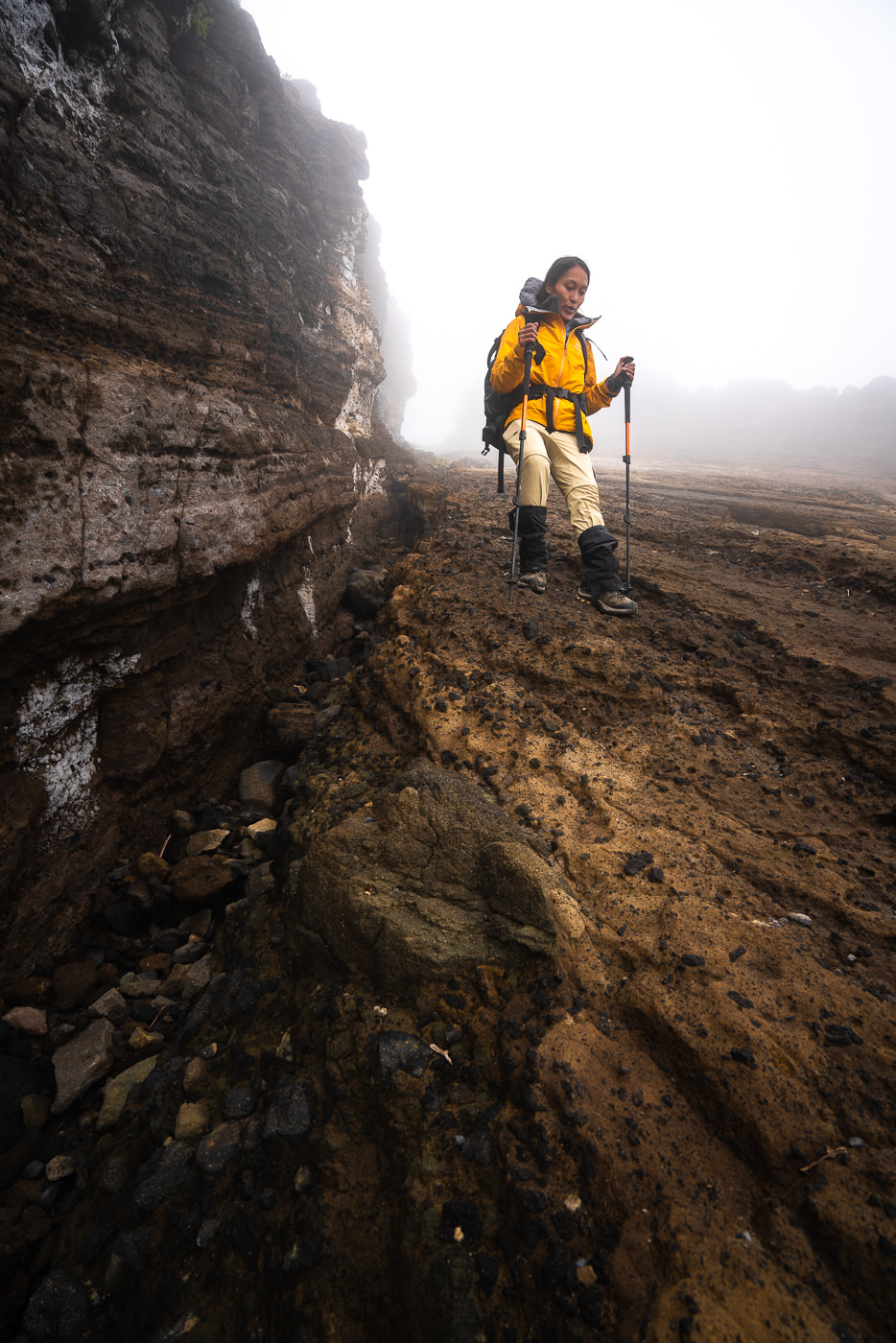
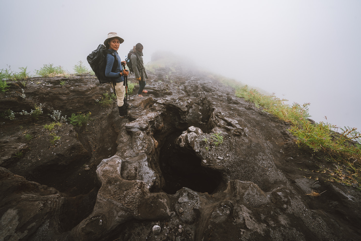
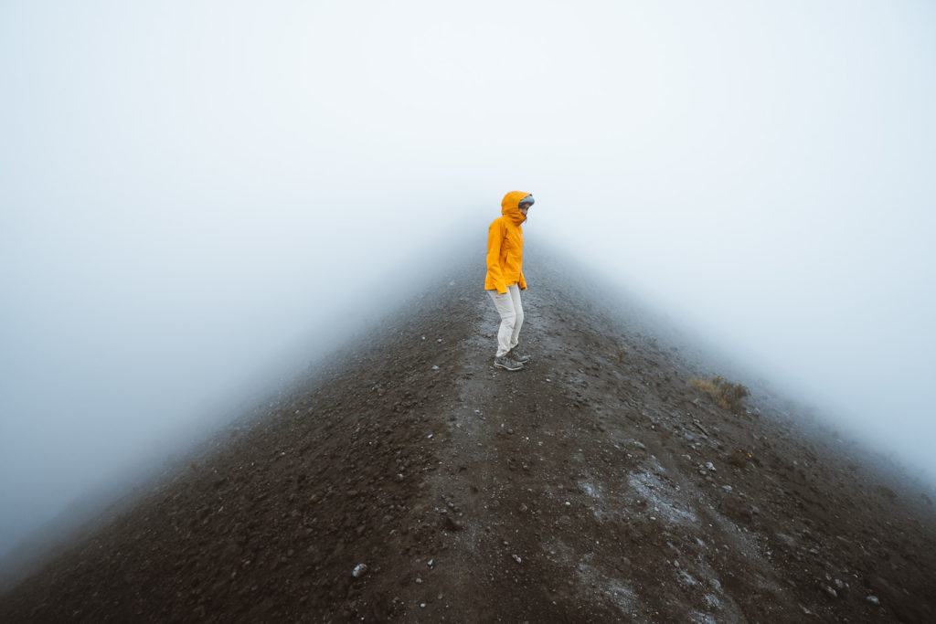
The terrain varied from dusty paths or rocks with footholds to smooth, slippery rocks. It was one of those hikes where you can expect to concentrate 100% of the time just to remain upright. With your head torch lighting the path, most of the ascent is spent watching your feet and pondering your life decisions. We could see a faint outline of the peak for most of the hike but it was nice to be ‘in the dark’ about how far or how high the summit was, we just kept walking.

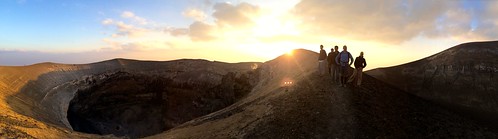
At about 4 am our guide realized we were way too far ahead of schedule and we crammed together in a cave and went to sleep on the rocks. I remember waking up and looking down to the view and being a bit surprised to be fast asleep on a steep slope at 2300m of elevation. At 5 am we continued up the mountain and reached the summit by 6 am, hoping for that early sunrise glow.


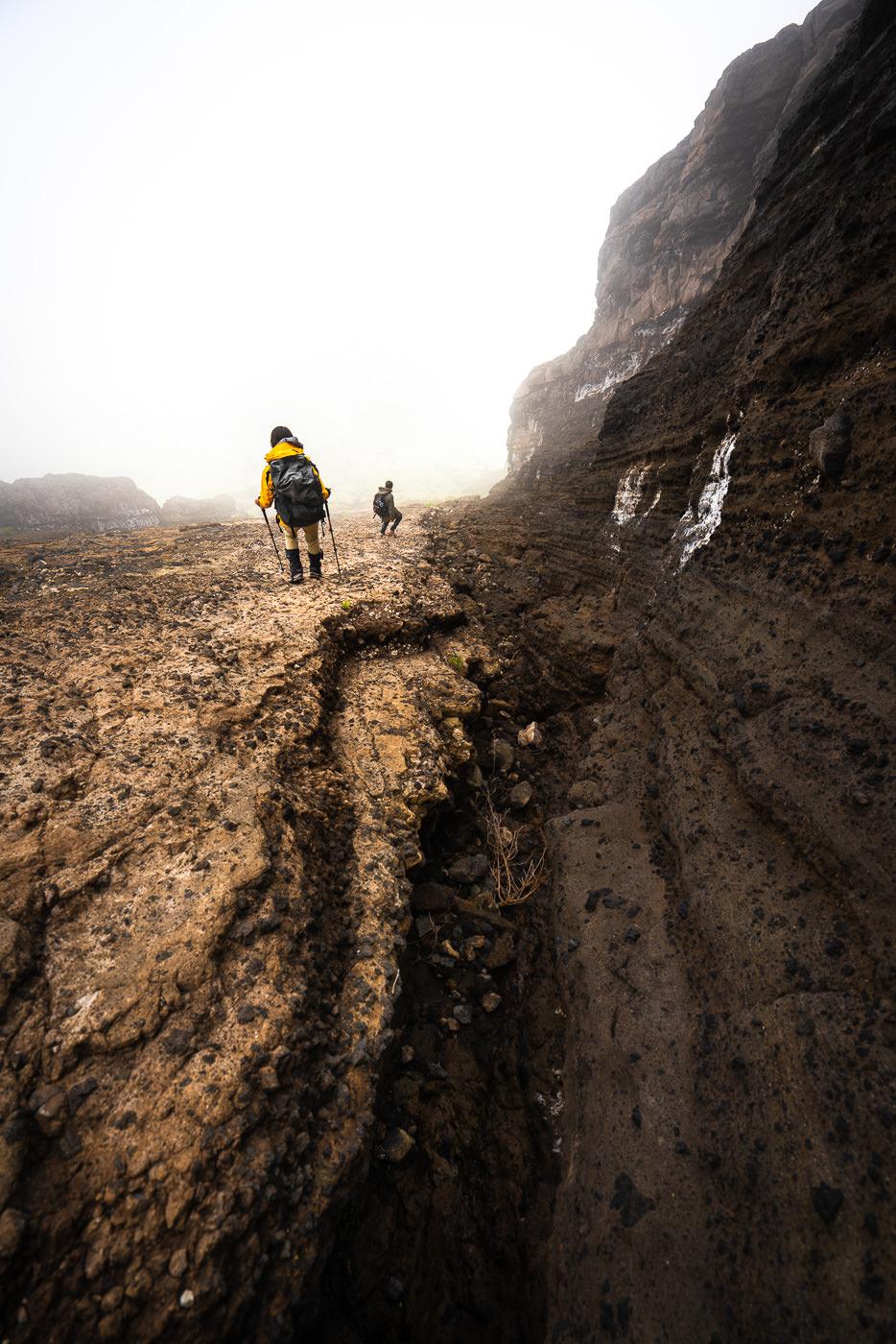
Unfortunately, we were inside a cloud, despite watching the stars and full moon all the way up during the hike. Ol Doinyo Lengai is actually quite well-known for giving hikers a white-out at the summit. We again curled into balls, hiding from the freezing wind-chill and waiting for the clouds to clear. They tried their best and so did we. Waiting for a ridiculous three hours at the summit still wasn’t enough.
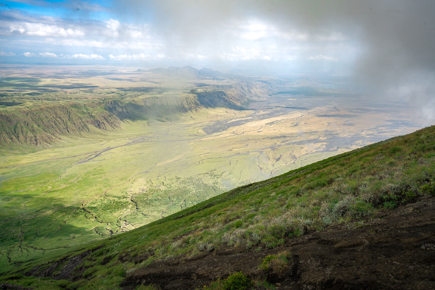
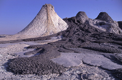
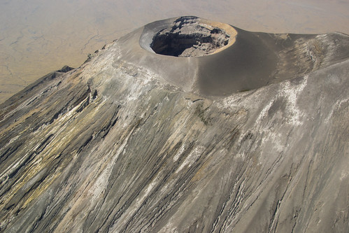
The mountain had the final say and we decided to descend without catching a view inside the crater or of the surrounding region. The clouds did clear enough for us to see the lava tower inside the crater but only momentarily.

On the descent, we managed to break through the clouds in some moments to enjoy the view of the Great Rift Valley and Lake Natron. I’ll share with you some photos from other photographers to give you an idea of what you can see at the top on a clear day. Luck favors the brave but sometimes you still get stuck inside a cloud.
The effusion of natrocarbonatite lava inside the pit crater is what you can hope to see. The last major eruption was in the 1960’s but you can often still have small eruptions these days. The smell of sulfur strikes you as you near the summit, with lots of small shoots coming out through the lava rock throughout the ascent.


The descent took us just two hours compared to the long journey up. It’s quite slow-going due to the very, very slippery terrain. I fell multiple times and even our guide was on the ground a few times. They were only minor slips but we are pretty seasoned hikers and our guide is a Maasai local just to give you an idea of the difficulty on the descent.
Because we waited so long at the summit, we ended up making it back to our vehicle at 11:30 am and copped some pretty hot conditions on the last part of our descent. You definitely don’t want to be on this mountain in the heat of the day even if that is when the summit might be the most likely to be clear.
I hope you enjoyed this guide about the Ol Doinyo Lengai hike and have better luck at the summit than we did!
MORE TANZANIA BLOG POSTS
- For the mountain lovers: 14 BEST HIKES IN TANZANIA
- The top waterfalls: 12 AWESOME WATERFALLS IN TANZANIA
- The must-do: CLIMBING KILIMANJARO: WESTERN BREACH ROUTE
- Tanzania’s second highest peak: MOUNT MERU CLIMB IN TANZANIA
- Best place to base in Tanzania: WHERE TO STAY IN ARUSHA
- What to do: 25 AWESOME THINGS TO DO IN TANZANIA
- My favorite solo adventure: USAMBARA MOUNTAINS
TOP 3 PLACES TO STAY IN ARUSHA
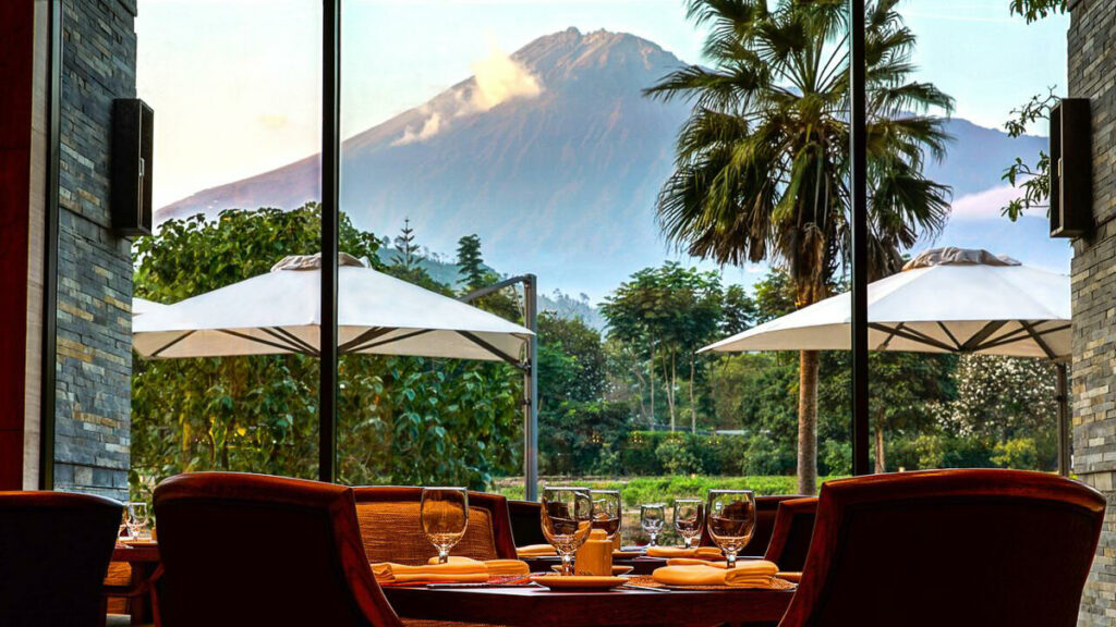
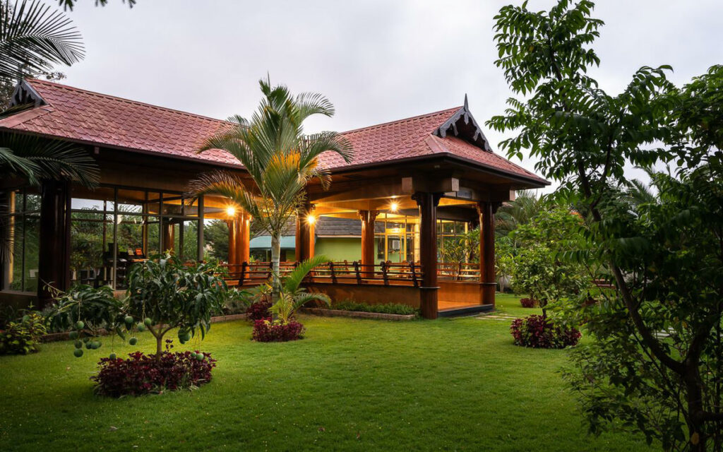
- Most Luxurious: Gran Melia Arusha – Incredible view of Mount Meru and premium 5-star luxury.
- Where I stayed on a budget: Wakawaka Hostel– Cheap, great location and chill vibes
- Best value place to stay: Tulia Boutique Hotel & Spa – very cheap price but has pool and high quality facilities and rooms.
Rufina
Friday 9th of April 2021
Hi congratulations for hiking to Oldonyo Lengai, I was there on December 2020 we had a great time and the Crater was clear, but March 23rd we were there again and the weather was challenging the Crater was not clear due to the clouds. Just when we were on those Rocky it were getting clear and some of us went back to see the Crater. It was incredible.... Got some pictures