
Kilelema means ‘that which is difficult or impossible’ and the translation of Njaro means ‘bird’. History tells us when local tribes looked up at the mountain we know now as Kilimanjaro, they saw it as a perilous peak too difficult to reach, even for birds.
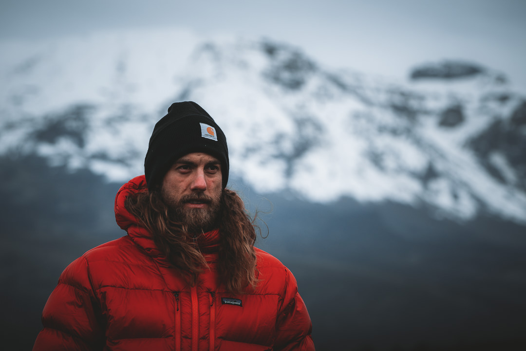
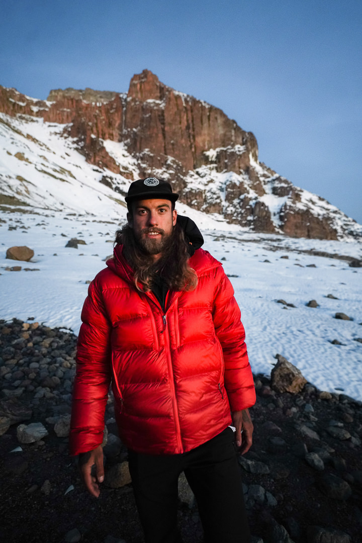
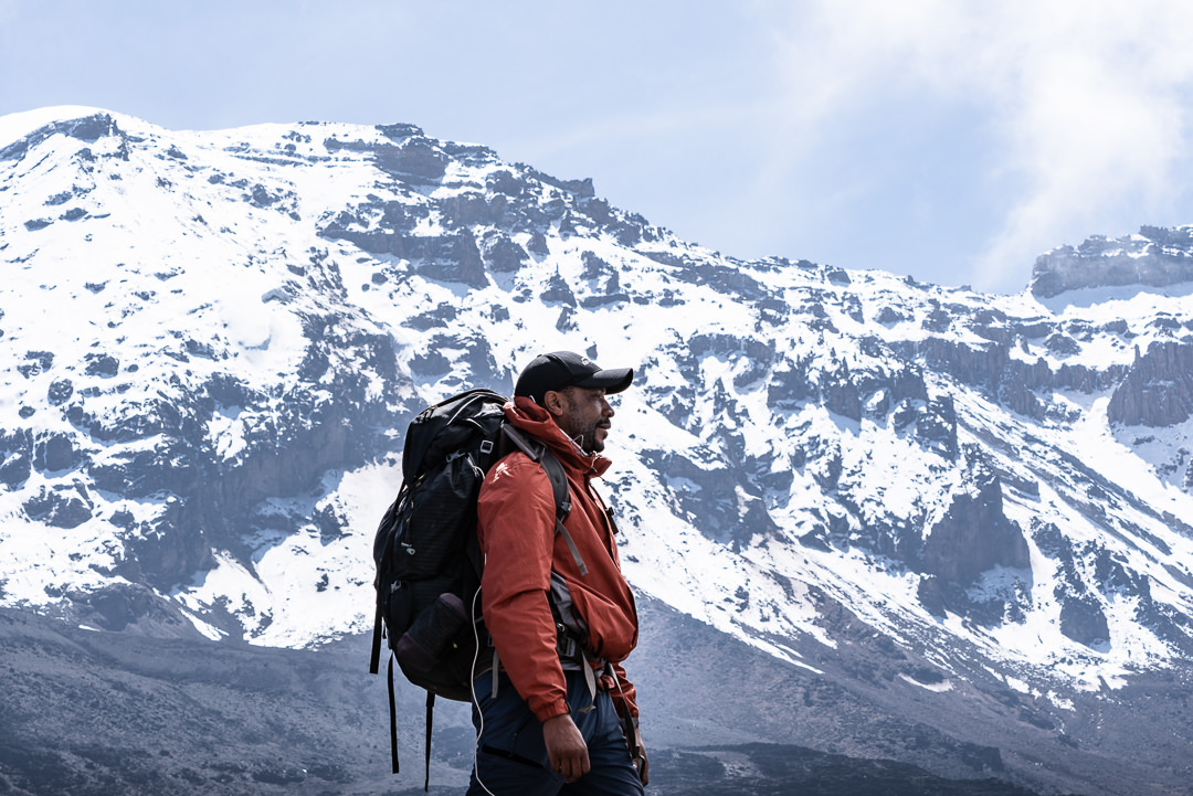
After settling in the town of Arusha for a few days, our journey up the ‘impossible mountain’ would be a nine-day expedition on the Western Breach route. There are many paths to Uhuru Peak, the summit of Kilimanjaro. However, the Western Breach is known to be the most scenic route of all. The Western Breach is also the most technical and physically demanding path to the summit, which is coined ‘The Roof of Africa’ as it’s the highest peak on the continent.
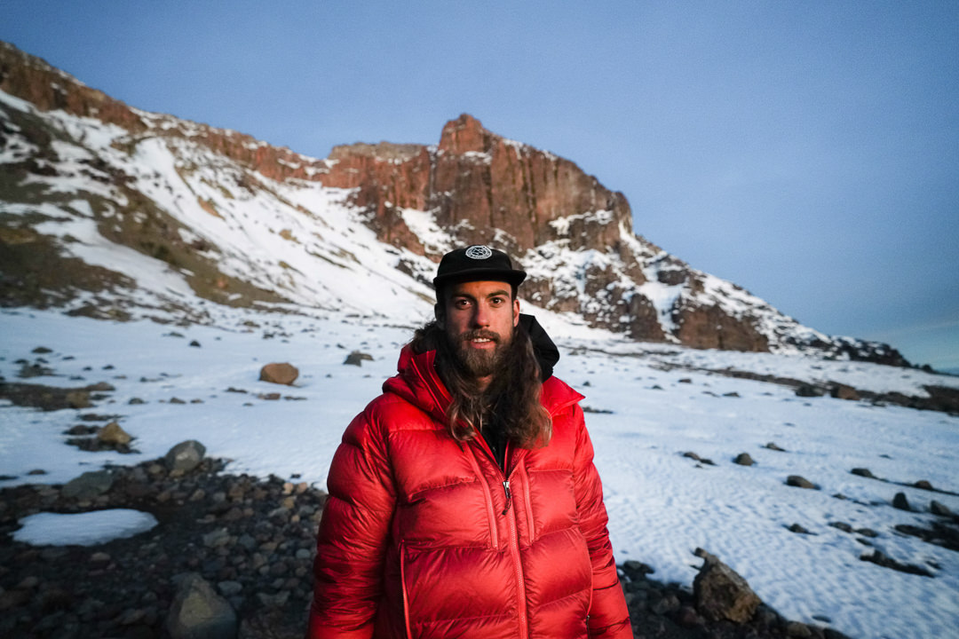
After two intense years of trekking, hiking, and multi-day expeditions I held no doubts about my physical ability to summit. However, with an altitude of 5,895m, Uhuru Peak is often a battle against the altitude more so than a test of one’s physical endurance.
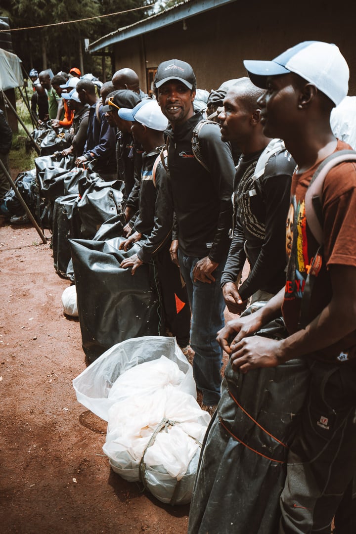
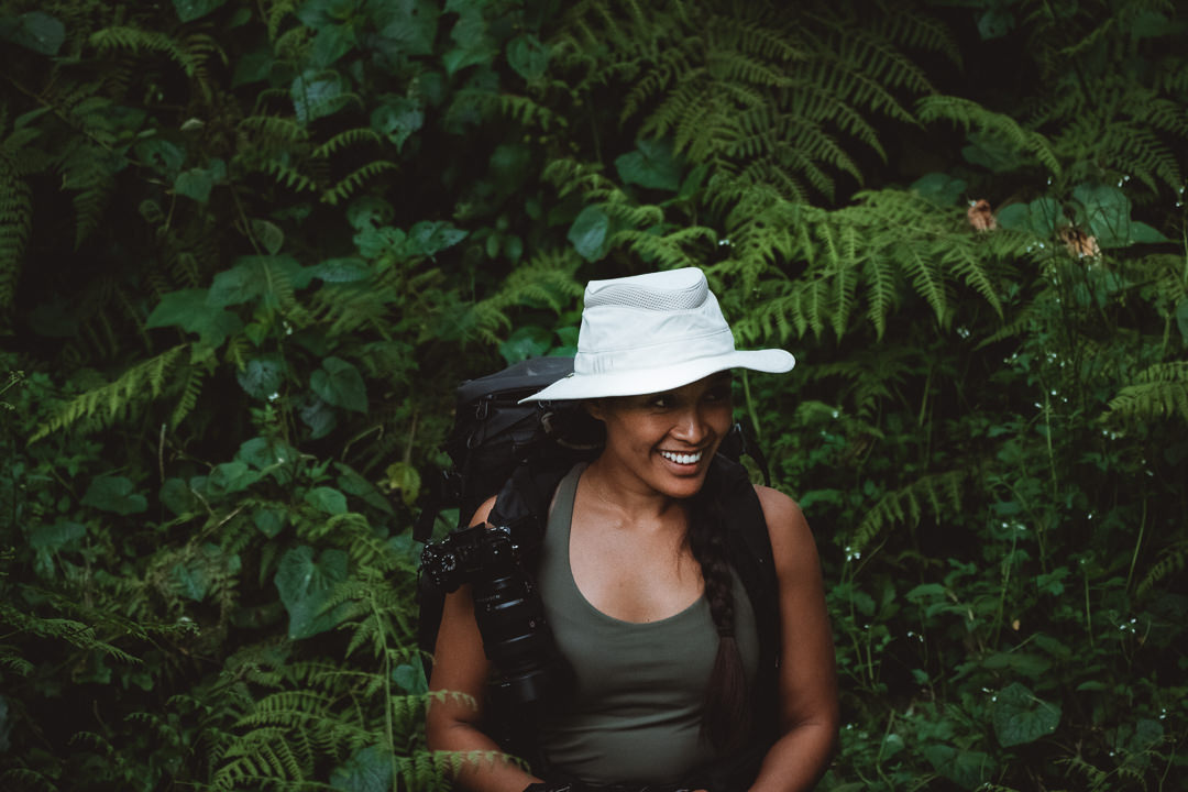
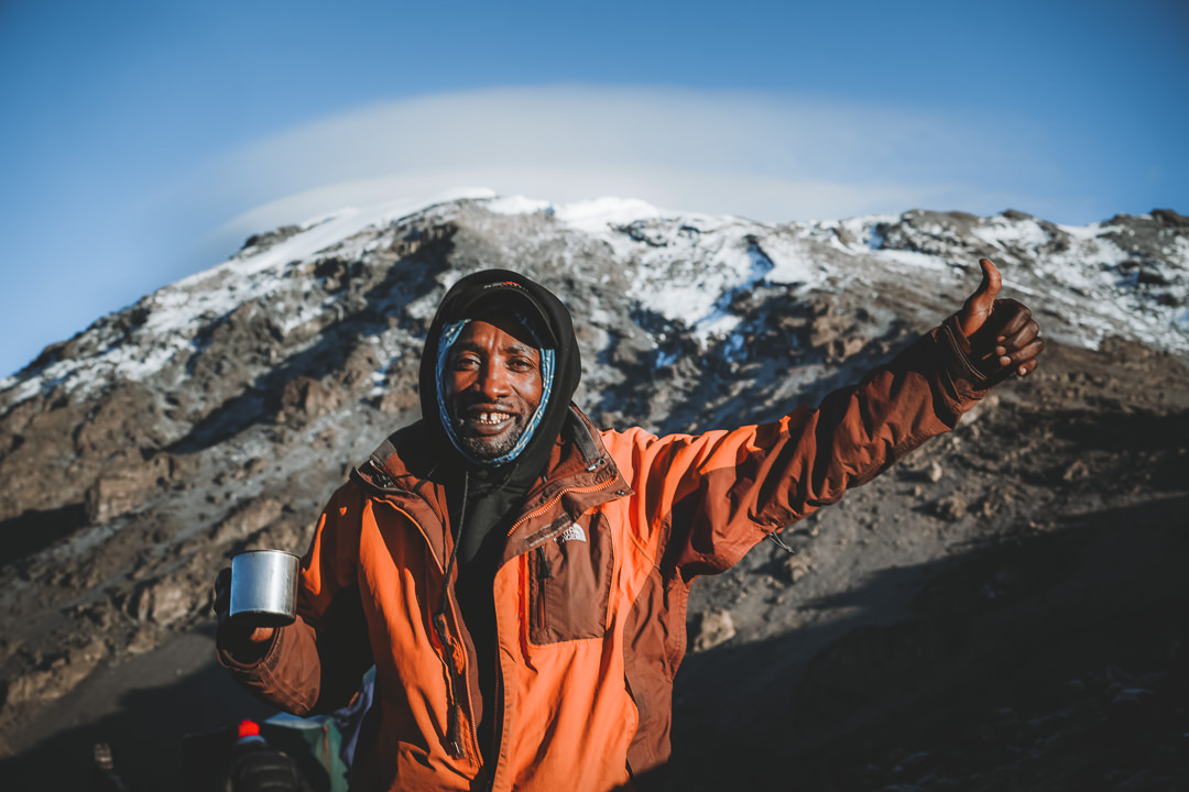
Our journey to the summit is with the Kiliwarriors. A strong name for a brave group of men who carry 20kg loads, tents, and supplies along the journey. Kiliwarrior Expeditions offer a premium Kili experience with all of the extra trimmings that made this trip one of the most luxurious camping experiences of my life.
TOP 3 PLACES TO STAY IN ARUSHA
- Most Luxurious: Gran Melia Arusha – Incredible view of Mount Meru and premium 5-star luxury.
- Where I stayed on a budget: Wakawaka Hostel– Cheap, great location and chill vibes
- Best value place to stay: Tulia Boutique Hotel & Spa – very cheap price but has pool and high quality facilities and rooms.
A GUIDE TO THE WESTERN BREACH ROUTE: KILIMANJARO
In this guide to climbing Mount Kilimanjaro via the Western Breach, it will be split into two sections. First I will share with you my photos and journal from each day of the trek. In the second section, I will brief you on everything you need to know about Climbing Mount Kilimanjaro including what to pack, costs, alternate routes, the best time of year to climb, and where to stay in Arusha before your climb.
MOUNT KILIMANJARO TREK DETAILS (WESTERN BREACH)
- Distance: 64 km
- Days required: 9 days.
- Total Incline: (Undulation) – 5,434m/17828ft
- The highest point on the trek: Uhuru peak is 5,895meters above sea-level.
- Difficulty: It’s hard for an average hiker but the altitude is definitely more difficult to manage than the distance with several rest days and acclimatization days. It is achievable for those with decent fitness even without climbing or trekking experience.
- Cost per trek: The costs range from $1600 to $6000 depending on the size of your group and your support crew including rangers, guides, porters and a chef.
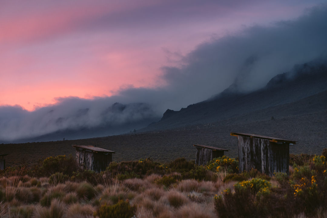
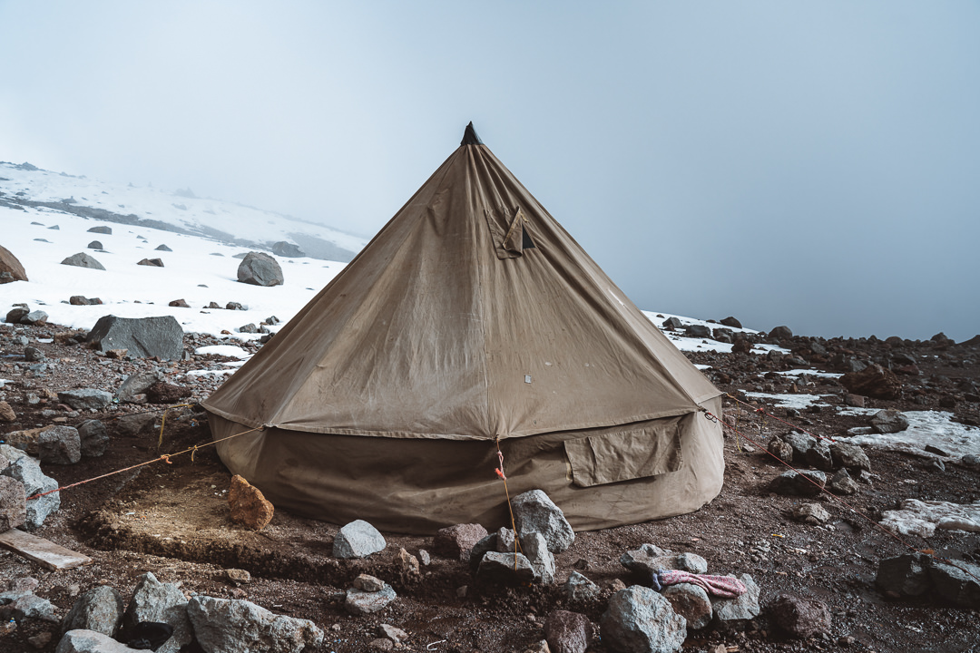
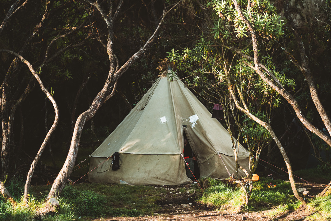
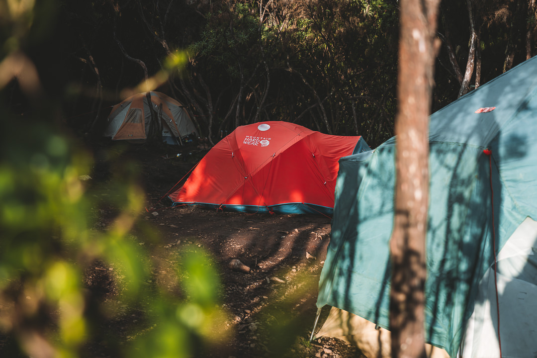
- Accommodation: The entire Western Breach/Lemosho route is camping. The tents will be carried by your porters in most cases.
- Who did I trek with: I booked my trek with Kiliwarriors and I can honestly say they were awesome. Our guides were the most organized, our food was incredible (other hikers looked jealous) and we were looked after from start to finish.
- My Mount Kilimanjaro Strava Map: Western Breach Route

CLIMBING MOUNT KILIMANJARO: THE WESTERN BREACH ROUTE
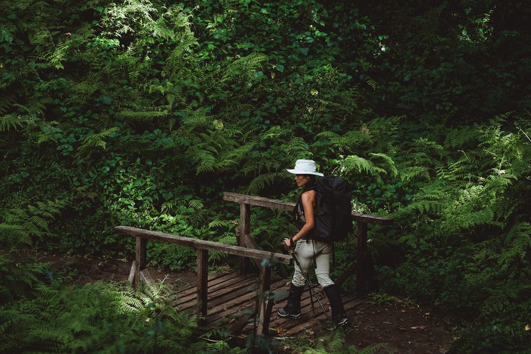
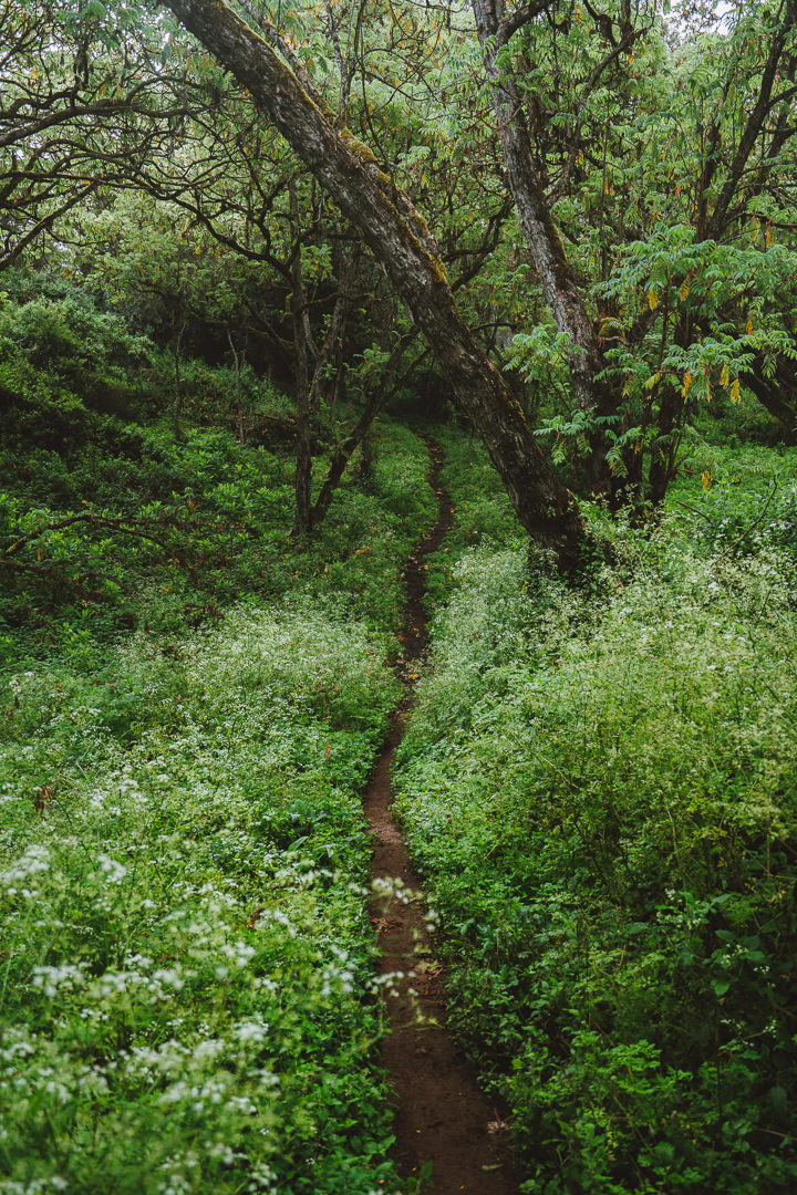
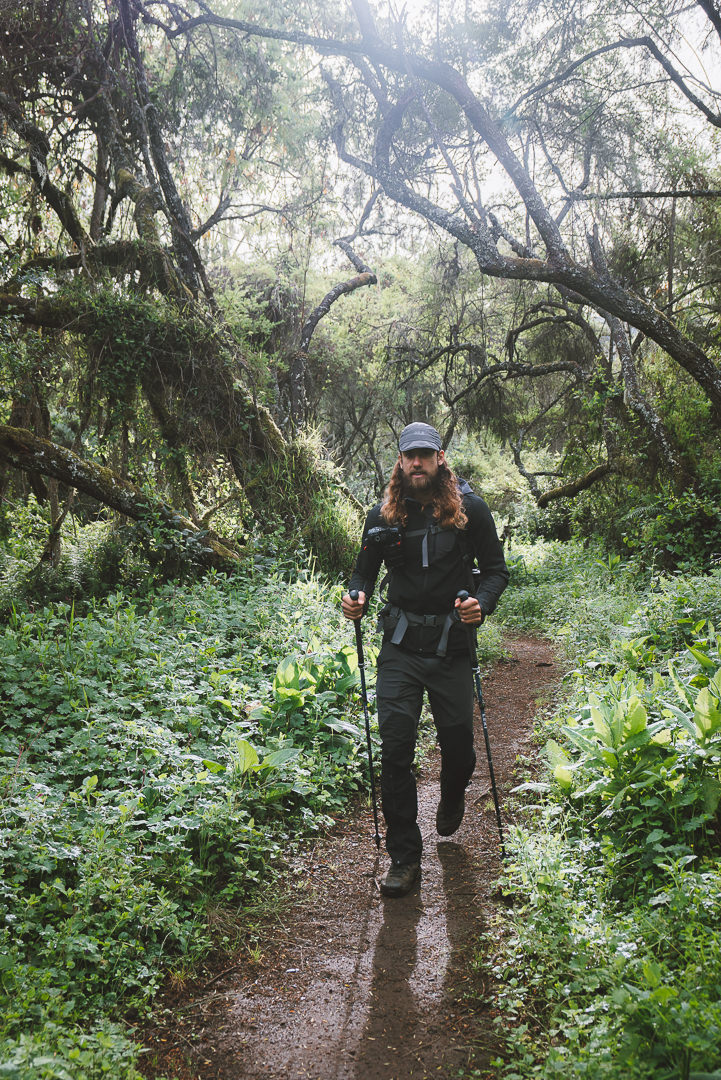
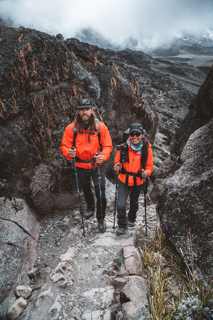
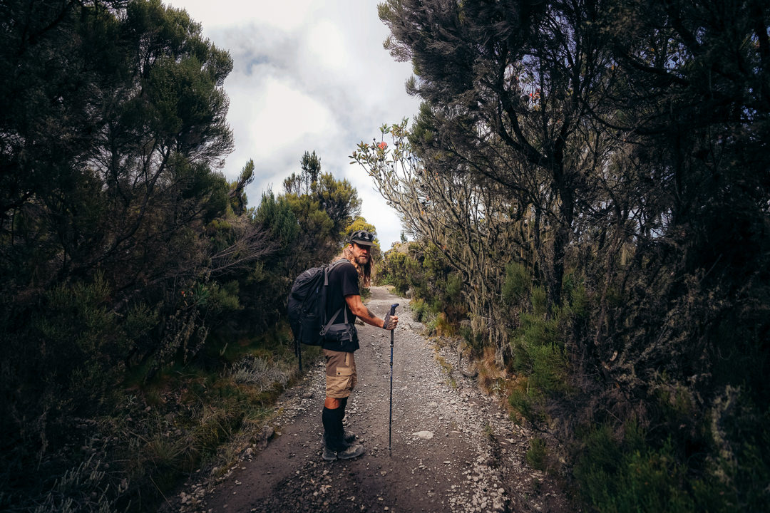
Day One: Rainforest Zone
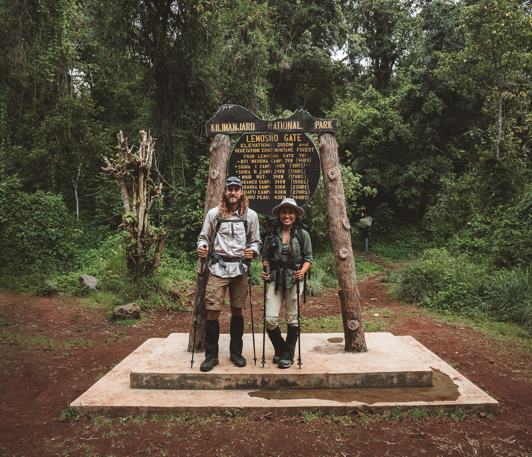
The day before our trek we had lunch with our guides for an expedition briefing and to do a gear-check. With everything in order, we left the next morning at 9 am from Kibo Palace Hotel en route to the Lemosho Gate entrance.
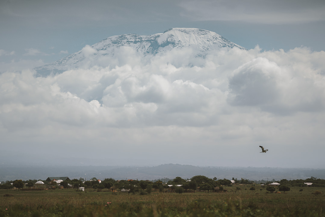
The three-hour drive from Arusha takes you through local villages, small towns, and farming fields. With some luck, you will catch a glimpse of Mount Kilimanjaro poking above the clouds in the distance. The adventure comes to life when you actually lay eyes on the mountain you are setting out to climb.
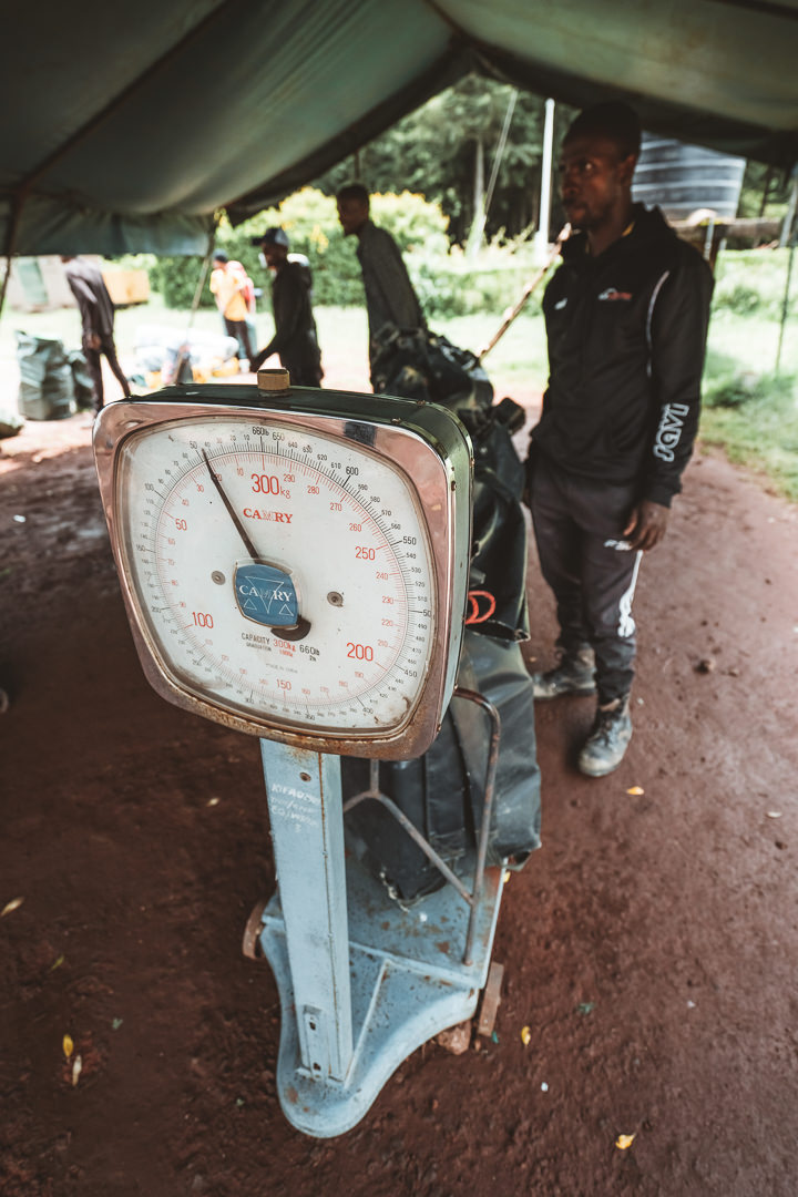
There are a few stops you need to make on the way to sign registration forms and sort out the logistics with the porters but it’s all handled by the team and you can just enjoy your last few moments before the trek begins. The porters need to weigh their bags as they have a 20kg limit, part of the rules to ensure good working conditions and that more locals are employed in the tourist trade. It’s a pretty interesting setup to see the porters lined up like school students, weighing their bags one-by-one on a retro scale.
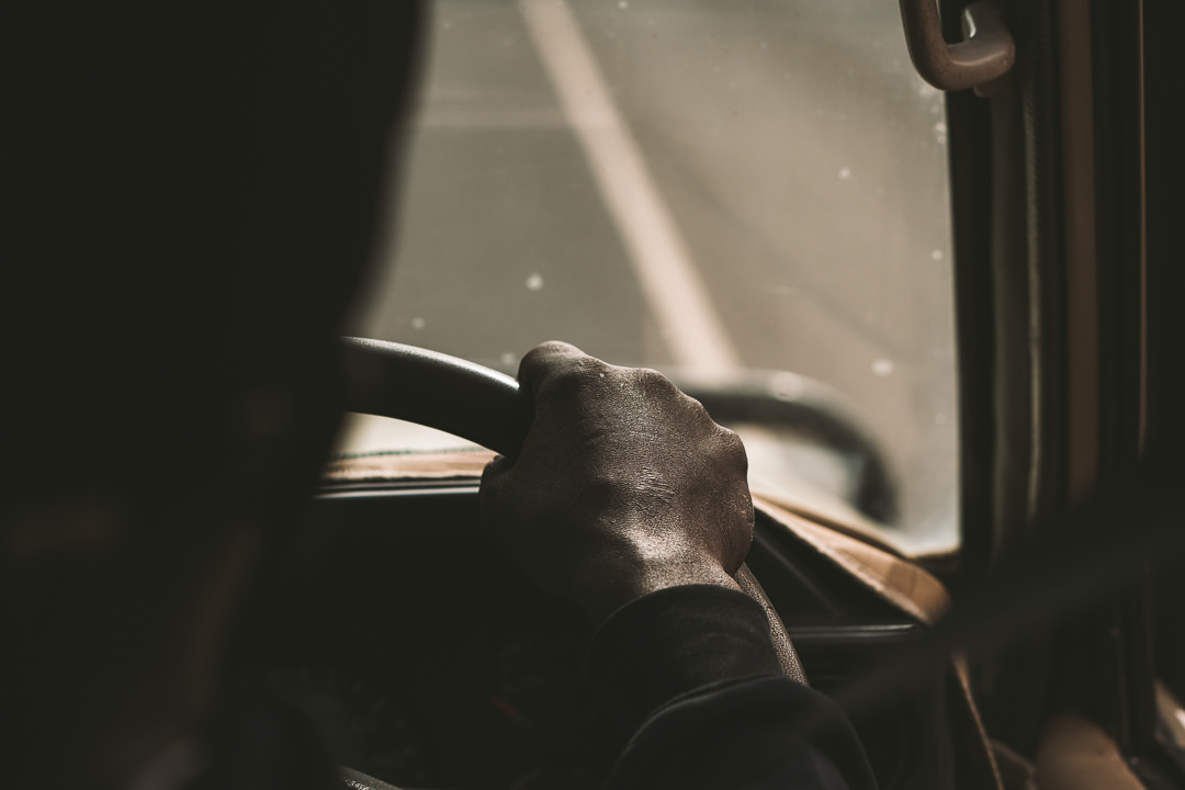
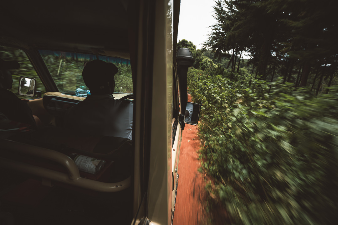
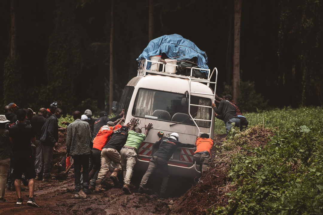
Our final drive to the Lemosho Gate entrance wound us through some off-beat back roads. Our Land Rover cruised along without an issue but the bus with the gear and porters had a more exciting journey through the muddy forest roads.

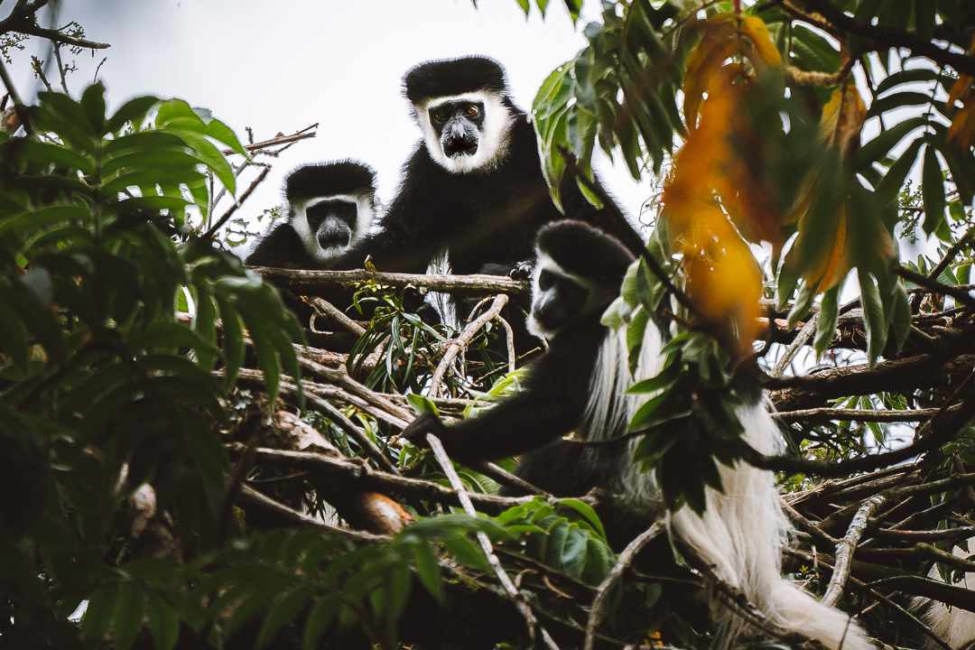
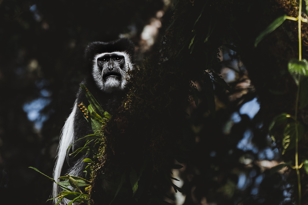
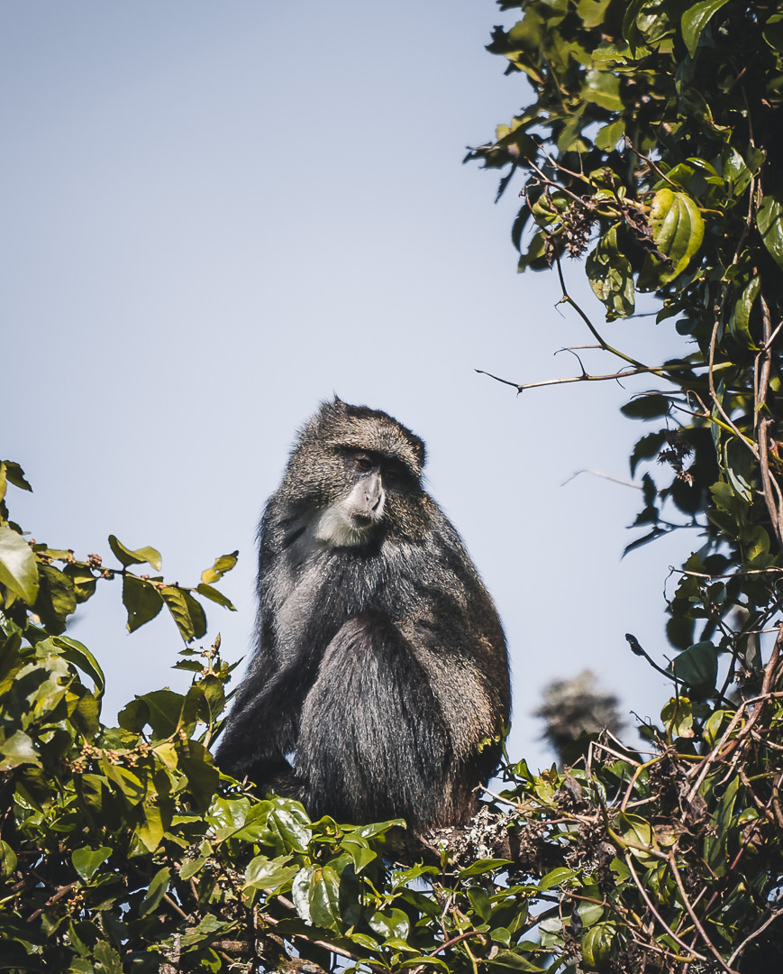
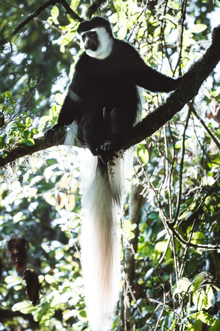
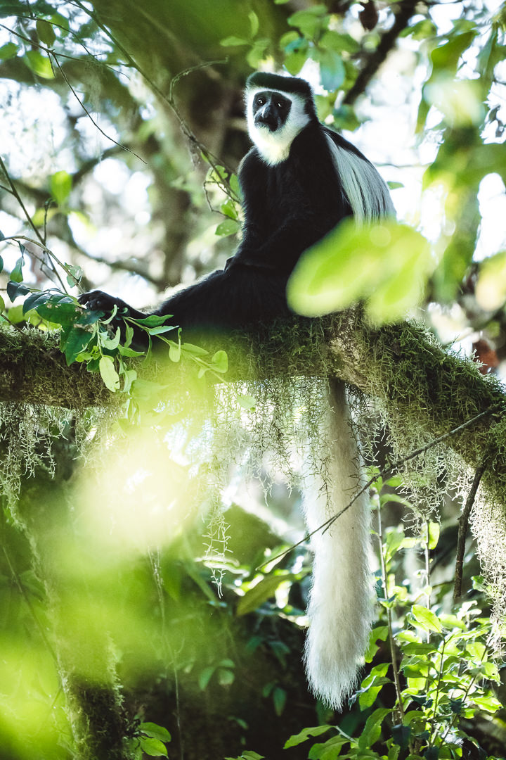
Arriving at the Lemosho Gate entrance, we were greeted by a family of shy Colobos monkeys. After our first brush with wildlife, it was a quick gourmet lunch, mandatory trailhead photo, final check of the gear and that was it, off we went. Nine days later we would emerge on the eastern side having summited Uhuru Peak, well that’s the plan anyway.
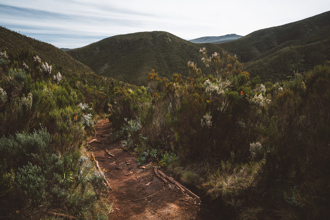
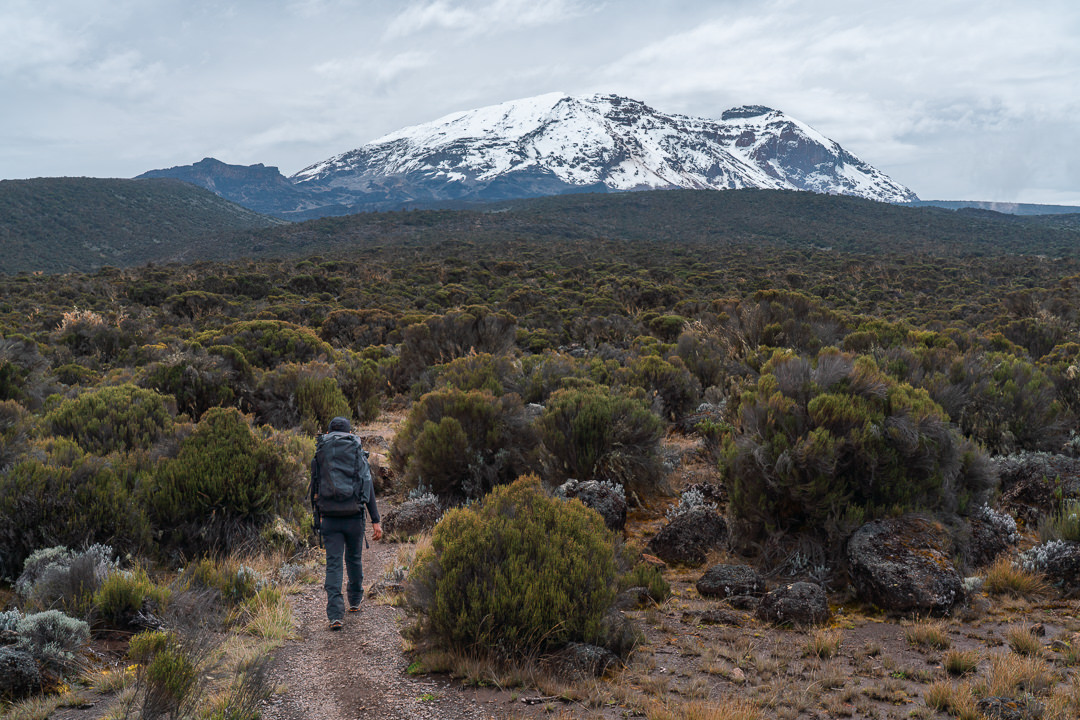
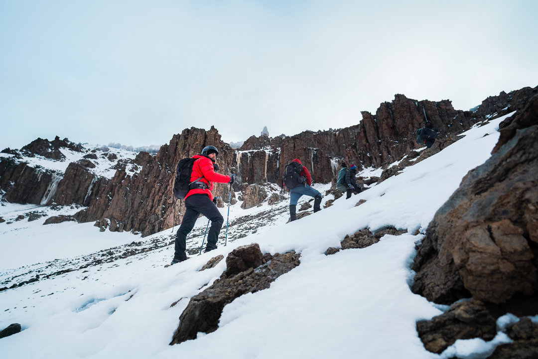
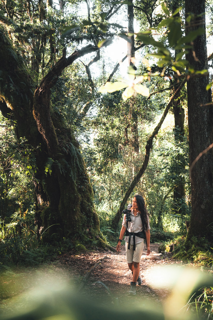
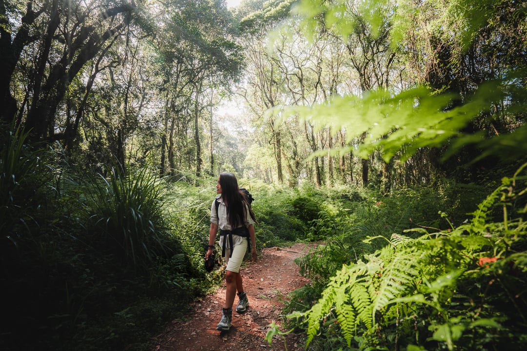
Day one on the trail reminded me of the Kokoda Track in Papua New Guinea. A lush forest split by a narrow dirt path, guiding us deeper and deeper within the canopy.
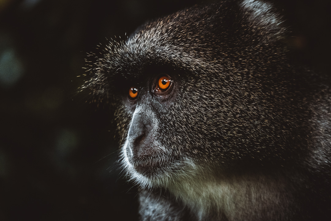
This first day is basically a warm-up. The six-kilometer trek has just over six hundred meters of incline. It’s a mild day with just 2-3 hours of slow-paced walking. We had plenty of time to observe the local monkeys engaging in turf wars and swinging throughout the treetops.
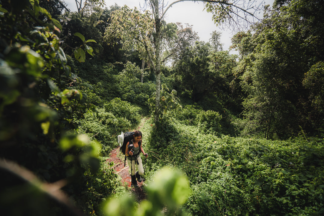

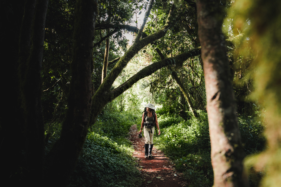
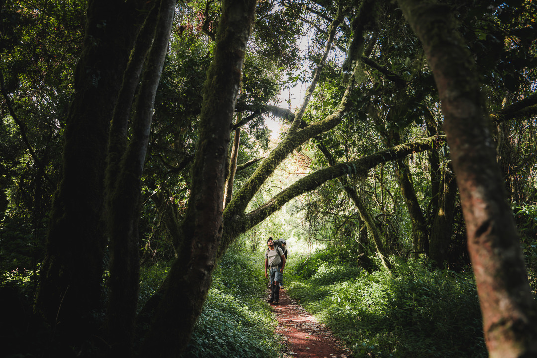
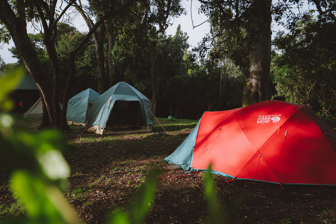
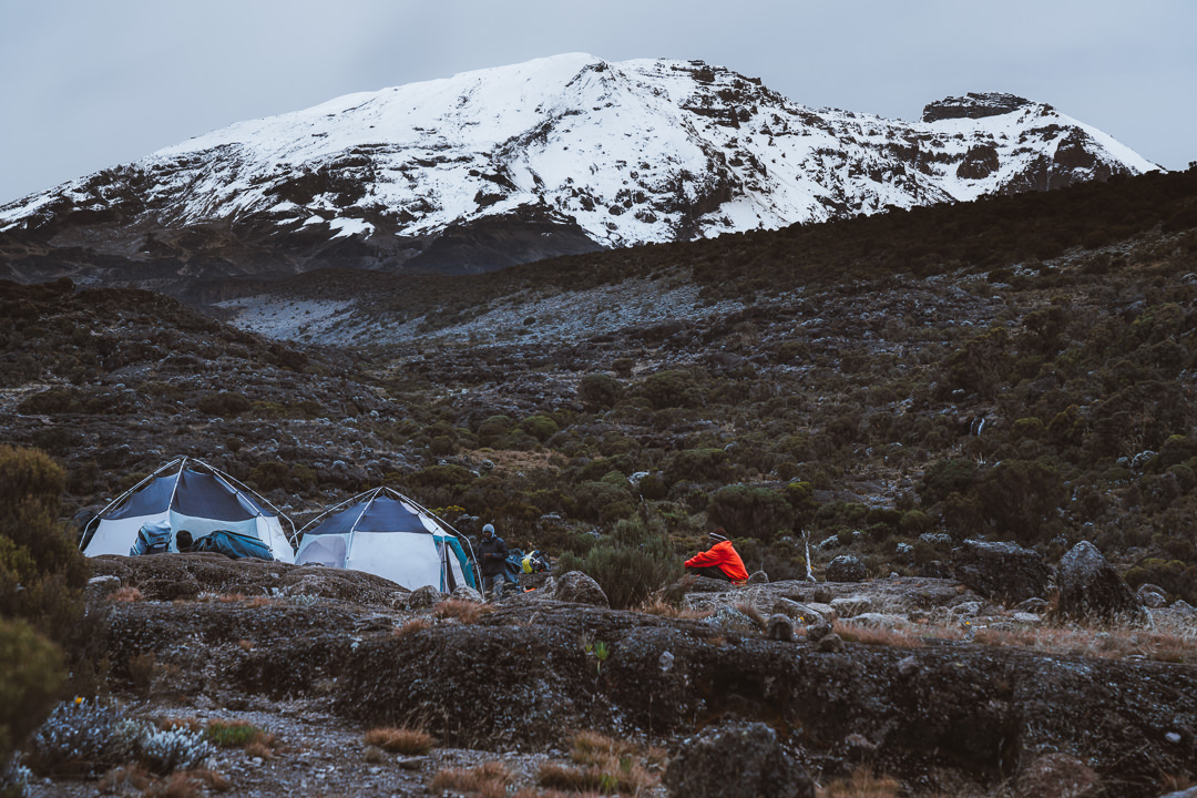
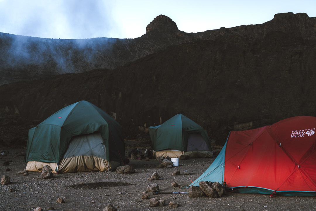
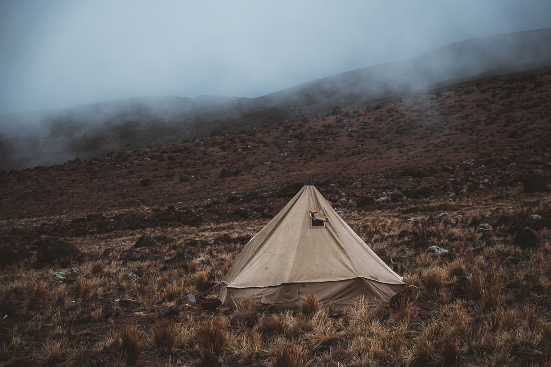
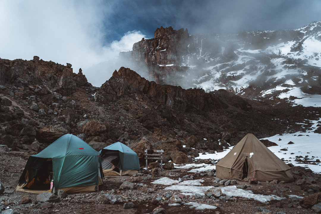
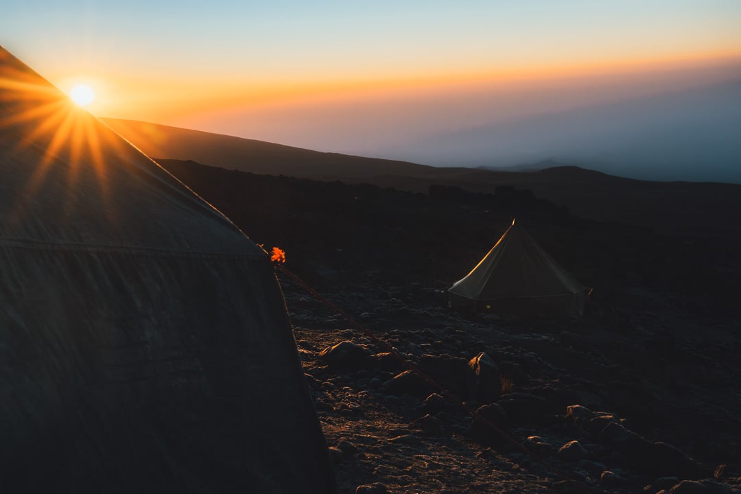
As the sun began to creep towards the horizon, the light filtered through the gaps in the canopy to paint the lush greenery with flickers of gold. It was a stunning first day of trekking beneath the lush canopy before we reached Forest Camp, also known as Big Tree Camp.
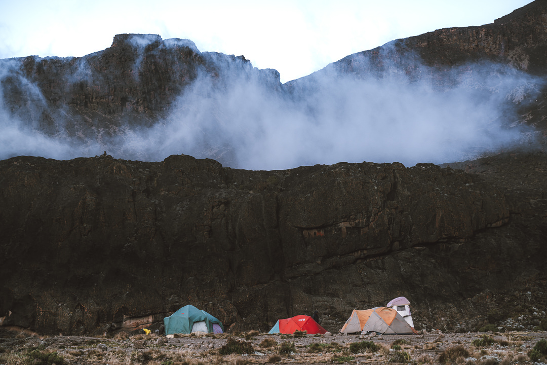
Our guides had already set up the tents, toilet, mess tent (dining room), their kitchen, water filter and all sorts of facilities you shouldn’t expect in the jungle. A bowl of hot water and soap was a nice touch and had us feeling refreshed. A tea and popcorn snack had us wondering how we were so lucky to be enjoying such hospitality.
Dinner was an incredible three-course spread with chicken, salads, soup, peanut curry, and dessert. So far, the trek has felt like a holiday but we know things only get tougher as the trip continues and the elevation increases. Tonight we sleep easy at 2,650m to the sounds of the wind blowing through the canopy of trees.
Day Two: Heather/Moorland Zone
Throughout the night, rainfall spattered our tent but we woke to a beautifully still morning amongst the trees. At 2,650m there was a chill in the air but a warm cup of coffee was the perfect antidote.
A breakfast of (very lucky) champions was served with bacon, eggs, tomato, toast, and fruit to start out the second day. Today would be one of the steepest parts of the route so we would need to be energized.
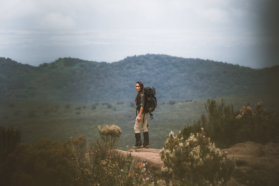
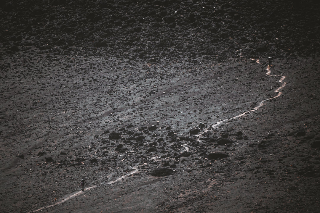
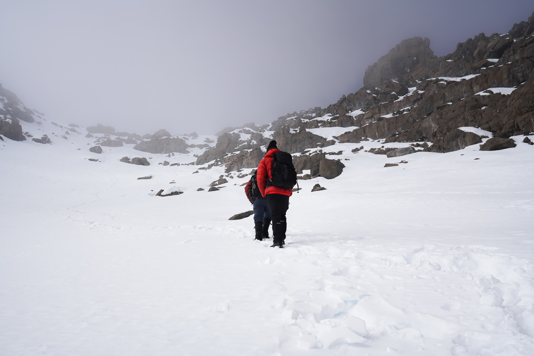
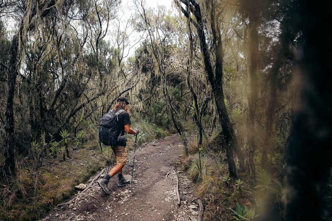
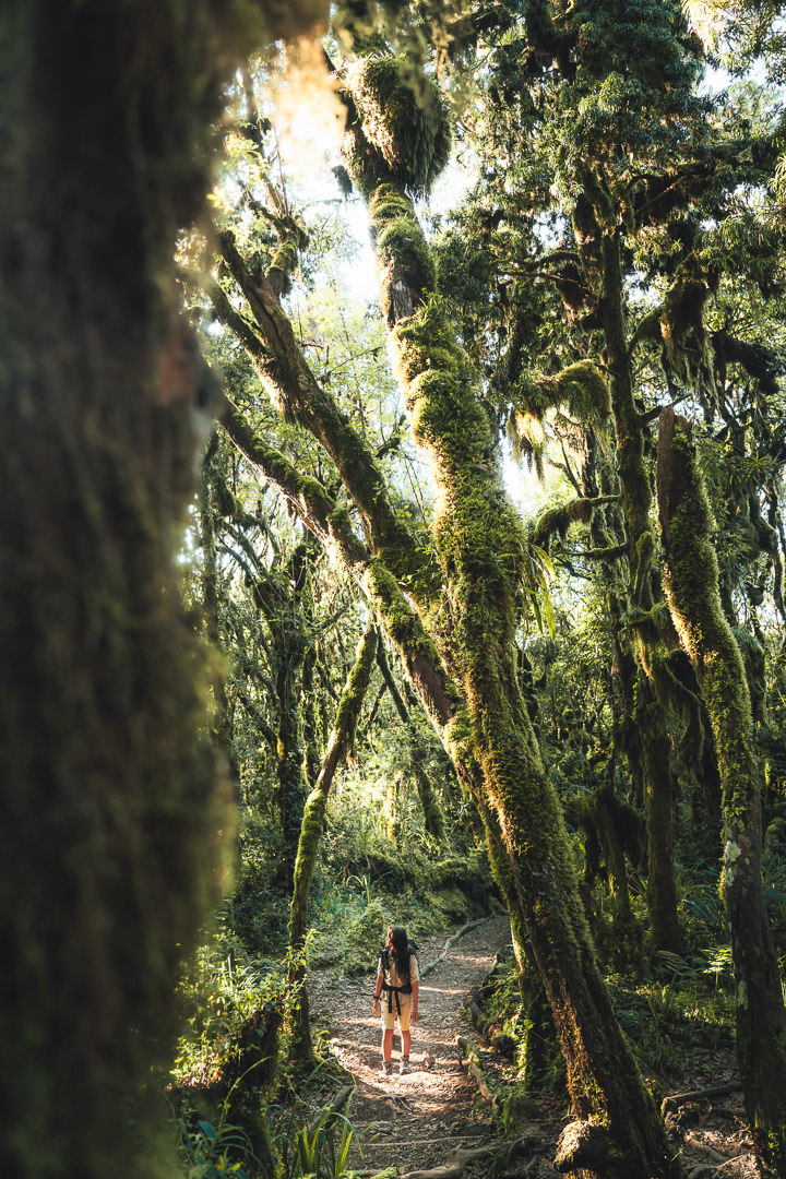
At 830am we set off into the forest, with stunning morning light seeping through the canopy. Following the narrow dirt path, we would enjoy the lush scenery throughout the repetitive undulations for the first hour of the day. The trail then emerged from the forest to reach the Heather Zone, where bushes replace the forest. We started to catch views of Mount Meru and Ol Doinyo Lebgai, two neighboring volcanoes.
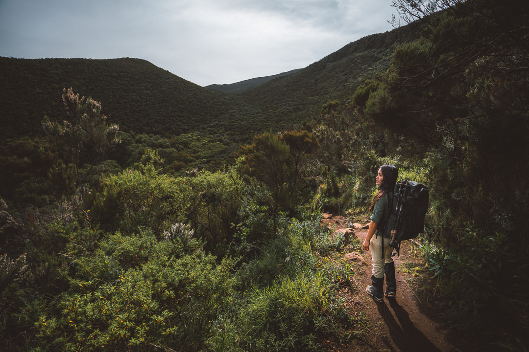
Our trek continued above the clouds, stopping only for a lunch break at a small plateau. This would be the last flat area we encountered for some time as we continued to elevate up the winding, muddy track towards Shira Ridge. There’s no rush here and trekkers are encouraged to move at a slow pace to negate the effects of altitude. After all, you are now at 3,300 meters above sea level.

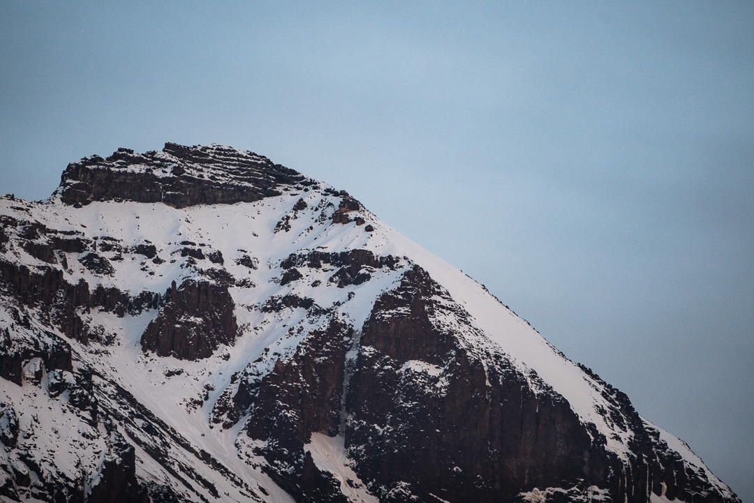
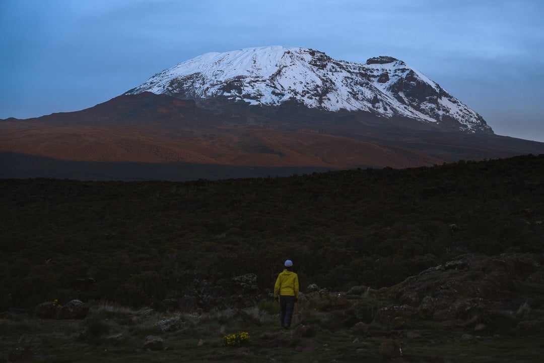
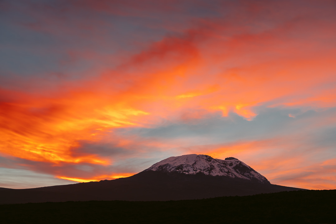
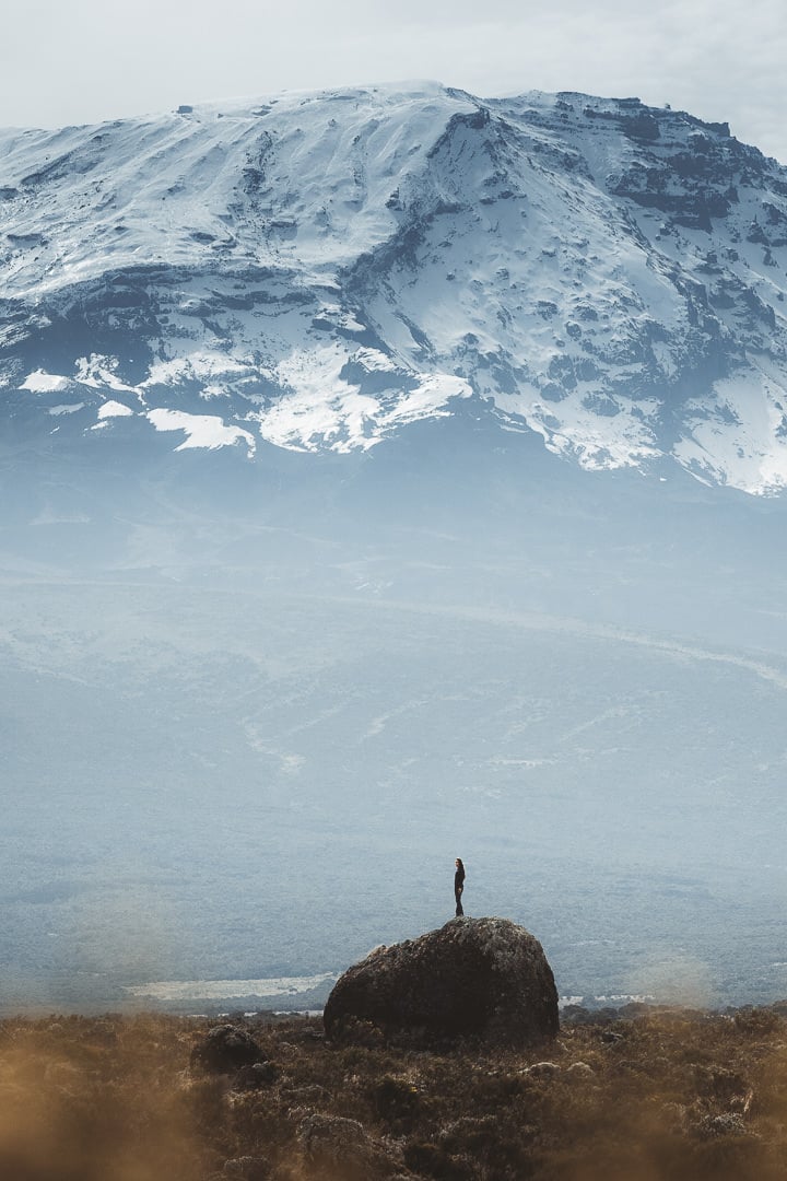
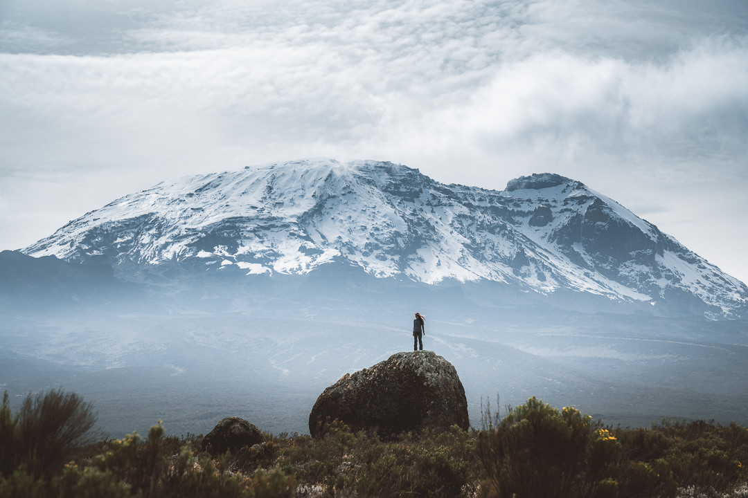
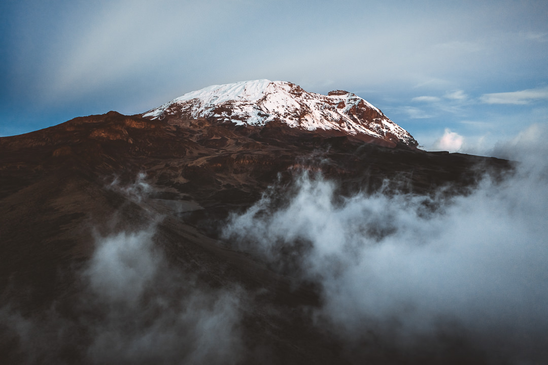
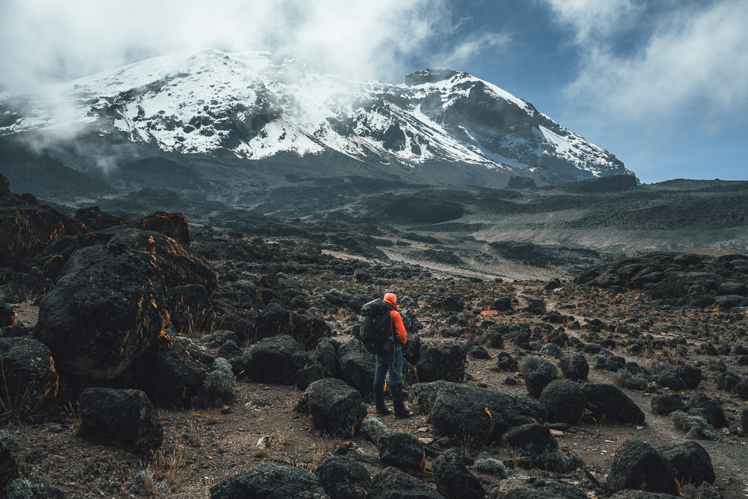
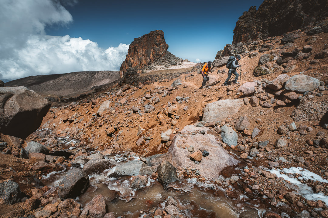
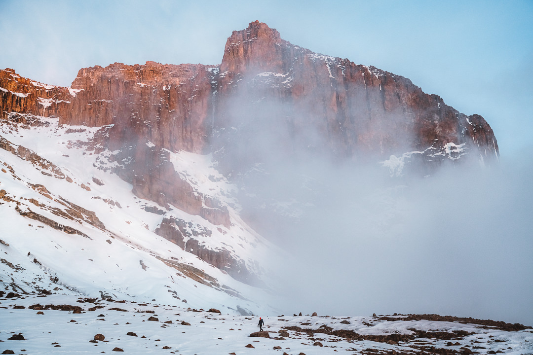
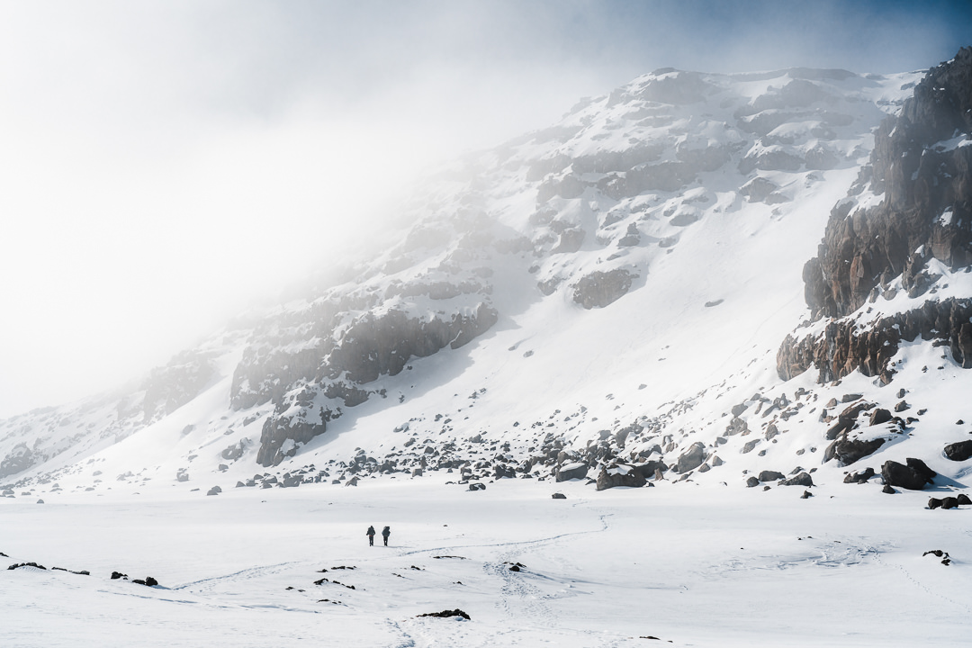
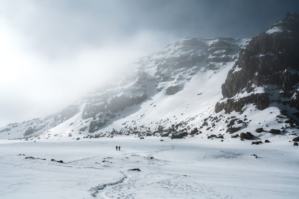
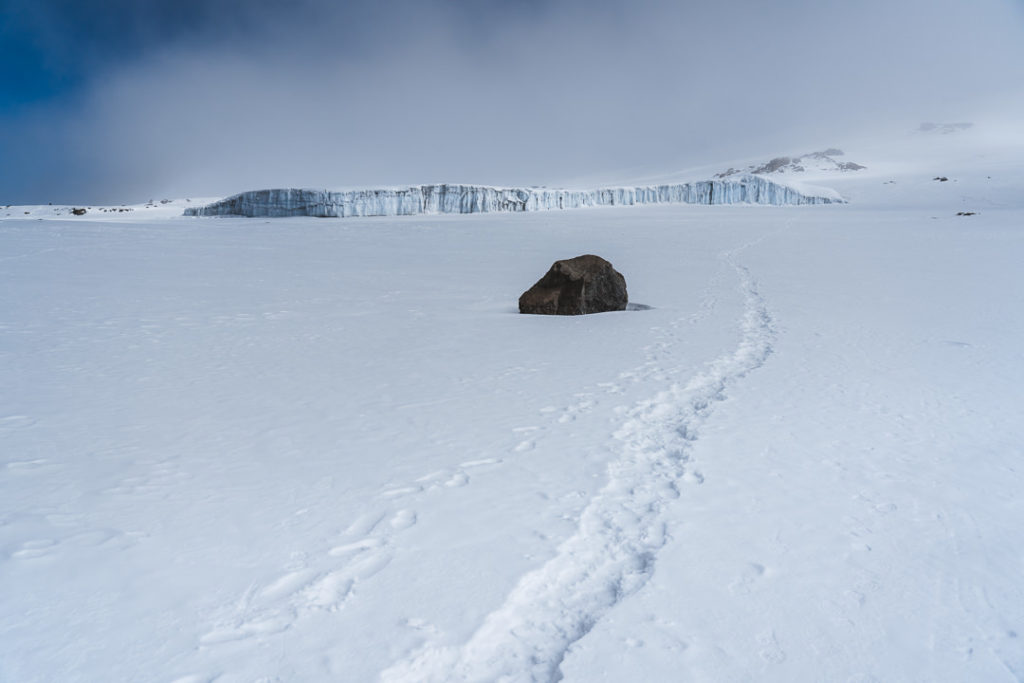
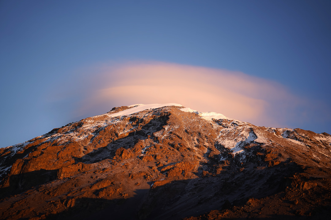
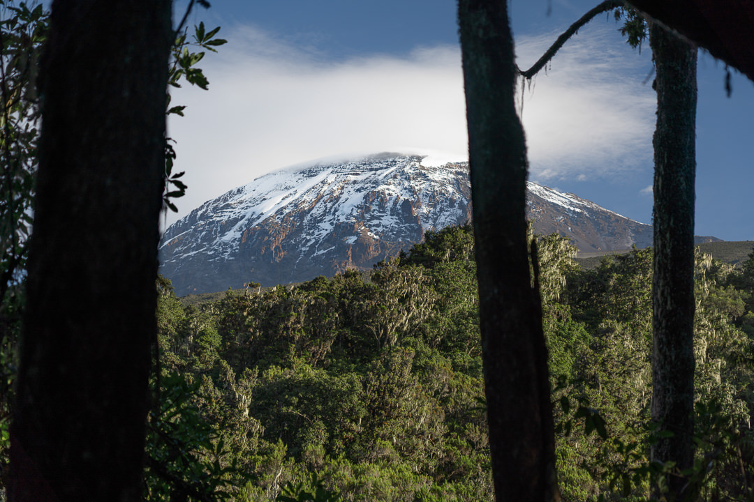
Almost reaching Shira Ridge, we deviated around the ridge and then crossed over on the left side to reveal our first views of Mount Kilimanjaro. Covered in snow and jagged peaks, the scale of our adventure begins to sink in.
We can spot Shira Camp One down in the plateau in between our trail and the base of the mountain. This was our last effort of the day as we descended down from the ridge to our camp for the night. All the while, Mount Kilimanjaro looked over us.
With the mountain as our backdrop, it was a healthy reminder to take it slowly during these early days for the true challenge lay in the final moments of our expedition on the snowy slopes to reach Uhuru Peak.
Clouds danced around Kili as we made it to Shira Camp One in the late afternoon. Believe it or not, a hot camp shower set up by Kiliwarriors had us refreshed and the only thing that could top off the day was a hot tea.
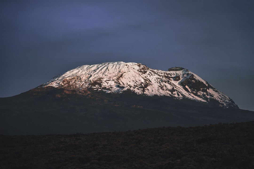
Dinner was of course fantastic with soup, fish, potatoes, salad, and a dessert to cap off a memorable second day on the trail. Dinner had to be paused as Kili received a golden glow from the final moments of sunshine. We rushed outside to bask in its glory.
We rest tonight at Shira Camp One, which is 3,400 meters above sea level. There’s no rain or wind outside as I write this journal from within my tent. Perfectly still. So far the mountain gods have blessed us with impeccable conditions, but tomorrow is a new day with new challenges and surely new blessings.

Day Three: Heather/Moorland Zone
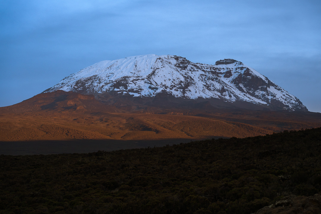
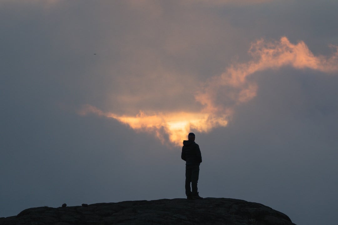
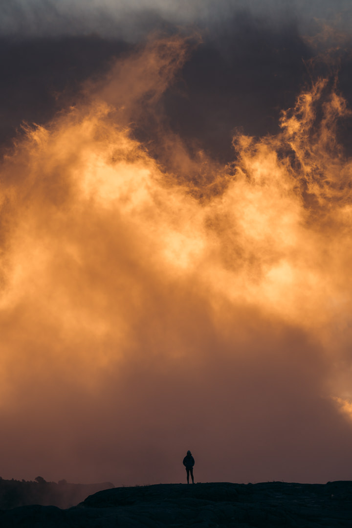
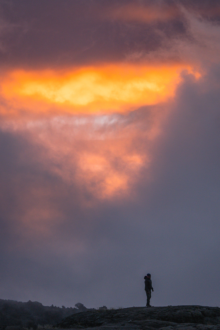
A quiet hum of activity woke me from a deep sleep inside the tent. Breakfast was being prepared and the camp was in the process of getting dismantled. I poked my head out of the tent and saw a sky of red, wispy clouds hovering above Mount Kilimanjaro. We quickly gathered our jackets and cameras to capture one of the most beautiful sunrises over Shira Camp One.
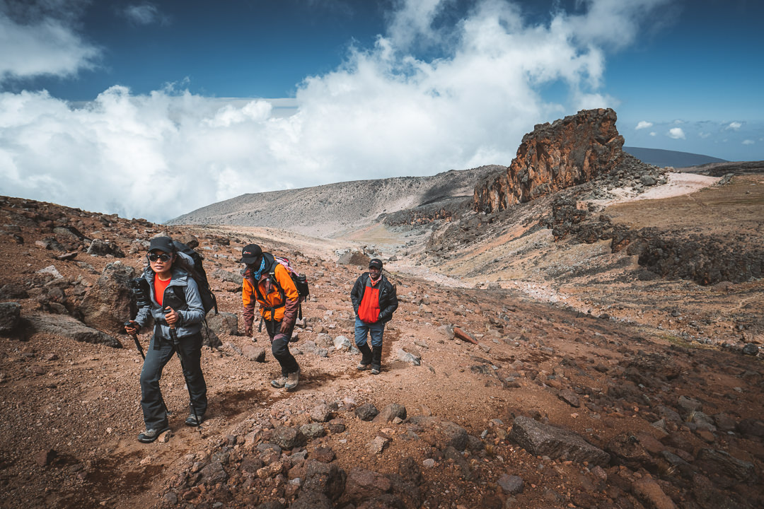
Our route today would take us from Shira Camp One to Scott Fischer Camp for lunch and then on to Moir Camp to spend the night.
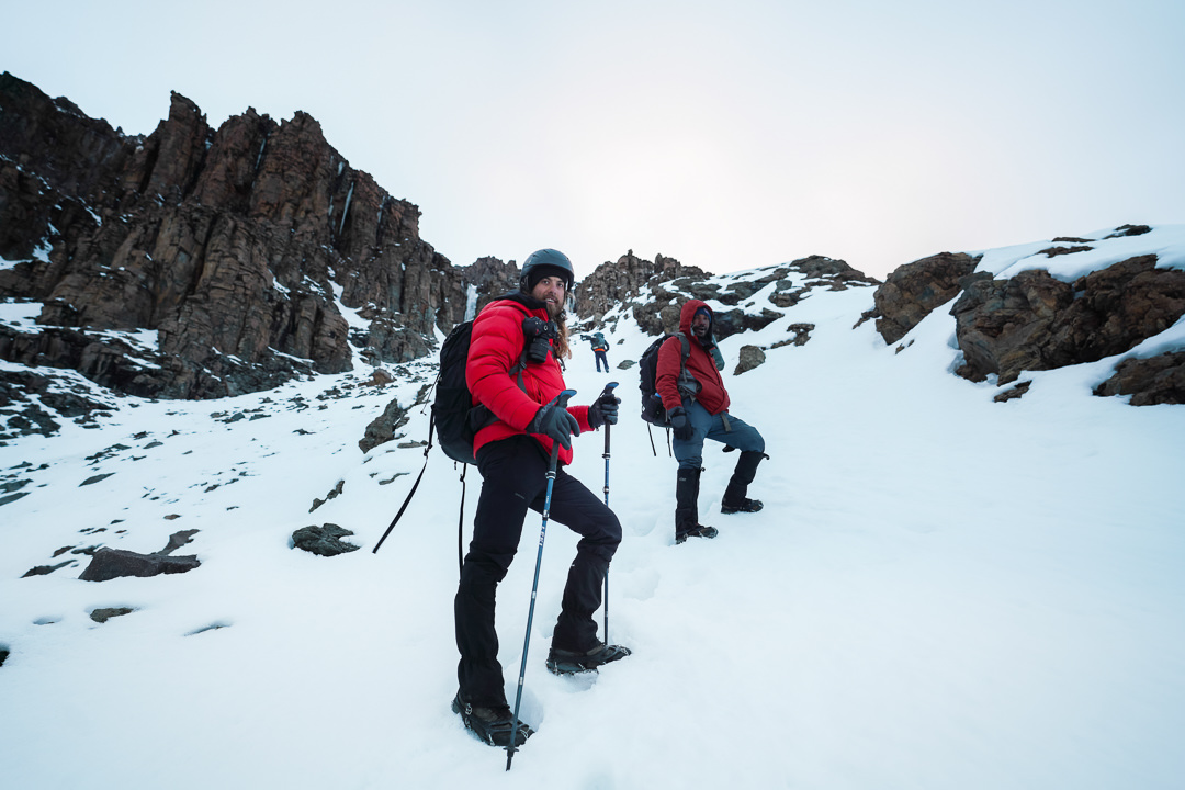
It’s now our third day on the Western Breach Route with Kiliwarriors. It always fascinated me how quickly you can become comfortable with a certain lifestyle. Walk, camp, sleep, repeat. This is a luxurious style of camping with a huge support crew but I’ve felt the same on independent trips.
You start to find a rhythm after a few days and your mind is triggered. You begin to delve a little deeper into your thoughts.
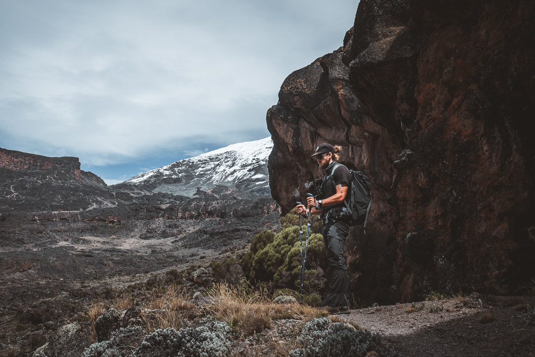
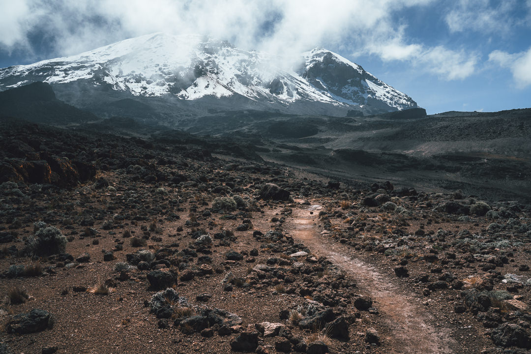
The beauty of the trail from Shira Camp One is the backdrop. For the first few hours of the day, we walked directly towards Kili. We were blessed with clear skies, which meant we could look up at our final destination.
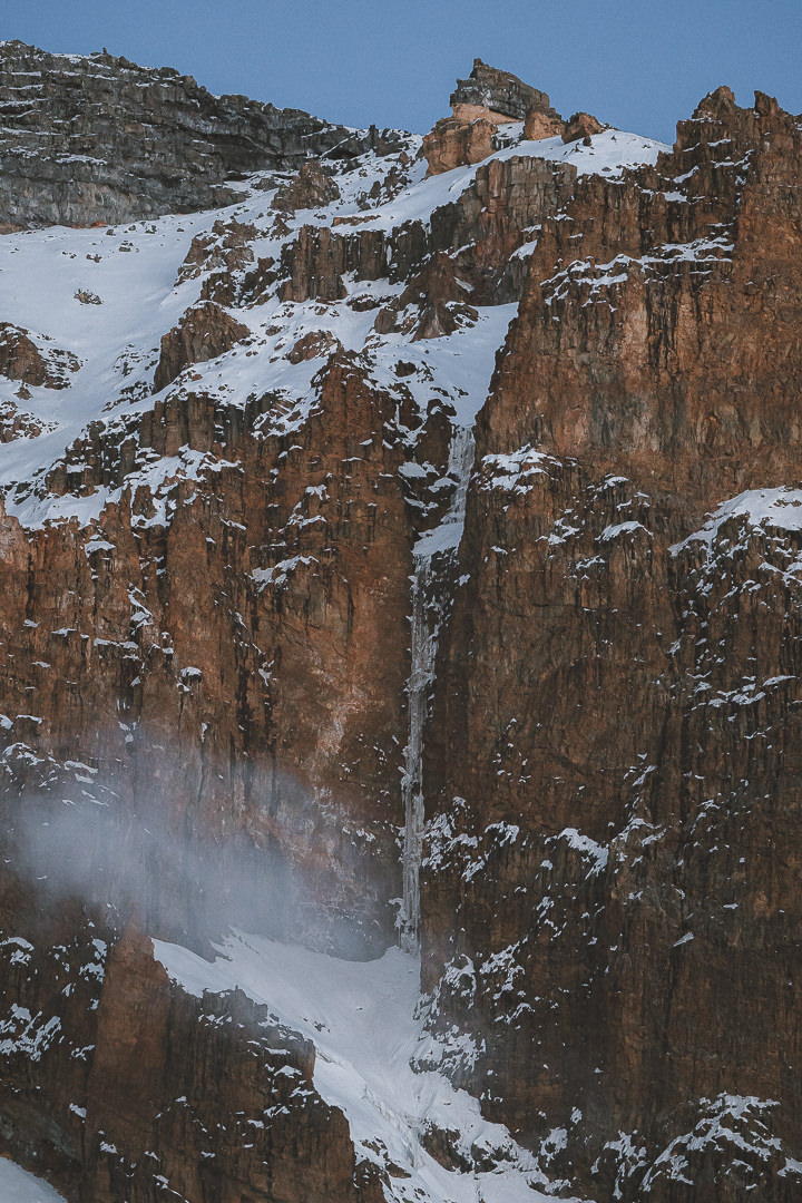
As we neared Mount Kilimanjaro, we could begin to see the details on the mountain. Small ridges, peaks, and even the Western Breach became visible.
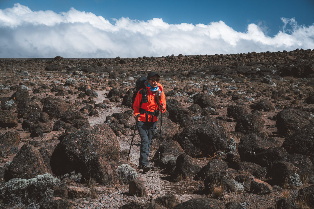
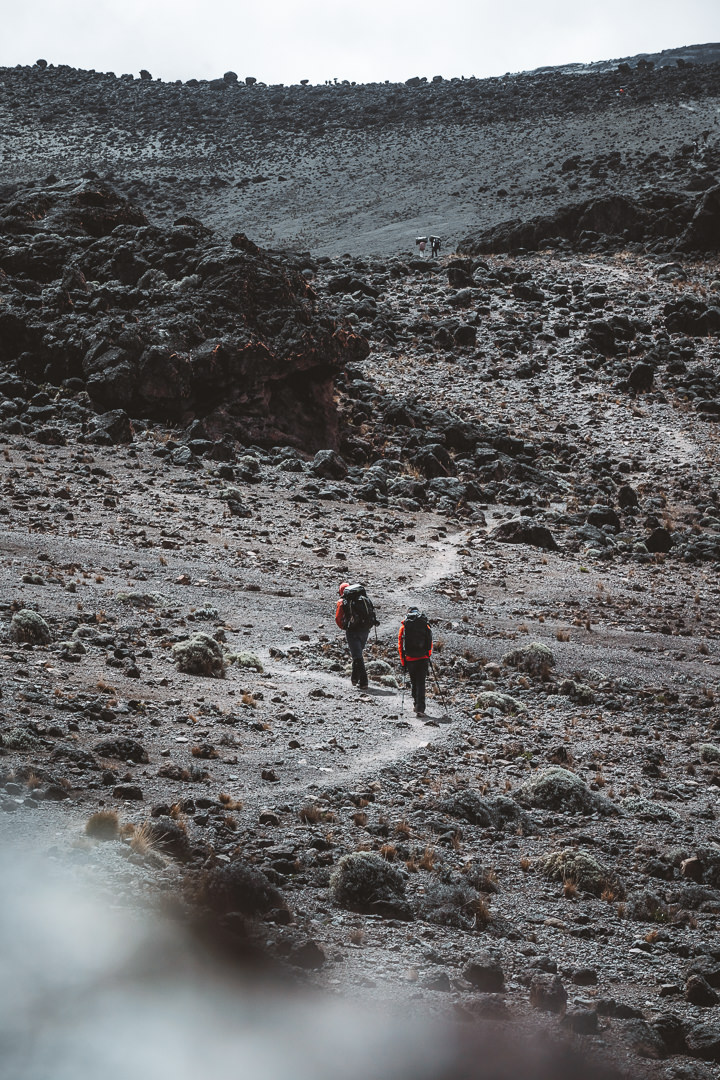
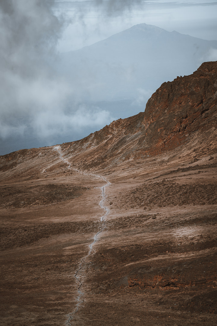
The scenery left behind the lowland shrubs and moss forest as we entered a rocky terrain, clambering up towards Scott Fischer Camp. Turning around we could take in the vast scale of the Shira Plateau.
Our lucky streak with the weather continued as we lay out in the hot sunshine while digesting another beautiful lunch. Our journey to Moir Camp was just a short incline up and over the rock wall. The total incline for the day was 800 meters with about 11 kilometers of distance covered.
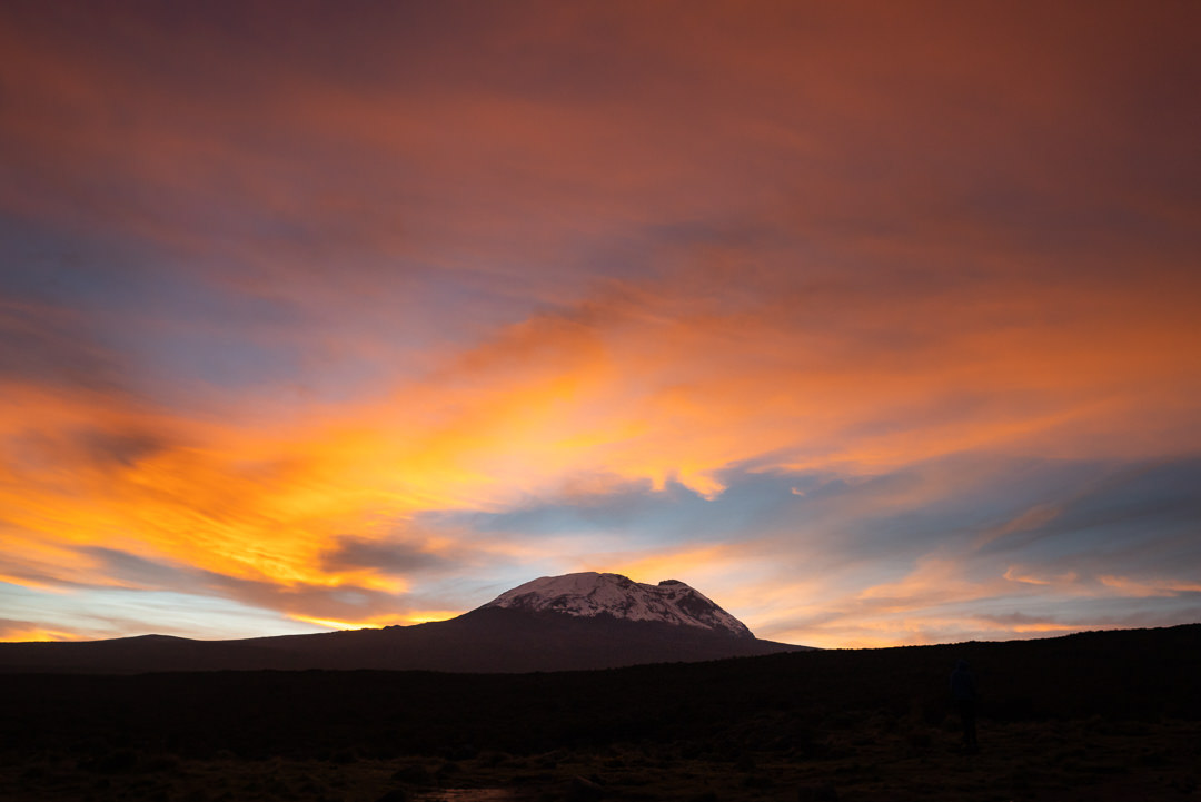
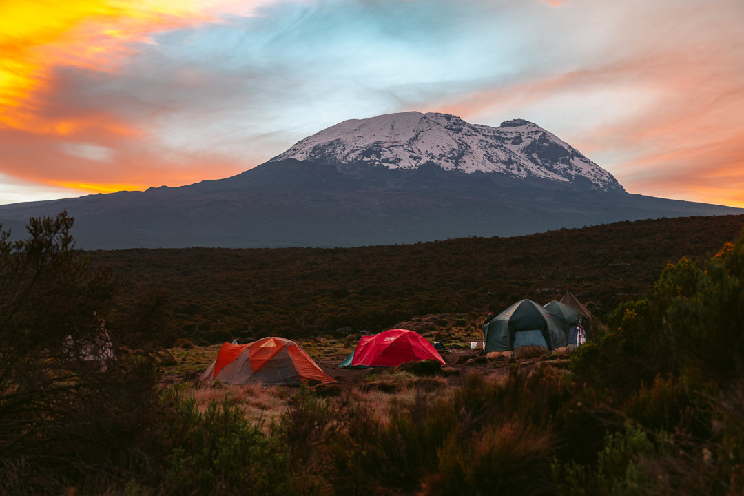
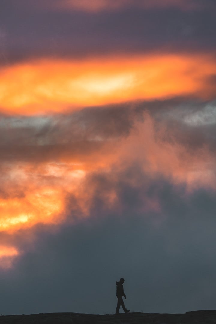
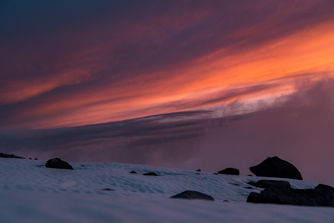
As always, our camp had been set up by the hard-working Kiliwarriors. We enjoyed the last warmth of the sun, played cards, drank ginger tea, and then tucked into another amazing dinner while we winds blew a gale outside. Our meal was interrupted by a sky on fire as sunset produced some amazing colors amidst the fast-moving clouds.
Tonight we sleep at 4,150 meters and thankfully the body is managing well so far. The wind is threatening to blow our tents over but I’m sure it will subside during the night. It’s been another day to remember on our journey to Uhuru Peak. Tomorrow is a new day and we take nothing for granted.
Day Four: Lava Tower
A chaotic night of extreme winds carried through till late morning. One of the tents had blown over and several others had threatened to follow. Despite the hostile weather, we had a good night’s sleep at Moir Camp.
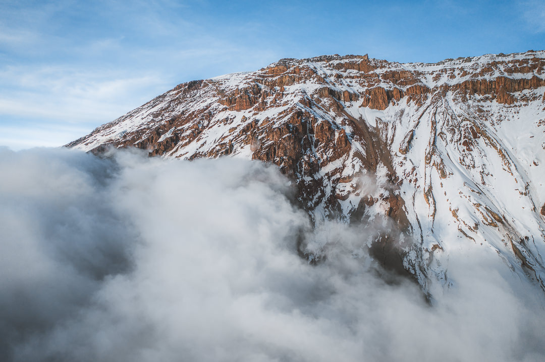
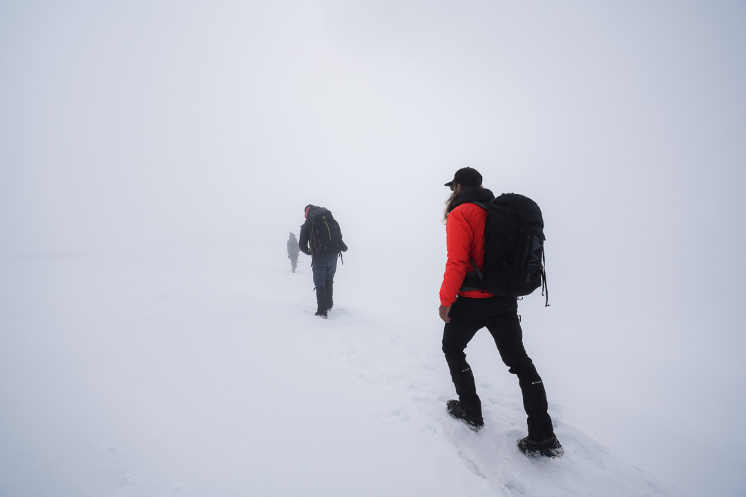
Shortly after wake-up, the sun shone over our camp and blue skies signaled another lucky day of dry weather. By the end of today, if it hasn’t rained, it won’t. We will simply be too high and any rain will actually be snow.
Our trek today was a short one. From Moir Camp we hiked 5 kilometers with 500m of elevation to reach Lava Tower Camp.
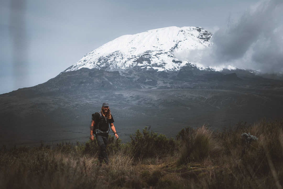
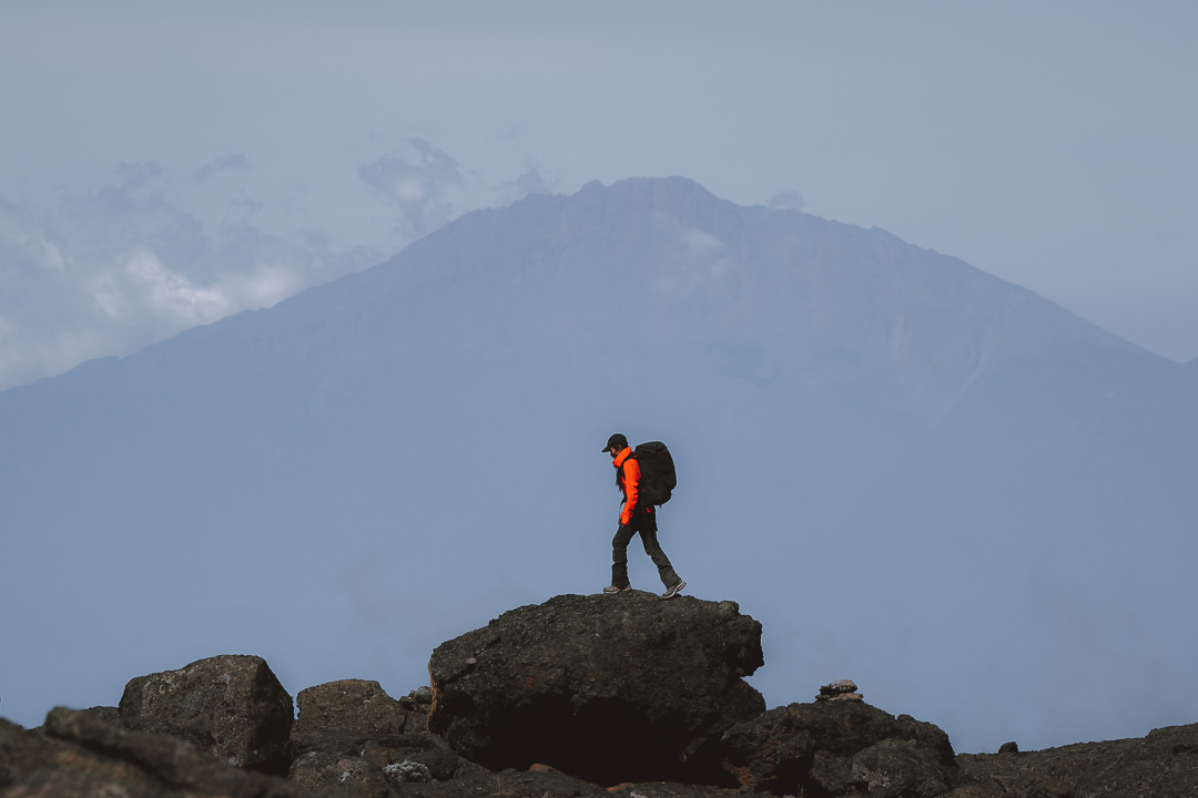
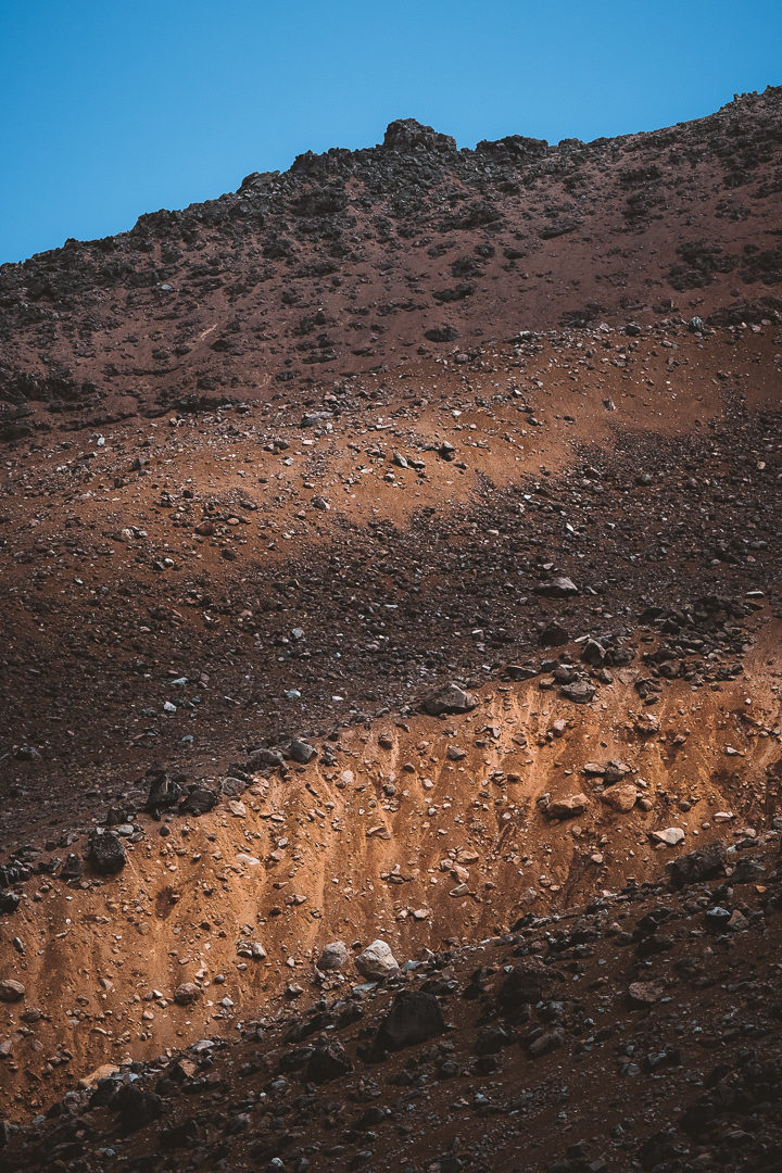
The terrain becomes quite otherworldly today with no trees in sight. Dry, rocky, dusty, and vast ridges were the landscape in this region. Kili seemed to be getting closer and closer as our necks began to hurt looking up at Uhuru Peak.
Although it was a short distance, the elevation is starting to play a part as we are now camping at 4,600 meters above sea level. I’ve had very mild light-headedness but otherwise am feeling fresh.
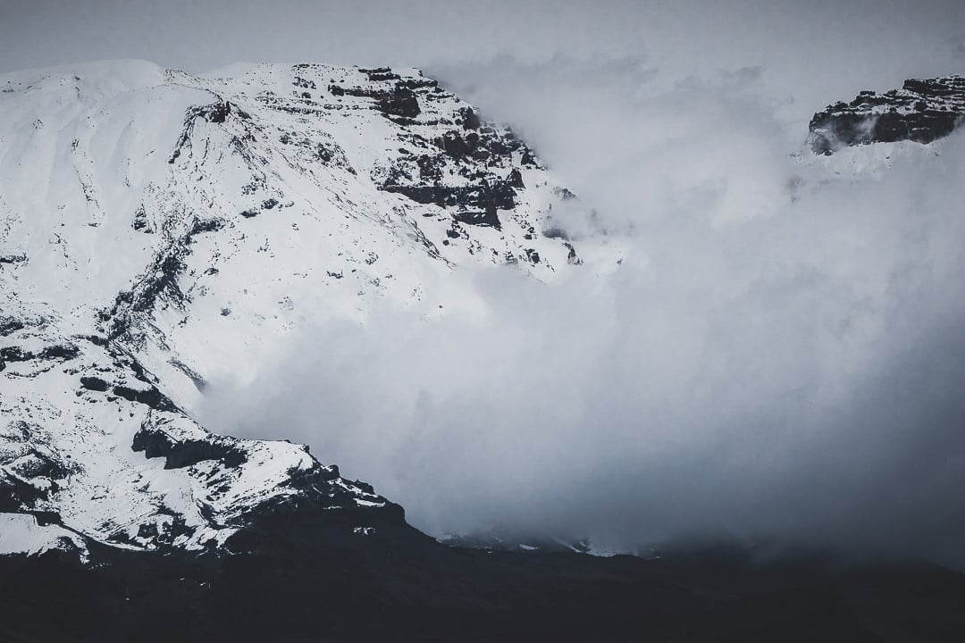
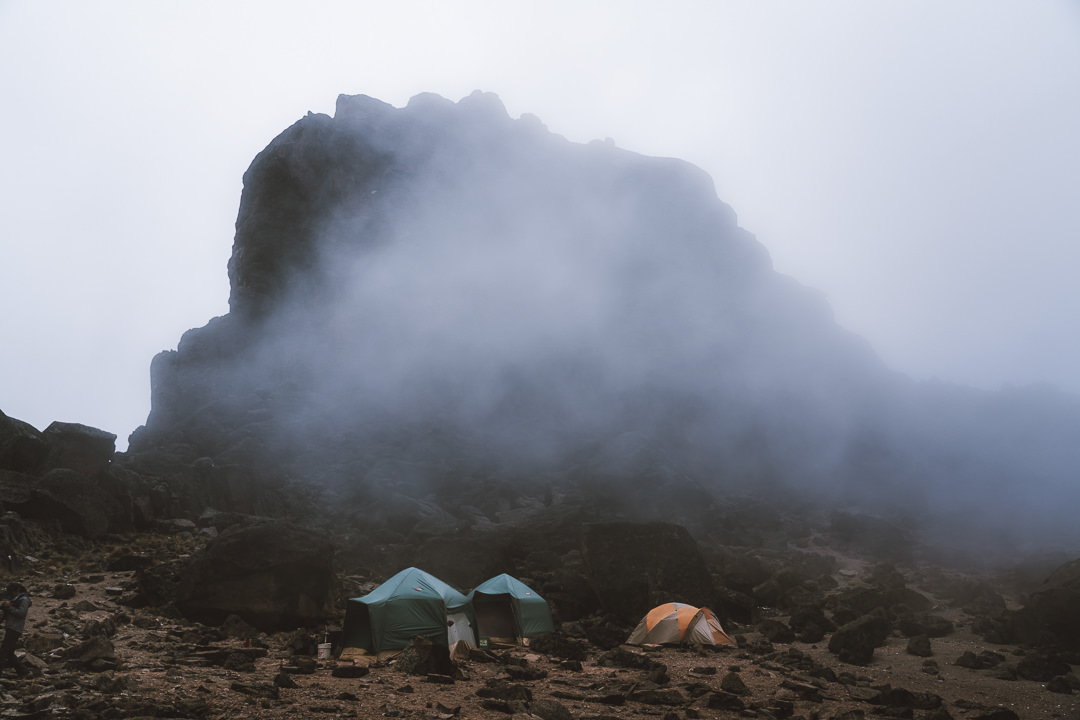
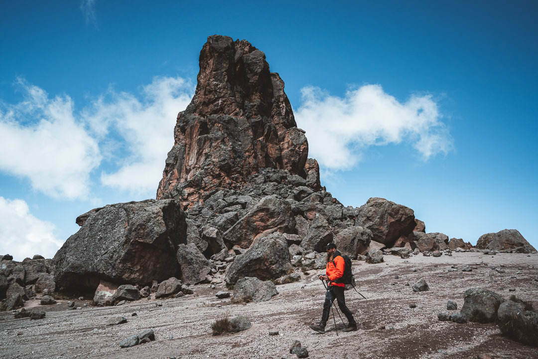
A heavy and chilly fog rolled through the camp, which led to a subdued afternoon of ginger tea, cards, and chatting with the cooking team. Looming over the camp is a huge lava tower. It’s possible to climb the tower but we will wait for better weather tomorrow.
We will spend two nights here at Lava Tower Camp to properly acclimatize. It’s funny how just staying at a campsite for two nights in a row can make it feel at home.
The air is getting thinner and cooler. Layers upon layers have been adorned but inside our sleeping bags at night we are toasty.
Tomorrow will be the halfway point of our journey to the summit of Mount Kilimanjaro. I’m nervously looking forward to the challenges that lat ahead on the snow-capped ridges of Kili.
Day Five: Lava Tower Acclimatization Hike
The mornings are only getting colder. Despite a beautiful pastel sunrise, it was hard to leave the warmth of my sleeping bag this morning. As I unzipped the tent door at 6:30 am, the moon was setting over the ridges in the distance.
Mount Kilimanjaro was casting its shadow, painting a dark pyramid over the view. I will have to wake up earlier tomorrow to capture what is hopefully a similar scene.
We stay two nights at Lava Tower Camp, which allows us to settle in but also plans some nice photos based on what we’ve seen the previous day. Our second day at Lava Tower Camp will be an earlier and colder start but hopefully produces some beautiful images.
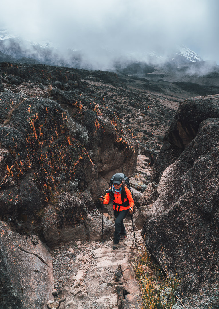
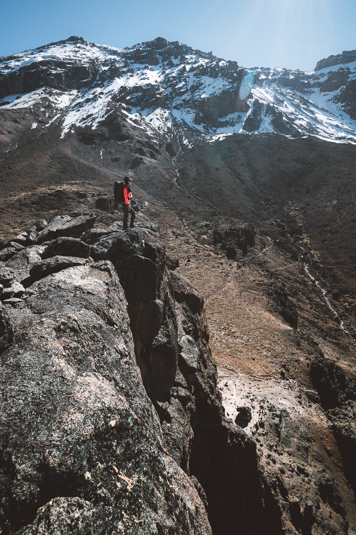
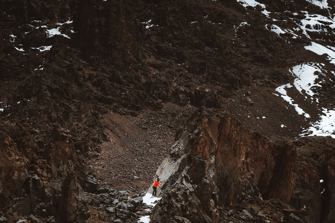
This morning we made the short climb up the lava tower that looks over our camp. It’s a short scramble with a few rock walls to clamber over.
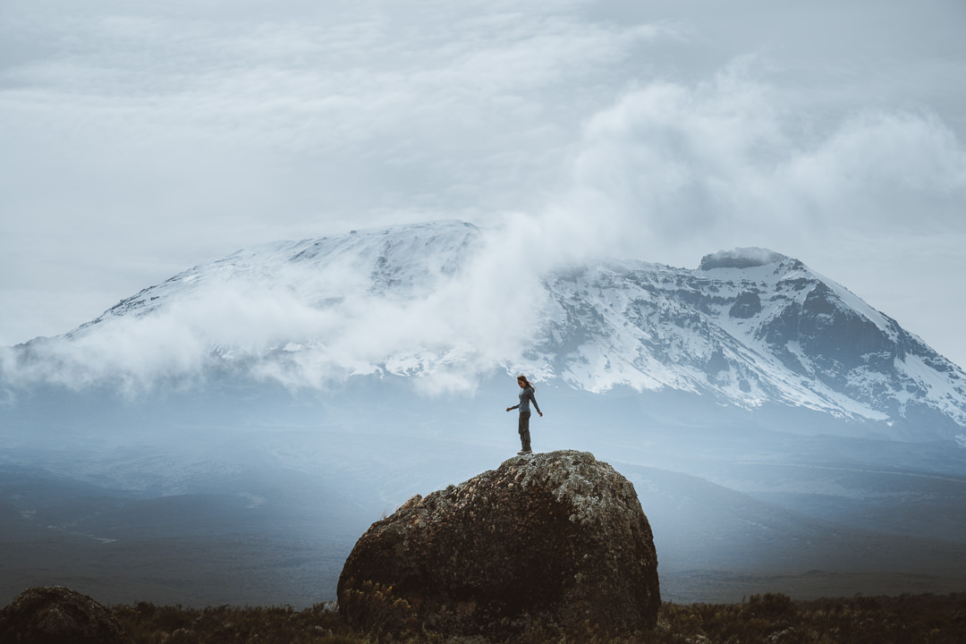
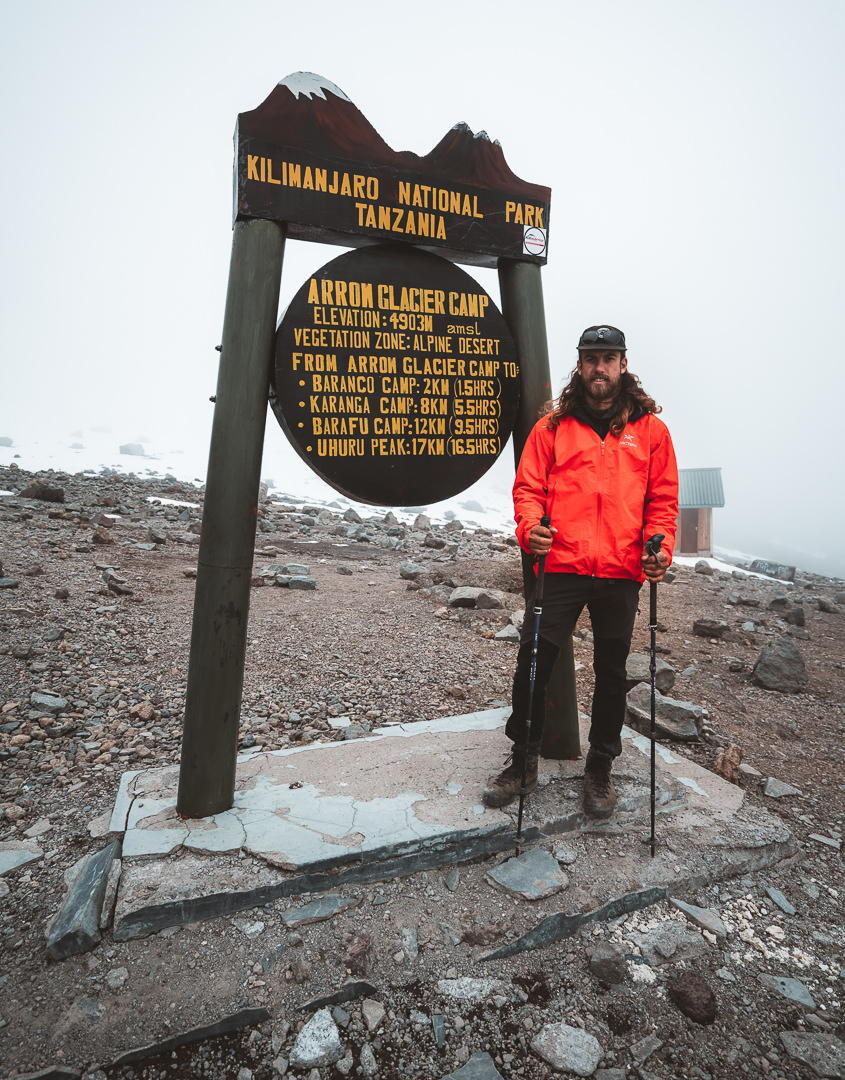
At the summit, we had an unbroken view of Kili. Basking in the warm sun on top of Lava Tower was exactly what my frozen toes needed. Our guides were able to point out the Western Breach and also Arrow Glacier Camp, which would be our second adventure of the day.
Before lunch, we headed out with small daypacks, which were basically just full of cameras. Our mission was to reach Arrow Glacier Camp, which sits at 4,900 meters. This is where we would stay the next night but today we would just trek up and back down to Lava Tower Camp as an acclimatization hike.
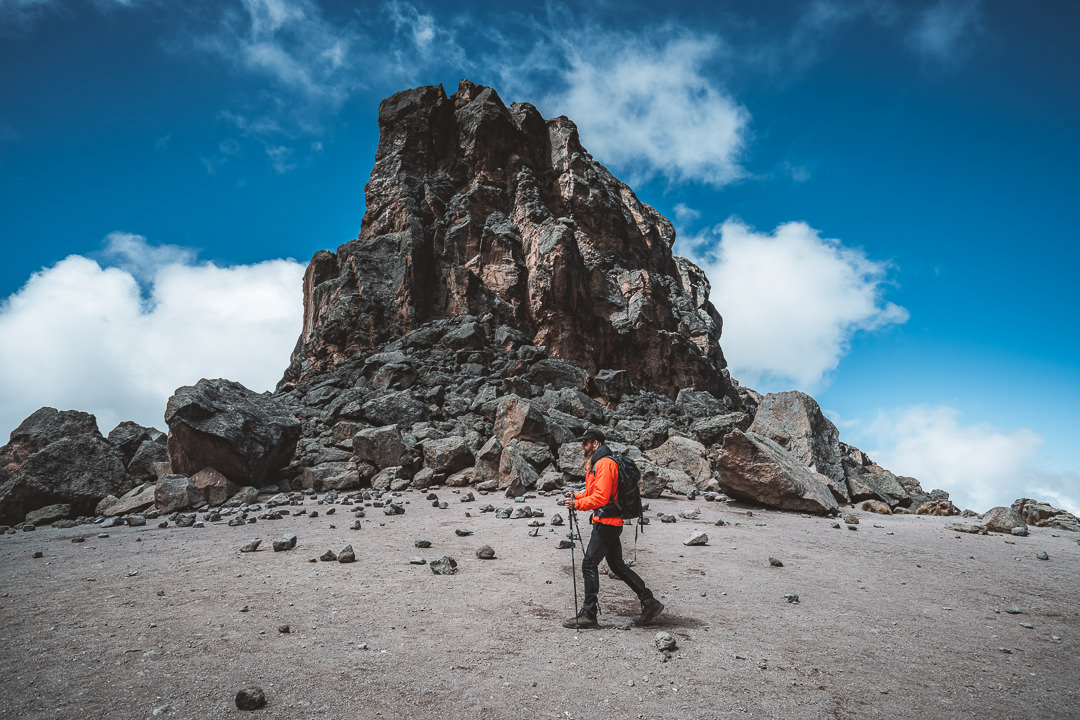
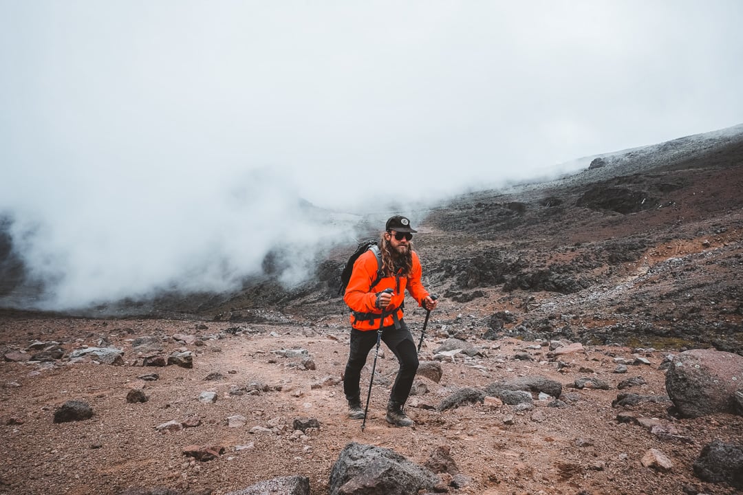
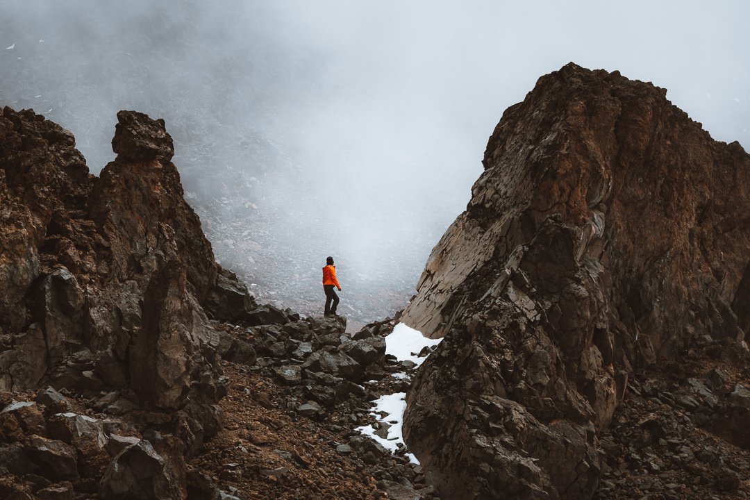
To reach Arrow Glacier Camp, we pass through the alpine desert region. This area looks like another planet and is very dry with a gravel path winding up switchbacks in between the boulders. Only a few determined spiders and flowers can sustain the conditions.
We reached Arrow Glacier Camp to find it mostly covered in snow except for small patches, big enough to pitch our tents. After hanging out and soaking in the altitude, we headed back down the slippery slope to Lava Tower Camp.
Back at camp we took a nap, played cards, ate too much food, and relaxed until sunset gave us some very moody, cloudy conditions up on Kili. We’ve been blessed with great weather and photography conditions so far and the ever-changing and fast-moving clouds have created many dramatic scenes.
With no cloud cover tonight, it’s well below freezing and feels like it. I’ll stay warm inside my sleeping bag, looking forward to reaching Arrow Glacier Camp tomorrow at 4,900 meters. The journey continues.
Day Six: Arrow Glacier Camp
It was a rough night. I woke too many times to count and my head seemed to be pounding. I woke early and sat outside in the freezing cold to let my body relax and could hear a ringing in my ears. This may all sound alarming but these are common effects of camping at high altitudes. Not everyone is impacted but attitude sickness chooses its victims at will.
Despite the heavy pressure and ringing in my ears, I woke early to shoot the sunrise and the setting moon but it was a dull, grey morning. I often enjoy those mornings with freezing cold conditions where I put in a lot of effort and planning but don’t even bother to touch my camera. I love being reminded of how hard you need to work for certain photographs and outcomes. Hard work I’m always willing to put in regardless of how many dull, grey mornings I witness before a spectacular sunrise.
Luckily our trek for the day was just 1.5km up to Arrow Glacier Camp. It’s the same trek we had done the day before as an acclimatization hike. I was left wondering why it hadn’t worked for me. After a slow pack-up, we began the trek up to our new camp at 4900 meters.
I was worried about this short hike. My headache wasn’t getting any better and we were going higher. Would it get worse? Would I be able to summit? Why was this happening to me? Needless to say, it was a stressful trek up the hills for me as thoughts buzzed about in my head, as did the constant ringing.
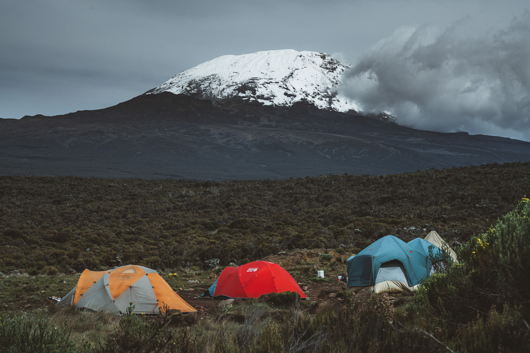
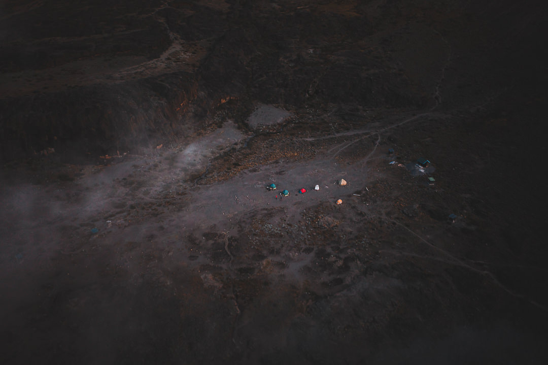
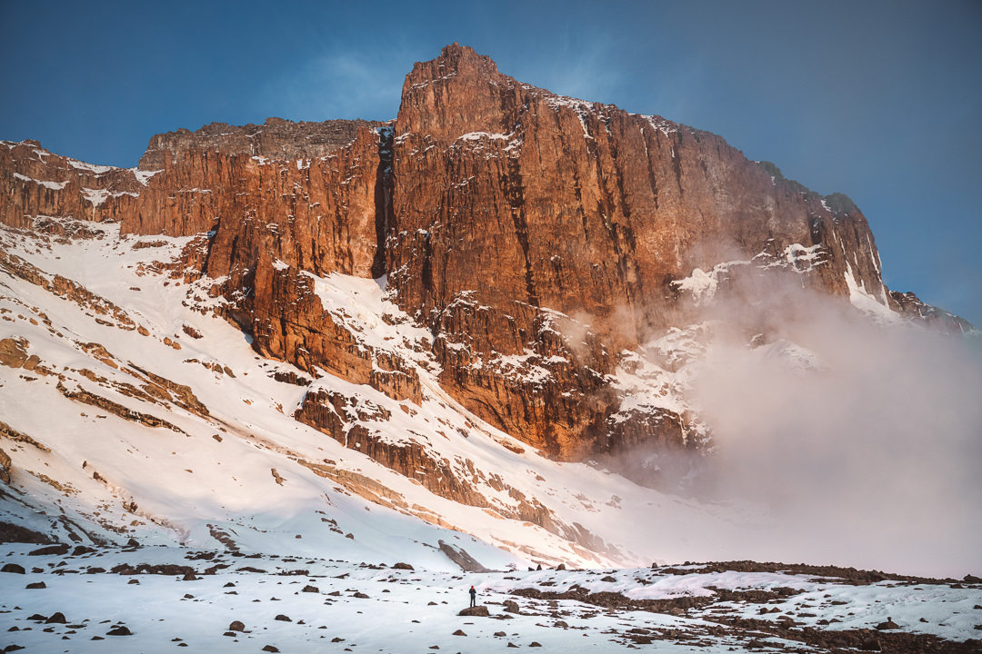
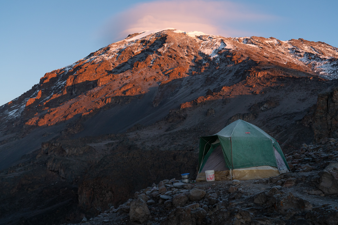
Arriving before midday at Arrow Glacier Camp meant we had the whole day to relax and enjoy the close proximity to Mount Kilimanjaro. This campsite really sits under the mountain and is the gateway to the Western Breach route to the summit.
Snow covers the campsite and the occasional rockfall gives this scenic campsite energy and atmosphere unlike any other on the expedition. As the clouds rolled past throughout the day. I often sat with my cameras waiting for opportune moments to capture a nice scene. The ever-changing clouds and light gave me a lot to consider.

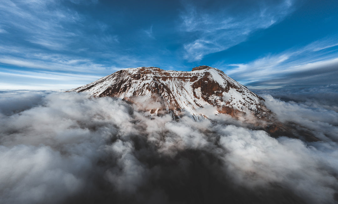
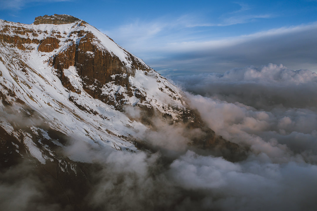
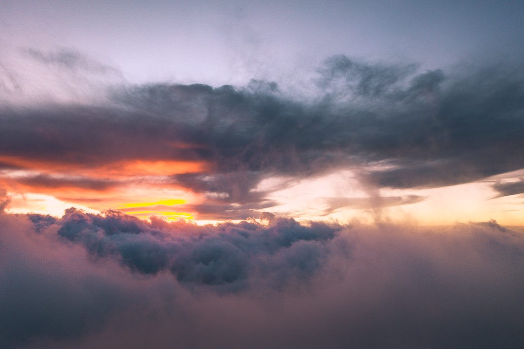
The golden hour approached and I decided to send up the drone for an aerial view of Kili from above the clouds. Ethereal and majestic are the only words I have to describe this monolith of a mountain.
The drone flight was an exciting one as my little buddy returned with 0% and promptly dropped from five meters into the snow. This unplanned landing was much to the delight of the Kiliwarriors who seemed to enjoy the commotion.
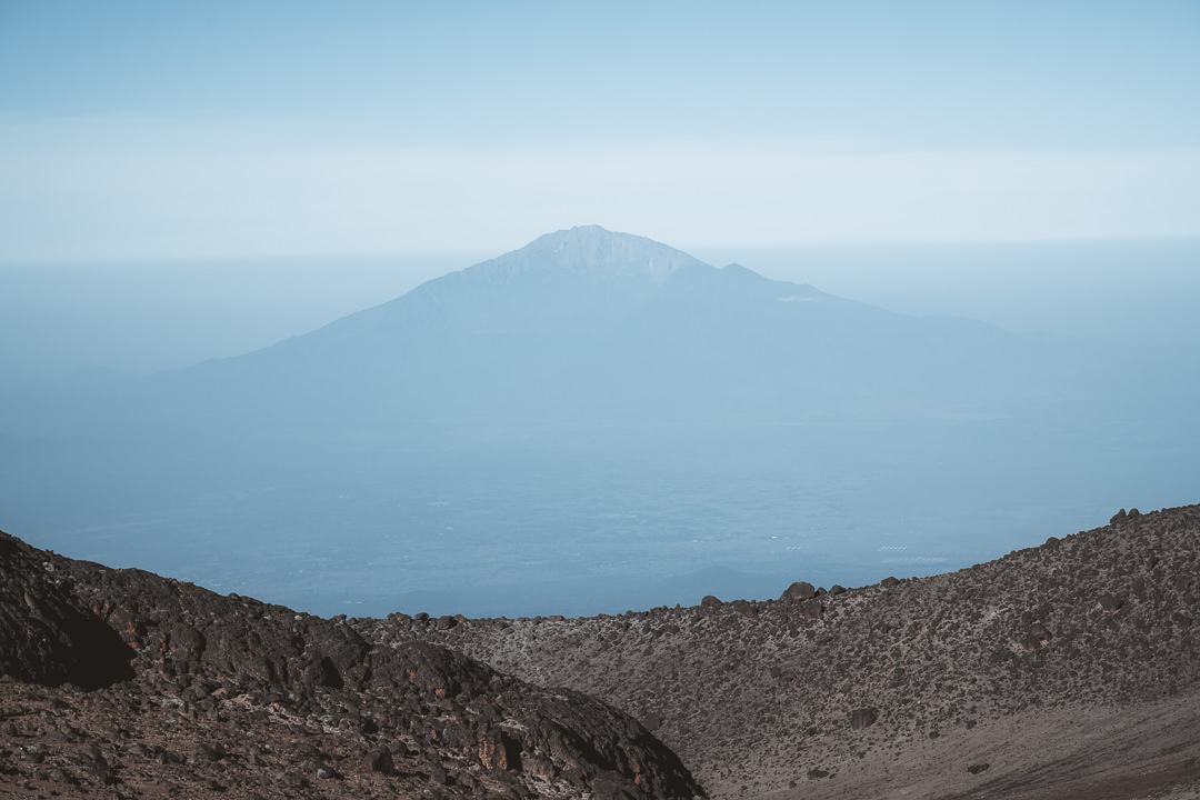
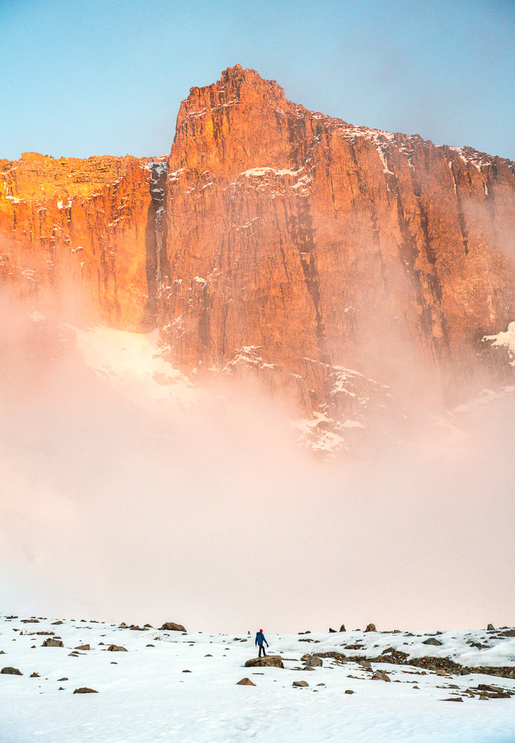
The sunset wasn’t over with fiery colors helping to bring out the beautiful shape of Mount Meru in the distance. I hoped it was a sign from Kili.
As I head to sleep inside my tent, hidden from the harsh cold, I can only hope to wake up with a clear head. Well, at least clear enough to reach the summit. It’s been a great journey so far but the summit is our goal after all. I’m ready to push as hard as I can. So for now, we sleep and wake at 2:30 tomorrow to begin the Western Breach route to the summit of Mount Kilimanjaro.
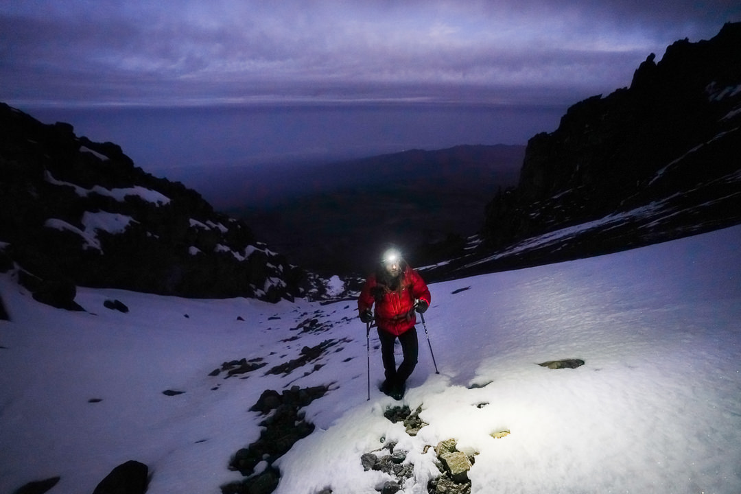
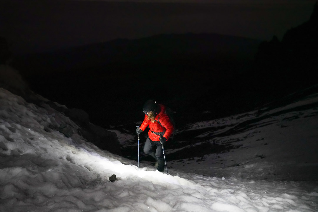
Day Seven: Western Breach, Crater Camp & Uhuru Peak (Summit Day)
“Good Morning, Good Morning” came the call from our guide outside our tent at 2:30. It was so cold I had slept in almost all of my summit gear. I leaned up in my sleeping bag, wiped my eyes, and immediately began to pack my daypack for our summit day. There was no time to rest this morning, it was summit day.
Unzipping the tent door, I could only pray for clear skies. I poked my head out and saw just a few clouds, shielding a sky full of stars. What a perfect morning to be heading up the challenging and technical Western Breach route to the roof of Africa, Mount Kilimanjaro.
The guides and chef had been up for a while. A breakfast of porridge, toast, tea, and coffee had been prepared. I could only stomach a piece of toast and a tea. It would be the last thing I ate for hours.
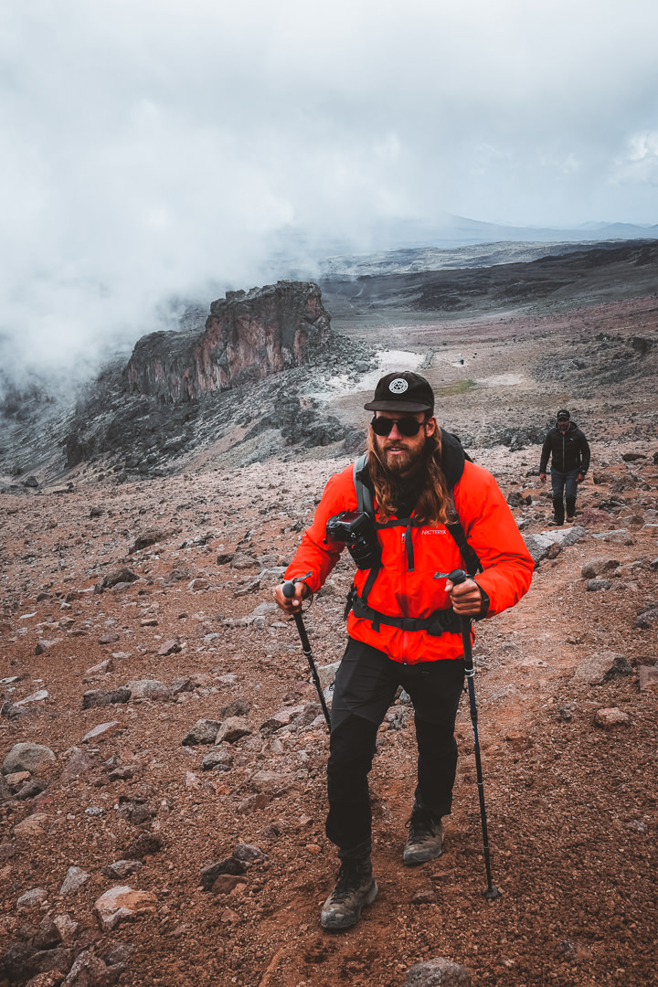
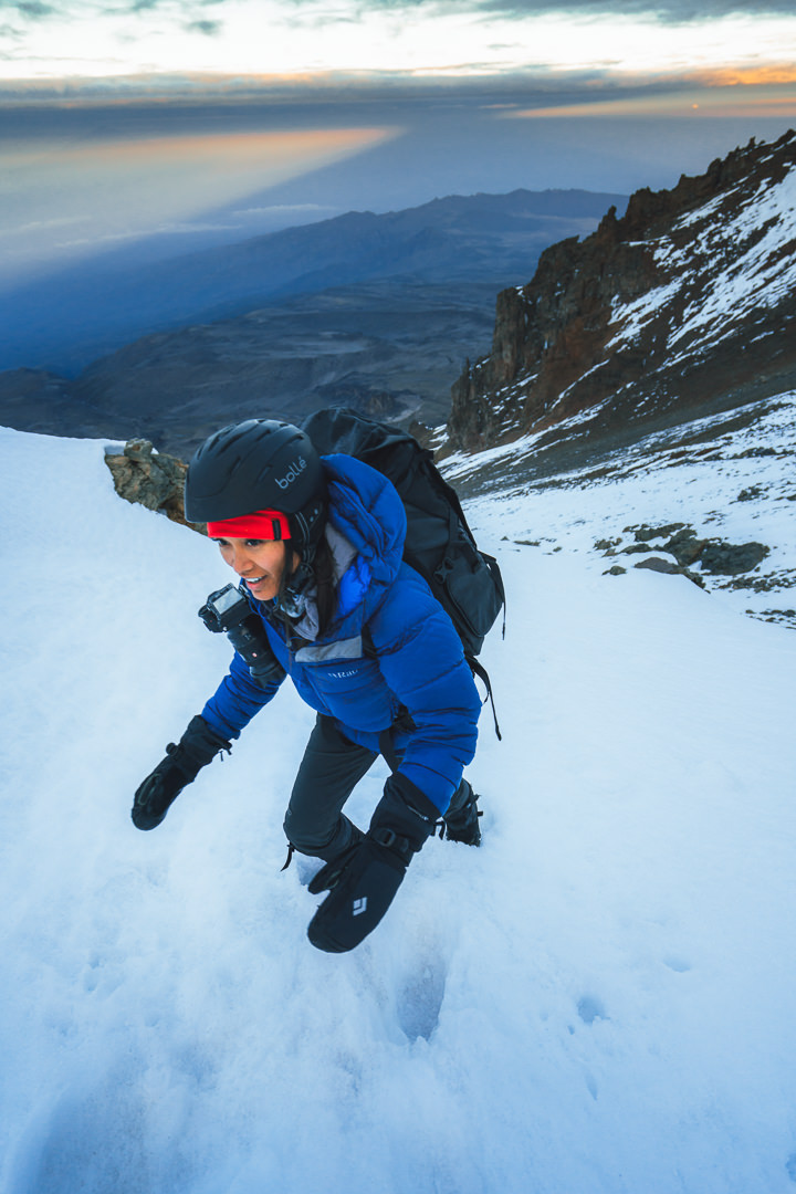
At 4 am, we strapped on our helmets, did a final gear check, and placed some hand-warmers inside our gloves. I took one final look up the entire Western Breach and felt mentally prepared to embark on the 1000m of vertical climbing.
The climb up the Western Breach is a combination of rock crossings, snow, and Boulder scrambling. The conditions really depend on the season and the amount of recent snowfall. We were lucky to have a good cover of snow but not deep enough to be dangerous. It was essentially a perfect run on this day.
The climb began in the dark, but a full moon gave us an ambient light on top of our head torches. It was a quiet and peaceful atmosphere as we made our way through the bottom half of the breach.
After about an hour of scrambling, we put on our crampons (micro-spikes) in preparation for a series of snow crossings and snow-glazed rock sections. I wasn’t expecting our Kilimanjaro Climb to be so beautiful. I constantly turned back over my shoulder to see a white slope leading sharply back down to the dry alpine desert region below. Sharp ridges towered over us on either side creating a dramatic atmosphere during blue hour.
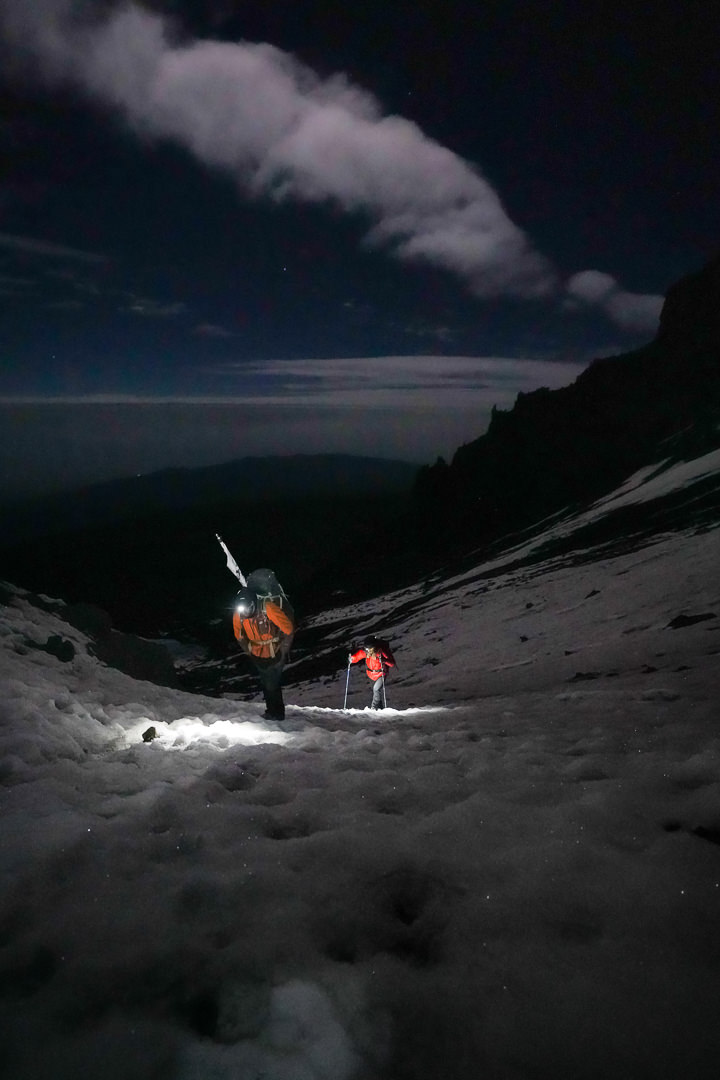
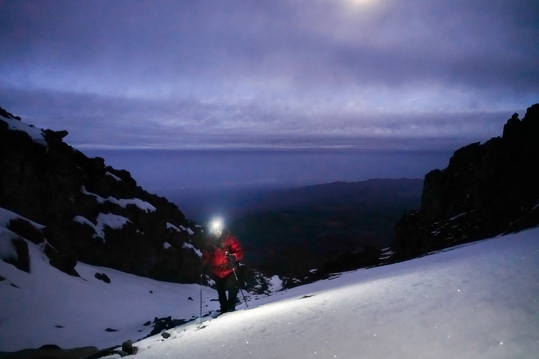
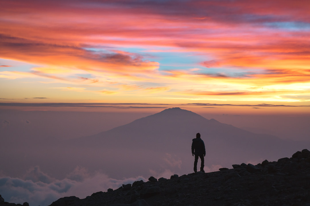
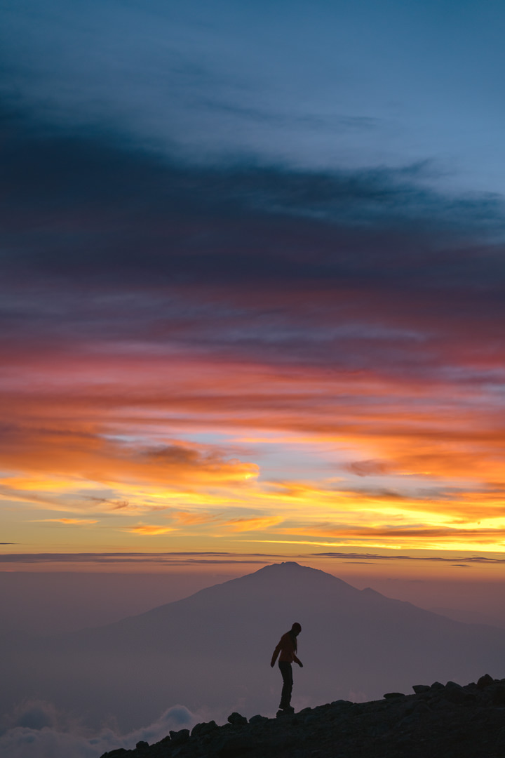
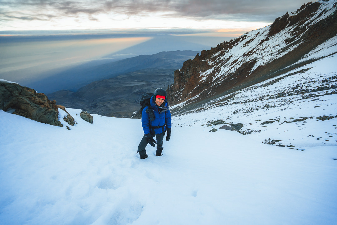
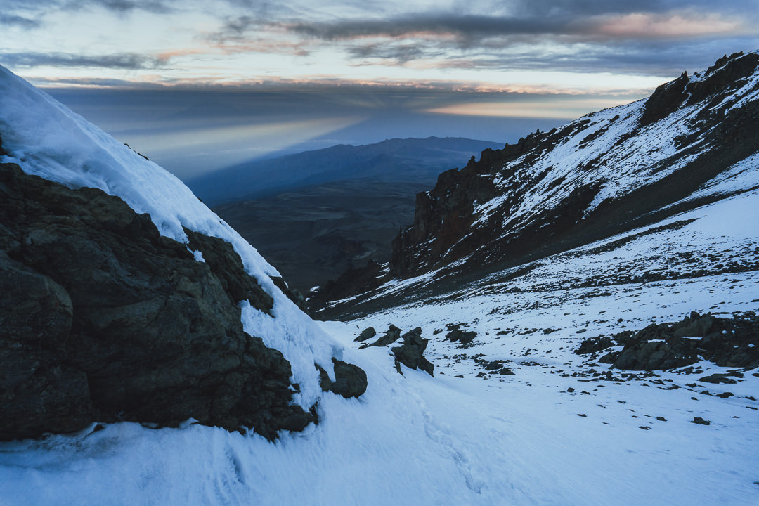
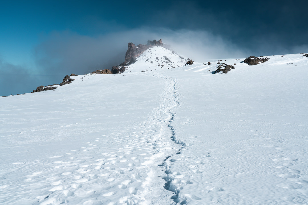
In the latter stages of the Western Breach, the sun finally began to pop over the top of the crater rim giving us some warmth and hope of reaching the rim before too long. After just three and a half hours, we reached the top of the Western Breach from Arrow Glacier Camp.
As the golden light began to enter the morning, Kili cast its imposing shadow on the horizon while Mount Meru also began to burst through the early fog. It was an incredible scene and one that was hard to capture in its entirety. We did put in quite a lot of effort on the Western Breach in cold and testing conditions to capture the route during some of our favorite moments.
The Western Breach is by far the best way to summit Mount Kilimanjaro if you want a more scenic and adventurous route. We came down the regular route and it just doesn’t even come close to comparing to the unbelievable morning we experienced on the Western Breach ascent.
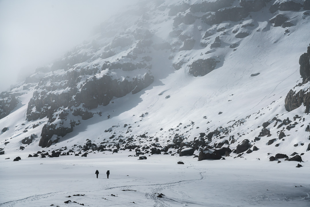
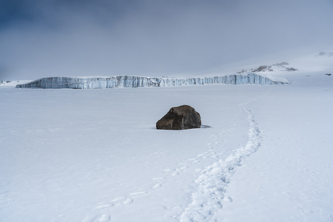
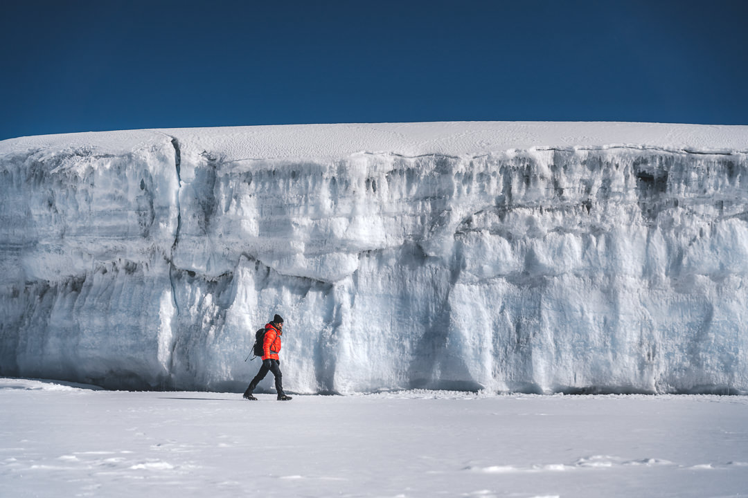
That was phase one of the morning completed and we were in pretty good condition by that stage despite 850 meters of vertical gain from our camp. We now had to cross the vast snowfield to reach Crater Camp, which sits just below the very steep gauntlet route to Uhuru Peak.
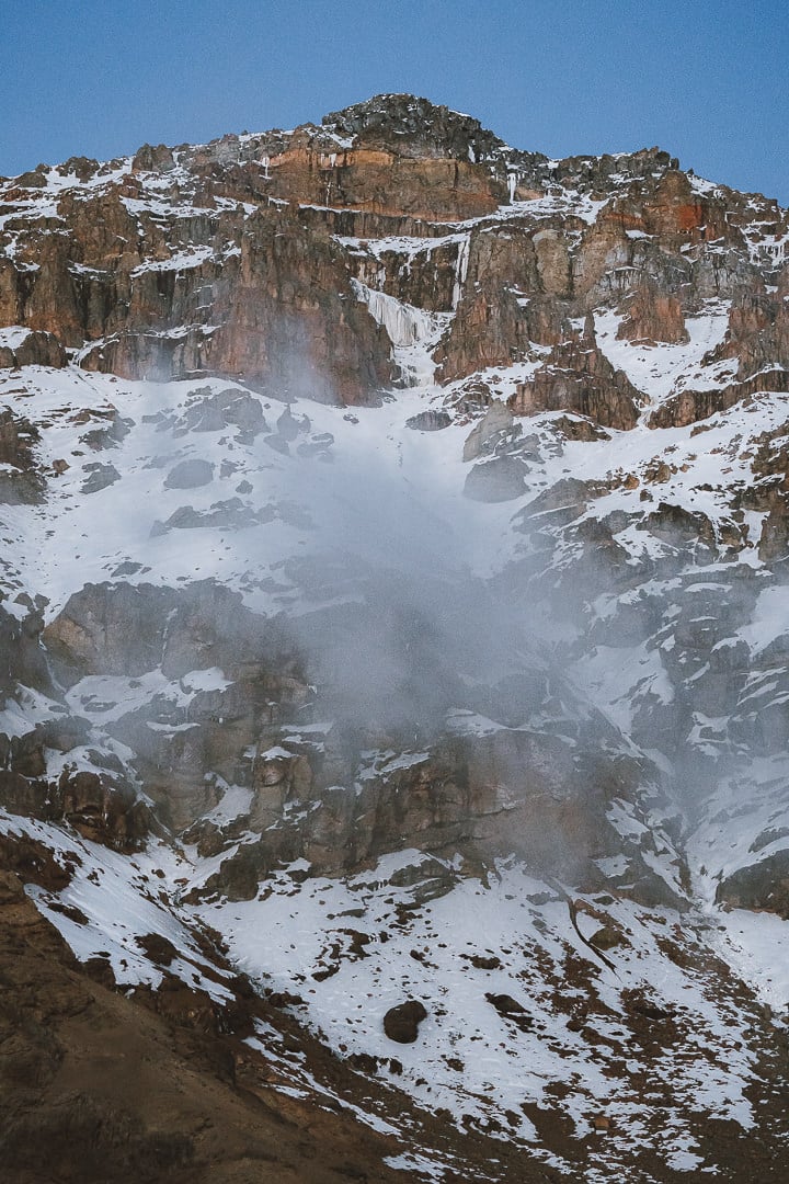
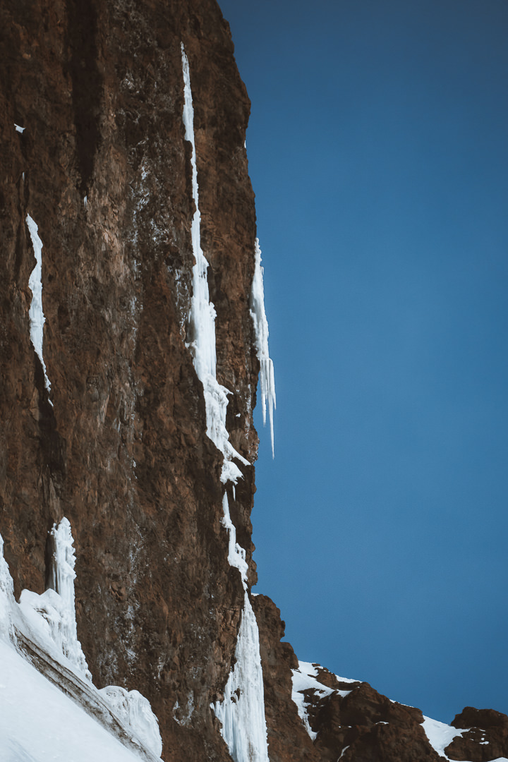
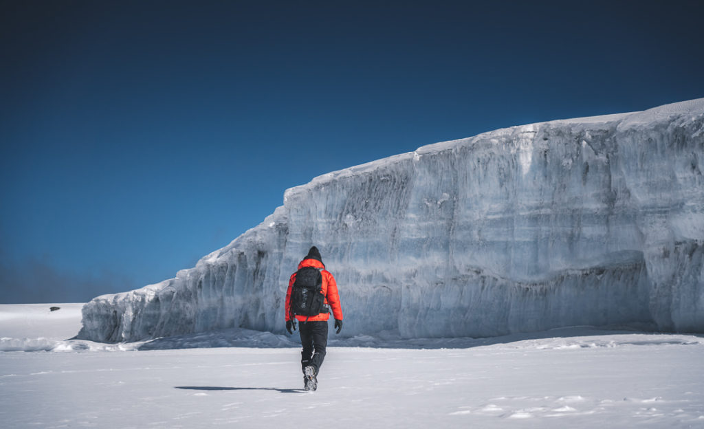
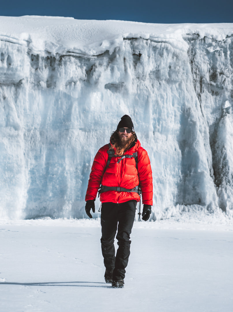
The crossing was short but the open snowfield was truly beautiful. It felt like Antarctica yet I had to remind myself we were in Africa. The highlight of the crossing was passing the glacier near Crater Camp.
The demise of the glaciers on Mount Kilimanjaro is well researched and documented but the remaining glaciers are still truly incredible. They tower over you and have a vivid blue glow, unlike any other substance. Walking beside the glacier wall was one of the highlights of the day.

In mid-morning, we reached Crater Camp to find our Kiliwarrior team with a makeshift setup. We decided to skip lunch and head straight up to the summit. By this stage, I had a growing headache so I was keen to get going on the summit, which would mean a quicker descent.
The route to Uhuru Peak is almost a direct line up the side of the mountain. You can see the footsteps from afar and it can be quite intimidating. However, if you take it one step at a time, reaching the summit can take just over an hour from Crater Camp although in bad conditions it can take more than three hours.
This ascent of a few hundred meters was very tough for me. My head became cloudier as we climbed. My body and mind were strong but an increasing earache hampered my progress. Nevertheless, I took each step as a victory, accumulating hundreds of small wins on my way to the peak.

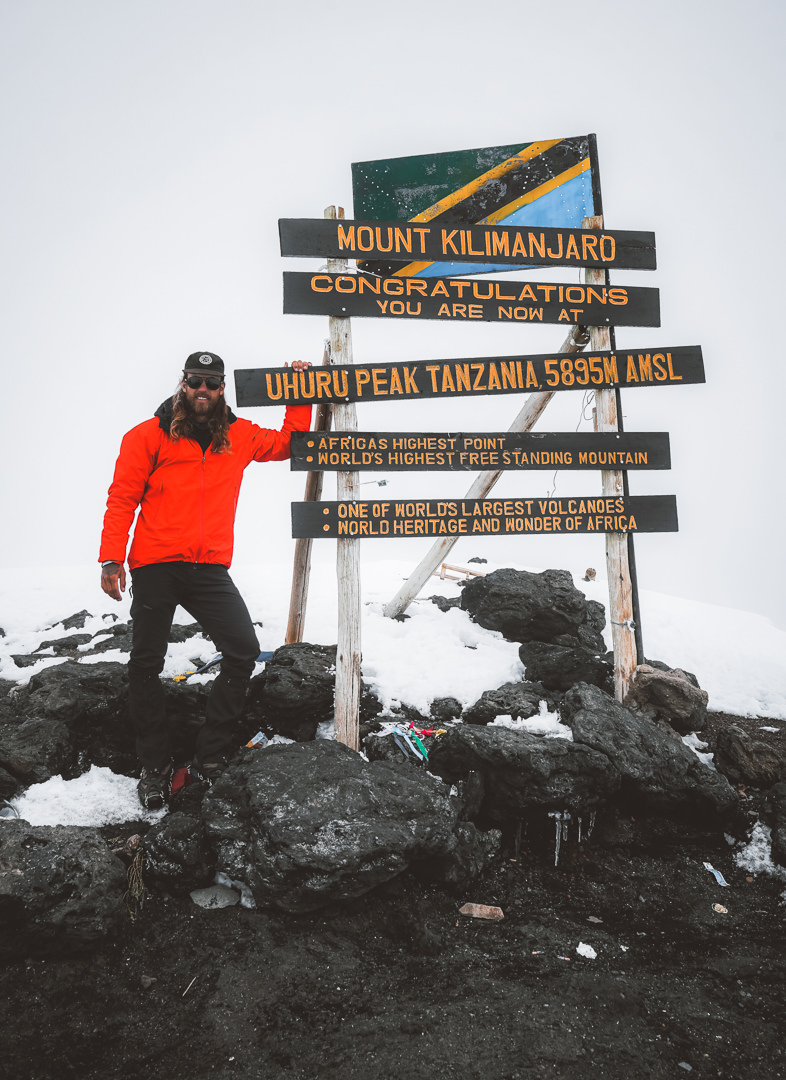
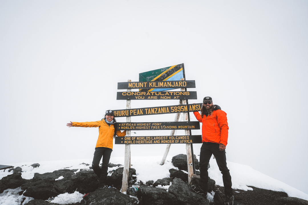
Once you reach the top of the vertical climb, there’s still a fifteen-minute stretch of relatively flat snow to navigate to reach the official peak. The sign is unmissable, ‘Congratulations you are now at Uhuru Peak, Tanzania’. We had made it.
The weather was a full whiteout at the summit but our views on the Western Breach earlier in the morning made up for it. Because we reached Uhuru Peak in the late morning, we were the only people at the usually crowded summit. This is another big advantage of the Western Breach route, which starts the summit day at 4 am and reaches Uhuru Peak long after the hoards of trekkers from the regular routes have begun their descent.
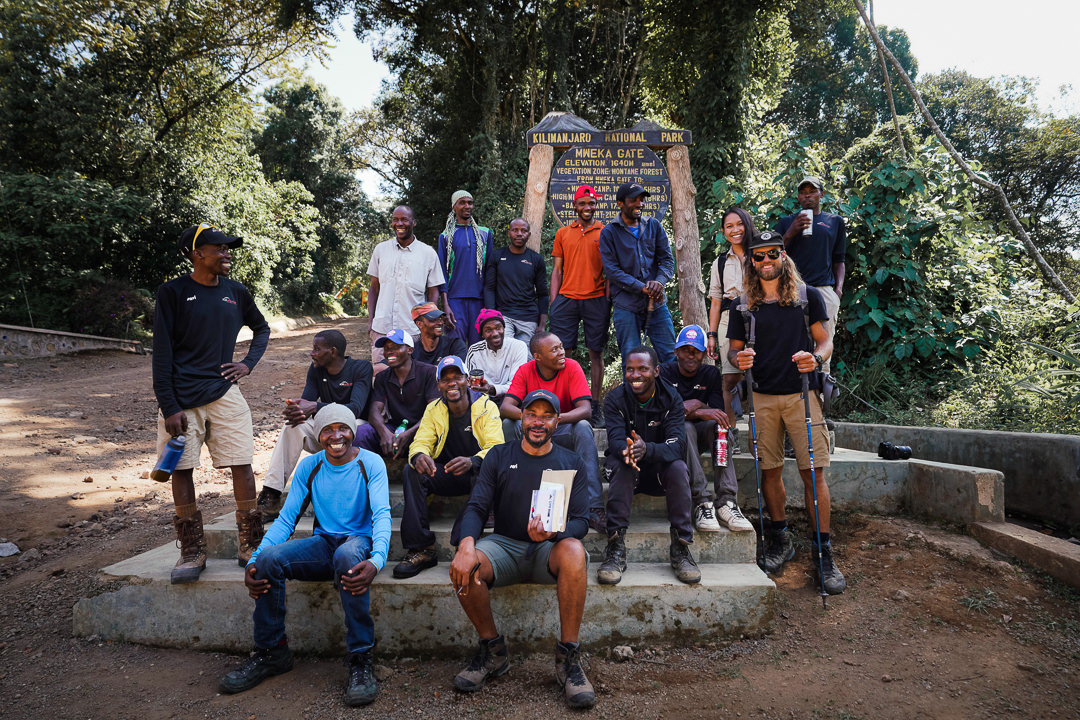
At the summit, I had quite a headache but still managed to savor the moment and enjoy the achievement. It was great to share our accomplishments with our guides. The entire Kikiwarrior team of 22 had helped us reach the summit, which is something we will never forget.
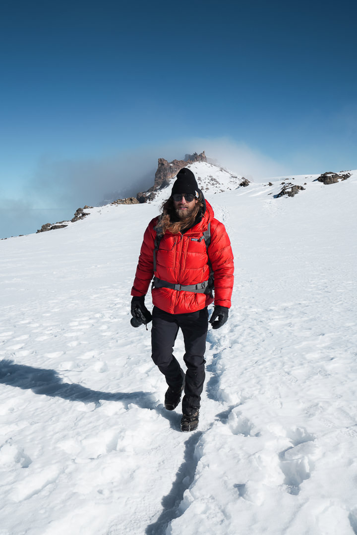
The descent heads down the regular route to Barafu Camp. It’s an altitude loss of 1300 meters through a slope of loose volcanic rock. The descent often resembles skiing more so than trekking as everyone does their best to remain upright while sliding down the mountain-side.
The journey from Uhuru Peak to Barafu Camp takes about two hours and the decline is more than welcome after 1,100 meters of climbing earlier in the morning.
Barafu is a large and busy camp, but we found our spot nestled away on the ridge with views looking back up to Kili. A hearty meal, hot chocolate, and some card games was a fitting end to one of my most memorable days up in the mountains. Tonight I rest my head upon my pillow with tired eyes, fatigued body but a nourished soul. Thanks, Kili.
Day Eight: Mweka Camp
Everyone enjoyed a long sleep and a late start at Barafu Camp. Sunrise still had us out of bed at 630 am with views of Mawenzi and Kili. The mood has changed. Everyone is much more relaxed now that we’ve summitted. Even I sat with a coffee, watching the ravens fly around camp as I reminisced on our adventure from yesterday.
This side of the mountain isn’t as beautiful but it’s still amazing to see such a giant snow-capped mountain at golden hour. We’re now on the eastern side of Mount Kilimanjaro, which is much more barren and far less scenic than the west. I’m glad we were able to enter from the west, cross Kili, and now exit from the East. It allows you to appreciate the mountain from both sides.
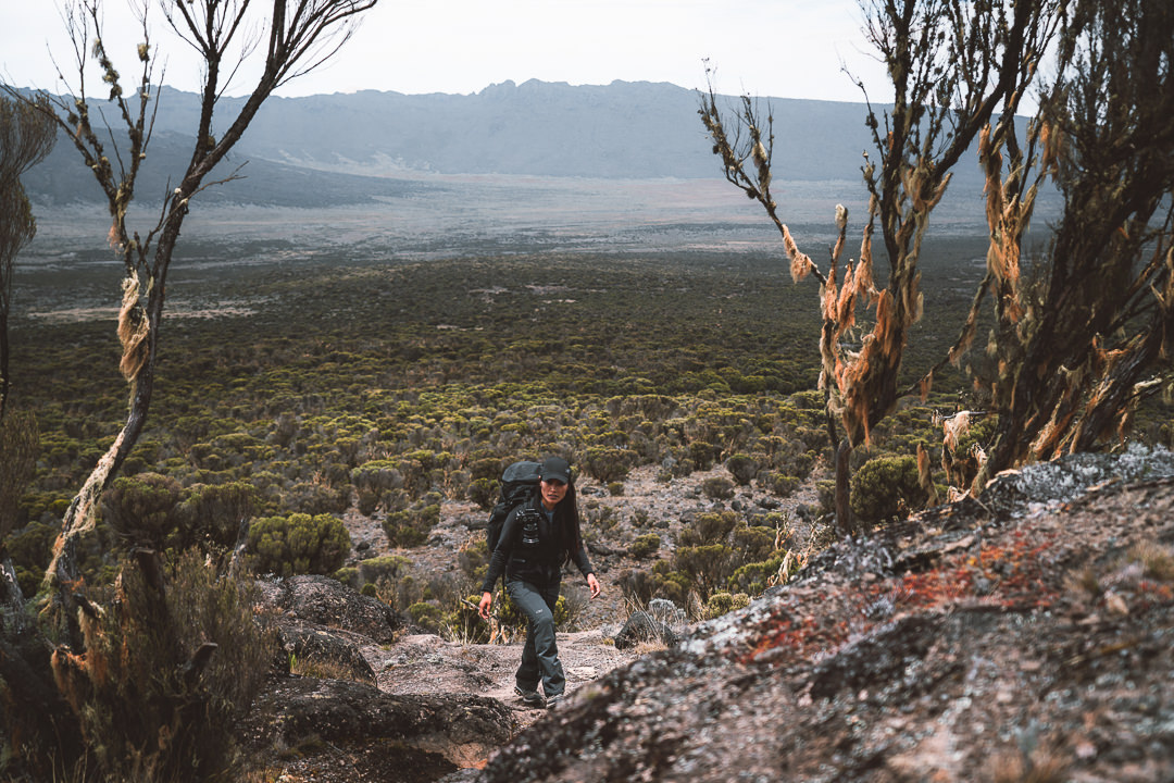
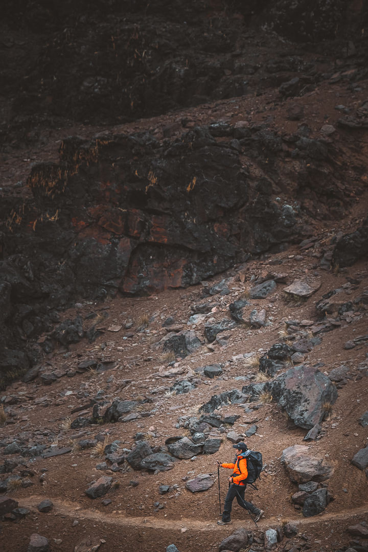
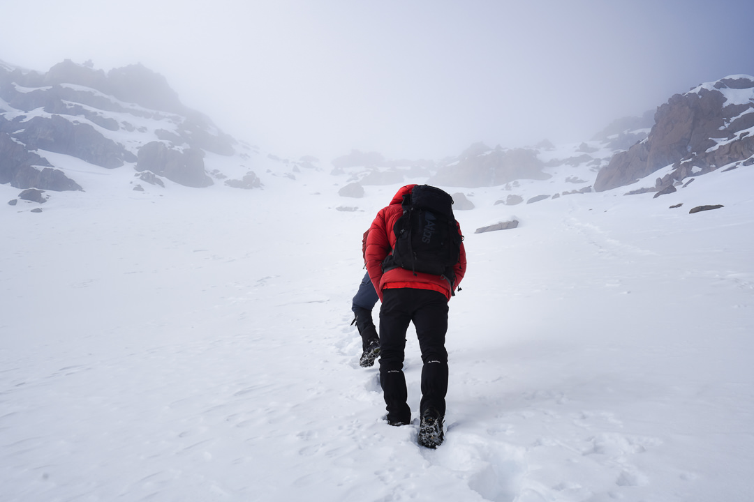
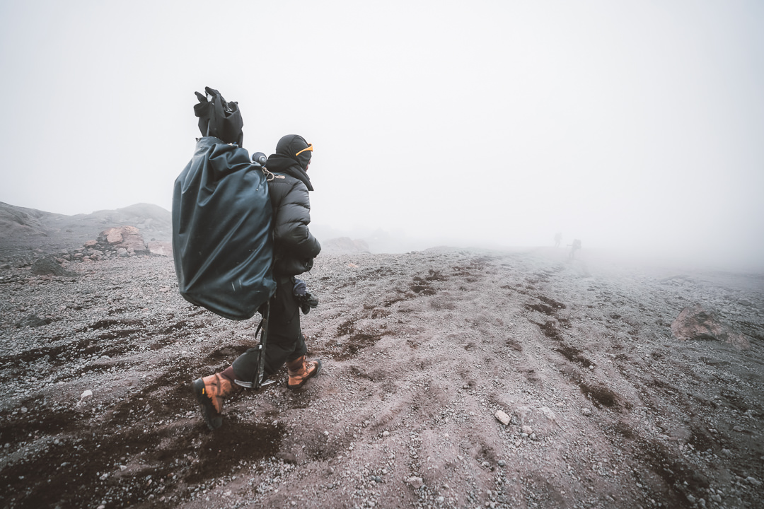
Our trek today began as a winding, rocky path down from Barafu Camp to High Camp. It’s a dusty, barren scene with wide-open expanses. As we walked, looking up we would see the change from the desert to the heather zone to the jungle and finally the town. It’s always nice to see where you are heading.
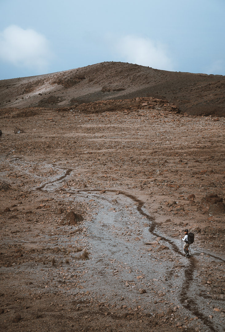
From High Camp, we passed through the edge of the forest to reach Mweka Camp. The total trip for the day was seven kilometers with a drop of 1500 meters. I definitely felt this one on the knees as most of the path had us dropping down from one Boulder to another.
Mweka Camp is just ten kilometers from the exit, which is called Mweka Gate. We probably could’ve easily made it all the way to Mweka Gate in the early afternoon but after a big summit day, there’s no rush to push on.
This camp is quite busy as many of the routes use this camp as part of their exit route. It’s the least scenic camp of the entire journey but by now we’ve been spoilt with epic camp views and private camps just for us.
Tonight we will sleep easy at 3000 meters before making the three-hour hike to Mweka Gate tomorrow to finish off this adventure.
Day Nine: Mweka Gate
With just ten downhill kilometers remaining on our Kilimanjaro adventure, there were no nerves and minimal anticipation during our last morning. There was a feeling of casual formality amongst the group. We packed up camp at a leisurely pace and began the walk down from Mweka Camp to Mweka Gate.
I wasn’t expecting much scenery on this final day, as it is simply a practical exit route down from the mountain. However, as happened many times on this trip, I was pleasantly surprised with some amazing rainforest scenery. There were even a few glimpses of Mount Kilimanjaro through the trees for one last chance to say goodbye.
The trail on the final two days of the trek gives your knees a workout as you are constantly downhill on muddy steps and boulders. It’s not technical but the repetition will test your durability.
The lush rainforest reminded me of our first day on the trek. Early morning light broke through the thick canopy as monkeys played about on the branches. Twisted branches were draped in vines to create a sea of green in every direction. This was one of my favorite parts of the trek despite having been to the summit and seen some incredible peaks, glaciers, and snow-covered mountains.
All good things must come to an end. After ten kilometers of downhill action, we made it down to Mweka Gate where we received our Mount Kilimanjaro certificates, took our final group photos, and tipped our Kiliwarrior Expedition team. From there we had a couple of hours of driving back to Arusha to our hotel Kibo Palace.
Climbing Mount Kilimanjaro via the Western Breach route with the team from KiliWarriors was one of the best experiences I’ve ever had on the mountain. After having completed the route, there is simply no way I would recommend doing it any other route as it is far more scenic and adventurous via the Western Breach. It’s simply incomparable.
In the section below, I will give you all the details about climbing Mount Kilimanjaro including what to pack, costs, comparison of alternate routes, the best time of year to climb, and where to stay in Arusha before your climb. I will also detail my experience with KiliWarriors and whether or not it was a good-value trip and what to expect when booking with them.
THE COMPLETE GUIDE TO CLIMBING MOUNT KILIMANJARO
WHERE IS MOUNT KILIMANJARO?
Mount Kilimanjaro is located in Tanzania, East Africa and is the highest free-standing mountain in the world and one of the Seven Summits prized by mountaineers and climbers.
THE FULL VLOG FROM OUR CLIMB OF MOUNT KILIMANJARO

MOUNT KILIMANJARO HEIGHT
Mount Kilimanjaro stands at 5,895 meters or 19,341 feet above sea-level.
WHICH TYPE OF VOLCANO IS MOUNT KILIMANJARO?
Mount Kilimanjaro is a stratovolcano, which is a term for a very large volcano made of ash, lava, and rock. Mount Kilimanjaro is made up of three cones: Kibo, Mawenzi, and Shira. Kibo is the summit of Mount Kilimanjaro and the tallest of the three volcanic formations. Uhuru Peak is the highest point of Kibo (Mount Kilimanjaro)
HOW HARD IS CLIMBING MOUNT KILIMANJARO
Mount Kilimanjaro is a non-technical mountain. It’s one of the easiest mountains of it’s height to climb. But that doesn’t make it easy. The route will take you anywhere from 6-9 days with more than 50 kilometers of trekking distance and approximately five thousand meters of incline.
However, don’t be intimidated by those numbers because when you break it down to a day-by-day schedule it is quite manageable.
The biggest part many struggle with is the altitude when they get above 5000 meters, which is harder to train for. If you can manage the following list below, you should be capable of climbing Mount Kilimanjaro. In the end, reaching Uhuru Peak (Mount Kilimanjaro Summit) is more mental than physical.
Mount Kilimanjaro Fitness Checklist
- You can walk 10 kilometers every day for a week
- You can hike a vertical kilometer (1000m of incline) in one day
It’s important to know that only 60-70% of trekkers reach the summit every year. Even with porters carrying bags and helping tourists every step of the way, not everyone reaches the summit. The longer the route, the more likely you are to summit, so keep that in mind when choosing your route. The Western Breach route that I took was one of the longest and has the highest success rate.
CLIMBING MOUNT KILIMANJARO COST
The cost of your tour will depend on the tour operator and the route you take. The prices range from $2000 to $6000 per person for the trek but there are some key differences that lead to this wide range. For example, some treks are just five or six days while treks like mine are nine days. Also with a higher quality of food, toilets, and equipment a company might require more porters, which would increase the cost again.
There is no way to climb Mount Kilimanjaro independently. You need to go with a guide and there are a minimum number of porters required. The mountain is very regulated to ensure local employment and fair working conditions.
It is possible to book the trek once you arrive in Arusha or Moshi but I advise booking online in advance so you have no hassles and everything is lined up. If you book with someone you meet on the street, you might not be quite sure what you can expect on the mountain. However, if you book on the street in Arusha or Moshi, you can probably haggle a much lower price than you will find online.
Booking with KiliWarrior Expeditions costs approximately $5,050 USD per person (as of 2021) and is a high-end trek but also a nine-day route so it’s longer than most routes. They have many luxuries other companies overlook. A portable toilet, fresh fruits, and vegetables at altitude, hot water bottles, multiple chefs, and high-quality gear may not all be necessary but it definitely makes the trip comfortable and improves your chance of reaching the summit.
PACKING FOR YOUR MOUNT KILIMANJARO CLIMB
When you’re packing for Mount Kilimanjaro, it’s a bit different from packing for a regular trek by yourself. You will have porters who will carry your food, gear, clothes, and water supplies for the entire trek. You will carry your day pack with a rain-jacket, water bottle, phone, camera, and anything else you might need on the hike between camps.
For my trek, I had a 15-kilogram allowance for my duffel that a porter would carry. In that duffel, I packed clothes, toiletries, electronics, chargers, and other essentials. I carried my daypack with most of my camera gear I needed each day.
KILIMANJARO PORTERS ASSISTANCE PROJECT
Make sure you book with a trekking company that is a KPAP (Kilimanjaro Porters Assistance Project) partner. KPAP was created many years ago and means there are set standards that need to be followed and met by the company. It basically ensures the rights of your guides, porters and crew. It’s a non-profit association that makes sure the porters and guides have a minimum wage, three set meals a day, and good sleeping conditions.
On every trek, one of the crew will be a member from KPAP, who is there to observe that the standards are met. That KPAP member is paid extra to be an unbiased observer while still working on the trip. There are almost 1000 companies that offer Mount Kilimanjaro treks and so far approximately 150 are part of KPAP.
KILIMANJARO TIPPING GUIDE
Tipping is standard for a Mount Kilimanjaro climb. About 10% is the average amount to tip although it can slightly depend on the company and cost of the tour. On our trip, it was recommended to tip $300 USD per person, which is what we did. Tipping is always a bit of a touchy subject so we asked our tour operator and he suggested $300 as a good amount.
As an Australian (the land of no tips), I’ve never liked tipping. I lived in Hawaii and Oregon for four years and have traveled around the world for five years.
Wherever there are tips you will find controversy and disappointment from someone involved. So why do we need to tip on Kilimanjaro. Basically, instead of including the tip in the price, tour operators can make their fees appear lower but stipulate a tip is required so the wages of the porters are still acceptable.
I don’t love this system but it requires systematic change and if one tour operator doesn’t co-operate they all need to require tipping to compete with the tour prices. The bottom line is that as of 2021, you need to tip your guides and porters and somewhere around 10% will be suitable.
MOUNT KILIMANJARO ROUTE OPTIONS & COMPARISON
There are many different route options to climb Mount Kilimanjaro, which include the Western Breach Marangu, Machame, Lemosho, Shira, Rongai, Northern Circuit, and Umbwe. Each route has a different itinerary, scenery, duration, and price but most importantly a different success rate.
Marangu Route
- 64km
- 6 days
- 65% Success rate
- The only trek with huts and toilets. The same route up and down. Not the most scenic but the quickest. Lower success rate. Not the most scenic.
Machame Route
- 49km
- 6-7 days
- 85% Success rate
- Most popular route and also a very scenic route. Good acclimatization profile with a rest day before summit day.
Rongai Route
- 65km
- 6-7 days
- 85% Success rate
- The only route to start on the north side of the mountain. More expensive, less busy. Kown as an easier route with a more gradual incline.
Lemosho Route
- 56km
- 7-8 days
- 80% Success rate
- Known as one of the most scenic routes. Begins. and ends in a stunning rainforest, not as busy.
Shira Route
- 56km
- 7-8 days
- 75% Success rate
- Drive in a jeep til 3500m and then follows the Machame route. Chance of altitude sickness.
Umbwe Route
- 37km
- 5-6 days
- 75% Success rate
- Most steep and difficult route as you just go straight up the ridge. Higher chance of altitude sickness.
Northern Circuit
- 90km
- 9 days
- 95% Success rate
- Known as the ‘Grand Traverse’ it has a high success rate due to the slow ascent. Starts at the same point as the Lemosho route and has great views.
Western Breach Route
- 60km
- 9 days
- 95% Success rate
- This is the route I did. The most scenic route climbs to the summit via the epic Western Breach. Great campsites, few crowds and in my opinion the best route by far.
BEST TIME TO CLIMB MOUNT KILMANJARO
The best time to climb Mount Kilimanjaro is January to March and June to October. It is colder if you go from January to March and it can often be snowing. I trekked in late February and there was thick snow, which was beautiful.
However, it is near the beginning of the rainy season so you can get unlucky with rain although we had no rain. June to October can be very busy and is the peak season with the summer holidays. It’s a great time to trek but there will undoubtedly be crowds. March to April and even November are the rainy months and times to avoid climbing Mount Kilimanjaro.
ALTITUDE SICKNESS WHILE CLIMBING MOUNT KILIMANJARO
They say the mountain decides if you summit or not, which is mostly due to either bad weather or altitude sickness. Neither of which you have much control over. Altitude sickness happens when you climb too quickly.
Basically there is less oxygen available at higher altitude and you can have headaches, diarheea and vomiting, dizziness and difficulty sleeping. Symptoms of altitude sickness can start at about 3000m (10 000 ft) above sea level.
The treatment is basically to go down in elevation, which is tricky when you are trying to climb further up the mountain. If you keep climbing you can make the situation worse and it could become a High Altitude Cerebral Edema (HACE) or a High Altitude Pulmonary Edema (HAPE). These are very serious and would require immediate medical attention and evacuation.
It’s common to have some altitude sickness while climbing Mount Kilimanjaro. However, usually overnight or during your acclimatization day your body will adjust and it should improve.
The general rule is to hike high and sleep low. So always do a hike a little higher and then return to sleep a bit lower. You should also not climb more than 5-600m of elevation per day.
On several of the days on the Mount Kilimanjaro trek, we climbed 1000m. This is why many trekkers get altitude sickness. The longer your trek the less you climb each day in elevation and the more likely you are to the summit and avoid altitude sickness.
INSURANCE FOR YOUR MOUNT KILIMANJARO CLIMB
It is a requirement from most tour operators that you have travel insurance. Make sure you check that you have emergency evacuation included in your plan as you never know what might happen up on the mountain.
Medical costs in Tanzania are actually quite low for general pharmacy visits and dentist appointments as I experienced but emergency operations and hospital visits might be a whole other story. I’m insured with World Nomads Insurance who lets you select the countries. You will be visiting (cheaper that way) and bill you accordingly rather than giving global coverage, although they do offer that also.
I’ve made a few claims with them over the years and never had any issues. If you want to check out their rates just click here to check the rates for your trip: World Nomads Insurance
WHAT WILL YOU EAT WHILE CLIMBING MOUNT KILIMANJARO
The menu on the Mount Kilimanjaro trek will vary a lot depending on your trekking company. With KiliWarriors, we had dedicated chefs and had three cooked meals per day. They took great pride in having luxury meals even up at high altitudes. I’m talking avocados, bacon, and eggs at 5000 meters of altitude.
Cheaper tours will still keep you well-fed but you might expect sandwiches and fruits for lunch instead of a big cooked meal. You. can request a vegetarian or vegan menu but need to specify this in advance.
Our meals were always different and there were very few repeated lunch/dinner dishes. We even had pizza one night. A typical day of food on Mount Kilimanjaro looked like this:
- Breakfast: Hot porridge with honey, fruit platter, toast with jam, omelette, bacon, coffee, tea, juice box
- Lunch: Pumpkin soup, pasta, vegetables, sauce, chicken, fruit platter, coffee, tea
- Afternoon Tea: Popcorn and tea/coffee
- Dinner: Chicken noodle soup, potatoes, beef stew, cucumber and tomato salad, fried banana
- Dessert: Cake with chocolate sauce, hot chocolate
TOP 3 PLACES TO STAY IN ARUSHA
- Most Luxurious: Gran Melia Arusha – Incredible view of Mount Meru and premium 5-star luxury.
- Where I stayed on a budget: Wakawaka Hostel– Cheap, great location and chill vibes
- Best value place to stay: Tulia Boutique Hotel & Spa – very cheap price but has pool and high quality facilities and rooms.
MORE TANZANIA BLOG POSTS
- For the mountain lovers: 14 BEST HIKES IN TANZANIA
- The top waterfalls: 12 AWESOME WATERFALLS IN TANZANIA
- The must-do: CLIMBING KILIMANJARO: WESTERN BREACH ROUTE
- Tanzania’s second highest peak: MOUNT MERU CLIMB IN TANZANIA
- Best place to base in Tanzania: WHERE TO STAY IN ARUSHA
- What to do: 25 AWESOME THINGS TO DO IN TANZANIA
- My favorite solo adventure: USAMBARA MOUNTAINS
Laura
Wednesday 29th of January 2025
The Western Breach is one of the most dangerous routes, which you don't mention. A friend of mine died in an avalanche on the Western Breach, so it's a topic I feel sensitive about.
Chris
Friday 24th of November 2023
Thanks for the incredible insight, photos, and bringing us along on your epic adventure.
What lens(es) did you hike up Kili with, and what lenses would you recommend taking?
Also did you get a permit to put the drone up? If so what was the process?
Tuesday 31st of October 2023
1
Tina
Friday 13th of January 2023
I love the pictures. We just hiked up Machame Route in 6 days. You're not true about "the most scenic route". They are all different. Machame has – as most guides say – the most scenic views. We had so nice views at Kibo and many pictures from ours look similar to yours.
We hiked at beginning of December, it's predicted to rain more than in January or February. Also to be much colder. We had a lot of snow and icecold wind during our summitnight. But: even in the morning: Not busy. So be honest and tell others: Just during high season it's busy at Uhuru Peak, not during other months. Our camps weren't also that busy as I expected. Loved and enjoyed every minute.
PS: As a blogger you also shouldn't talk about using your drone (!!) in a national park. This is strictly forbidden.
Best from Germany, Katrin
Richard
Tuesday 27th of September 2022
Good Content brother. Check out more on the top Kilimanjaro Hiking routes 👇
https://northernlagoontravels.com/top-hiking-routes-up-kilimanjaro-mountain/