
Australia has some great hikes but isn’t known for its mountains or alpine hiking regions. However, there is a beautiful alpine hiking trail that reaches Australia’s highest peak, Mount Kosciuszko aswell as the nine next highest peaks in the country along the way. It’s known as the 10 Peaks Hike or the Aussie 10. It’s quite remarkable to be able to reach the ten highest peaks in Australia within a singular hiking route but I set out to see what this 44km route was all about.
The hiking trail takes most people 2-3 days although it can be smashed out in a day for fit and ambitious trailblazers. The route follows the Main Range Track for the majority of the hike but also deviates off the path and onto natural terrain and wild paths to reach several of the peaks. It can be attempted year-round although you will find the scenery and conditions to be much more adventurous should you attempt the route during or after a snowfall.
In this guide, I will give you all the information you need in order to prepare yourself for the Ten Peaks Hike. I will go through the best times to do the hike, park fees and permits for Kosciuszko National Park, how to get there, where to stay before and after, what to expect on the trail, where to camp during the hike, and what gear you will need. I’ll also show you all of the photos and notes from my trip to give you an idea of what the trail will look like although it can vary depending on what time of year you hike.
TEN PEAKS HIKE DETAILS
Distance: 44km
Days required: 2-3 days
Total Incline: 1900m
The highest point on the trek: Mount Kosciuszko (2228m)
Difficulty: The terrain is a mixture of service road, paved walking track, natural paths, and then some minor scrambling and bouldering. If you have basic experience of hiking ad can manage your way up through some bouldering/rock scrambling you are good to go on this one. The distance of 44km can be broken up into two manageable days or even three days if you are concerned. The incline is moderate for the most part with a consistent undulation but no incredibly steep sections. I would recommend training prior to this hike by doing a 15-20km hike on one day and then repeating it the next day. Remember you will be carrying all of your gear too!
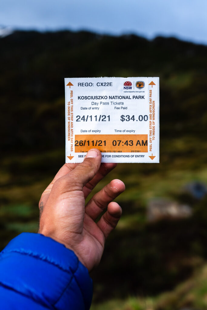
Cost per trek: The costs for this trek are free but you will need the daily permit for the Kosciuszko National Park, which was $17 per day for me ad my vehicle.
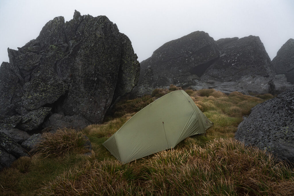
Accommodation: The entire route is camping only with no cabins. I carried a tent and slept one night at the 23km mark just beneath Mount Townsend. Before and after the hike, I stayed in Jindabyne. This small town is just a 40-minute drive from the trailhead and has everything you need.
Best time of year for the hike: The best time of the year for the Ten Peaks Hike really depends on what weather conditions and scenery you are looking for. In my opinion, this region is prettiest with some snow cover. I had snow one week before my hike and while it made it more difficult, the scenery was amazing. If you want to completely avoid snow and have warmer conditions, December to March is going to be the best time of year for you. My hike was in November for your reference when looking at my photos.
Starting location: The hike begins in the Charlotte Pass parking lot at the end of Kosciuszko Road
GPX Map: I used this GPX map and found it relatively accurate. You can download it by clicking on the link and uploading it into your smartwatch. I prefer to upload it into an app called TrackViewer.
TEN HIGHEST PEAKS IN AUSTRALIA BY ORDER OF HEIGHT
- Mount Kosciuszko 2228m
- Mount Townsend 2209m
- Mount Twynam 2195m
- Rams Head 2190m
- Rams Head North 2177m
- Alice Rawson Peak 2160m
- Abbott Peak 2145m
- Carruthers Peak 2145m
- Mt Northcote 2131m
- Muellers Peak 2129mm
TEN HIGHEST PEAKS IN AUSTRALIA BY SUMMIT ORDER
- Mount Twynam
- Carruthers Peak
- Mt Northcote
- Muellers Peak
- Alice Rawson Peak
- Mount Townsend
- Abbott Peak
- Mount Kosciuszko
- Rams Head North
- Rams Head
TEN PEAKS HIKE MAP
GPX Map: I used this GPX map and found it relatively accurate. You can download it by clicking on the link and uploading it into your smartwatch. I prefer to upload it into an app called TrackViewer. As you can see, the route follows the Main Range Track for a large percentage of the route but veers off to reach many of the summits. Having the GPX on your phone is very handy because often I was completely surrounded by fog and could only rely on the offline map for directions.
MY EXPERIENCE ON THE TEN PEAKS HIKE
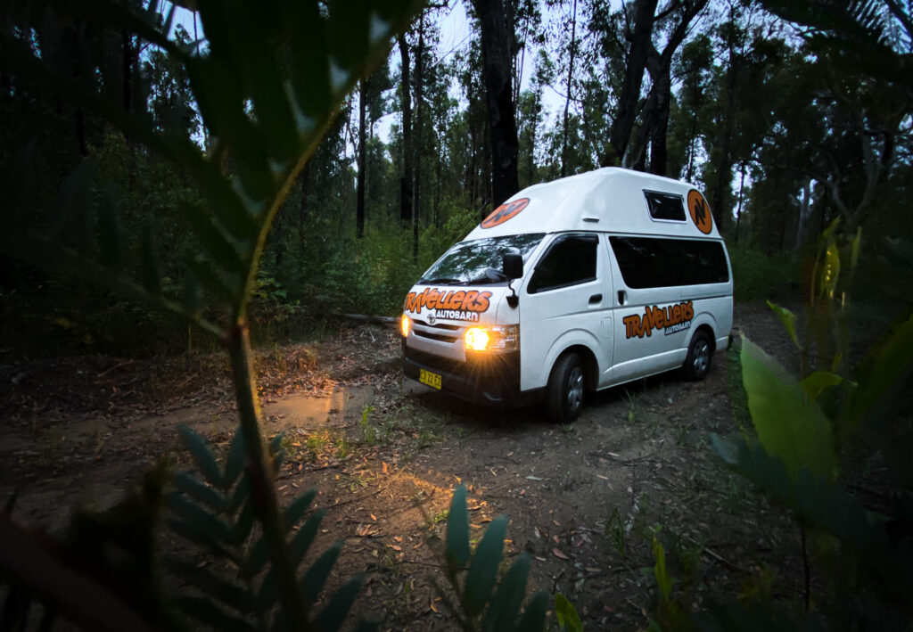
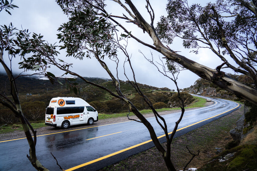
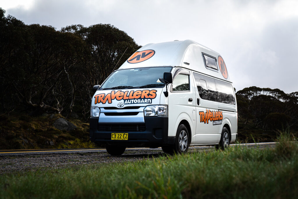
Summiting Kosciuszko had always been an adventure I was keen on but when I found out about the 44km route of the Ten Peaks Hike, I was motivated to get out there and make it happen. It’s pretty unique to be able to touch the ten highest peaks of a country in just a couple of days throughout a single route. I landed in Sydney and picked up a campervan from Travellers Autobarn. It ended up being a great way to do this hike and a pretty cheap alternative to staying in hotels in rural towns. Much easier than camping also.
I drove down to Jindabyne, which is one of the towns nearby the hike starting point in Charlotte’s Pass. I slept one night in Jindabyne and waited until the ticket station opened in the morning so I could legally enter the Kosciuszko National Park. It’s just $17 a day for one person with a vehicle to be inside the park. Camping within the park is just a small fee per night at one of the registered campsites. I simplified things and just drove straight to Charlotte’s Pass that morning and parked my car just below the parking lot. The parking is free and it is requested that multi-day hikers park slightly below the regular parking lot, which is used for day visitors. I set off for the hike from the parking lot at about 8:30am with the plan to be back in the late afternoon the following day having completed the 44km route of the Ten Peaks Hike.
The hike is a 44km loop route, which starts and ends at Charlotte’s Pass parking lot. Most of the reports I’ve read, recommend summiting Mount Twynam first, traveling in a counter-clockwise direction. This worked for me but I can’t see that doing it in reverse would be much different given that the incline undulates.
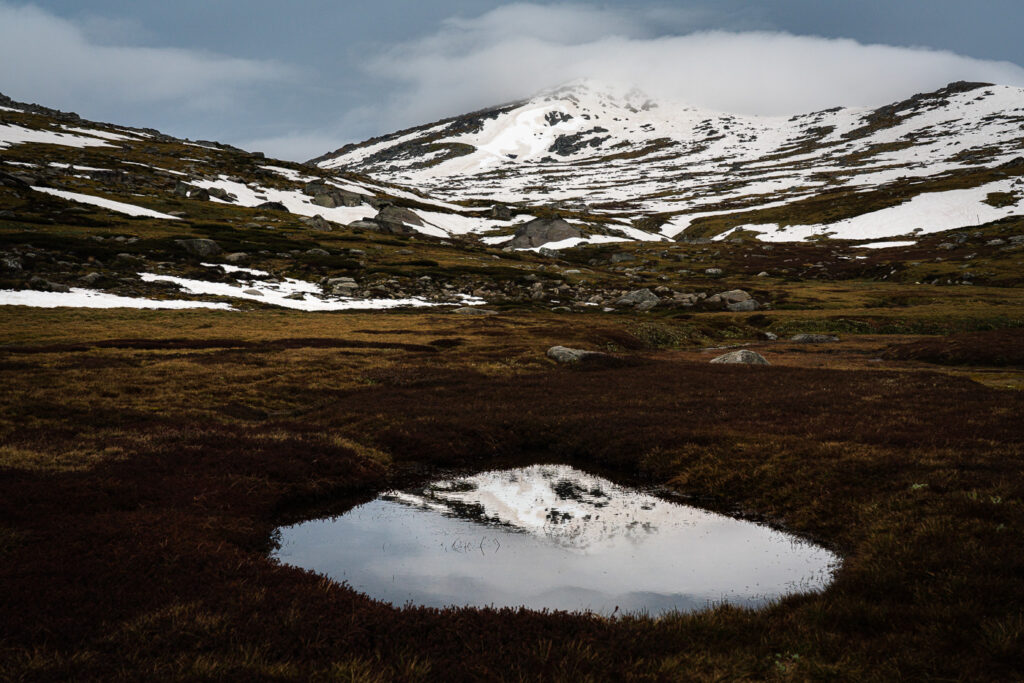
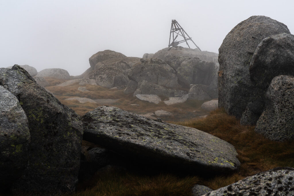
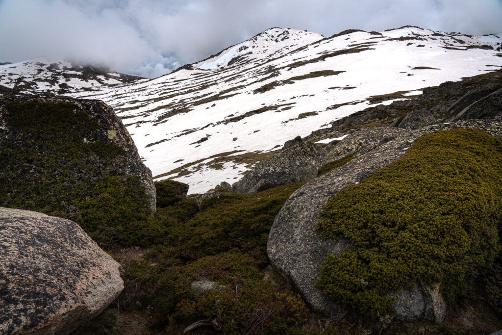
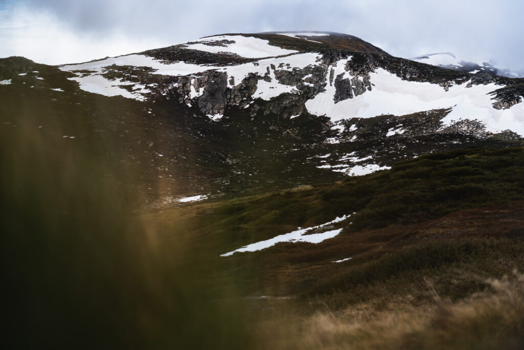
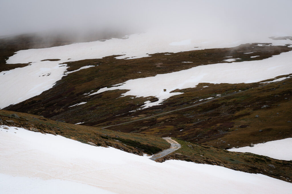
It snowed the week before my hike and a storm was scheduled, which is why my photos are quite gloomy and many of the summits lack an amazing photograph. However, I did get enough pockets of sunshine amidst the fog and rain to enjoy the scenery.
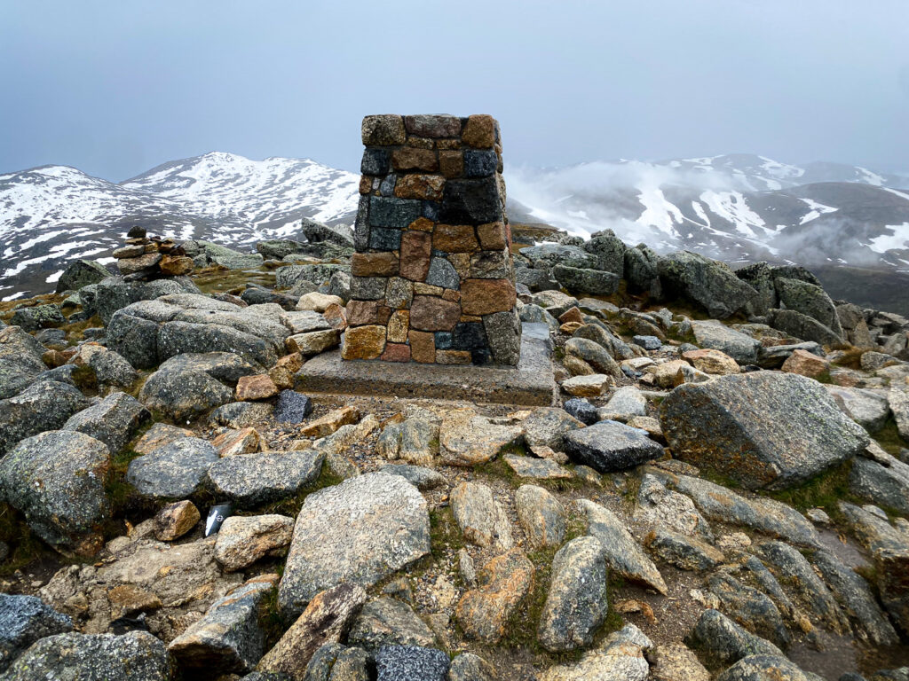
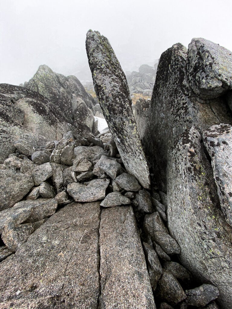
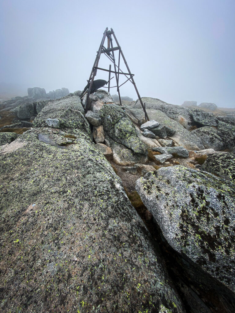
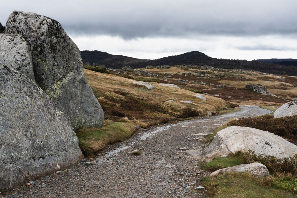
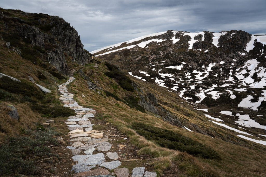
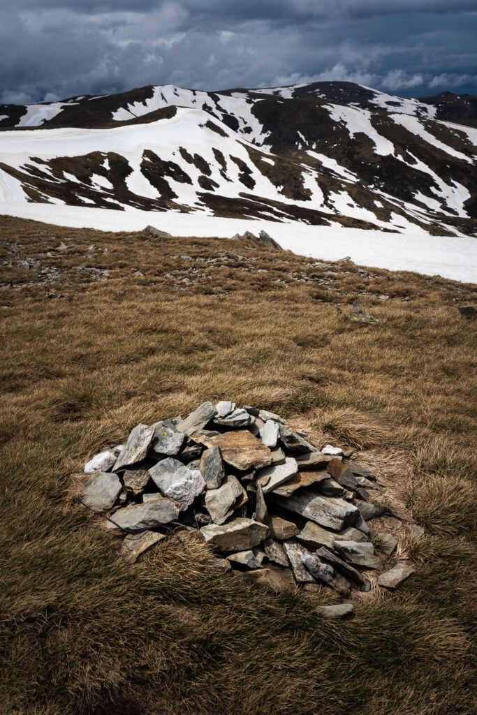
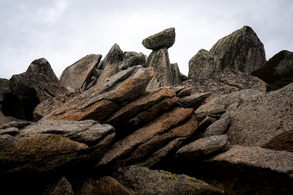
The hike begins along the Main Range Track, which is essentially a service road. It doesn’t feel too wild as you make your way through nature on such a wide path but after about an hour, you deviate off the trail and into the wilderness to reach your first peak of Mount Twynam. Atop each peak, you should find a clear rock stack or monument to notify you have actually reached the summit. Many of these peaks are not frequently visited and are well off the main tourist track. This is why having the GPX to follow closely helped in times when everything was covered in snow or it was a ‘choose your own path’ type of scrambling up the rocks and boulders.
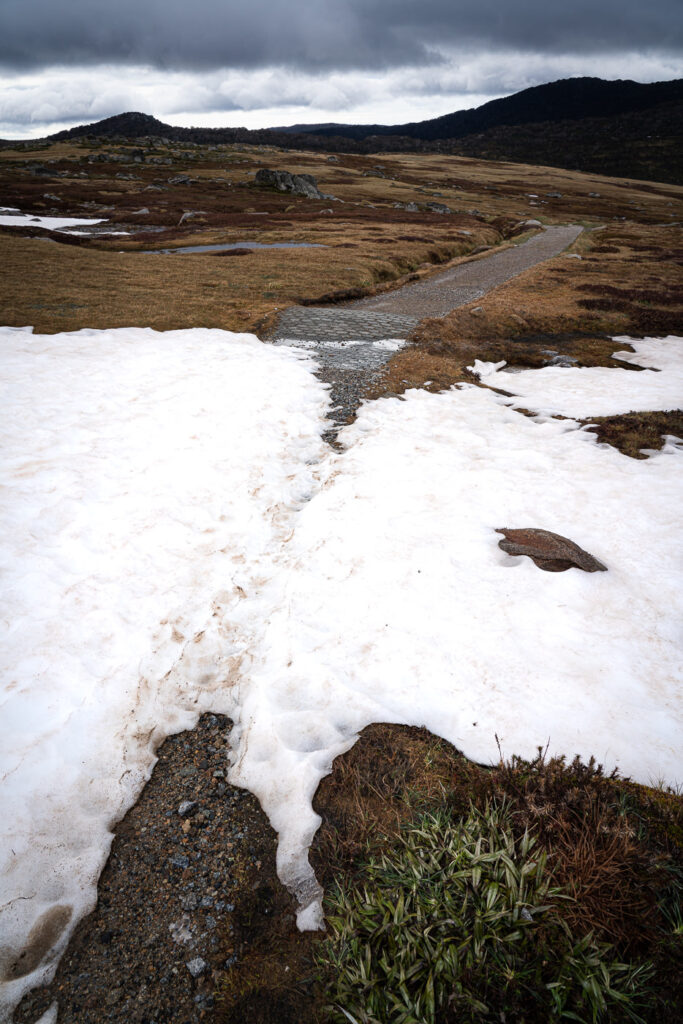
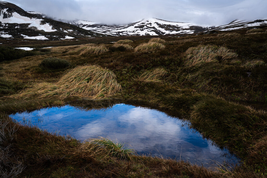
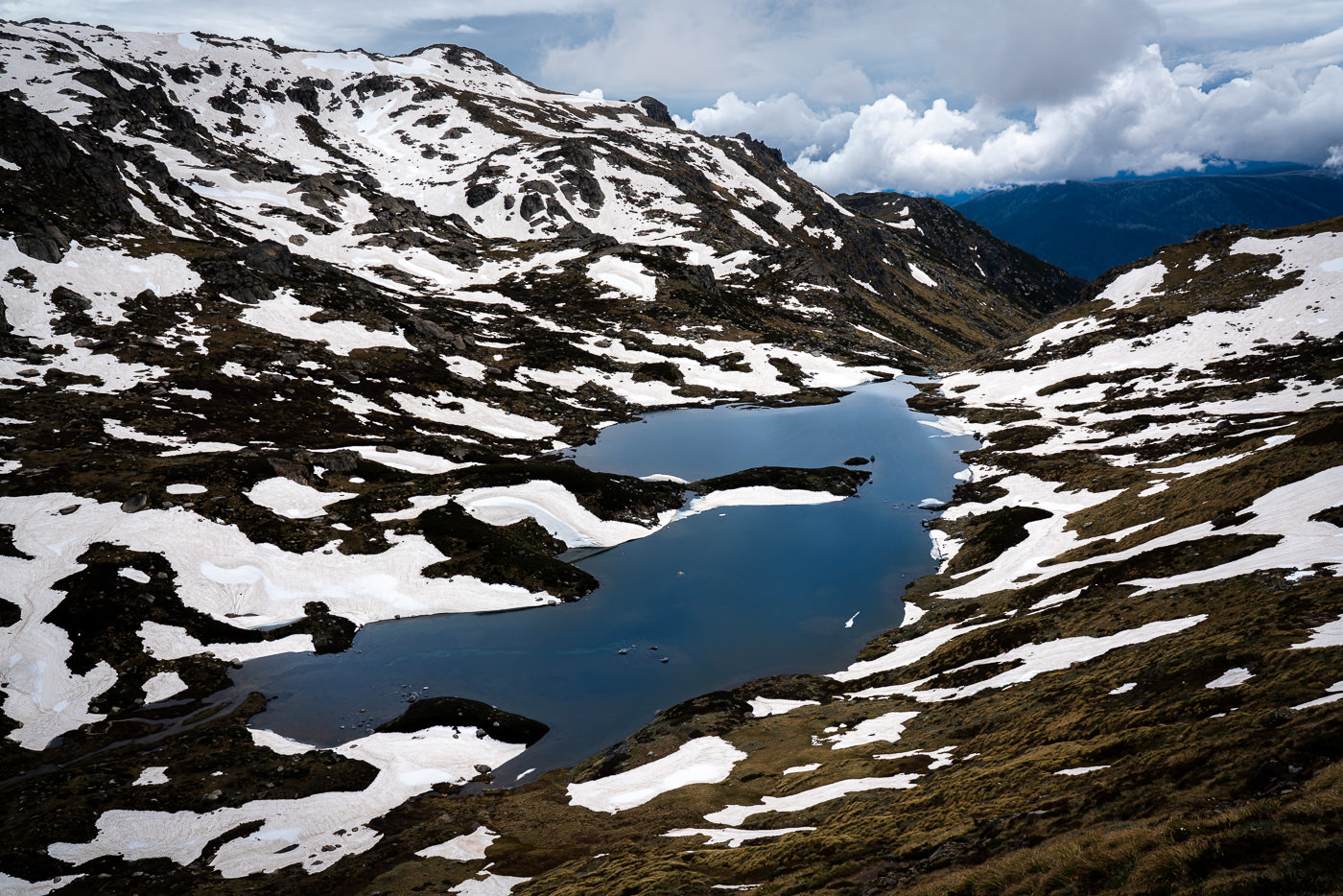
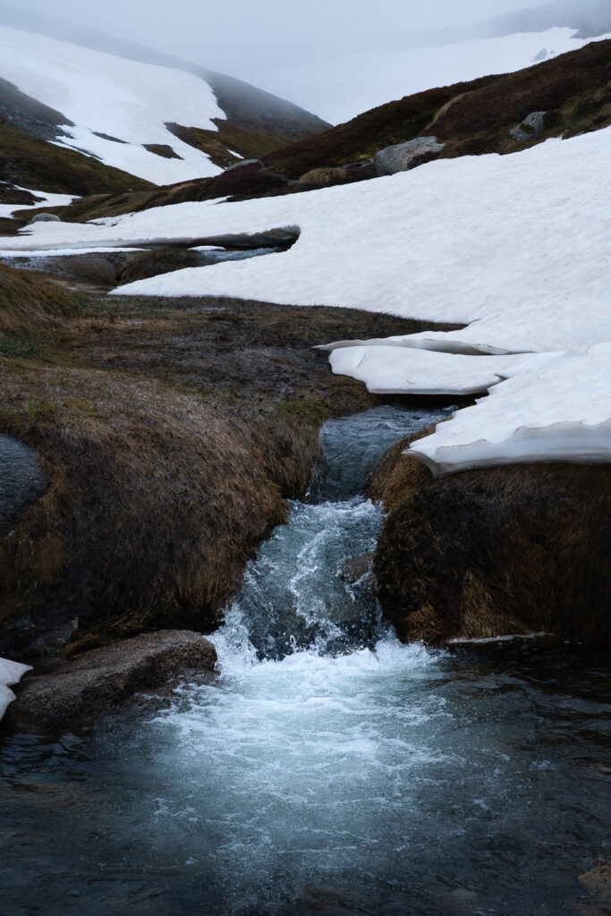
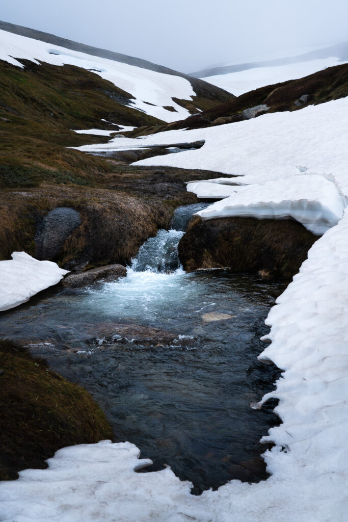
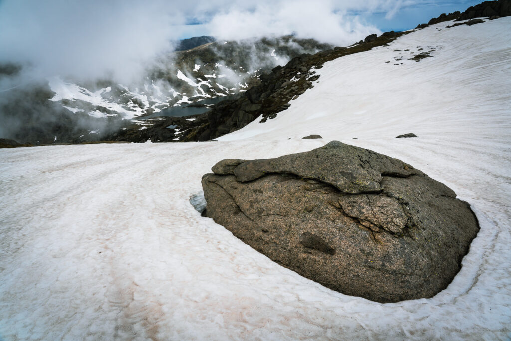
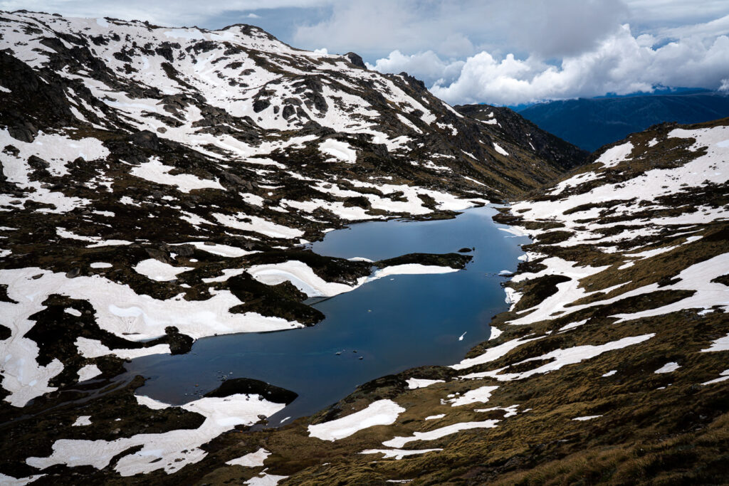
Amidst the fog, I continued on to reach the next few peaks in succession as the snow began to thicken. I found myself at times completely surrounded by fog while walking in the snow. I never thought I’d experience that while hiking in Australia in November but here I was. navigation became quite hard and I was thankful to have a reliable GPX route to follow. I crossed a few beautiful lakes with little cascades and waterfalls that had broken through the ice and snow cover. It was a winter scene one would expect in New Zealand or Iceland.
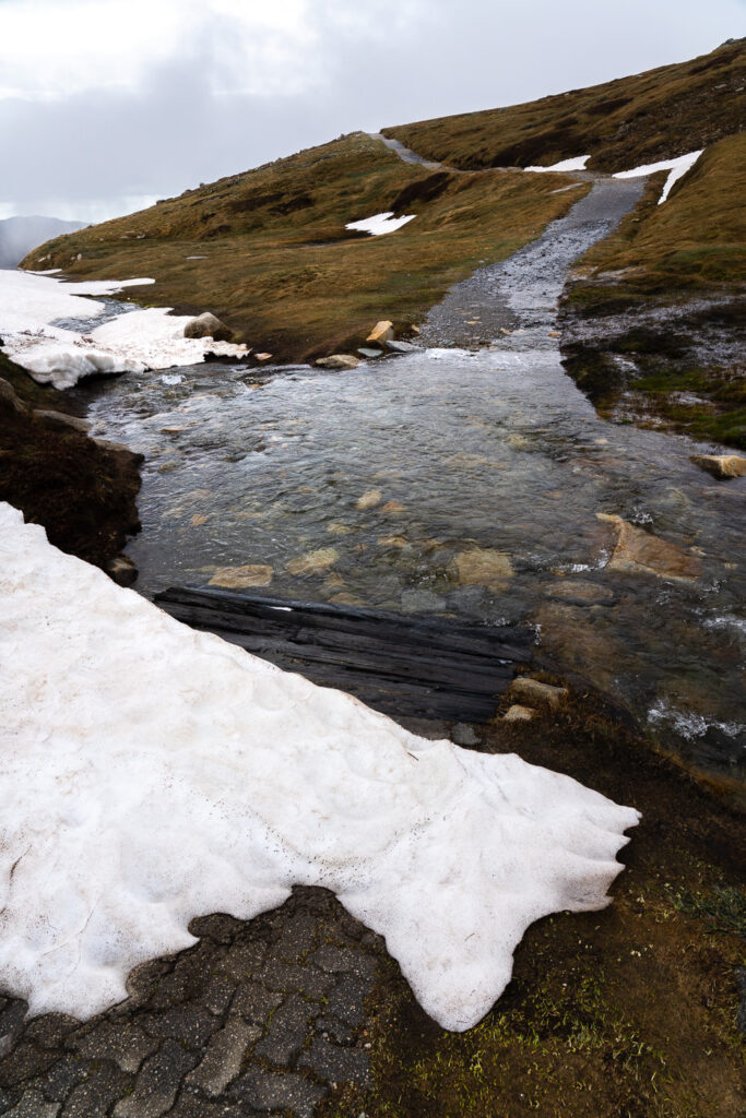
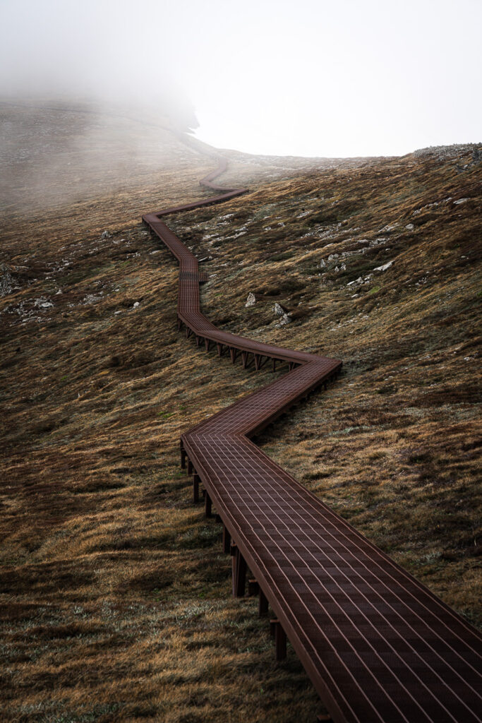
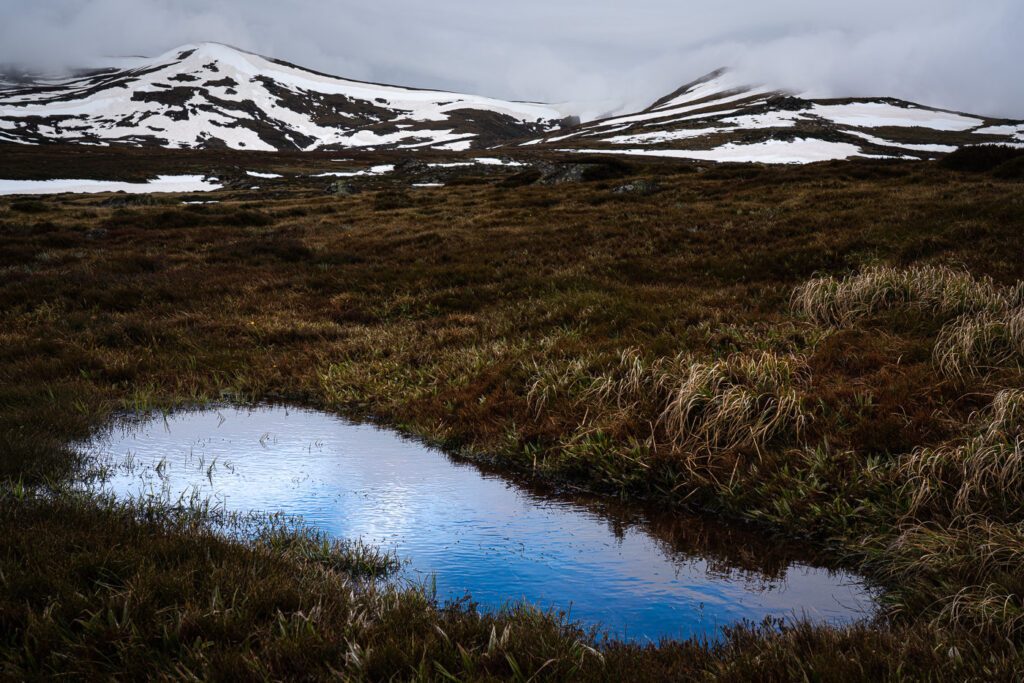
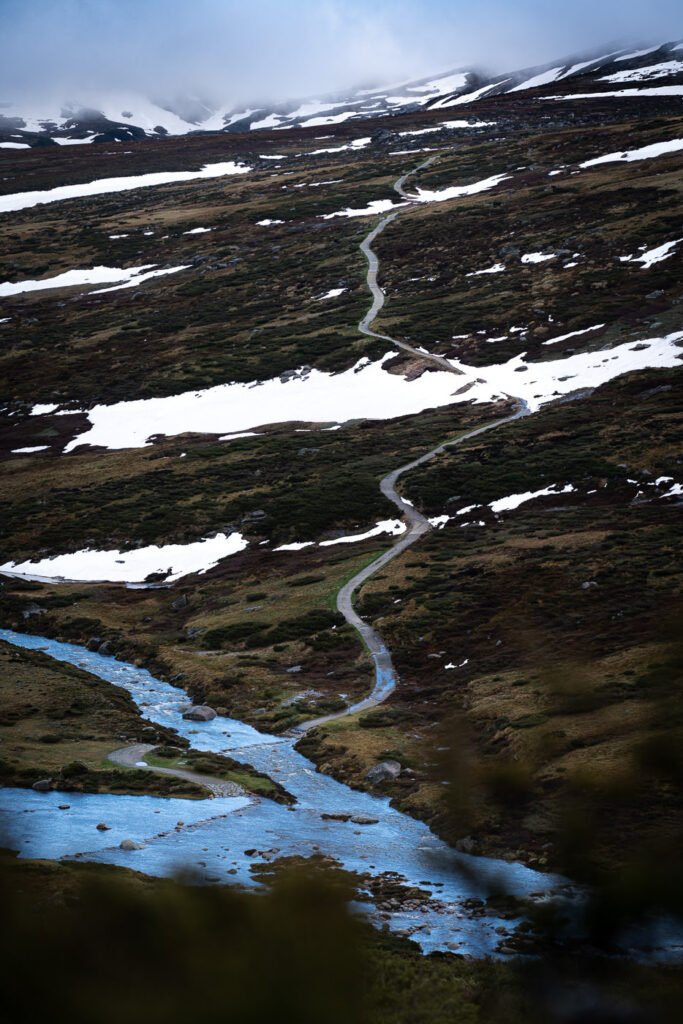
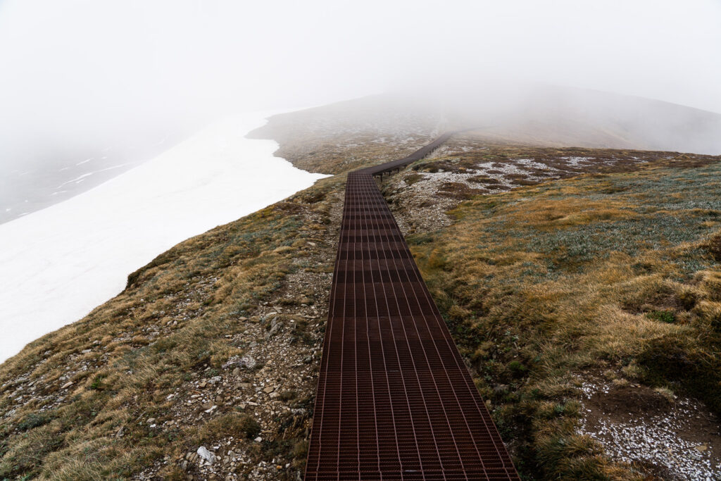
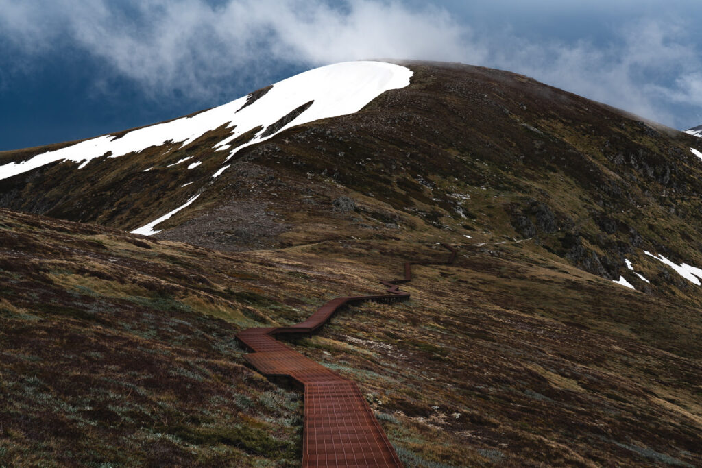
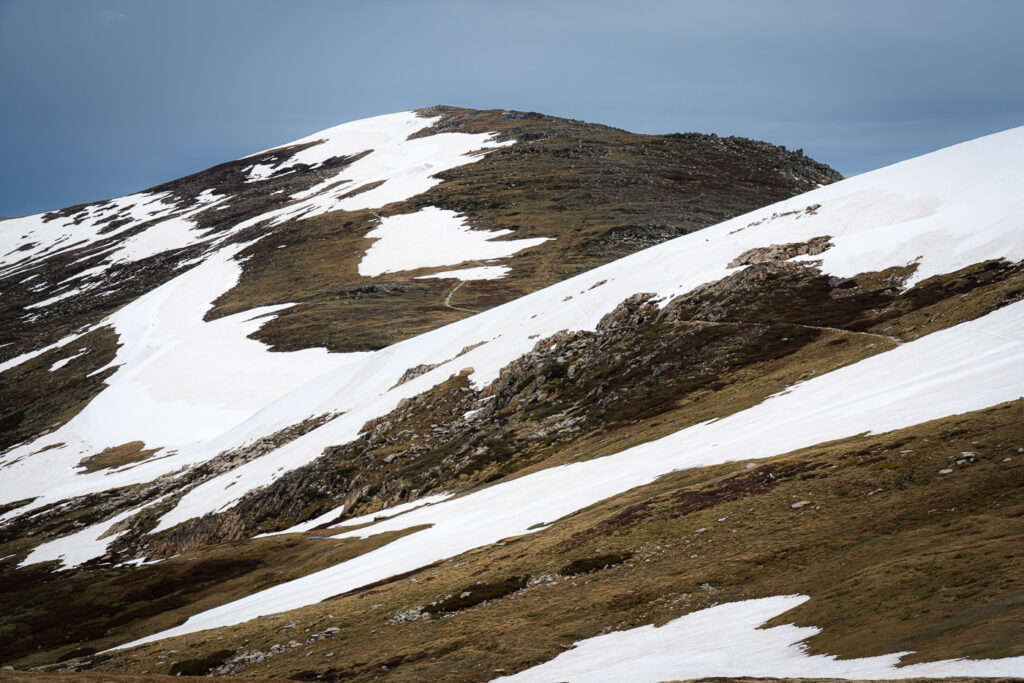
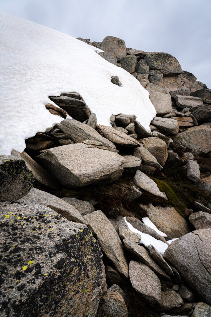
After the first few peaks, the trail begins to open up a bit with some scenic views over towards Mount Townsend and Alice Rawson Peak. The fog cleared and a number of stunning alpine lakes came into view. With the spotted layering of snow surrounding the striking blue of the lake, it was quite a scene. During this traverse over towards Mount Townsend, the trail joins a metal boardwalk for a kilometer before rounding the lake and heading up for a rock scramble to join the ridge on the other side. The rock scrambling was never too extreme but for those expecting a simple walking trail, you will be up for a bit more of a challenging route than expected. No extra gear is needed but this area did get. a little interesting especially once the rocks became a little slippery in the rain.
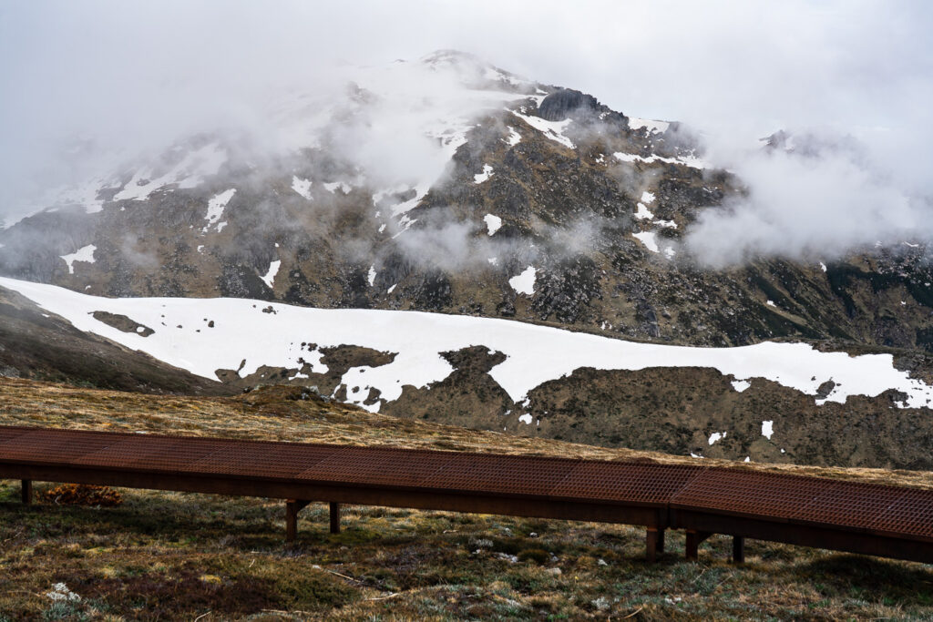
The weather had finally caught up with me and by mid-afternoon, the rain started to come down with some force. I quickly set up camp just beneath Mount Townsend after almost 23km of hiking done and dusted. There’s plenty of flat patches to camp on around these areas with water available throughout most parts of the hike aswell but this would all depend on the season. I set up early in the afternoon and hid from the rain for the rest of the day and during the night hoping for better weather in the morning.
The next morning provided some slight improvements to the weather although my first peak of the day, Abbott Peak, was completely covered by fog in a full white-out. It was now time to head down into the valley and cross over and up onto the ridge leading up to the biggest of them all, Mount Kosciuszko. Unfortunately for me, tragedy struck and I had an injury while trying to cross one of the rivers. A bad landing had me rupturing two ligaments and chipping off my bone. I continued up to the summit of Kosciuszko, despite extreme discomfort. The torrential downpour didn’t help my spirits.

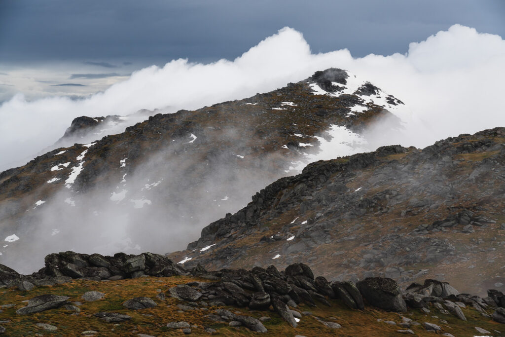
Around mid-morning I made it up the snowy ridge to Kosciuszko, Australia’s highest peak. The clouds came and went but never fully opened up for an excellent view from the summit. This spot is normally crowded in good weather, but I met just two people atop the peak. They had done the popular Summit Trail from Charlotte’s Pass, which is a 9km route one way so 18km return trip.
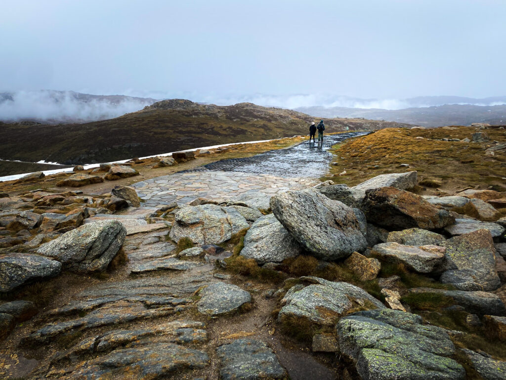
From Kosciuszko, the trip is relatively easy with just two more peaks to collect, which are Ram’s Head and Ram’s Head North. The rain and bad weather continued for me with more whiteout conditions but I carried on and ended up making it back to the Charlotte’s Pass Parking Lot by mid-afternoon. The final few kilometers were among the prettiest of the entire route with the trail looking down over the river and snowy valley below. Overall, (despite the injury) it was a great journey and a hiking trail I would highly recommend to Aussies looking for a challenging expedition.
I hope you enjoyed this guide about the Ten Peaks Hike and my gloomy but scenic photos gave you some inspiration for one of the top multi-day hikes in Australia.
Jenny
Sunday 27th of April 2025
Hi, do you think that is doable in May? Will be all trails covered in snow? Avalanche?
Alex
Friday 4th of October 2024
Hey thanks for writing this. Thinking of going in November this year for conditions just like this, did you pack any specialized snow gear?
Jackson
Monday 28th of October 2024
obviously depends on the conditions but no i didn't. you could take some microspikes in case but there's nothing too dangerous.
Explore with Guggy
Tuesday 9th of January 2024
Excellent summary and just the right level of info..thabk you for sharing
jackson
Tuesday 8th of February 2022
PS great write up, thanks. am reading in prep for running the route this weekend with a mate. cheers
Jackson
Monday 28th of March 2022
Hope it went well
Darcy
Saturday 29th of January 2022
Hey there, just wanted to let you know the gpx link provided doesn't actually work. The file type seems to be an xml file. If you do have the original gpx, are you able to send it my way? Thanks!
jackson
Tuesday 8th of February 2022
@Darcy, GPX link worked for me and was able to upload it direct to my garmin