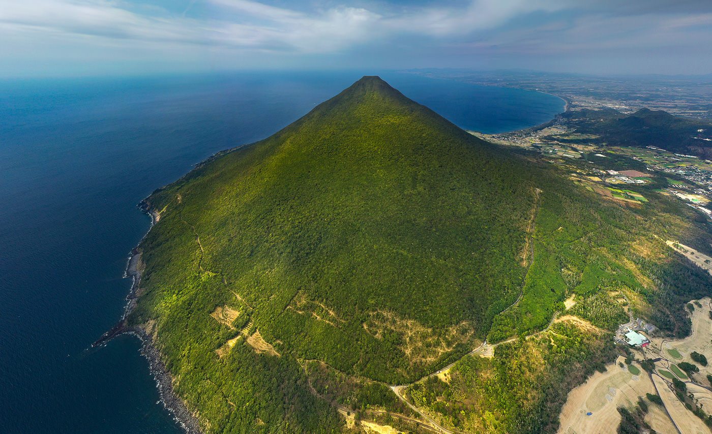
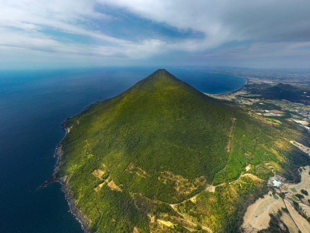
Mount Kaimon (Kaimondaek) is an inactive volcano along the coast in the south of Kyushu known for its conical shape. The Mount Kaimon hike leads you through the forest on a steep, rocky trail up ladders and boulders to the summit where you are rewarded with coastal views from the top of the volcano.
MOUNT KAIMON HIKE DETAILS
- Hike Distance: The total hike distance for me was a 6.5km return trip.
- Hike Duration: The total moving time was 1 hour and 51 minutes but I really tried to hit this one pretty fast. I also chilled at the top for an additional 45 minutes. I’d imagine it would take most people 3 hours up and down and then 30 minutes at the top.
- Hike Difficulty: This hike is not difficult nor dangerous but there are some ladders and boulders to navigate so it isn’t necessarily a flat path. There were no real dangerous drop-offs.
- Hike Incline: The total hike incline was 730m.
TOP 3 PLACES TO STAY IN KYUSHU
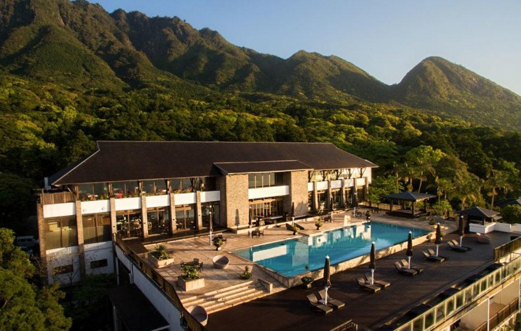

- Ultimate Luxury: Amane Resort Seikai best location and view
- My Favorite: Sankara Hotel & Spa – Natural Forest, Pool & Beautiful surroundings.
- Budget Hostel in Kyushu: WeBase Hakata Hostel is easily the top hostel in Kyushu
HOW TO GET TO THE MOUNT KAIMON TRAILHEAD
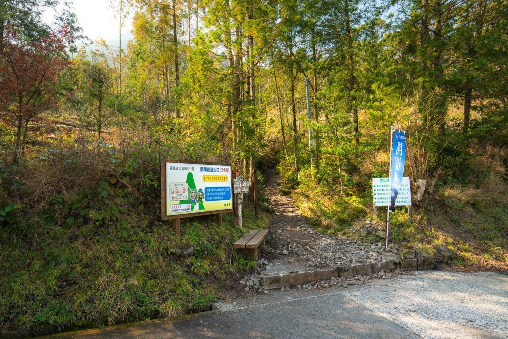
Getting to the trailhead for the Mount Kaimon (Kaimondake) hike it’s not too difficult. There is a clear trail entrance and public parking. However, public parking is about 400m before the trailhead. Lots of people park in the trees right near the trailhead so I copied them. I’ve attached the pin below so you can see exactly where to head for the trailhead. The pin is to a soba noodle shop but by that stage, you will have seen the signs so you are on track and just keep following the signs. I’ve also attached photos below of where I parked my car and the trail entrance so you should be set. It took me about 80 minutes to drive to the trail entrance while I was staying in Kirishima so it’s a bit of a long haul but worth it.
I’ve also attached my hiking map at the bottom of this blog post, which I recorded on my Garmin during the hike. If you want to download that map as a GPX file you can download it by clicking here.
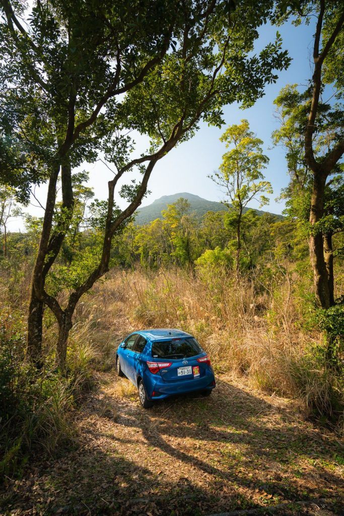
A scenic drive of almost 1.5 hours brought me right down to the southern coastline in Kyushu. In the last 15 minutes of driving you get a good view of Mount Kaimon so that was a fun way to head towards my challenge as it loomed ever larger.
I found the parking lot on the pin recommended but decided to drive all the way to the trail and park beside it in the trees as others had done. It was a very picturesque parking space with Mount Kaimon as a backdrop so I had to take a step back to admire it and take a snap.
I walked down to the trailhead, which is signed with quite a bit of fanfare. It’s hard to miss this one for sure.
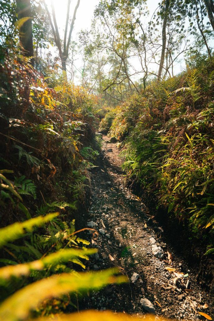
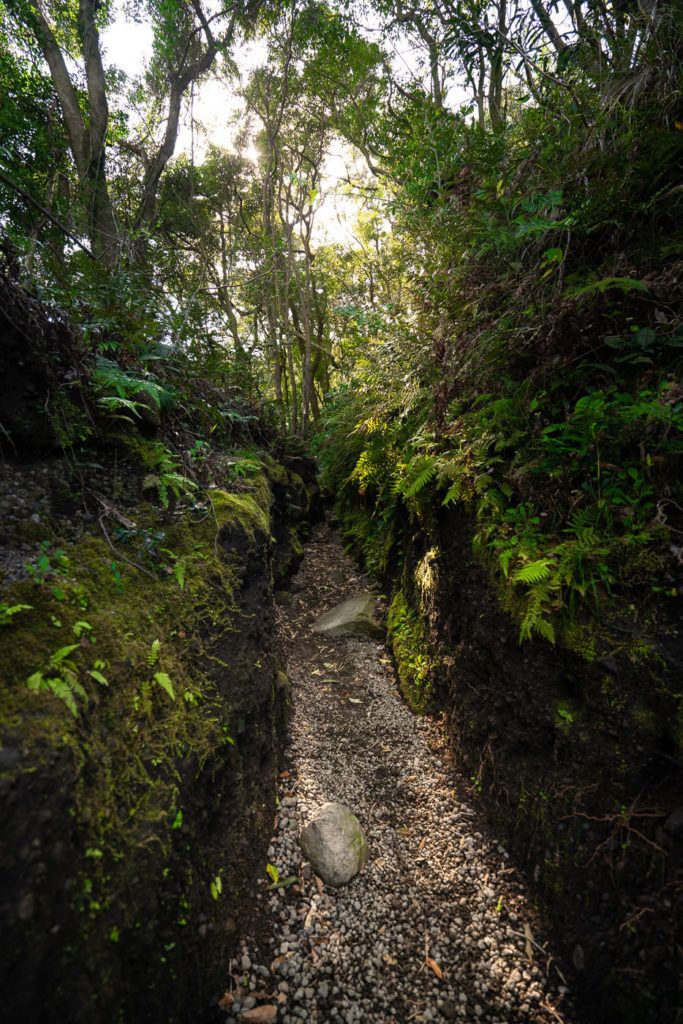
The trail begins with an incline from the very first moment as you wind your way through the woodlands at the base of the volcano. It was a very beautiful part of the trail as the sunlight shone through the trees and into the mini canyons created by erosion on the path. At some points, the walls on either side of the trail were above head height, which added a unique atmosphere to the trail.
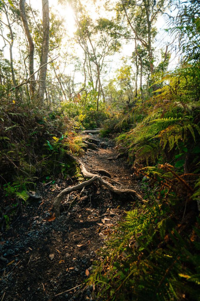
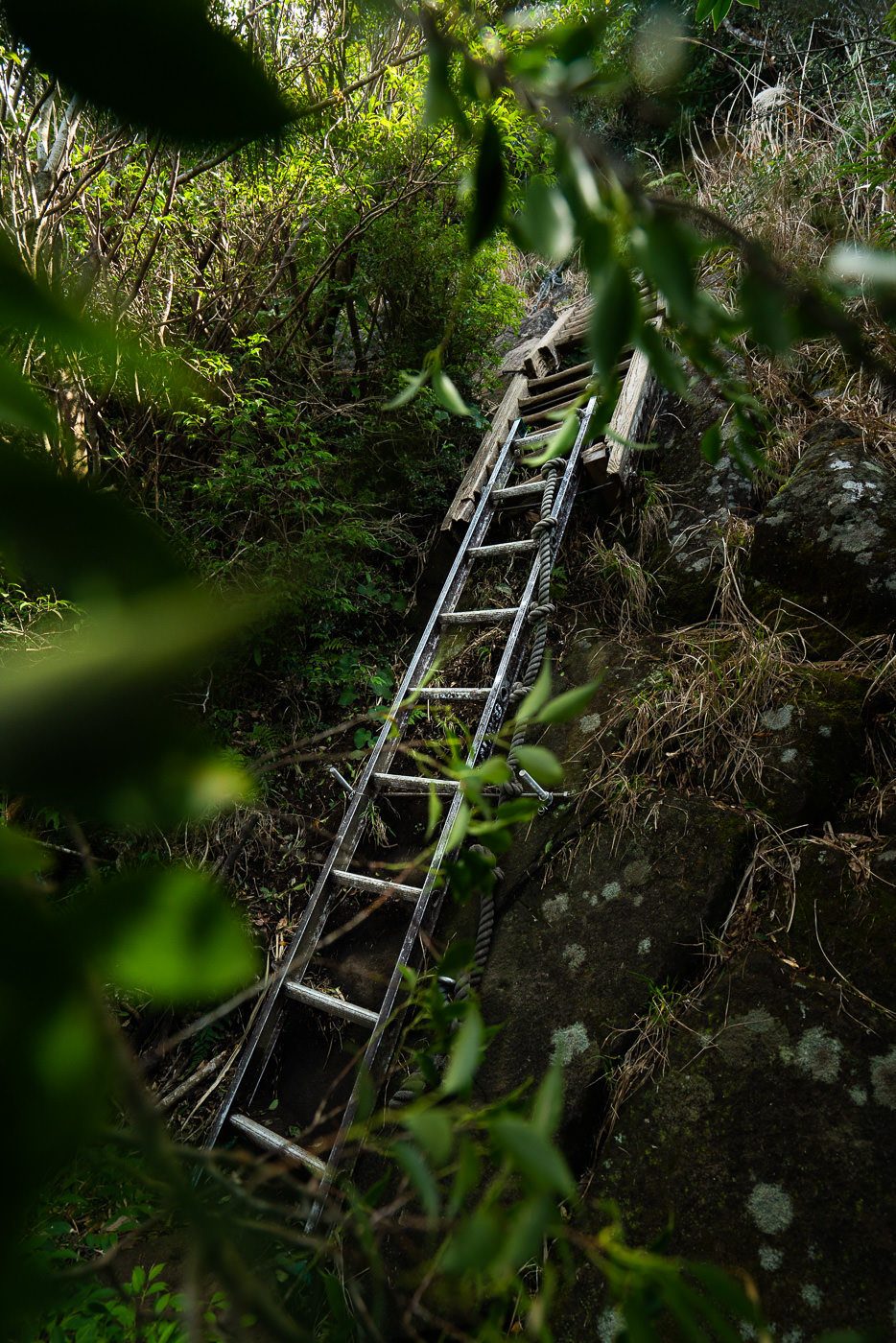
The trail quickly intensifies as the dirt paths transition into a boulder-laden trail, which requires agility and concentration. Lots of old hikers were on the trail so it’s by no means too challenging but it will certainly slow you down somewhat. I was trying to power through so I did my best to keep upright as I passed through the ladders and rocky terrain in the latter part of the journey to the summit.
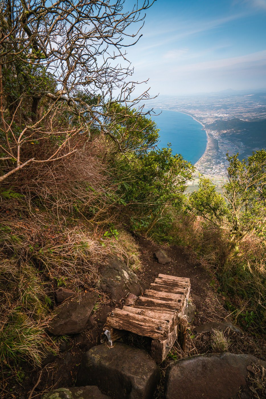
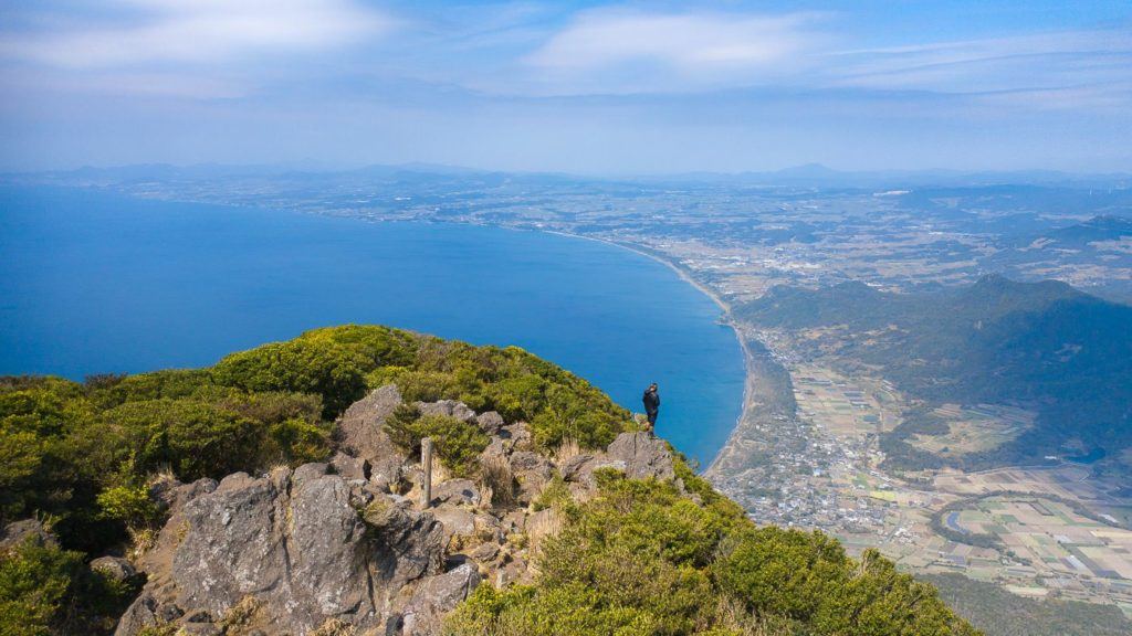
With about one kilometer left before reaching the summit, you will get your first taste of the view that awaits you when you reach the final destination on top of this inactive volcano. The coastline is quite beautiful as it curves around the bay of vibrant blue water.
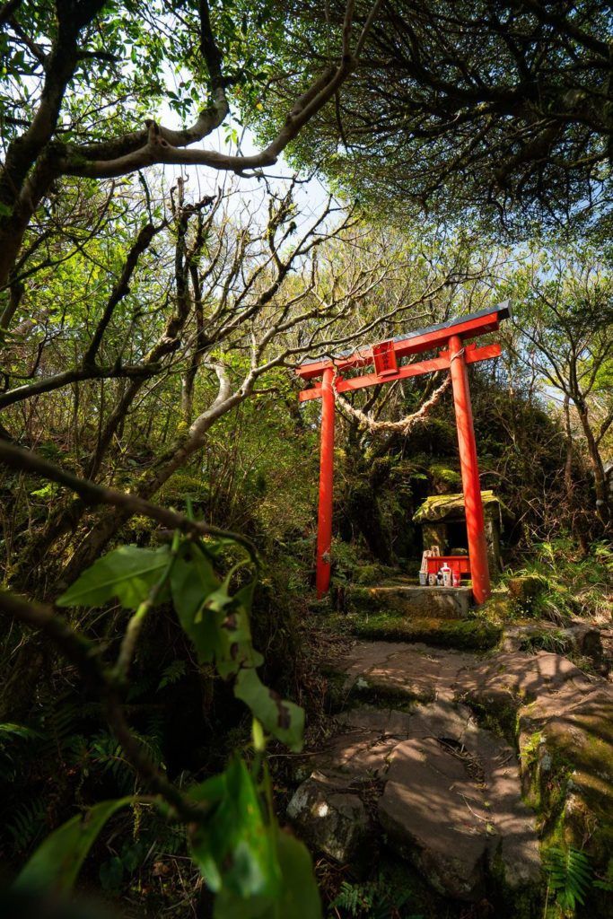
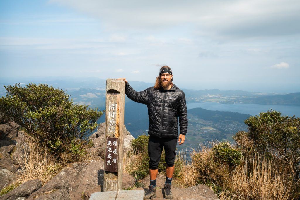
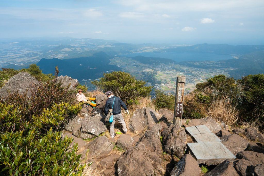
I was trying to make it up in an hour and missed my goal by just a couple of minutes. It wasn’t to matter I made it up on the way down to go under two hours in total. The end of the trail is marked by a Tori Gate and a shrine. Once you reach the gate you can breathe a sigh of relief as you have all but made it to the summit after 730m of incline on tough terrain.
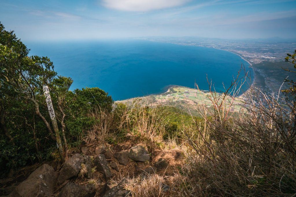
The viewpoint at the top extends from coast to coast as you have a view of more than 180 degrees to really take in this southern region of Kyushu. One downside to this summit is that the viewpoint isn’t too elevated compared to the thick coverage of trees so you can’t see in every direction and some of the views is covered. On the other hand, it is nice that it isn’t overdeveloped and it’s been left pretty natural apart from a summit marker and a couple of signs.
It was super windy up at the summit so I ate a few bananas, had a very limited conversation with some old Japanese retirees (our mutual word beyond hello was kangaroo), and had a quick little fly of the drone to check out the area. The old Japanese man insisted on taking my photo. I’ve said it before but Japanese hikers are the most polite in the world … by far.
The trek back down was a quick one for me taking just 45 minutes or so before I was back to the car. This is a great little hike in the southern region of Kyushu and I suggest giving it a crack if you are based in Kagoshima or even Kirishima like me.
Happy hiking!
WHERE TO STAY IN KYUSHU
- Best Luxury Place to Stay in Fukuoka: Hotel WBF Grande Hakata (Value): This is by far the most popular hotel and one of the most luxurious in Fukuoka.
- Best Value Place to Stay in Kumamoto: Hotel The Gate Kumamoto (Value): Hotel The Gate is a well-situated accommodation in the heart of Kumamoto, just across the train station and within walking distance to shops and restaurants.
- Best Luxury Place to Stay in Kumamoto: Kumamoto Hotel Castle (Luxury): Set near the infamous Kumamoto Castle, this luxury hotel features a wide range of carpeted rooms from standard rooms to suites fitted with plush amenities.
For a full list of the top-rated places to stay in Kyushu, you can check out my comprehensive guide: WHERE TO STAY IN KYUSHU: BEST REGIONS & HOTELS
ARE YOU FOLLOWING MY KYUSHU BLOG SERIES?
I spent over three weeks exploring Kyushu and visited some incredible waterfalls, hiked some amazing trails, and visited a number of epic volcanoes. I created a number of guides to help travelers find the best spots in Kyushu. You can explore the articles by clicking on the links below.
- The Ultimate Kyushu Bucketlist: 30 AWESOME THINGS TO DO IN KYUSHU
- The best places to stay in Kyushu in each region: WHERE TO STAY IN KYUSHU: BEST REGIONS & HOTELS
- How to plan your Kyushu vacation: THE ULTIMATE KYUSHU ITINERARY: 5-DAY, 7-DAY & 10-DAY
- Interested in chasing waterfalls?: 12 AWESOME WATERFALLS IN KYUSHU
- Keen for some epic hiking?: 11 AWESOME HIKES IN KYUSHU
- Everything you need to know about Oita: 11 AWESOME THINGS TO DO IN OITA
- Your Ultimate Guide to Kumamoto: 13 AWESOME THINGS TO DO IN KUMAMOTO
- My favorite waterfall in Kyushu: TAKACHIHO GORGE – MOST BEAUTIFUL WATERFALL IN JAPAN