

7000m is a place I never imagined I would find myself. However, atop Spantik Peak at 7,027m is exactly where the week ended. It was an enduring battle to get there in bad snow conditions and wild weather but it was a journey I’ll never forget. I’ve documented the entire expedition in this guide: CLIMBING SPANTIK PEAK
In this Weekly, I will re-share the text from the second week of the climb. This portion of the story sees us attack the summit push after having reached base camp last week.
ACCLIMATIZATION ROTATION TO CAMP 2 ON SPANTIK PEAK
Our focus now turns to acclimatization. We will first make a rotation, which will include camps one and two before coming back down to basecamp and riding out a few bad days of weather. With acclimatization under our belt, we will then wait for a weather window and make the push up all three camps, and head on to the summit on our next venture up the mountain.
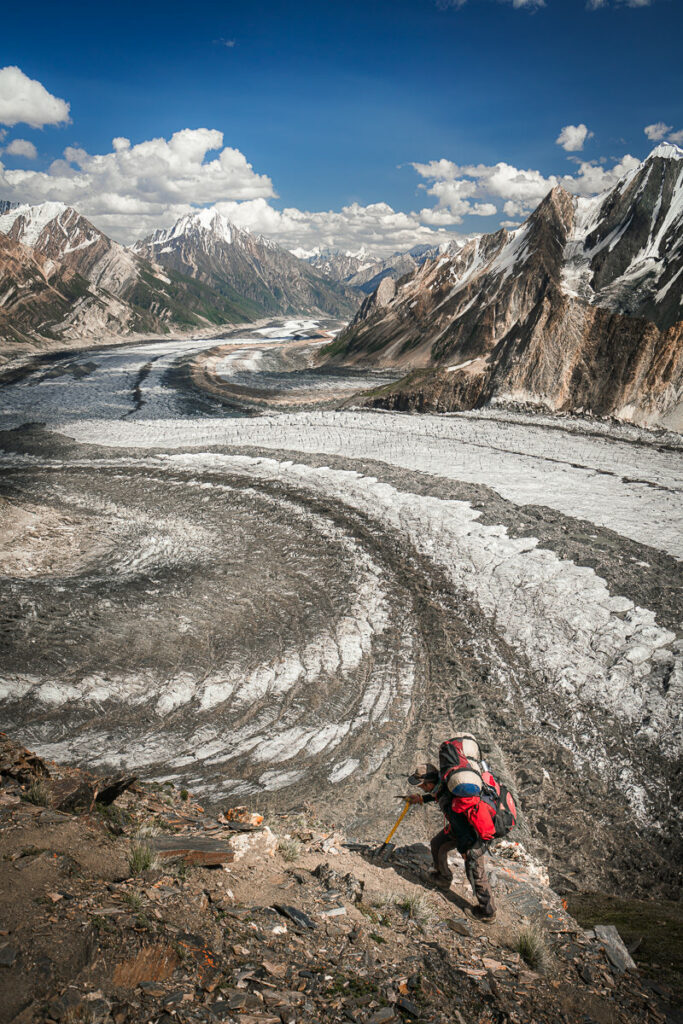
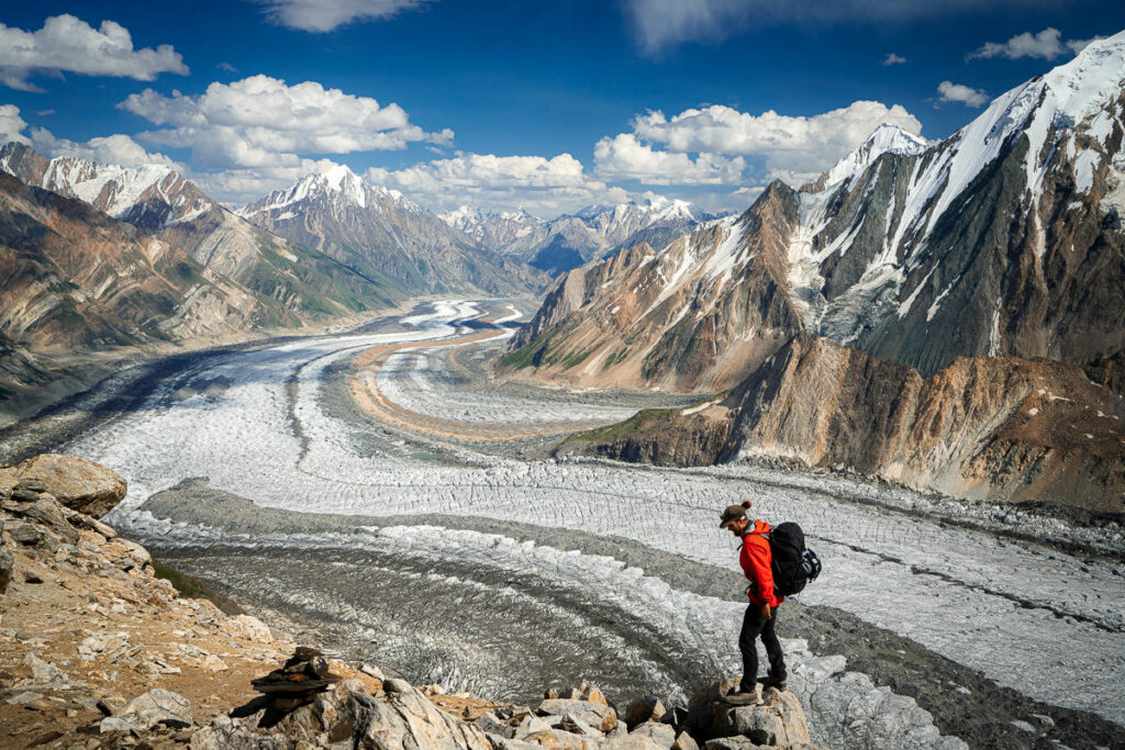
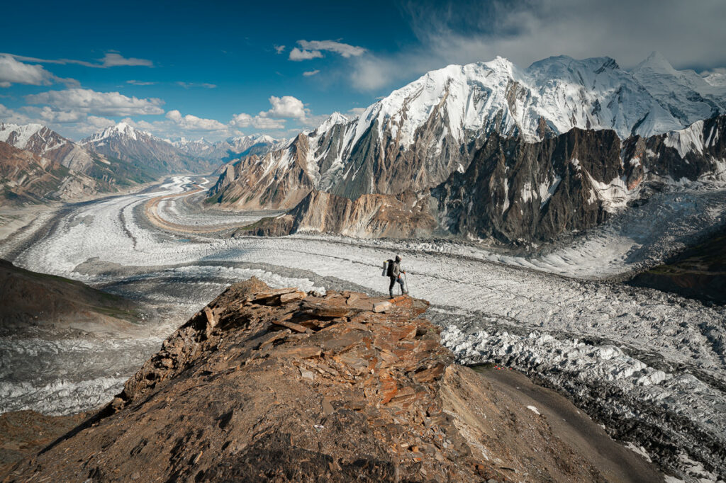
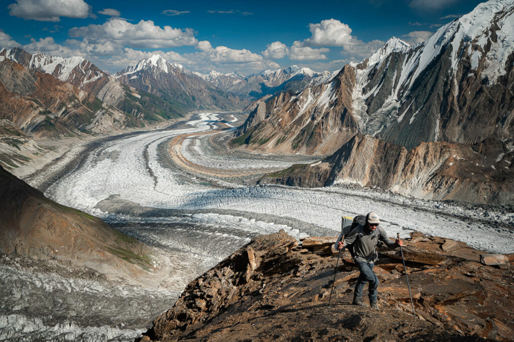
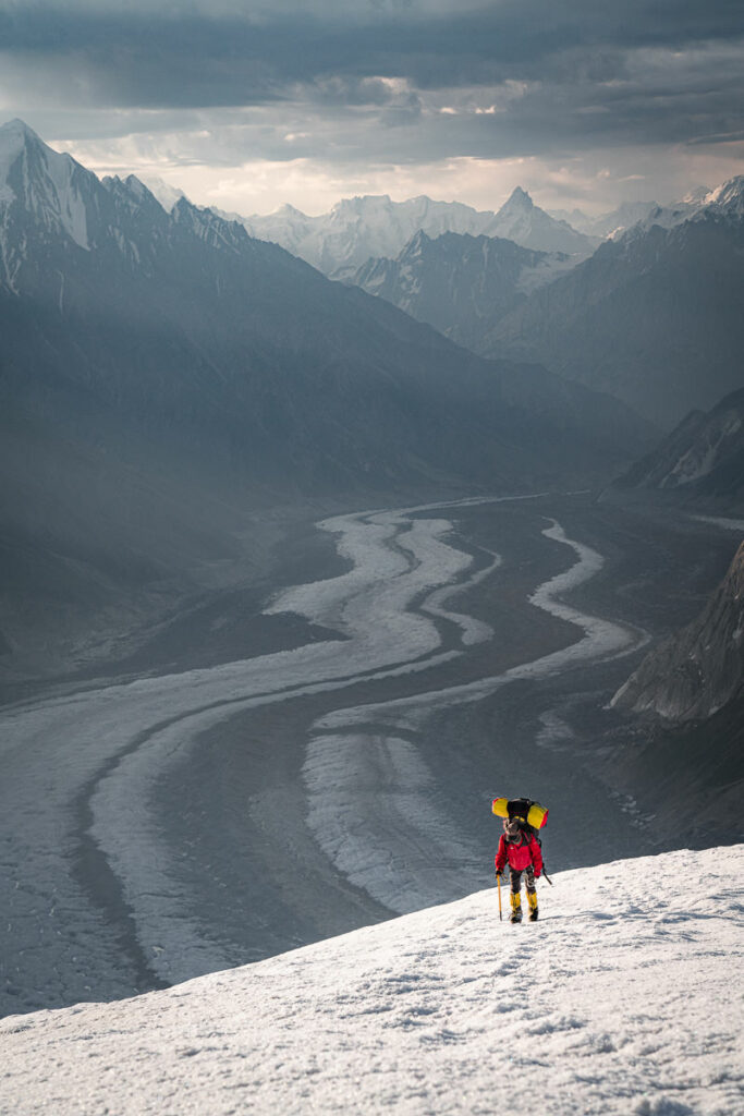
The journey from basecamp to Camp 1 is inherently steep. The distance is just a mere 2-kilometers but in that small journey, you will ascend more than 800m. With rocky terrain, often laced with gravel, this route can be a little slippery but overall is a comfortable ascent. At the halfway point there is a magnificent perch overlooking the Chogholungma Glacier, which we have traversed to reach basecamp from Arandu. The views of the glacier and surrounding peaks only increase as you continue the ascent up to Camp 1. You can expect this journey to take about two hours from base camp to Camp 1.
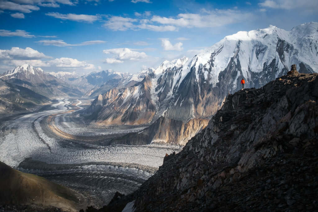

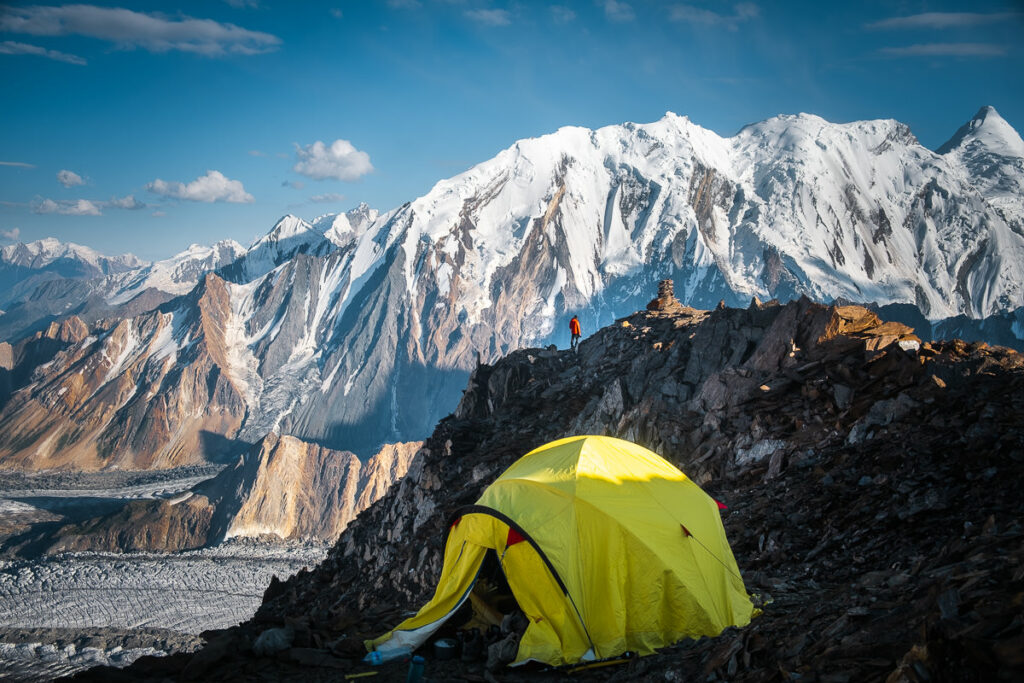
At the campsite, you will find a few small ledges with room for a handful of tents. The view right out of the tent is purely amazing with the Chogholungma Glacier in full view. The snowline begins right at the campsite, which means in the morning you can put your boots and crampons on and head off into the snow. We left this tent set up and stored gear in here while venturing further up the mountain.
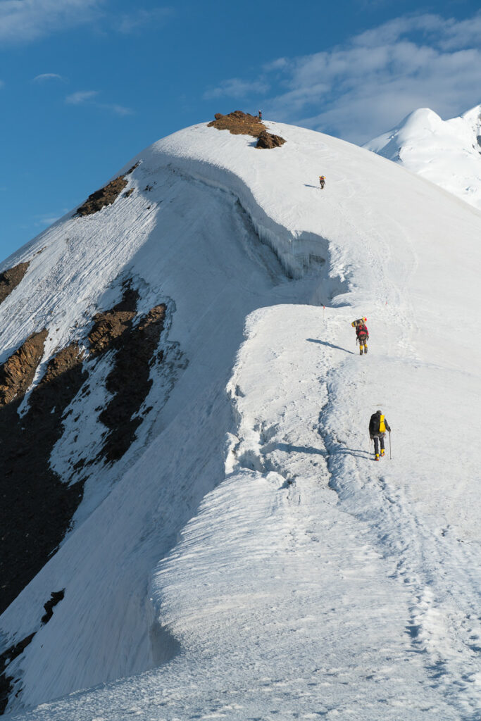
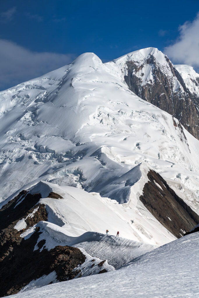
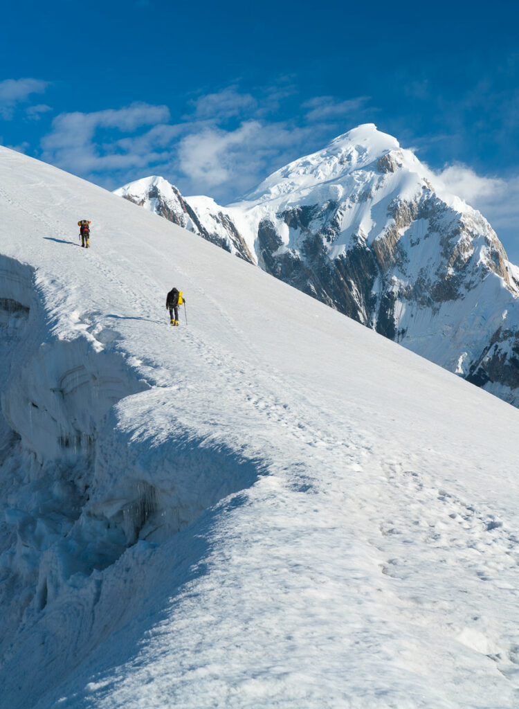
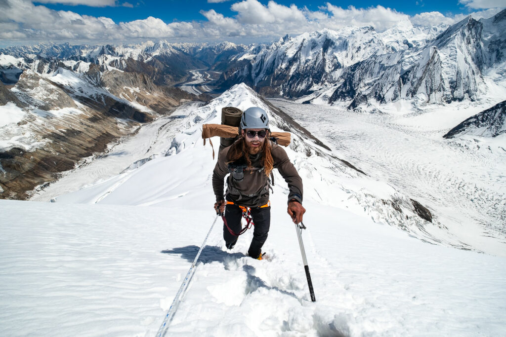
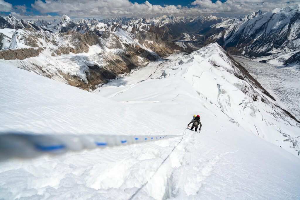
Once you leave the comforts of Camp 1 behind, you venture into the land of snow and crevasses. The route follows the narrow ridgeline, with four kilometers of undulation leading you towards the second camp of Spantik. It’s important to rope up here as a team or at least a duo. There were multiple crevasses that at times swallowed our ankles and we even found ourselves knee-deep in snow during some moments. The conditions will vary depending on the weather and snowfall. On our acclimatization hike from Camp 1 to Camp 2, the journey took us four hours. The next time we did this traverse in heavier snow would take us eight hours as we had to break the entire trail in thick snow.
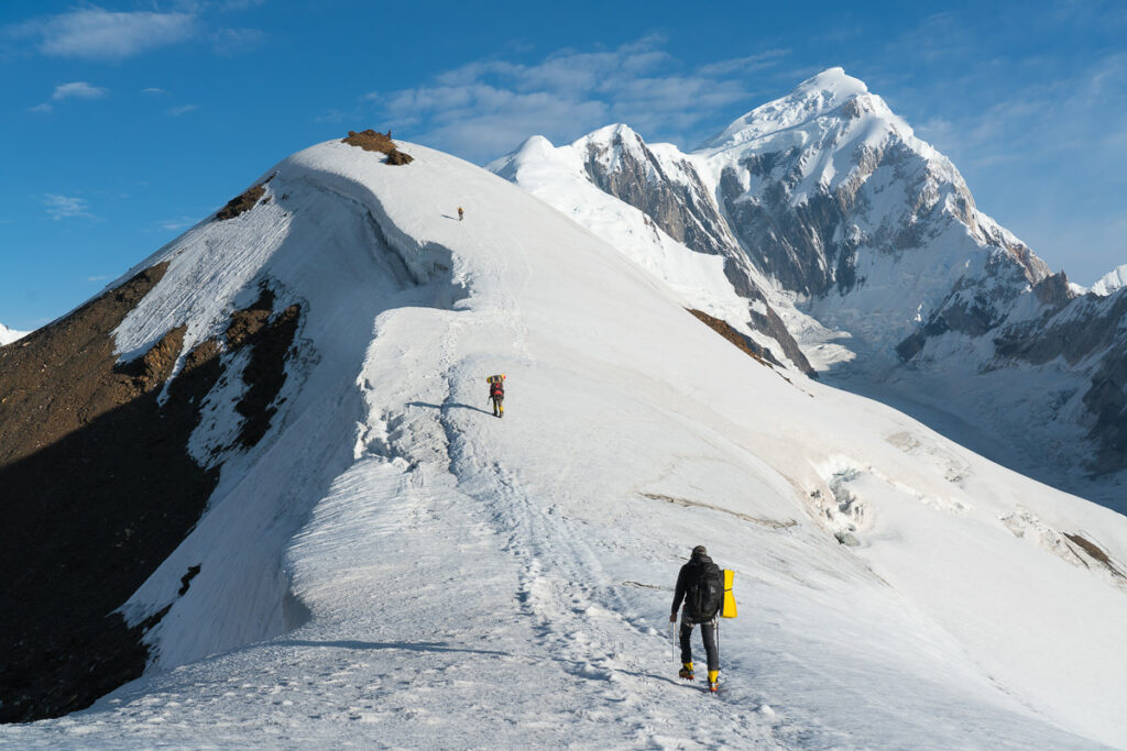
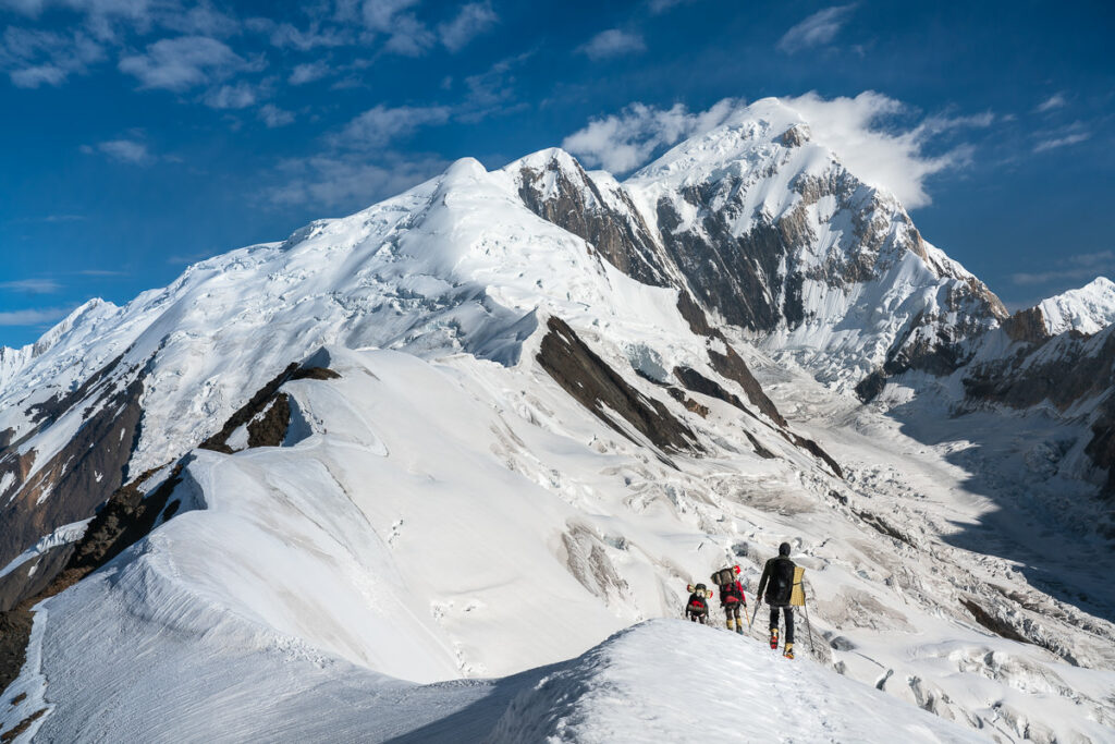
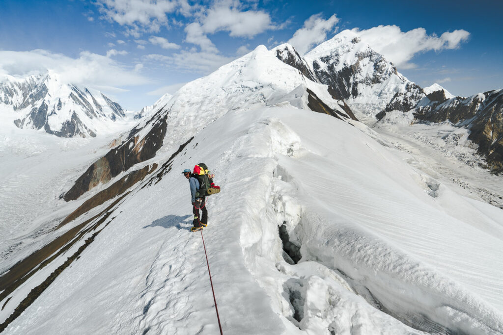
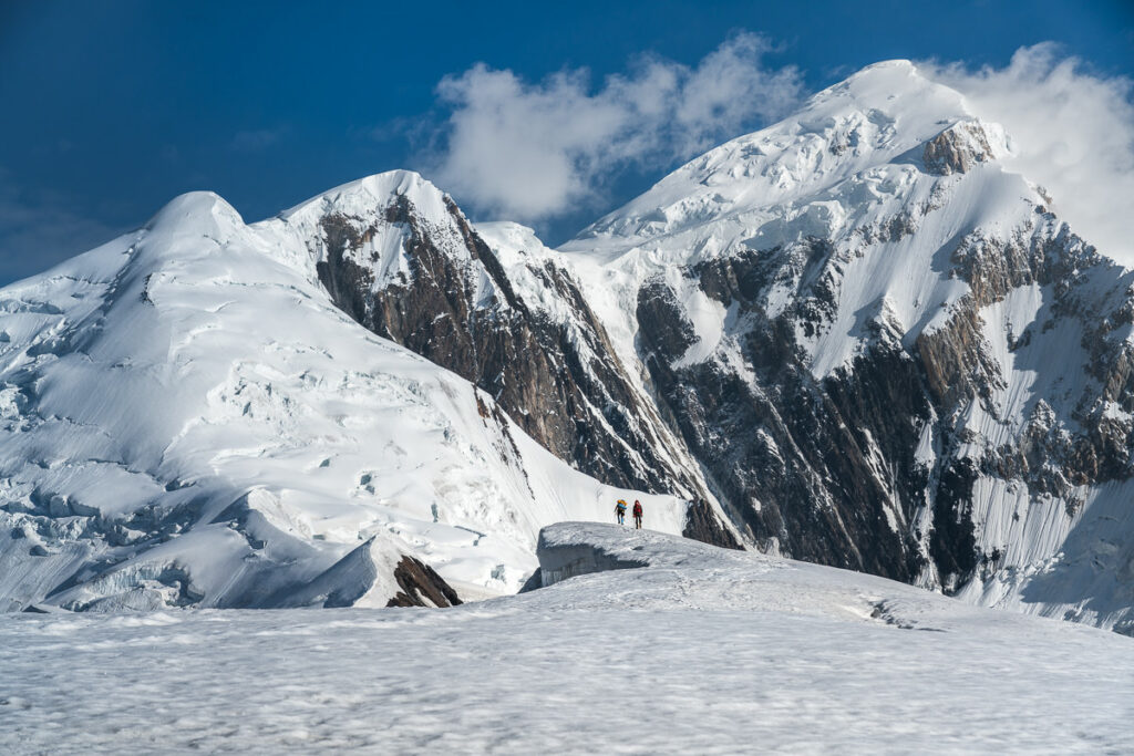
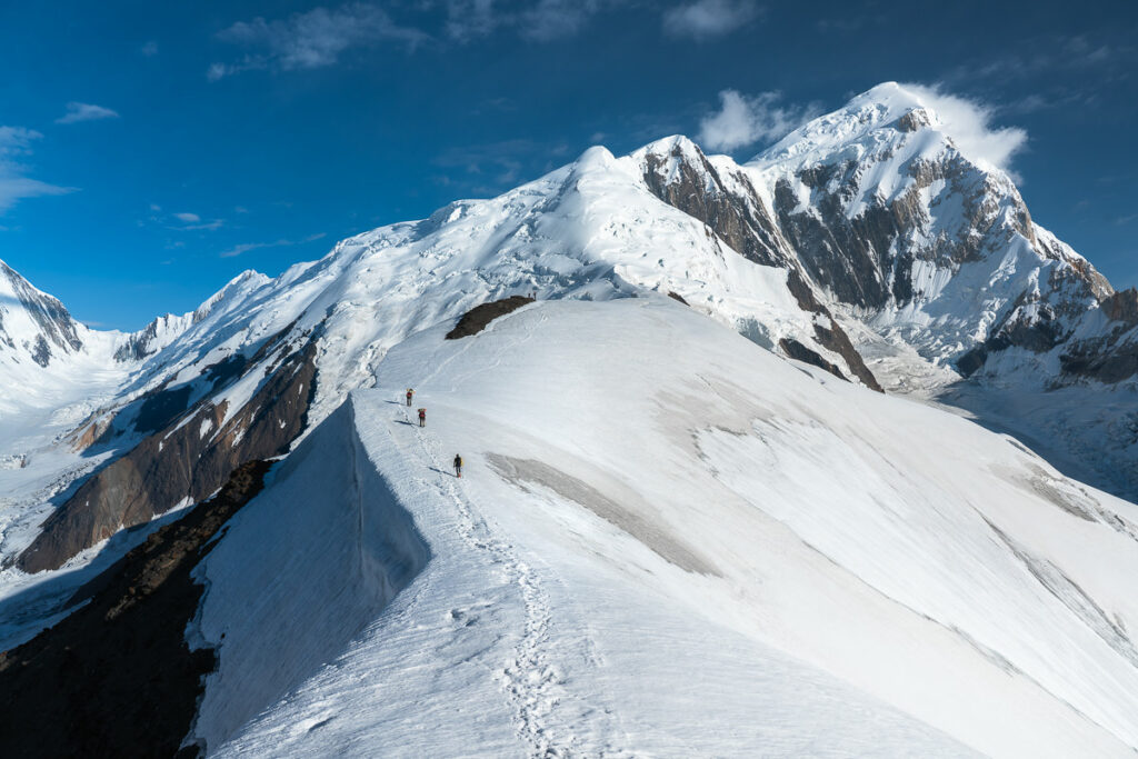
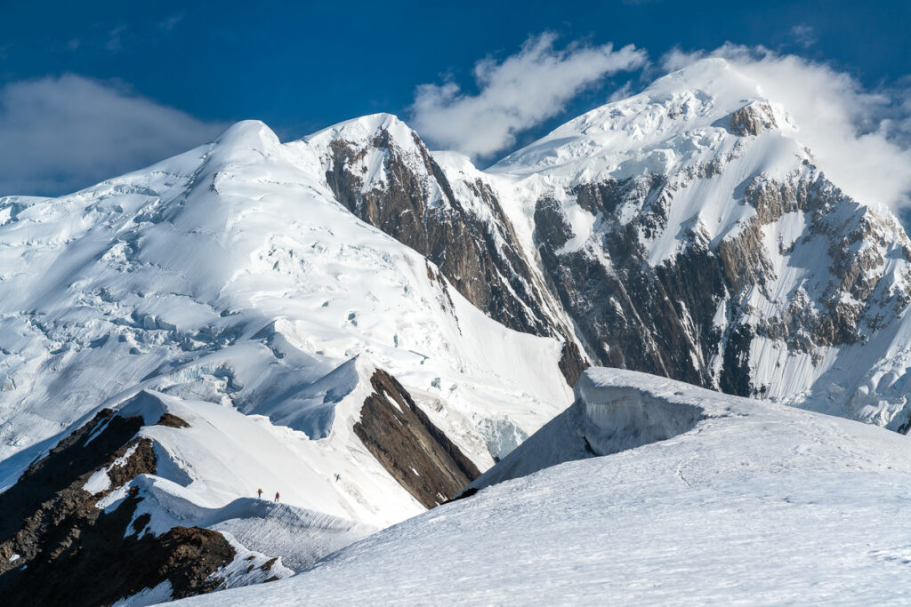
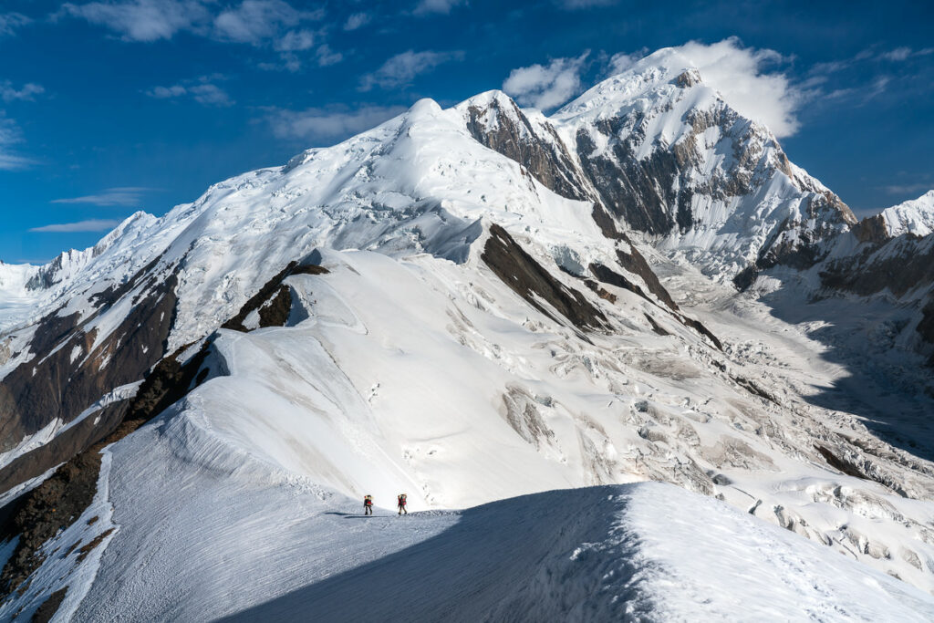
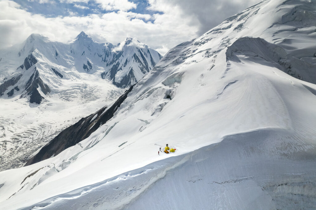
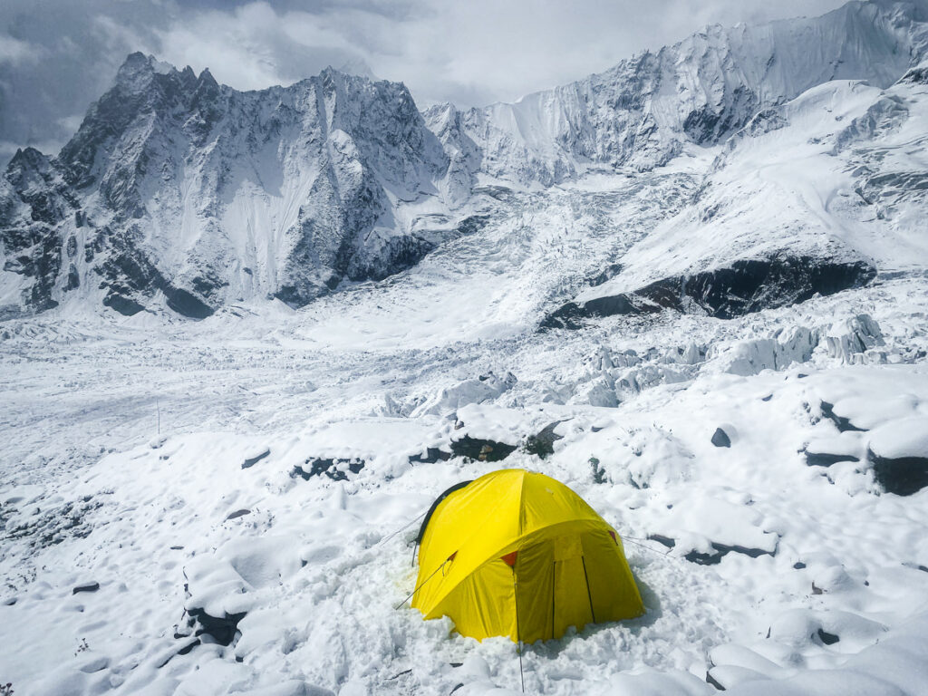
Camp 2 is on a wide plateau with steep drop-offs down to the glacier on either side of the site. It’s very exposed so there isn’t really anywhere to hide at this campsite from a stinging sun or a fierce storm. We had a couple of incredible sunsets here and the shots from the drone shots captured by Off The Atlas at this campsite are just phenomenal.
After a night at Camp 1 and then spending the following night at Camp 2, we headed back to basecamp in one day. The journey down from Camp 2 took us two hours and then from Camp 1 to base camp took just 1.5 hours. Therefore, descending from Camp 2 to basecamp took us 3.5 hours in these good conditions during our acclimatization.
CLIMBING SPANTIK PEAK
After arriving back down at Spantik Base Camp, we had to start analyzing the weather for a potential summit push window. Unfortunately, the weather wasn’t looking great and our only window for the next ten days was a 3.5-day period directly after a forecasted snowfall. This would mean heavy snow conditions up top on the ridge and peak in the days before we made our summit push. Not ideal, but it was our only window and we were willing to head up and give it a chance. It’s important to note that you really do need a satellite phone or Garmin InReach to be able to access the weather, which will help you make decisions about your weather window.
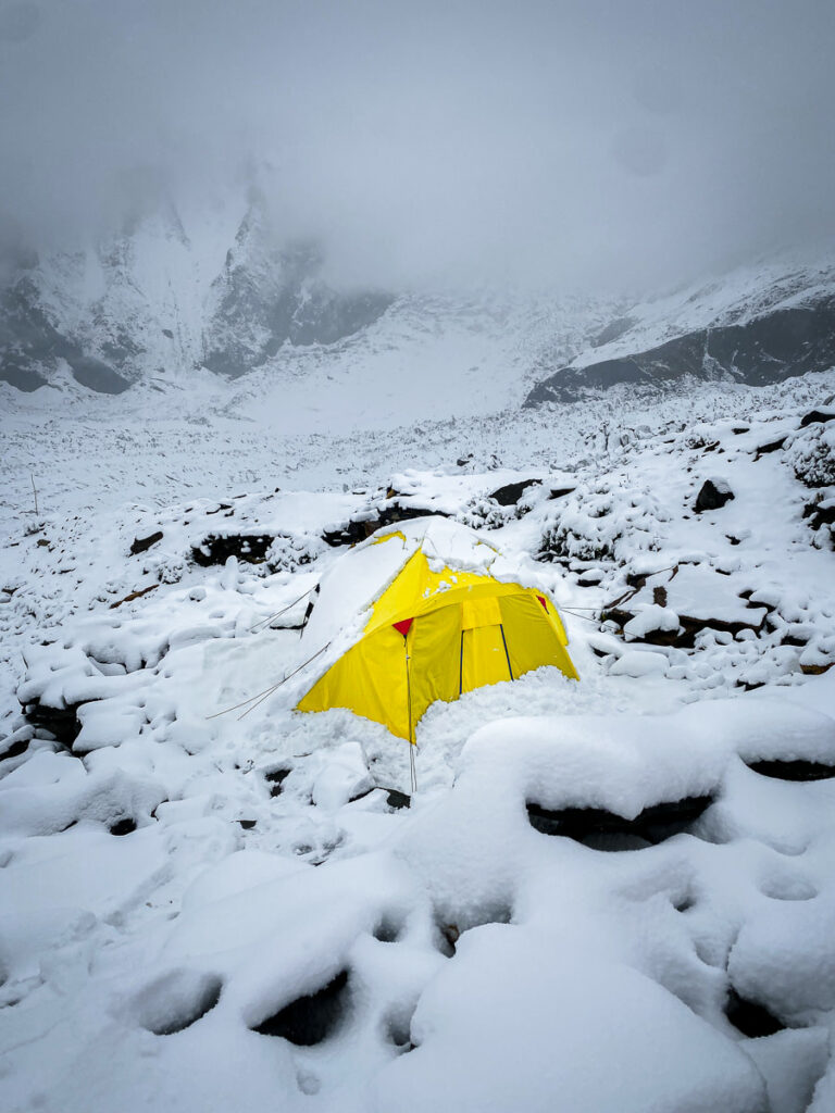
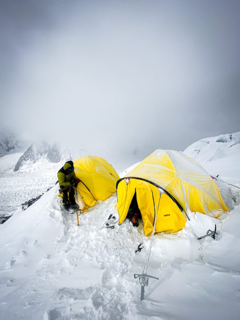
We hung out at basecamp in the snow for a few days. I watched my tent become completely engulfed by the snowstorm to the point I couldn’t even make it out of the yellow fabric underneath. We kept warm in our mess tent, ate well, and prepared both mentally and physically for the task ahead.
The weather had given us three clear days and then one semi-clear day. This was our 3.5-day weather window. Our plan was to climb to Camp 2 on day one, then to Camp 3 on day two. On the night of day two, we would begin our summit push to Spantik Peak and then descend back to Camp 3 on day three. We would then descend all the way to basecamp on day four to complete the journey. This plan would be quite manageable in normal conditions but due to the thick snowfall in the days prior, it would be a massive mission if we could pull it off.
Our journey began with the short climb back up to Camp 1. This time much of the trail was covered in the snow whereas, during our acclimatization journey, the snowline began after Camp 1. We stopped for an hour or so to assess the conditions while at Camp 1 but our guides decided it was ‘safe enough’ to continue on to Camp 2.
A journey that had taken us just 3-4 hours previously, this time cost us almost 8 hours as we reached Camp 2 late in the day. Thick snow was slowing us down dramatically and increasing the chance of falling into the menacing crevasses. Nevertheless, we made it to Camp 2, which was our objective for the day and I was relieved at that. It meant our summit push dreams were still alive.
The following morning as we were packing up, a disaster occurred. Chris, my climbing partner, was packing up his bag when his sleeping bag slipped out. In the blink of an eye, it was yards away and picking up speed as it began to roll down the steep hill. A $500 sleeping bag was gone as we headed up to sleep for two nights at 6,200 meters. Would we survive sharing just one bag between the two of us? We were about to find out!
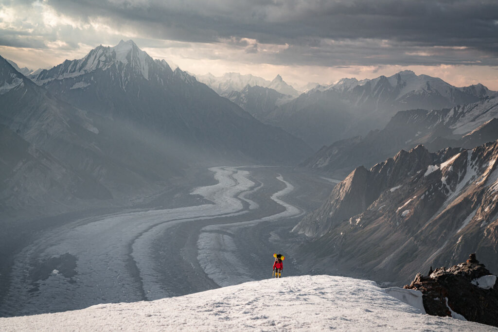
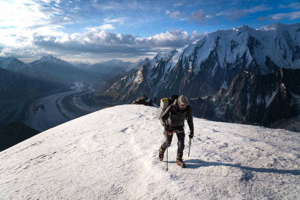
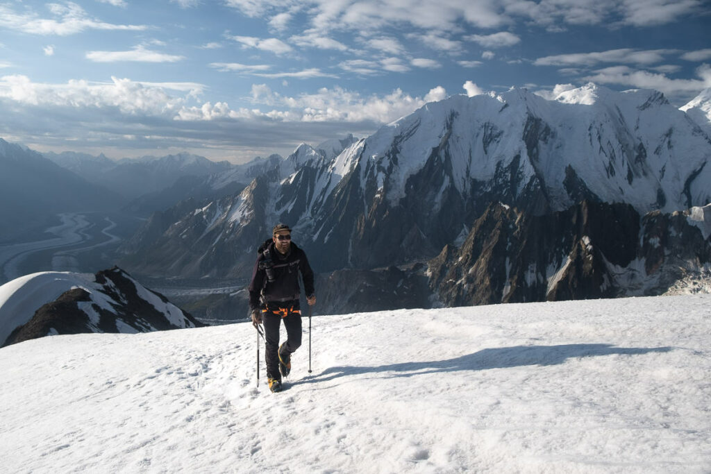
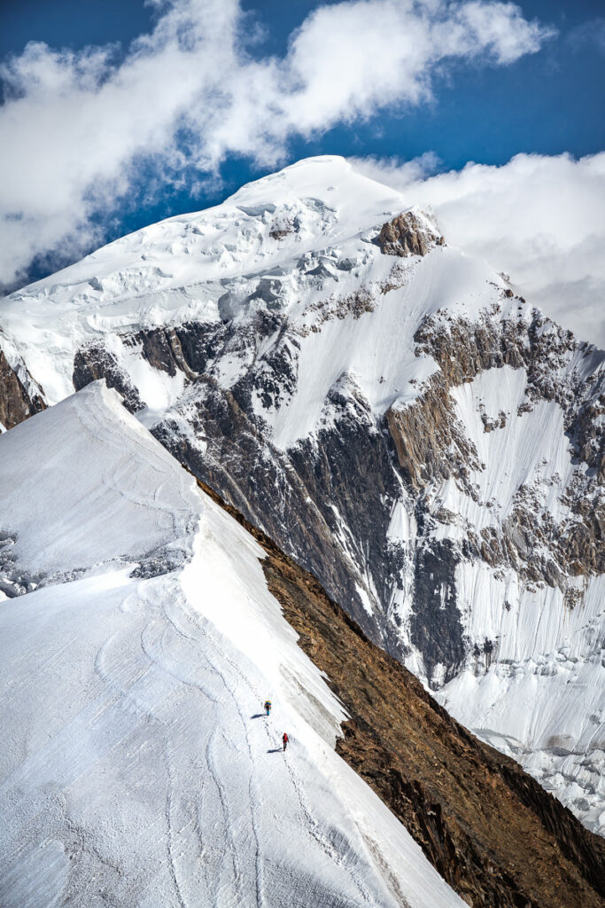
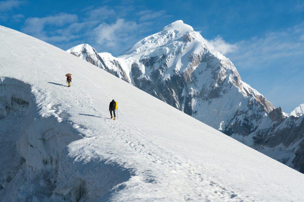
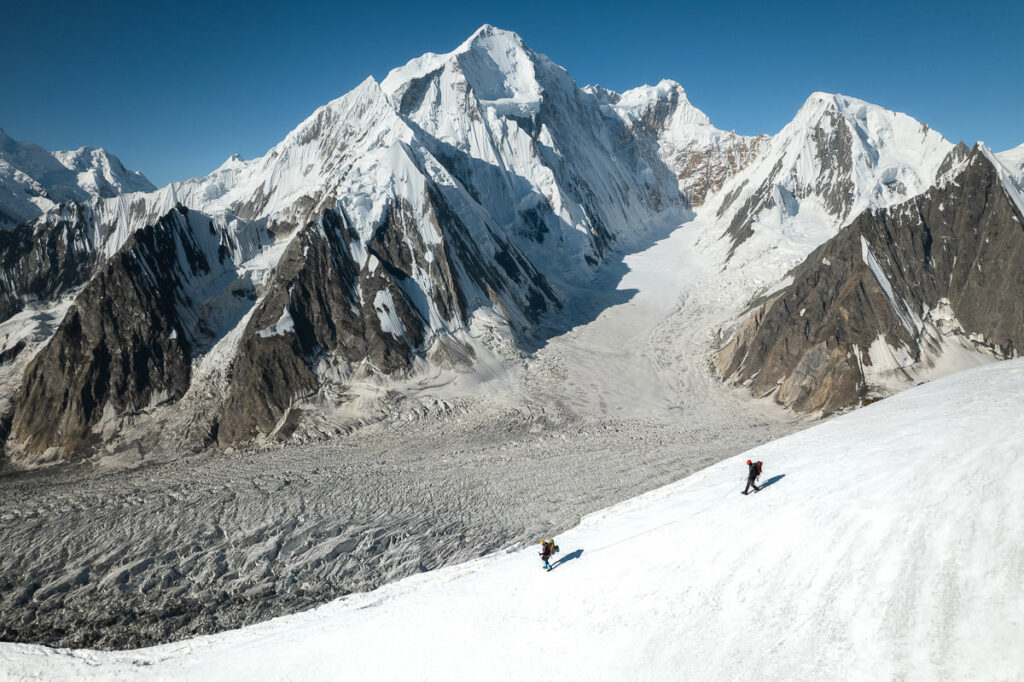
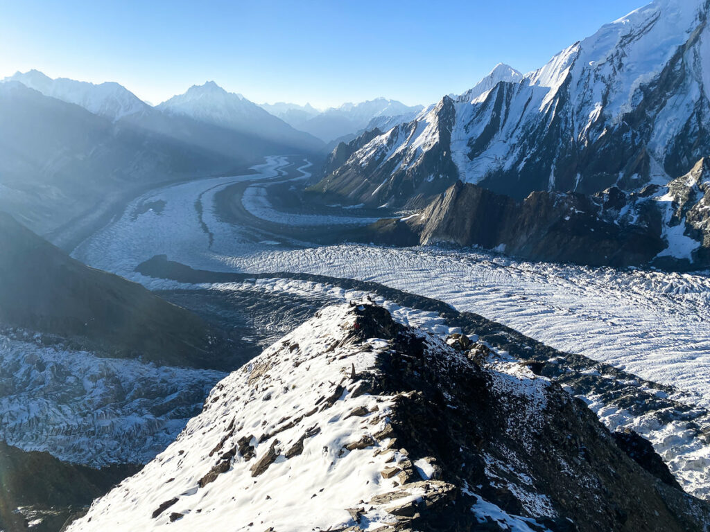
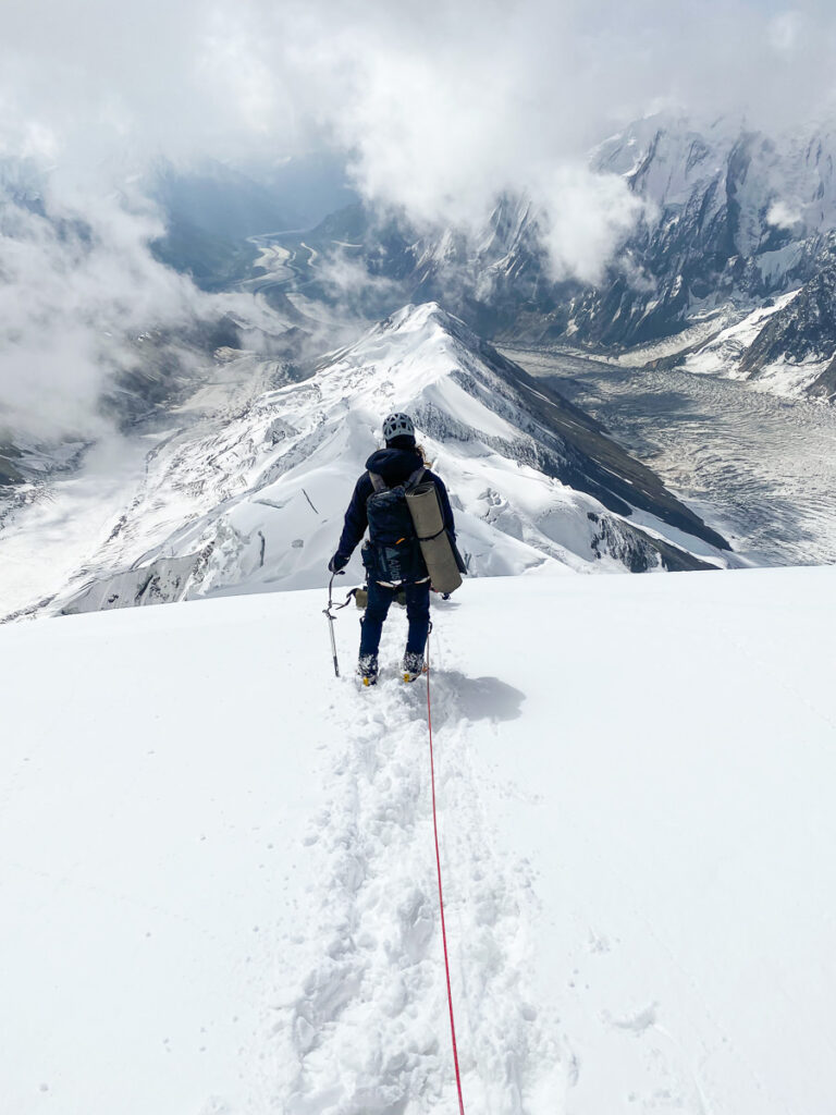
The climb up from Camp 2 to Camp 3 is largely the most technical part of the entire expedition. It doesn’t involve anything too extreme but you will jumar up a 45-degree slope for several hours (depending on your speed) to reach the third camp. The views back down the Chogholungma Glacier while ascending are just incredible and this section of the climb was definitely my favorite.
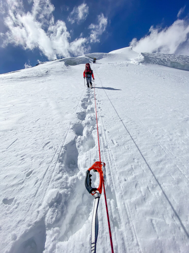
Despite the relatively short distance from Camp 2 to Camp 3 of less than four kilometers, the trip took us the entire day. The approach to the jumar section was incredibly thick with snow and the ‘Shark Fin’ ridge had to be traversed with care for crevasses. We ended up reaching Camp 3 at 6 pm after leaving early that morning. We then had just two hours of sleep after setting up the tents before it would be time to rise again to begin the final summit push to Spantik Peak.
After two hours of uncomfortable napping, we rustled ourselves out of the tent at 9 pm and geared up with boots, crampons, and all of our warmest gear. It was time for the summit push.
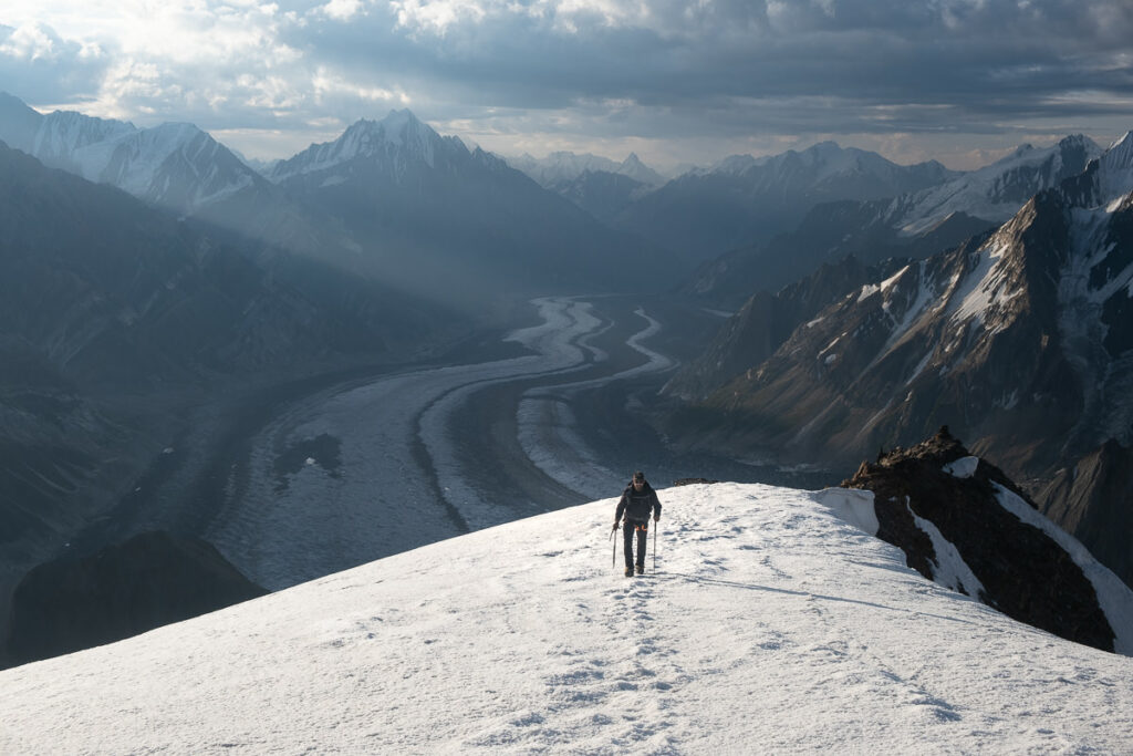
Our journey to the summit was dark, cold, and arduous. Through the night we trudged through the thick snow reaching the plateau by sunrise to sit beneath the final climb to Spantik Peak. With bad weather and blizzards rolling in, two members from the other expedition decided to head back. Our guides sipped a tea with us and said they were happy to move on to complete the mission.
The final climb up Spantik Peak is a continuous steep slope gaining the final 500m of elevation to reach 7,027m above sea level. The thick snow became incredibly difficult to manage throughout this portion of the climb. It seemed as if we moved two steps forward and one step backward with no traction for crampons or ice axes.
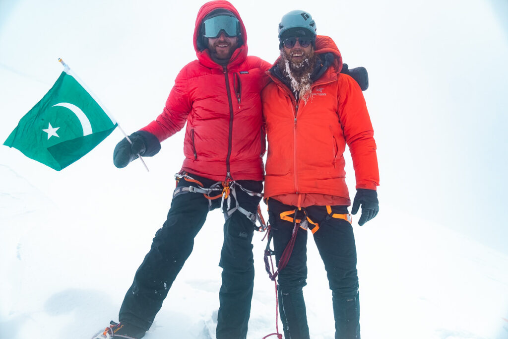
Unfortunately, at the summit, we had a complete whiteout with only a glimpse of Nagar Valley for a few moments. On a clear day, you can expect to find incredible views including looks toward K2, Nanga Parbat as well as other peaks. On this day it was snowing sideways. We took a photo, a breather, and then began the long descent back to Camp 3. We made it back to camp just before sunset completing a 22-hour push on just two hours of sleep. We made it.
The following morning, we woke tired and fatigued but had to descend all the way down to basecamp. It snowed heavily again during the night so we had to break the trail once again. It ended up taking us the entire day to descend and we reached basecamp at sunset after an arduous journey back down the ridge. We celebrated with a coca-cola (no alcohol allowed in Pakistan) and went straight to bed.
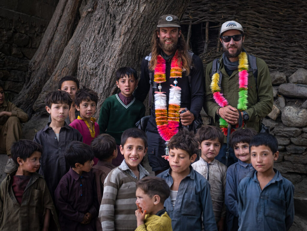
A rest day would have been nice but our team of porters had arrived and so we had to wake up at sunrise and march 28km in the piercing sun to Chogo Balansa, which is the first camp on the trek into Spantik Base Camp. We survived the day and then made the final 14km trek back out to Arandu the next day. Keeping the surprising level of efficiency rolling, we then jumped straight into a Jeep and headed back to Skardu that night. The following morning we flew to Islamabad. If you know anything about traveling in Pakistan, you would be astounded at that turnaround. Normally one form of transport fails you but on this occasion, we were in Islamabad just four days after being on the summit of Spantik Peak.
Ahdan Nabong
Sunday 5th of September 2021
You just introduced to the world summits that might not be as popular as the Himalayas. With same environment, same danger and same adventure. But up there, after all the picture taking, video shooting, it must be lonely with the quiet and cold. And no wine to warm you up. I mean, are they really that strict with alcohol.
Ahsen Abbas
Monday 30th of August 2021
Wow so impressive,hope ever be able to do adventure like this..salute