
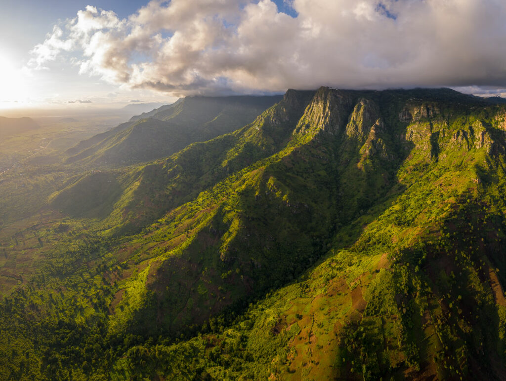
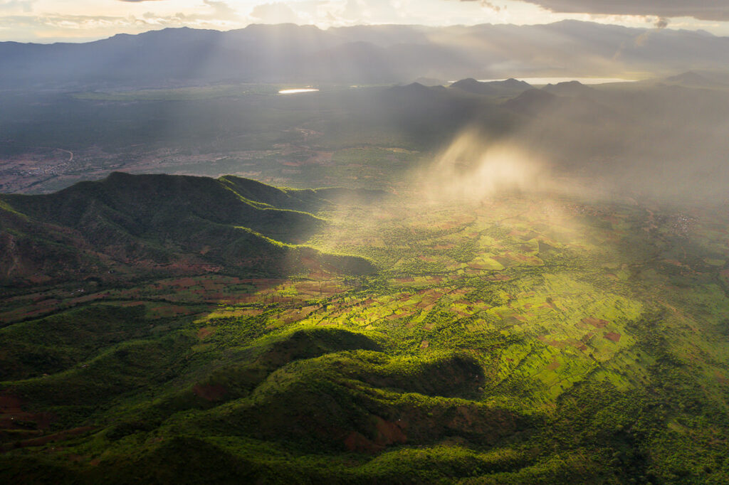
The Usambara Mountains are one of the hidden gems of Tanzania. A rich biodiversity hotspot with lush forests, incredible cliffs and mountain ranges, a network of local villages, and rare wildlife such as chameleons. Lushoto is the main town in the region and acts as the entry point to the mountains. It’s here that I began my journey as I trekked all the way to Mtae, passing through villages and forests throughout my 82-kilometer journey.
In this blog post, I will share everything you need to know about hiking in the Usambara Mountains. I’ll go through the details of hiking from Lushoto to Mtae including distances, accommodations, food, guides, best time of year and safety measures. I’ll also detail how to get to and from Lushoto and Mtae, where to stay before and after the trek and two epic waterfalls you can visit before and after the trek. Basically, I’ve been there and experienced it all myself and now I can help you prepare to explore the Usambara Mountains.

LUSHOTO TO MTAE TREK DETAILS
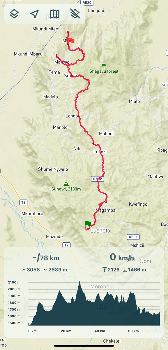
Hike Distance: The total distance of the hike was 82.5 km from Lushoto to Mtae. However, I took the scenic route including Magamba Peak on Day 1 and to Kidhege Falls on Day 4. The trek can be done in 60km more or less, but Magamba Peak and Kidhege Falls were highlights so I suggest my route.
Hike Duration: This depends a lot on your speed and the route you take. I carried all my gear so had a decently heavy load. The route took me four days but could have easily been done in three days if I skipped Mambo and went straight to Mtae. Many tour groups take 4-5 days and don’t carry their gear, making it a more leisurely affair. The total moving time according to my Garmin was 18 hours and 43 minutes.
Hike Difficulty: The trail is a variety of surfaces including forest paths, wide gravel roads, and small tracks that wind through the farming fields. It’s not a technical hike, there are no steep drop-offs and you shouldn’t find any danger.
The hard part is the distance and carrying your gear. The incline was a slow-burner as well with an average of a vertical kilometer a day. This through-hike will be a challenge for many people. However, it’s easier than many through-hikes because you have lodges to sleep in each night rather than carrying your sleeping equipment, food and having to set up camp each night.
Having a guide will simplify the journey but I used a GPX map (like mine linked below) to find the path. Going solo creates additional difficulties but I had no issues finding food, water and accommodation.
Hike Incline: My route was 3,952 meters of incline.
My Strava Map Upload: Lushoto to Mtae
MY LUSHOTO TO MTAE TREK DRONE VIDEO
HOW TO GET TO LUSHOTO
For travelers based in Arusha and Moshi, the best way to get to Usambara is via the public bus. It’s not fancy, it’s not quick but it will get you there. I took the bus from the Arusha Bus Stand and while the journey was long, it was safe and relatively efficient. I went to the bus stand the day before my journey and purchased a ticket (you can choose an aisle or window).
Arusha/Moshi to Lushoto: The price was 15,000 Tanzanian Schillings (in 2021), which is about $6 USD. The Journey from Arusha began at 5:30 am and we arrived eight hours later to Lushoto (Moshi will be a slightly shorter journey maybe 5-6 hours). From there I took a boda-boda for 3,000 Tanzanian Schillings ($1.50 USD) to my accommodation Irente Farm Lodge.
Mtae to Arusha/Moshi: The journey back from Mtae was a little bit longer and more arduous. The bus left at 5:00 am from Mtae and snaked its way along the bumpy dirt roads back to Lushoto and out to the highway. I didn’t make it back to Arusha until 5:30 pm.
The ticket was 20,000 Tanzanian Schillings and got me where I needed to go but it’s a hefty journey. Mtae is where the buses begin so you will get the first pick of the seats, about the only perk of the trip!
WHERE ARE THE USAMBARA MOUNTAINS
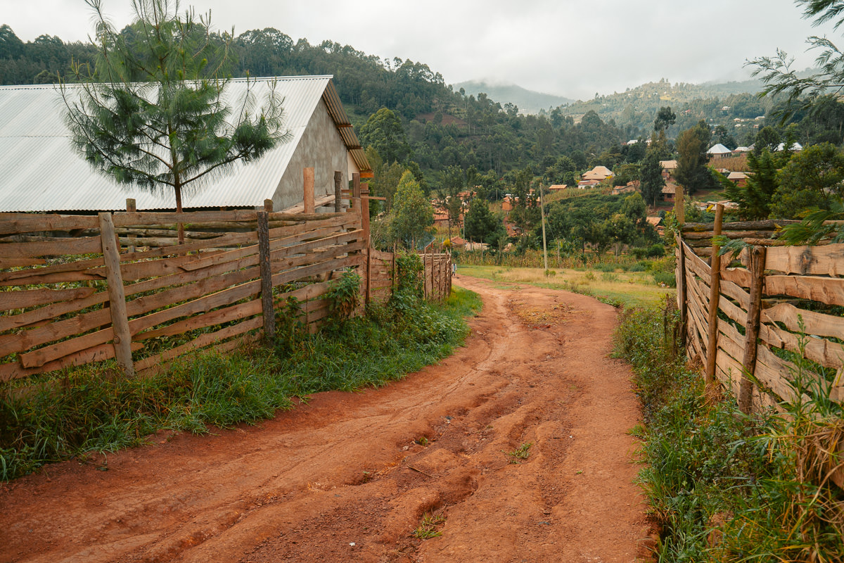
Usambara Mountain Range is in the eastern region of Tanzania, close to the coastal town of Tanga. There’s a population of about 50,000 people spread through the villages on the route from Lushoto to Mtae. Although it is one of the most beautiful parts of Tanzania, it is less frequently visited compared to safari destinations, Mount Kilimanjaro and Zanzibar. It might not seem far from Arusha or Moshi but it will basically take a full day to reach this mountainous region via the public bus.
Below on the map, you can see where the Usambara Mountains are positioned with Tanzania.
FOOD AND WATER ON THE LUSHOTO TO MTAE HIKE
In general, there was plenty of food options along the way but not always a restaurant or a cafe that travelers might be used to. Below I will share a few notes for each town so that you can prepare accordingly for your meals.
TIP: I carried some tuna, crackers, and one ready-made long-life tuna pasta meal in case I didn’t find something suitable one day on the trek and it turned out handy to have those two backup meals, so I suggest doing that. This is just a guide from my experience but I hope it helps you to plan ahead. You won’t go hungry on this trek.
Lushoto: In Lushoto you have a bus station and lots of guest houses so there are many places to eat. I stayed at Irente Farm Lodge, which has meals and a cafe so it was a great option. You can eat here even if you aren’t staying at the lodge. I also had a chipsi mayai at the bus station for 3000 Tanzanian Schillings (1.30 USD), which is basically an omelet and chips.
There are many places to eat near the center/bus station. Here you will have no problem finding food but do plan ahead as there aren’t cafes and restaurants everywhere like you may be used to.
Lukozi: There was lots of buying and selling going on with the big market when I arrived. In Lukozi on the main street you will find street food and some basic places to eat some chicken, chips and omelettes but no big fancy restaurants.
There’s only two guesthouses in the town so it’s not set up for tourists. I wasn’t hungry this night so skipped dinner after a big lunch anyway. Buying fresh fruits and getting chicken and chips here would be the play.
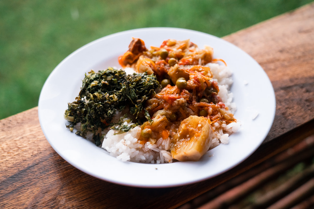
Rangwi: I stayed at the Nun’s Convent and they cooked me lunch, dinner, and breakfast. Including my accommodation and all of those meals, my stay was just 30,000 Tanzanian Schillings (13 USD), which is incredible. The food was quite good with beef and chips for dinner, vegetables for lunch, and omelet and toast for breakfast. I can highly recommend staying at the Nun’s Convent.
Mambo: In Mambo, I stayed at Mambo View Point Eco Lodge, where I had all of my meals. The food was very good here and I didn’t see much else for purchase as I walked through the town. I imagine here in Mambo you should eat all meals at the guesthouse where you are staying.
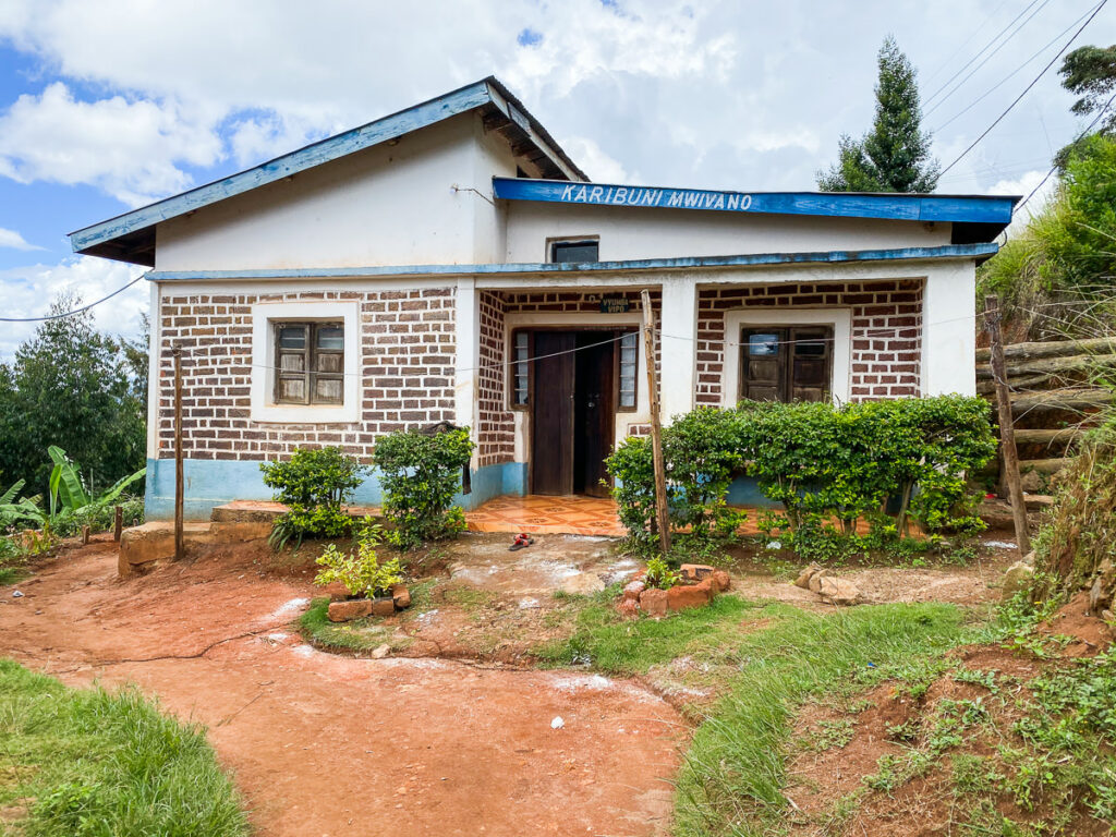
Mtae: This was my last stop and the most difficult to find food. Although there were a number of places that looked like they might sell food, I only found one place that reluctantly made me an omelet and chips. I think there used to be more buses coming through here but it has died off and therefore many restaurants are now out of action.
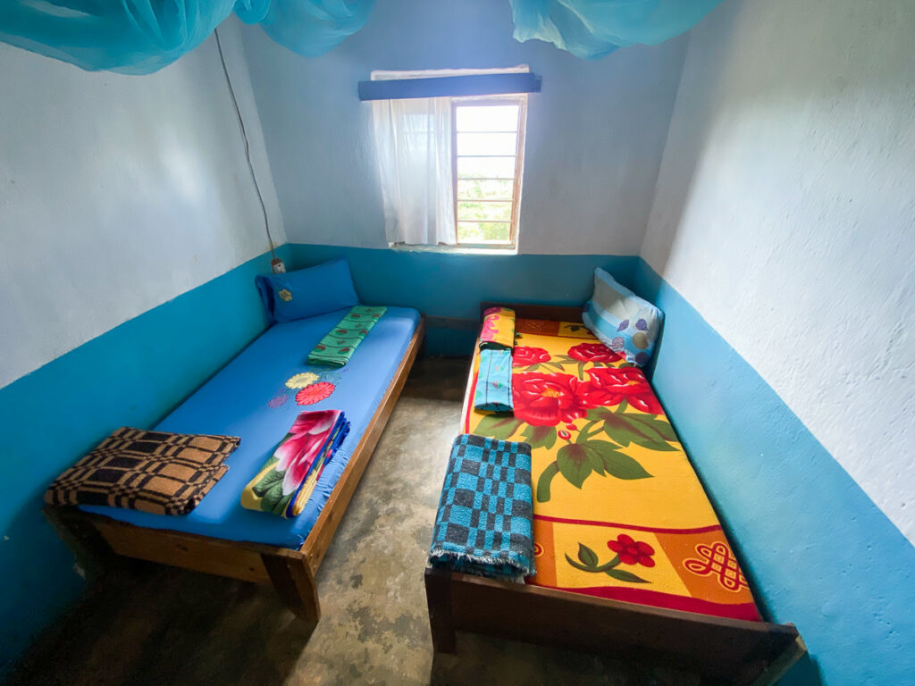
You’ll find something basic but you may have to search a bit and take what you get. The ‘Mwivano Guesthouse’ was simply 10 rooms with a bed and there was no kitchen or meals on offer.
ACCOMMODATION ON THE LUSHOTO TO MTAE HIKE
I’ve already mentioned a few of the accomodations for the trek in the previous sections but I’ll detail them here so you know what is on offer:
Lushoto:
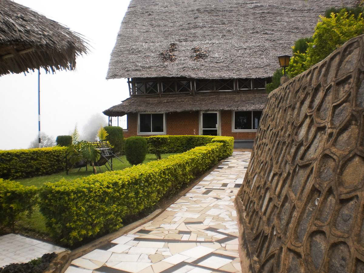
Irente Farm Lodge: I spent two nights at the farm lodge before my Lushoto to Mtae trek and found it a great place with excellent food and budget prices. It had a very peaceful vibe and I could highly recommend it.
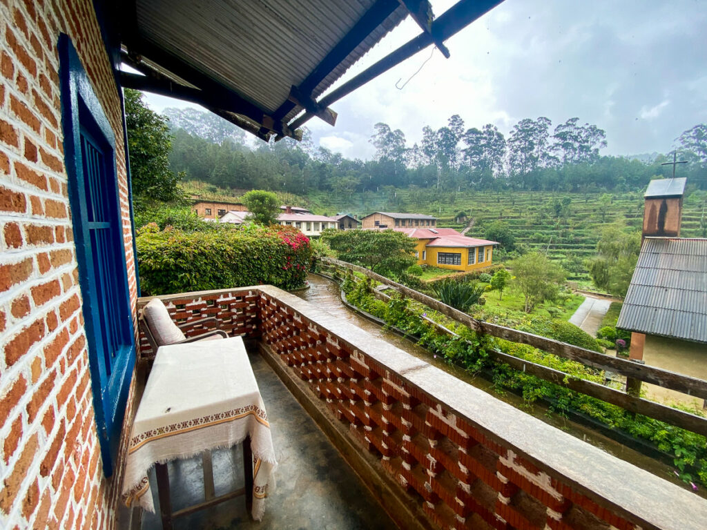
Irente View Cliff Lodge: This one is a little fancier than the farm lodge and has an incredible cliff-edge location. Sunrise and sunset time are epic with expansive views and easy access to the viewpoint. Surrounded by lush forest, it’s an experience you will never forget and the prices are modest with nights available for under $70 USD.
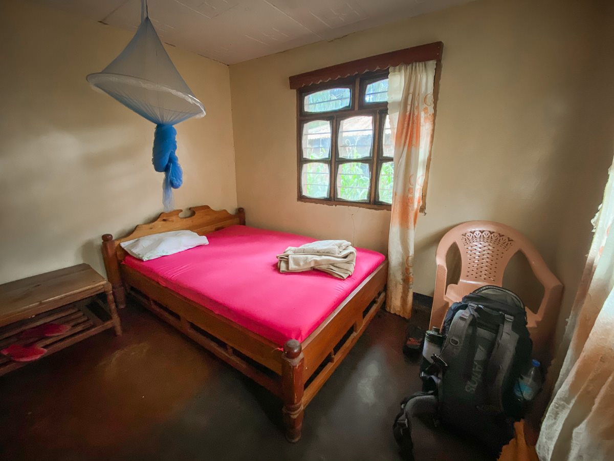
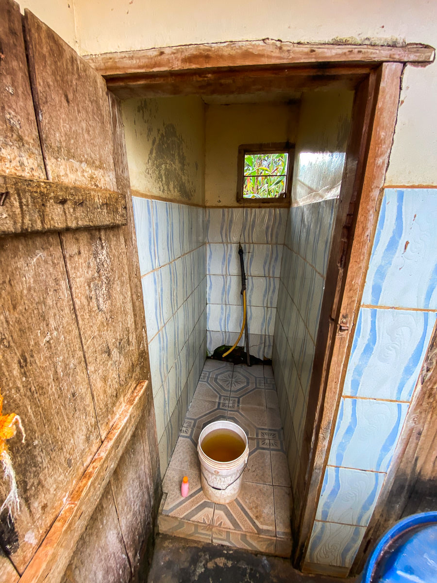
Lukozi: I stayed at New Watoto Guesthouse. Unbelievably, the price per night was just 5,000 Tanzanian Schillings, which is about $2 USD. It was very basic but had a double bed with a fly net and a key and lock for the door. A bucket shower and toilet were on offer at this place. There wasn’t really another option in Lukozi although I heard rumours of a hidden lodge further out of the town.
Rangwi: I stayed at the Nun’s Convent and they cooked me lunch, dinner, and breakfast. Including my accommodation and all of those meals, my stay was just 30,000 Tanzanian Schillings (13 USD), which is incredible. I can highly recommend staying at the Nun’s Convent.
Mambo: In Mambo, I stayed at Mambo View Point Eco Lodge, where I had all of my meals. You have easy access to the Mambo Viewpoint, which is very convenient as it is the main thing to do in this region.
Mtae: I stayed at Mwivano Guesthouse and while super basic it was efficent and did the job for me. Lots of bus drivers and passengers stay here. The price was 10,000 Tanzanian Schillings per night, which is $4 USD.
WHAT TO PACK FOR THE LUSHOTO TO MTAE HIKE
Because this hike has accommodations and lodges on every night, you won’t need to carry any camping gear. Additionally, you will have enough food options along the trek that you should never go hungry. I did pack two ready-made, long-life tuna pasta meals as emergency meals and did use them both so I would pack some tuna or biscuits to fill the gaps.
I won’t list the entire packing list but I’ll share most of the important things you shouldn’t forget and why you will need them on this trek.
- Trekking Poles: With 4000m+ of elevation on my route, I was happy to have my trekking poles to give me an extra push especially with a heavy pack of gear.
- GrayL Geopress: I have been using the GrayL GeoPress water filter for three years now and it means I’ve saved thousands of plastic bottles and money. You can filter any water, anywhere and it becomes drinkable. I used this throughout the trek and didn’t need to buy water once. You can check out the filter here: GrayL GeoPress Filter
- Rain Jacket: I hiked just at the beginning of the rainy season and had little rain, which was very lucky. However, this mountain region is often covered in clouds and experiences rain so always have a rain jacket in your bag.
- Hiking Boots: I would say waterproof shoes are ideal for this trail with many sections with wet grass or mud. My feet were dry the whole trek in waterproof hiking boots.
- Two sets of clothes: I took two t-shirts, lightweight hiking pants, shorts, two hiking socks, three pairs of underwear, a hat, and a buff, lightweight down jacket, rain jacket. That was about it and much more and the bag will start to be heavy.
- Headlamp: You won’t really need this as all of the hiking is done during the day but handy to have for an emergency.
- Money: Everything will be paid in cash. I spent just under $100 USD but I would bring about 500,000 Tanzanian Schillings to be ready for any scenario. I don’t think you will find an ATM in the area.
- Chargers: I didn’t have electricity to charge my gear in Lukozi, Rangwi or Mtae. I didn’t ask if they had it in other rooms or living areas as I had my portable power bank but just so you know. I would definitely bring a power bank. I had electricity to charge in Lushoto and Mambo.
MY ROUTE FOR THE LUSHOTO TO MTAE TREK IN USAMBARA
This trek is normally done with a guide who shows the way. However, a guide is not mandated as a rule so I decided to go alone. While you can use maps.me to find your way between towns, you may not take the most scenic route and just walk along roads.
I found a map on Wikiloc that seemed to have gone off-road a lot. I downloaded it from Wikiloc and uploaded it into the TrackViewer app.
However, I also added to several parts of the trek such as hiking to Mambo Peak on day one and to Kidhege Falls on day two. Therefore, I will say that I think my map is now a more scenic route than the one I used although also much harder with more incline and distance. What you can do is click on the link to my map below from Strava and then upload it into your GPX viewer on your phone. I use TrackViewer as the most reliable.
My route (seen below as shown on TrackViewer) was created using a mixture of my original map, maps.me, and some adventurous discovery at times where no path was shown.
Download my GPX by visiting here: Lushoto to Mtae Strava Upload and Map
DO YOU NEED A GUIDE FOR THE LUSHOTO TO MTATE TREK
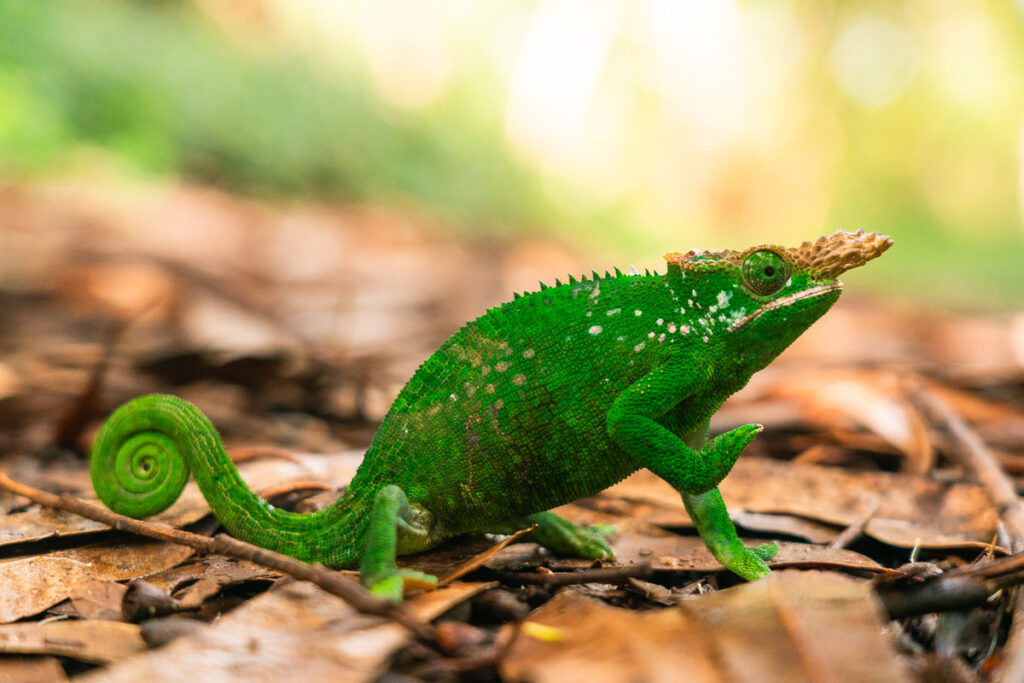
I would recommend a guide for most people as they will know the route, help with the accommodations, keep you safe and spot some chameleons (quite hard). I’m pretty experienced following maps, organizing my own trips and navigating in new places so I wanted a challenge but I imagine 90% of people will want a guide for this trip.
I obviously didn’t do the trek with a guide but I can recommend one guy who actually created the route and he was super nice to me offering lots of free help and advice even when I told him straight up that I’m doing the route without a guide. Ally from Mambo Viewpoint Eco Lodge is a genuine guy and texted me throughout the trip with advice and tips. You can contact him on his Whatsapp to organize a guide and tell him what you need. I’ve added his number below:
Ally from Mambo Whatsapp: +255 757 901 484 or his website/business is Usambara Eco Tours
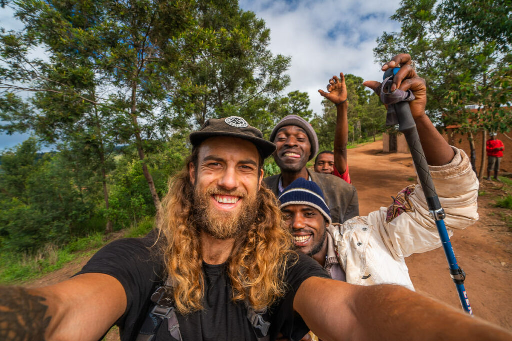
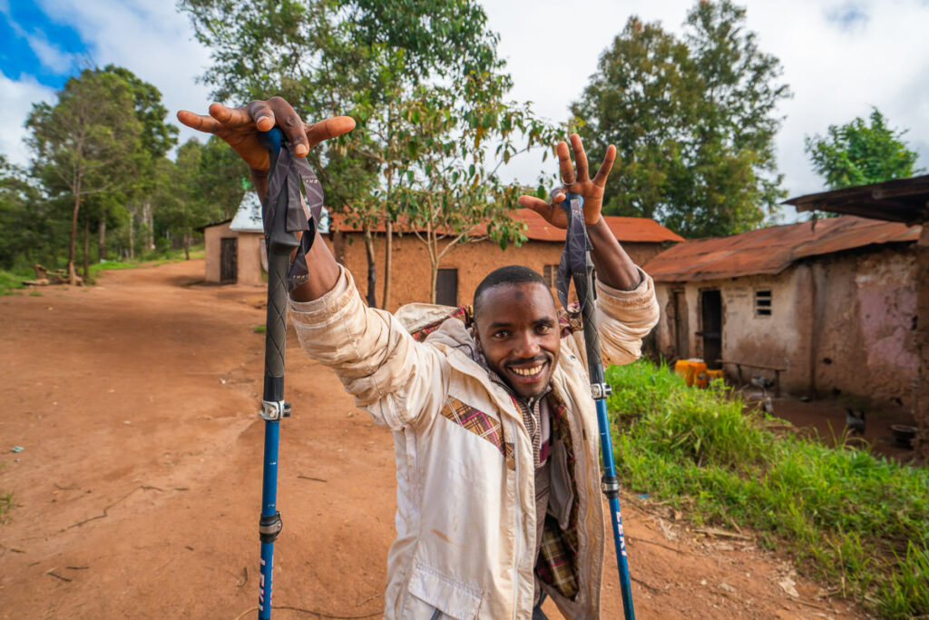
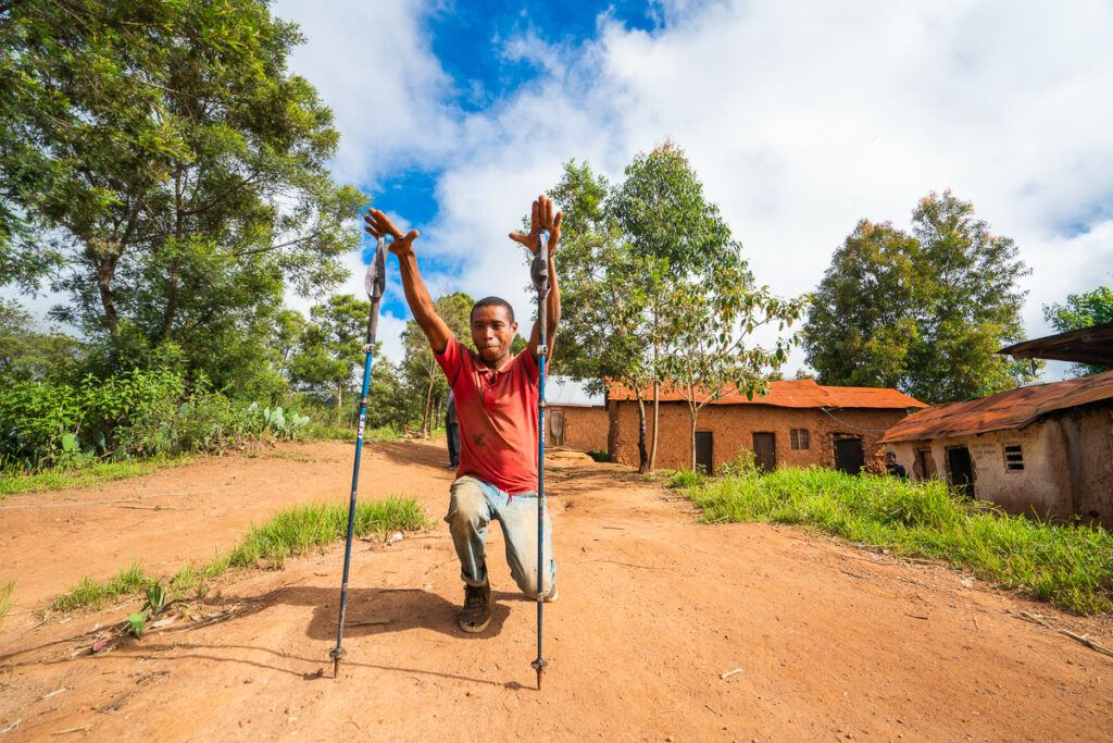
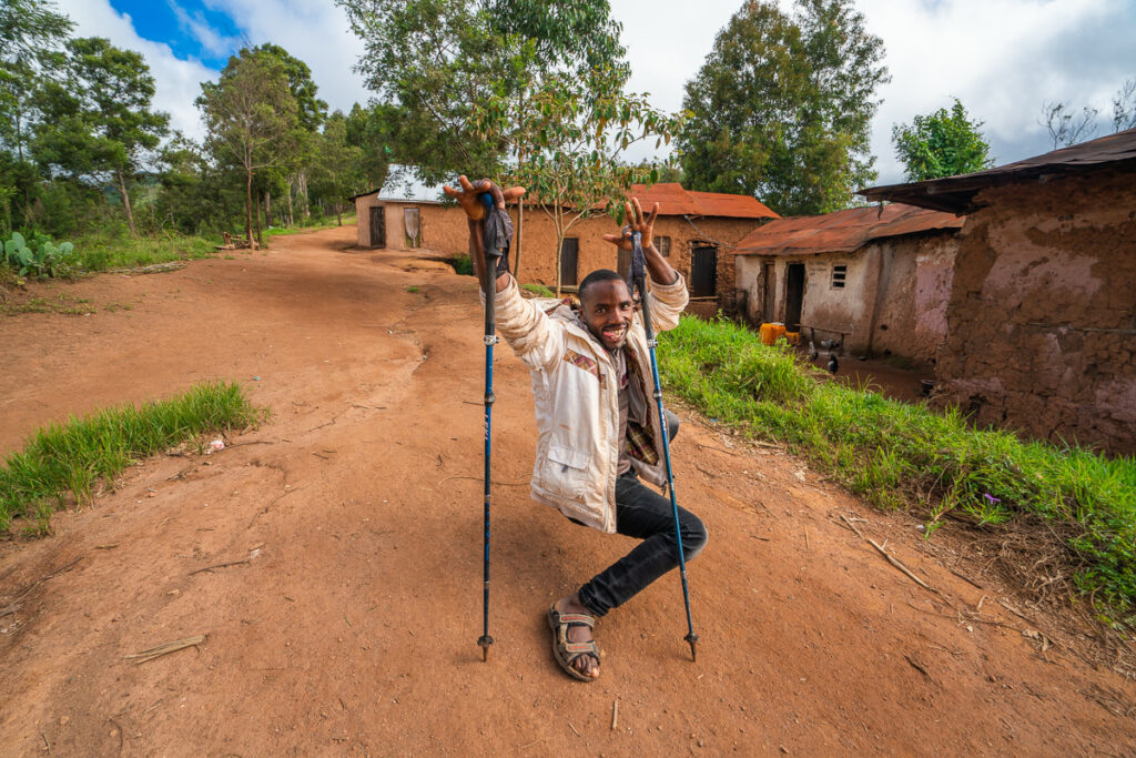
MY EXPERIENCE ON THE LUSHOTO TO MTAE TREK IN THE USAMBARA MOUNTAINS
Okay, that is most of the logistics out of the way. Now let’s get into the actual trek and what you can expect along the way. I filmed a video, took photos along the way, and also wrote a short daily journal so I’ll share those with you here.
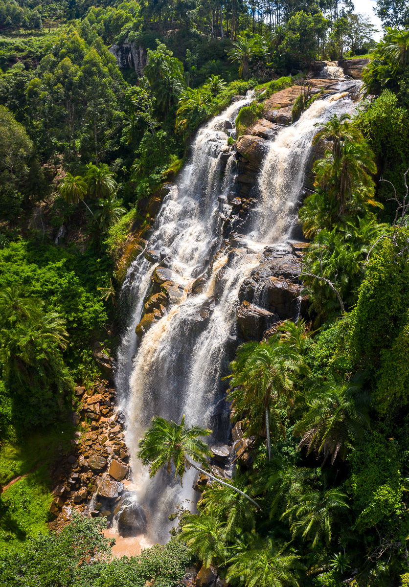
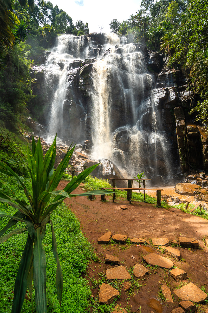
The day before I began the big trek from Lushoto to Mtae, I did a day-hike to Kisasa Falls. What can be a 12-kilometer out and back turned into a 24-kilomter journey as I added in some sweet viewpoints to my return trip. I wrote an entire blog post about that hike and I do suggest adding it in to your itinerary. Here are a few photos from that hike and the link to the full article about the Kisasa Falls adventure.
Read the full blog post: KISASA FALLS HIKE

Day one: Lushoto to Lukozi
Today would be the biggest day of the trek by far, both incline and distance. With 26km ahead of me and 1300 meters to climb I would have liked to set off early from Irente Farm Lodge. However, I had a slow breakfast and a second coffee as I waited for the morning rains to clear off.
Slightly after nine, I set off into the forest as I bid farewell to Irente Farm Lodge. I was using a combination of maps.me and a GPX recording I had loaded into Track Viewer. Both were valuable at different times, especially on this first morning.
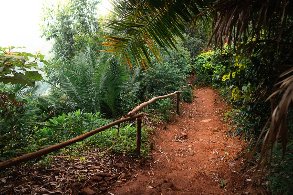
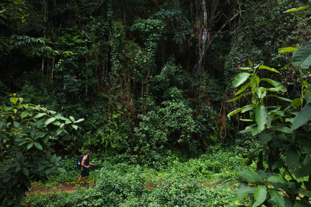
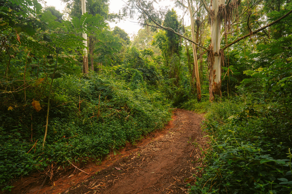
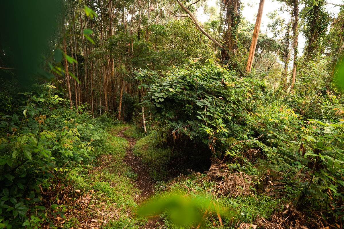
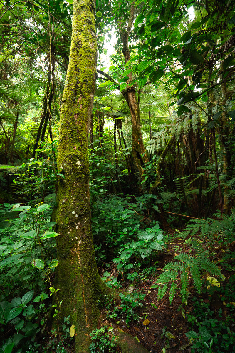
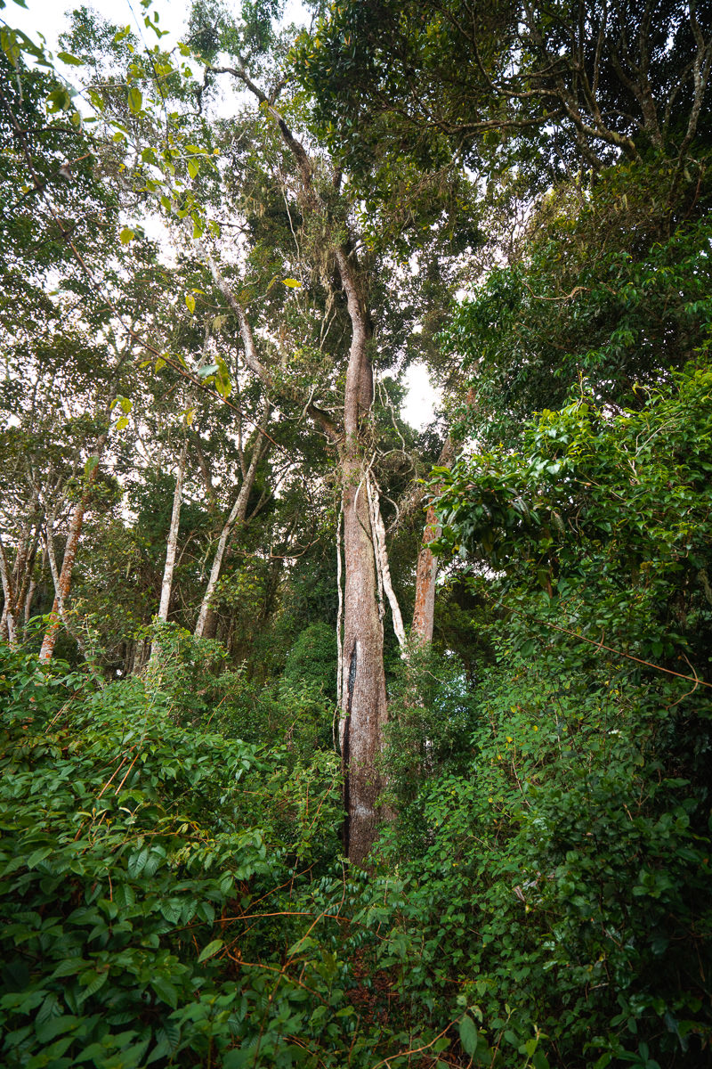
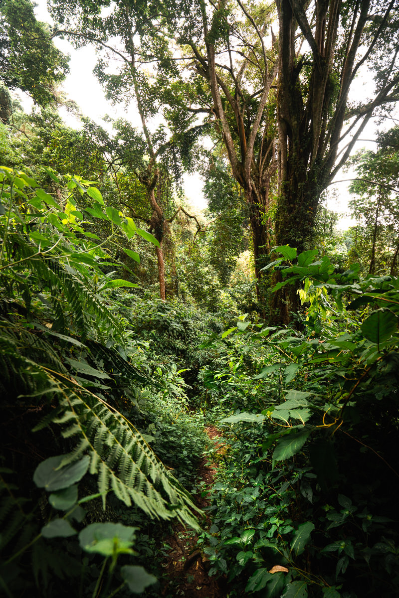
With a wall of trees and lush forest on either side of me, I was quickly immersed in the green scenery of Usambara. Idyllic forest sounds filled the air with birds chirping and water dripping rim the canopy. Bliss.
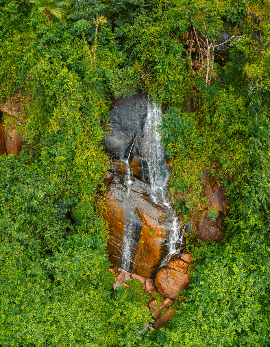
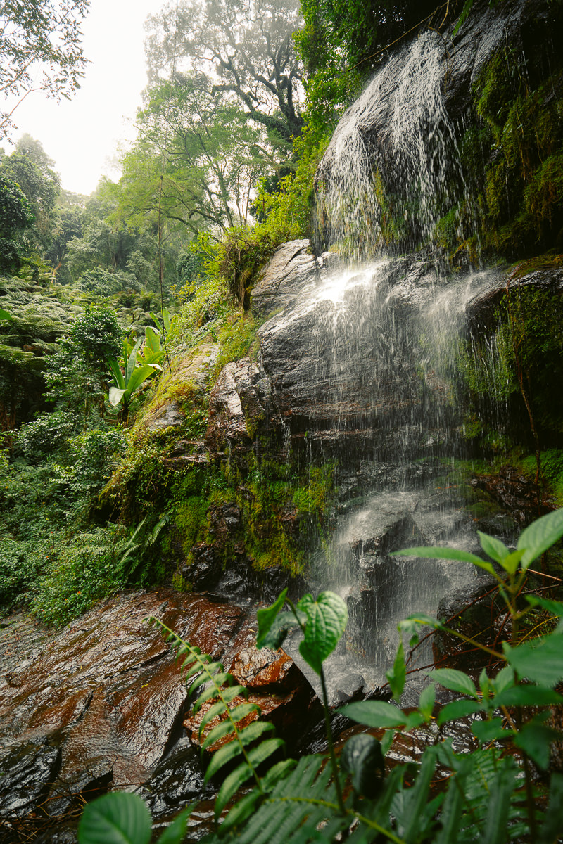
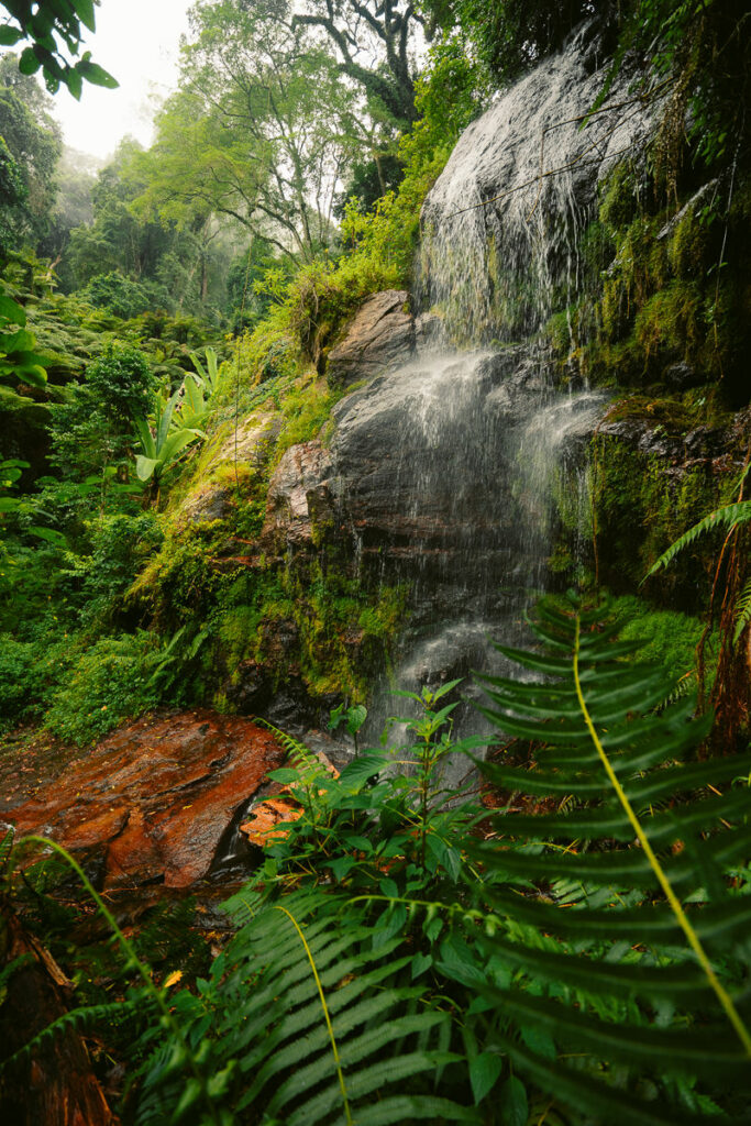
My first point of interest for the day was the Irente Farm Waterfall. In times of more frequent visitors, the path to its base has been cleared but despite my best efforts, it was a tangled mess. I still managed to observe it from afar. It turned out the early attractions on this trail would be right under my nose.
I was told I would need a guide to help me lead the way but also to spot the wildlife, in particular the elusive chameleon. One hour into my hike, I spotted one just to the side of the trail. How was my luck?
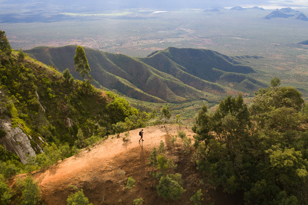
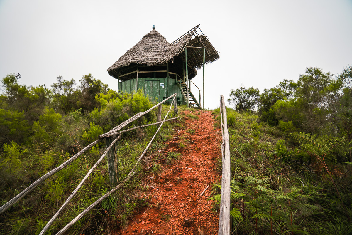
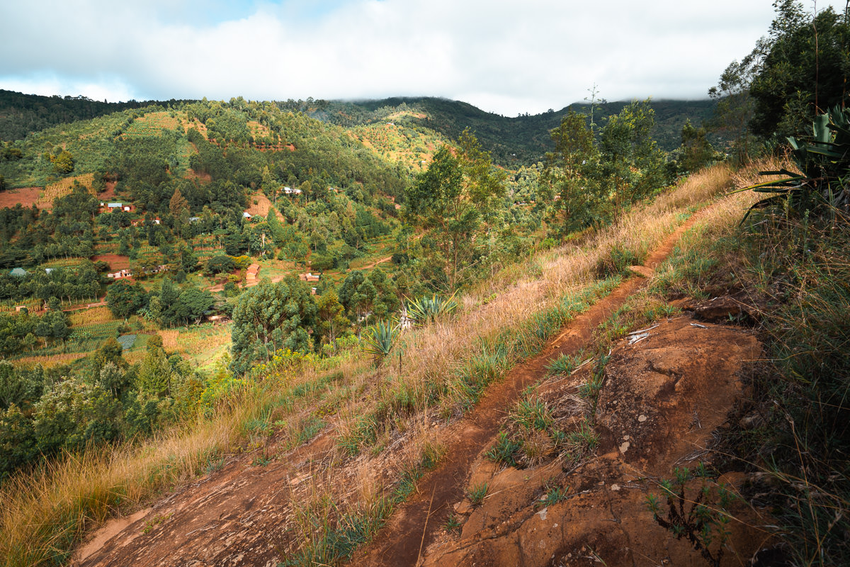
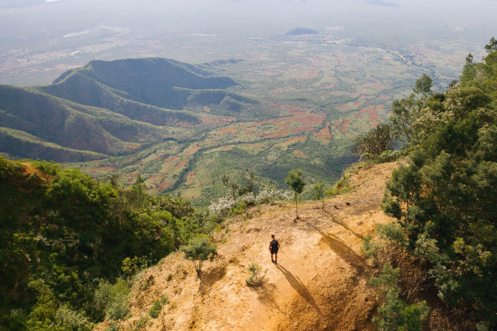
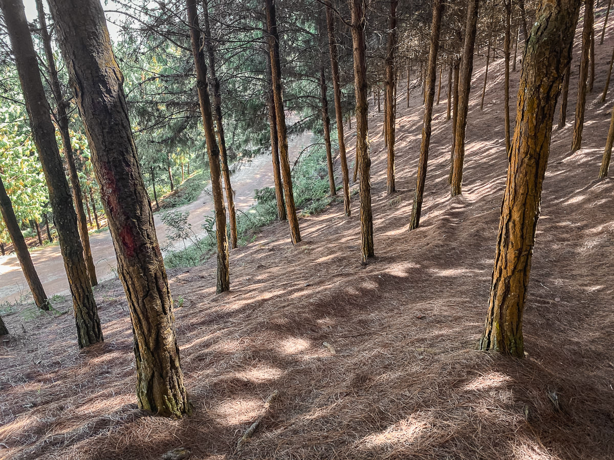
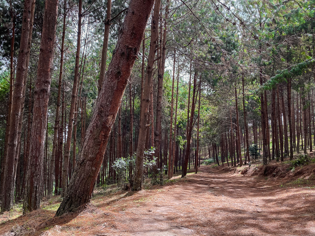
After the surprise of the chameleon and Irente Farm Waterfall, I picked up the pace and headed through the village of Kwembago. I was headed up the steep forested hills towards Magamba Peak (1,850m). The peak is inside the Magamba Forest Reserve, which has a $10 USD entrance fee. It’s worth the price as you will leave behind the red-dirt village roads for a while to Detour through some magnificently lush scenery.
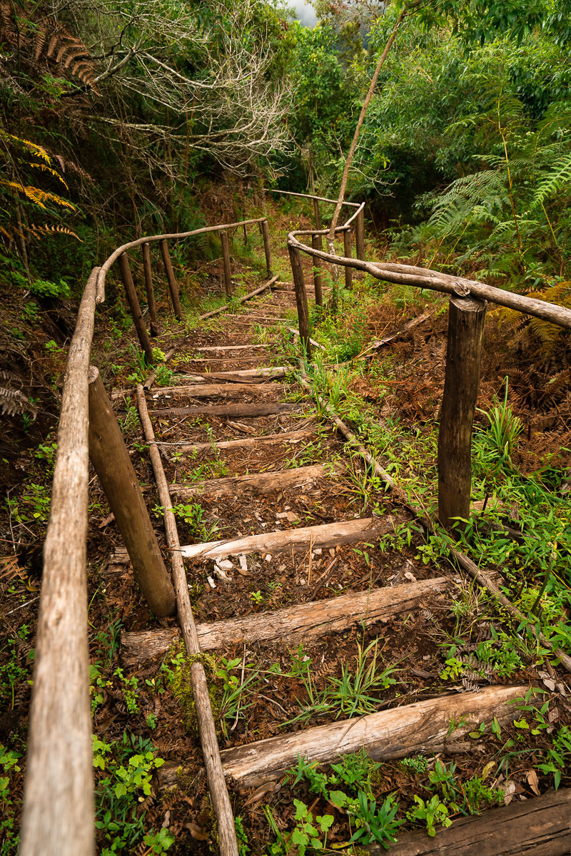
There’s a small hut atop Magamba Peak where I ran into the park ranger who requested the fee. I enjoyed the view before the fog rolled in. I saw it as a good time to duck back into the cover of the forest. I followed a dark, narrow path and often ducked through tree tunnels or crossed shaky wooden bridges. This was the most adventurous part of the day.
I put the maps away and tried to reach Magamba directly through the forest without doubling back. My gamble paid off and I enjoyed a great stretch through the forest, only bumping into a few monkeys along the way.
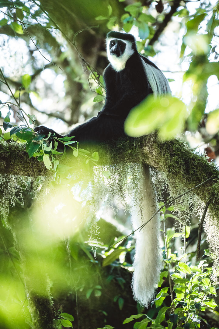
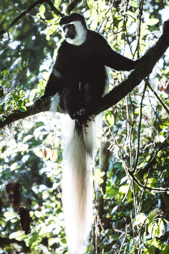
From Magamba it was the toughest part of the day. I followed a gravel road all the way up the hill for what seemed like hours. Buses tooted their horns as they passed by. I think many people will find this section quite tough. I did see a few Colobus monkeys while on this road though.
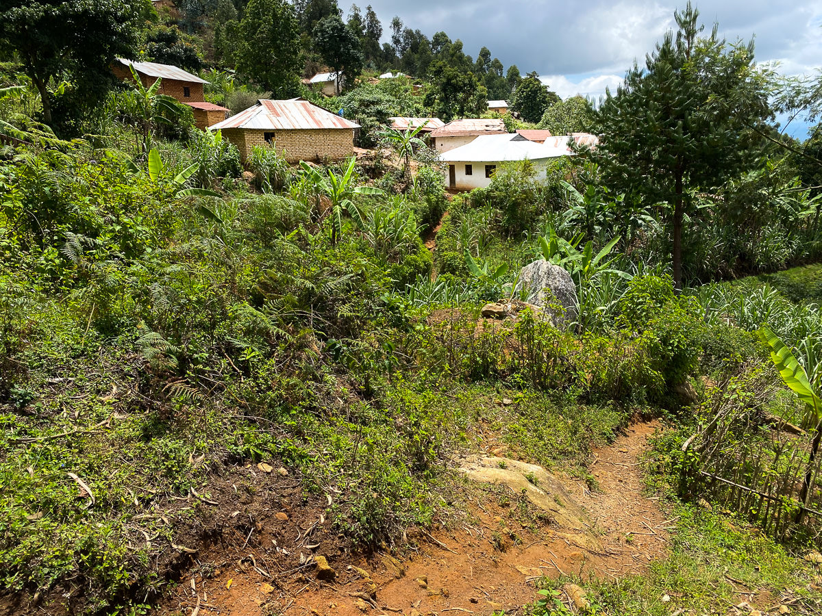
When I finally reached the top of the hill, I just had 6km of downhill road to reach Lukozi. I’d timed my run perfectly, as I joined the school kids on their walk home.
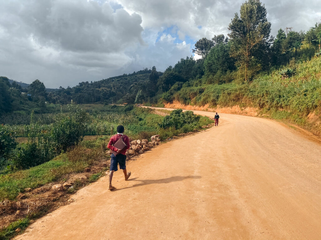
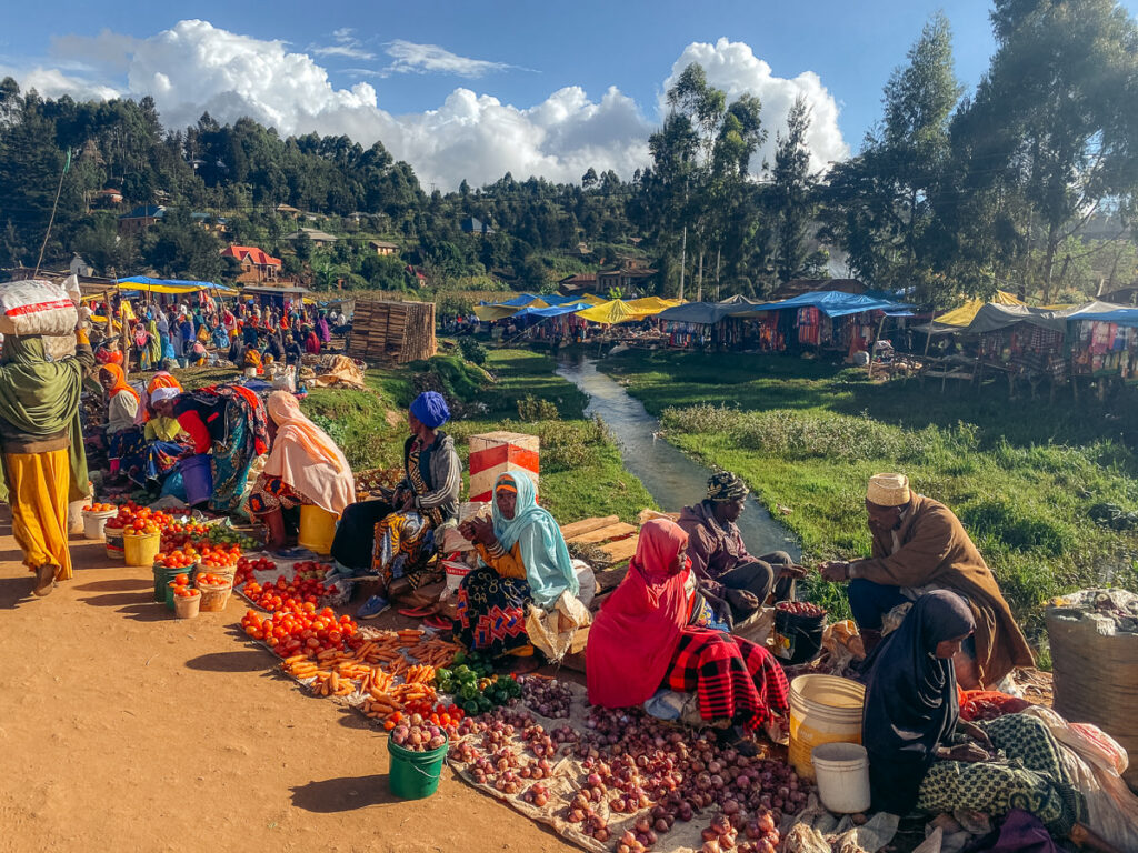
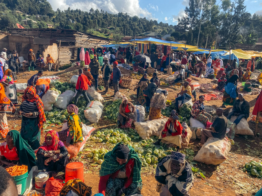
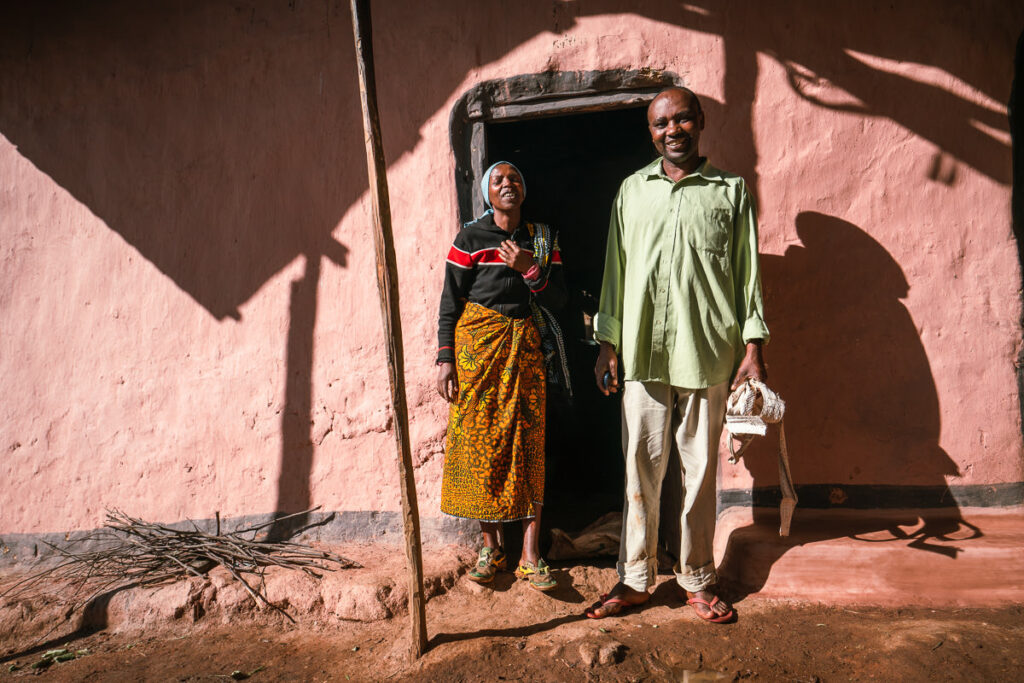
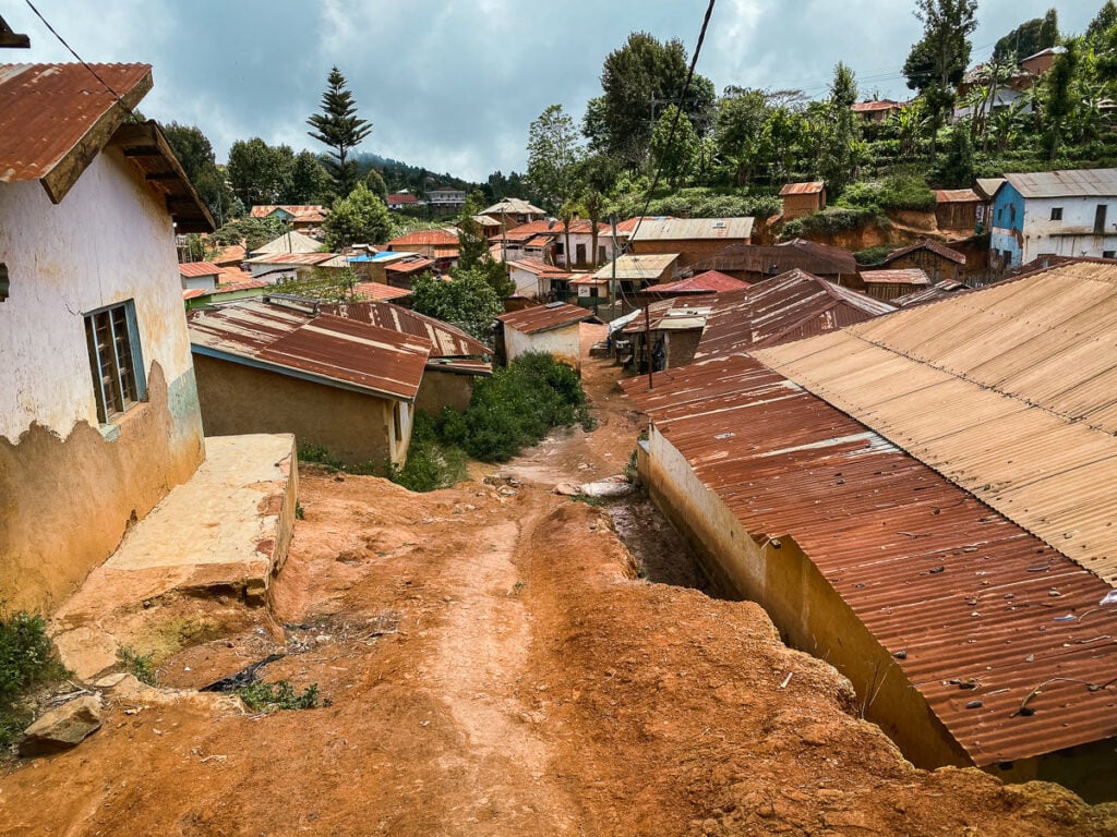
There was lots of colorful action on a Monday evening in Lukozi with a bustling market down the main road. It was a bit intimidating to walk down the main strip, with literally a thousand people stopping to stare and talk to their mate as I marched on through. I’d not seen a single foreigner all trip to Usambara and it seemed they hadn’t seen one in a while either.
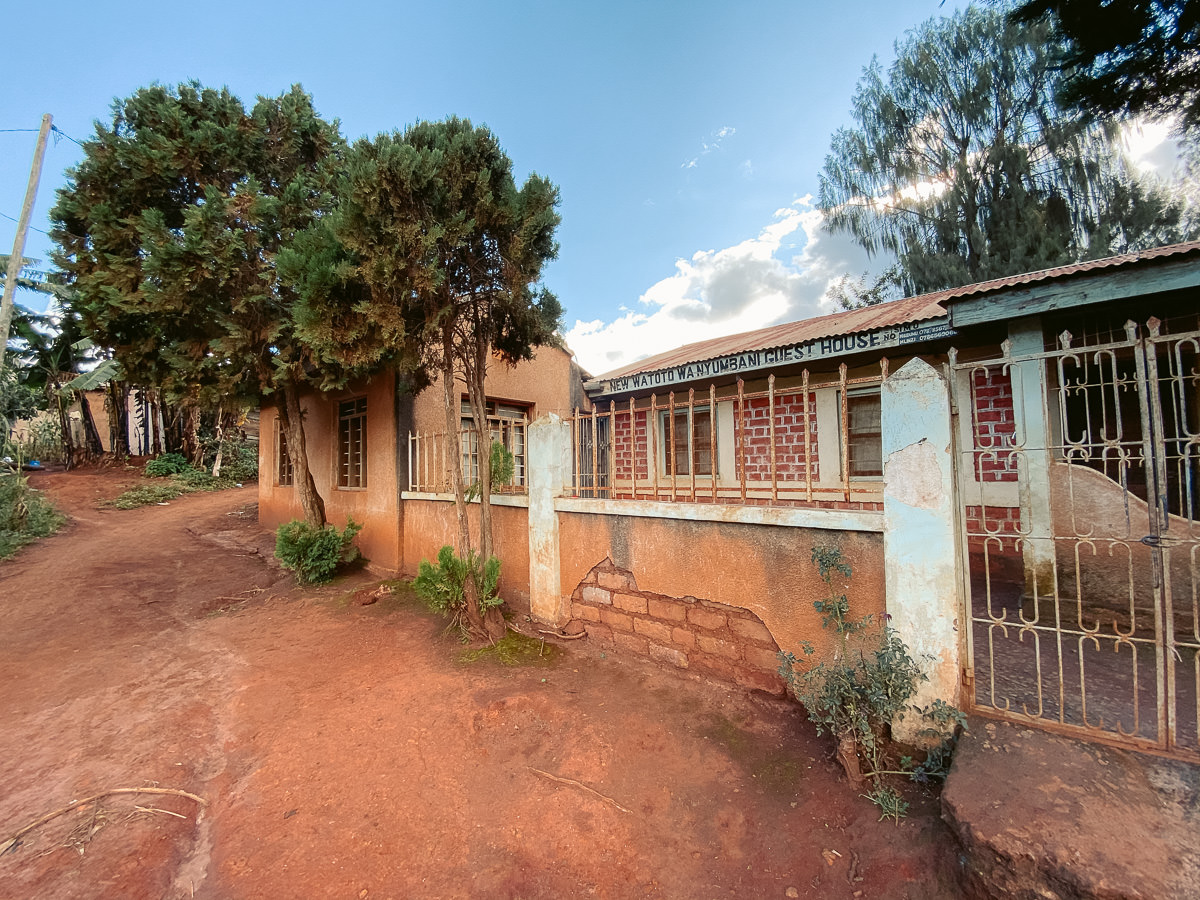
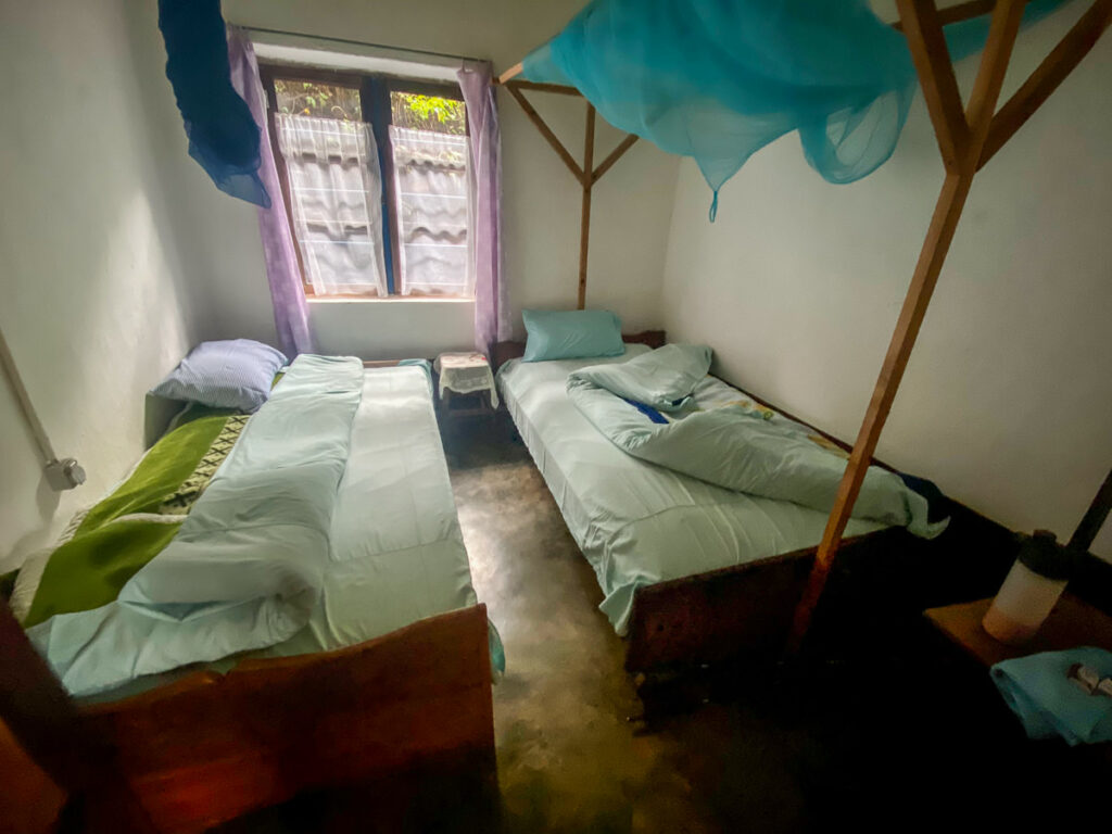
I found the New Watoto Wa Nyumbani Guest House just past the main street in the town. It’s one of only two places to stay in the town. For just $2 USD, I was allocated a private room with a lock and given a hot bucket of water to shower with. Pretty good if you ask me.
Expect some loud noises throughout the night up until 10 pm with prayers being blasted over the speakers for all to hear. Other than that it was a great night’s sleep and I was ready to go the next day.
Day Two: Lukozi to Rangwi
The sound of a rooster woke me just before my alarm was set to go off at 7 am. I skipped breakfast and grabbed five packets of cookies for 40 cents on my way out of town. I’d dip them into some peanut butter at a stop 5km into the journey.
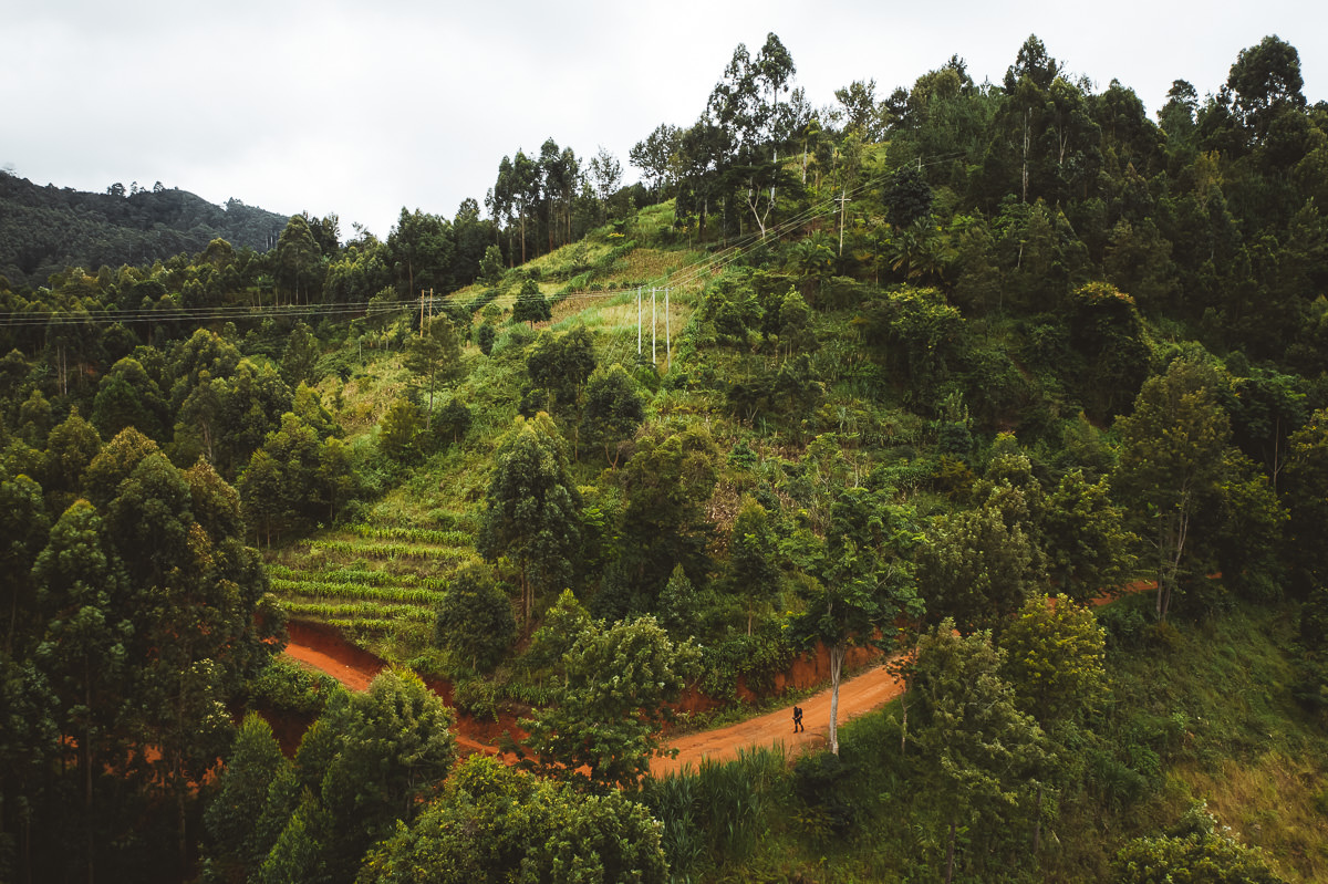
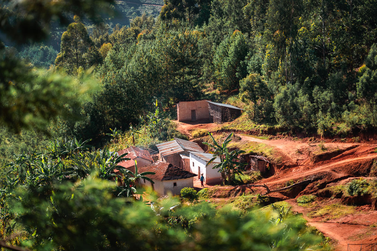
Today was much shorter with just 15km and 750m of incline to get through. All of the hills came early and after the sixth kilometer, it was all downhill. Compared to the first day of trekking, the trail stayed much closer to the villages. It was a mixture of single-track, road, and local path but rarely did a delve into a natural forest or field.
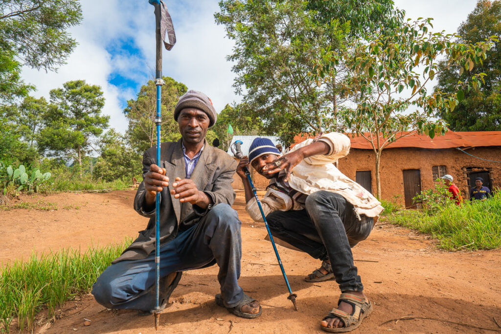
I met a few funny locals along the way who seemed to have a fascination with my hiking poles and camera. We hung out for a few minutes before they seemed to want payment for being such good models with my trekking poles. I said I’d buy a coffee but they only had some moonshine type of concoction. At 930 am, I passed on the homemade alcohol and pushed up the final climb of the day.
I really enjoyed this natural single-track that looked down over the village I had been through earlier in the day. I had breakfast here, enjoying some peace and quiet.
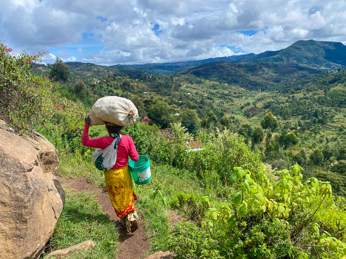
Similar to day one, I had a downhill journey to finish the day and passed alongside many villages including Longoi. I found myself behind a lady carrying a huge sack of apples on her head as well as a bag slung around her back. She dropped one apple then another. I managed to find them and handed them back. Graciously, she offered me one and I accepted.
I had to work to keep pace with her despite the fact she was balancing a huge sack of apples on her head. She suddenly stopped and let me past, gesturing to me with another apple. I accepted again but took out my wallet and gave her 200 Tanzanian Schillings (20 cents USD). She was very thankful and gave me five baby apples to fuel me on my journey.
I arrived at Rangwi around midday after making good time on my journey. It had been a recommendation to stay at the Nun’s convent. I’d never done something like that so thought why not?
I walked into the complex and a few people were staring but that’s normal. A nun at the top of the stairs welcome me in English and before I knew it, I had a room for 35,000 Tanzanian Schillings (13 USD) and coffee served. Lunch, dinner, and breakfast were all available although quite simple. Lunch was seasoned potatoes and carrots, which sounds basic but it was quite nice and filling.
With tired legs, I relaxed and reveled in the fact that I’d beaten the rain. It began pouring just minutes after I arrived and I was very glad to watch the storm from the comfort of the patio while reading a book.
Big kudos to the sisters at the convent for putting on one of the best roasts I’ve ever tasted. One of the best meals I’ve had in Tanzania.
Day Three: Rangwi to Mambo
After a few days on the trails, my legs are well and truly warmed up now. Today promises just 15 kilometers em route to Mambo View Point Eco Lodge. I could push through to Mtae but I’m keen to check out Mambo View Point and Shagayu Forest tomorrow.
Today’s route passed through village roads and never delved into a forest. Was constantly amongst locals who walked to and from school, farms, and work. Everyone says hello on this trail and it’s been a great atmosphere so far for a traveler in Usambara.
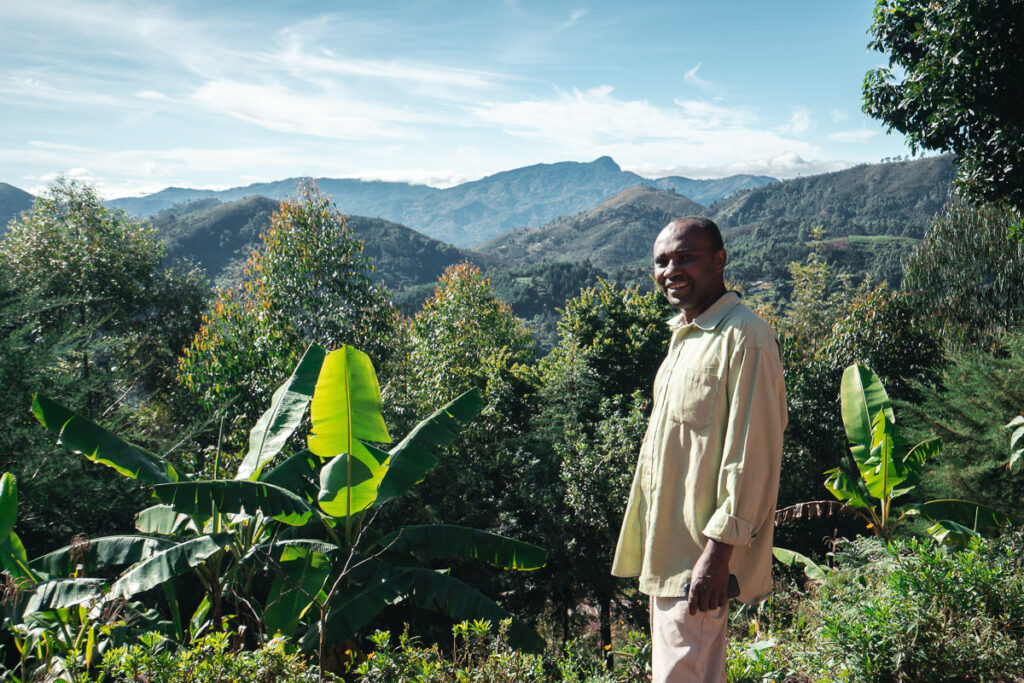
I met David, a chairman of a local village, on the trail. He explained a lot of facts about the region and then when we got to the turn-off for his home he wanted me to come and meet his wife. A small detour had me perched up at his house, which had an excellent view. He wanted to give me something and tried to rip some corn straight from his farm. I told him to save it and went on my way, thankful to chat to such a knowledgeable local.
Just before arriving at Mambo Village, I passed through a vast landscape of man-made forests. Here, I encountered two more chameleons that were right in the middle of the path. These two were off into the trees before I had time to whip out my camera so I continued on my way into the town.
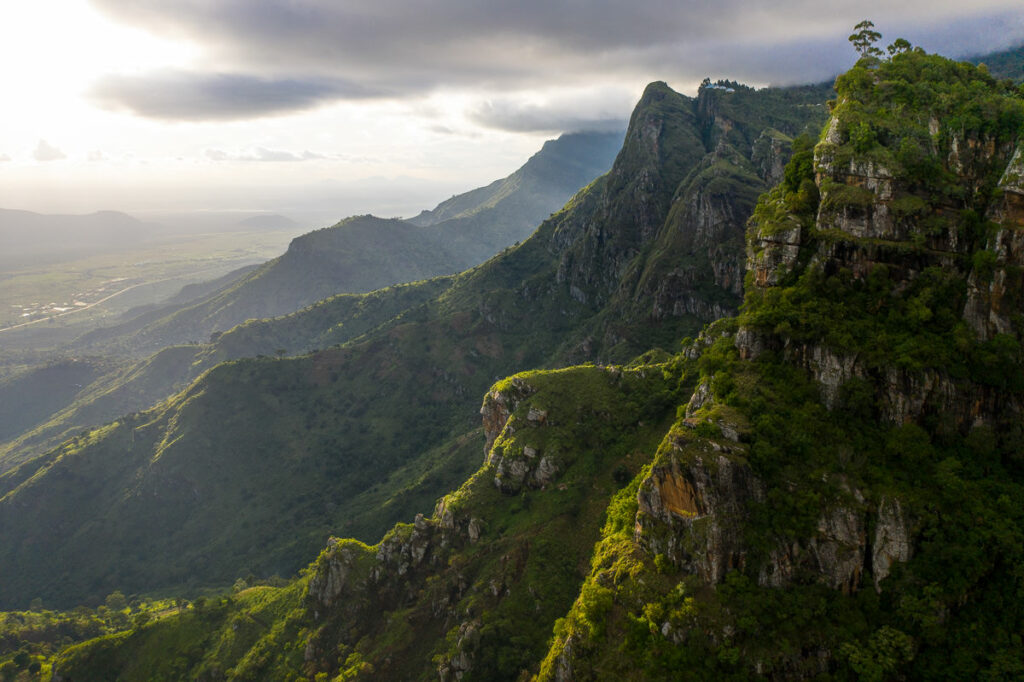
I reached Mambo Viewpoint Eco Lodge in the late afternoon and took some time to enjoy the incredible view from my room. The sun was out and I was happy to be so far into the journey.
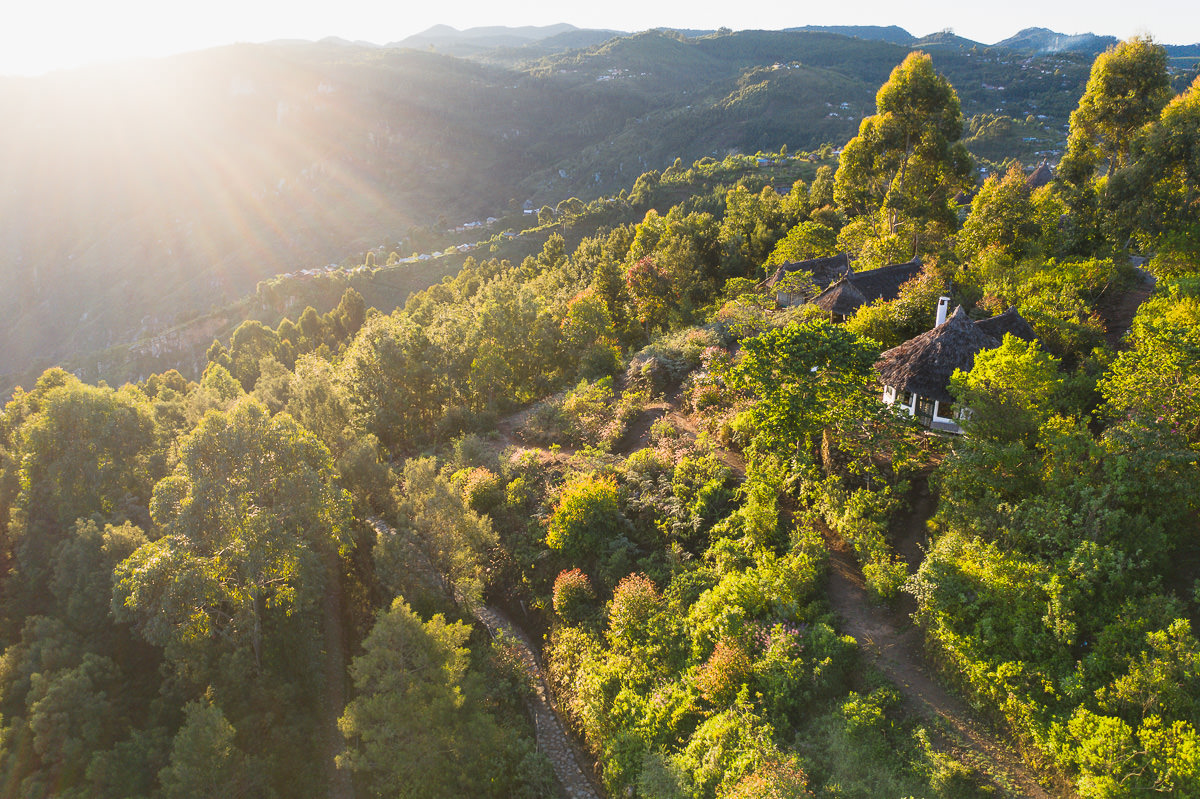
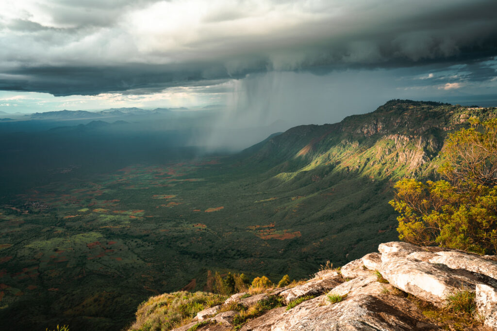
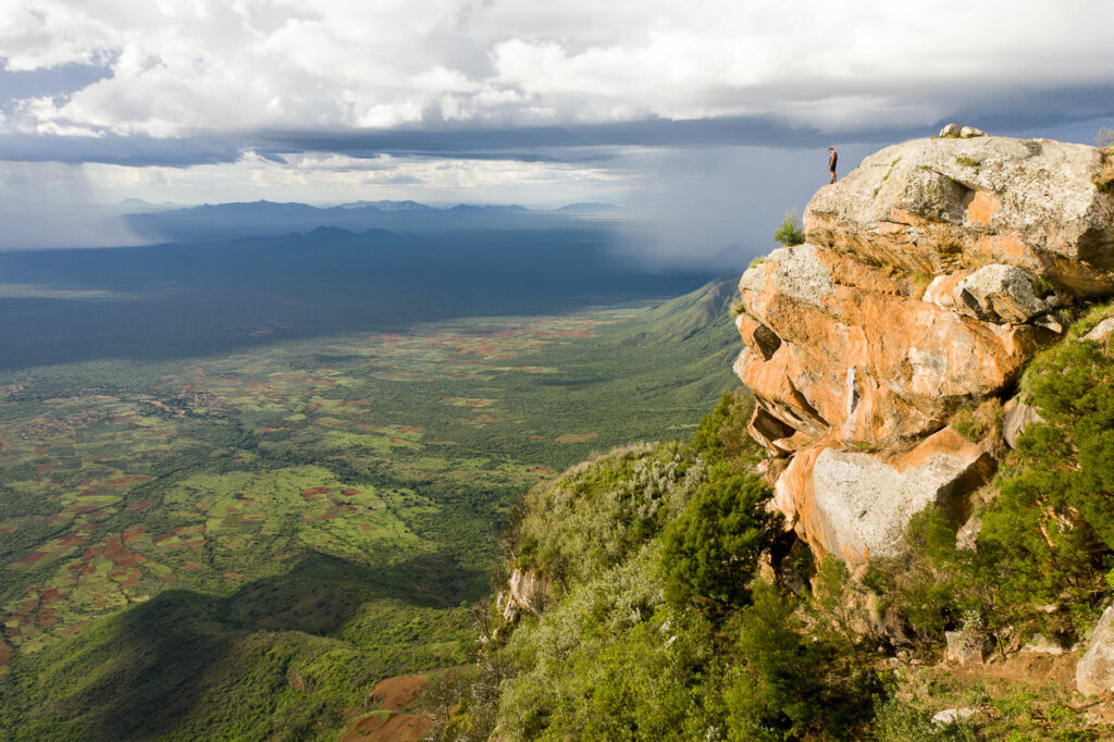
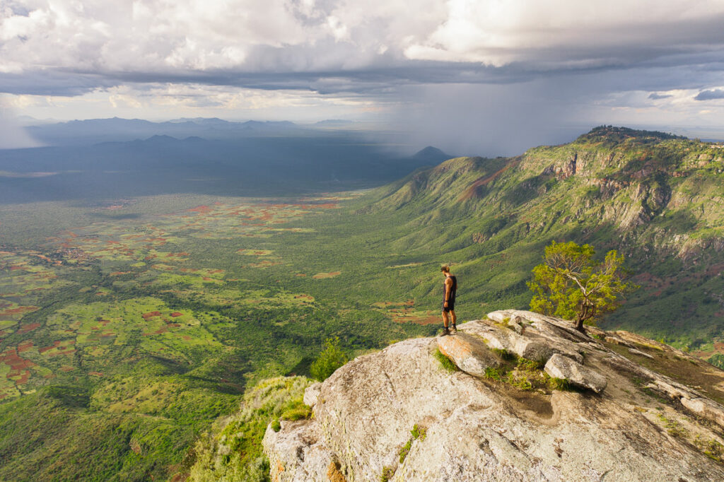
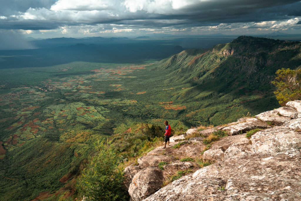
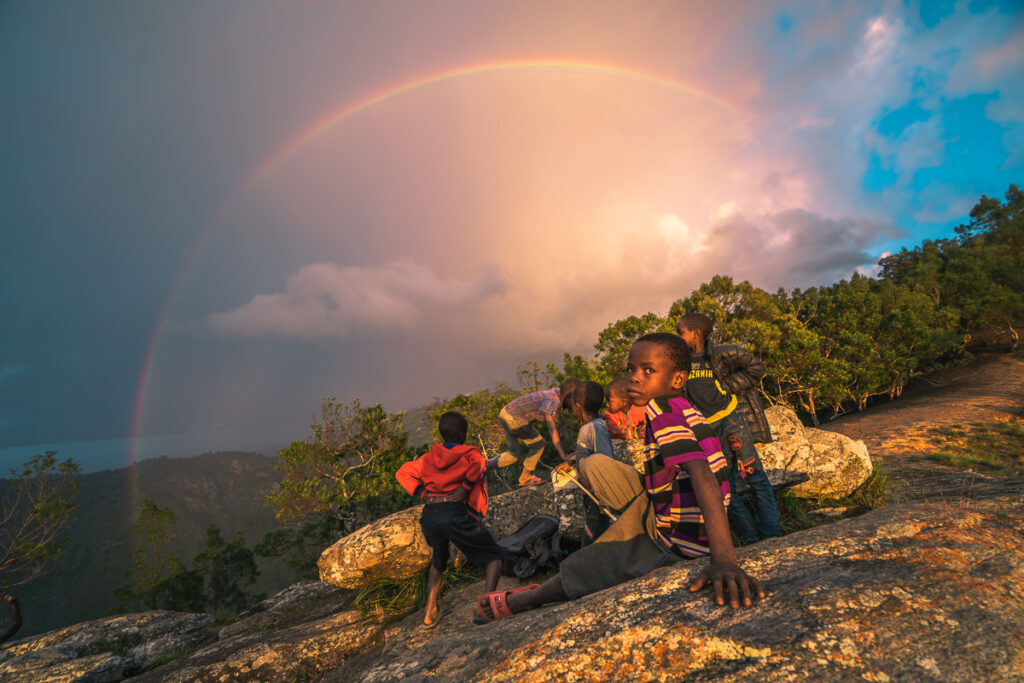
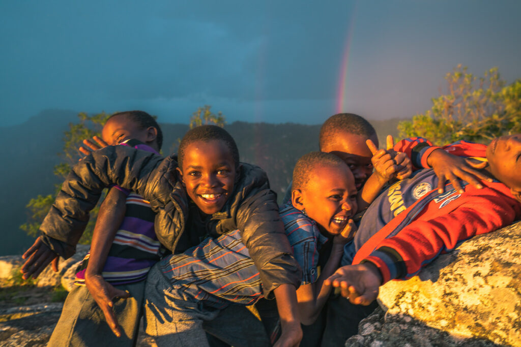
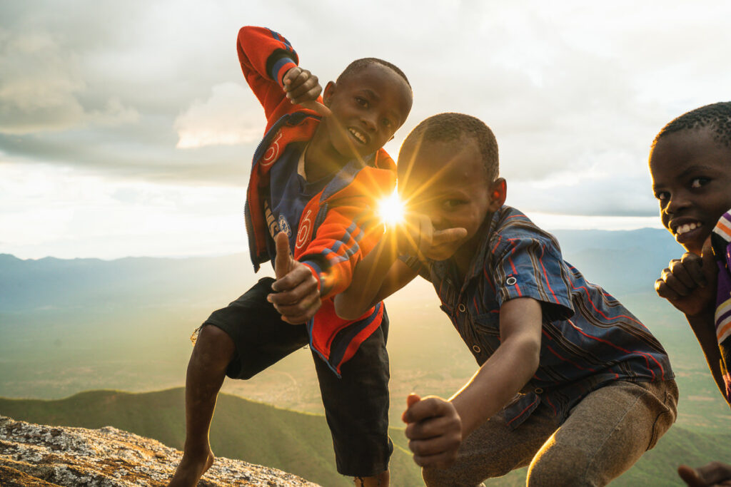
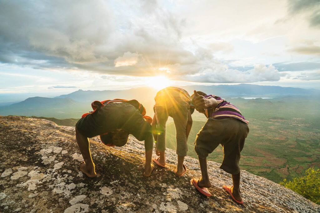
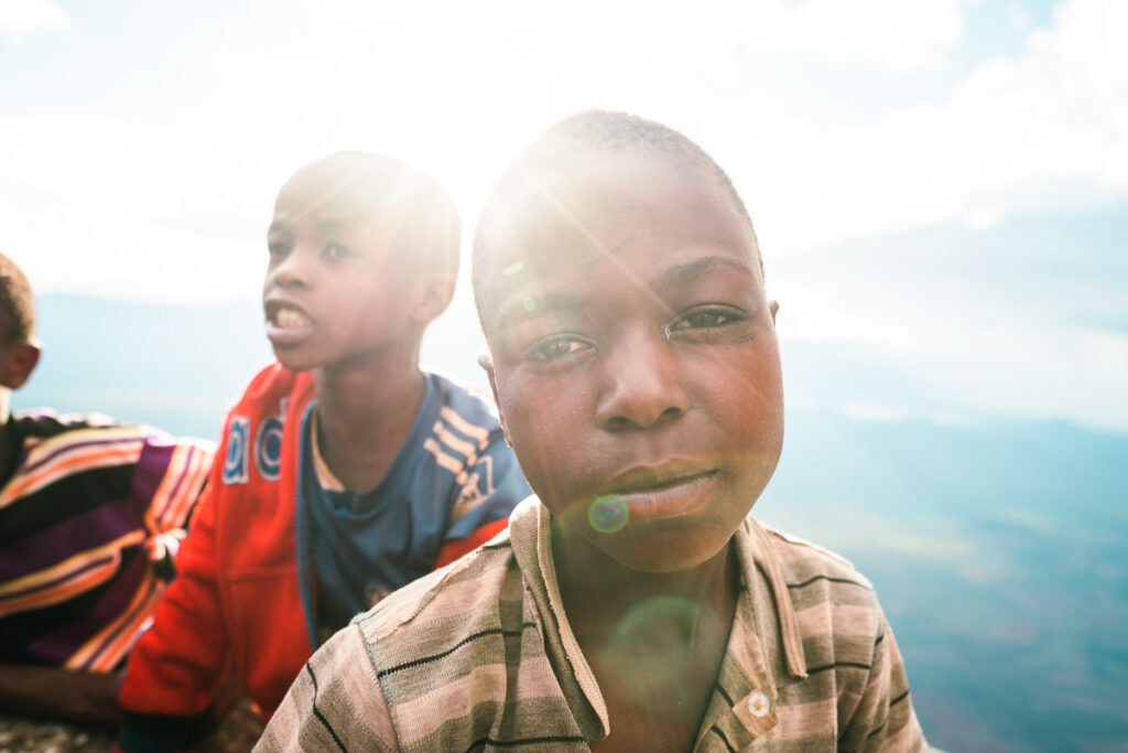
The best viewpoint in Usambara is just a short walk from the lodge. Mambo View Point is truly incredible and even topped Irente View Point in my opinion. I hung out here for a couple of hours with some local kids who were herding their goats.
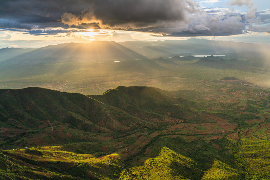
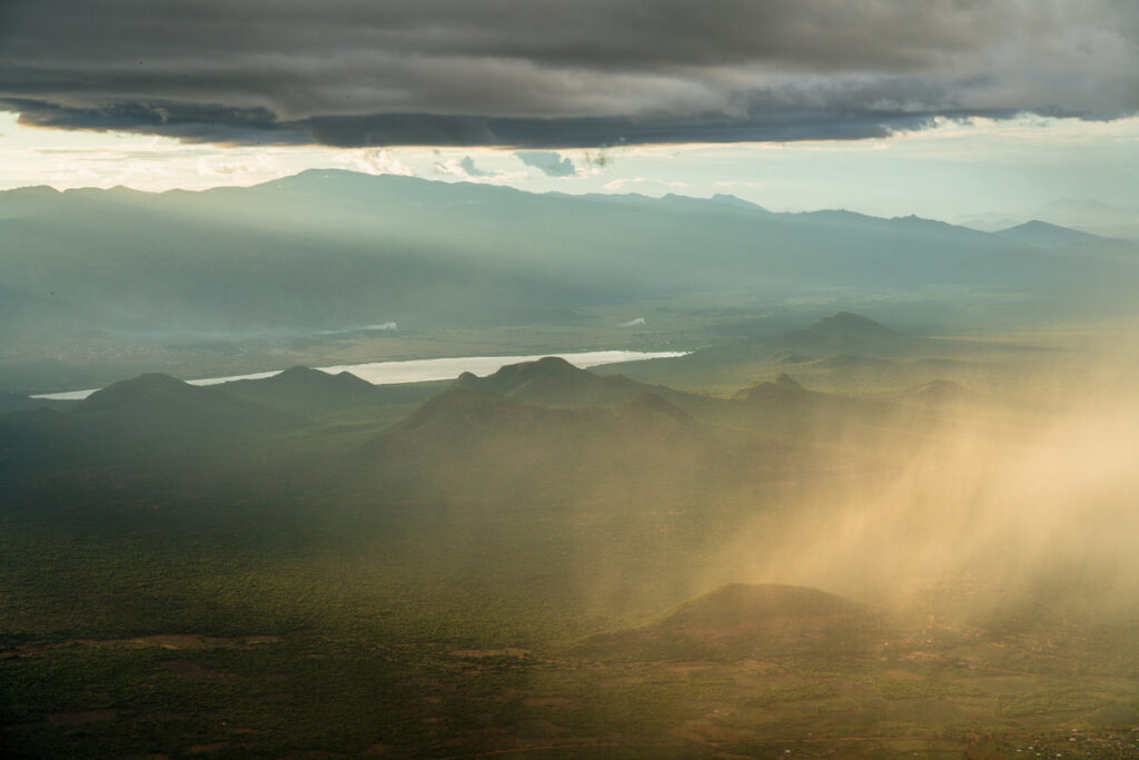
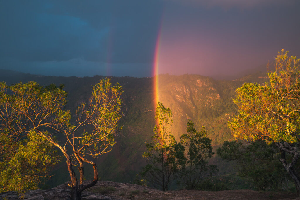
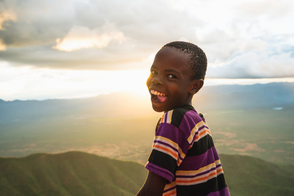
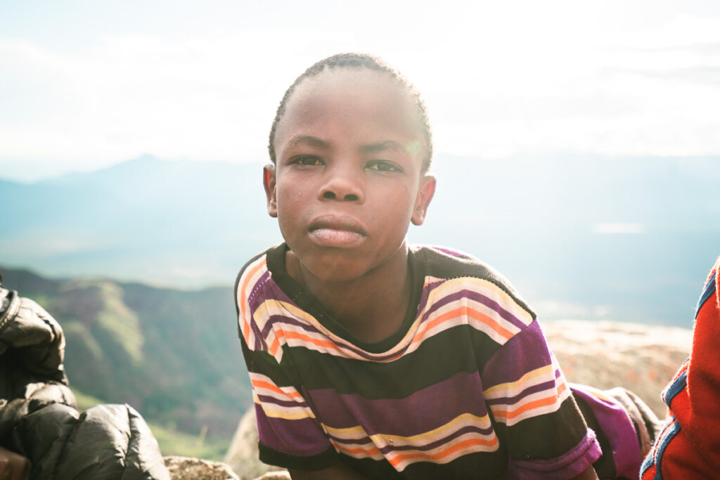
As you sit on the rocky viewpoint you have the ridge of Mtae to your left and the vast plains out before you. The sun sets directly over the plains making this the ideal spot to finish the day. Rain swept through in front of us creating a dramatic atmosphere with golden funnels pouring down over the plains. A rainbow and wide smiles from the young boys capped off an amazing third day of trekking

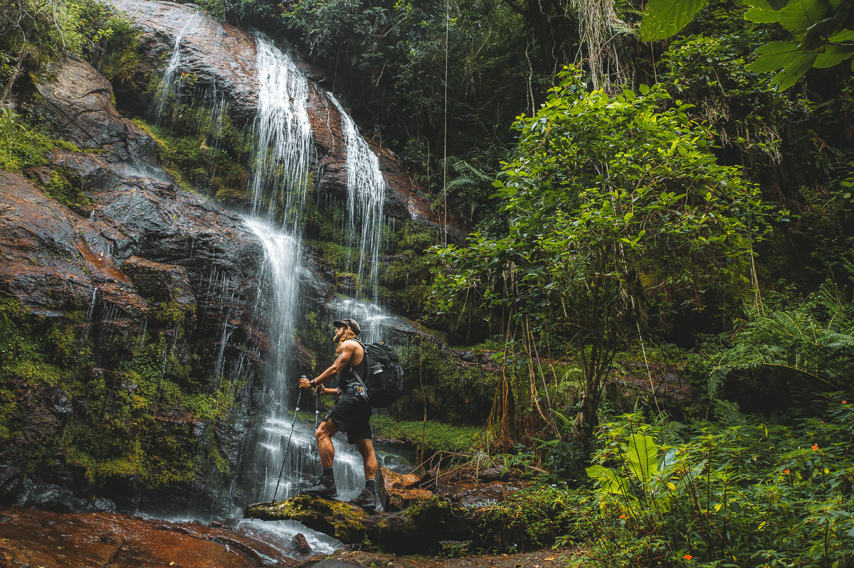
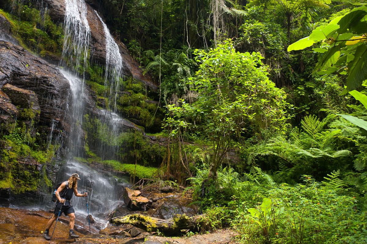
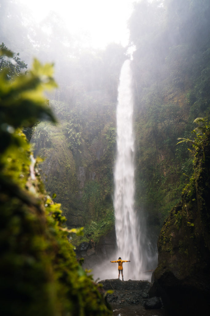
Day Four: Mambo to Mtae via Kidhege Falls
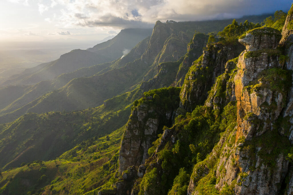
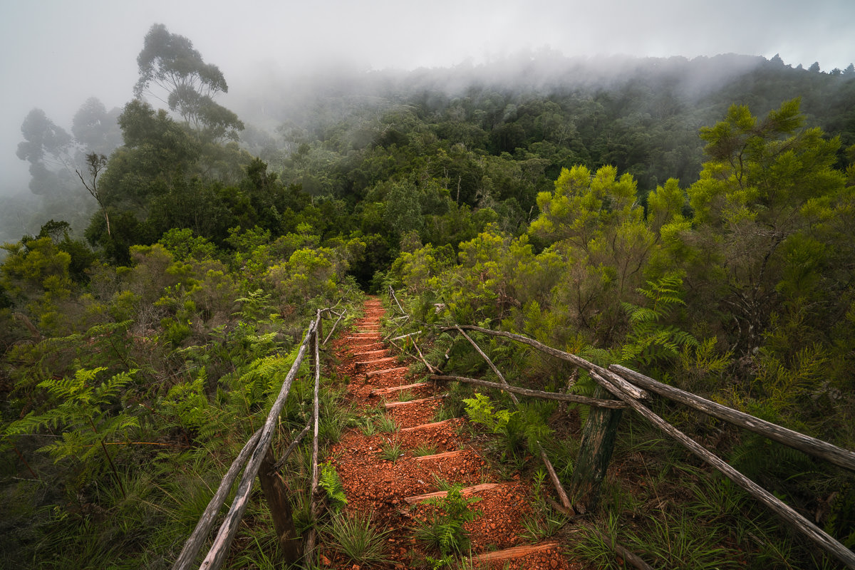
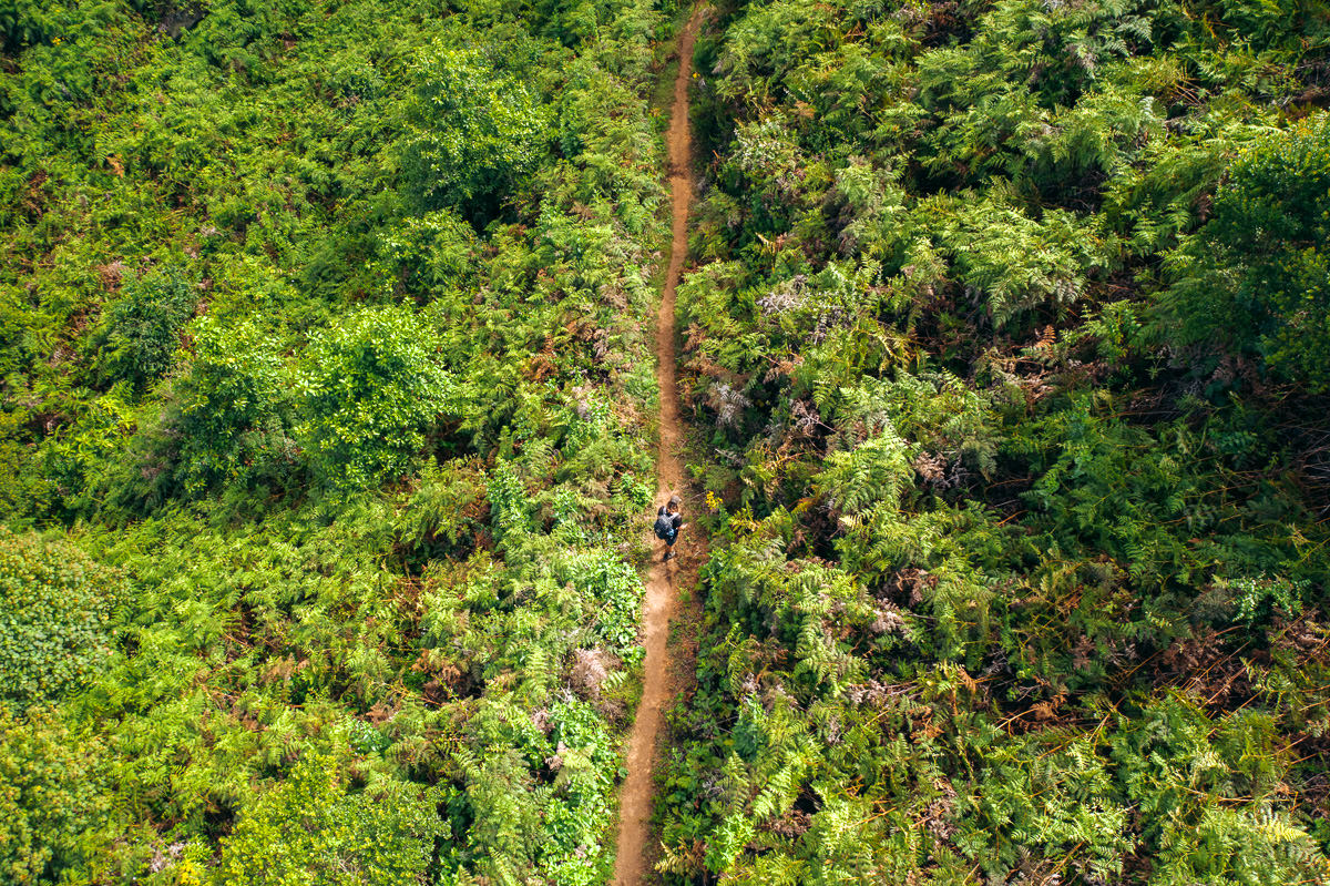
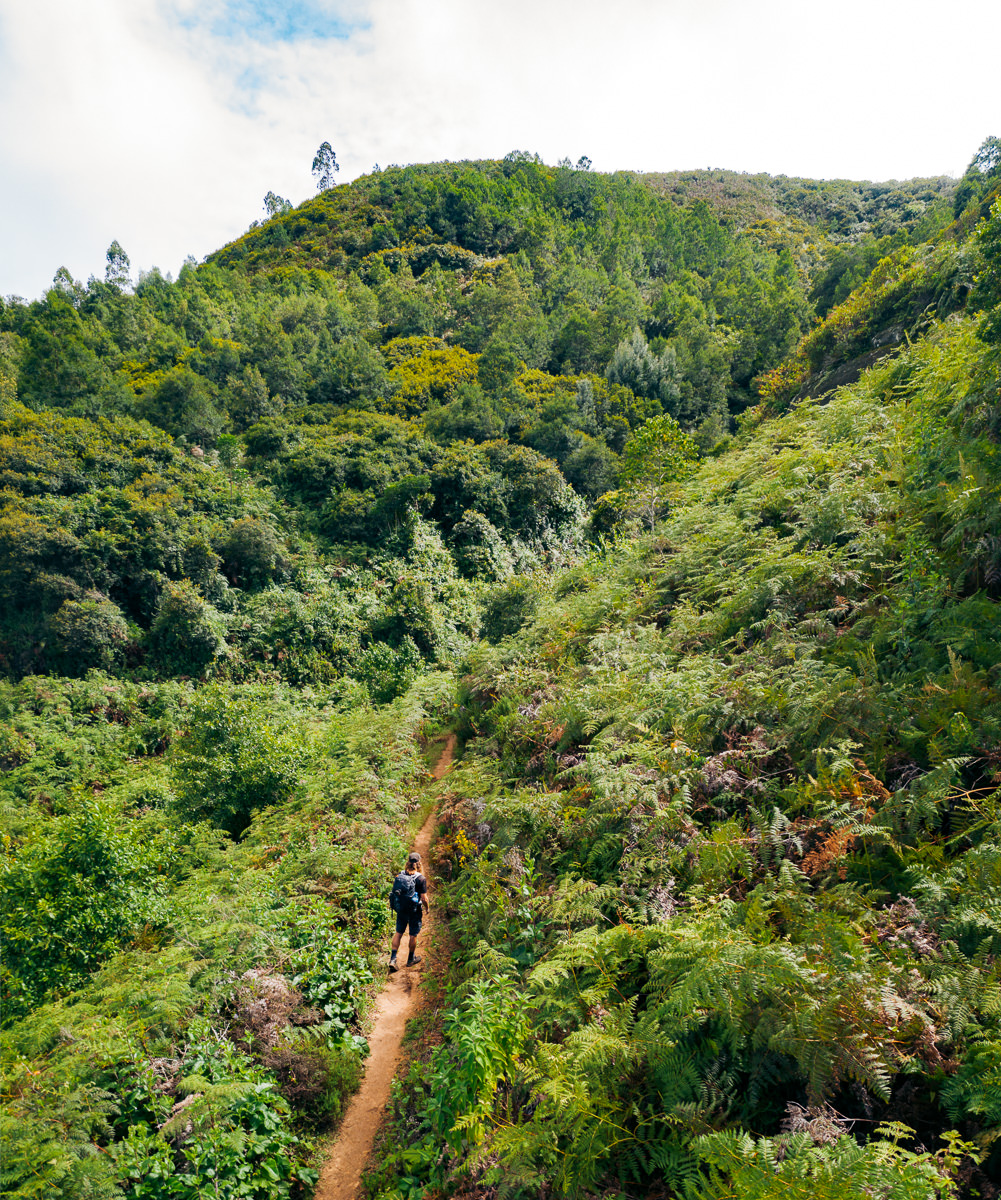
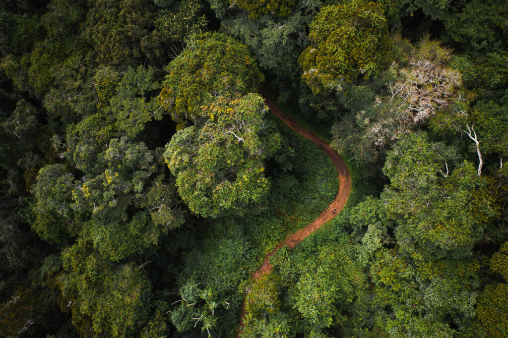
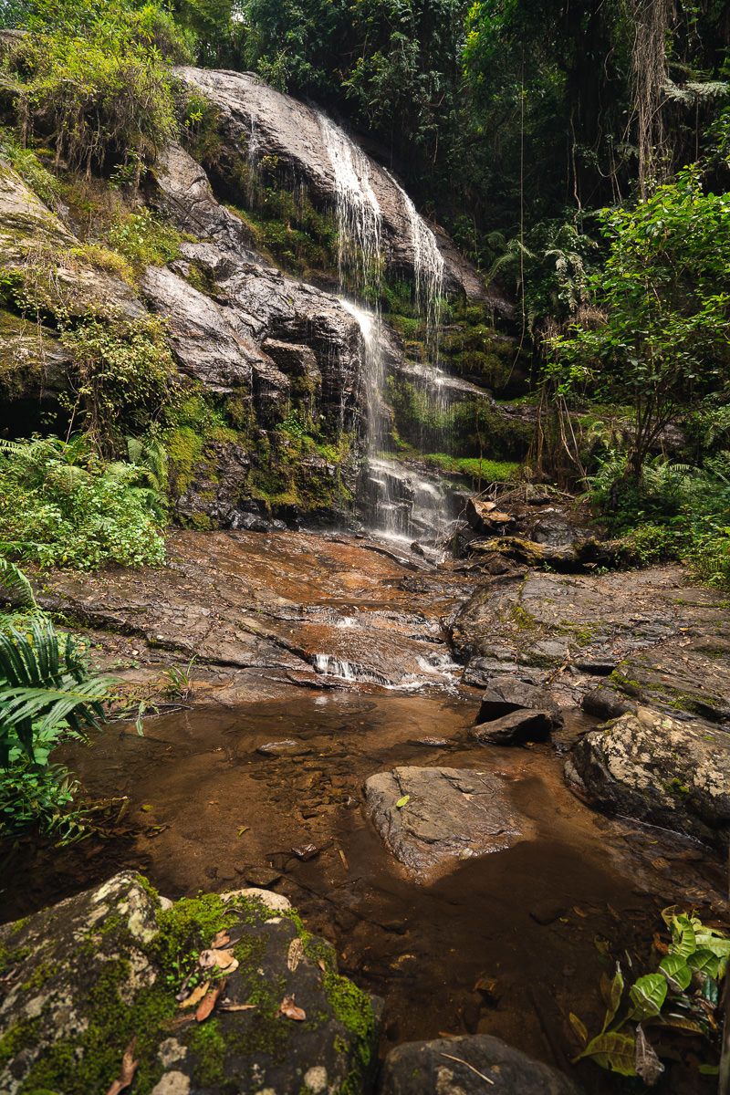
After three long days on the trail, the final day of my journey had arrived. Instead of just hiking the six kilometers along the road to Mtae, I decided to make a huge detour through Shagayu Forest to find Kidhege Falls. It’s highly recommended to do this walk with a guide but I felt confident in my map.
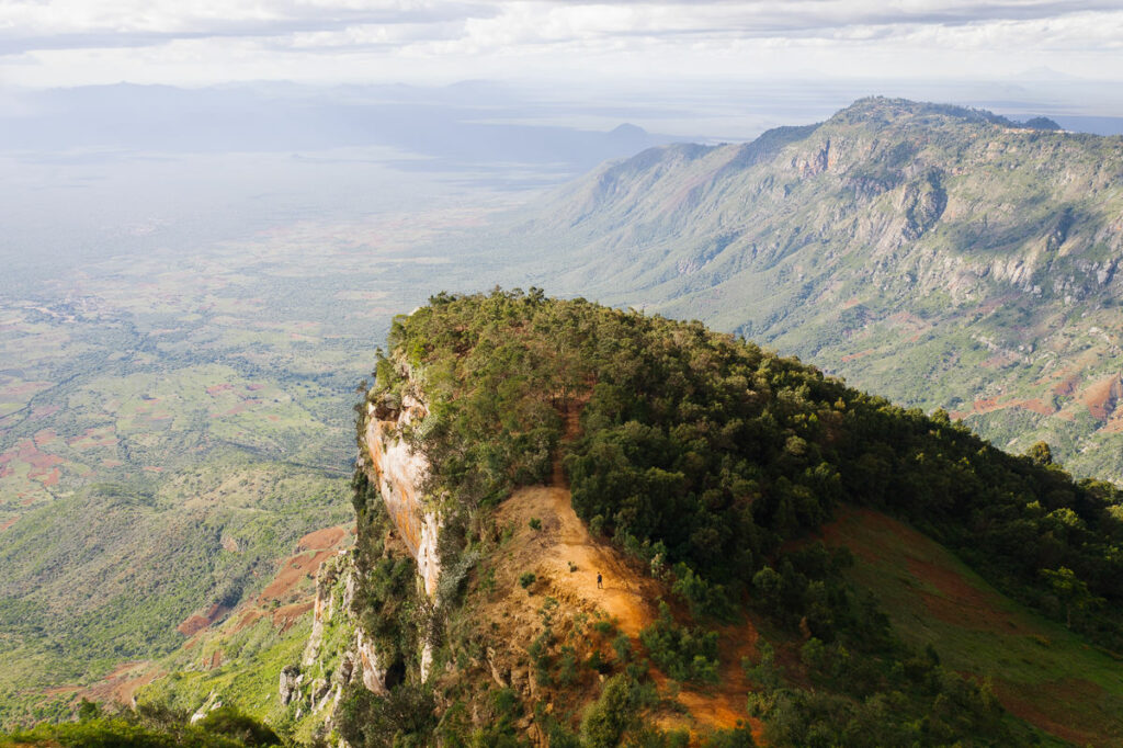
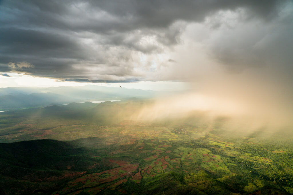
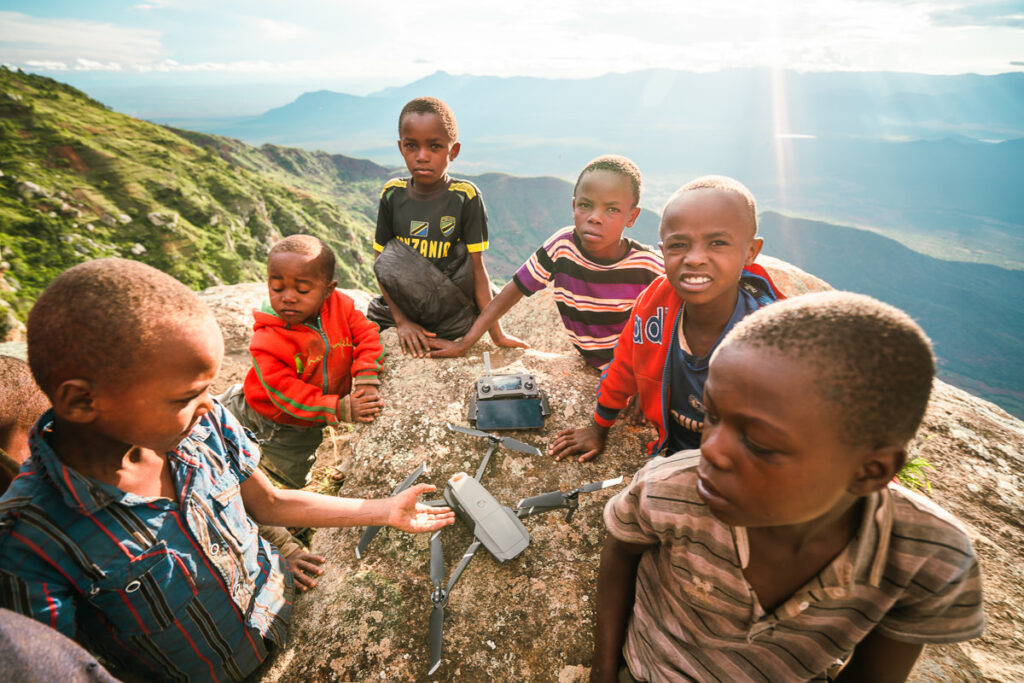
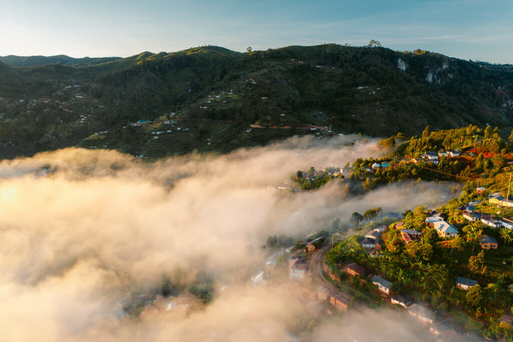
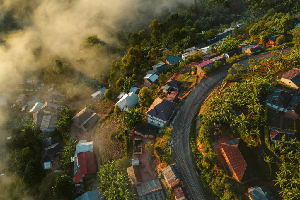
Before heading off I watched the sunrise from the lodge and had a quick aerial tour of the Mtae ridge nearby. The clouds filled the valleys on either side of the ridge and made for some incredible scenes.
The route turned out to be a pretty good choice and in total it took 6.5 kilometers to reach Kidhege from Mambo View Point and then another five to reach Mtae from the waterfall.
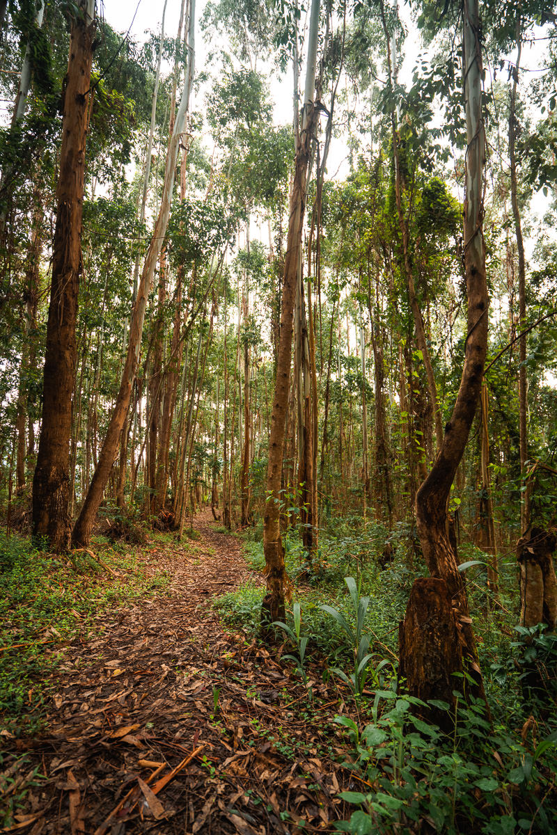
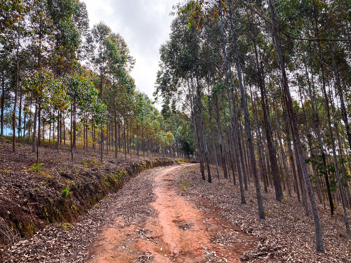
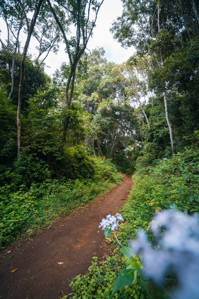
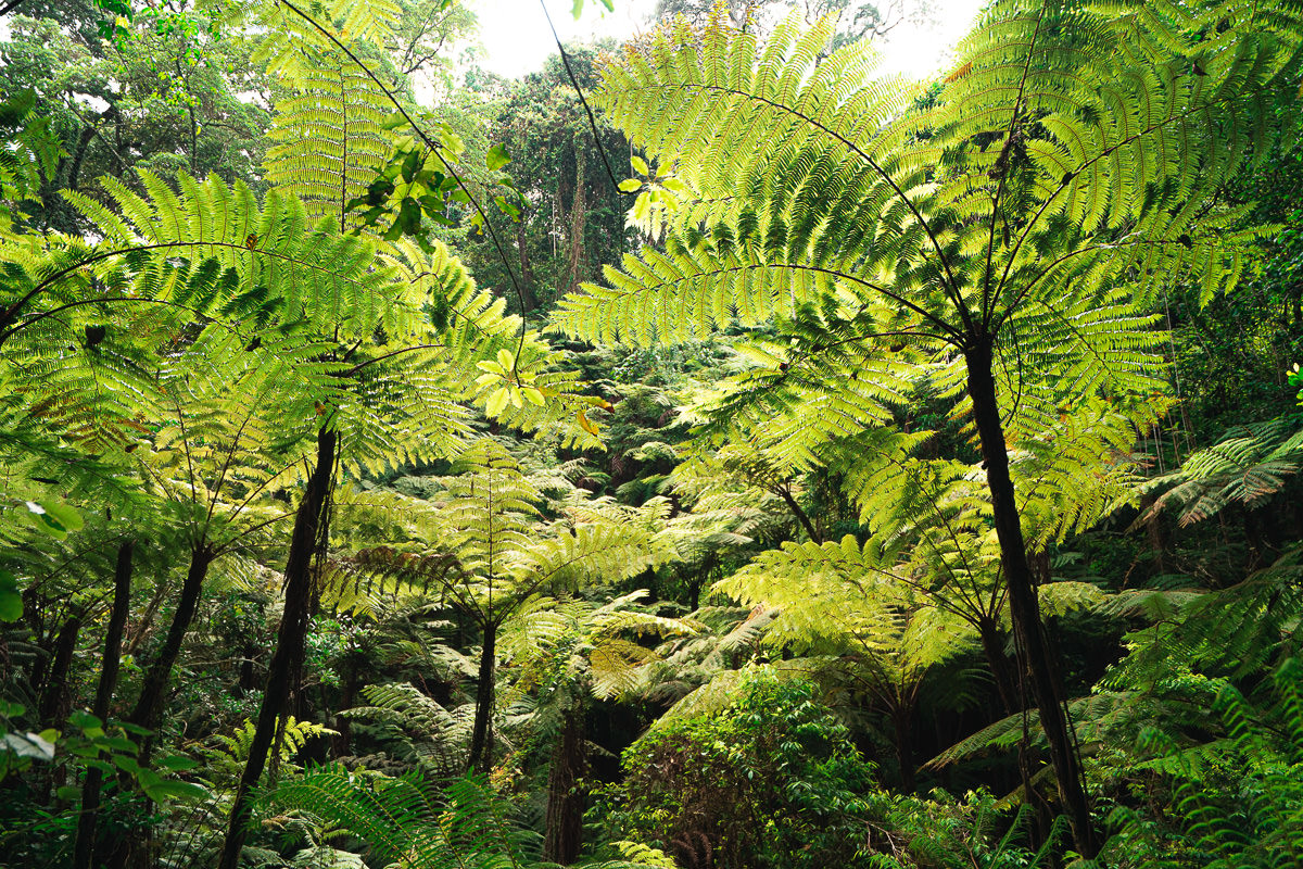
The route to Kidhege takes you through Mambo and down to Kwemtindi, where you will be passing through local neighborhoods, villages and then onto the forest plantations. There wasn’t much cover from the sun in these first few kilometers so I was happy to make it to the tree cover of the forest.
The turn off into the forest wasn’t very clear but I followed the path on the maps.me app and it led me up a dirt ramp and into the perfectly lined trees. I had a lot of trust in that map that day. Once inside the pine forest, you will stay amongst the trees for a couple of kilometers until the path really enters the more natural, wild forest and becomes a single-track route.
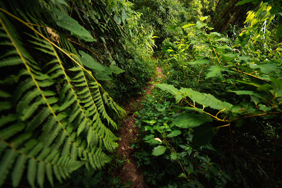
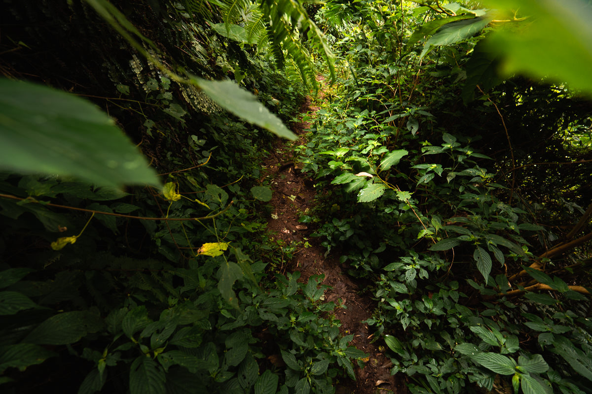
There is then a turn-off into the wall of ferns and trees that would surely be missed if not for the map or a local guide. It was literally a hole in a green wall.
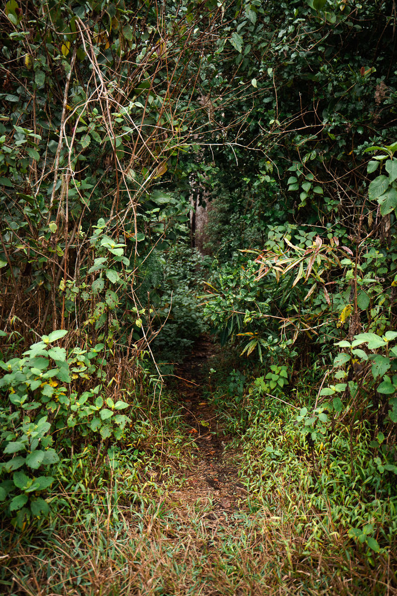
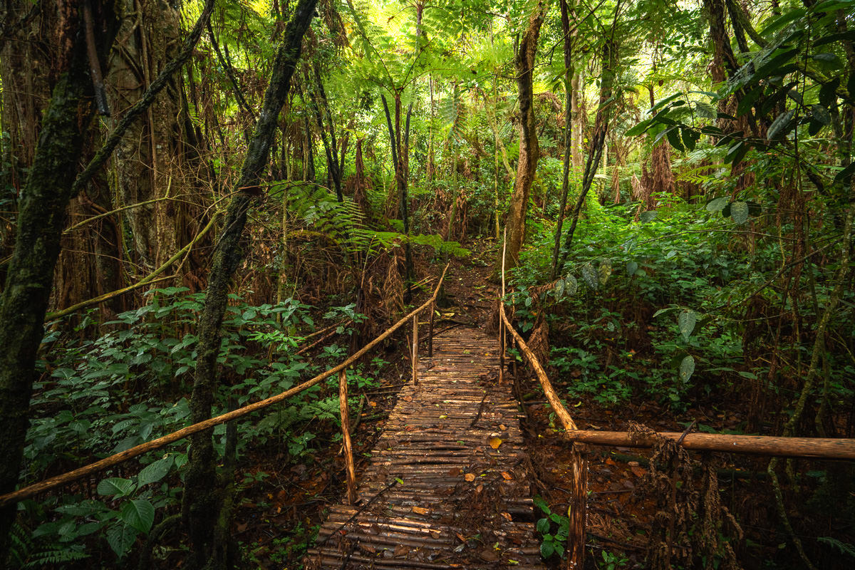
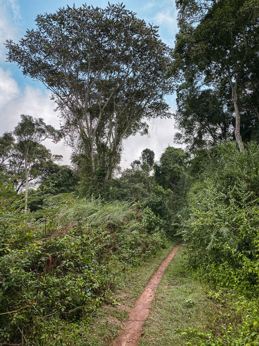
This hole in the wall led me along a dense forest trail that would not relent for the next hour as I squeezed through the narrow gaps, holes, and tunnels created by the thick bushes and ferns. I started to realize why no regular tourist would come in here without a guide. I kept a very close eye on my GPS location in relation to the trail so that I never got far off the path.
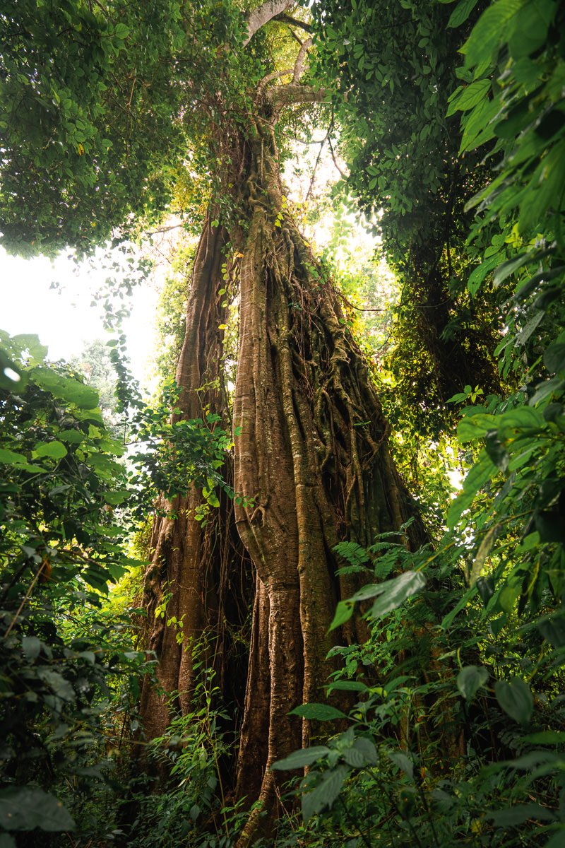
Every now and again I would reach a small clearing and come across a huge tree, so high I couldn’t see the top. This truly was a forest rich in diversity and unique species. I was loving every minute of it.
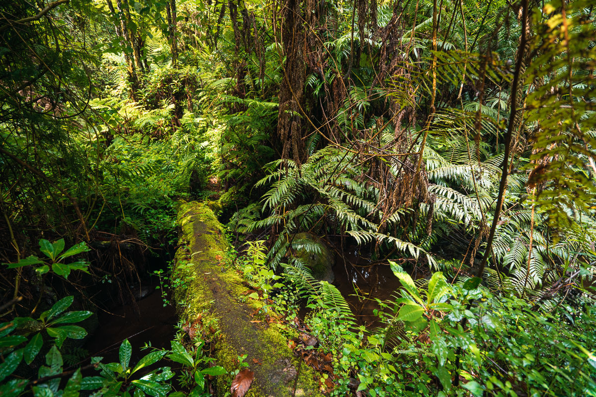
After the warnings of needing a guide and the intense nature of the trail, I was both stoked and relieved to make it to Kidhege Falls without getting lost. I was the only one there and sat down upon a big rock to take in the entirety of this peaceful spot. What makes it so magical is the lush surroundings and how dense the forest is throughout the journey to the falls. I had lunch, basked in the sun took a few photos and moved on to the exit part of my journey.
The route out on the Mtae side was much less intense and I imagine this might be the side a tour guide takes those wanting to reach the waterfall in the simplest manner possible. I highly recommend the Kwemtindi side if you are up for the adventure. I made a few wrong turns on the way out to Mtae but managed to re-join the road and wound my way up the hill to reach the small ridge village of Mtae and complete my 82-kilometer trek from Lushoto to Mtae (with a few detours) in four days.
I did go out to the end of Mtae looking for a viewpoint I saw on maps.me but I didn’t find much and ended up accidentally walking through a school. I had a chipsi mayai and a coca cola in town to celebrate my journey and then headed in for the night at Mwivano Lodge. The lodge was very basic but I had a clean room with a lock and key to go with a cold shower so I was sorted. for $4 USD a night you have to be happy with that.
I booked my ticket for the bus the night before to secure a seat with extra leg-room. It left at 5 am the next morning and ended up taking 12 hours to reach Arusha, which was a fair journey but that’s how it goes. The bus stops all the time and sometimes even waited at the station for 30 minutes or more. At 6 pm I arrived back in Arusha and walked back to the hostel to complete the entire loop door-to-door.
I can’t recommend this trip enough. It’s one of the few treks you can do in Tanzania without a ranger or a guide and that changes the dynamic, interactions with locals, and overall experience. I found it very, very safe and the viewpoints were beautiful. If you have any questions about the hike just shoot me a comment below or an email to [email protected] and I’ll be happy to help. Enjoy your hike!
TANZANIA TOUR COMPANY I TREKKED WITH
I did almost every single one of my treks, tours, safaris, and transfers with Altezza Travel. The guides and drivers were always well trained and on time with high-quality gear. They offer a wide range of tours, treks, and activities including climbing Mount Kilimanjaro. If you book any safari, tour, or trek with Altezza Travel and use my code JACKSON5, they will give you a 5% discount on the entire tour price.
MORE TANZANIA BLOG POSTS
- For the mountain lovers: 14 BEST HIKES IN TANZANIA
- The top waterfalls: 12 AWESOME WATERFALLS IN TANZANIA
- The must-do: CLIMBING KILIMANJARO: WESTERN BREACH ROUTE
- Tanzania’s second highest peak: MOUNT MERU CLIMB IN TANZANIA
- Best place to base in Tanzania: WHERE TO STAY IN ARUSHA
- What to do: 25 AWESOME THINGS TO DO IN TANZANIA
- My favorite solo adventure: USAMBARA MOUNTAINS
TOP 3 PLACES TO STAY IN ARUSHA
- Most Luxurious: Gran Melia Arusha – Incredible view of Mount Meru and premium 5-star luxury.
- Where I stayed on a budget: Wakawaka Hostel– Cheap, great location and chill vibes
- Best value place to stay: Tulia Boutique Hotel & Spa – very cheap price but has pool and high quality facilities and rooms.
Lorenz
Tuesday 27th of February 2024
Thank you Jackson for this great post and beautiful pictures! I have just done a similar hike and here's my comments:
This is a great treck for people who want to physically challenge themselves, especially on the first day. For anyone that really wants to enjoy nature and hike off the grid, I would definitely recommend to go with a guide - like Jackson ssays, 90% of us. Only with a guide will you see the beautiful spots and manage to stay away from the dusty roads that most of this treck is compiled off - not the most pleasurable thing for someone seeking refuge in nature and exploring the gems of Usambara mountains.
Also in Lukozi definitely stay at the Bush Baby Lodge rather than the lodge Jackson stayed in. It's a bit more pricey at 40,000 TSH (including a delicious & healthy dinner and breakfast!), but much more of a nature bliss and great space to unwind. The owner Godwin is a very nice guy from Usambara and helped me out getting back on the small trecks after a long dusty ending of the first day, his brother is a guide as well. (Godwin +255 788 611 318) .
Enjoy your explorations of Usamabara!
Jackson
Saturday 23rd of March 2024
Cheers, good tips!
Ray
Sunday 2nd of July 2023
Hello Jackson. Hope all is good with you. We greet you from Usambara mountain.
BOOK A TOUR WITH LOCAL ORGANISATIONS FOR SUSTAINABLE ECO CULTURAL TOURISM AND SUPPORT LOCAL ECONOMY.
In Usambara we have been running cultural tourism for such a long time and the world appreciate this initiative as it improve life of the locals in many ways such as provision of employment to young people who work as tour guides as well as environmental conservation using money obtained from the tour activities.
The government along with international organisation initiated cultural tourism programmes so as to fight poverty in local level and improve people's living standard and this is the world millennia goals to eradicate poverty in developing countries
By encouraging a tour without a guide in Usambara through blog posts you are discouraging and kill the entire sustainable cultural tourism in Usambara and all offices will be closed. All environmental care initiatives taken by these organisation will stop.
Remember tour guides works with registered local organisations which pays taxes and do a lot to the community. It does not make sense for a tourist to climb Kilimanjaro+ safari and pay 3000 USD and when he comes to Usambara does a tour alone to save 90 USD and take part in dicouraging and killing cultural tourism initiatives.
Now days we witness groups of tourist who hates tour guides and local organisations in Usambara so as they can do trip on their own without a guide or local office and as a result it creates a gap between locals and foreigners.
This started soon after blogers started writing about Usambara that you don't need a guide for cultural experiences which is not true meaning for the cultural interaction .
Dear bloggers You can not easily understand the negative impact you have caused to the Usambara community whose daily life depend on tourism through your posts. The wearer of the shoe knows where it pinches.
Some professional tour guides of Usambara are now moving to other urban areas to look for jobs out of their professions some are now motor bike riders working as taxes, these are some of the negative impacts.
We know blogers make money by using blogs as you promote others people's business ,get followers but we kindly ask you to appreciate the initiatives of the locals and let tourists decide on their own on what to do rather than reading on blog which mis lead them on how to do things they way they did.
One tourist got lost in Magamba forest after reading the blog post and then asked for our support to go get him out.
Sometimes we go discovering beautiful routes to connect villages and attractions but once blogers are familiar with these routes they start promoting them as guide free route without even appreciating the work of those who sweat for that. Now we realized that our enemy is not the tourists but the blogers who make money online by sharing informations. THANKS.
Kibungi
Sunday 2nd of July 2023
Hi Jackson, Thank you very much for your good write up about Usambara hiking. It has been more than 20 years now since Usambara local Guides started promoting this Sustainable Eco and Cultural Tourism. This sector is growing and already more than 50 local Guides are benefiting on it. This means, your write up that recommending tourists to do the Hiking without hiring a local Guide. This will totally eliminate the employment of all these Guides and even for those who are now in collages expecting Guide as their future job. Further more, we are very happy to receive big numbers of tourists in Usambara mountains but we are not happy to see tourists doing Hiking without hiring a local Guide. I would like to ask you to edit your write up and stop recommending tourists to do Hiking without a Guide. This will not only create unemployment to the local Guides but also will force them to find out other ways of getting income which might be criminal ways hence will end them in jail. And, the safety of the tourists as well should be endangered.
It is all my hope that you will take this as a serious case and edit your blog to direct way of recommending local Guides. I know you get some income out of this blog but think of the local Guides plus their entire families.
Thank you.
Kibungi. 0687759599
Simon
Wednesday 15th of March 2023
Hi Jackson, Thank you for your recommendations. I appreciate that. Have you booked the lodges in advance? And what was the exact date of your trip? Did it rained a lot? And was there any danger of a gale or something like that? Greetings Simon
Margaret Eldred
Saturday 21st of May 2022
Loved reading about your trip. We took approximately the same route about 20 years ago, and your description brought back many wonderful memories. We also stayed at the convent and had banana wine at dinner. We did have a really good guide named Christina Pamphil. She introduced us to many locals, including a traditional healer and some potters from Mgubai. Your description made me want to go back again.
Kibungi
Saturday 1st of July 2023
@Margaret Eldred, Thank you very much for your good memories about the Hiking you did with our Guide Christina. You can imagine from 20 years ago to now, how many Guides like Christina have inspired by Tourism Industry and are taking advantage of the Sector as source of their employment. Further more, we are very happy to receive big number of tourists in the Usambaras but we are not happy to see tourists doing Hiking without hiring a local Guide. I would like to ask your favor to shout out to the bloggers who are directly recommend tourists to do the Hiking without a Guide. This will not only create unemployment to the local Guides but also will force them to find out other ways of getting income which might be criminal ways which will end them in jail.
Thank you very much for your help.
Kibungi.