
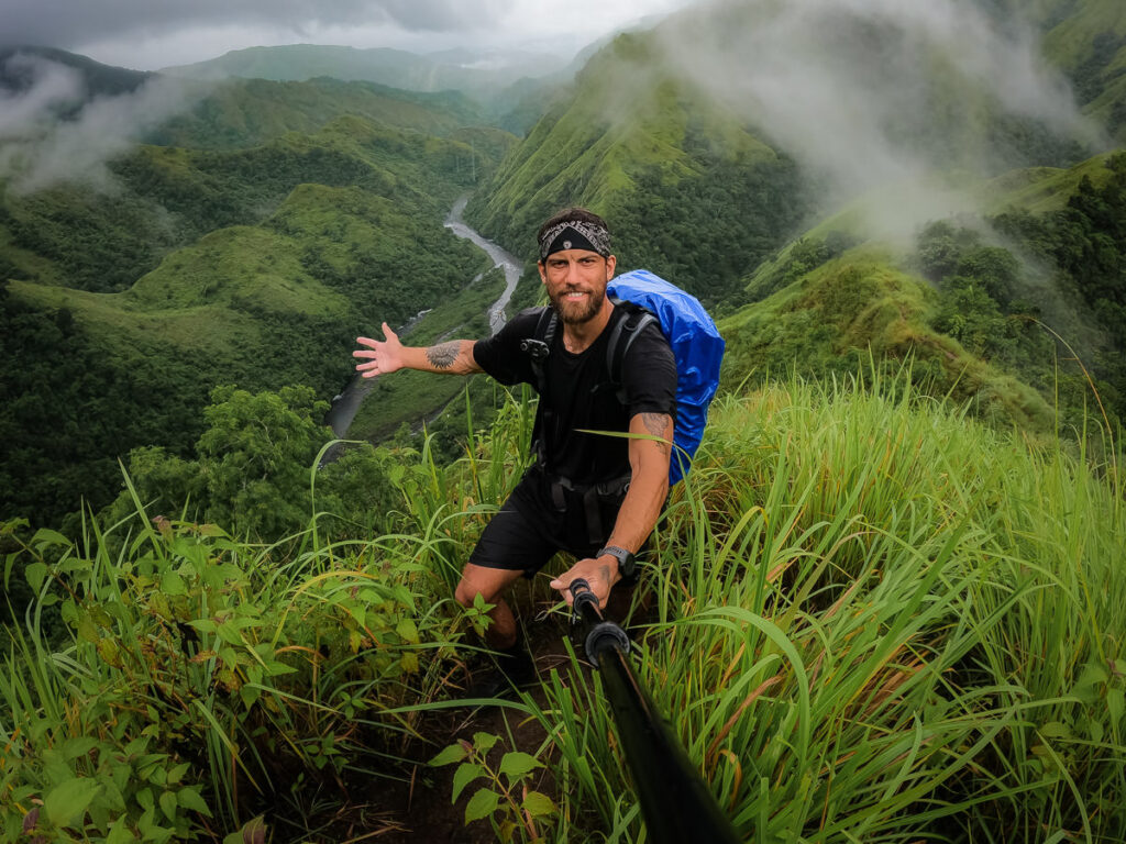
Mount Baloy is one of those adventures that push you to the edge of your comfort zone. It’s a steep physical challenge, but it’s the arduous conditions that make this one of the most challenging hikes in the Philippines.
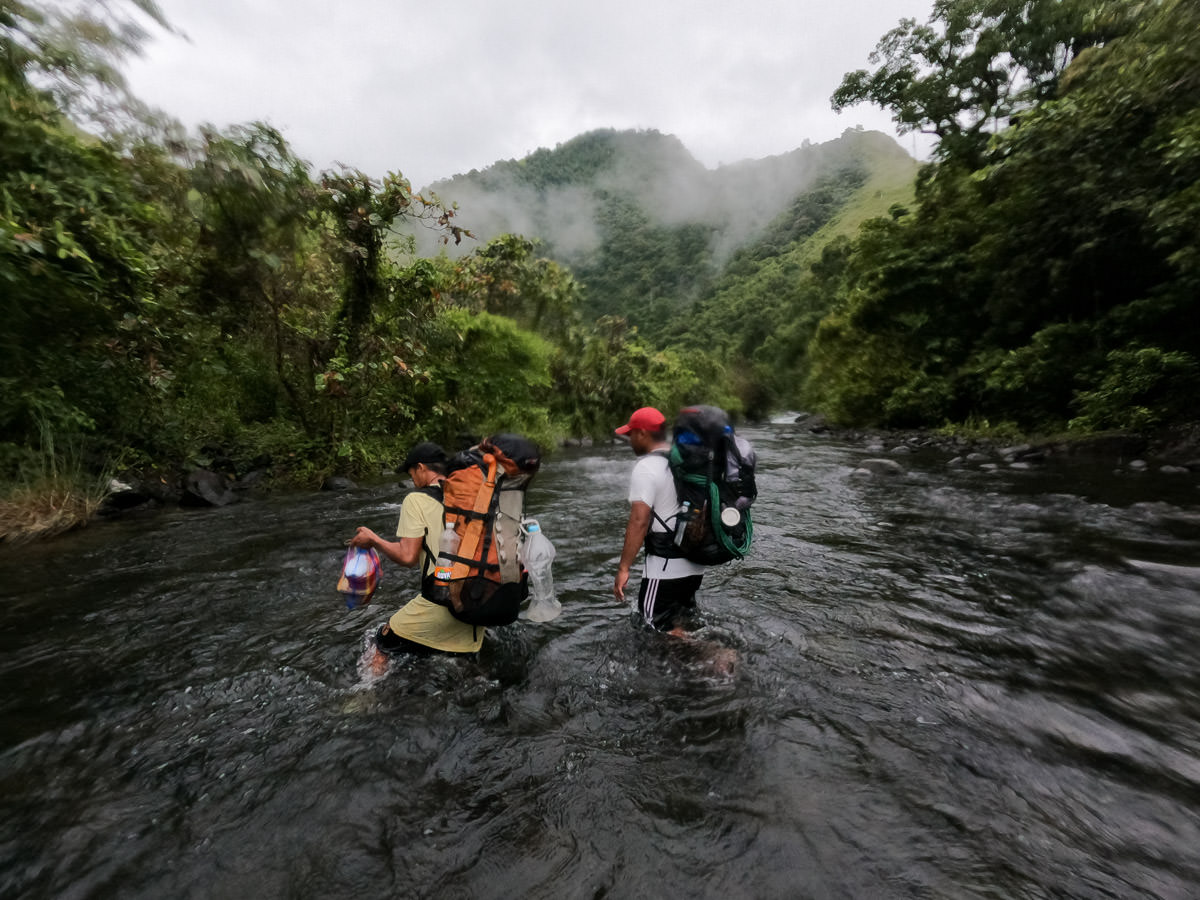
We were wet every single moment of the hike except when sleeping, I pulled more than 500 leeches off my body throughout the hike and the undergrowth scratched me up beyond belief. Combine that with 2,800m of incline, multiple river crossings, and rugged terrain and it’s a damn tough adventure for the body and mind. The final layer of difficulty to this hike is receiving a permit, one of the most impractical processes of any trek in the world.
CLIMBING MOUNT BALOY
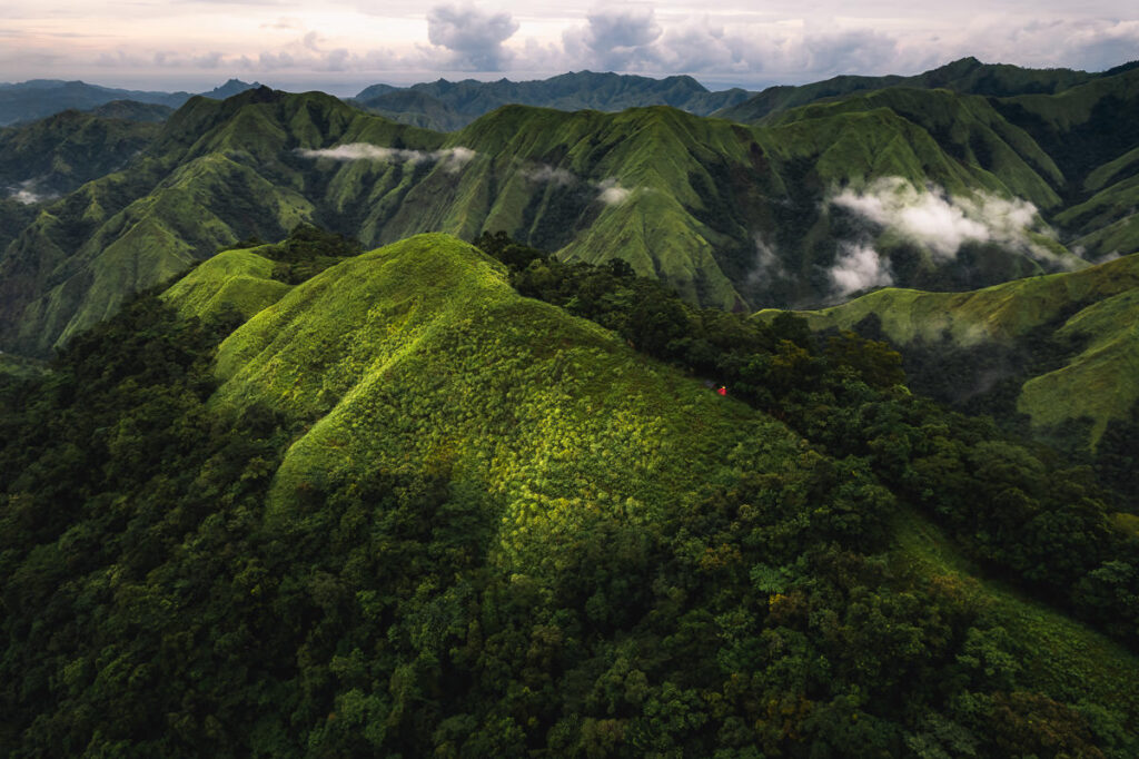
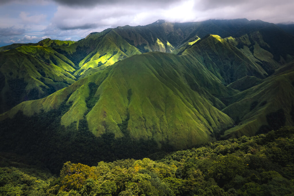
Mount Baloy is located in the beautiful, mountain region of Valderrama on the west side of Panay Island. It’s in the Western Visayas of the Philippines in a long mountain range that spans almost the entire west side of Panay. The peak is one of three tough climbs in the region, which combine to form a series called the Trilogy.
Mount Nangtud (2,073m), Mount Madjaas (2,117m), and Mount Baloy (1,958m) are the three mountains in the Panay Trilogy. It’s a bit of a badge of honor for trekkers who are mentally strong enough to bag all three peaks in the trilogy.
In this blog post, I will give you all the information you need to know before attempting a climb on Mount Baloy. I’ll take you through the chaotic permit process, fill you in on what to expect on the trail, and also help you contact of the guide you will need for this adventure.
MOUNT BALOY HIKE DETAILS
- Duration: This trek is usually done over a minimum of three days and a maximum of five. Taking the out-and-back route makes it a bit shorter and easier to do over three or four days. Taking the circuit route usually adds an extra day or so to the itinerary as it is more overgrown and is an additional 15km.
- Incline: I did the out-and-back route, which ended up having a total of 2,800m of incline.
- Distance: The total for my out-and-back route was 30km.
- Difficulty: It’s a tough hike but not outrageous when it comes to physical difficulty. 2,800m of incline over three days isn’t extreme. However, the leeches, river crossings, constant rain, and overgrown terrain are what make this a 9/9 on the Philippines difficult scale.
- Permits: I will explain the permit process in-depth below. Basically, though, you will need a permit from the local indigenous community, the tourism office, the local search and rescue office, and then sign in at the police station. Think it sounds complex? Wait until I explain the order of events and process below!
WHERE IS MOUNT BALOY AND HOW TO GET THERE
Mount Baloy is on the western side of Panay Island. The main town you will stay in before climbing Mount Baloy is Valderrama. The jump-off is in a small, rural barangay in San Agustin.
My order of events was to travel from Ilo-Ilo by bike (you can use the Ceres bus, which takes three hours) to the turn-off for Valderrama. Then take a jeepney or tricycle for a few dollars up to Valderrama, which is a 15-kilometer journey inland. From Valderrama, you will ride a motorbike (500 PHP per ride) along a crazy, rural track for an hour to reach the Barangay of San Agustin. This is where you will begin the hike.
HIRING A GUIDE
Mount Baloy is a bit of a complex mountain to climb due to its official listing as an IP (Indigenous People’s) community. The rule is that you need to hire a guide from the Barangay of San Agustin.
However, this guide will provide no food, or gear, or have completed any guide training. They are more of the local accompaniment to protect their land. It is highly advised to hire a guide in Valderrama, who will be your actual guide and also provide the food and gear to the local guide from San Agustin. If it sounds confusing, it is just the beginning and I highly, highly recommend contacting my guide Benito Pagayanon.
Contact Benito here: Benito Pagayanon Facebook Page
Without Benito, my climb simply wouldn’t have happened for so many reasons. He organized everything, accompanied me to get permits, and food, organized the local guides’ logistics, spoke English, and was one of the most helpful and friendly people I’ve met in the Philippines. Here’s the breakdown of costs below as of 2022.
- 4000 PHP per group up to 5 for the local guide from the IP community of San Agustin.
- 3500 PHP per head to have Benito as your guide. All included. (Includes food, gear, and transport to and from Valderrama) The food and motorbike to and from Valderrama is about 2000 PHP by itself so this is quite a good price and may rise over the years. So basically it is 3,500 PHP per person with Benito and then your entire group of up to 5 will split the 4000 PHP of the local IP community guide.
PERMIT FOR MOUNT BALOY
I’ll try and make this as concise as possible. For me, the journey to receiving a permit was anything but concise.
- Travel to the IP office in San Jose and receive the permit after presenting your letter of intent, which is basically a short, signed statement that you intend to climb the mountain.
- Travel 60km to Valderrama and then to San Agustin on a 1-hr motorbike to present your letter of intent and permit from the IP office to the local elders. They will approve you to climb the mountain or not. They have the right to deny you access to climbing.
- If you receive approval from the local community, take a 1-hr bike back to Valderrama, then a 60km jeepney journey back to San Jose to present the approval from the local elders to the IP office. They will then sign you off to climb.
- Travel 60km back to Valderrama. Travel 1 hour by bike back to San Agustin and you are now ready for the climb.
It’s a very impractical process and with WiFi now in San Agustin, we were able to skip going back to San Jose one more time to show the approval to the IP office. We emailed it to them and they made an exception for us. This was thanks to Benito convincing them. If you book in advance with Benito, he will organize your letter of intent and help manage the permit so you don’t need to spend three days traveling around to get approved for the permit, this in itself is worth hiring Benito.

MY MOUNT BALOY VLOG
MY EXPERIENCE CLIMBING MOUNT BALOY
By cycle, I made my way to Valderrama in two days. The 150-kilometer journey from Ilo-City was broken up with an overnight stay in San Jose.
Upon arrival in Valderrama, I checked into the police station. They were unsure if Mount Baloy was even possible, and tried to convince me it had been raining too much. It hadn’t been raining too much and their reluctance would be a sign of things to come. They then sent me to the Mountain Rescue center, where I also signed in.
They called Benito, the guide and I waited there before he came to meet me and got a grip on the situation. Unfortunately, even with his contacts at the mayor’s office, it became clear we would need to go back to San Jose on the bus to get the initial permit from the IP office. It would have been great to read this requirement online before riding through San Jose on a bicycle.
The next day we rode the jeepney back to San Jose and got the permit. We also convinced the lady in the office we would email the permit from the local community in San Agustin rather than drop it back in physical form the next day.
That night we traveled all the way back to Valderrama and then by motorcycle to San Agustin. They approved our climb in a big group meeting of the elders that lasted more than an hour. It was emailed back to the IP office in San Jose and we began the climb the next morning. Sorry for that long story about a permit but that was the reality of the build-up to this hike.
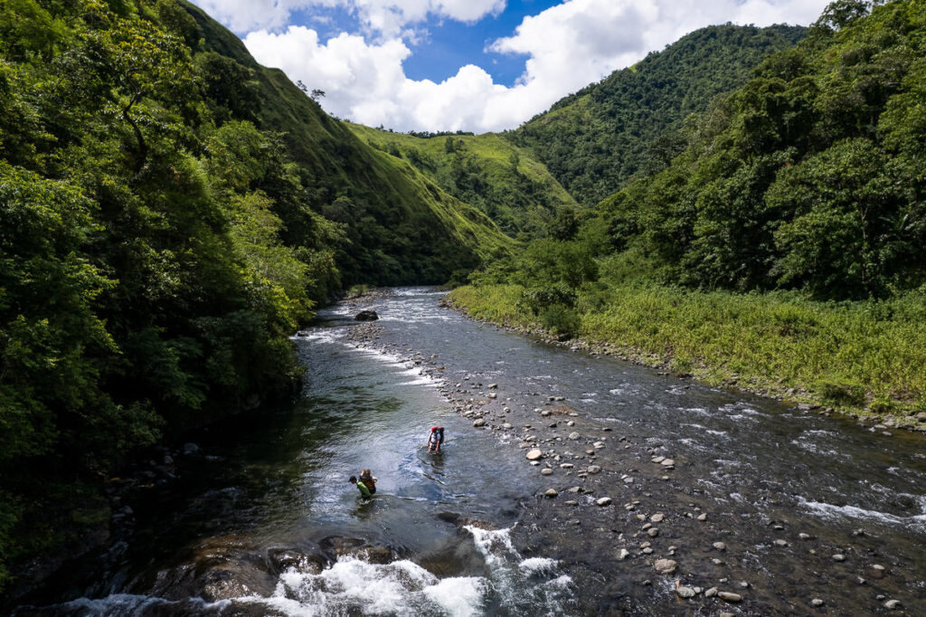
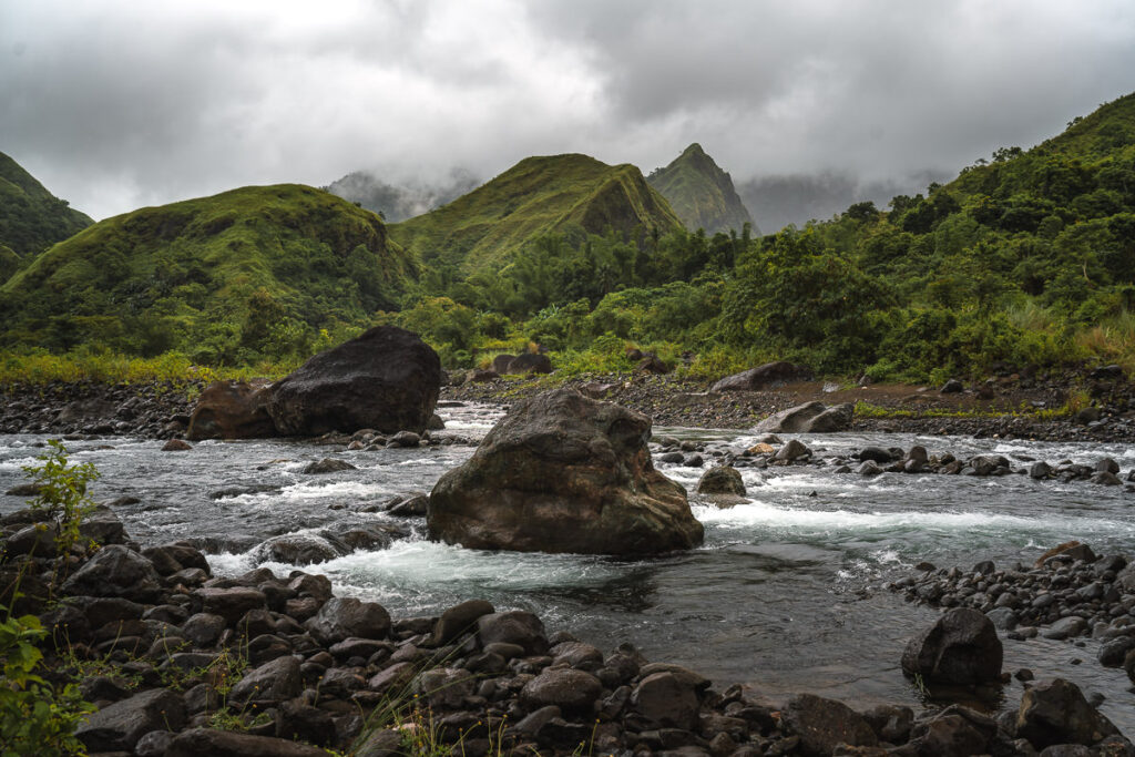
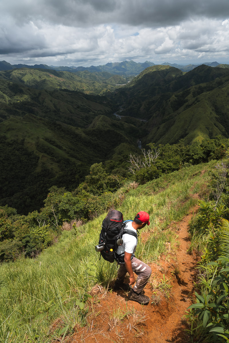
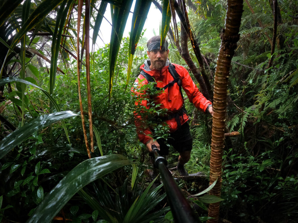
After so much organization and preparation for this hike, it was great to finally set off and get started. The trail begins with about 20 river crossings. You will sometimes be up to hip height in the water or even higher depending on the recent rains. Along the way, you will pass a number of local fishing traps, which are huge structures built out of bamboo to trap fish in floods.
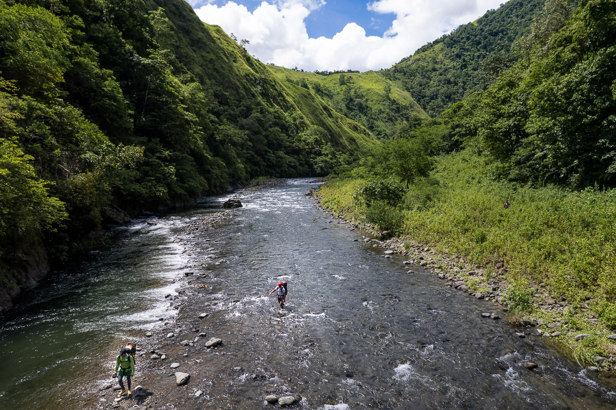
It takes about two hours to complete the river crossings and make it to the start of the uphill climbing. You will reach Camp 1, which is beside the river although it’s only used for hikers who start very late in the day. The local guides decided to just use flip-flops up until this stage but I opted to get my shoes wet, which I recommend from the first moment.
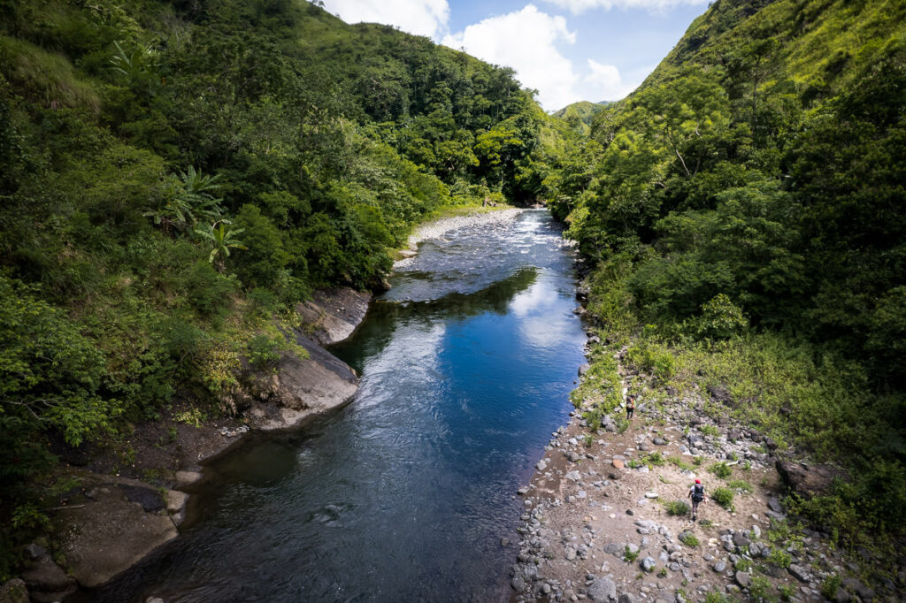
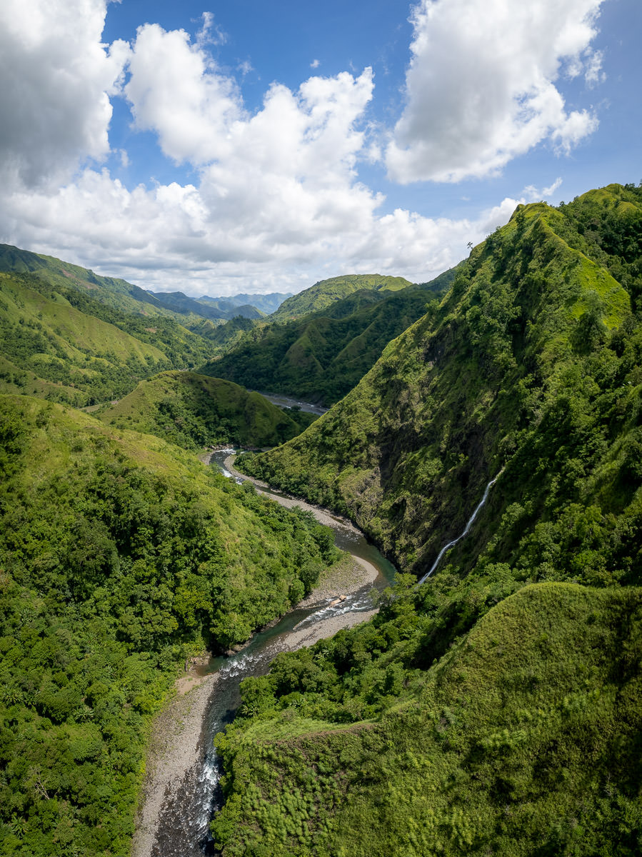
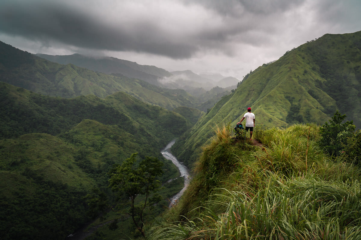
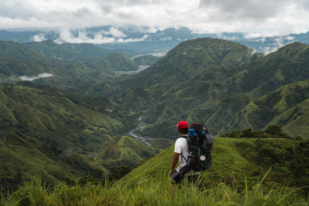
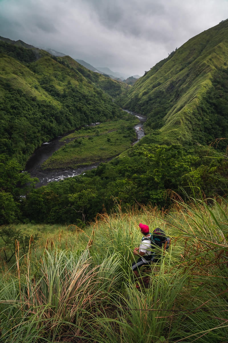
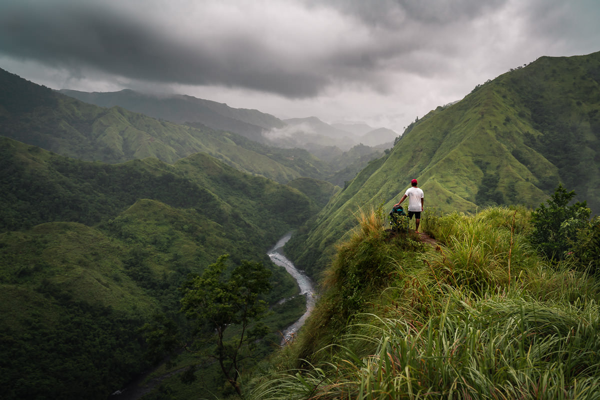
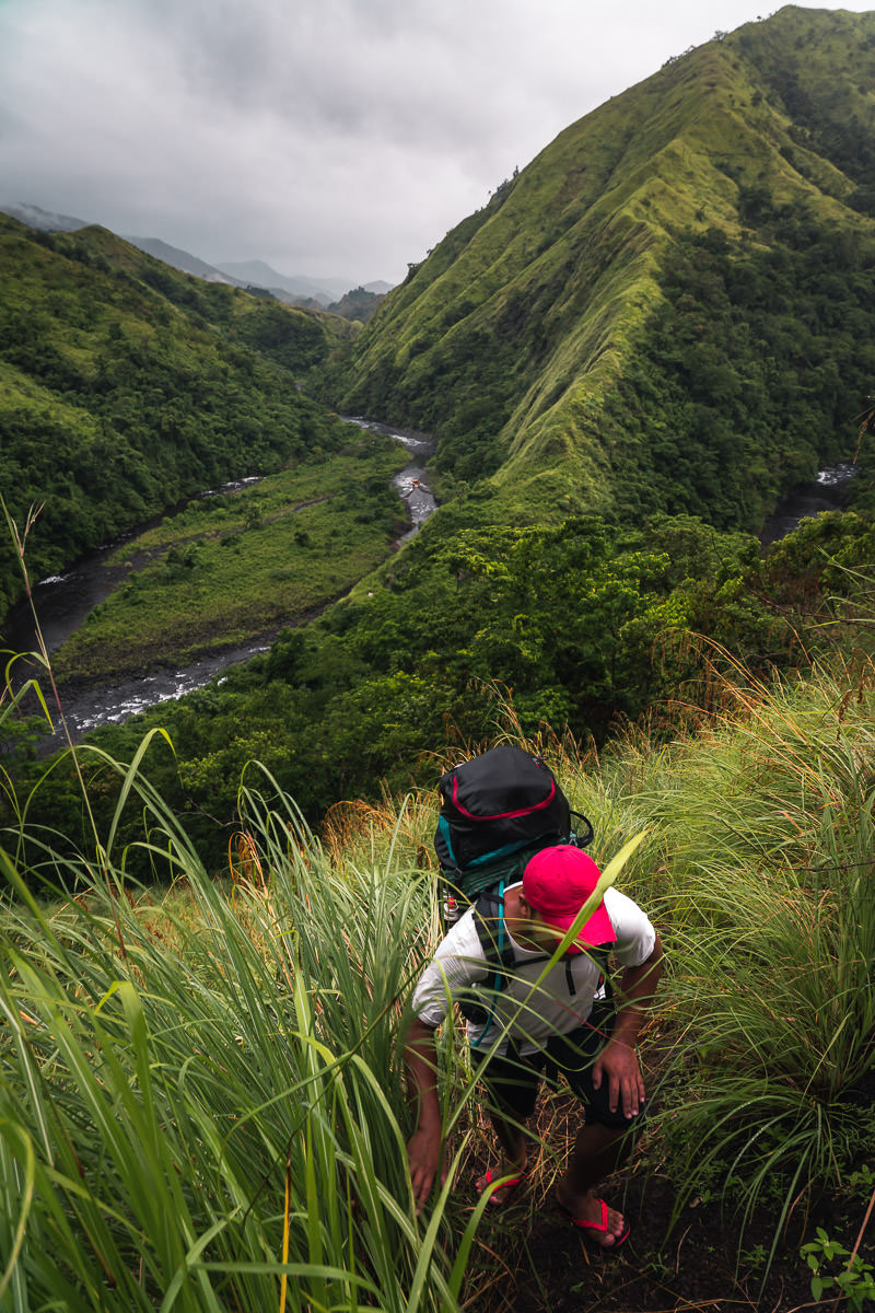
The next part of the hike is probably the most scenic. Following a winding path, you rise up a steep slope to look back over the gorge and the river you have just spent hours zig-zagging along. This section provided some of the best views of the hike. It takes about two hours of hiking in this section to reach the ‘Emergency Camp’, also known as Camp 2.

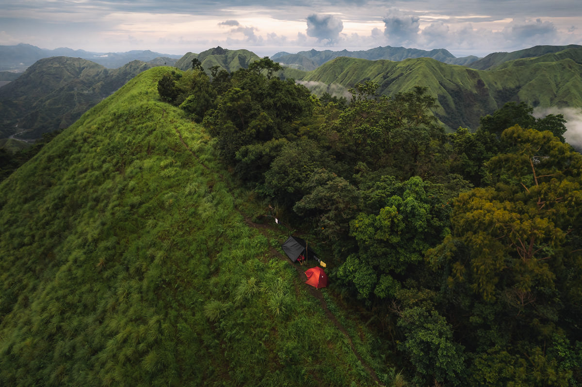
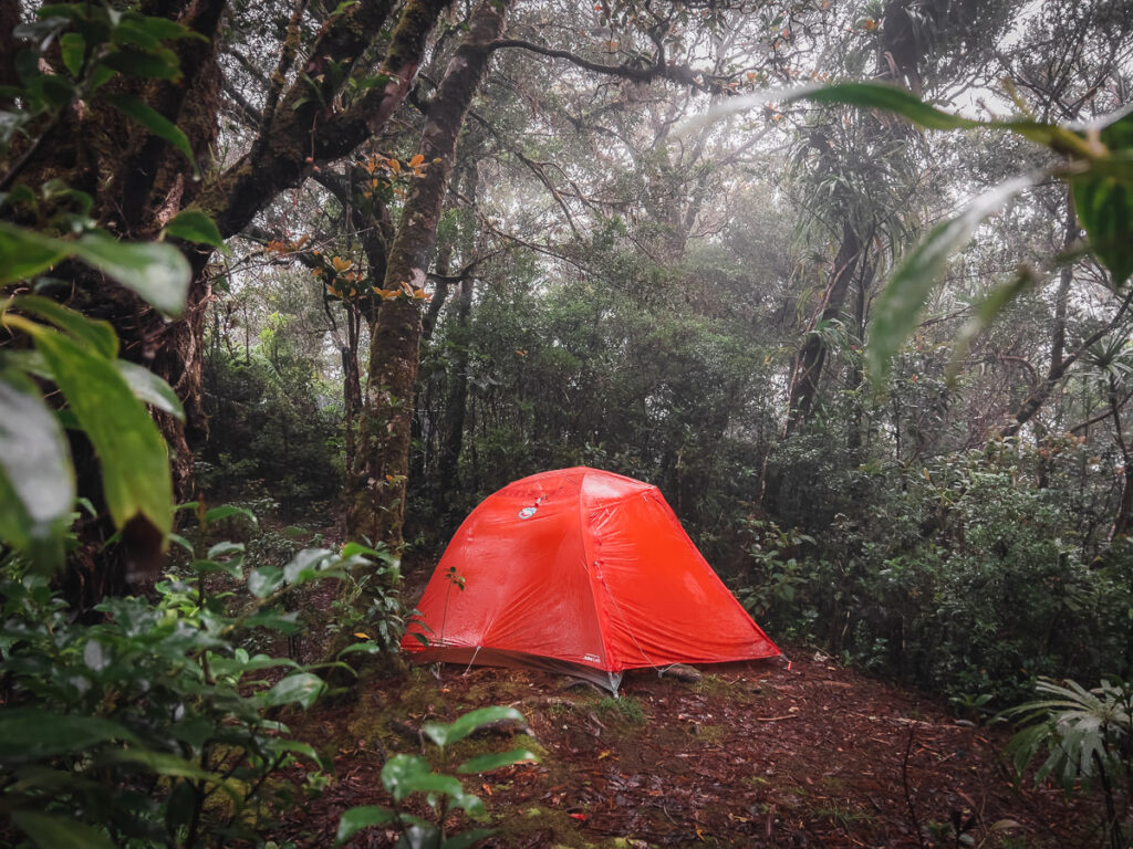
After just four hours, we reached Camp 2 at an elevation of about 800m. Little did I know, but this would be the last place where I wasn’t concerned about leeches. We set up camp on the little strip beneath the forest. There wasn’t much room here and I managed to set up my tent on a slight slope in the mud while the guys hung their hammocks nearby.
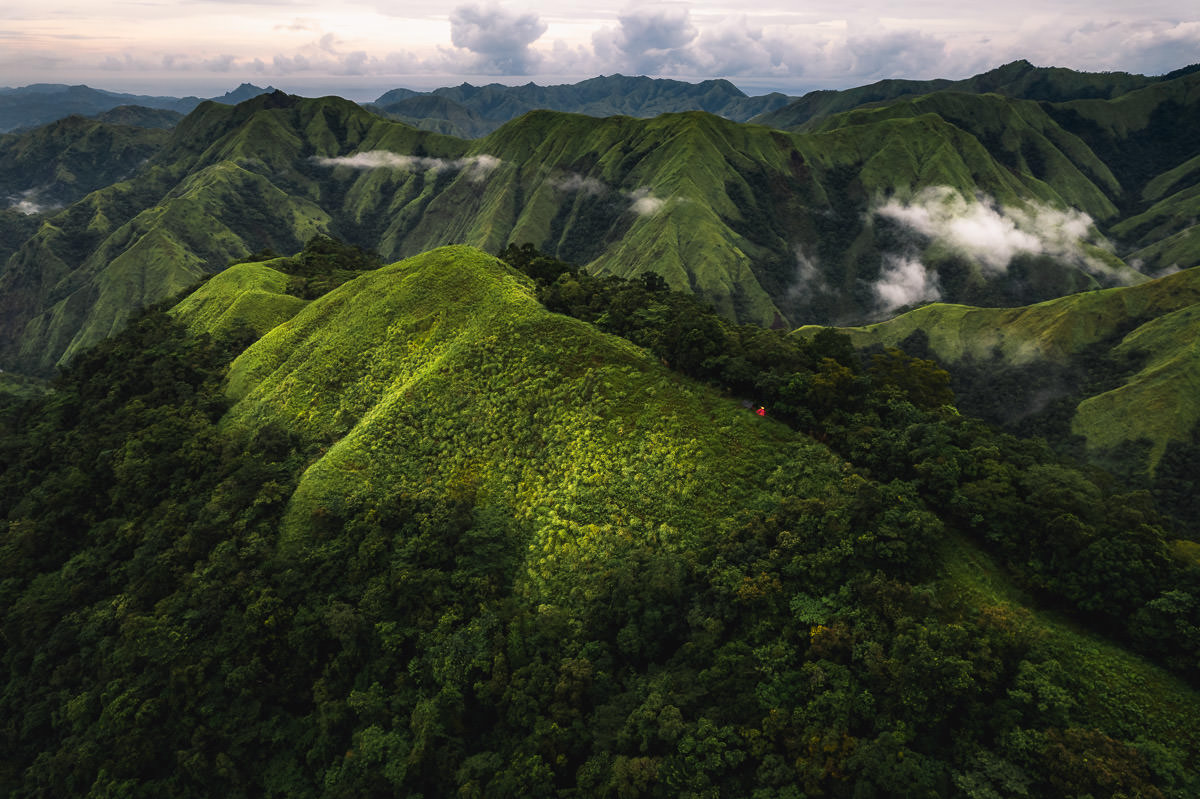
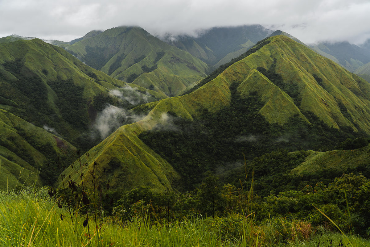
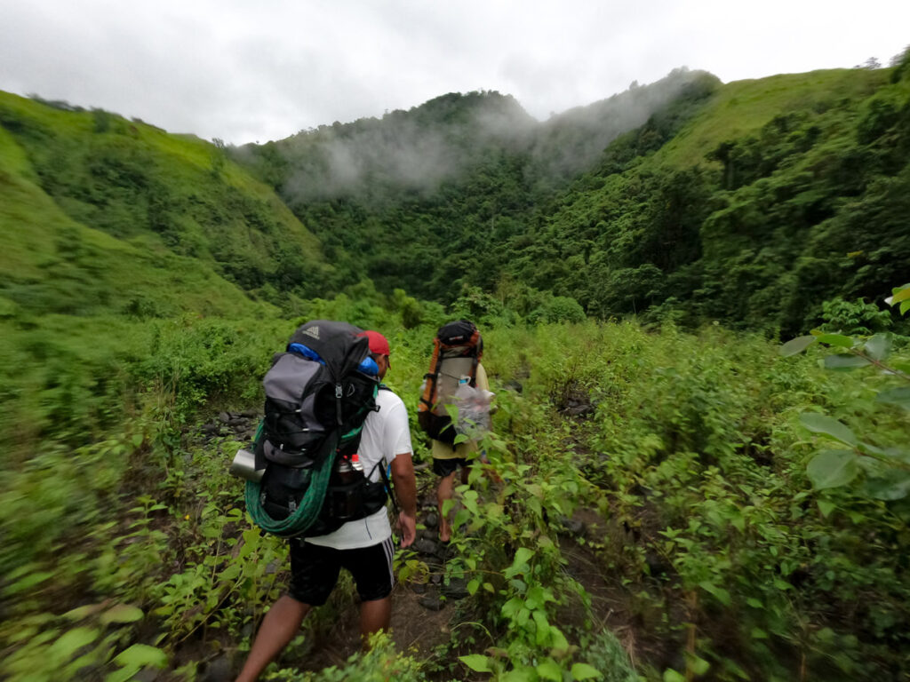
We rose early the next morning at Camp 2 and got ourselves packed up and ready for a big day. Our plan was to go straight from Camp 2 to the summit of Mount Baloy and then camp overnight at Camp 3. We set off up the open ridge, passing by the local, free-range cows. The incline on this day is pretty constant with 1500m gained to reach the summit.
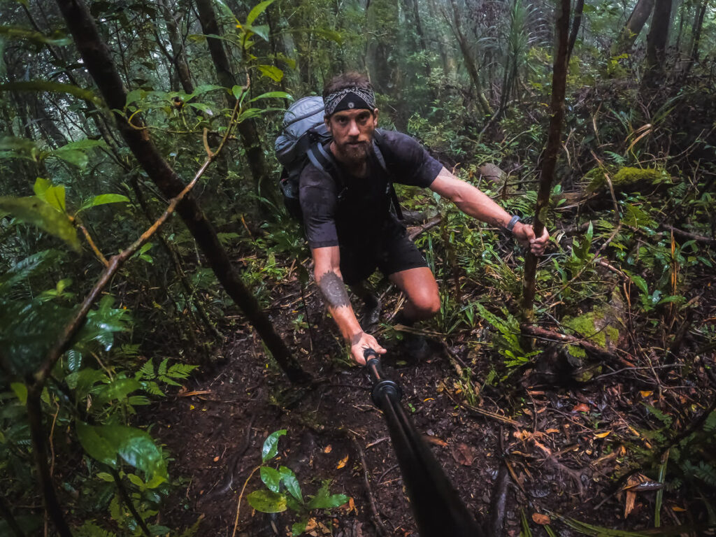
The great thing about the dense nature of this trail is that even if the sun is out, you can avoid being exposed to the heat for the majority of the climb. However, what you cannot escape is the rain that is known to be a constant on Mount Baloy.
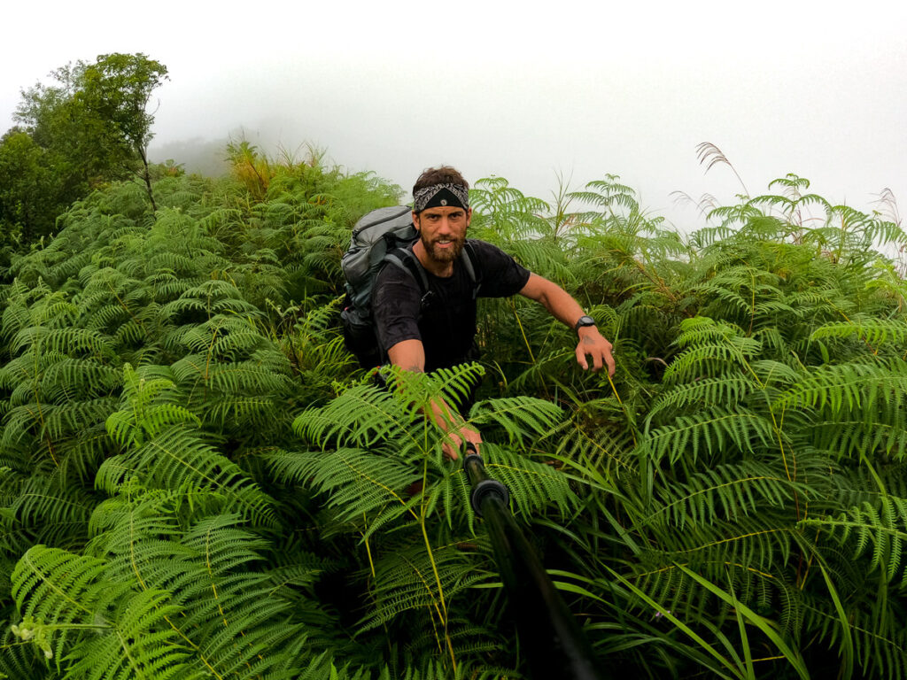
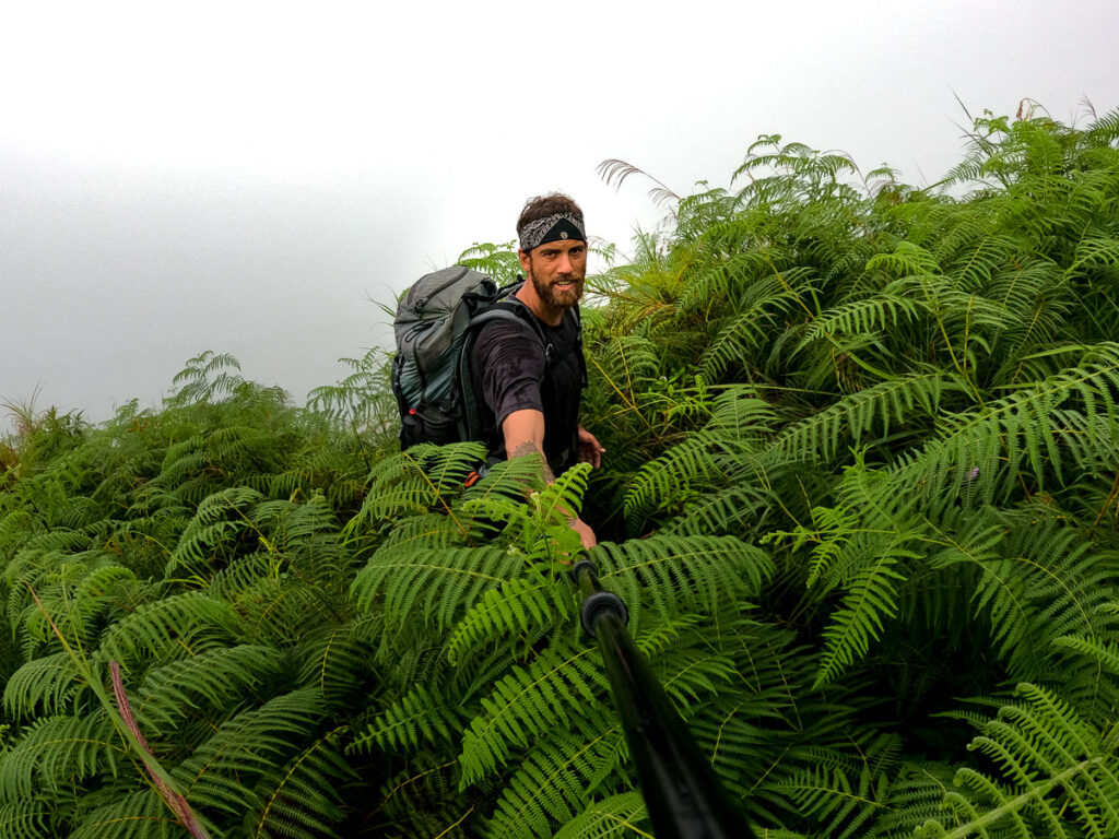
The other constant on Mount Baloy is the leeches. The locals had told me to expect leeches and I thought I’d come across a couple. Was I wrong! The leeches were intense. As soon as we reached the forest on the way from Camp 2 to Camp 3, they were everywhere.
I had more than 500 on me throughout the entire trip. Yes, I counted! While most of the leeches are small, they are hard to flick off.
They attach to your shoes and then crawl their way up your legs. It was disgusting and slowed us down a lot. It got to the point where there were so many, we didn’t remove them from our socks and only flicked them off if they crawled onto the skin of our legs.
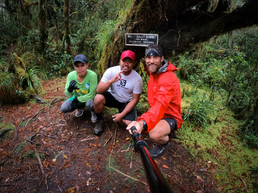
After four hours and forty minutes, we reached Camp 3. It’s a wet, swampy little area inside the forest. Leeches were rampant. We set up our tents, had a quick pre-prepared lunch, and then made our way up for the summit push. It takes about an hour to get up to the summit from Camp 3.
On the way, you will encounter the ‘Snake Trail’. It’s essentially just a winding section of trail that has a lot of branches and roots tangled across the path, making it hard to progress. It’s nothing too technical and just forces a slower trek up to the summit.
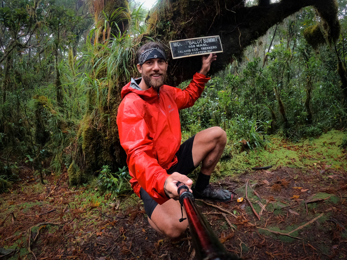
At the summit, you actually have no view. There is a small plaque posted on a tree at the summit stating the elevation. This is where you get your photo for proof of completion!
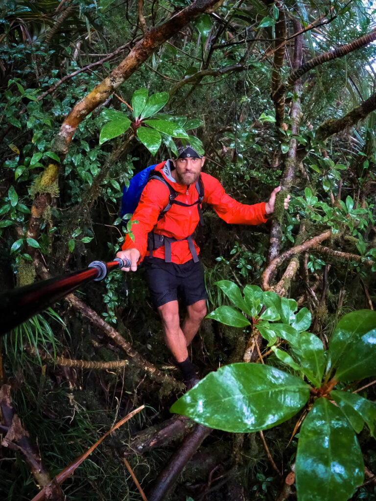
Despite having no summit view, the entire area near the summit is like a mystical enchanted forest. Vines and moss are draped over twisted trees as fog rolls through and raindrops fall from the leaves. It’s very beautiful in its own way.
We then made the quick descent down to Camp 3, also known as Leechville, and got secured in our tents for the night. I watched as leeches crawled on the exterior of the tent, trying to find a way in to suck my blood. If you don’t like being soggy and wet or critters and bugs, this hike will be a nightmare for you. It’s a good mental challenge as you will be enduring some type of discomfort for most of the journey.
The next morning we set off and made it all the way back down to Camp 2 for lunch. We then traversed the river crossings and made it back to San Agustin in the early afternoon. We had enough time to catch the motorbike back to Valderrama to complete our 3-day trek of Mount Baloy! Here you need to sign out at the police office and the mountain rescue office.
I hope this was a helpful guide and that you have a decent understanding of the logistical requirements and physical requirements for a climb of Mount Baloy.
Sonia
Friday 16th of February 2024
I will hike just about anything, but leeches, I cannot haha. Thanks for sharing your trip!