
The Walpenpfad hike starting either in Bannalp or in Engelberg is a fantastic trail that has a bit of everything. This 10km, alpine route passed several lakes, crossed ridges, and had stunning views above the valleys.
The Walenpfad Hike: Panorama Mountain Trail
The Walenpfad Hike known as the Panorama Mountain Trail can be hiked in either direction. The two endpoints are Bannalp and Engelberg. I hiked the trail from Bannalpsee to Engelberg and this blog will be based on my experience but if you prefer to do it in the other direction, simply spin the route around and go for it.
WALENPFAD HIKE DETAILS
- Hike Distance: The total distance of the hike was 10.6km starting at the Bannalpsee Lake and finishing at the Brunnihutte. However, we hiked down from the Brunnihutte as we stayed for sunset so the cable cars had definitely finished by then. That meant our total hike from Bannalpsee to Brunnihutte to Engelberg Town was 16.3km.
- Hike Duration: Our total elapsed time from Bannalpsee to Engelberg Town was 5 hours and 41 minutes but the total moving time was only 3 hours and 41 minutes. We take lots of photos and stop to take in the scenery often.
- Hike Difficulty: The Walenpfad hike is one of the easier hikes we’ve done out here in Switzerland. There were some moments of incline but the trail itself was always quite safe and there was no scrambling or rock bouldering necessary. This is a good hike for anyone who can handle the distance. I could imagine families, young children and dogs managing this hike fine especially with the cable car down from Brunnihutte.
- Hike Incline: Total elevation from Bannalpsee to Brunnihute was 834m. We also grabbed about a kilometer of decline as well, which is often just as hard!
CHECK OUT MY GUIDE FOR ENGELBERG HIKING: 5 AWESOME HIKES IN ENGELBERG, SWITZERLAND
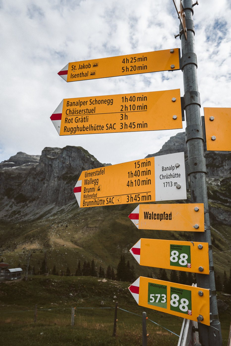
HOW TO GET TO THE WALENPFAD HIKE (STARTS AT BANNALPSEE)
The Walenpfad hike is a great trail to head out on if you are based in Engelberg Town, which is in central Switzerland. From Engelberg Town, it takes 1 hour and 15 minutes on a train and one bus before you reach the ticketing office for the gondola/cable car. The trail starts at the Luftseilbahn Fell where you will catch the cable car to Bannalp and hike through to Brunnihutte. You can do the hike in reverse but I prefer this route as you can visit at golden hour with views of Mount Titlis.
GET A SWISS TRAVEL PASS!


Enjoy UNLIMITED train, boat, and bus rides in Switzerland for up to 15 days. Click to book a flex Swiss Travel Pass or choose the Consecutive Swiss Travel Pass.
The Swiss Travel Pass starts at $260 for 3 days. Click here to check if it’s available on your travel dates.
CABLE CAR TO BANNALP AND DOWN FROM BRUNNI
The Bannalp-Chruzhütte cable car costs $12 for a one-way ride. The last cable car is at 5:30 in the summer but you can check the timetable here to be sure of the latest updated info.
The Brunni cable car to and from Engelberg is $20 for adults for a one-way ticket. The last cable car down from Brunnihutte to Engelberg is 4:59 pm. You will need to check the current timetable here.
However, what that means is that if you want to catch the last cable car down you should start by midday at Bannalpsee to make sure you get there in time. If you prefer to stay for the golden hour and don’t mind the 1.5-hour walk down to Engelberg, catch a cable car to Bannalpsee around 3 pm or 4 pm, and then save yourself the $20 when you arrive at Brunnihutte, enjoy the sunset, and walk down to Engelberg.
If you have the Swiss Half-Card you will receive a huge discount on your tickets. I bought mine when I arrived in Switzerland and it has saved me over a thousand dollars.
WALENPFAD HIKE MAP
On the below map you can see the route we took from Bannalpsee to Brunnihutte and then down to Engelberg. I’ve attached our GPX route so you can see where we went. You can download it here for use on your Garmin, smartwatch or another app.
Hiking The Walenpfad Hike: Panorama Mountain Trail
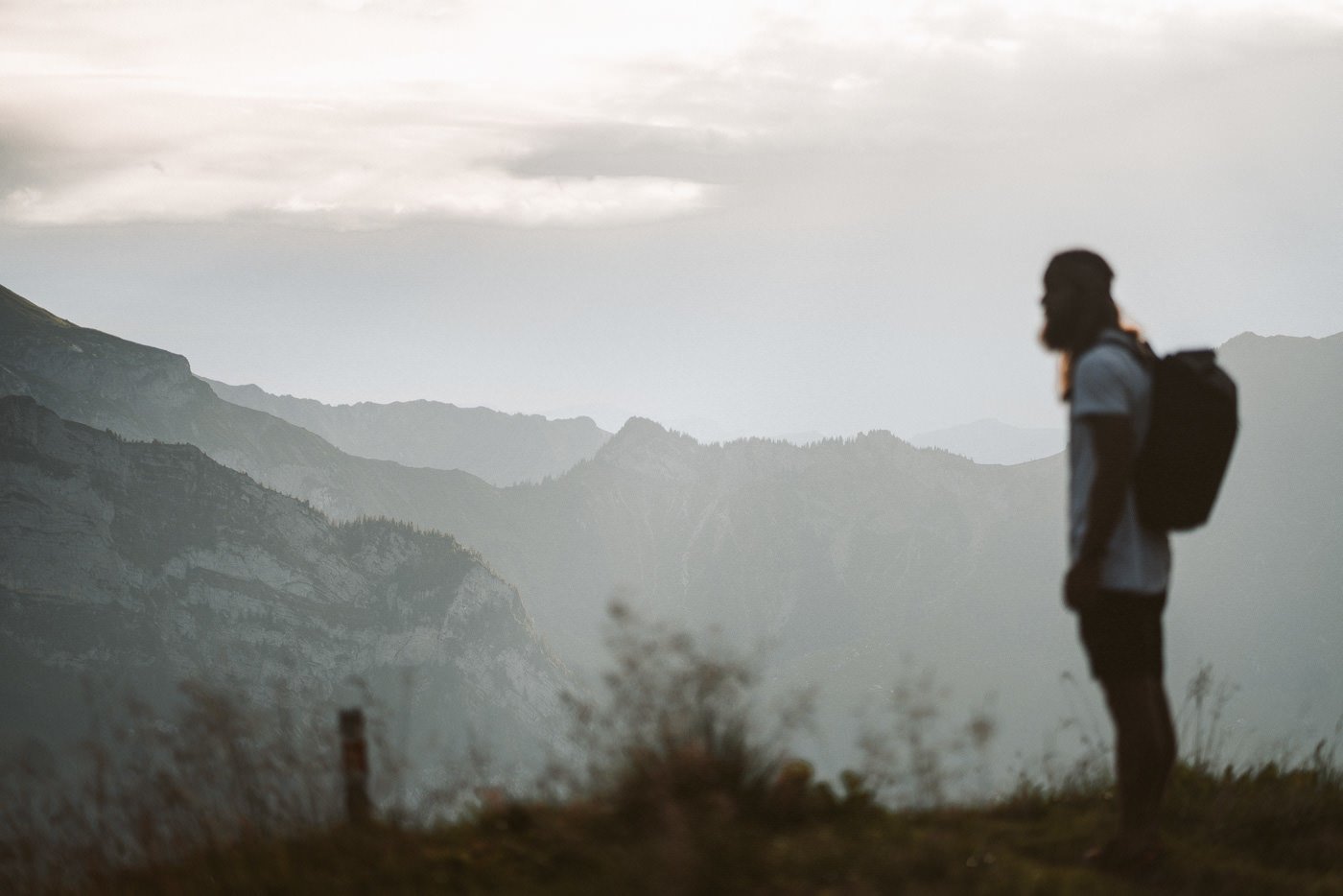
The Walenpfad trail can begin from either Brunnihutte, Engelberg, or Bannalpsee. We did the hike from Bannalpsee so we could have a beautiful golden hour/sunset looking out towards Mount Titlis and the mountain range surrounding. This meant we left Engelberg around 3 pm and kicked off our hike at 4 pm. That might seem quite late for a hike that ended up taking 5 hours and 41 minutes.
However, the trail down from Brunnihutte to Engelberg is very safe in the dark and this is the best way to have nice lighting as we have in the photos you will see.
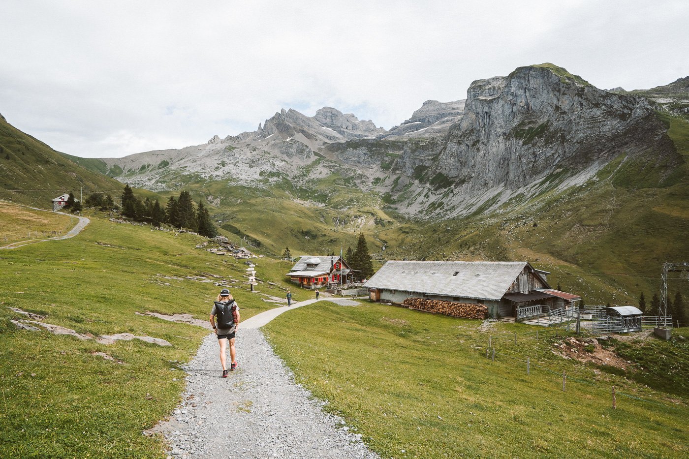
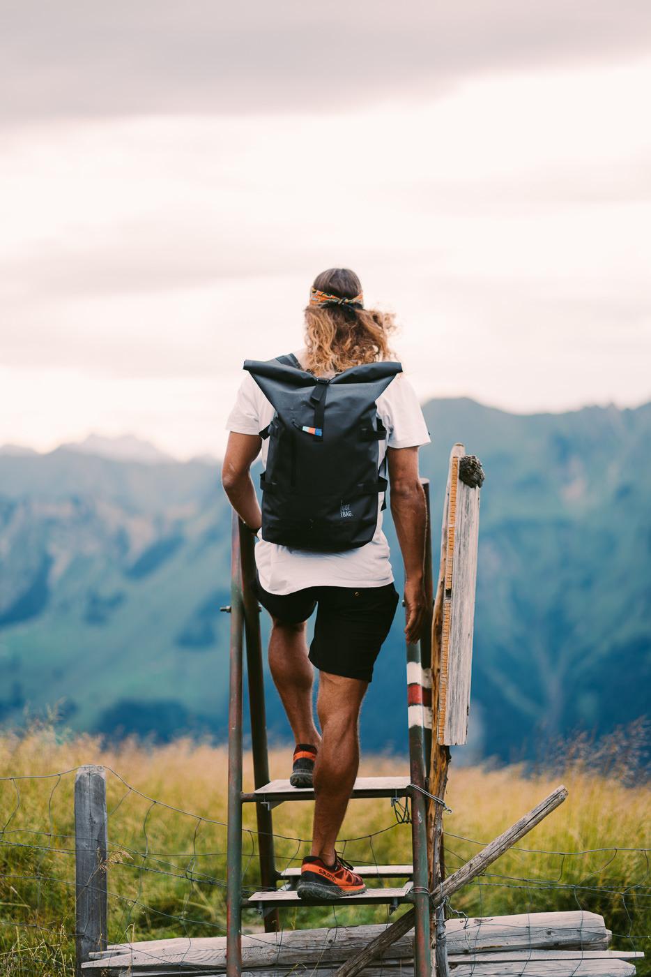
At 4 pm we arrived at Bannalp after taking the cable car up. There are actually quite a few nice little huts here with food, coffee, and playgrounds for the kids. We continued on without stopping in this area.
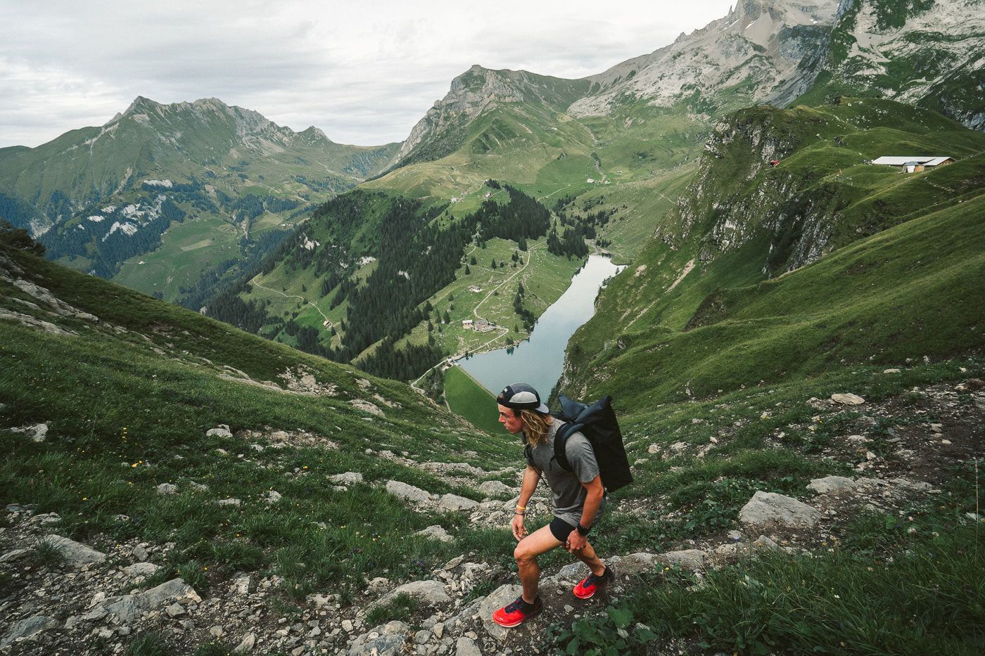
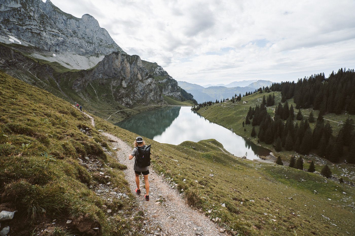
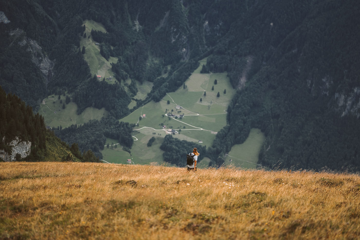
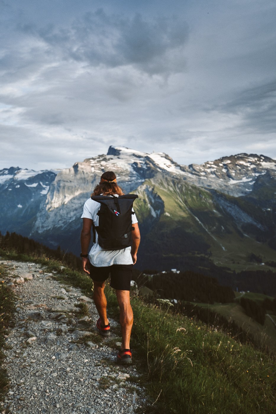
The trail begins by winding around Bannalpsee, a beautiful alpine lake. At the same time as you begin to marvel at the lake, you will also start to hit the incline as the trail heads up into the mountains. The view of the lake continues to get better and better as you climb higher and higher.

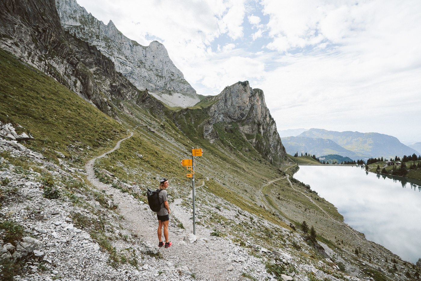
The gradient is quite intense with a consistent incline for the first 1-2 hours of the trail. However, if you do feel like a break mid-climb there is another mountain hut halfway up the climb. We skipped the hut but took a break on our own little viewpoint after passing the herds of cows and goats.
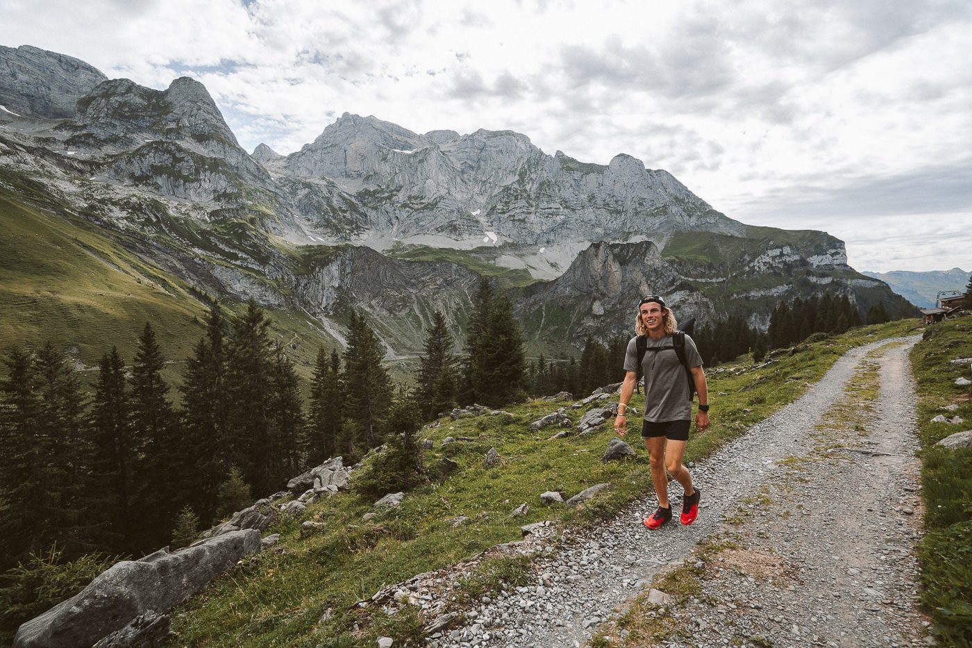
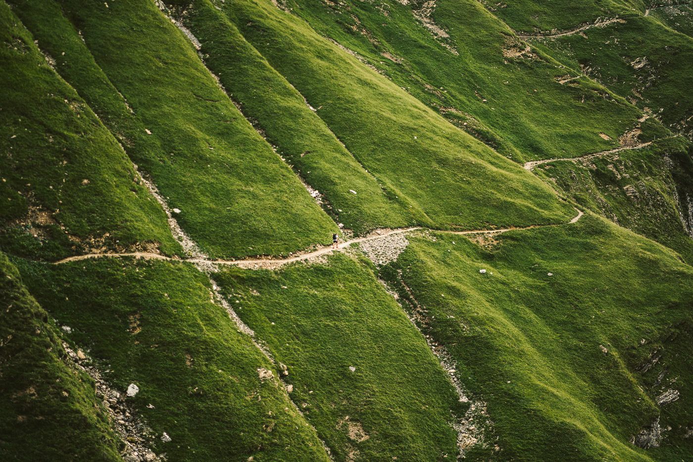
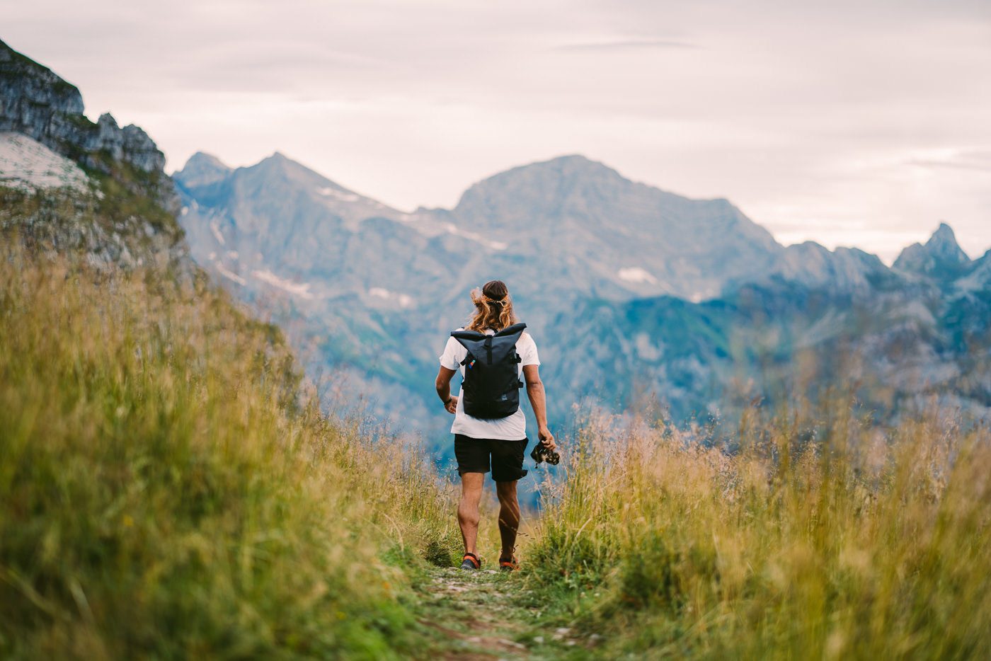
After the mountain hut, the trail really juts into the side of the grassy mountain and is quite spectacular in making the hikers look like tiny ants crawling across its surface. This section of the trail is really the last final climb before you start to hit the downhill and send your farewells to Bannalp as you edge closer to Engelberg.
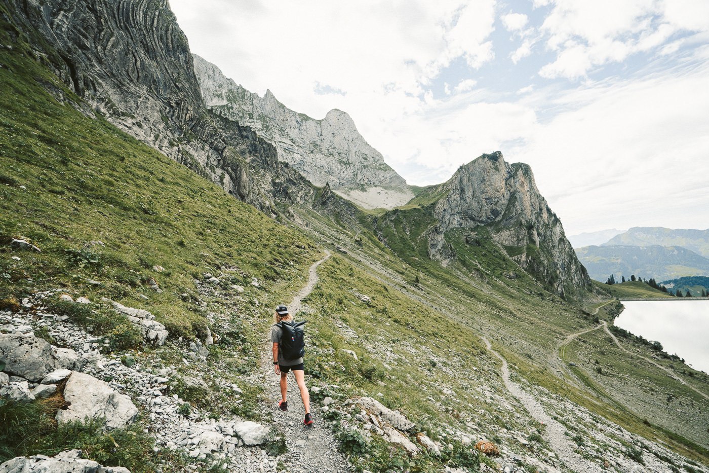
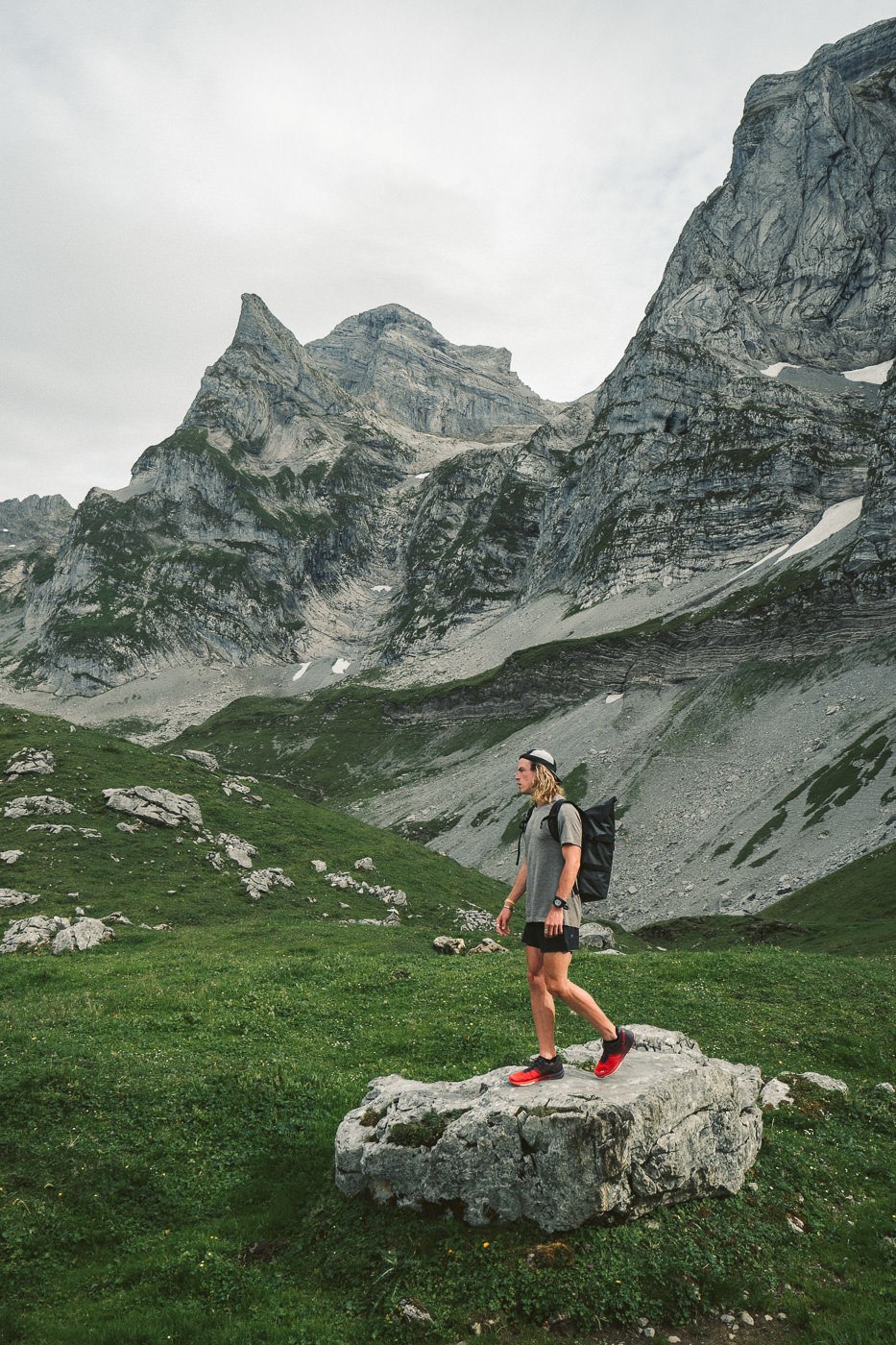
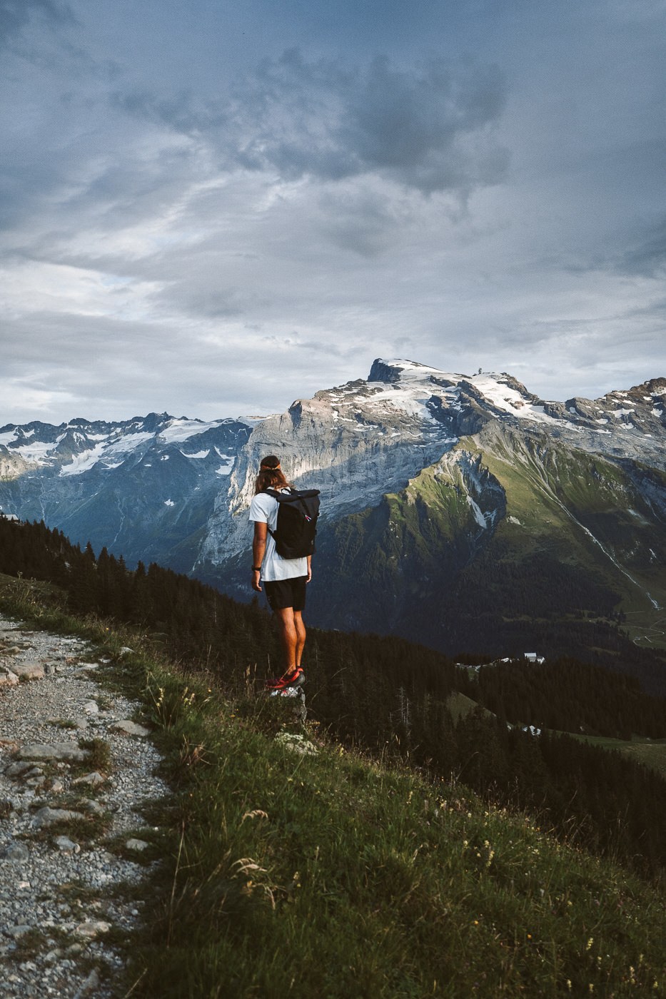
You will know you have hit the halfway point when you reach the fence crossing in the middle of the field. From this point on you are heading down, down, down to the Brunnihutte. First, you will wind your way along the switchbacks of the huge grassy hills. You won’t quite see Titlis yet but the backdrop is already starting to form with multiple layers of mountains in the distance.
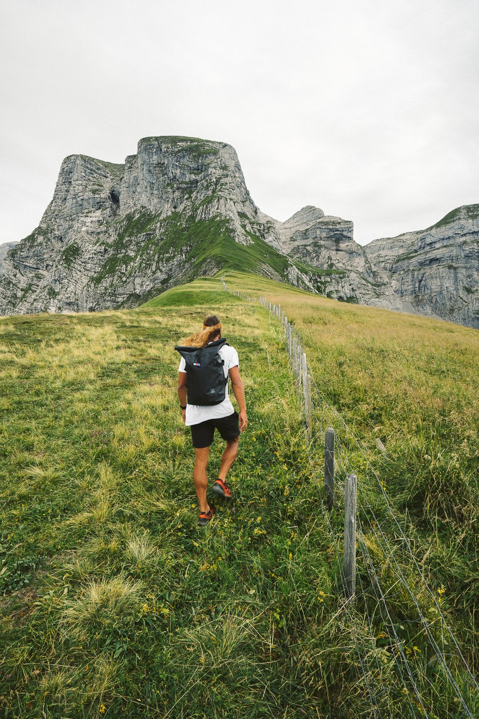
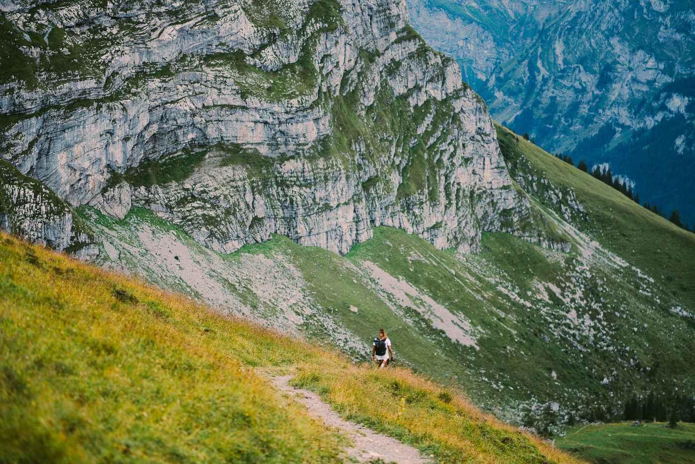
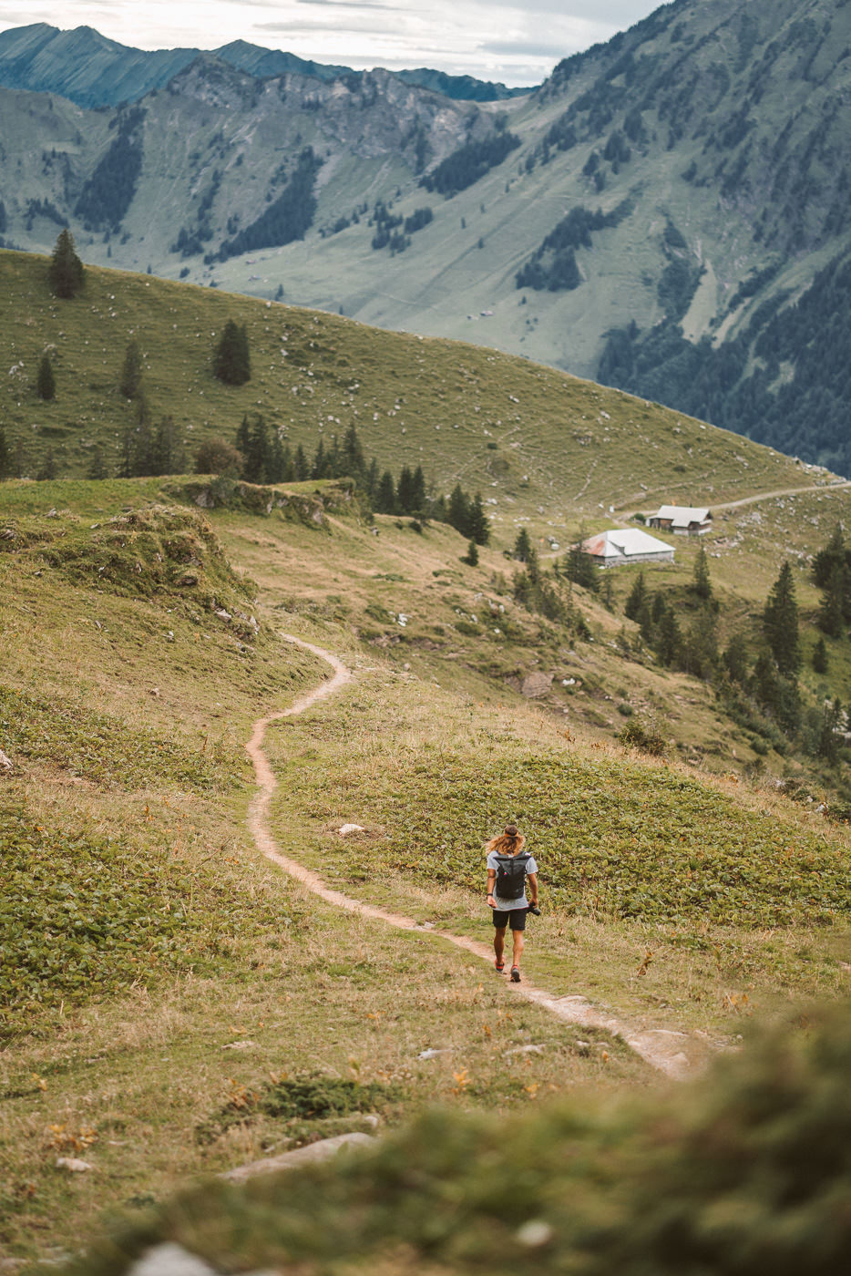
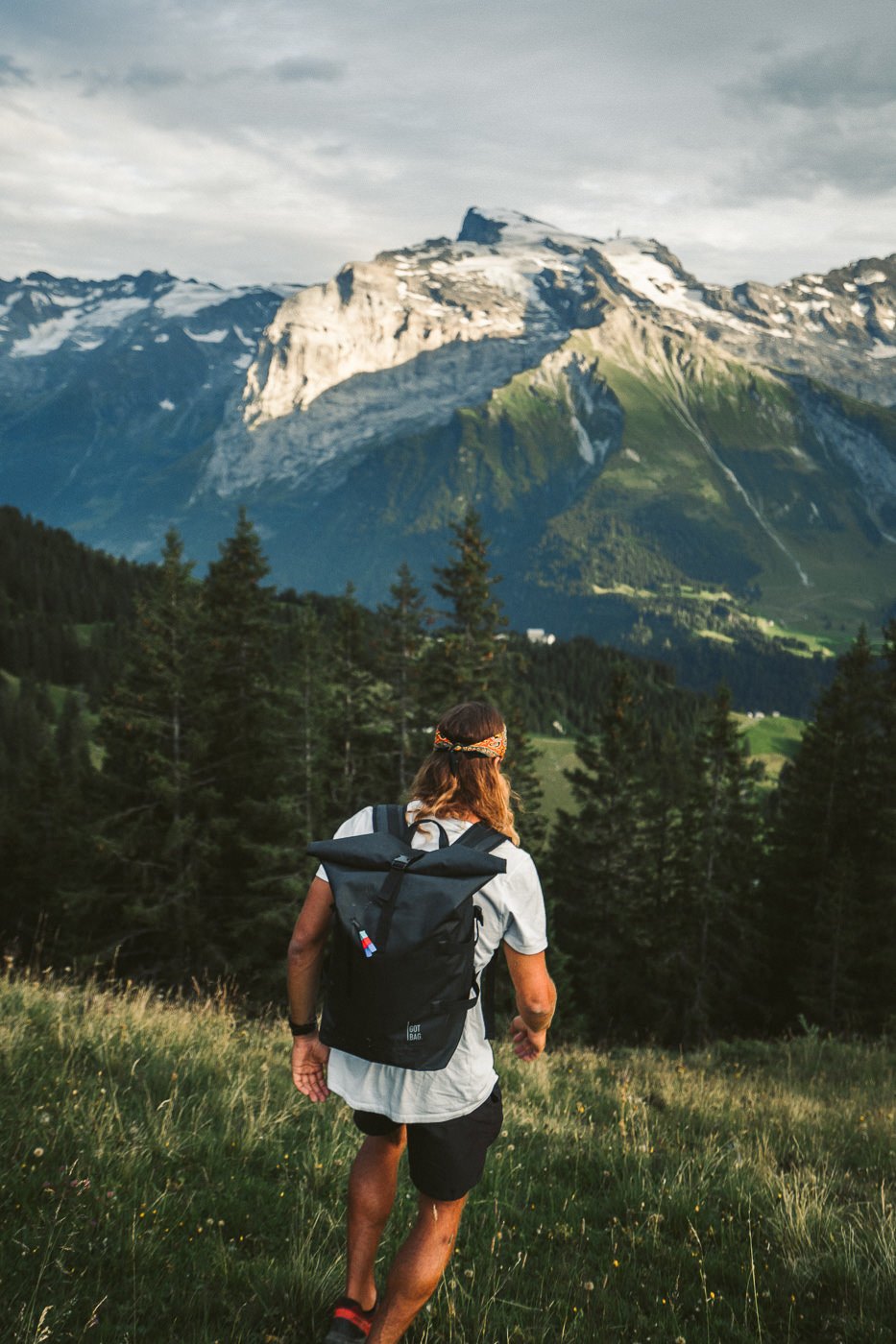
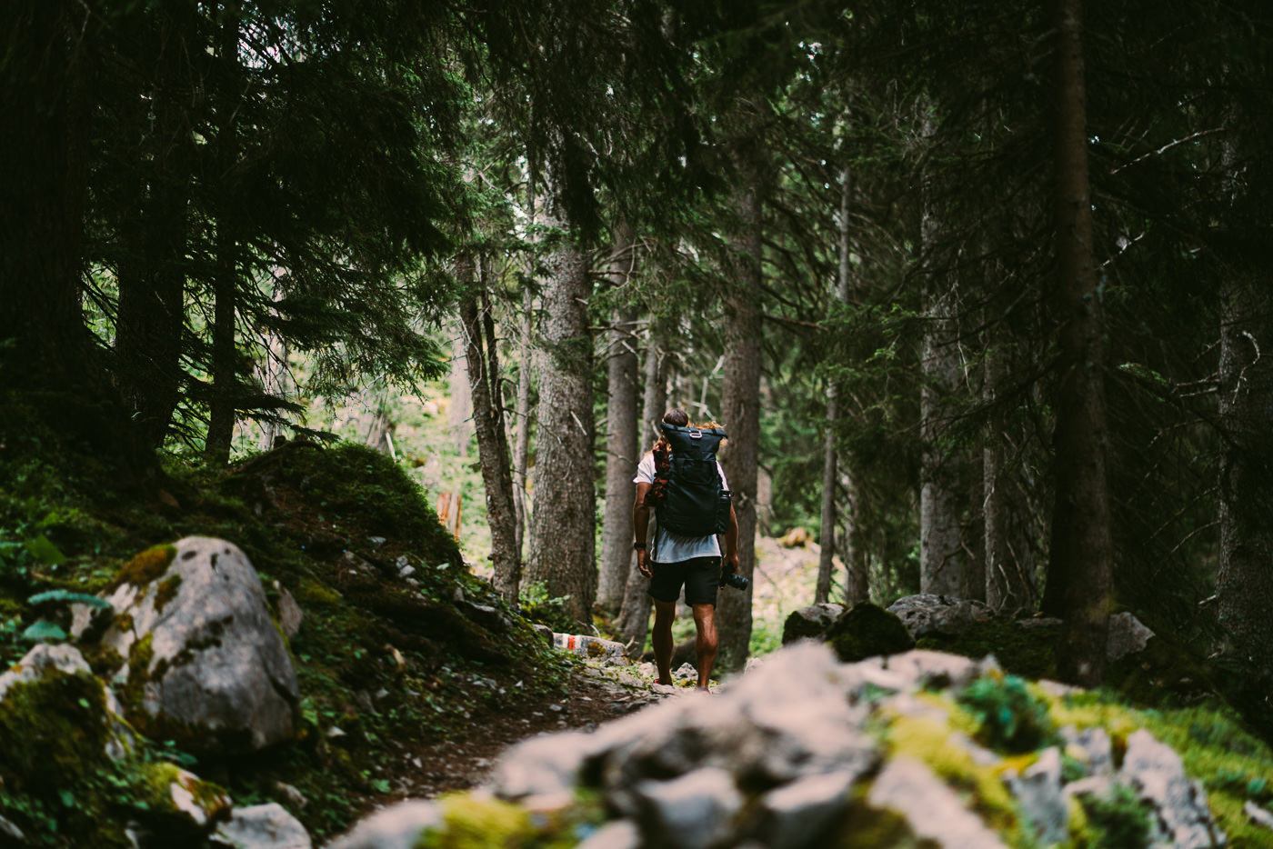
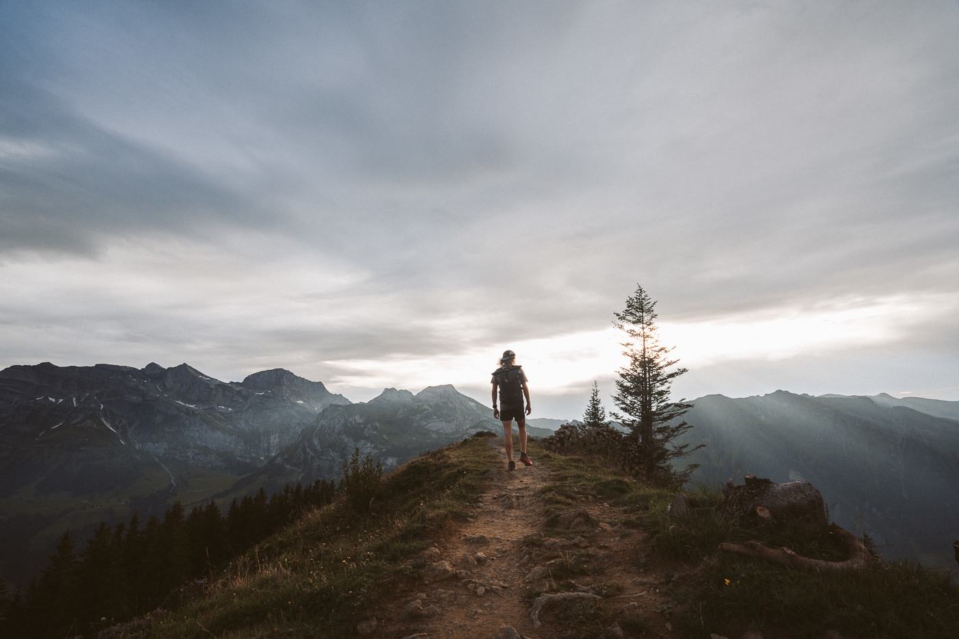
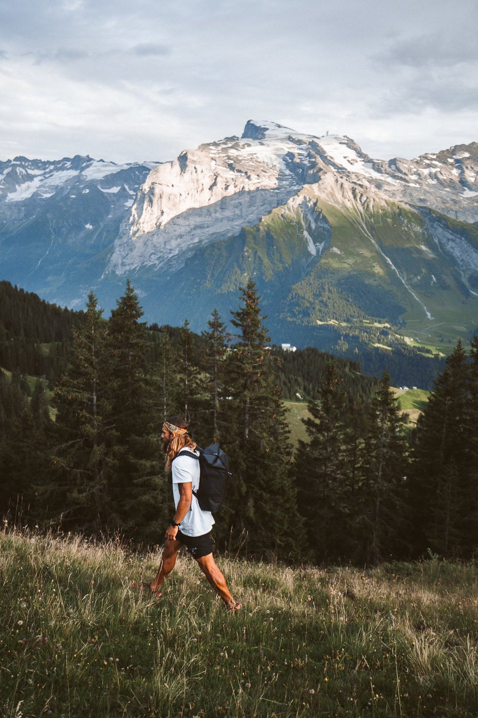
The trail then sends you into the forest and the trail really diversifies as you are in complete shade and surrounded by trees rather than the wide-open views as you were accustomed to earlier in the hike. As you wander through the forest the trail undulates ever so slightly with small ups and downs before finally, you emerge into the open again and the views have intensified with bigger mountains now dominating the horizon.
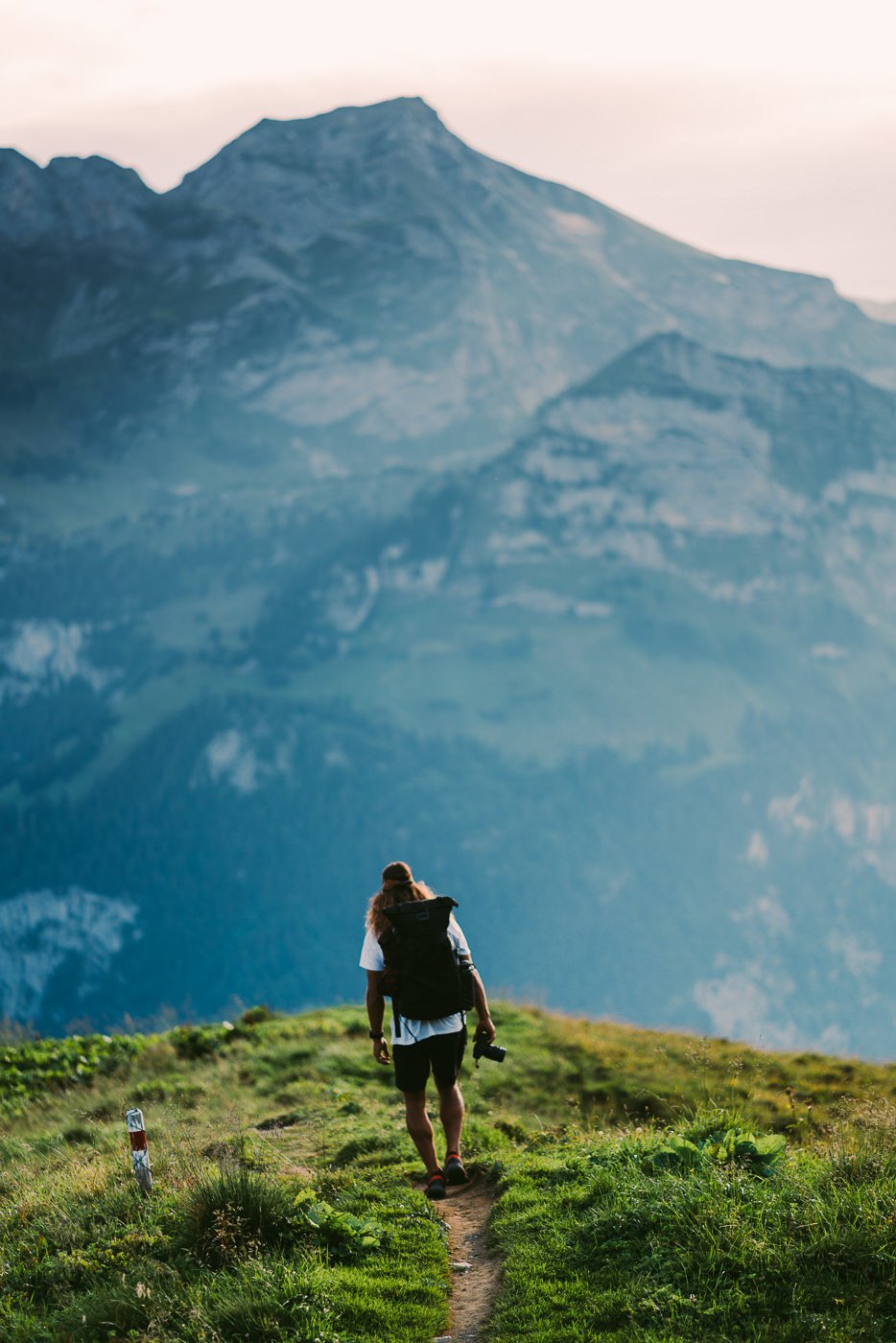
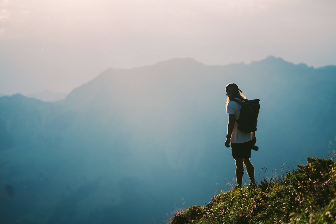
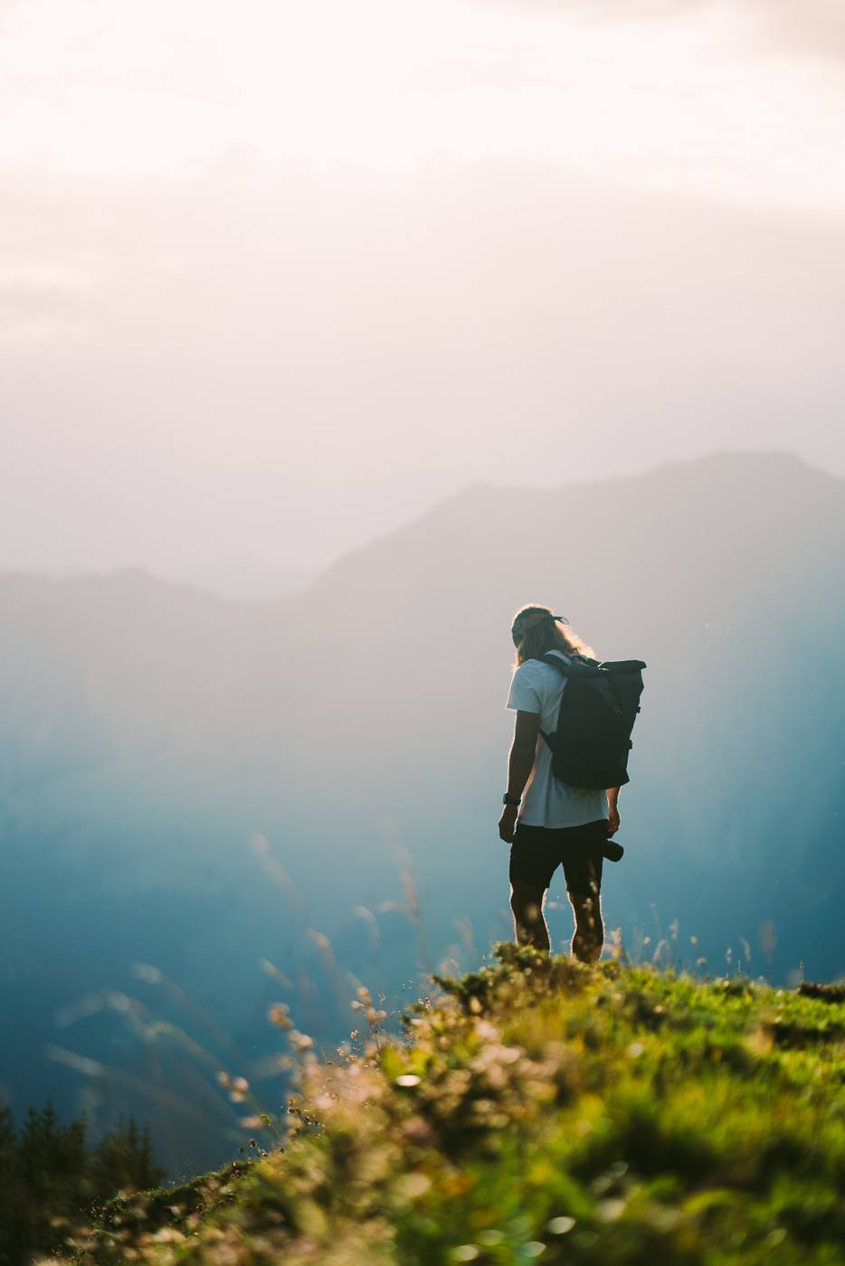
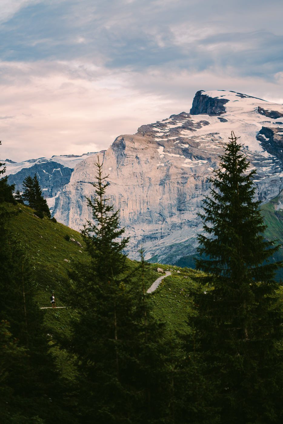
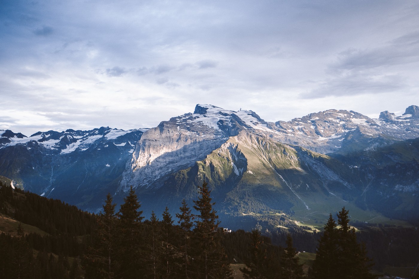
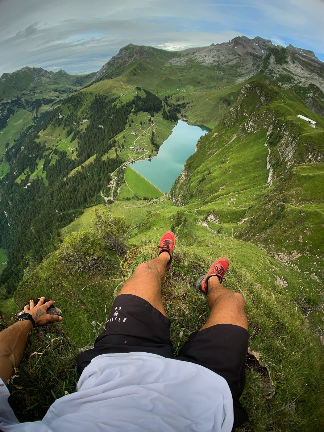
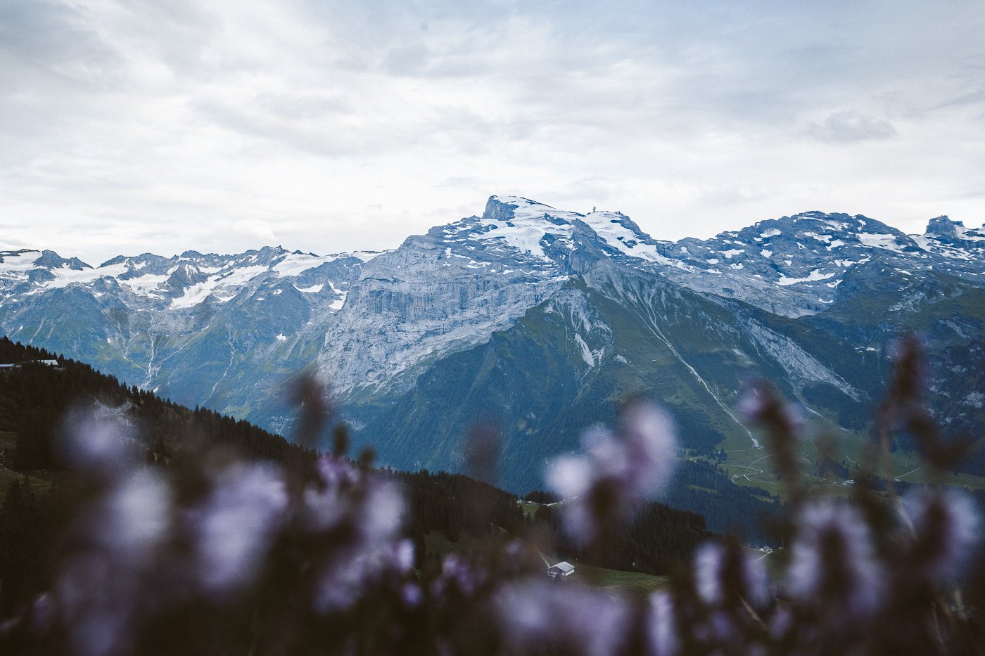
Now the trail is hugging the underside of the cliffs above as it winds you in the final steps towards to Brunnihutte. Titlis (3,238m), the most popular peak in Engelberg emerges just before you reach Brunnihutte. If you have timed it well the lighting should be giving you some incredible views towards Titlis and the other peaks in the region.
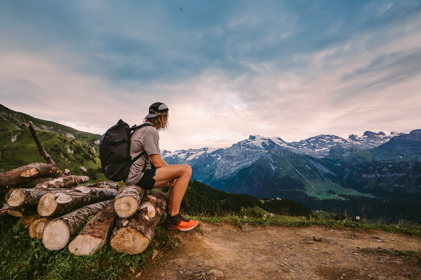
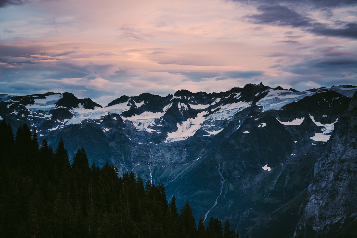
At Brunnihutte there is a small pond, kids’ games, and of course a restaurant, toilet facilities, and a great seating area looking out towards Titlis. We sat down here for a while enjoying the late colors of the evening sky. There was no epic sunset but the golden hour we had enjoyed on our walk to Brunnihutte would make the journey worth it.
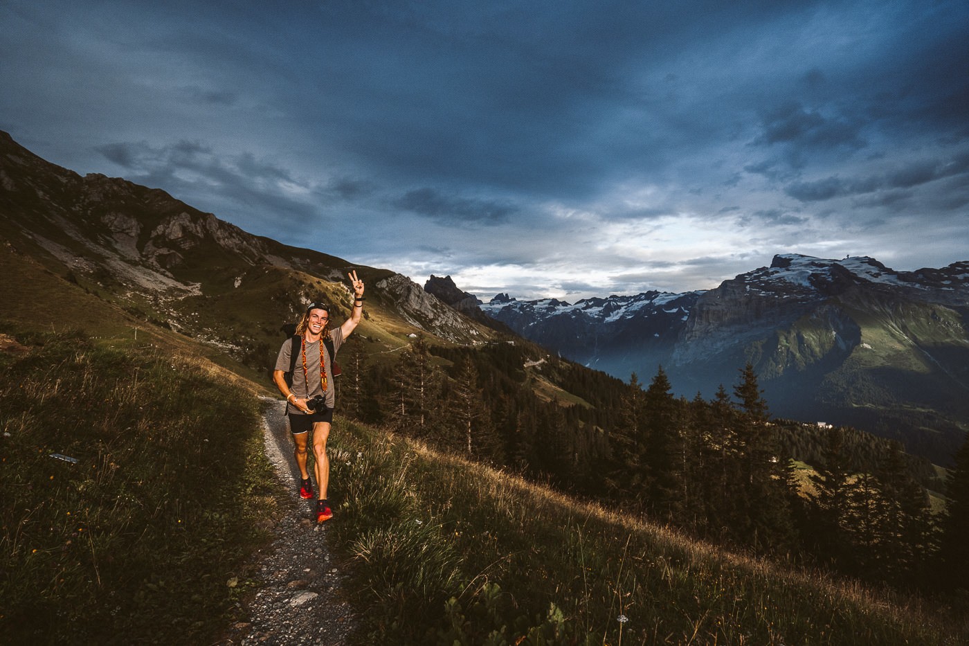
We now had a 1.5-hour walk down to Engelberg from Brunnihutte, which took just over an hour an actuality. It’s a very safe and easy trail down, which is signed the whole way.
I highly recommend this hike, especially doing it from Bannalpsee to Brunnihutte to Engelberg if you are a keen photographer as the lighting you will get with that route and the late part of the day is spectacular!
SWISS TRAVEL PASS or HALF-FARE CARD
OPTION 1: Buy the Swiss Half Fare Card: Switzerland trains, buses, and cable cars are EXPENSIVE! I found the best way to get around cheaply was to buy the Swiss Half-Fare Card before I arrived. It gives you 50% off every regular train, bus, and even many cable cars. It only costs $150 USD but pays itself off in just a few days with many train tickets in Switzerland costing close to $100 alone. If you are staying for more than 5 days, I suggest buying the Swiss Half-Fare Card.
OPTION 2: Buy the Swiss Travel Pass: The second option is to get the Swiss Travel Pass, which gives you unlimited train, bus, and (many) cable car rides but it’s pretty expensive at around $100 USD per day so if you don’t travel each day it isn’t worth it.
OPTION 3: Buy the FLEXI Swiss Travel Pass: The final (BEST) option is to get the FLEXI Swiss Travel Pass, which allows you to buy 8 days’ worth of transit but you can choose the night before if you want to activate the next day. That way you don’t need to travel every day to get your money’s worth, you can just activate the FLEXI Swiss Travel Pass on the days when you are doing sizeable transits. My advice is to book the Swiss Half-Fare Card or the FLEXI Swiss Travel Pass in advance before your trip so it’s ready to go when you arrive.
GET A SWISS TRAVEL PASS!
Enjoy UNLIMITED train, boat, and bus rides in Switzerland for up to 15 days. Click to book a flex Swiss Travel Pass or choose the Consecutive Swiss Travel Pass.
The Swiss Travel Pass starts at $260 for 3 days. Click here to check if it’s available on your travel dates.
MY SWITZERLAND HIKING GUIDES
I spent 100 days hiking in Switzerland and created a guide for different regions around the country. You can click on one of my Switzerland hiking guides below to help you plan your trip.
- The Complete Guide: 50 AWESOME HIKES IN IN SWITZERLAND
- The Via Ferrata Guide: 4 EPIC SWITZERLAND VIA FERRATA COURSES
- Lauterbrunnen Guide: 10 AWESOME HIKES NEAR LAUTERBRUNNEN
- Interlaken Guide: 15 AWESOME HIKES IN INTERLAKEN
- Grindelwald Guide: 12 AWESOME HIKES NEAR GRINDELWALD:
- Mürren Guide: 7 AWESOME HIKES IN MURREN
- Appenzell Guide: 9 AWESOME HIKES NEAR APPENZELL
- Chur Guide: 7 AWESOME HIKES NEAR CHUR

MY SWITZERLAND TRAVEL TIPS
- For Backpackers: SWITZERLAND BUDGET BACKPACKING GUIDE
- Travel Tips: 20 THINGS TO KNOW BEFORE VISITING SWITZERLAND
- Transport Tips: RENTING AND DRIVING A CAR IN SWITZERLAND
- Accommodation Guide: 30 BEST PLACES TO STAY IN SWITZERLAND
