
Sharp Peak Hike in Sai Kung is one of the most scenic hikes in Hong Kong. The stunning coastline of Sai Kung wraps around the dramatic ridges below you as you stand atop one of the highest points in the region. The turquoise water and white sand of the beaches will blow away your perceptions of Hong Kong as a city destination.
SHARP PEAK HIKING GUIDE
In this blog post, I’ll share everything you need to know about the Sharp Peak Hike including where it is, how to get there, and when it’s best to visit.
SHARP PEAK HIKE DETAILS
- Hike Distance: The hike to Sharp Peak actually has a number of different routes. They range from just a 4-kilometer round trip to 20+ kilometers.
- Alternate Route: However, the route I did and one of the most popular routes (easiest for public transport) is to start and finish at Pak Tam Au. This way you can catch the bus directly to the start point of the trail. It is a 14.5-kilometer loop that takes you all the way down to the beach and then back up to Sharp Peak before returning to Pak Tam Au. t’s the full experience. I’ll detail it more below but it’s called the Sharp Peak & Tai Wan Beach Loop.
- Hike Duration: The duration (assuming you do the 14.5-kilometer Tai Wan Beach Loop) was about 6-7 hours but it depends how long you spend at the beach and the summit.
- Hike Difficulty: The hike was actually not that easy, to be honest. We took a different route in as we hiked to the Sai Kung Rock Pools and the bushes destroyed our legs and the trail was often hard to follow. Other than that the hike was okay. Obviously, there were quite a few sections with steep climbs but there was never any exposure or dangerous sections. Heading down was at times slipper on the gravel but when going slowly it posed only minimal risk. Distance-wise the 14-kilometers will test most and if you aren’t sure, you might consider one of the shorter route options.
- Hike Incline: The 14.5-kilometer loop had 650m of incline throughout but we actually did 1100m as we included the rock pools on our journey.
HOW TO GET TO SHARP PEAK IN SAI KUNG
Getting to Sharp Peak in Sai Kung is pretty easy but it definitely depends on the route you are taking. First I’m going to tell you how I did it with the regular but challenging, Sharp Peak & Tai Wan Beach Loop. After explaining that system, I’ll give you a few alternatives.
How I did it: The trail begins at Pak Tam Au, which has a bus stop at the trailhead as well as a restroom and vending machines with drinks. You can catch the bus from Sai Kung Pier. We caught the 94 to and from Pak Tam Au and everything was pretty seamless.
The route is an out-and-back loop so you will finish where you started and reverse your transit. The public transport to Sai Kung Pier will depend on where you are based in Hong Kong. I’ve provided a map below of the route we took (more or less).
Easier option: The other option is to reach Sharp Peak is to head to Wong Shek Pier and then take a ferry to Chek Keng. From there you can head uphill along MacLehose Section 2 and ascend along Nam She Tsim route to the Sharp Peak summit. When the ferry drops you in Chek Keng, it is just a 2.2km trek up to Sharp Peak.
You can then descend back down to Chek Keng. It’s not the most well-rounded or scenic way to reach Sharp Peak but it is the simplest, and least physical way compared to the 15km trek I am suggesting above. Highly consider this if you want the views but aren’t sure about your fitness!
You NEED the Octopus Card
TRAVEL TIP: In Hong Kong you NEED the Octopus Card to use public transport and ferries, which is how everyone gets around. Pre-Book your Octopus Card with a Pre-Loaded balance of 50HKD so you can pick it up at the airport (very easy) and then catch public transport straight to your hotel.
- Conveniently ride the MTR, bus, ferry, coach, and tram with just a tap of your Hong Kong Tourist Octopus Card
- Conveniently pick up your card with a preloaded credit of HKD50-100 at the Hong Kong International Airport
SHARP PEAK AND TAI WAN BEACH MAP
I said above that we took this route more or less. We actually extended it by going to the Sai Kung Rockpools. We still started and finished at Pak Tam Au but our loop at the bottom was extended to the bay further south. If you plan to do that it’s not hard to add it in but for the purpose of sharing this map, most will use the regular Sharp Peak and Tai Wan Beach route.
TOP 3 PLACES TO STAY IN HONG KONG
- Best Value Hotel: Metropark Hotel Causeway Bay – 4-star hotel for less than $100
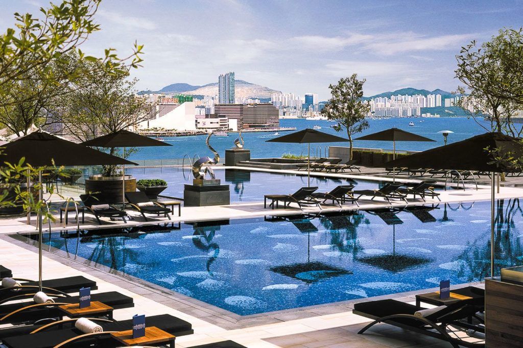
- Best Value Luxury Hotel: Hotel ICON – $150 for a 5-star hotel with an epic pool
- Best Hiking/Adventure Base: Hotel Stage – Located in Kowloon and right next to lots of epic hikes.
Check out my full guide here: BEST AREAS TO STAY HONG KONG
MY EXPERIENCE HIKING SHARP PEAK IN SAI KUNG
I set off at 7 am from Tsim Sha Tsui and made my way out into the Hong Kong Hustle on a subway and then two buses to arrive at Pak Tam Au bus stop. This would be the start and the end of our hike. As I mentioned in some o the details above, we took a slightly different route to the map.
We first headed through the wild, uncleared trails from Pak Tam Au to reach the Sai Kung Rockpools. If you do head along these backwoods trails, I highly advise pants as the route is a bit unruly and our shins copped a beating from the low brush.
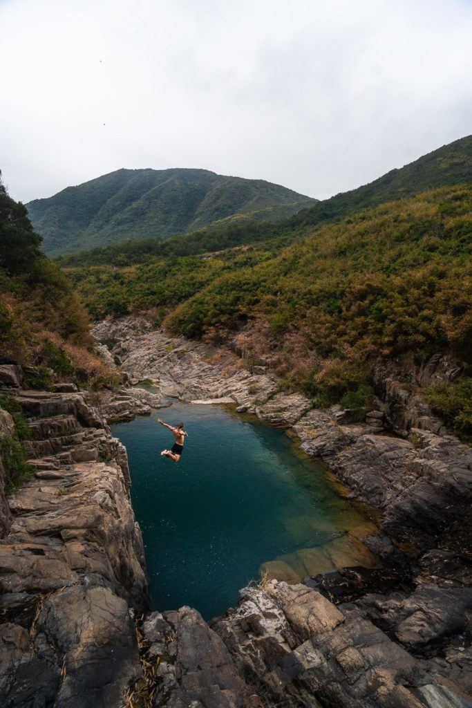
After an hour along the undulating ridges of Sai Kung, we made our way down to the Sheung Luk Stream, which we followed as we headed towards the coast. Just before the beach came into sight, we came across the rockpools. No-one was there, which is apparently quite rare. Although it wasn’t all a perfect situation.
The clouds were keeping the sun at bay and the water was damn freezing. The cliff-jumps were a guarantee but boy was it cold! We sent a few cliff jumps from a 6-7-meter high rock wall into the icy waters of the Sai Kung Rockpools.
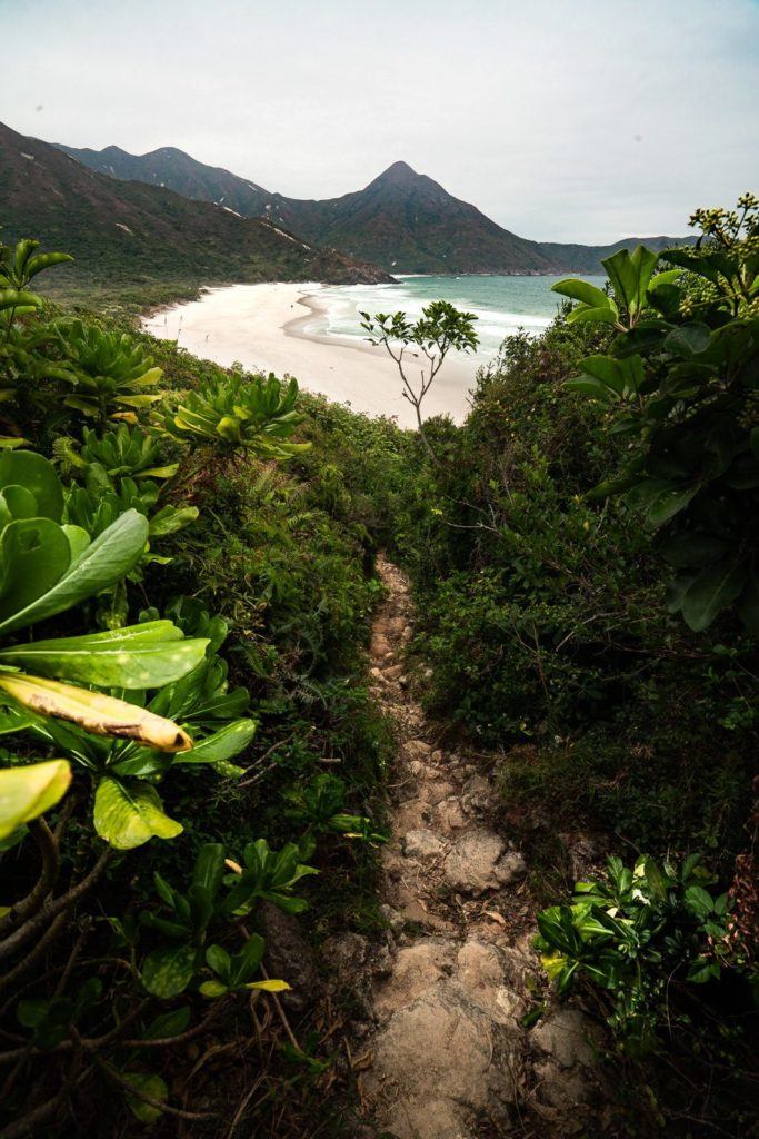
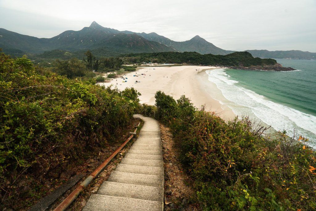
After the rockpools, we made our way out to the Ham Tin Beach. There are two small restaurants in between Ham Tin Beach and Wai Tan Beach. They actually served uop some great food and we had a vegetarain fried rice with egg for $70HKD.
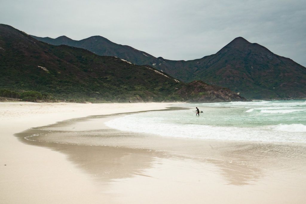
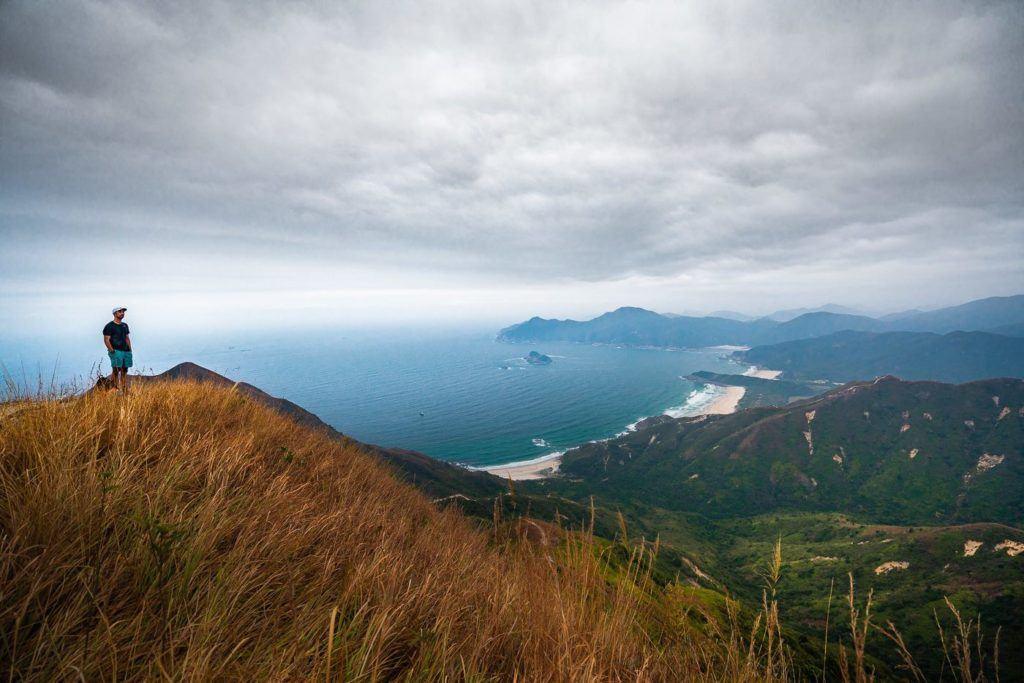
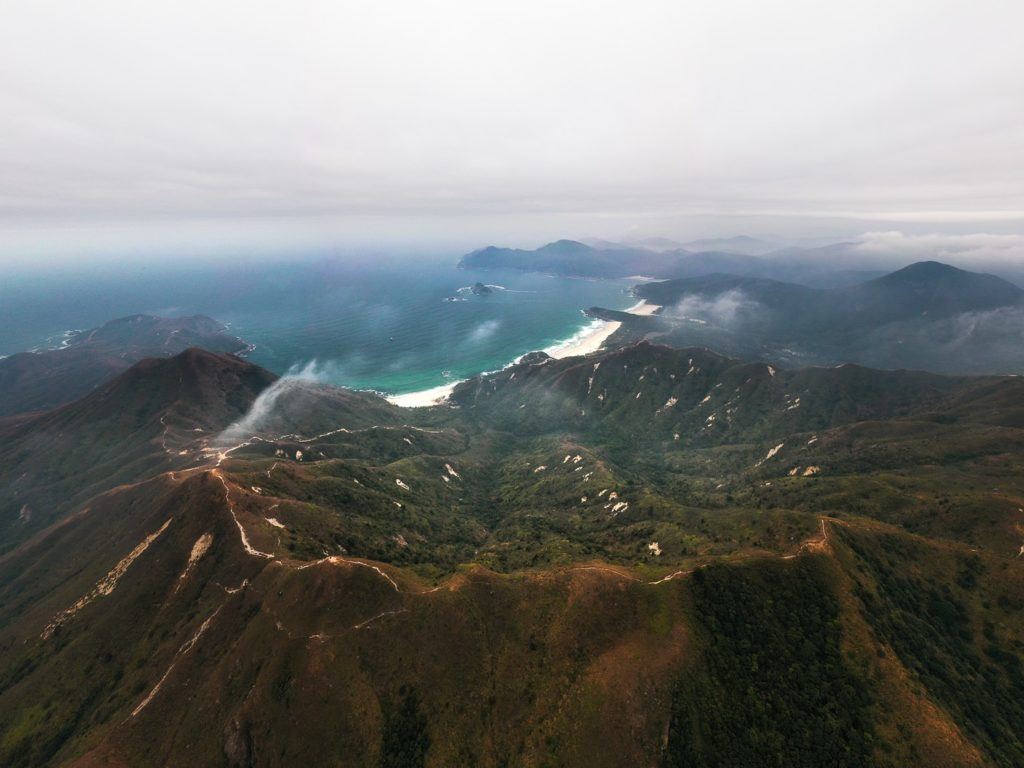
After lunch, we then linked onto the Maclehose 2 section of the trail. We were now pretty much back on the route listed above, which takes you along some beautiful coastal trails. It reminded me of a lot of the Great Ocean Road or walking the boardwalks at beaches in Sydney. It was a very gloomy day so don’t judge the beauty from my dark photographs but just trust me, on a sunny day this region is a pristine paradise with white sand and turquoise water.
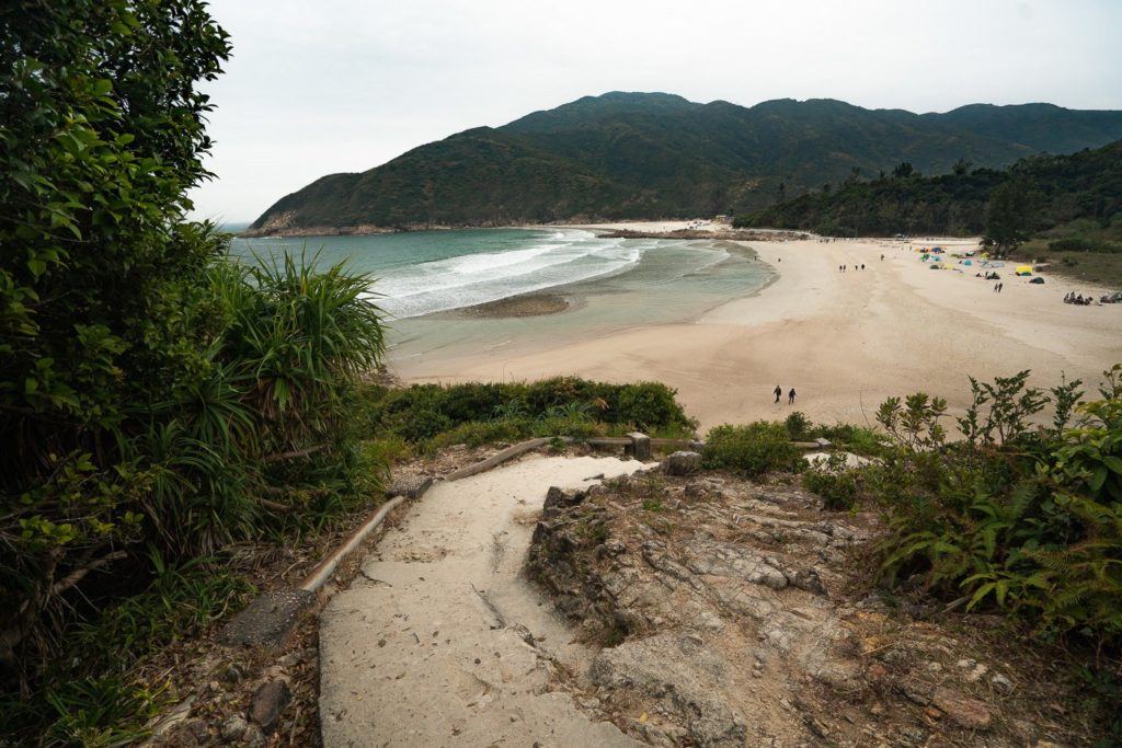
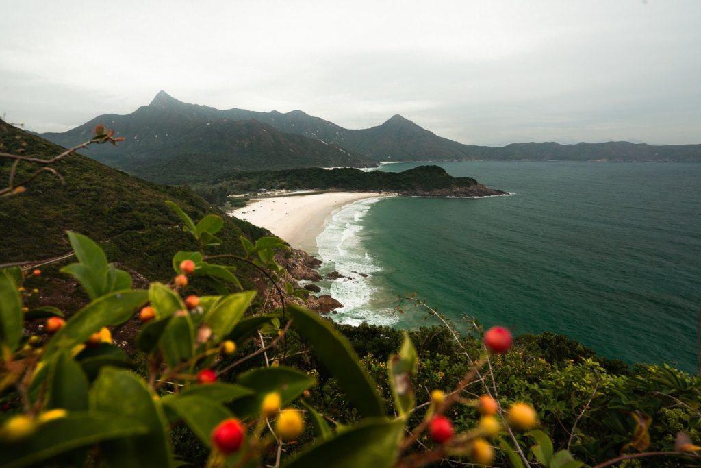
The trail hugs the coast for the rest of the journey now until you reach the surf beach of Tai Wan. I was just praying for the sun to come out at this point because I could tell how beautiful the beach would be with just a little bit of a golden shimmer but it wasn’t to be. I’m sure the group of surfers at Tai Wan were keen on some sun too but nothing was stopping them.
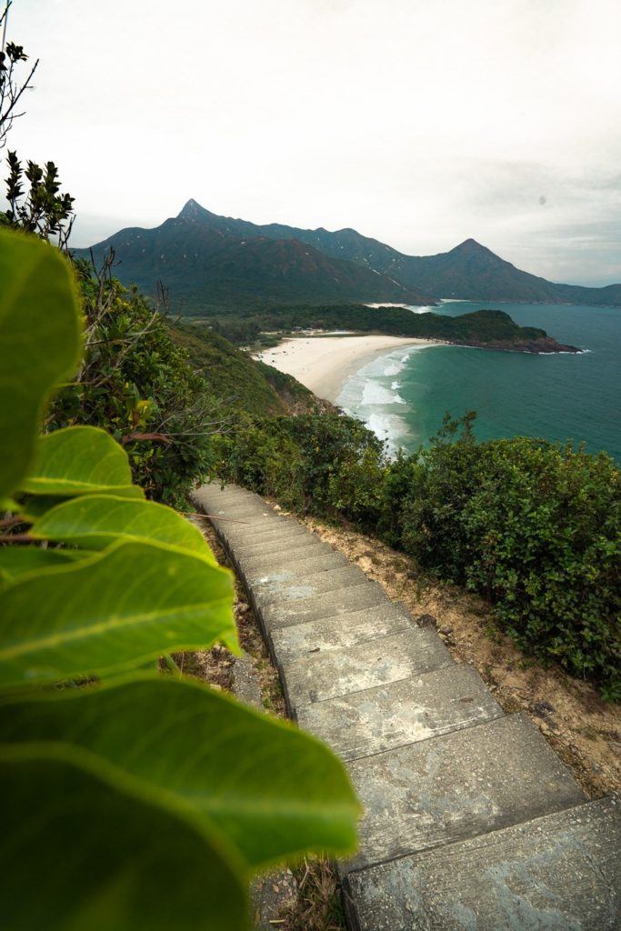
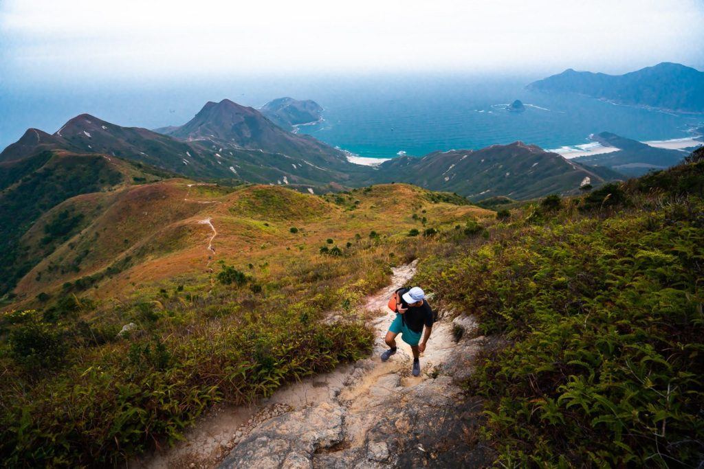
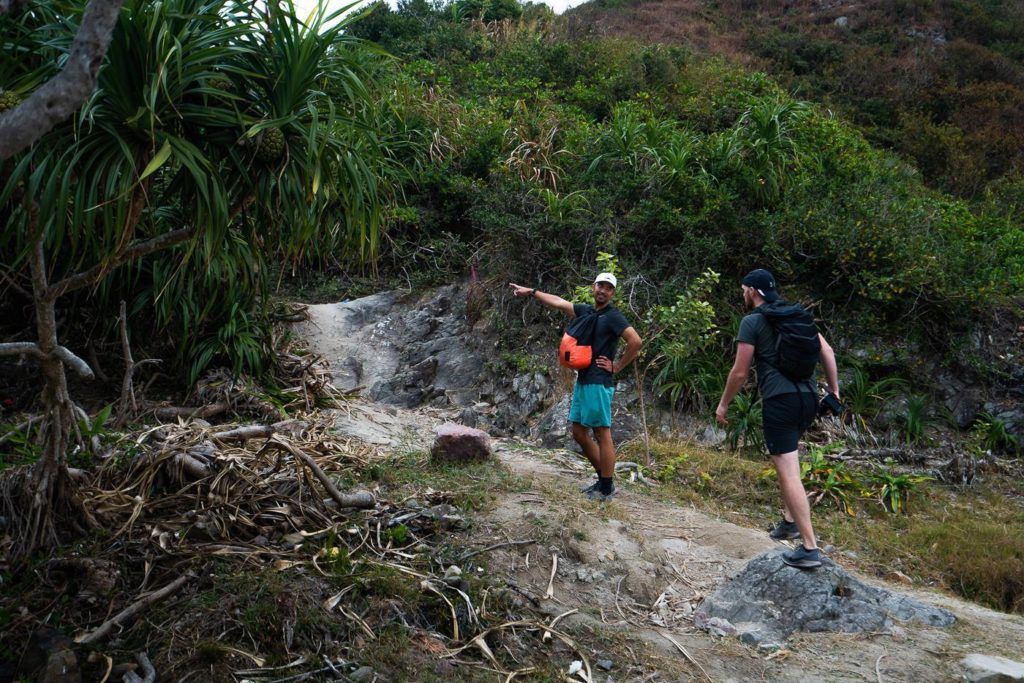
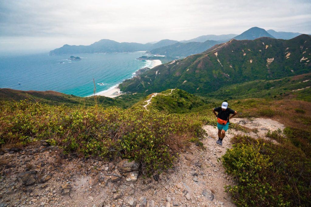
Once you reach the far end of Tai Wan Beach, you will find multiple routes that all lead you up to Sharp Peak. We decided to take the furthest route and wrap around the far side of the summit. This adds a bit of time onto your hike but also gives you a little look into the scenery to the north of Sharp Peak.
Both ways are steep, there is no avoiding the incline from the beach that’s for sure. The entrance we took from the beach was not very formal but it was a defined trail most of the way.
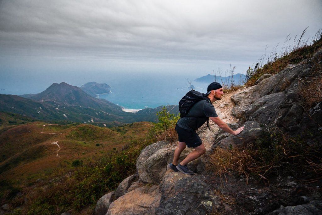
At this point in the trek, it is time to roll up the sleeves because you are about to get climbing. Before the trek I had been reading some pretty bizarre comments about needing to use your hands a lot and it was very dangerous. This is not at all the case. We might’ve used our hands once but it was never a rock-climbing course. When I say ‘climbing’, I mean trekking up a mountain.
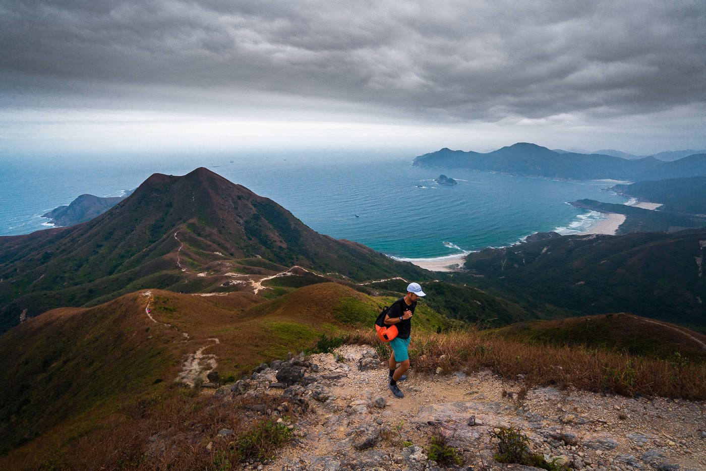
As you power your way up the rocky route the view slowly reveals itself. We found ourselves looking back towards the coast throughout the climb as the view became more and more impressive the higher we rose.
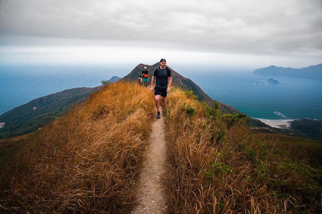
This part of the trail will challenge even those with good fitness. Those who are out of shape will curse their friends who dragged them on the hike. However, you are now so close. You can see the summit and there is no turning back. The trail becomes a white path of loose rock, cutting through the dead-orange grass. We’re nearly there.
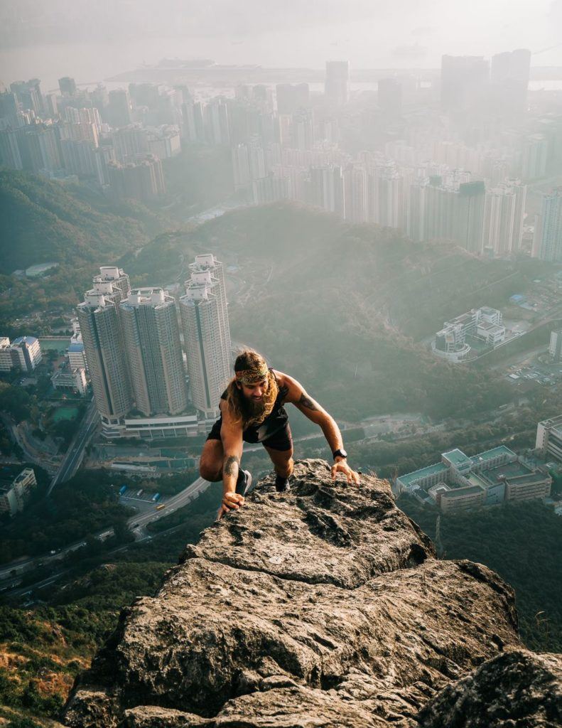
The final section of the trail was rocky and almost could be called bouldering. It was possible to navigate without using your hands but as you can see below it was a section that required a bit of technical bouldering. Don’t fear this part, young and old were cruising through without a stutter.
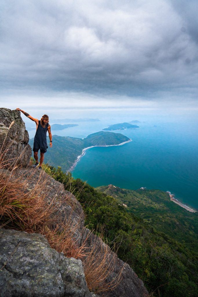
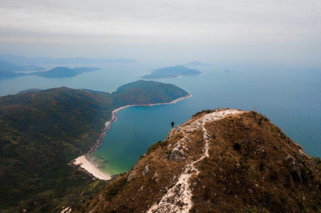
Just before the Sharp Peak summit was a great little rocky outcrop with views over the Sai Kung peninsula. We stopped here before making the final ascent.
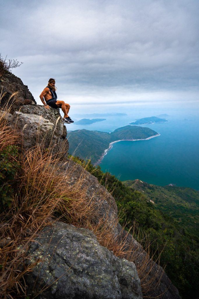
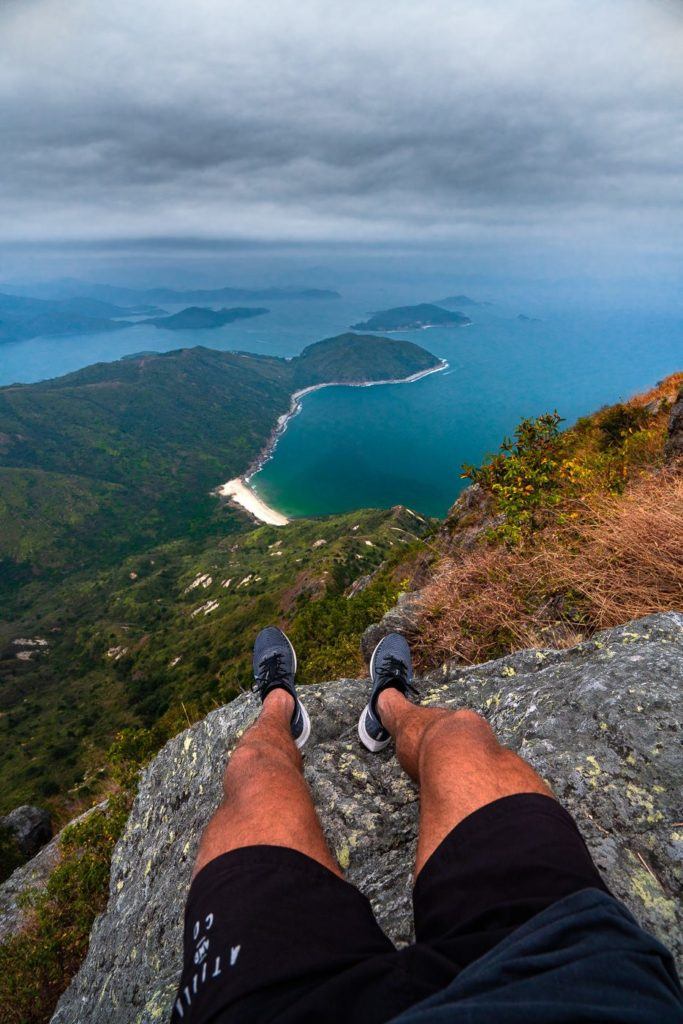
Finally, we reached the summit of Sharp Peak in Sai Kung. The top was quite crowded with around 20 or so others enjoying the views. After a few moments, there was a mass exodus and it was just a few of us left to take it all in. We hung out here at the top for about half an hour but some storm clouds were rolling in to make the dark scene even darker. The views on a clear day from this summit will be absolutely phenomenal. On this day they were great but with the light on the ridges and the blue water, it will be out of this world. Here are the photos from the summit taken on the camera and the drone.
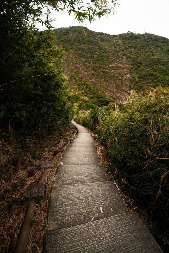
After an epic time at the summit watching the clouds come and go, we made the dash back to Pak Tam Au, which took us just under two hours. The slippery gravel caught us off guard a few times as I went for a couple of slips but the trail was paved for the last 3-kilometers back to Pak Tam Au bus stop.
I hope you get out and enjoy the Sharp Peak Hike and if you can make it work, I’m sure it would be an epic spot for a sunrise or a sun-set but due to its position, it may be a little tough logistically. Good luck and happy hiking.
HAVE YOU READ MY OTHER HONG KONG ARTICLES?
- A complete guide to the best things to do: 27 AWESOME THINGS TO DO IN HONG KONG
- My favorite hikes in Hong Kong: 21 AWESOME HIKES IN HONG KONG
- How to plan your Hong Kong trip: 3-DAY HONG KONG ITINERARY FOR ADVENTURE-LOVERS
- The biggest ever guide for where to stay in Hong Kong: WHERE TO STAY IN HONG KONG: BEST AREAS & HOTELS
- My favorite EASY hikes: 10 EASY HIKING TRAILS IN HONG KONG
- The most luxurious places to stay: THE TOP 10 LUXURY HOTELS IN HONG KONG (5-STAR LIST)
- The ultimate adventure: EPIC HONG KONG HELICOPTER TOUR FROM THE PENINSULA HOTEL
- The toughest overall hike: WEST DOG’S TEETH HIKE ‘HARDEST HIKE IN HONG KONG’
- Best waterfall hike: TAI MO SHAN HIKE: THE HIGHEST PEAK IN HONG KONG
5 BEST HIKES IN HONG KONG
I wrote a massive guide about the 21 Best Hikes in Hong Kong, but if you are only in Hong Kong for a week or less here are the five most epic routes.
Xav
Sunday 15th of October 2023
Really great. Thanks a lot 🙏
Dhanashree
Friday 26th of March 2021
Hi, thank you for this post. It really helped us do this trek and prepared us mentally. One question I have, is the easiest route actually just 2.2 kms from Chek Keng ferry to the summit ? We did this one. But showed up 10km door to door. I live in Taikoo/Island line.