
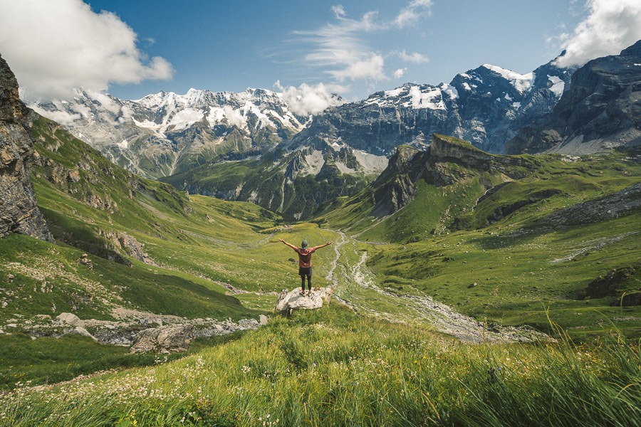
Interlaken is a stunning town in central Switzerland that is one of the best spots for hiking in Switzerland. I used Interlaken as my hiking base for several weeks in the summer and found it to be very central and convenient to nearby hiking trails but also several nearby hiking hotspots that are within an hour or so by trains such as Grindelwald, Lauterbrunnen, Murren, and Thun. I created this Interlaken Hiking Guide to show you all of the hiking trails in the region. I’ve done all of the hikes on this list but there are many more you can explore for yourself (I’ve got a list of more hikes near Interlaken for when I return).
THE BEST 15 HIKES NEAR INTERLAKEN
In this blog post, you will find a description of each of the hikes in Interlaken and some photos I took as well as a link to the individual blog post I wrote about every hike I did near Interlaken. You can click on that link for a more detailed review of the hike including maps, starting points, how to get there, photos, directions, difficulty, and a short story about my experience on that Interlaken hike.
So, let’s get into it and start looking at all of the top hikes near Interlaken in my Interlaken Hiking Guide. All of the hikes on the list are trails I hiked while based in Interlaken. So, even if the hike is in Murren or Lauterbrunnen, it means that I went from Interlaken and hiked it, and came back the same day (unless I stayed in the hut overnight). This is a guide to what hikes are possible while based in Interlaken.
GET A SWISS TRAVEL PASS!


Enjoy UNLIMITED train, boat, and bus rides in Switzerland for up to 15 days. Click to book a flex Swiss Travel Pass or choose the Consecutive Swiss Travel Pass.
The Swiss Travel Pass starts at $260 for 3 days. Click here to check if it’s available on your travel dates.
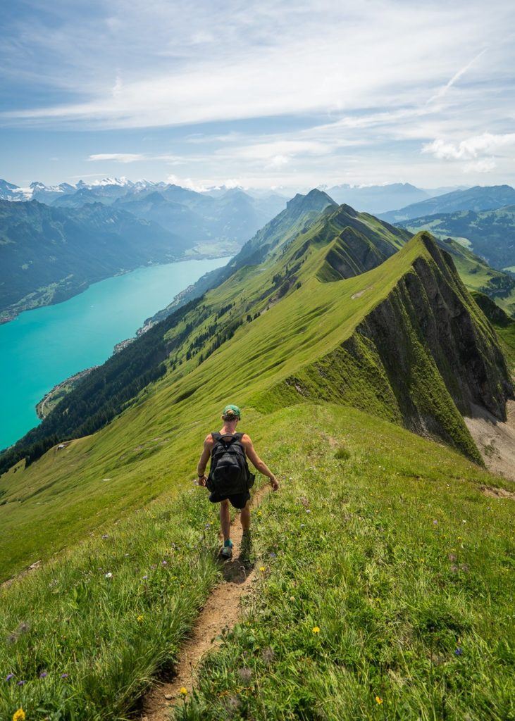
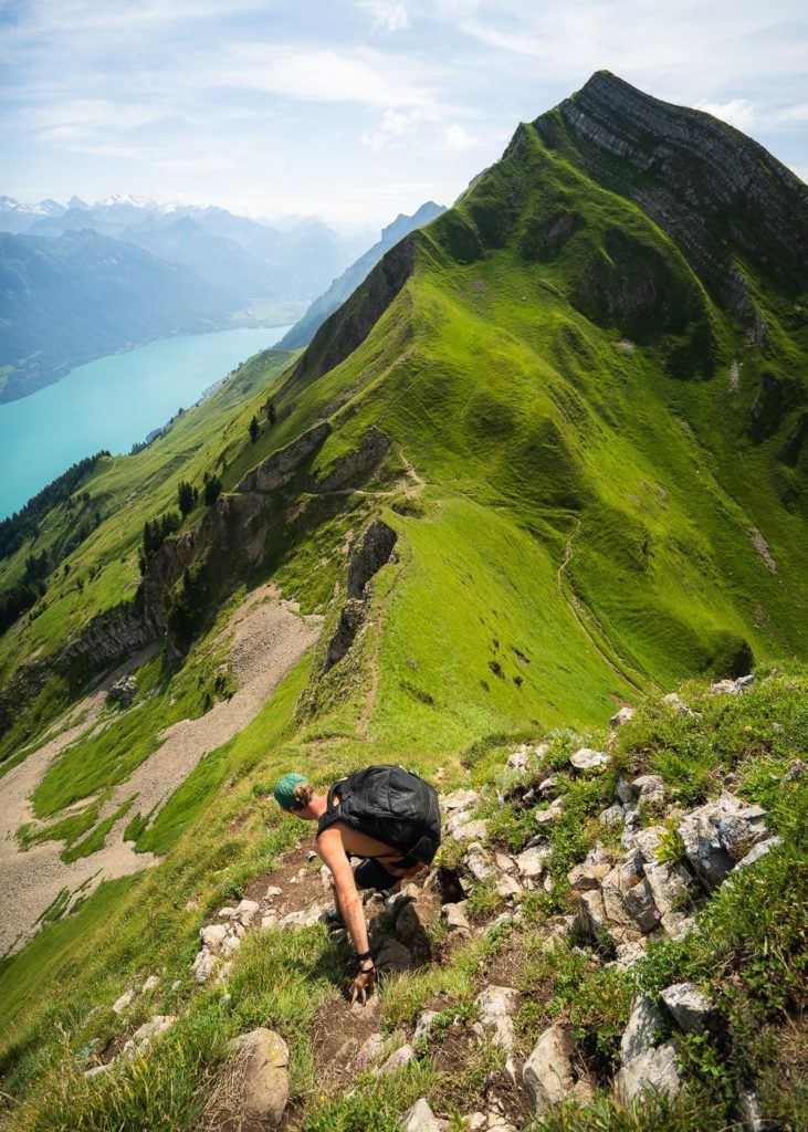
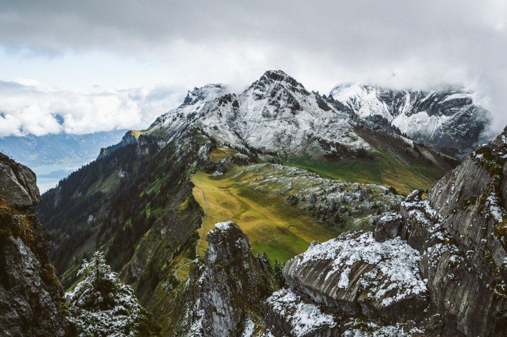
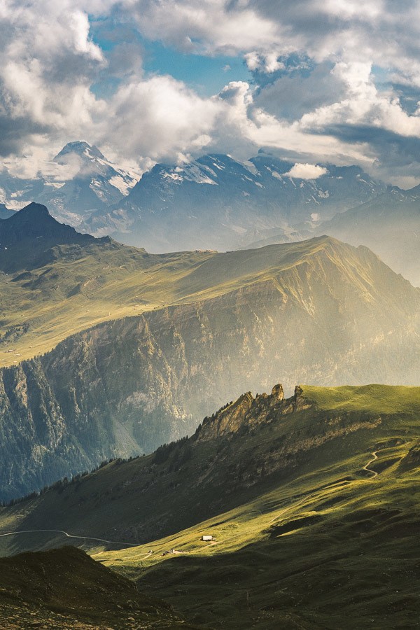
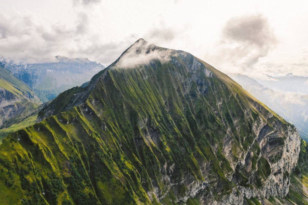
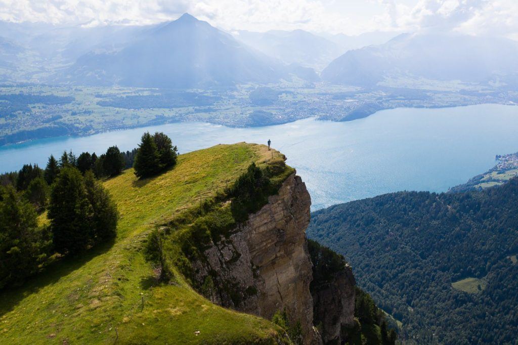
HARDERGRAT TRAIL
The Hardergrat hike has to be somewhere at the top of this list. It’s known as one of the toughest hikes in Interlaken and also one of the most dangerous. The trail begins at Brienz and runs along the Brienzersee (Brienz Lake) all the way to Harder Kulm Station.
Experienced hikers can complete the hike in about six hours, but it’s important to note that there are many sections with extremely steep drop-offs which can be dangerous in wet conditions. The trail is not recommended for novice hikers. If you plan on taking the train up to Brienz and then down from Harder Kulm, make sure to hike at a fast pace to avoid missing the last train. Otherwise, you will need to hike down another 800m of incline.
Your best option would be taking the early train from Brienz as it’s half-price and working your way up to Harder-Kulm Station, making sure to catch the last train down. Alternatively, if you are an experienced hiker, you can hike up to Brienzer Rothorn and follow the ridge to Harder Kulm Station and then hike down to Interlaken. This will be a strenuous hike of almost 30 kilometers with an incline of over 3000 meters throughout the day. Wishing you a successful journey.


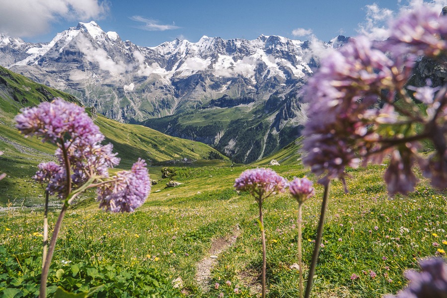
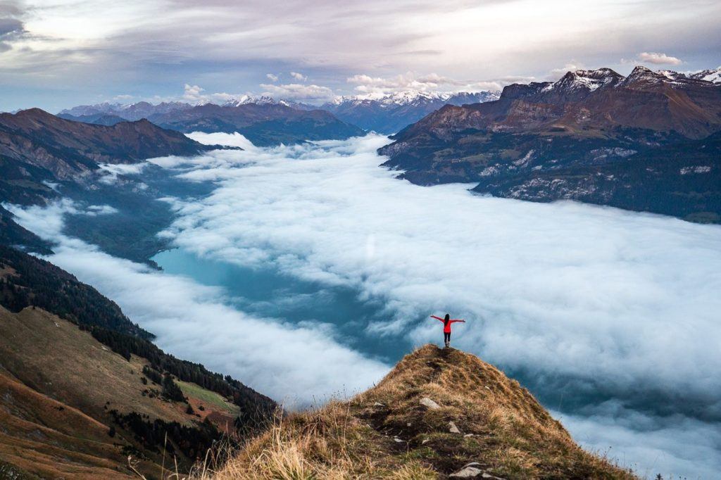
SCHYNIGE PLATTE TO FIRST HIKE
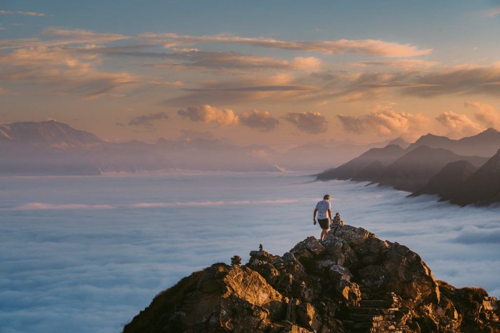
If you’re looking for a great hiking route in Interlaken, the trail starting from Schynige Platte and ending at First via Faulhorn is definitely worth considering. You’ll be rewarded with breathtaking views at every corner. However, it’s important to note that the trail is quite long, spanning over 16km with an incline of nearly 1000m. So, make sure you’re prepared for a long day on your feet. That being said, the stunning panorama that awaits you at Faulhorn is definitely worth the effort. Once you reach Faulhorn, you can enjoy a bowl of soup and a hot cup of coffee while taking in the beautiful view.
I completed the hike in five hours, but skipping Oberberg and Faulhorn could make it a bit faster. However, the whole point of the hike is to summit those peaks! My suggestion would be to set aside 5-7 hours for the hike, which will give you enough time to rest and enjoy a coffee and soup break at Faulhorn. Keep in mind that the last cable car from First to Grindelwald operates until 5:30 pm during the summer. So, it’s better to leave Schynige Platte before noon to catch it. If you miss it, you’ll have to take a 2-hour trail down to Grindelwald with tired legs.
Want more details and photos? View the full blog post here: SCHYNIGE PLATTE HIKE TO FAULHORN & FIRST
What are my favorite pieces of hiking gear?
There are four pieces of gear that I simply never forget when I go on a hike. These are four items that I using right now and this list gets updated every year! Here are my hiking essentials.
- Arcteryx BETA AR Rain Jacket: This is my go-to rain jacket. It’s super light, folds down into a tiny ball, and protects brilliantly in a storm. This one never leaves my backpack.
- Salomon X Ultra 3 Mid GTX Hiking Boots: For the best ankle support, waterproofing, and durable exterior I’m a fan of tough but light hiking boots like these Salomons for my adventures.
- Black Diamond Head Torch: I can’t tell you how many times, I’ve arrived back from a hike unexpectedly late. I always keep this lightweight but strong headtorch in my bag for the unexpected.
- Darn Tough Socks: These are the most comfortable hiking socks I’ve ever worn and last for years. They also have a lifetime warranty and you just send them in with a hole and they replace it no questions asked.
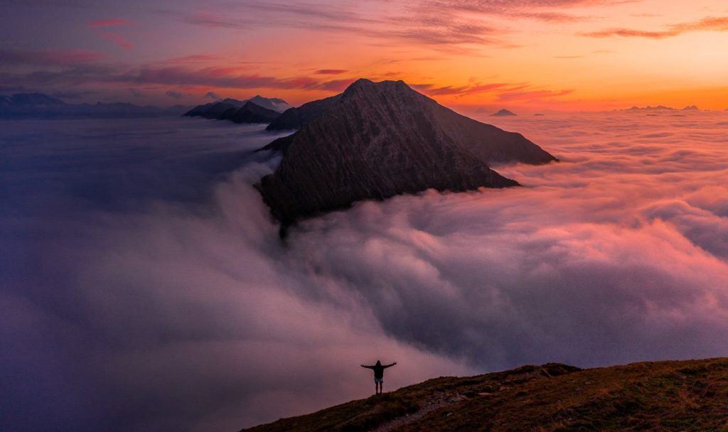
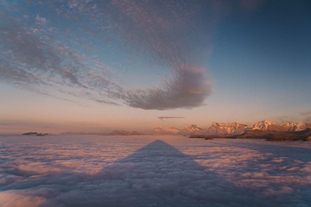
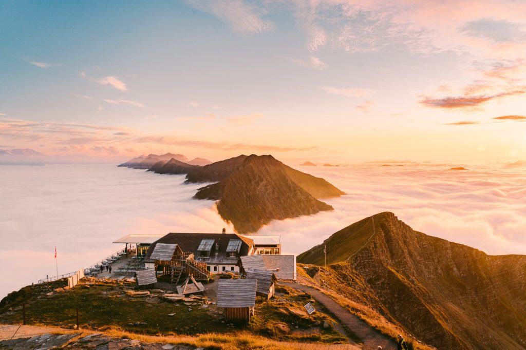
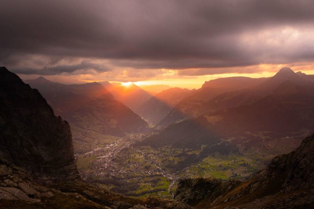
MOUNT NIESEN HIKE ‘THE SWISS PYRAMID’
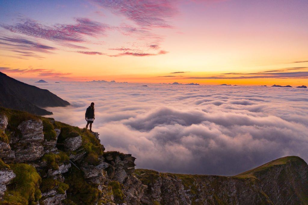
I went for a hike to Mount Niesen, which I hadn’t heard much about before, but it ended up being an amazing experience in several ways! The cable car ride was exhilarating due to its steepness, the views on the panorama trail to the summit were breathtaking, and being above the clouds at Niesen Kulm Berghaus to watch the sunset was beyond words.
On clear days, this peak’s pyramid shape sets it apart from the clouds. It is a breathtaking sight to see, especially with its mountain hut restaurant on top. This peak is located in Thun, just one town away from Interlaken. The photos below show the pyramid’s shadow at sunset, which was one of the highlights of my solo hike in Interlaken.
The distance from Mulenen to Niesen Kulm is 7.7 km. Alternatively, you can take the cable car to Schwandegg station, which is halfway up, and then hike the remaining distance to Niesen Kulm. This is what I did, and it took me 1 hour and 13 minutes to complete the 4.8 km trail with an incline of 646 meters. If you have enough time, it is recommended to take 2-3 hours to complete the hike.
Want more details and photos? View the full blog post here: HIKING MOUNT NIESEN ‘THE SWISS PYRAMID’
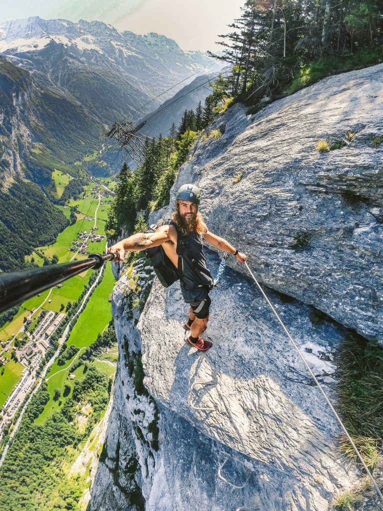
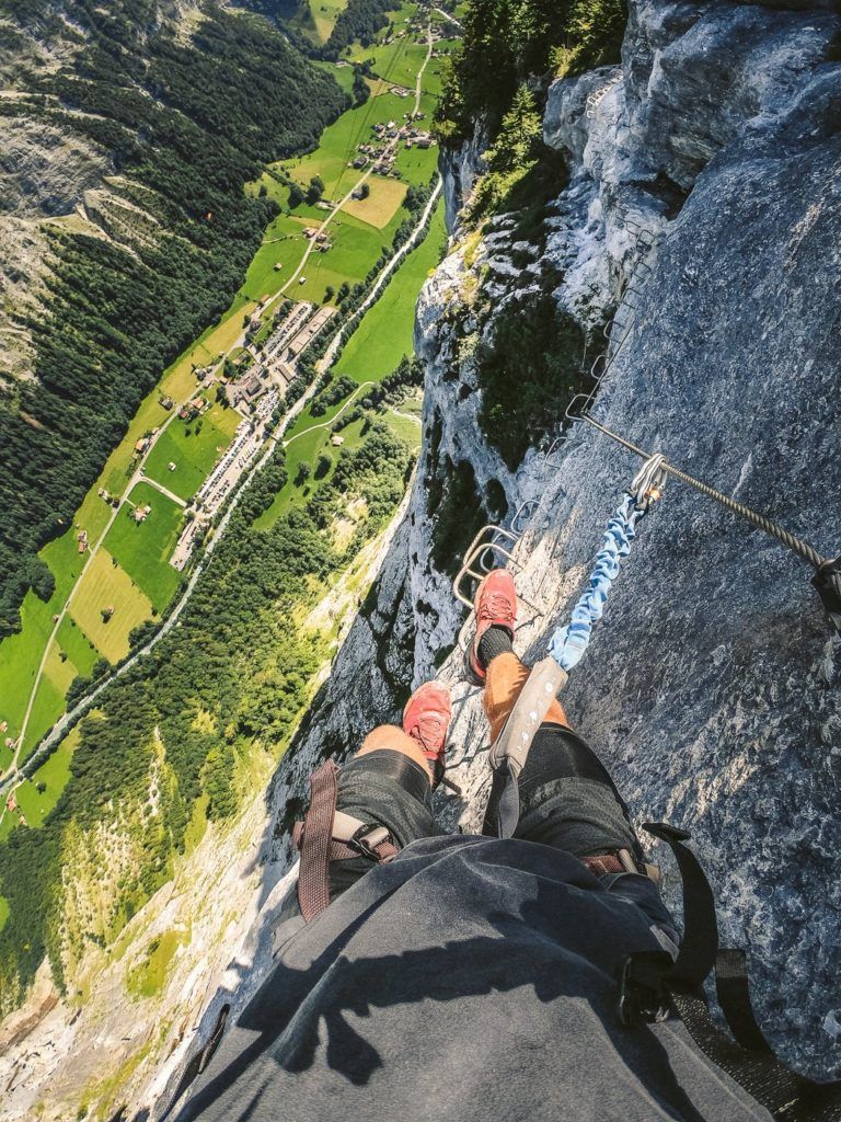
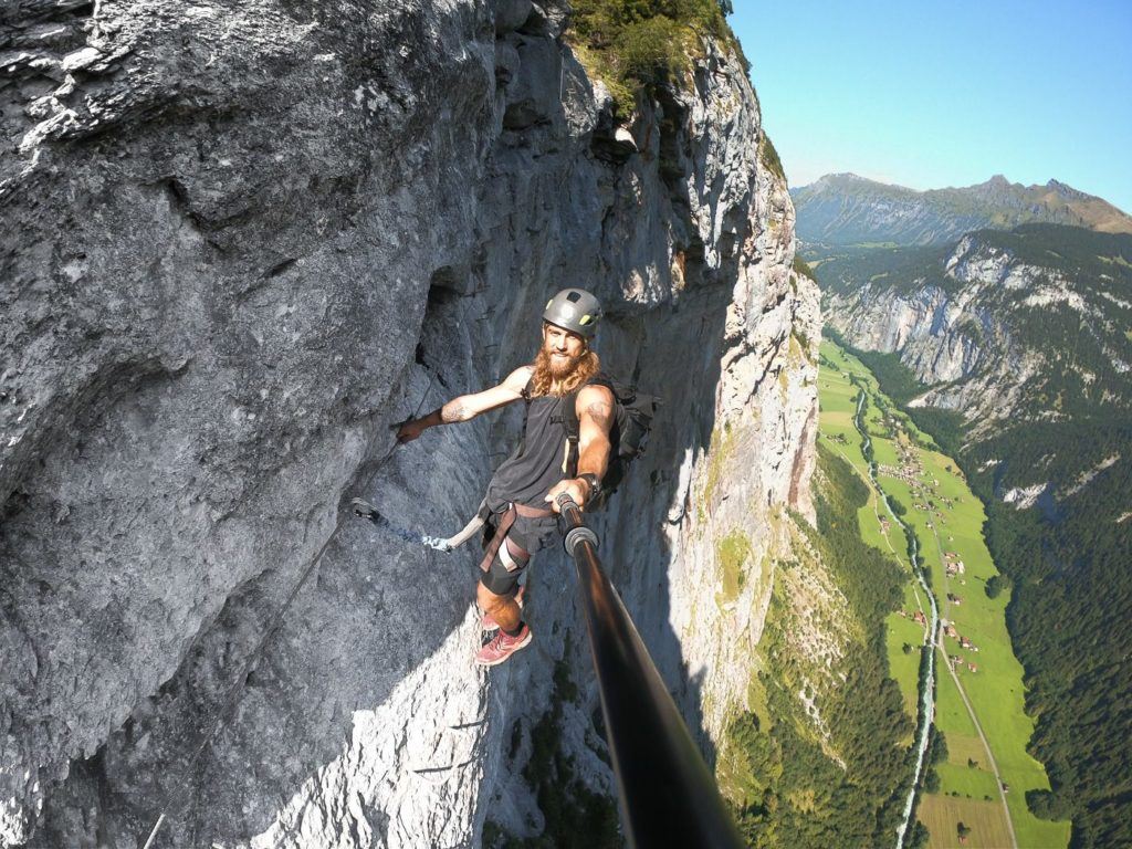
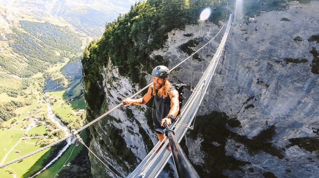
MURREN TO GIMMELWALD VIA FERRATA
The Via Ferrata from Murren to Gimmelwald is an epic adventure in Switzerland. Traverse ladders and steps on the edge of a cliff overlooking Lauterbrunnen while being safely harnessed!
For those who don’t know what a Via Ferrata is, it’s basically a series of ladders, steps, and rock climbing that leads you up a wall. You are wearing a harness and clip into a strong wire at the start of the Via Ferrata. From that point, you are always clipped in with at least one clip.
I’ve added the instructions to get to the start of the Murren Via Ferrata below.
- From Interlaken, you will need to catch the train Lauterbrunnen
- Once in Lauterbrunnen take the Grutschalp cable car, which is right next to the train station. This will take you all the way up to Grutschalp station where you can switch onto the historic, Murren Railway.
- The Murren Railway is one of the most scenic rides in Switzerland with views of Eiger and the surrounding peaks along the journey.
- Once you arrive at the Murren Train Station turn left out of the station and walk for 10-minutes past Hotel Edelweiss and you will arrive at the sports chalet on your right and Intersport on your left for the hiring of the gear.
Want more details and photos? View the full blog post here: THE MURREN TO GIMMELWALD VIA FERRATA
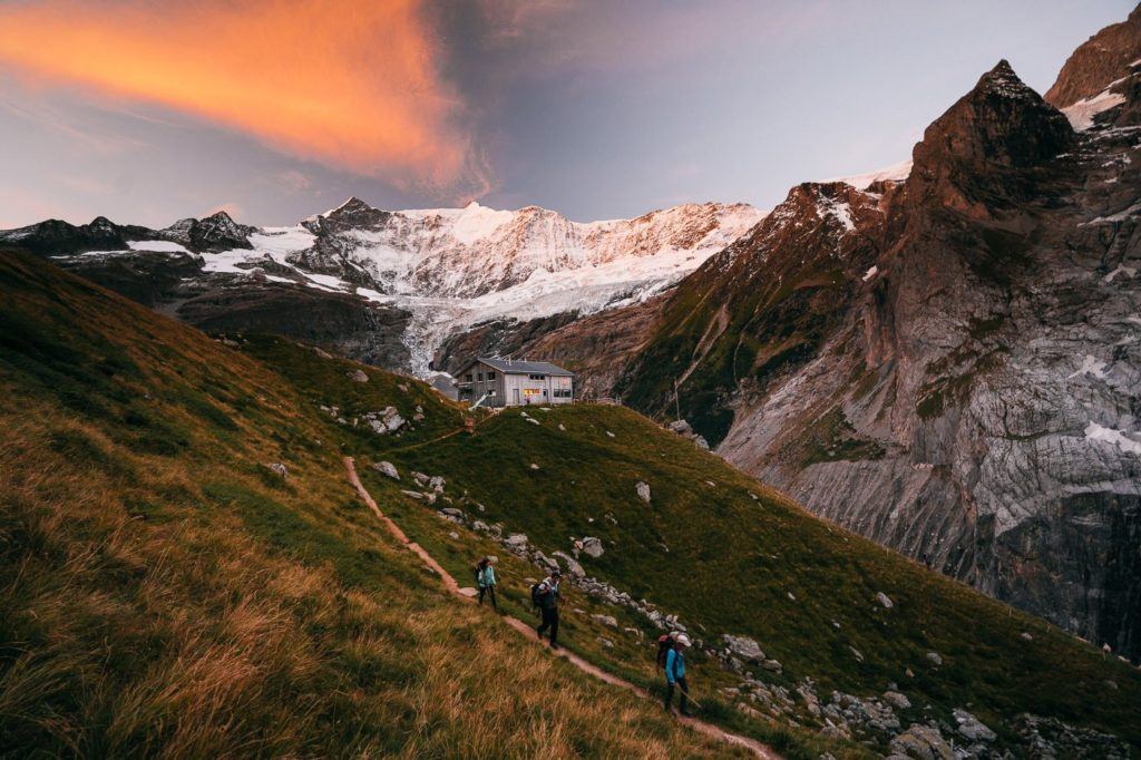
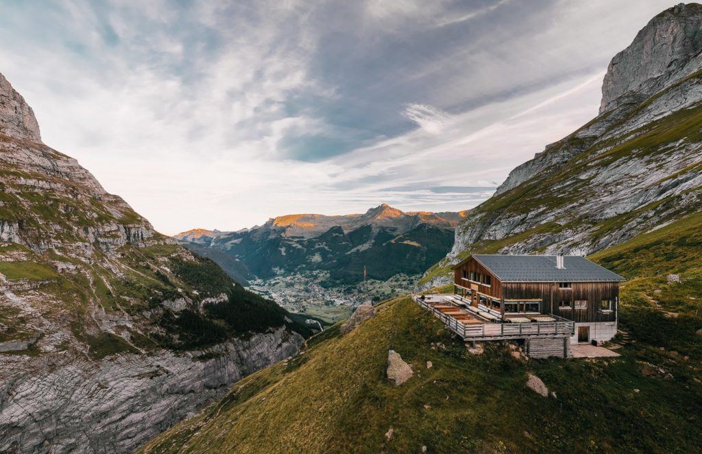
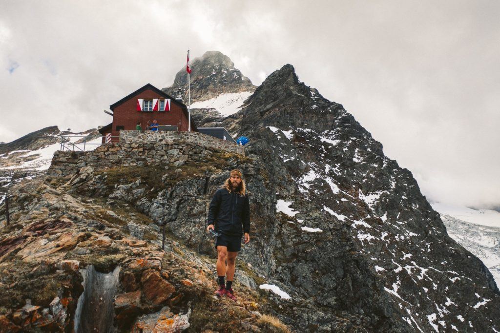
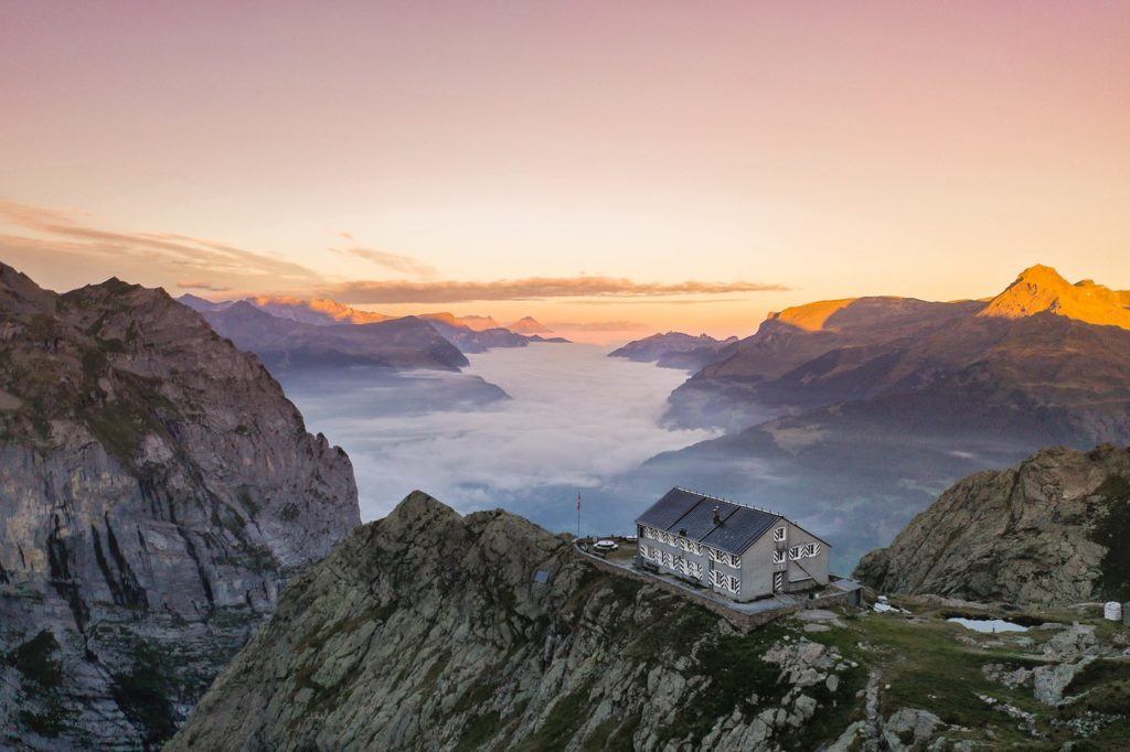
BAREGG HUT HIKE WITH OVERNIGHT STAY & HIKE TO SCHRECKHORN HUT
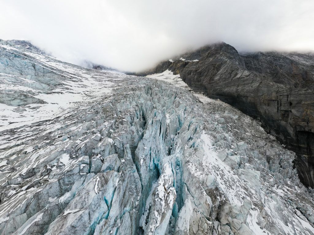
Baregg Hut (Bareghutte) is perched on the edge of a cliff, overlooking the lower Grindelwald Glacier. It’s just a 3km walk from Pfingstegg and is a great place for an overnight stay and a basecamp to hike to the Schreckhorn Hut (Schreckhornhutte). I caught the train from Interlaken to Grindelwald and began from there and returned the next day. My hostel let me leave my bags in their lockers for free.
The trail follows along the edge of the cliff, alongside the Lower Grindelwald Glacier… or at least where the glacier used to be. This hike shows you exactly how much the glacier has receded in the last century and a half. I arrived at the hut in the late afternoon dropped my gear off in the dormitory, got changed, and went outside to enjoy the scenery.
The hike from Baregg Hut to Schreckhorn Hut is a bit more challenging than the route from Pfingstegg to Baregg Hut. It’s a 12km round-trip hike back to Baregg with over 1000m of incline.
Aside from the ladders and cables, you do have to climb 1000+ meters, which is a challenge in itself so definitely gear up for an adventure! The views of the glacier that are within touching distance throughout the trail make it all worth it!
The distance from Pfingstegg to Baregg Hut is just 2.75km. However, the next day the hike to Schreckhorn and return to Baregg Hut is 11.8 kilometers, and then the 2.75km return to Pfingstegg. So all up for this expedition it is 17.3km.
Want more details and photos? View the full blog post here: BAREGG HUT HIKE WITH OVERNIGHT STAY & HIKE TO SCHRECKHORN HUT
GET A SWISS TRAVEL PASS!
Enjoy UNLIMITED train, boat, and bus rides in Switzerland for up to 15 days. Click to book a flex Swiss Travel Pass or choose the Consecutive Swiss Travel Pass.
The Swiss Travel Pass starts at $260 for 3 days. Click here to check if it’s available on your travel dates.
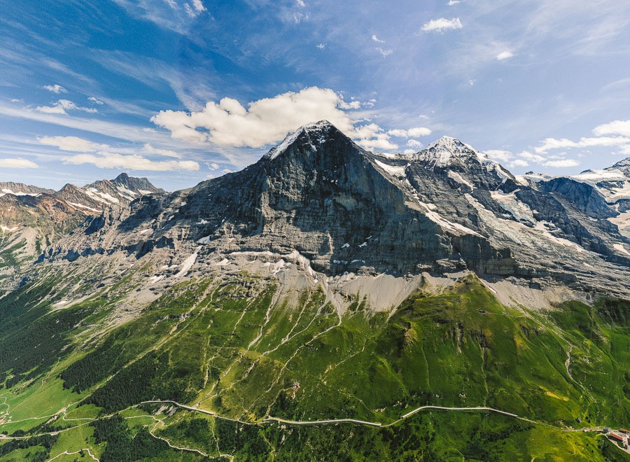
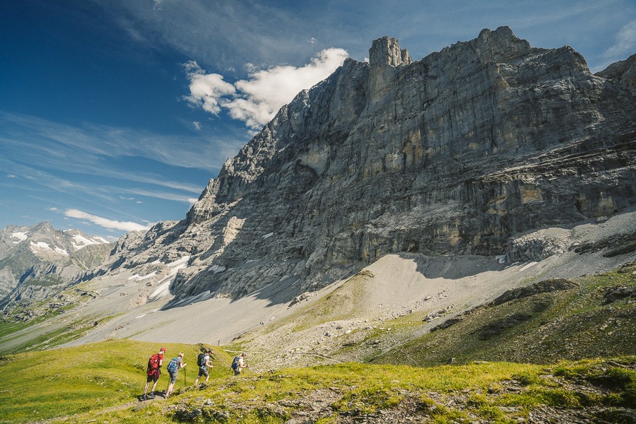
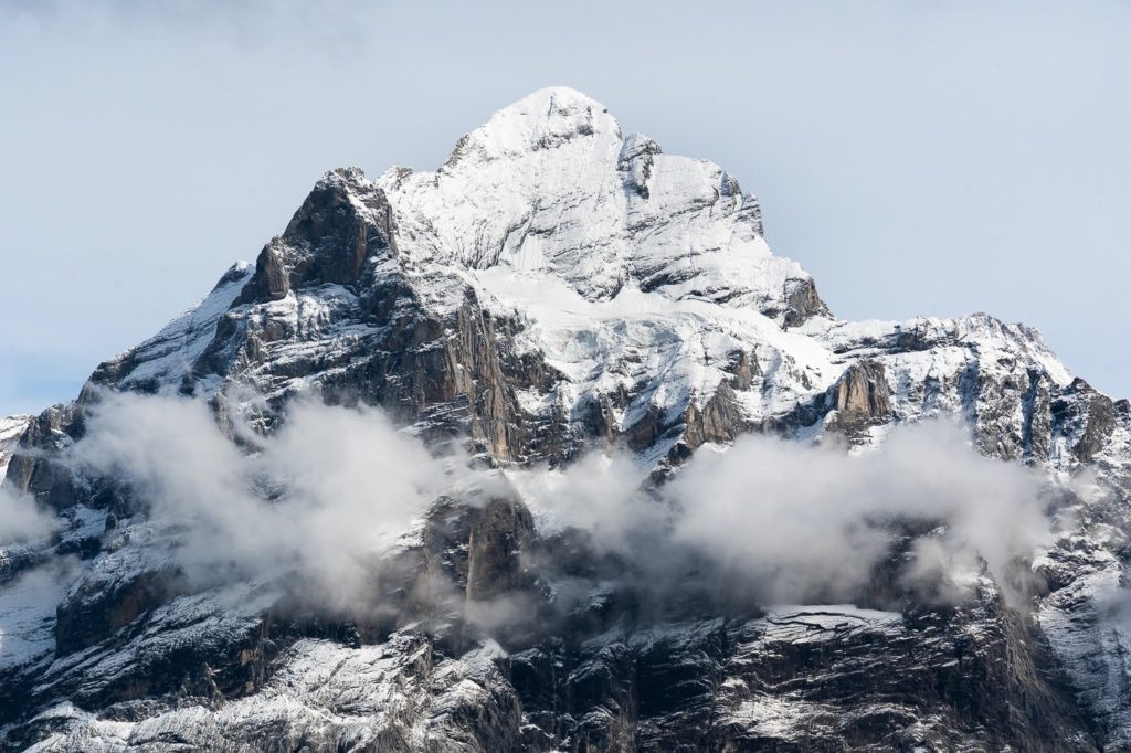
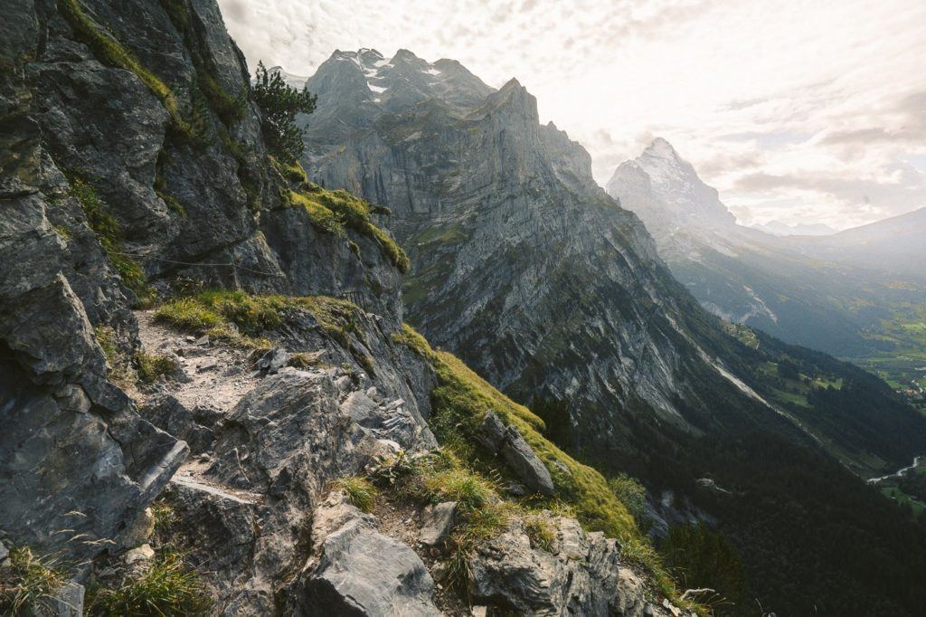
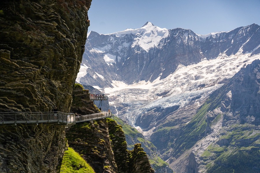
THE EIGER TRAIL HIKE: EIGERGLETSCHER TO ALPIGLEN
The Eiger Trail hike is a popular route in Switzerland that leads hikers directly under the world-famous Eiger North Face Wall, which is renowned as one of the toughest climbs in the world.
The trail begins with a 200m incline that is spread over a few kilometers and is not too difficult. From this point, Eiger is not visible, but the views of the valley and the towering glacial mountains are breathtaking. In every direction, there is something amazing to admire.
After walking for about 2km into the trail, you will soon arrive at the Eiger viewing area. You may see a small group of people and some local cows gathered there. From this point, you can look up towards Eiger Mountain and read the signs to identify the path that climbers use to scale the North Face wall of Eiger.
The Eiger Trail spans 6.5km from Eigergletscher Train Station to Alpiglen. The hike takes approximately 2.5 hours, but if you avoid stopping or taking photos, you could complete it in under two hours. Running the trail could take less than an hour.
Want more details and photos? View the full blog post here: THE EIGER TRAIL HIKE: EIGERGLETSCHER TO ALPIGLEN
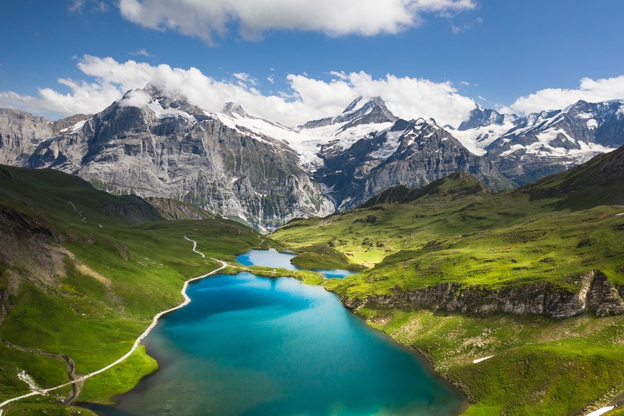
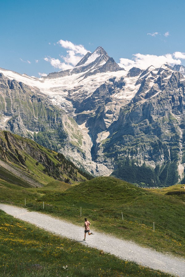
HIKING TO FAULHORN SUMMIT VIA FIRST & BACHALPSEE
Bachalpsee is among the most stunning alpine lakes in Switzerland. It is surrounded by wildflowers and boasts an incredible backdrop of glacial mountains. The beauty of Bachalpsee Lake lies in the fact that there is a cable car to First, making it only a one-hour trek to the lake despite its altitude of 2,265m. This hike is one of the most impressive ones near Interlaken, offering an all-round experience of natural beauty.
- Hike Distance: After the cable car to First the hike from First to Bachalpsee was 3km one way and you will need to hike back so 6km in total.
- Hike Duration: 2-hours of moving time. With breaks, swim and photos, total time was 3 hours return.
- Hike Difficulty: Very easy. Dirt trail the whole way. Some incline but nothing too major just 188m up and 188m down.
- Hike Incline: 188m
Want more details and photos? View the full blog post here: HIKING TO FAULHORN SUMMIT VIA FIRST & BACHALPSEE

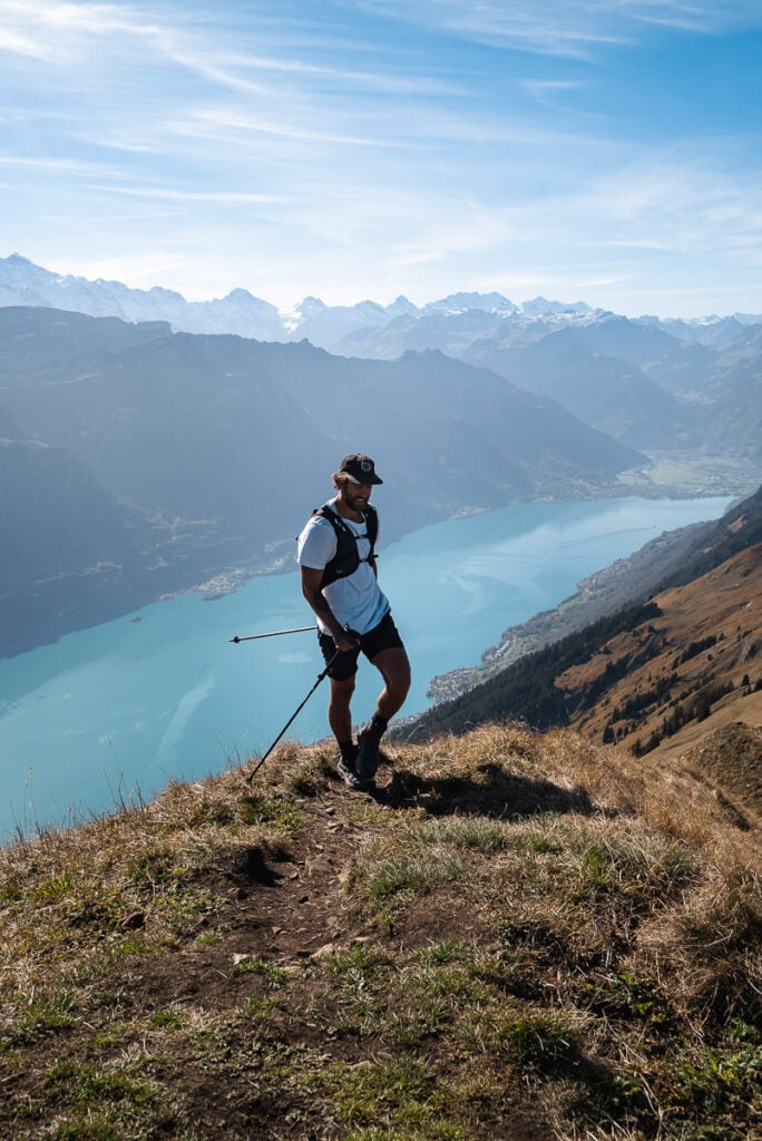
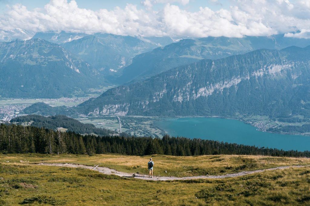
MORGENBERGHORN HIKE: BEST VIEW OF LAKE THUN
The Morgenberghorn Hike is a challenging trail that includes an incline of 1300m. However, the panoramic view of Lake Thun from the top is considered the best in the region! This hike is conveniently located near Interlaken, and as you will see, I actually walked all the way back to Interlaken after completing the hike, which shows how close it is.
It’s a fun little trail up to a viewpoint that overlooks Lake Thun and even has views of ‘The Big Three’ when the clouds clear. Those are Eiger, Monch, and Jungfrau.
The total hike distance was 19km kilometers, which includes the summit of Morgenberghorn and then continuing on all the way to Wilderswil. That is the route I took but you can make it shorter in distance by returning to Aescherid or other nearby descents. You then add on 1.5 hours of transit back to Interlaken if you are staying there so timewise it is similar. It just depends if you want to walk back to Interlaken or take the train.
Want more details and photos? View the full blog post here: MORGENBERGHORN HIKE: BEST VIEW OF LAKE THUN
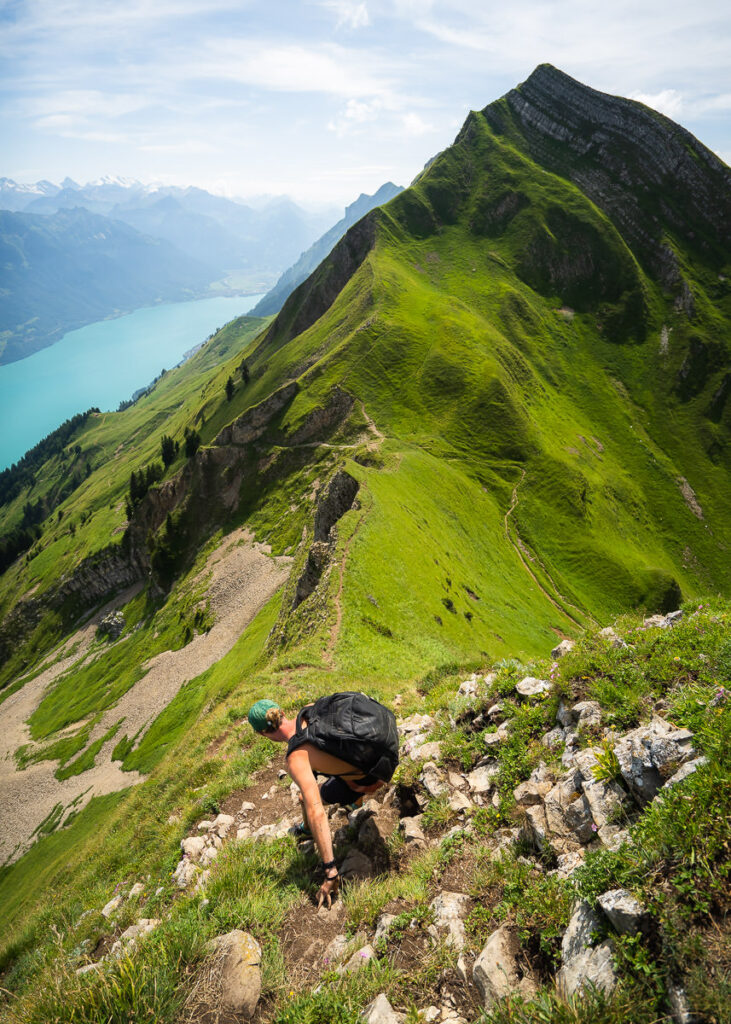
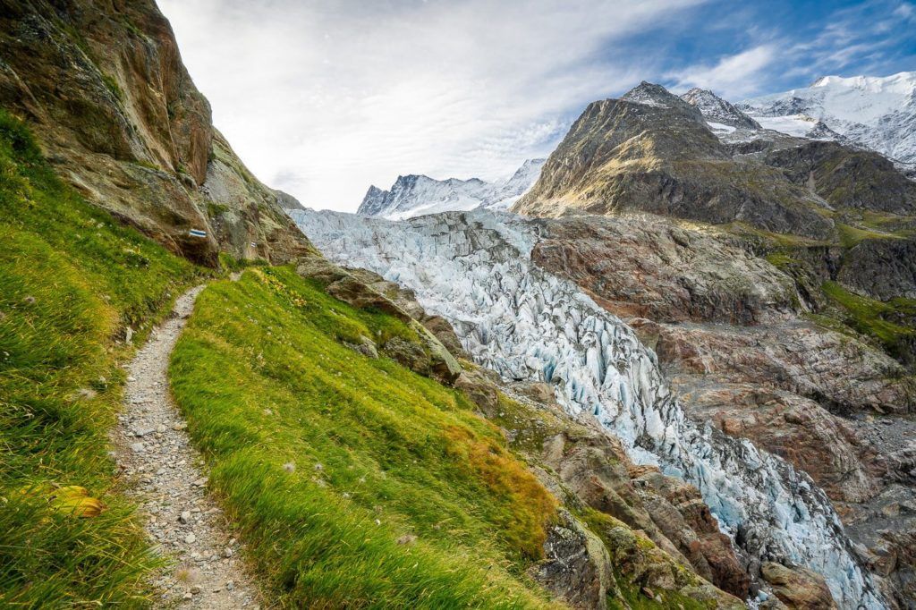
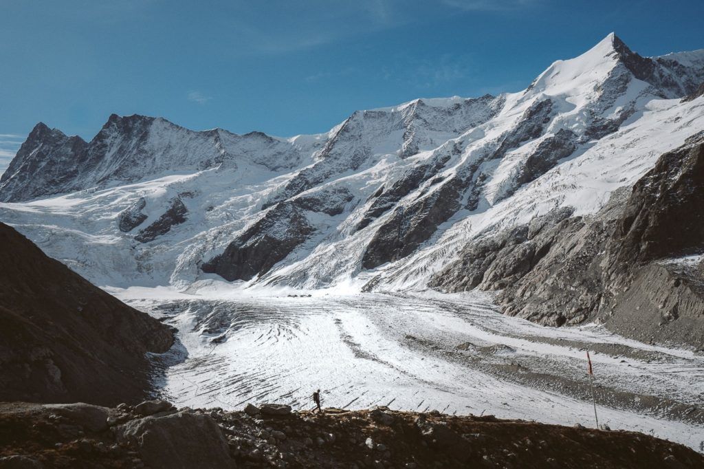
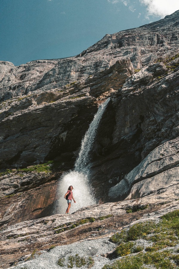
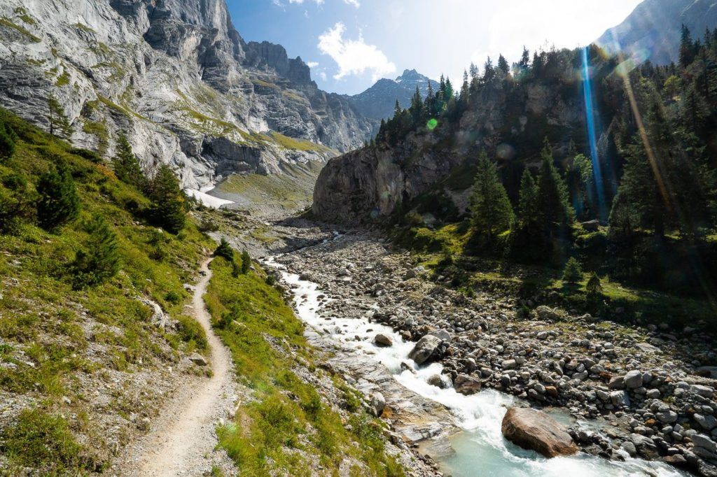
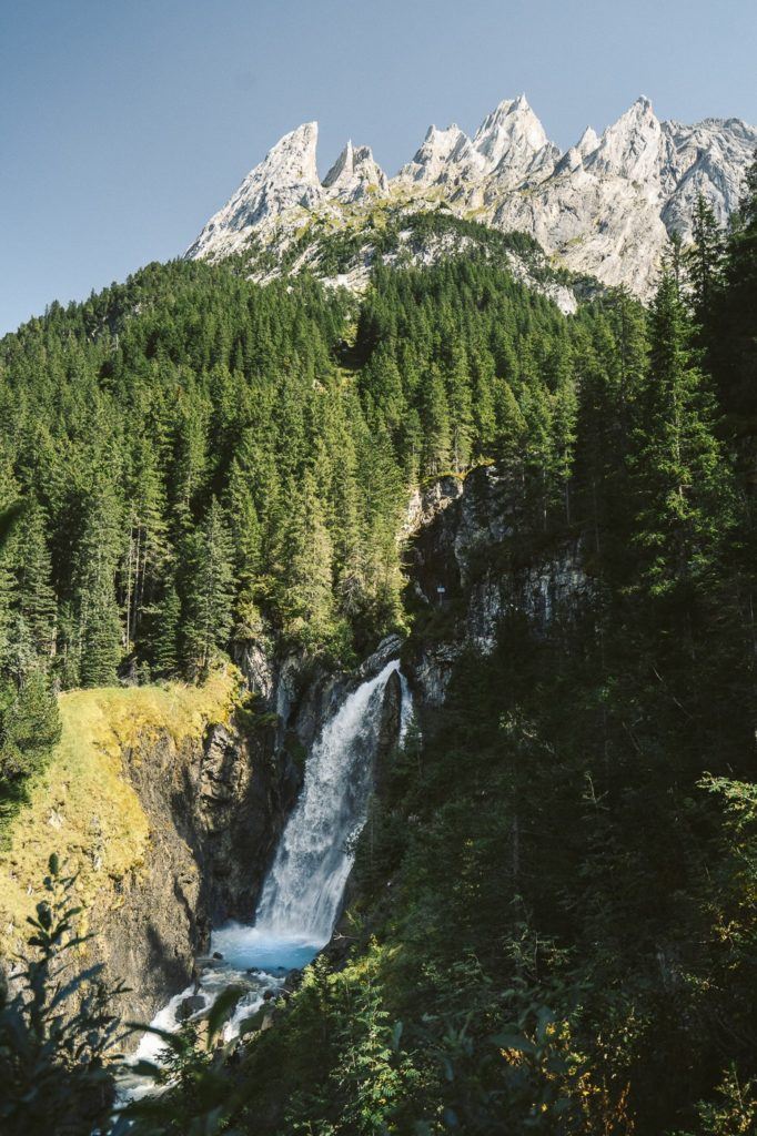
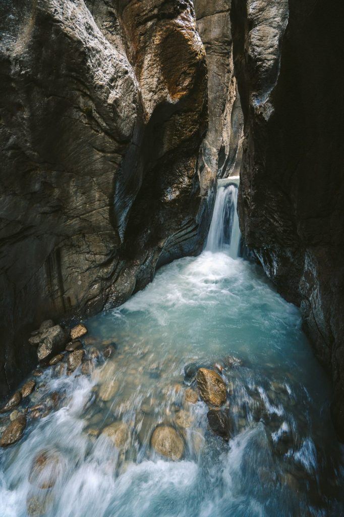
HIKING TO DOSSEN HUT VIA ROSENLAUI GLACIER
The Dossen Hut hike is an epic 19km T4 Difficulty route that starts off at Rosenlaui Glacier, leads you up to the mountain hut and down to Innertkirchen. This one requires a train and a bus from Interlaken but I made it all work as an Interlaken day-hike.
The hike begins by taking you through a canyon with several waterfalls. After that, you will start the T4 route up the rocky slopes. To assist you on the way, you will find ladders, ropes, and pegs to lead you up the scramble to the mountain hut. Once you reach there, you will be rewarded with an epic view of the Rosenlaui Glacier. On your way back, you will return through the canyon on the other side of the ridge. Finally, you can catch the train back to Interlaken.
It is recommended to allocate around 8 hours for the hike from Rosenlaui Hotel to Dossen Hut and then down to Innertkirchen. However, my personal experience, which I have shared in my blog post, shows that I was able to complete the hike in 5 hours, but I had to run an additional 5 kilometers from Innertkirchen to Meiringen Train Station. Therefore, although it may be possible to finish the hike in less than 5 hours, it is more likely to take between 5 to 10 hours for most hikers.
Want more details and photos? View the full blog post here: HIKING TO DOSSEN HUT VIA ROSENLAUI GLACIER
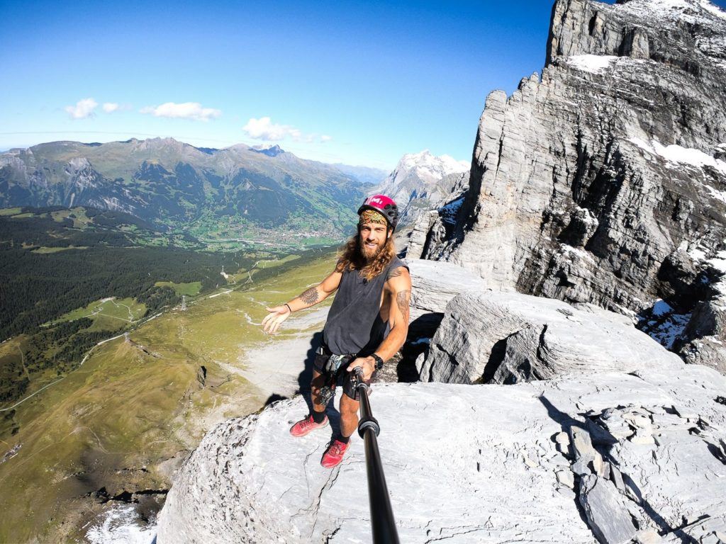
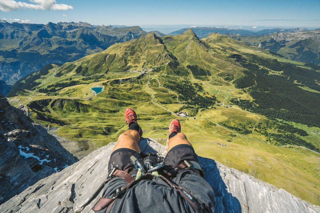
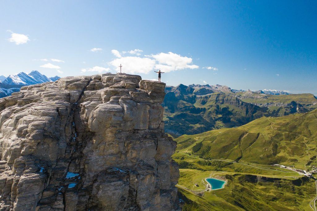
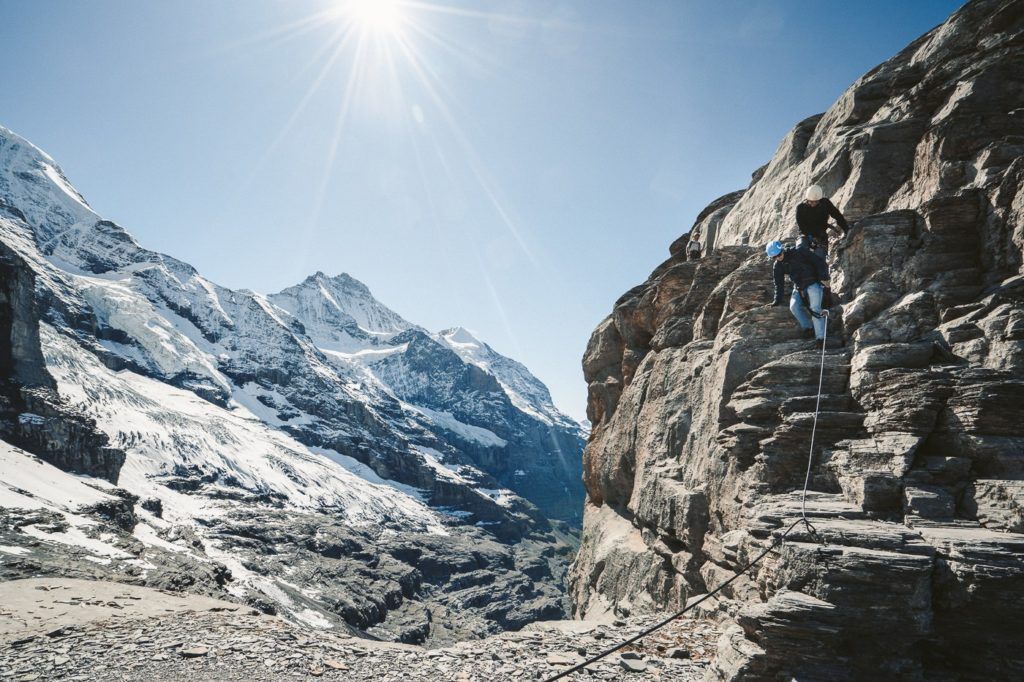
THE ROTSTOCK VIA FERRATA AT EIGER
The Rotstock Via Ferrata is an epic climb right next to the famous North Face Wall of Eiger. Using a harness, stairs, and metal stairs you can climb 400m of incline to the 360-degree panoramic viewpoint.
If you are unaware of what a Via Ferrata is, it’s essentially a sequence of ladders, steps, and rock climbing that guides you up a wall. You wear a harness and attach yourself to a sturdy cable at the beginning of the Via Ferrata. Subsequently, you remain secured at all times with a minimum of one clip.
The total hike distance was 5km from the start of the Eiger Trail up to the summit and then back down to Eigergletscher Station.
Want more details and photos? View the full blog post here: THE ROTSTOCK VIA FERRATA AT EIGER, GRINDELWALD
BEST TRAVEL CAMERA FOR SWITZERLAND

The GoPro Hero11 is the BEST camera for traveling around Switzerland.
- Waterproof for rain, hiking, snow lake activities.
- Built-in stabilization for filming your travels and adventure activities
- 5.3K video and 27MP Photo to capture awesome memories of friends and family
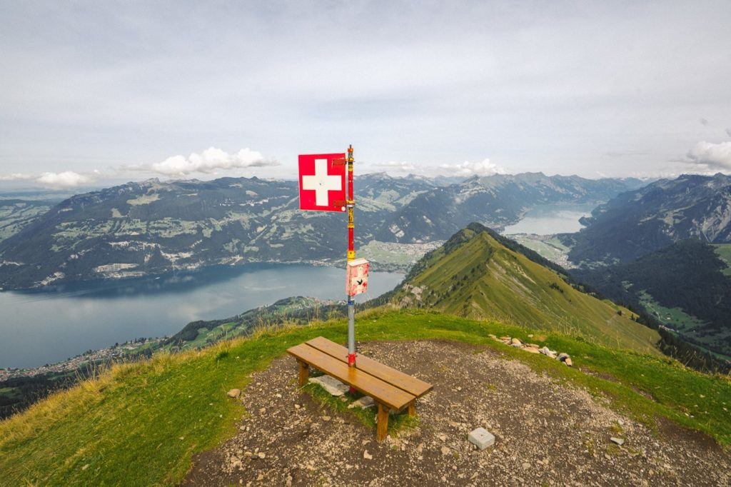
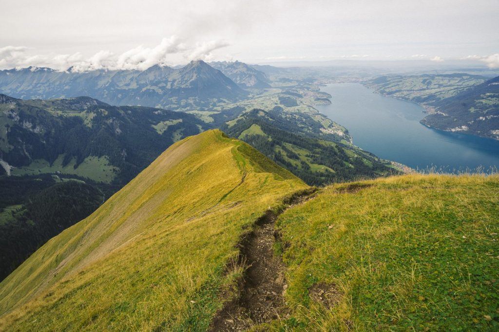
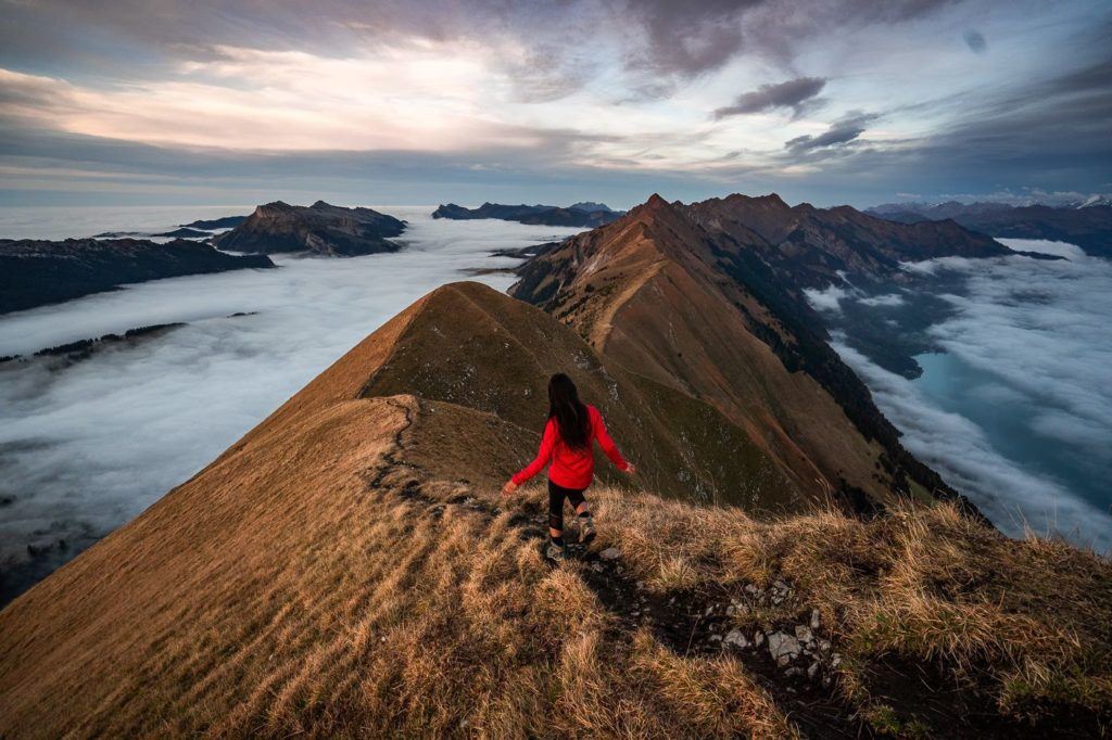
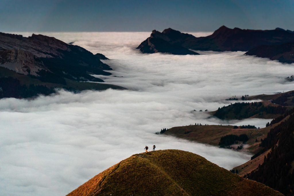
THE NIEDERHORN HIKE: A BEAUTIFUL RIDGE WALK
The Niederhorn is a frequently visited mountain peak that offers a range of activities and stunning vistas of Lake Thun, located in close proximity to Interlaken. You can take a cable car to reach the summit or hike along the Niederhorn ridge to fully explore the area. Either way, it’s a must-visit destination for anyone who loves the outdoors and natural beauty.
At the summit, we hung out on the ridge that overlooks the western end of Lake Thun and was all by ourselves the entire time. We watched as paragliders took off (I watched that one from my drone, which was a little scary), scoped out Lake Thun, and looked at the small huts in the valley below.
The way we did the hike was to take a cable car to the summit and then hike along the ridge and then down to Beatenberg Station. This was 7 kilometers. It can be done in reverse or as an entire loop for 14kms.
Want more details and photos? View the full blog post here: THE NIEDERHORN HIKE: A BEAUTIFUL RIDGE WALK
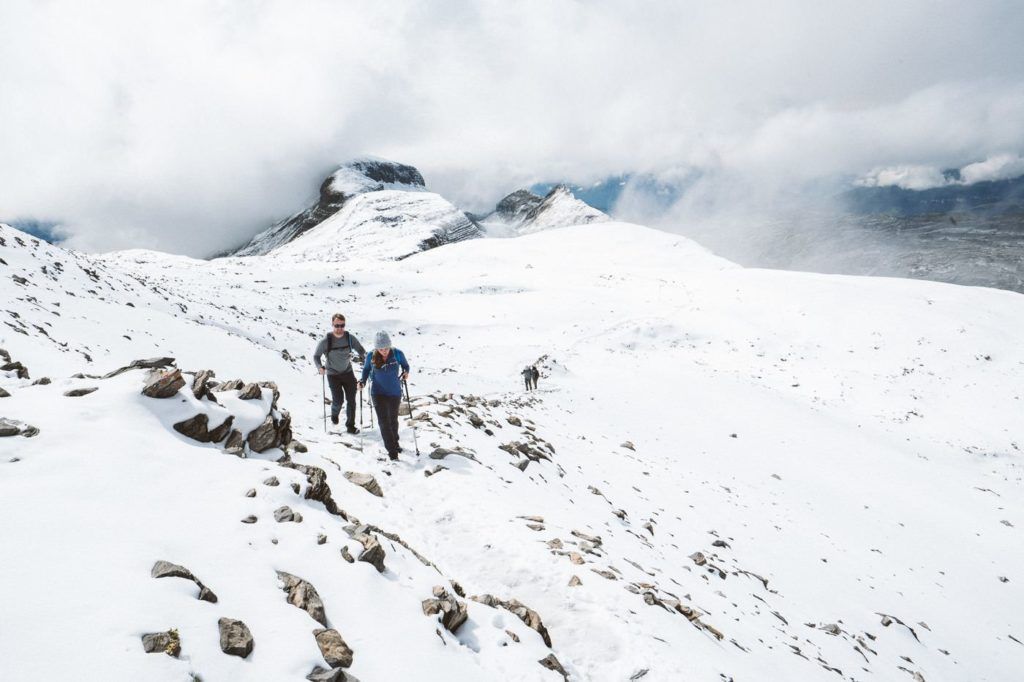
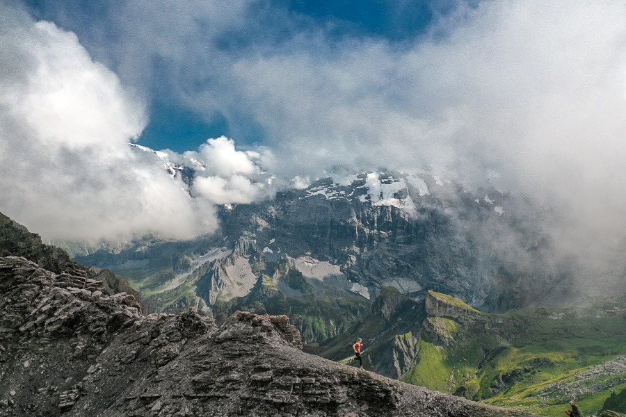
HIKING TO GLECKSTEIN HUT AND CHRINNENHORN PEAK
The Gleckstein Hut, also known as Glecksteinhutte, is situated above Grindelwald, offering breathtaking views of the valley below and the awe-inspiring glaciers in the mountains behind. Spending a night at this location is a remarkable experience, allowing you to witness the mesmerizing sunrise and sunset. Furthermore, the Chrinnerhorn summit is located a few hundred meters above the Gleckstein Hut and can be accessed without any mountaineering experience. From the summit, you can enjoy stunning views of the Gleckstein Hut and Grindelwald.
According to the sign, the suggested duration for the hike is 3 hours and 50 minutes. However, it took me 1 hour and 34 minutes to go up and 58 minutes to come down the next day. The trail is marked with red-and-white and has a few exposed areas, but there are cables wherever the trail is exposed to make it safer. The hike involves an incline of 1,100m, which can be challenging for many, but I noticed quite a few older hikers making it up to the hut. Therefore, a slow and steady approach can make the hike doable for most people.
Want more details and photos? View the full blog post here: HIKING TO GLECKSTEIN HUT AND CHRINNENHORN PEAK
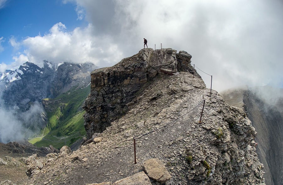
MURREN TO SCHILTHORN HIKE (PIZ GLORIA)
The hike from Mürren to Schilthorn can be quite challenging, as it involves an altitude gain of 1600 meters throughout the trail leading up to the Piz Gloria summit, where James Bond ‘007’ was filmed. However, the reward at the summit is worth the effort. You can treat yourself to a warm bowl of soup at the revolving restaurant, which offers breathtaking panoramic views in all directions. It is advisable to start early from Interlaken to allow enough time for the hike and to return on the same day.he same day.
The hiking trail from Murren to Rotstockhutte is relatively easy to manage. It consists mostly of a dirt path, but there are some areas where rocks and path intersect. Families can comfortably navigate their way up to Rotstockhutte, as the trail only has an elevation gain of 300-400m.
The trail from Rotstockhutte to Schilthorn is extremely steep. You will ascend over 1000 meters in just a few kilometers, which means you’ll be climbing straight up the mountain and scrambling over rocks. Despite the challenging terrain, it’s relatively safe and there are no dangerous drop-offs to worry about. If you’re able to handle the steep incline, the rest of the trail shouldn’t be too much of a concern.
It’s 12.9km Total distance from Murren to Schilthorn mountain summit. If you want to hike down you will need to add a few more kilometers but we caught the Schilthornbahn down to Murren, which was a nice way to return after a long day on the legs.
Want more details and photos? View the full blog post here: MURREN TO SCHILTHORN HIKE
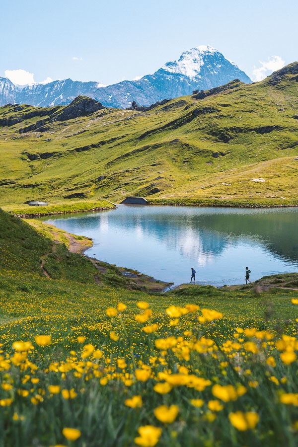
HIKING TO LAKE BACHALPSEE FROM GRINDELWALD/FIRST
One of the most breathtaking alpine lakes in Switzerland is the Bachalpsee Lake. It is surrounded by wildflowers and has a stunning backdrop of glacial mountains. What makes this lake even more accessible is that there is a cable car to First, making it only a one-hour trek from the First station, despite its altitude of 2,265m.
Bachalpsee is one of the most spectacular lakes in Switzerland and probably one of the most incredible lakes you will find on a hike near Interlaken. It’s relatively easy to get there with the cable car or you can refer to an earlier hike on this list: Schynige Platte to First if you want to take the long adventurous route.
After the cable car to First, the hike from First to Bachalpsee was 3km one way and you will need to hike back so 6km in total.
Want more details and photos? View the full blog post here: HIKING TO LAKE BACHALPSEE FROM GRINDELWALD/FIRST
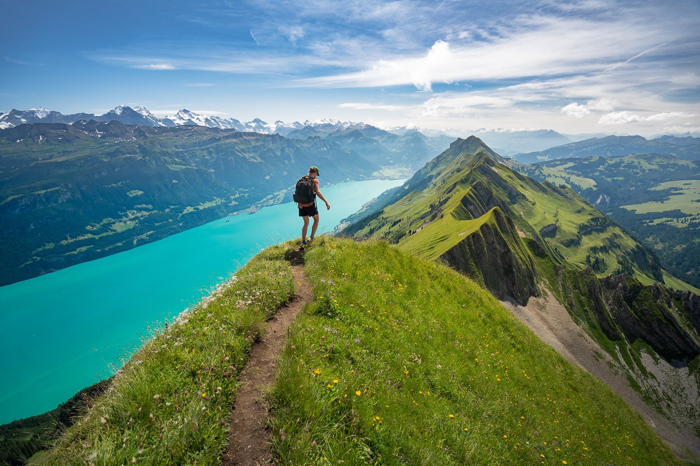
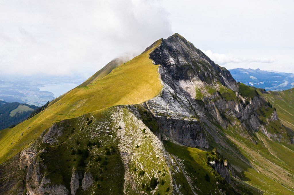
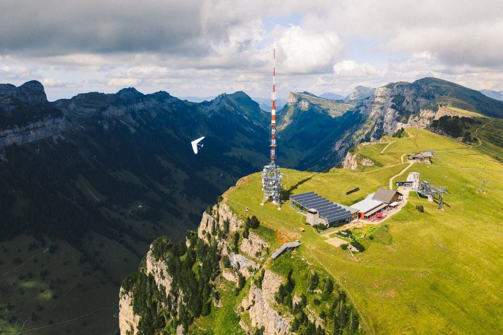
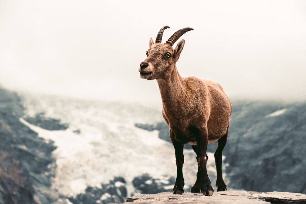
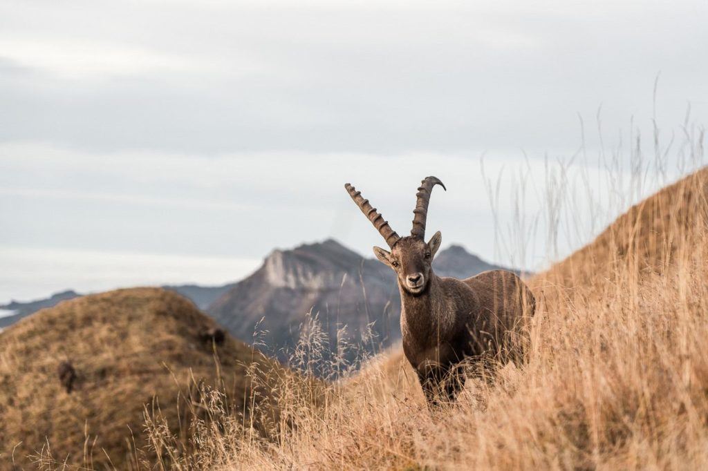
AUGSTMATTHORN HIKE FROM HARDER KULM
Augstmatthorn is an incredibly impressive peak located along the Hardergrat Ridge. It is renowned for its breathtaking views and the Ibex colony that inhabits the area. While there are multiple routes available to reach the summit, the most well-traveled path starts at Harder Kulm and follows the ridge to the top.
The view from Augstmatthorn was absolutely stunning with the clouds below us. We had an amazing sight of the Hardergrat ridge, and could even see the beautiful Brienzersee and beyond. We spotted the Ibex colony and were amazed by how carefree they were around hikers. It was a magical experience to watch these incredible creatures in such a breathtaking location. I consider this hiking trail as one of the top hikes in Interlaken!
The hike distance from Harder Kulm to Augstmatthorn and then down to Habkern is 16 kilometers. Once you reach Habkern, you can take a bus back to your destination. If you plan to hike out and back from Harder Kulm, it is recommended to start early in the day to ensure that you catch the last train from Harder Kulm to Interlaken.
Want more details and photos? View the full blog post here: AUGSTMATTHORN HIKE FROM HARDER KULM
I hope you enjoyed that list of epic trails near Interlaken in my Interlaken Hiking Guide. If there are any hikes in Interlaken you think I need to check out on my next visit, please comment them below!
SWISS TRAVEL PASS or HALF-FARE CARD
OPTION 1: Buy the Swiss Half Fare Card: Switzerland trains, buses, and cable cars are EXPENSIVE! I found the best way to get around cheaply was to buy the Swiss Half-Fare Card before I arrived. It gives you 50% off every regular train, bus, and even many cable cars. It only costs $150 USD but pays itself off in just a few days with many train tickets in Switzerland costing close to $100 alone. If you are staying for more than 5 days, I suggest buying the Swiss Half-Fare Card.
OPTION 2: Buy the Swiss Travel Pass: The second option is to get the Swiss Travel Pass, which gives you unlimited train, bus, and (many) cable car rides but it’s pretty expensive at around $100 USD per day so if you don’t travel each day it isn’t worth it.
OPTION 3: Buy the FLEXI Swiss Travel Pass: The final (BEST) option is to get the FLEXI Swiss Travel Pass, which allows you to buy 8 days’ worth of transit but you can choose the night before if you want to activate the next day. That way you don’t need to travel every day to get your money’s worth, you can just activate the FLEXI Swiss Travel Pass on the days when you are doing sizeable transits. My advice is to book the Swiss Half-Fare Card or the FLEXI Swiss Travel Pass in advance before your trip so it’s ready to go when you arrive.
GET A SWISS TRAVEL PASS!
Enjoy UNLIMITED train, boat, and bus rides in Switzerland for up to 15 days. Click to book a flex Swiss Travel Pass or choose the Consecutive Swiss Travel Pass.
The Swiss Travel Pass starts at $260 for 3 days. Click here to check if it’s available on your travel dates.
MY SWITZERLAND HIKING GUIDES
I spent 100 days hiking in Switzerland and created a guide for different regions around the country. You can click on one of my Switzerland hiking guides below to help you plan your trip.
- The Complete Guide: 50 AWESOME HIKES IN IN SWITZERLAND
- The Via Ferrata Guide: 4 EPIC SWITZERLAND VIA FERRATA COURSES
- Lauterbrunnen Guide: 10 AWESOME HIKES NEAR LAUTERBRUNNEN
- Interlaken Guide: 15 AWESOME HIKES IN INTERLAKEN
- Grindelwald Guide: 12 AWESOME HIKES NEAR GRINDELWALD:
- Mürren Guide: 7 AWESOME HIKES IN MURREN
- Appenzell Guide: 9 AWESOME HIKES NEAR APPENZELL
- Chur Guide: 7 AWESOME HIKES NEAR CHUR
MY SWITZERLAND TRAVEL TIPS
- For Backpackers: SWITZERLAND BUDGET BACKPACKING GUIDE
- Travel Tips: 20 THINGS TO KNOW BEFORE VISITING SWITZERLAND
- Transport Tips: RENTING AND DRIVING A CAR IN SWITZERLAND
- Accommodation Guide: 30 BEST PLACES TO STAY IN SWITZERLAND

stacey
Tuesday 19th of September 2023
Hey there. My partner and I are going to be in Interlaken tomorrow and we have one hour to hike before we have to get back on the road. Would you be interested in meeting us, and taking us on a fantastic hike to see the best of what you can see in such a short period of time? If so, what is the cost, and where should we meet? We are driving in from Lucerne and should be there by 9:00 am. We need to be back in our car by 11:00 at the latest. Crazy I know but you do what you can with what you have. Thanks - Stacey
jc
Thursday 11th of August 2022
FANTASTIC INFO!!!!! Thanks so much - it beats every guide out there!