
Augstmatthorn is one of the most spectacular peaks along the famous Hardergrat Ridge in Interlaken. It’s famous not only for the stunning views but for the Ibex colony that calls Augstmatthorn home. There are several ways to reach the summit, but the most popular route is from the Harder Kulm to Augstmatthorn, hiking along the ridge to the summit. You’ll find spectacular views of the Brienz Lake below and even catch a glimpse of Eiger, Monch, and Jungfrau on the horizon.
AUGSTMATTHORN HIKE FROM HARDER KULM
In the blog post, I will share with you my experience, hiking from Harder Kulm to Augstmatthorn along a portion of the Hardergrat Trail. I’ll also fill you in on the details about the best time of year this ridge is possible to hike, the distance, difficulty, and other tips for hiking in the region.
AUGSTMATTHORN HIKE DETAILS
- Hike Distance: The hike distance from Harder Kulm to Augstmatthorn and then down to Habkern is 16 kilometers. From Habkern you then catch the bus back to your destination.
- Hike Duration: The total hiking time from Harder Kulm to Augstmatthorn and then down to Habkern should be about 5-6 hours.
- Hike Difficulty: The hike is a red and white marked trail. There are sections where the trail is exposed on one side and a few small sections where it is exposed on both sides.
- Dangerous spots: I’ve tried to photograph the ‘worst’ moments in this blog post so you can get a visual on the drop-offs. I found it less dramatic than what many reports detail online, although there are deaths from falling/incidents on Hardergrat trail every couple of years. In addition to the supposed danger, there is also close to 1,000m of incline so that is a challenge in itself.
- Hike Incline: 1000m+
You will also enjoy reading my Interlaken Hike Guide: 15 AWESOME HIKES NEAR INTERLAKEN
HOW TO GET TO AUGSTMATTHORN TRAILHEAD ( HARDER KULM)
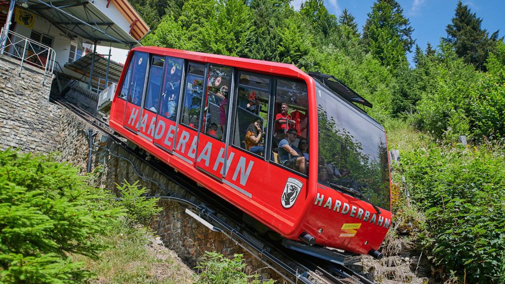
The trail begins at Harder Kulm. There are two main ways to get to Harder Kulm, which is pretty much the most popular viewpoint/restaurant in the Interlaken region. The easiest way is to take the funicular (cable car) up the steep track to the top. To check the timetable and prices of the Harder Kulm Funicular you can click here.
- Funicular: The funicular runs every 30 minutes but for most of the year the first ride up is at 9:10 am except for Sundays when it is 8: 30 am. This means you can’t catch the funicular up for sunrise, which brings us to option two. Skip the line for the Funicular and book your ticket in advance online at no extra cost.
- Hiking: The second option is to hike up from Interlaken to Harder Kulm. This is a challenge in itself and if you combine it with the 16km Augstmatthorn hike you are in for a huge day not to be underestimated. The hike begins at the funicular and follows the red and white marked trail up to Harder Kulm. It’s incredibly steep with 750m of incline over the 4-kilometer journey.
GET A SWISS TRAVEL PASS!


Enjoy UNLIMITED train, boat, and bus rides in Switzerland for up to 15 days. Click to book a flex Swiss Travel Pass or choose the Consecutive Swiss Travel Pass.
The Swiss Travel Pass starts at $260 for 3 days. Click here to check if it’s available on your travel dates.
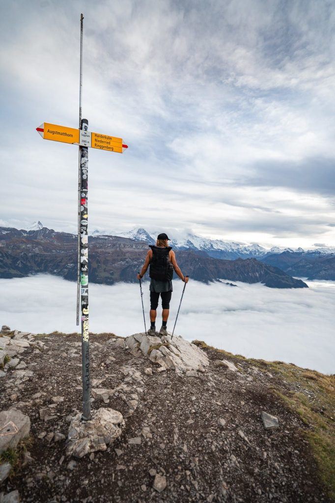
Once you arrive at Harder Kulm, there are yellow signs pointing you to Augstmatthorn and then you simply follow the red and white trail markers along the ridgeline. Hard to go wrong.
If you have the Swiss Half-Card you will receive a huge discount on your tickets. I bought mine when I arrived in Switzerland and it has saved me over a thousand dollars throughout my trip.
MY EXPERIENCE ON THE AUGSTMATTHORN HIKE FROM HARDER KULM
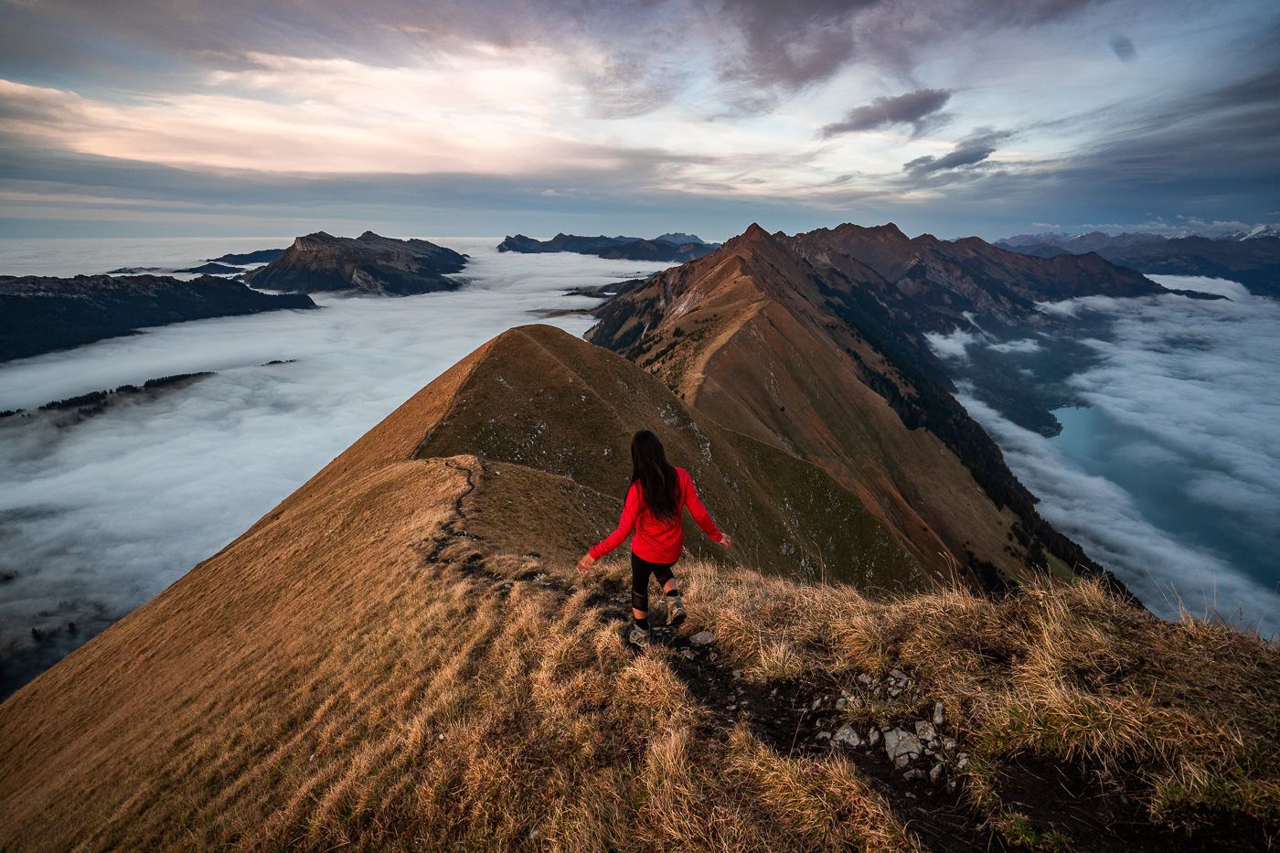
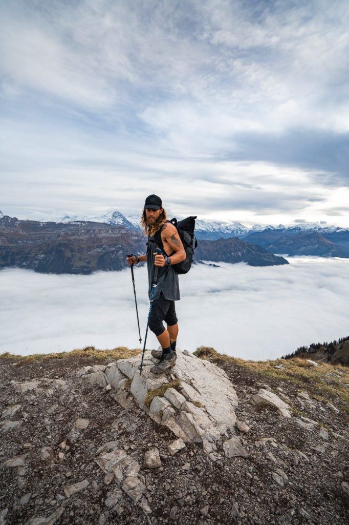
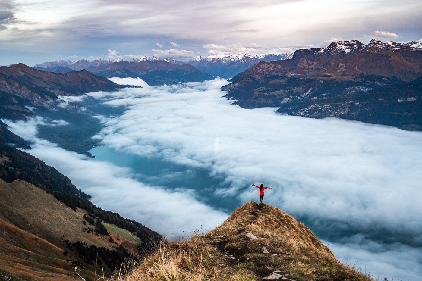
I had pretty low expectations on the day I did this hike because the weather was very foggy and it wasn’t forecast to improve too much. However, what I didn’t know is that even with just a few hundred meters of elevation from Harder Kulm, we would be high enough to get up above the clouds. While we didn’t have views of the beautiful blue lakes in the valley, we had a sea of clouds below the ridge.
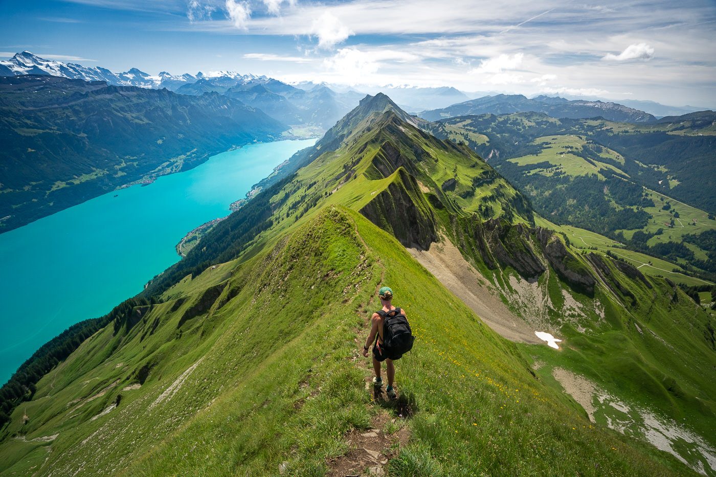
On a clear day in the summer, the trail will be green and grassy and the lakes below will be a vibrant blue. I hiked further down the ridgeback in the summer and took the photo below (from Brienz end of Hardergrat, which is actually called Brienzergrat if done in the opposite direction), which shows the contrast. Both of the conditions are awesome but just be aware that the colors will depend on the time of year and weather conditions.
The day for me began in Interlaken where I was based. I walked across the river to the Harderbahn Station and caught the funicular up to Harder Kulm. It’s so steep on the funicular that all I could do on the whole ride up was to imagine hiking up and then hiking to Augstmatthorn. What a journey!
When we arrived at Harder Kulm, it was completely engulfed by the white clouds. We couldn’t see a thing. Sitting at the outdoor restaurant for a while, we wondered if today just wasn’t our day. The clouds never cleared so we decided to set off anyway and hope it improved.
Our goal was to be at Augstmatthorn for sunset and then quickly hike down to Habkern in the last light of the day. Make sure you check the bus timetable from Habkern if you haven’t got a car parked at Lombochalp/Habkern ready to pick you up or drive home.
Off we set on the trail from Harder Kulm, expectations low but hopeful as always. Switzerland had treated me well throughout my 50 hikes over the summer so I just needed one more favor from the Swiss weather gods. They would deliver.
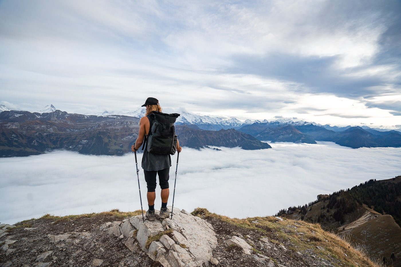
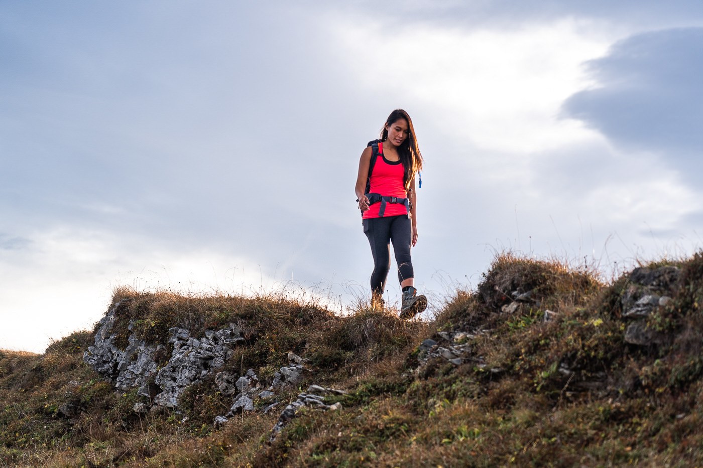
The trail begins with a steady incline through the forest with infrequent glimpses out towards the Jungfrau region’s ‘Big Three’, Eiger, Monch and Jungfrau. It wasn’t long before we noticed we were above the clouds and it was then we knew we were in for a spectacular afternoon and sunset.
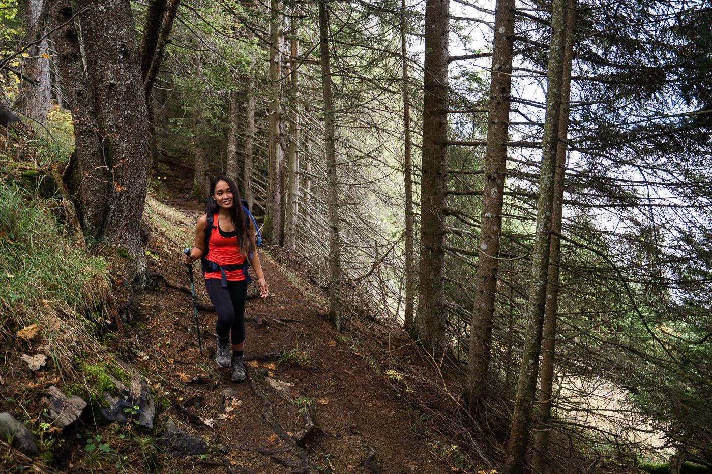
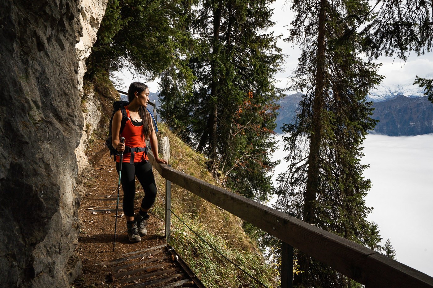
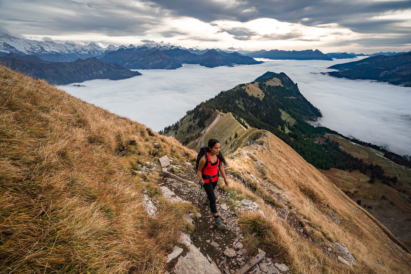
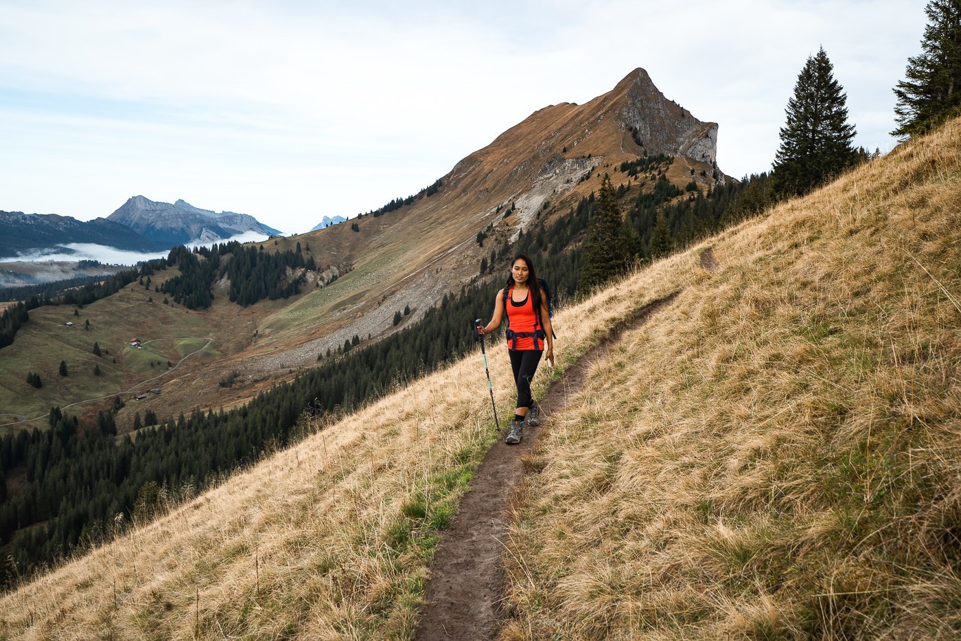
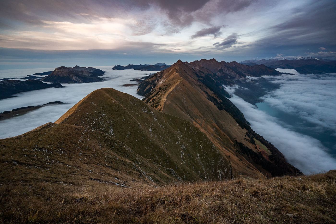
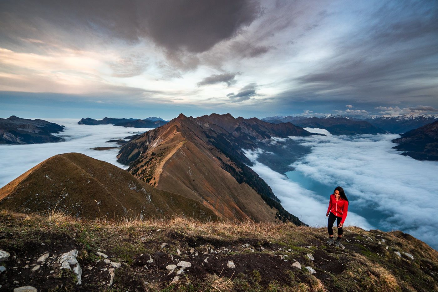
The first 5-6 kilometers of the trail is in the forest. Nothing much is happening except a quick opening in the trees to look out over the valley every now and again. When you finally emerge from the forest, the trail really picks up and you are now hiking along the ridge with constant views on both sides.
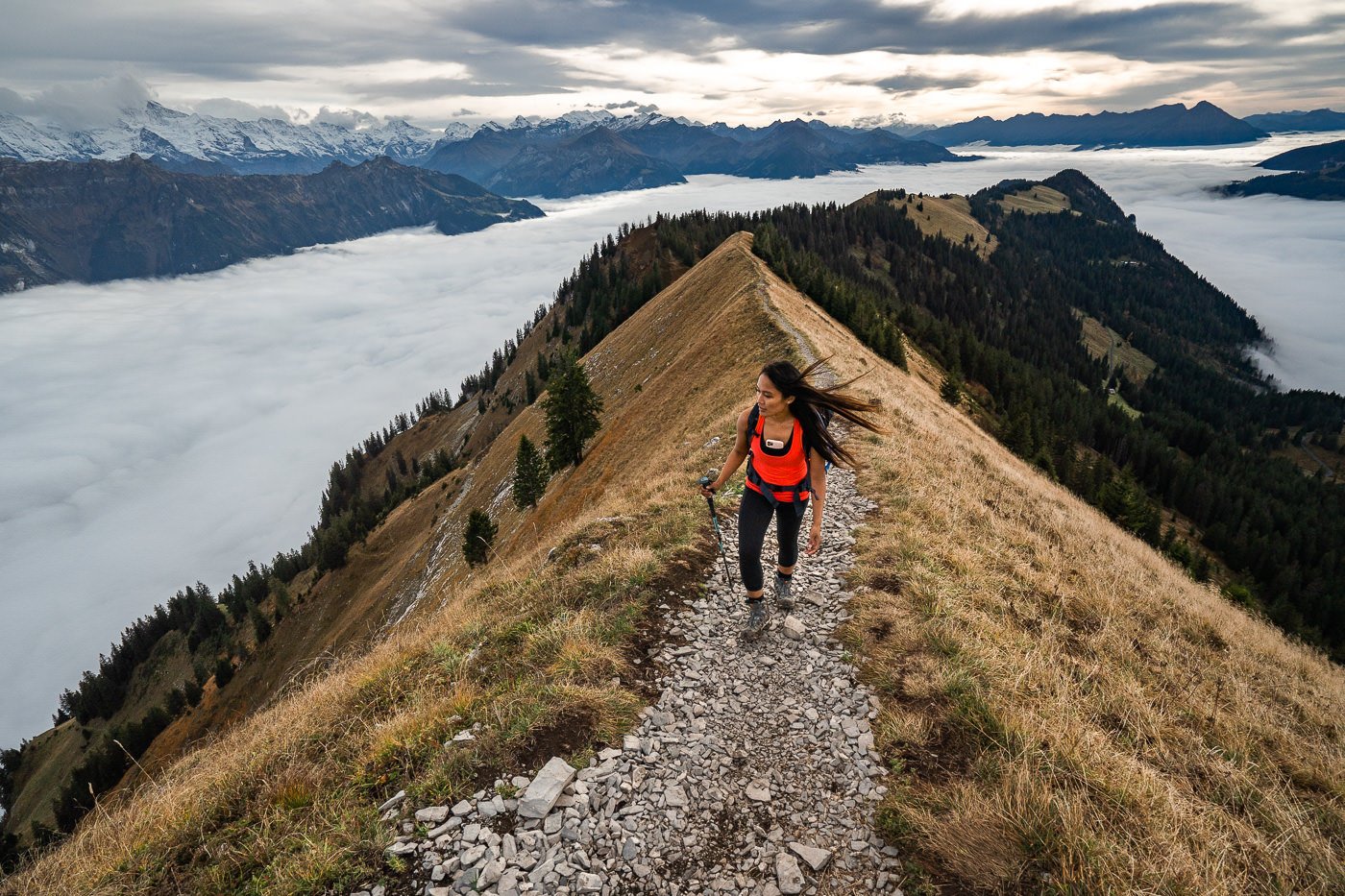
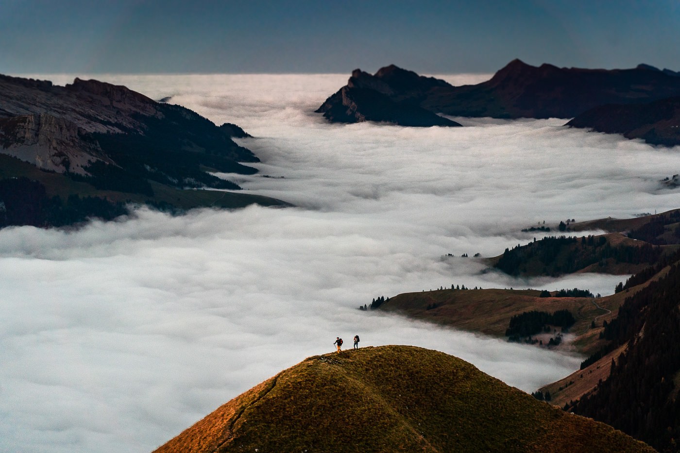
There are a few moments where there is exposure but generall it is only on one side of the trail. In a couple of sections, there may be a drop on both sides but the trail is wide and flat. There is never a moment where you need to exercise a high degree of caution compared to down the other end of the Hardergrat Trail where the ridge narrows to less than a foot wide with steep drops on either side.
We were now well and truly above the clouds and on our way to Suggiture, the first real checkpoint. The trail up to Suggiture is getting a little rocky and steep but still no huge danger.
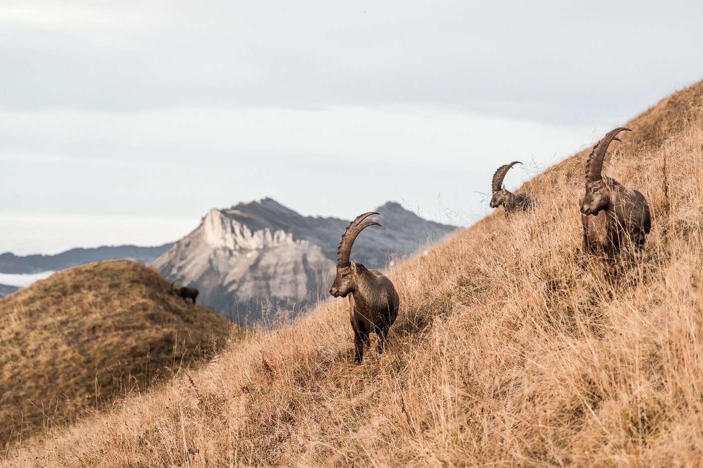
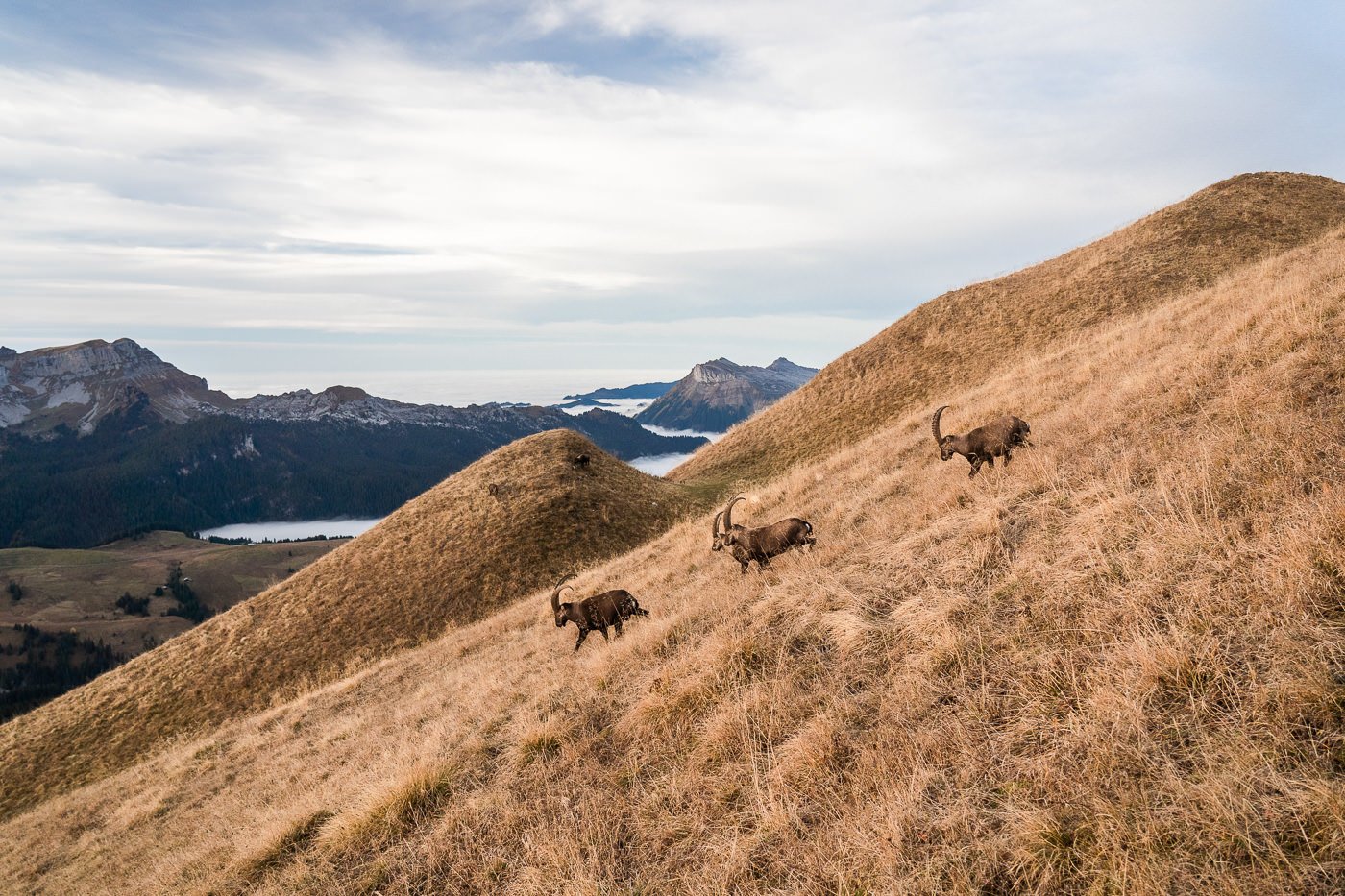
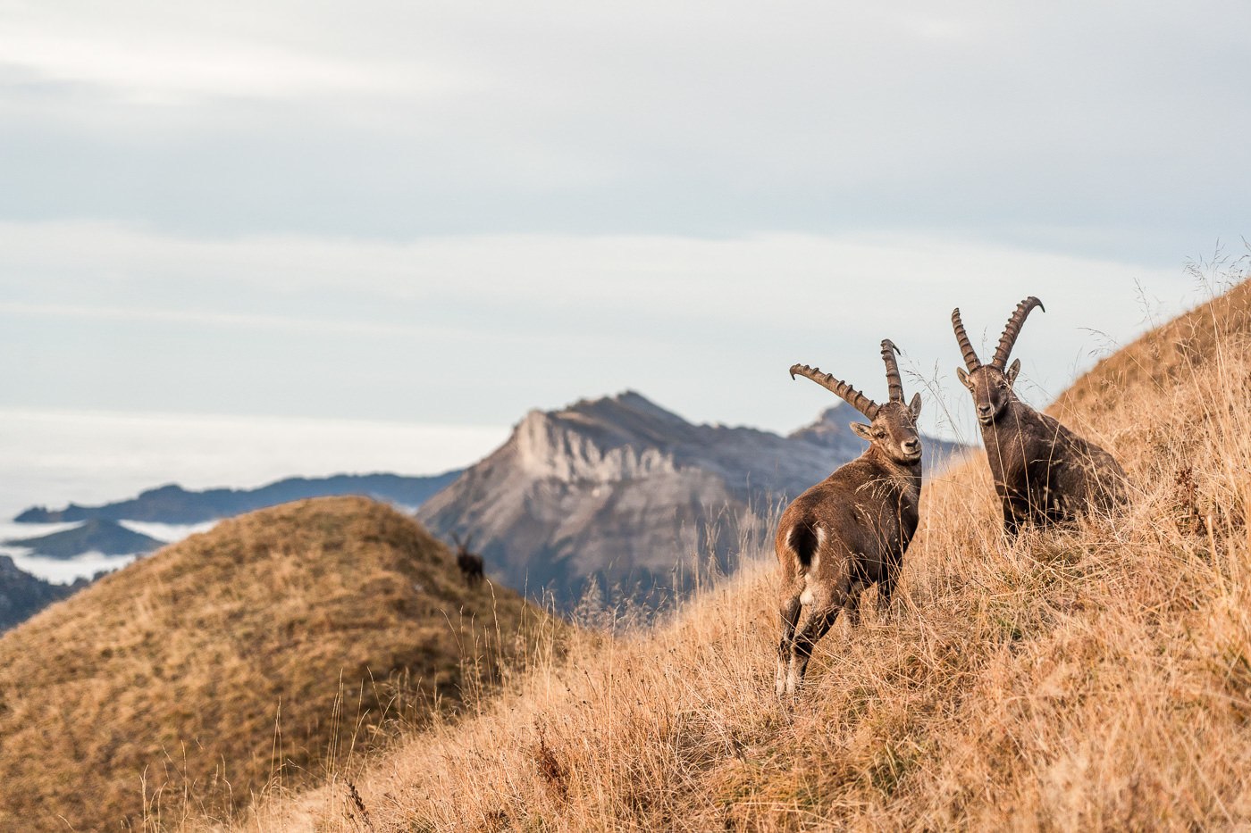
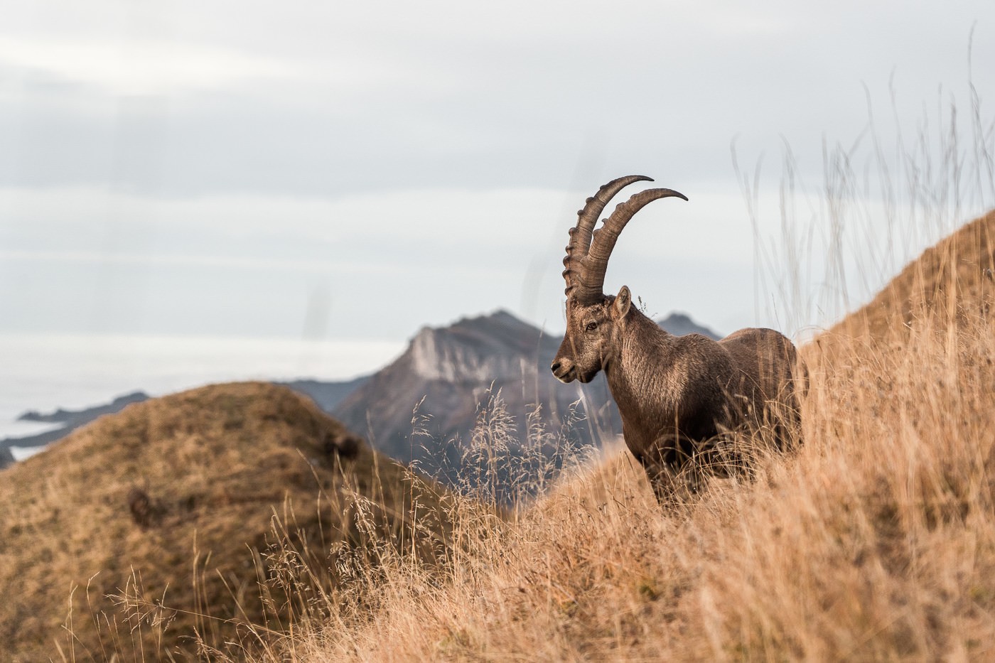
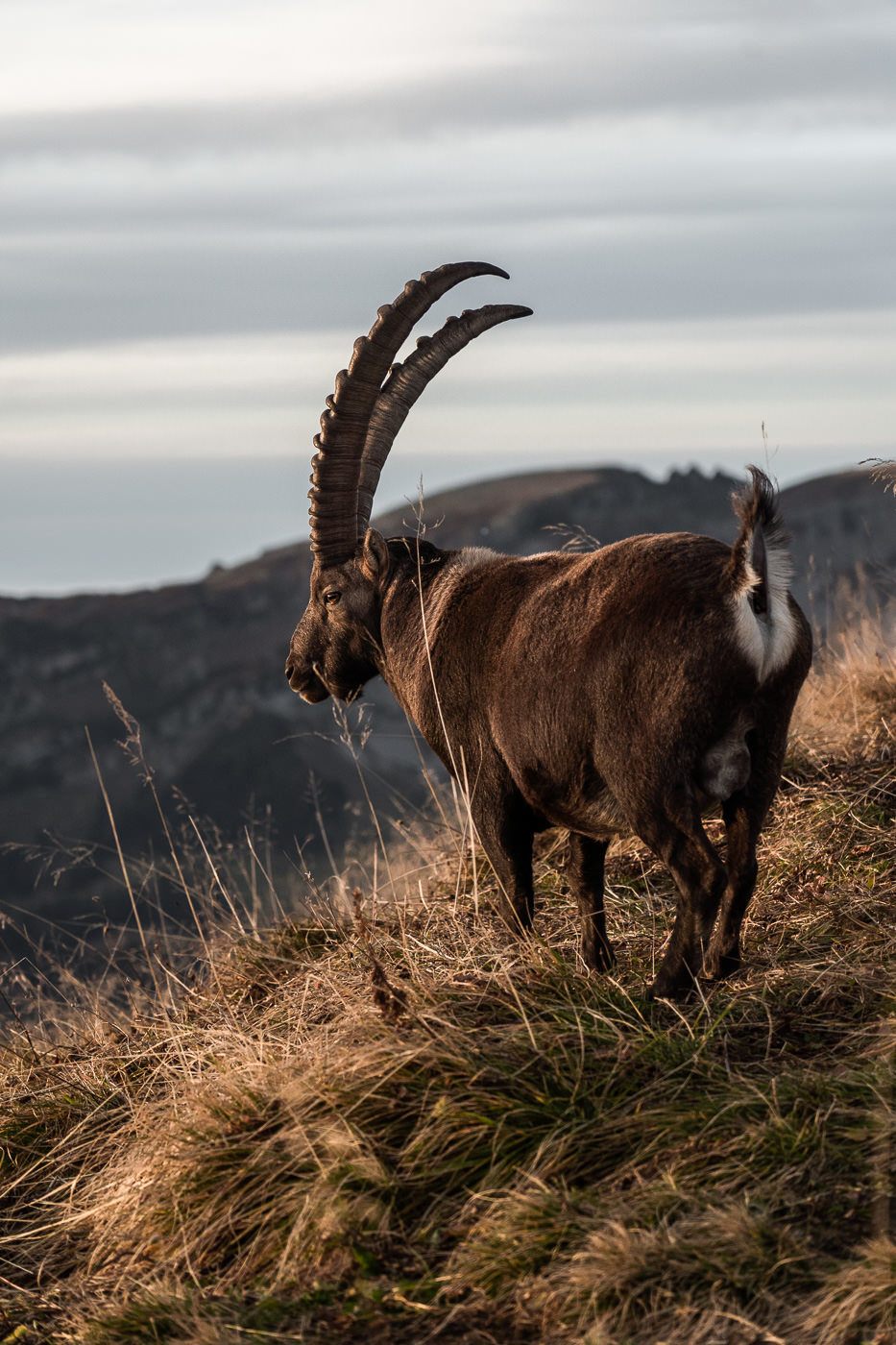
Once you leave Suggiture, it’s time to start the lookout for Chamois and Ibex. There are colonies of both that live on Augstmatthorn and the surrounding areas. On this beautiful evening, there were no other hikers as we trekked up to Augstmatthorn, which meant there was a high likelihood we would bump into some wildlife.
It didn’t take long before we came across some Chamois, which are like a cross between a deer and a mountain goat.
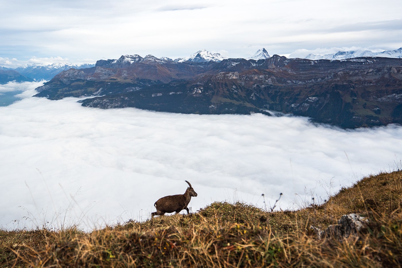
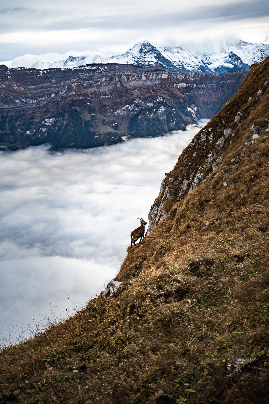
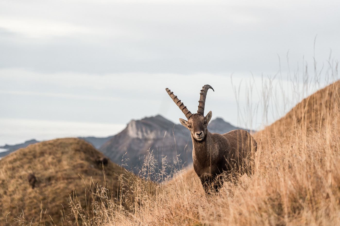
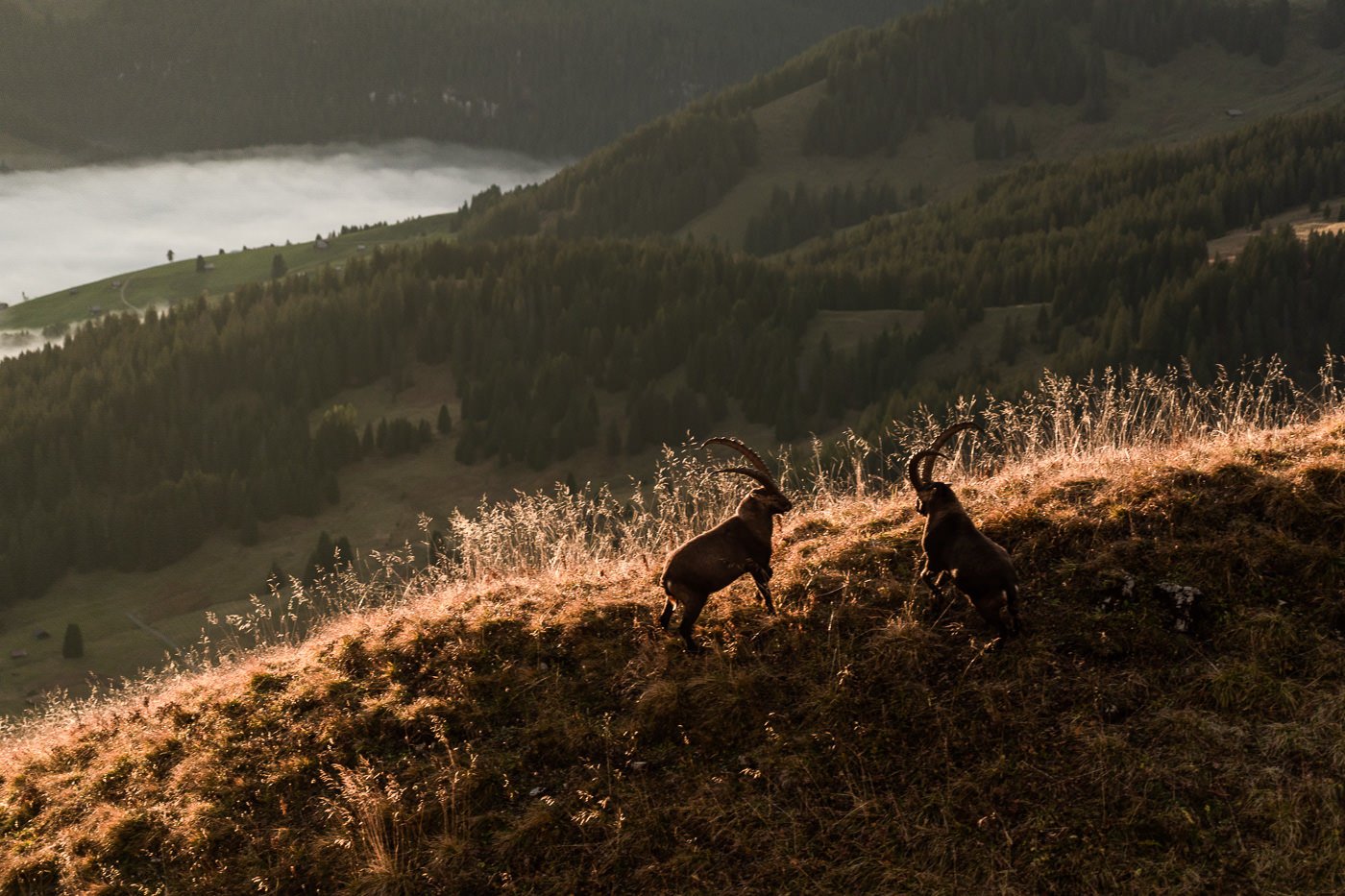
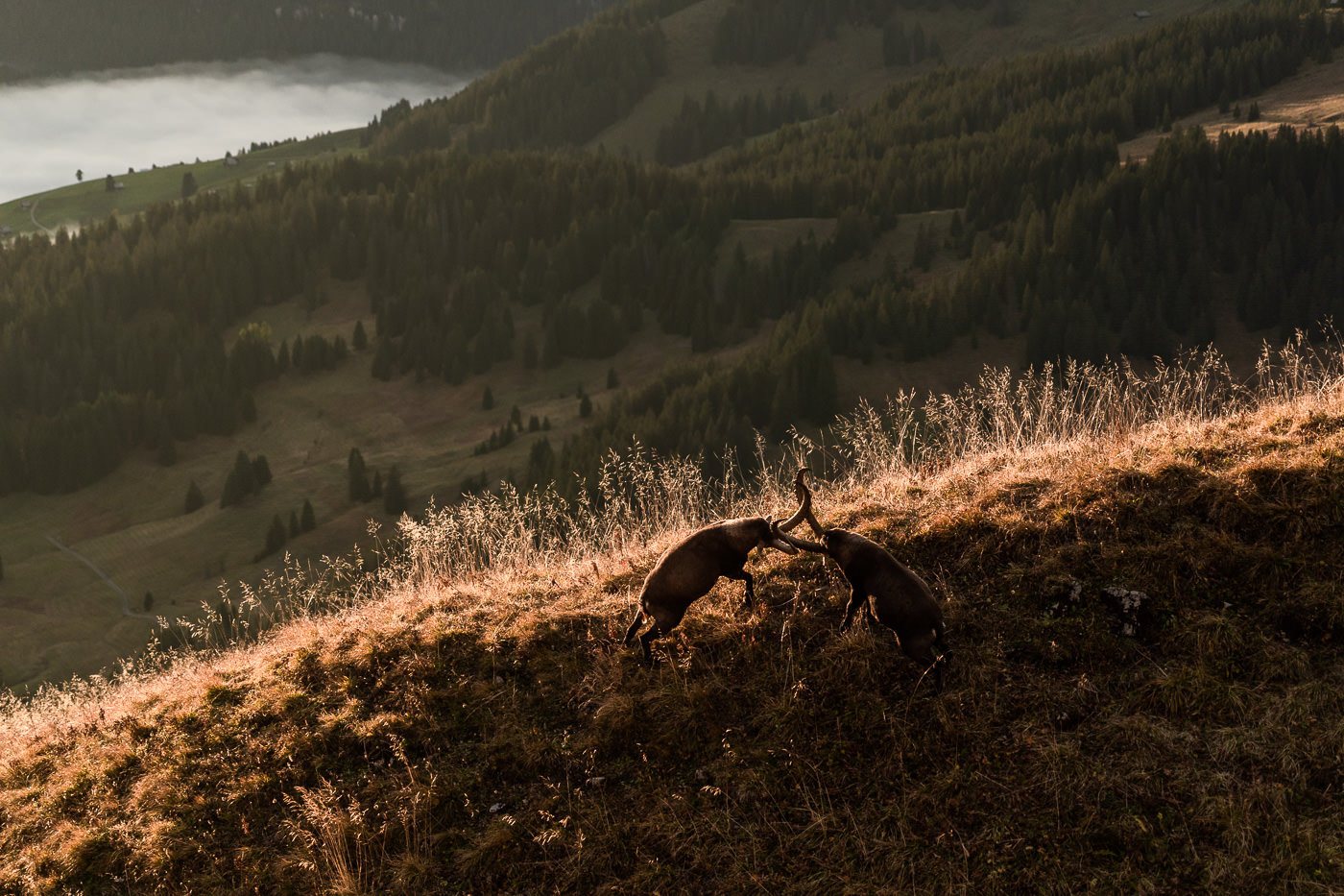
However, it wasn’t the Chamois that were present in numbers. Close to the summit of Augstmatthorn, we came across a colony of more than 30 Ibex chewing their way through the steep slopes of grass. These animals are majestic with their large, curved horns and ability to effortlessly walk up inclines that humans wouldn’t dare attempt.
I was fortunate enough to have my camera ready and shot some beautiful moments of the Ibex. Two aggressive Ibex even had a fight on the hill and positioned themselves right in the golden lighting for me. It was all just too good and a moment to treasure. Here are my favorite Ibex photos from the hike.
BEST TRAVEL CAMERA FOR SWITZERLAND

The GoPro Hero11 is the BEST camera for traveling around Switzerland.
- Waterproof for rain, hiking, snow lake activities.
- Built-in stabilization for filming your travels and adventure activities
- 5.3K video and 27MP Photo to capture awesome memories of friends and family
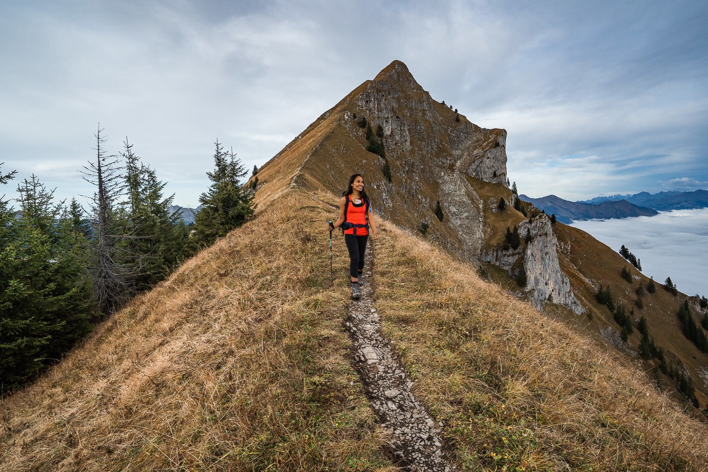
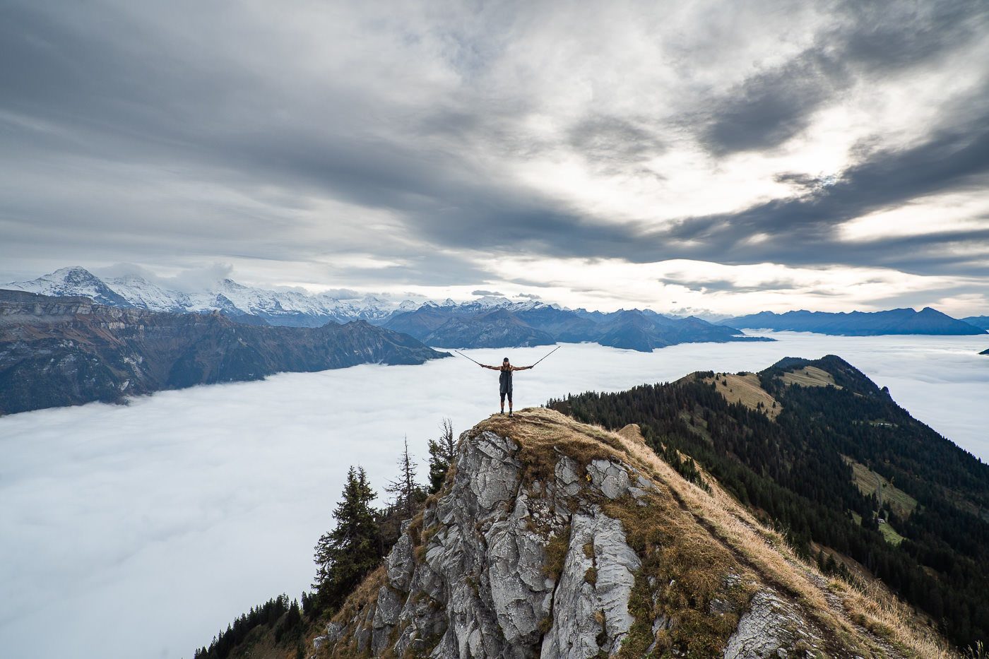
After our Ibex encounter, we continued up the final section of the ridge to Augstmatthorn. This was the most picturesque section and it seemed from this point on, if you continued down the Hardergrat Trail, it would be incredibly scenic the whole way.
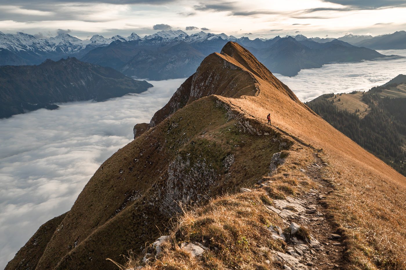
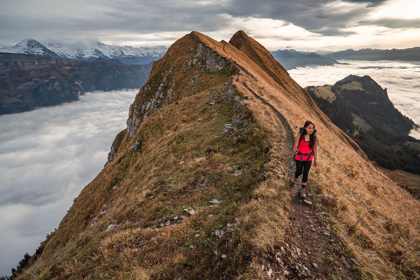
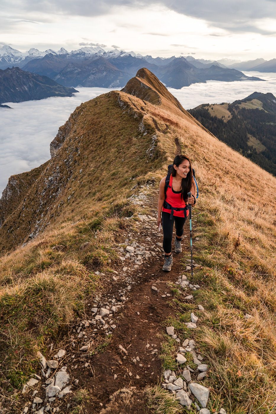
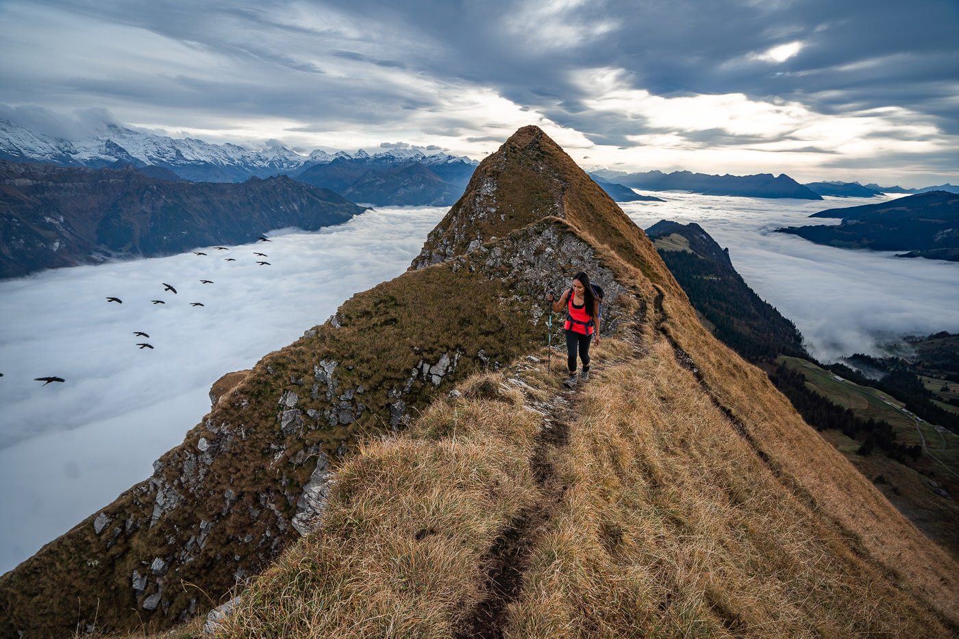
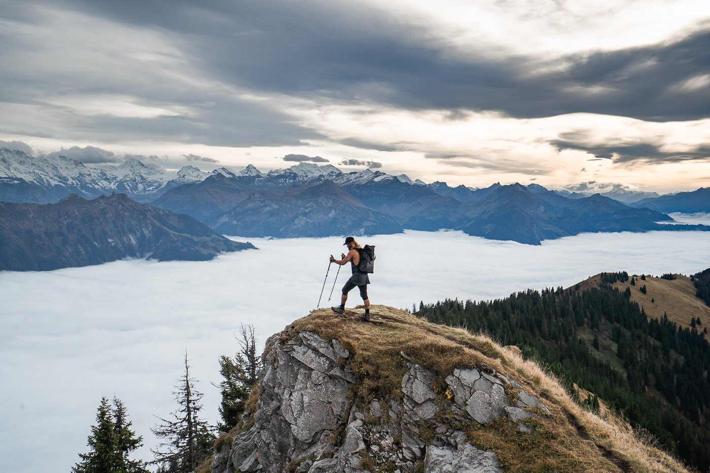
We reached the Augstmatthorn summit just in time for sunset and what an incredible spot to be, up above the clouds, with views over the valley on both sides. The clouds were rolling in and putting on a show as we explored the ridges and viewpoints at the summit.
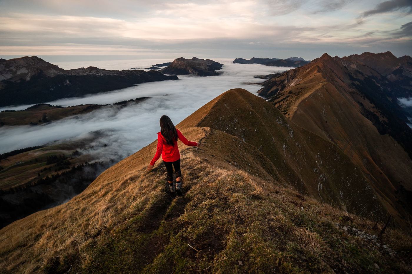
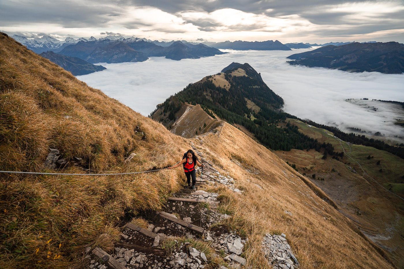
After enjoying the golden light at the Augstmatthorn summit, we now headed back the way we had come but after a short distance turned right down the dirt path that leads to Habkern. The trail down is very steep and slippery when wet but not very dangerous and there are no drop-offs or high-risk sections. Just go slow and steady because it is steep.
After about 3-kilometers you will reach the road and be in Lombochalp, where there is a parking lot, and it’s then another 4.8-kilometers to Habkern. Make sure you check when the last bus is and give yourself enough time to make it.
It is possible to park at Lombochalp and hike up to Augstmatthorn for just 3-kilometers and then hike back down. I think a lot of people do that just for the sunset viewing rather than a big 16-kilometer hike.
I hope you enjoy your adventure on Augstmatthorn and/or the Hardergrat Trail!
SWISS TRAVEL PASS or HALF-FARE CARD
OPTION 1: Buy the Swiss Half Fare Card: Switzerland trains, buses, and cable cars are EXPENSIVE! I found the best way to get around cheaply was to buy the Swiss Half-Fare Card before I arrived. It gives you 50% off every regular train, bus, and even many cable cars. It only costs $150 USD but pays itself off in just a few days with many train tickets in Switzerland costing close to $100 alone. If you are staying for more than 5 days, I suggest buying the Swiss Half-Fare Card.
OPTION 2: Buy the Swiss Travel Pass: The second option is to get the Swiss Travel Pass, which gives you unlimited train, bus, and (many) cable car rides but it’s pretty expensive at around $100 USD per day so if you don’t travel each day it isn’t worth it.
OPTION 3: Buy the FLEXI Swiss Travel Pass: The final (BEST) option is to get the FLEXI Swiss Travel Pass, which allows you to buy 8 days’ worth of transit but you can choose the night before if you want to activate the next day. That way you don’t need to travel every day to get your money’s worth, you can just activate the FLEXI Swiss Travel Pass on the days when you are doing sizeable transits. My advice is to book the Swiss Half-Fare Card or the FLEXI Swiss Travel Pass in advance before your trip so it’s ready to go when you arrive.
GET A SWISS TRAVEL PASS!
Enjoy UNLIMITED train, boat, and bus rides in Switzerland for up to 15 days. Click to book a flex Swiss Travel Pass or choose the Consecutive Swiss Travel Pass.
The Swiss Travel Pass starts at $260 for 3 days. Click here to check if it’s available on your travel dates.
MY SWITZERLAND HIKING GUIDES
I spent 100 days hiking in Switzerland and created a guide for different regions around the country. You can click on one of my Switzerland hiking guides below to help you plan your trip.
- The Complete Guide: 50 AWESOME HIKES IN IN SWITZERLAND
- The Via Ferrata Guide: 4 EPIC SWITZERLAND VIA FERRATA COURSES
- Lauterbrunnen Guide: 10 AWESOME HIKES NEAR LAUTERBRUNNEN
- Interlaken Guide: 15 AWESOME HIKES IN INTERLAKEN
- Grindelwald Guide: 12 AWESOME HIKES NEAR GRINDELWALD:
- Mürren Guide: 7 AWESOME HIKES IN MURREN
- Appenzell Guide: 9 AWESOME HIKES NEAR APPENZELL
- Chur Guide: 7 AWESOME HIKES NEAR CHUR

MY SWITZERLAND TRAVEL TIPS
- For Backpackers: SWITZERLAND BUDGET BACKPACKING GUIDE
- Travel Tips: 20 THINGS TO KNOW BEFORE VISITING SWITZERLAND
- Transport Tips: RENTING AND DRIVING A CAR IN SWITZERLAND
- Accommodation Guide: 30 BEST PLACES TO STAY IN SWITZERLAND

Somayeh
Friday 30th of July 2021
Thanks I almost get all the information for my hiking . It does not get dark after sunset ?? Coming back from summit after sunset. If I like to take your last advice , “park at Lombochalp and hike up to Augstmatthorn for just 3-kilometers and then hike back down” , am I missing the scenery part of journey? Or I still can experience the parts with narrow passes??
Janine
Wednesday 8th of April 2020
Hi Jackson, I'm planning a trip to Switzerland and your blog has helped me out a lot!! Your pictures are breathtaking. I'm new to hiking so i was wondering if you have any tips on what to bring with you on the hike? Also, would you consider it a dangerous hike for beginners? I really want to do this hike, it seems absolutely amazing!
Jackson
Wednesday 8th of April 2020
Hi Janine, Thanks so much. I would say it isn't the easiest hike it had some elevation as you can read above, which will challenge many. There are a few narrow ridges and one side there is a big drop off as I've pictured. If you are smart, go slow and stay as far away from the edges as you can then I think it's okay for beginners but that's up to you to measure as that is your interpretation of a beginner. If I were a parent I would take my child (supervised) on this hike. We stooed on edges for photos and such so I wouldn't advise that but as you can tell, this wasn't my first time up in the mountains :) Enjoy
Fern K-Hamp
Monday 9th of March 2020
Hi Jackson. Your blog answered loads of my questions, it's really insightful, thanks. I was wondering though if you flew in to Geneva and if so how you then got to Interlaken from there? Is the transfer relatively simple?
Thanks, Fern
Jackson
Tuesday 10th of March 2020
Hi, awesome glad it helped. Yea the train will connect Geneva to Interlaken. Everything in Switzerland is connected. Generally even if you have 2-3 connections it is still simple because it is on time, comfortable and efficient even if u are carrying backpacking bags like me.
George
Monday 17th of February 2020
Are there signs to know you have taken the right turn / don't end up in Hardergrat? Also, would you recommend this to a person new to hiking but in relatively good physical condition?
Thanks and awesome photo's, reallly wanna do this hike!
Jackson
Tuesday 18th of February 2020
There are signs but it is also on maps.me and alltrails. Once you get to Augstmatthorn you would just simply stop following the ridge. Technically Hardergrat is the entire trail so you are already on Hardergrat but just not doing the whole ridge. I would not suggest this hike for beginners as there are some big drops (I don't find it dangerous) and some steep incline.
Jackson
Saturday 18th of January 2020
Assuming it is legal then yes it would be possible. One thing to keep in mind is that there are lots of Ibex so you would not to check first if this is allowed to bring a dog into their habitat but if all is legal then the dogs if kept on lead would manage the trail just fine.